GDP Official Exchange Rate (OER is more precise at gauging a countries economic power)
(Estimated 2011): $216.1 billion (US$) or (GBP)
GDP (OER) Per Capita (per member of the population estimated 2011): (US$) or (GBP)
GDP Purchasing Power Parity (PPP is good for gauging living conditions and use of resources but not as accurate as OER. This data has been calculated based on the sum value of all goods and services produced in the country valued at prices prevailing in the United States)
(Estimated 2011): $389.8 billion (US$) or (GBP)
GDP (PPP) Per Capita (per member of the population estimated 2011): $4,100 (US$) or (GBP)
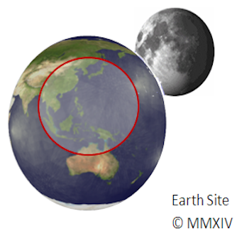
Capital: Manila
Population (Estimated July 2012): 103,775,002
Area: 300,000km2 or 115,831mi2
Currency: Piso (₱)
Official Language: Filipino and English
Political Information: Presidential Republic
Official Religion: No Official Religion (but approximately 82.9% of the population Roman Catholic, 9.6% are other Christian, 5% are Muslim, 2.4% have other or unspecified beliefs and 0.1% have no religious beliefs).
Highest Mountain: Mount Apo at 2,954m or 9692ft
Largest River:

Time Zone (GMT/UTC): +8:00
Wildlife:
Counties/Provinces/States: 80 provinces and 39 chartered cities
provinces: Abra, Agusan del Norte, Agusan del Sur, Aklan, Albay, Antique, Apayao, Aurora, Basilan, Bataan, Batanes, Batangas, Biliran, Benguet, Bohol, Bukidnon, Bulacan, Cagayan, Camarines Norte, Camarines Sur, Camiguin, Capiz, Catanduanes, Cavite, Cebu, Compostela, Davao del Norte, Davao del Sur, Davao Oriental, Dinagat Islands, Eastern Samar, Guimaras, Ifugao, Ilocos Norte, Ilocos Sur, Iloilo, Isabela, Kalinga, Laguna, Lanao del Norte, Lanao del Sur, La Union, Leyte, Maguindanao, Marinduque, Masbate, Mindoro Occidental, Mindoro Oriental, Misamis Occidental, Misamis Oriental, Mountain Province, Negros Occidental, Negros Oriental, North Cotabato, Northern Samar, Nueva Ecija, Nueva Vizcaya, Palawan, Pampanga, Pangasinan, Quezon, Quirino, Rizal, Romblon, Samar, Sarangani, Siquijor, Sorsogon, South Cotabato, Southern Leyte, Sultan Kudarat, Sulu, Surigao del Norte, Surigao del Sur, Tarlac, Tawi-Tawi, Zambales, Zamboanga del Norte, Zamboanga del Sur, Zamboanga Sibugay
chartered cities: Angeles, Antipolo, Bacolod, Baguio, Butuan, Cagayan de Oro, Caloocan, Cebu, Cotabato, Dagupan, Davao, General Santos, Iligan, Iloilo, Lapu-Lapu, Las Pinas, Lucena, Makati, Malabon, Mandaluyong, Mandaue, Manila, Marikina, Muntinlupa, Naga, Navotas, Olongapo, Ormoc, Paranaque, Pasay, Pasig, Puerto Princesa, Quezon, San Juan, Santiago, Tacloban, Taguig, Valenzuela, Zamboanga (2012)
Leaders: President Benigno S. Aquino III.
Additional: Gained independence from Spain on the 12th of June 1898 and then from the U.S. on the 4th of July 1946.
Sources: CIA World Fact Book, and Encyclopaedia Britannica.


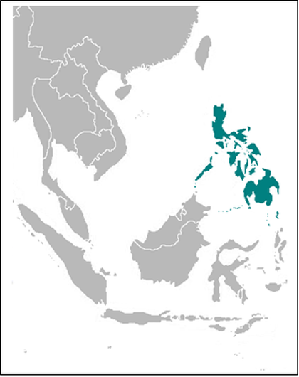


Philippines (Republika ng Pilipinas (Filipino); Republic of the Philippines (English)