Explore the World Through Geography, Natural Resources & Daily History
Clear, reliable and engaging guides that help you understand our planet — from UK geography education to global natural resources and On This Day history events.
Explore, discover, and learn about the wonders of our world! At Earth Site, we’re passionate about bringing geography, history, and science to life for curious minds of all ages. Whether you’re delving into historical events, uncovering the mysteries of the natural world, or seeking interactive resources, you’re in the right place.
Here, you can uncover the stories behind historical events, explore the natural wonders of our planet, and gain valuable insights into how the Earth’s systems shape our daily lives. From the towering peaks of mountain ranges to the far-reaching impacts of human innovation, we aim to make every topic both engaging and informative.
Start your journey of discovery with us today, and let’s make learning an adventure!
What We Cover
Earth Site brings together engaging and accessible educational content designed to help you understand the world, its history, and its natural systems.
🌍 Geography Education (UK & Worldwide)
We publish clear, easy-to-understand geography resources for students, teachers and curious learners. Our guides support geography education in the UK and cover physical geography, climate, ecosystems, population, and global development.
⛏️ Natural Resources & Environmental Geography
Explore detailed country profiles covering natural resources, mining, energy, geology and global environmental challenges. We show how nations manage minerals, water, land and ecosystems, and why these resources matter.
📅 On This Day in History
Every day has a story. Our On This Day history series features major events, anniversaries, traditions, and cultural milestones from around the world — with timelines, context, and fun facts.
TIMELINE

Political Boundaries of Comoros: Provinces, Districts, or Historical Boundaries.
Comoros, officially known as the Union of the Comoros, is a small archipelago located in the Indian Ocean off the eastern coast of Africa. It consists of three main islands – Grande Comore, Mohéli, and Anjouan – as well as several smaller islands. The country has a rich history and a unique cultural heritage that is influenced by its African, Arab, and French colonial past. Understanding the political boundaries of Comoros is crucial in comprehending the country’s dynamics and complexities. These boundaries define the administrative divisions within the nation and play a significant role in shaping its society, culture, and economy. By examining the provinces, districts, towns, and villages that make up Comoros, we can gain a deeper understanding of the country’s identity and nation-building process. Summary Comoros is a small island nation located in the Indian Ocean. The country is divided into three provinces: Grande Comore, Mohéli, and Anjouan. Grande Comore has several districts, including its capital city Moroni and other major areas. Mohéli has administrative centers and localities, while Anjouan has towns and villages. Political boundaries have played a significant role in shaping Comorian society, culture, and economic development. The Three Provinces of Comoros: Grande Comore, Mohéli, and Anjouan Comoros is divided into three provinces: Grande Comore (also known as Ngazidja), Mohéli (also known as Mwali), and Anjouan (also known as Nzwani). Each province has its own distinct characteristics and historical significance. Grande Comore is the largest and most populous province in Comoros. It is home to the country’s capital city, Moroni, which serves as the political, economic, and cultural center of the nation. The province is...

Terrain and Topography of Comoros: mountains, valleys, and plains.
Comoros, a small archipelago located off the eastern coast of Africa, is a country known for its stunning natural beauty. With its diverse terrain and topography, Comoros offers a unique landscape that is worth exploring and understanding. From majestic mountains to vast plains, Comoros’ terrain plays a crucial role in shaping the country’s geography, climate, and ecosystems. In this article, we will delve into the different aspects of Comoros’ topography and explore its significance for the country’s water resources, biodiversity, agriculture, and livelihoods. Summary Comoros is a volcanic archipelago located in the Indian Ocean. The island is characterized by majestic mountains, vast plains, and unique coastal features. Erosion has had a significant impact on Comoros’ topography, shaping its valleys and cliffs. Volcanic activity has played a crucial role in the formation of Comoros’ terrain. Comoros’ topography is essential for agriculture and livelihoods, but faces challenges such as deforestation and climate change. The Majestic Mountains of Comoros Comoros is home to several majestic mountains that dominate its landscape. The highest peak in Comoros is Mount Karthala, an active volcano that stands at an impressive height of 2,361 meters (7,746 feet). This towering mountain not only offers breathtaking views but also plays a vital role in the country’s water resources. The slopes of Mount Karthala are covered with lush vegetation, which acts as a natural sponge, absorbing rainfall and replenishing the groundwater reserves. The mountain also serves as a habitat for a variety of plant and animal species, contributing to the country’s rich biodiversity. Another notable mountain in Comoros is Mount Ntingui, which reaches a height of 1,575 meters (5,167 feet)....

Climate Zones of Comoros: Different climate regions Of Comoros
Comoros, a small island nation located off the eastern coast of Africa, is known for its diverse geography and unique climate zones. The country consists of three main islands – Grande Comore, Mohéli, and Anjouan – each with its own distinct climate characteristics. Understanding the different climate zones in Comoros is crucial for various reasons, including agriculture, tourism, and conservation efforts. Summary Comoros has a diverse range of climate zones, including tropical rainforest, monsoon, savanna, semi-arid, arid, highland, and coastal. The tropical rainforest climate zone is characterized by high rainfall and humidity, and is home to a variety of plant and animal species. The tropical monsoon climate zone experiences heavy rainfall during the wet season and is known for its lush vegetation. The semi-arid climate zone has a dry season and is home to drought-resistant plants and animals. The impact of climate zones on Comoros’ biodiversity is significant, with each zone supporting unique species and ecosystems. The Tropical Rainforest Climate Zone of Comoros The tropical rainforest climate zone in Comoros is characterized by high temperatures, abundant rainfall, and lush vegetation. This climate zone is found primarily in the central and eastern parts of Grande Comore and Mohéli islands. The region experiences a wet season from November to April, with heavy rainfall and high humidity. The dry season occurs from May to October, with relatively lower temperatures and less rainfall. The tropical rainforest climate zone in Comoros is home to a rich biodiversity. The dense vegetation provides habitat for a wide range of plant and animal species, including various types of trees, ferns, orchids, and endemic bird species. The forests...

Climate Zones of Comoros: Different climate regions Of Comoros
Comoros, a small archipelago located off the eastern coast of Africa in the Indian Ocean, is known for its diverse geography and unique climate zones. The country consists of four main islands – Grande Comore, Mohéli, Anjouan, and Mayotte – each with its own distinct climate characteristics. Understanding these climate zones is crucial for both agriculture and tourism, as they play a significant role in determining what crops can be grown and what attractions can be enjoyed. Summary Comoros has a diverse range of climate zones, including tropical wet, semi-arid, subtropical, and mountainous. The coastal regions experience a tropical wet climate, with high humidity and rainfall throughout the year. The central plateau has a semi-arid climate, with hot temperatures and limited rainfall. The highlands have a subtropical climate, with cooler temperatures and more rainfall than the coastal regions. The volcanic islands have a mountainous climate, with cooler temperatures and higher rainfall due to their elevation. Understanding the Different Climate Regions of Comoros Comoros can be divided into four main climate regions: the tropical wet climate of the coastal regions, the semi-arid climate of the central plateau, the subtropical climate of the highlands, and the mountainous climate of the volcanic islands. These regions are influenced by various factors such as altitude, proximity to the ocean, and topography. The Tropical Wet Climate of the Coastal Regions The coastal regions of Comoros experience a tropical wet climate characterized by high temperatures and abundant rainfall throughout the year. The average annual rainfall in these areas ranges from 1,500 to 3,000 millimeters. This climate is ideal for the growth of lush vegetation and supports...

Natural Resources of Comoros: Where Natural Resources are located In Comoros
Comoros, officially known as the Union of the Comoros, is a small archipelago located in the Indian Ocean off the eastern coast of Africa. It consists of three main islands – Grande Comore, Mohéli, and Anjouan – as well as numerous smaller islands. The country is known for its rich natural resources, which include agricultural land, mineral deposits, marine resources, forests, water sources, renewable energy potential, and unique wildlife. Summary Comoros is a small island nation with a variety of natural resources. Agriculture is the mainstay of the economy, with crops like vanilla, cloves, and ylang-ylang being major exports. Mineral resources in Comoros include deposits of rare earth metals, gold, and copper. The marine resources of Comoros are abundant, with fish and seafood being important sources of food and income. Forests in Comoros are under threat from deforestation, but efforts are being made to protect them and promote sustainable use. Agricultural Resources of Comoros Agriculture plays a vital role in the economy of Comoros, employing a significant portion of the population and contributing to food security and export earnings. The main crops grown in Comoros include vanilla, cloves, ylang-ylang, coconuts, bananas, and cassava. These crops have significant economic importance for the country, with vanilla and cloves being major export commodities. However, the agricultural sector in Comoros faces several challenges. Limited access to modern farming techniques and technologies hinders productivity and efficiency. The lack of infrastructure, such as irrigation systems and storage facilities, also poses challenges to farmers. Additionally, climate change and unpredictable weather patterns affect crop yields and increase the vulnerability of farmers to natural disasters. Mineral Resources in...

History of Comoros
The Comoros Islands, officially known as the Union of the Comoros, is an archipelago located in the Indian Ocean off the eastern coast of Africa. It is comprised of four main islands: Grande Comore, Mohéli, Anjouan, and Mayotte. The islands are known for their stunning natural beauty, with lush forests, volcanic landscapes, and pristine beaches. The population of the Comoros is estimated to be around 850,000 people. The official languages spoken are Comorian, French, and Arabic. Comorian is a Bantu language with influences from Arabic and French. The majority of the population is Sunni Muslim. The history of the Comoros dates back to ancient times, with evidence of human settlement on the islands as early as the 6th century. Arab traders began arriving in the 10th century and had a significant influence on the islands’ culture and religion. The islands were later colonized by European powers, including the Portuguese and the French. Summary The Comoros Islands have a rich history of early settlement and colonization by Arab traders, Portuguese explorers, and French colonizers. The struggle for independence and formation of the Union of the Comoros was marked by political turmoil and coups in the post-independence era. Economic development and challenges in the 21st century have been a major concern for the Comoros, with a focus on improving infrastructure and attracting foreign investment. Comorian culture and traditions are deeply rooted in Islamic beliefs and practices, with a strong emphasis on family and community values. Environmental issues and conservation efforts are also a key concern for the Comoros, with efforts to protect the islands’ unique biodiversity and natural resources. Early Settlement...

Population Density of Comoros
Comoros is a small archipelago located off the eastern coast of Africa, in the Indian Ocean. It consists of four main islands: Grande Comore, Mohéli, Anjouan, and Mayotte. The country has a rich history and culture, with influences from African, Arab, and French traditions. Comoros gained independence from France in 1975 and has since faced various challenges, including political instability and economic struggles. Summary Comoros is a small island nation located in the Indian Ocean. Population density is the number of people living in a specific area, usually measured in persons per square kilometer. Comoros has a population density of 467 people per square kilometer, making it one of the most densely populated countries in Africa. Factors affecting population density in Comoros include limited land availability, high fertility rates, and urbanization. Urban population density in Comoros is much higher than rural population density, with the capital city of Moroni being the most densely populated area. Definition of Population Density Population density refers to the number of people living in a specific area, usually measured per square kilometer or square mile. It is calculated by dividing the total population of an area by its land area. Population density is an important indicator of how crowded or sparsely populated an area is. It can provide insights into the social, economic, and environmental conditions of a region. Population Density of Comoros Comoros has a relatively high population density compared to other countries in the region. As of 2021, the estimated population density of Comoros is around 450 people per square kilometer. This is significantly higher than the global average population density of...

Cultural or Historical Sites of Comoros: Important Cultural Landmarks or Historical Sites In Comoros
Comoros, officially known as the Union of the Comoros, is a small island nation located off the eastern coast of Africa in the Indian Ocean. Comprising of three main islands – Grande Comore, Mohéli, and Anjouan – as well as several smaller islands, Comoros is known for its rich cultural and historical heritage. The country has a diverse population with influences from African, Arab, and French cultures, making it a unique and vibrant destination. Preserving cultural and historical sites is of utmost importance in order to maintain the identity and heritage of a nation. These sites serve as a window into the past, allowing us to understand and appreciate the traditions, customs, and achievements of our ancestors. They also play a crucial role in attracting tourists and promoting sustainable tourism, which can contribute to the economic development of the country. By preserving these sites, we ensure that future generations can learn from and be inspired by the history and culture of their homeland. Summary Comoros is an island nation with a rich cultural and historical heritage. The Grand Mosque of Moroni is an iconic religious and architectural marvel. Mutsamudu Old Town is a living museum of Swahili culture and architecture. Mount Karthala is a sacred volcano with historical and cultural significance. The Coelacanth is a prehistoric fish species with cultural and scientific importance. The Iconic Grand Mosque of Moroni: A Religious and Architectural Marvel The Grand Mosque of Moroni is one of the most iconic landmarks in Comoros. Located in the capital city of Moroni on the island of Grande Comore, this mosque holds great religious and architectural significance....

Population Density of Comoros
Comoros is a small archipelago located off the eastern coast of Africa, in the Indian Ocean. It consists of three main islands – Grande Comore, Mohéli, and Anjouan – as well as several smaller islands. With a total land area of just 2,235 square kilometers, Comoros is one of the smallest countries in Africa. Despite its small size, Comoros has a rich cultural heritage and is known for its beautiful beaches and diverse marine life. Population density refers to the number of people living in a given area, usually measured per square kilometer. It is an important indicator of a country’s demographics and can provide insights into various aspects of its society, economy, and environment. In the case of Comoros, understanding its population density is crucial for assessing the challenges and opportunities that the country faces in terms of sustainable development. Summary Comoros is a small island nation with a high population density of over 400 people per square kilometer. Population density is an important measure of the number of people living in a given area and can impact economic and social development. Factors affecting population density in Comoros include limited land availability, high fertility rates, and urbanization. Historical trends show a steady increase in population density in Comoros, with the highest density in urban areas. The current population density in Comoros is a challenge for sustainable development, with implications for the environment and economy. Understanding Population Density and its Importance Population density is a measure of how crowded or sparsely populated an area is. It is calculated by dividing the total population of an area by its land...
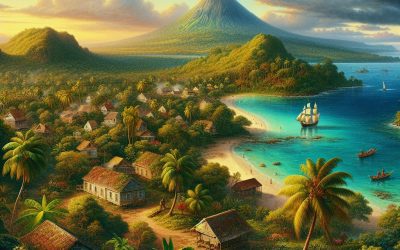
Comoros
Comoros (Udzima wa Komori (Comorian); Jumhūrīyat al-Qamar al-Muttaḥidah (Arabic); Union des Comores (French); (Union of the Comoros)) Capital of Comoros: Moroni Population (Estimated July 2012): 737,284 Area: 1,862 km2 or 719 mi2 Currency: Comorian franc (CF) Official Language: Comorian (Shikomor); Arabic; French Political Information: Federal Republic Official Religion: Islam(approximately 98% of the population are Sunni Muslim and 2% are Roman Catholic) Highest Mountain: Karthala on GDP Official Exchange Rate (OER is more precise at gauging a countries economic power) (Estimated 2011): $600 million (US$) or (GBP) GDP (OER) Per Capita (per member of the population estimated 2011): (US$) or (GBP) GDP Purchasing Power Parity (PPP is good for gauging living conditions and use of resources but not as accurate as OER. This data has been calculated based on the sum value of all goods and services produced in the country valued at prices prevailing in the United States) (Estimated 2011): $816 million (US$) or (GBP) GDP (PPP) Per Capita (per member of the population estimated 2011): $1,200 (US$) or (GBP) Time Zone (GMT/UTC): +3:00 Wildlife: Counties/Provinces/States: 3 islands and 4 municipalities*; Grande Comore (N’gazidja), Anjouan (Ndzuwani), Domoni*, Fomboni*, Moheli (Mwali), Moroni*, Moutsamoudou* Leaders: Ikililou Dhoinine as President with Fouad Mohadji, Mohamed Ali Soilih and Nourdine Bourhane as Vice President. Additional: Independence from France on the 6th of July 1975. Sources: CIA World Fact Book, Encyclopaedia Britannica. Comoros Comoros, officially known as the Union of the Comoros, is a small island nation located in the Indian Ocean off the eastern coast of Africa. It is composed of four main islands: Grande Comore, Mohéli, Anjouan, and Mayotte. The country has a total land area of approximately 2,235...

Climate Zones of Colombia: Different climate regions Of Colombia
Colombia, located in the northwestern part of South America, is a country known for its diverse geography and climate. It is bordered by the Caribbean Sea to the north, the Pacific Ocean to the west, and is home to the Andes Mountains which run through the country. Due to its unique geographical features, Colombia experiences a wide range of climate zones, each with its own distinct characteristics. Understanding these climate zones is crucial for various reasons, including agriculture, tourism, and conservation efforts. Summary Colombia has a diverse range of climate zones due to its location near the equator and varying elevations. The Tropical Rainforest Climate Zone is characterized by high temperatures, heavy rainfall, and lush vegetation. The Tropical Monsoon Climate Zone experiences distinct wet and dry seasons, with heavy rainfall during the wet season. The Tropical Savanna Climate Zone has a dry season and a wet season, with grasslands and scattered trees. The Desert Climate Zone is hot and dry, with little vegetation and sparse populations. The Subtropical Highland Climate Zone has cooler temperatures and more rainfall than lower elevations, with forests and agriculture. The Alpine Tundra Climate Zone is found at high elevations and experiences freezing temperatures and snow. The Coastal Climate Zone has warm temperatures and high humidity, with beaches and mangroves. The Polar Climate Zone is found in the highest elevations and experiences freezing temperatures and snow year-round. Climate change is affecting the climate zones of Colombia, with changes in rainfall patterns and temperatures impacting agriculture and ecosystems. The Tropical Rainforest Climate Zone in Colombia One of the most prominent climate zones in Colombia is the...

Political Boundaries of Colombia: Provinces, Districts, or Historical Boundaries.
Political boundaries are the lines that separate different territories or regions within a country. These boundaries play a crucial role in governance as they define the jurisdiction and authority of different administrative units. In Colombia, political boundaries are essential for the effective functioning of the government and the distribution of power and resources. Summary Colombia is divided into administrative divisions known as provinces and districts. There are 32 provinces in Colombia, each with its own governor and assembly. The districts of Colombia are Bogotá, Cartagena, and Santa Marta, each with its own mayor and council. Colombia’s historical boundaries have been shaped by colonialism, wars, and territorial disputes. Political boundaries in Colombia have a significant impact on governance, economy, and society. Overview of Colombia’s Administrative Divisions Colombia has a three-tiered administrative system consisting of departments, municipalities, and localities. The departments are the highest level of administrative division and there are 32 departments in total. Each department is further divided into municipalities, which are the second level of administrative division. Finally, municipalities are divided into localities, which are the smallest administrative units. The roles and responsibilities of each level vary. Departments have their own governor and administrative bodies responsible for overseeing public services, infrastructure development, and economic planning within their jurisdiction. Municipalities have mayors and local councils that handle local governance, including education, healthcare, and public safety. Localities, on the other hand, have local administrators who focus on community-level issues such as sanitation, transportation, and public spaces. Understanding the Provinces of Colombia Colombia’s provinces are an important part of its administrative divisions. There are 32 provinces in total, each with its...