Cape Verde’s Population Density: A Closer Look
Cape Verde is an archipelago located off the northwest coast of Africa in the Atlantic Ocean. It consists of ten […]
Cape Verde’s Population Density: A Closer Look Read More »
Cape Verde is an archipelago located off the northwest coast of Africa in the Atlantic Ocean. It consists of ten […]
Cape Verde’s Population Density: A Closer Look Read More »

Cape Verde, officially known as the Republic of Cabo Verde, is an archipelago located off the coast of West Africa
Exploring the Fascinating History of Cape Verde Read More »

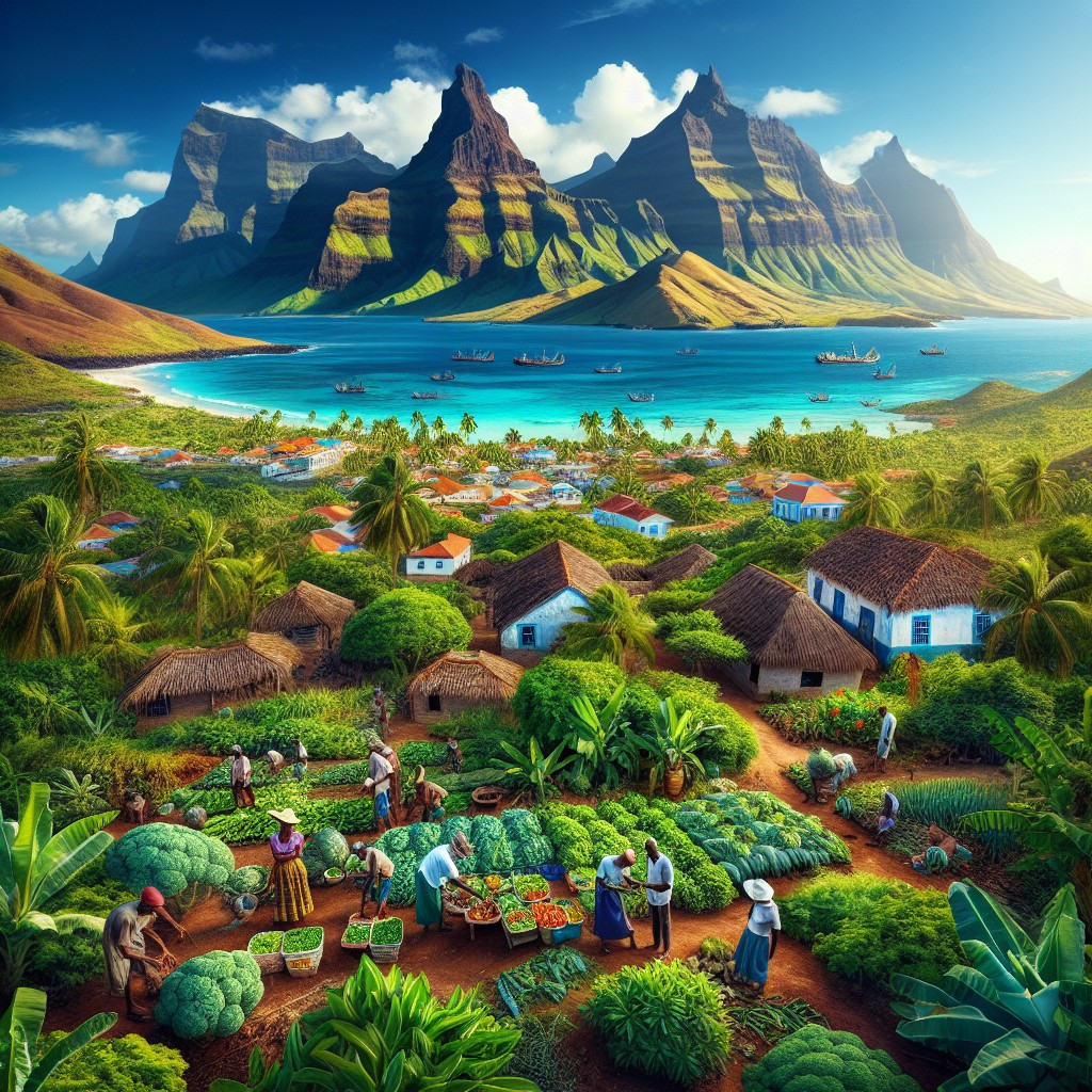
Cape Verde, an archipelago located off the coast of West Africa, is known for its diverse and stunning terrain. The
Exploring Cape Verde’s Varied Terrain: Mountains, Valleys, and Plains Read More »

Cape Verde, an archipelago located off the coast of West Africa, is known for its diverse climate zones. The country
Cape Verde’s Climate Zones: Diverse Regions to Explore Read More »

Cape Verde, officially known as the Republic of Cabo Verde, is an archipelago located off the coast of West Africa.
Cape Verde’s Political Boundaries: Provinces, Districts, or Historical Limits? Read More »

Natural Resources of Cape Verde: Where Natural Resources Are in Cabo Verde Cape Verde, also known as Cabo Verde,
Natural Resources of Cape Verde: Where Natural Resources Are in Cabo Verde Read More »

Cape Verde, an archipelago located off the coast of West Africa, is a country rich in cultural heritage. Its unique
Cape Verde’s Cultural and Historical Landmarks: Must-Visit Sites Read More »
Cabo Verde, also known as Cape Verde, is a hidden gem located off the coast of West Africa. This enchanting
Discover the Hidden Gems of Cabo Verde: A Journey Through the Enchanting Archipelago Read More »