World Geography
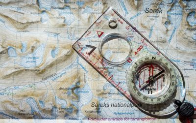
Geography is the study of the Earth’s landscapes, environments, and the relationships between people and their surroundings. It encompasses both the physical aspects of the Earth, such as its landforms, bodies of water, and climate, as well as the human aspects, including population distribution, cultures, and economies. World geography is a broad field that seeks to understand the complexities of our planet and how humans interact with it. By studying world geography, we can gain a deeper appreciation for the diversity of our planet and the interconnectedness of its various regions.
Geography is a multidisciplinary field that draws on elements of physical science, social science, and humanities. It involves the use of maps, spatial analysis, and geographic information systems (GIS) to understand the Earth’s surface and the processes that shape it. World geography also encompasses the study of human geography, which examines the ways in which people and their activities are distributed across the Earth. By understanding world geography, we can better appreciate the environmental, cultural, and economic challenges facing different regions of the world. This knowledge is crucial for addressing global issues such as climate change, resource management, and international development.
The Five Oceans and Seven Continents
The Earth’s surface is divided into five major oceans: the Pacific, Atlantic, Indian, Southern (or Antarctic), and Arctic Oceans. These vast bodies of water play a crucial role in regulating the Earth’s climate and supporting diverse marine ecosystems. The oceans also serve as important transportation routes and a source of food and other natural resources for human societies around the world.
In addition to the oceans, the Earth’s landmasses are divided into seven continents: Africa, Antarctica, Asia, Europe, North America, Australia (or Oceania), and South America. Each continent has its own unique physical and cultural characteristics, shaped by millions of years of geological processes and human history. From the deserts of Africa to the rainforests of South America, the continents offer a rich tapestry of landscapes and environments for exploration and study.
Major Mountain Ranges and Deserts
The Earth’s surface is also marked by major mountain ranges and deserts that have shaped the planet’s physical and cultural landscapes. The Himalayas, for example, are the highest mountain range in the world and are home to diverse ecosystems and cultures in countries such as India, Nepal, and Bhutan. The Andes in South America, the Rockies in North America, and the Alps in Europe are other prominent mountain ranges that have influenced human settlement patterns and economic activities.
Deserts cover about one-third of the Earth’s land surface and are characterized by low precipitation and extreme temperatures. The Sahara Desert in Africa is the largest hot desert in the world, while the Gobi Desert in Asia is one of the largest cold deserts. Deserts are not only home to unique flora and fauna but have also been important trade routes and cultural crossroads throughout history.
Climate Zones and Biomes
The Earth’s climate is influenced by a variety of factors, including latitude, altitude, ocean currents, and prevailing winds. As a result, the planet is divided into different climate zones, each with its own characteristic weather patterns and ecosystems. The equator, for example, experiences a tropical climate with high temperatures and heavy rainfall, while the polar regions have a cold and dry climate.
These climate zones give rise to different biomes, or large ecological areas characterized by distinct plant and animal communities. The tropical rainforest biome, found near the equator, is home to a diverse array of species and is vital for regulating the Earth’s climate. The grasslands biome, found in regions such as the African savannah and North American prairies, supports grazing animals and has been important for human agriculture throughout history.
Human Geography and Population Distribution
Human geography examines the ways in which people and their activities are distributed across the Earth’s surface. It encompasses topics such as population growth, migration patterns, urbanization, and cultural diversity. Understanding human geography is crucial for addressing global challenges such as poverty, inequality, and environmental degradation.
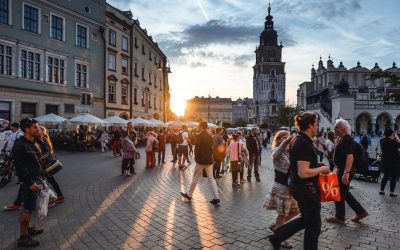
Population distribution is uneven across the world, with some regions experiencing rapid population growth while others are declining. The majority of the world’s population lives in Asia, particularly in countries such as China and India. Urban areas are also growing rapidly, with more than half of the world’s population now living in cities. This trend has significant implications for infrastructure development, resource management, and social inequality.
Historical and Cultural Geography
Historical geography examines how human activities have shaped the Earth’s landscapes over time. It explores topics such as colonialism, trade routes, and the rise and fall of empires. Cultural geography focuses on how human cultures have developed in different regions of the world and how they interact with their environments.
The Silk Road, for example, was an ancient trade route that connected China with Europe and facilitated the exchange of goods, ideas, and technologies across Eurasia. This historical trade route had a profound impact on the development of cultures and economies along its path. Similarly, cultural geographers study how different societies have adapted to their environments through practices such as agriculture, architecture, and religious beliefs.
The Importance of Geographic Knowledge
Geographic knowledge is crucial for addressing global challenges such as climate change, resource management, and international development. By understanding world geography, we can better appreciate the environmental, cultural, and economic challenges facing different regions of the world. This knowledge is crucial for addressing global issues such as climate change, resource management, and international development.
Geographic knowledge also helps us to understand our interconnectedness with other regions of the world. By studying world geography, we can gain a deeper appreciation for the diversity of our planet and the interconnectedness of its various regions. This understanding can foster a sense of global citizenship and empathy for people from different cultures and backgrounds.
In conclusion, world geography is a complex and multifaceted field that encompasses both physical and human aspects of the Earth’s landscapes. By studying world geography, we can gain a deeper appreciation for the diversity of our planet and the interconnectedness of its various regions. This knowledge is crucial for addressing global challenges such as climate change, resource management, and international development. It also helps us to understand our interconnectedness with other regions of the world and fosters a sense of global citizenship.
FAQs
What is world geography?
World geography is the study of the Earth’s landscapes, environments, and the relationships between people and their environments. It encompasses the physical features of the Earth, as well as the human activity that takes place on it.
Why is world geography important?
World geography is important because it helps us understand the world around us. It provides insights into the physical and human processes that shape our planet, and helps us make informed decisions about how to interact with our environment.
What are the main branches of world geography?
The main branches of world geography include physical geography, which focuses on the Earth’s natural features and processes, and human geography, which examines the relationships between people and their environments.
How does world geography impact our daily lives?
World geography impacts our daily lives in numerous ways, from influencing the weather and climate we experience, to shaping the availability of natural resources and influencing the distribution of populations and cultures around the world.
What are some key concepts in world geography?
Key concepts in world geography include location, place, human-environment interaction, movement, and region. These concepts help geographers understand and interpret the world around them.
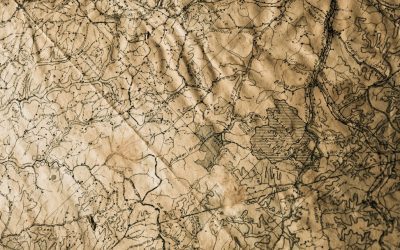
Political Boundaries of Czech Republic: Provinces, Districts, or Historical Boundaries.
Political boundaries refer to the lines that separate different political entities, such as countries, provinces, and districts. These boundaries play a crucial role in governance and development, as they define the jurisdiction and authority of governments, determine the allocation of resources, and shape the identity and culture of a nation. In the case of Czech Republic, understanding its political boundaries is essential for comprehending its governance system and historical context. Summary Czech Republic is a landlocked country in Central Europe with a population of over 10 million people. The country is divided into 14 provinces, each with its own unique culture, history, and geography. There are 76 districts in Czech Republic, which play a significant role in local governance and administration. The country’s political boundaries have evolved over time, shaped by historical events and political decisions. Political boundaries have a significant impact on Czech Republic’s economy, society, and governance, and managing them presents both challenges and opportunities for the country’s development. Understanding the Provinces of Czech Republic Czech Republic is divided into 14 provinces, also known as regions. Each province has its own unique historical and cultural significance. For example, Prague is not only the capital city but also a province in itself. It is known for its rich history, stunning architecture, and vibrant cultural scene. Other provinces like South Bohemia are famous for their picturesque landscapes and historical towns such as Český Krumlov. Each province has its own distinct identity and contributes to the overall diversity of Czech Republic. The provinces are not only administrative divisions but also serve as centers for economic activities, tourism, and cultural heritage....
History of Czech Republic
The Czech Republic, located in the heart of Europe, has a rich and fascinating history that spans thousands of years. From its early settlements to its role in the European Union, the country has experienced significant political, cultural, and social changes throughout the centuries. In this article, we will explore the key moments in Czech history, from the early settlements to the present day, and delve into the country’s cultural heritage. Summary Early settlements in Czech Republic date back to the Paleolithic era. The Czech Kingdom rose to power in the 10th century under the rule of the Přemyslid dynasty. The Hussite Wars and the Reformation brought religious and political turmoil to the region in the 15th century. The Habsburgs ruled over Czech lands for centuries, including during the devastating Thirty Years’ War. The Czech National Revival in the 19th century sparked a renewed interest in Czech language, culture, and identity. The Early Settlements in Czech Republic The history of the Czech Republic dates back to prehistoric times when the region was inhabited by various tribes. The first known settlers were the Celts, who arrived in the area around 400 BC. They were followed by Germanic tribes and later by Slavic tribes, who settled in the region in the 6th century AD. The arrival of the Slavic tribes marked a significant turning point in Czech history. These tribes established several powerful states, including Great Moravia and Bohemia. Great Moravia was a Slavic state that existed from the 9th to the 10th century and played a crucial role in spreading Christianity in Central Europe. Bohemia, on the other hand, became...
Population Density of Czech Republic
Population density refers to the number of people living in a specific area, usually measured per square kilometer. It is an important indicator of the distribution of population within a country and can provide insights into various social, economic, and environmental factors. Studying population density in the Czech Republic is crucial for understanding the country’s demographic patterns, urbanization trends, and infrastructure needs. The Czech Republic, located in Central Europe, has a rich history and a diverse population. With a land area of approximately 78,866 square kilometers, it is one of the smaller countries in Europe. However, despite its size, the Czech Republic has a relatively high population density compared to other European countries. Understanding the factors that have influenced population density in the past and present can help policymakers make informed decisions about managing population growth and ensuring sustainable development. Summary Czech Republic has a population density of 135 people per square kilometer. Population density has fluctuated throughout history due to wars, migration, and political changes. The highest population density is found in urban areas, particularly Prague. Factors affecting population density include economic opportunities, transportation, and natural resources. Regional variations in population density exist, with the highest density in the western part of the country. Historical Trends in Population Density The population density of the Czech Republic has fluctuated over time due to various historical events and factors. In the past, the country experienced periods of both high and low population density. During the medieval period, for example, the population was concentrated in urban areas such as Prague and other major cities. This led to relatively high population density...
Cultural or Historical Sites of Czech Republic: Important Cultural Landmarks or Historical Sites in Czech Republic
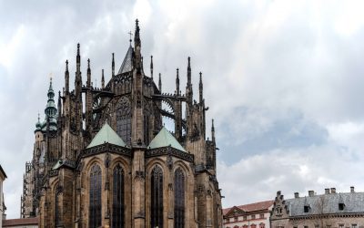
Introduction: Prague, the capital city of the Czech Republic, is a popular tourist destination known for its rich history and stunning architecture. With its cobblestone streets, medieval buildings, and charming atmosphere, Prague offers visitors a unique experience that transports them back in time. Exploring the city’s historical and cultural landmarks is not only a way to appreciate its beauty but also to gain a deeper understanding of Czech history and culture. From Prague Castle to the Jewish Quarter, each landmark tells a story that is worth discovering. Prague Castle: A Symbol of Czech History and Culture: Prague Castle is one of the most iconic landmarks in the city and holds great historical and cultural significance. It is the largest ancient castle complex in the world and has been the seat of power for Czech rulers for over a thousand years. The castle’s history dates back to the 9th century when it was founded by Prince Bořivoj. Over the centuries, it has been expanded and renovated by various rulers, resulting in a unique blend of architectural styles. One of the highlights of Prague Castle is St. Vitus Cathedral, a stunning Gothic masterpiece that dominates the skyline of Prague. The cathedral took nearly six centuries to complete and is known for its intricate stained glass windows, beautiful chapels, and the tomb of St. Wenceslas. Another must-visit attraction within the castle complex is Golden Lane, a picturesque street lined with colorful houses that once housed castle guards and artisans. Today, it is home to small shops selling traditional crafts and souvenirs. Charles Bridge: A Stunning Piece of Gothic Architecture: Charles Bridge is...
Natural Resources of Czech Republic: Where Natural Resources are located In Czech Republic
The Czech Republic is a landlocked country located in Central Europe. It is known for its rich natural resources, which play a significant role in the country’s economy. The natural resources in the Czech Republic include forests, minerals, water, agricultural land, energy resources, wildlife, and natural parks and reserves. These resources are vital for the country’s economic development and provide numerous benefits to its citizens. Summary Czech Republic has a diverse range of natural resources including forests, minerals, water, agriculture, energy, wildlife, and natural parks. Forests cover over one-third of the country’s land area and are a significant source of timber and wood products. Mineral resources in Czech Republic include coal, uranium, and various metals such as lead, zinc, and copper. Water resources are abundant in Czech Republic, with numerous rivers and lakes providing water for drinking, irrigation, and hydroelectric power generation. Agriculture is an important sector in Czech Republic, with crops such as wheat, barley, and potatoes being major exports. Forest Resources in Czech Republic Forests cover approximately one-third of the total land area in the Czech Republic. The country is home to various types of forests, including deciduous forests, coniferous forests, and mixed forests. These forests not only provide timber for the wood industry but also play a crucial role in maintaining the ecological balance and biodiversity of the region. Forests in the Czech Republic are managed sustainably to ensure their long-term viability. Forest management practices include selective logging, reforestation, and protection of endangered species. The government has implemented strict regulations to prevent overexploitation of forests and promote sustainable forestry practices. Mineral Resources in Czech Republic The...
Cyprus
Cyprus (Kipriakí Dhimokratía (Greek); Kıbrıs Cumhuriyeti (Turkish) (Republic of Cyprus); Kuzey Kıbrıs Türk Cumhuriyeti (Turkish) (Turkish Republic of Northern Cyprus)) Capital: Nicosia (Lefkosia) Population (Estimated July 2012): 1,138,071 Area: 5,896 km2 or 2,276 mi2 Currency: Euro Official Language: Greek and Turkish Political Information: Presidential Republic Official Religion: No Official Religion (approximately 78% of the population are Greek Orthodox, 18% are Muslim, 4% have other religious beliefs) Highest Mountain: Mount Olympus at 1,951m or 6,401ft GDP Official Exchange Rate (OER is more precise at gauging a country’s economic power) (Estimated 2011): $25.7 billion (US$) or (GBP) GDP (OER) Per Capita (per member of the population estimated 2011): (US$) or (GBP) GDP Purchasing Power Parity (PPP is good for gauging living conditions and the use of resources but is not as accurate as OER. This data has been calculated based on the sum value of all goods and services produced in the country valued at prices prevailing in the United States) (Estimated 2011): $23.77 billion (US$) or (GBP) GDP (PPP) Per Capita (per member of the population estimated 2011): $29,100 (US$) or (GBP) Time Zone (GMT/UTC): +2:00 Wildlife: Counties/Provinces/States: 6 districts; Famagusta, Kyrenia, Larnaca, Limassol, Nicosia, Paphos. Leaders: President Dimitris Christofias Additional: Gained independence from the United Kingdom on the 16th of August 1960. Sources: CIA World Fact Book, Encyclopaedia Britannica. Cyprus Cyprus, located in the eastern Mediterranean Sea, is a small island nation with a rich history and vibrant culture. Known as the birthplace of Aphrodite, the ancient Greek goddess of love and beauty, Cyprus has long been a popular destination for tourists seeking sun, sea, and sand. With its stunning beaches, picturesque villages, and archaeological sites, Cyprus...

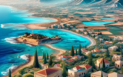
Terrain and Topography of Cyprus: mountains, valleys, and plains.
Cyprus, the third largest island in the Mediterranean, is known for its stunning landscapes and diverse terrain. From mountains to plains, and from coastlines to forests, Cyprus offers a wide range of natural wonders to explore. Understanding the geography of a destination is crucial for travellers, as it allows them to plan their activities and make the most of their time. In this article, we will take a closer look at the different regions of Cyprus and highlight their unique features and importance. Summary Cyprus has a diverse terrain and topography, ranging from mountains to plains and peninsulas. The Troodos Mountains are a natural wonder, with stunning landscapes and unique flora and fauna. The Kyrenia Range is a coastal gem, offering breathtaking views of the Mediterranean Sea. The Mesaoria Plain is the breadbasket of Cyprus, with fertile soil and a rich agricultural history. The Akamas Peninsula is a wilderness paradise, home to rare species and untouched natural beauty. The Troodos Mountains: A Natural Wonder The Troodos Mountains, located in the central part of Cyprus, are a true natural wonder. This mountain range is home to the highest peak on the island, Mount Olympus, which stands at an impressive 1,952 meters. The Troodos Mountains are known for their rugged beauty, with deep valleys, dense forests, and picturesque villages scattered throughout. One of the highlights of the Troodos Mountains is the network of hiking trails that crisscross the region. These trails offer breathtaking views of the surrounding landscape and allow visitors to explore the diverse flora and fauna of the area. In addition to hiking, the Troodos Mountains are also a...

Climate Zones Of Cyprus: Different climate regions Of Cyprus
Cyprus, the third largest island in the Mediterranean, is known for its diverse climate zones. Understanding these climate zones is crucial for various industries such as tourism and agriculture. With its strategic location between Europe, Asia, and Africa, Cyprus experiences a range of climates, from Mediterranean to desert. Each climate zone has its own unique characteristics and influences the daily lives of the people living there. Summary Cyprus has a diverse range of climate zones, including Mediterranean, semi-arid, subtropical, alpine, coastal, mountainous, and desert. The Mediterranean climate region is the most common in Cyprus, with hot, dry summers and mild, wet winters. The semi-arid climate region is characterized by hot, dry summers and cool, wet winters, and is found in the central and eastern parts of the island. The subtropical climate region is found in the southern coastal areas of Cyprus, with hot, humid summers and mild winters. The alpine climate region is found in the Troodos Mountains, with cold, snowy winters and mild summers. Understanding the climate zones of Cyprus is important for tourism and agriculture, as different regions are suited to different crops and activities. Factors affecting the climate zones of Cyprus include latitude, altitude, proximity to the sea, and prevailing winds. The coastal climate region is influenced by sea breezes and has milder temperatures than inland regions. The mountainous climate region is cooler and wetter than other regions, with snowfall in winter. The desert climate region is found in the eastern part of the island and is characterized by hot, dry conditions. Mediterranean Climate Region of Cyprus The Mediterranean climate zone is the most dominant in...

Political Boundaries of Cyprus: Provinces, Districts, or Historical Boundaries.
Political boundaries are the lines that separate different political entities, such as countries, states, provinces, or districts. These boundaries define the jurisdictional authority of a particular government and determine the extent of its control over a specific territory. In the case of Cyprus, an island country located in the Eastern Mediterranean, its political boundaries have been a subject of contention and dispute for many years. Cyprus is a divided island with a complex political history. The island has been inhabited for thousands of years and has been under the control of various empires and civilizations, including the Greeks, Romans, Byzantines, and Ottomans. In 1878, Cyprus was placed under British administration as a result of the Congress of Berlin. It remained a British colony until it gained independence in 1960. Summary Cyprus has a complex political boundary system, with provinces, districts, and municipalities. The island has a long history of political division, with conflicts between Greek and Turkish Cypriots. There are six provinces in Cyprus, each with its own distinct characteristics and economic strengths. The districts of Cyprus are further divided into municipalities, which play an important role in local governance. The political boundaries of Cyprus have changed significantly over time, with the most recent division occurring in 1974. Historical Background of Cyprus’ Political Boundaries Cyprus has a long and complex history that has shaped its political boundaries over time. The island has been inhabited since prehistoric times and has been under the control of various empires and civilizations throughout its history. The Greeks, Romans, Byzantines, and Ottomans have all ruled over Cyprus at different points in time. The colonization...

Natural Resources of Cyprus: Where Natural Resources are located In Cyprus
Cyprus, located in the eastern Mediterranean Sea, is a beautiful island known for its rich natural resources. The island’s geography is diverse, with mountains, plains, and a stunning coastline. The climate is Mediterranean, characterized by hot, dry summers and mild, wet winters. These natural features have contributed to the abundance of resources found in Cyprus. Natural resources play a crucial role in the economy and society of Cyprus. They provide employment opportunities, contribute to economic growth, and support various industries. Additionally, these resources are essential for meeting the energy needs of the island’s population. Cyprus has a long history of utilizing its natural resources, and their sustainable management is vital for the future development of the country. Summary Cyprus has a variety of natural resources including mineral deposits, natural gas reserves, agricultural resources, water resources, forests and woodlands, wildlife and biodiversity, renewable energy sources, coastal and marine resources. Copper and iron are the main mineral deposits found in Cyprus, with copper being the island’s most important export. Cyprus has significant natural gas reserves in its exclusive economic zone, which are expected to contribute to the country’s energy security and economic growth. Agriculture is an important sector in Cyprus, with citrus fruits, potatoes, and grapes being the main crops grown on the island. Cyprus faces water scarcity issues, with the majority of its water resources coming from underground aquifers. The government is implementing measures to promote sustainable water management practices. Cyprus’ forests and woodlands cover around 17% of the island’s land area and are home to a variety of plant and animal species. Cyprus has a rich biodiversity, with over...

Cultural or Historical Sites of Cyprus: Important Cultural Landmarks or Historical Sites in Cyprus
Cyprus is an island with a rich history and cultural heritage that dates back thousands of years. Located in the eastern Mediterranean, it has been influenced by various civilizations throughout its history, including the Greeks, Romans, Byzantines, and Ottomans. The island is home to numerous historical sites that provide a glimpse into its past and help us understand the development of Cypriot society over the centuries. Historical sites are crucial in understanding Cyprus’ past because they offer tangible evidence of the people who lived there and the societies they built. These sites provide insights into their daily lives, beliefs, and cultural practices. By exploring these ancient ruins, visitors can gain a deeper appreciation for Cyprus’ rich history and cultural heritage. Summary Kourion offers a glimpse into Cyprus’ ancient past with its impressive ruins and mosaics. The Tombs of the Kings in Paphos are a fascinating archaeological site with underground tombs and intricate carvings. Kyrenia Castle is a medieval fortress with a rich history, offering stunning views of the coast. Hala Sultan Tekke is a significant Islamic shrine in Larnaca, attracting visitors from all over the world. St. Hilarion Castle is a picturesque ruin with a fascinating history, said to have inspired the castle in Disney’s Snow White. The Ancient City of Kourion: A Glimpse into Cyprus’ Rich History The ancient city of Kourion is located on the southwestern coast of Cyprus, near the modern city of Limassol. It was one of the most important city-kingdoms in Cyprus during the Hellenistic and Roman periods. The city was inhabited from the 13th century BC until it was destroyed by an earthquake...

Population Density of Cyprus
Population density refers to the number of people living in a specific area, usually measured per square kilometer. It is an important indicator of how crowded or sparsely populated an area is, and it can have significant implications for various aspects of society, including infrastructure, resources, and social services. In this blog post, we will explore the population density in Cyprus, examining how the population is distributed across the island, the factors that influence population density, and the impact of immigration on population density. We will also discuss the relationship between population density and economic development, compare Cyprus’ population density with other European countries, and look at future projections and the challenges and opportunities of managing population density in Cyprus. Summary Cyprus has a population density of 131 people per square kilometre. The majority of the population is concentrated in the southern coastal areas of the island. Factors affecting population density include economic opportunities, climate, and infrastructure. Urban areas have a higher population density than rural areas. Nicosia, Limassol, and Larnaca are the major cities with the highest population density. Overview of Population Density in Cyprus Population density in Cyprus is defined as the number of people per square kilometer. As of 2021, the current population density in Cyprus is approximately 130 people per square kilometer. This places Cyprus in the middle range compared to other European countries. For example, countries like Belgium and the Netherlands have much higher population densities, while countries like Sweden and Finland have lower population densities. Population Distribution Across Cyprus The population in Cyprus is not evenly distributed across the island. The majority of...