World Geography
Geography is the study of the Earth’s landscapes, environments, and the relationships between people and their surroundings. It encompasses both the physical aspects of the Earth, such as its landforms, bodies of water, and climate, as well as the human aspects, including population distribution, cultures, and economies. World geography is a broad field that seeks to understand the complexities of our planet and how humans interact with it. By studying world geography, we can gain a deeper appreciation for the diversity of our planet and the interconnectedness of its various regions.
Geography is a multidisciplinary field that draws on elements of physical science, social science, and humanities. It involves the use of maps, spatial analysis, and geographic information systems (GIS) to understand the Earth’s surface and the processes that shape it. World geography also encompasses the study of human geography, which examines the ways in which people and their activities are distributed across the Earth. By understanding world geography, we can better appreciate the environmental, cultural, and economic challenges facing different regions of the world. This knowledge is crucial for addressing global issues such as climate change, resource management, and international development.
The Five Oceans and Seven Continents
The Earth’s surface is divided into five major oceans: the Pacific, Atlantic, Indian, Southern (or Antarctic), and Arctic Oceans. These vast bodies of water play a crucial role in regulating the Earth’s climate and supporting diverse marine ecosystems. The oceans also serve as important transportation routes and a source of food and other natural resources for human societies around the world.
In addition to the oceans, the Earth’s landmasses are divided into seven continents: Africa, Antarctica, Asia, Europe, North America, Australia (or Oceania), and South America. Each continent has its own unique physical and cultural characteristics, shaped by millions of years of geological processes and human history. From the deserts of Africa to the rainforests of South America, the continents offer a rich tapestry of landscapes and environments for exploration and study.
Major Mountain Ranges and Deserts
The Earth’s surface is also marked by major mountain ranges and deserts that have shaped the planet’s physical and cultural landscapes. The Himalayas, for example, are the highest mountain range in the world and are home to diverse ecosystems and cultures in countries such as India, Nepal, and Bhutan. The Andes in South America, the Rockies in North America, and the Alps in Europe are other prominent mountain ranges that have influenced human settlement patterns and economic activities.
Deserts cover about one-third of the Earth’s land surface and are characterized by low precipitation and extreme temperatures. The Sahara Desert in Africa is the largest hot desert in the world, while the Gobi Desert in Asia is one of the largest cold deserts. Deserts are not only home to unique flora and fauna but have also been important trade routes and cultural crossroads throughout history.
Climate Zones and Biomes
The Earth’s climate is influenced by a variety of factors, including latitude, altitude, ocean currents, and prevailing winds. As a result, the planet is divided into different climate zones, each with its own characteristic weather patterns and ecosystems. The equator, for example, experiences a tropical climate with high temperatures and heavy rainfall, while the polar regions have a cold and dry climate.
These climate zones give rise to different biomes, or large ecological areas characterized by distinct plant and animal communities. The tropical rainforest biome, found near the equator, is home to a diverse array of species and is vital for regulating the Earth’s climate. The grasslands biome, found in regions such as the African savannah and North American prairies, supports grazing animals and has been important for human agriculture throughout history.
Human Geography and Population Distribution
Human geography examines the ways in which people and their activities are distributed across the Earth’s surface. It encompasses topics such as population growth, migration patterns, urbanization, and cultural diversity. Understanding human geography is crucial for addressing global challenges such as poverty, inequality, and environmental degradation.
Population distribution is uneven across the world, with some regions experiencing rapid population growth while others are declining. The majority of the world’s population lives in Asia, particularly in countries such as China and India. Urban areas are also growing rapidly, with more than half of the world’s population now living in cities. This trend has significant implications for infrastructure development, resource management, and social inequality.
Historical and Cultural Geography
Historical geography examines how human activities have shaped the Earth’s landscapes over time. It explores topics such as colonialism, trade routes, and the rise and fall of empires. Cultural geography focuses on how human cultures have developed in different regions of the world and how they interact with their environments.
The Silk Road, for example, was an ancient trade route that connected China with Europe and facilitated the exchange of goods, ideas, and technologies across Eurasia. This historical trade route had a profound impact on the development of cultures and economies along its path. Similarly, cultural geographers study how different societies have adapted to their environments through practices such as agriculture, architecture, and religious beliefs.
The Importance of Geographic Knowledge
Geographic knowledge is crucial for addressing global challenges such as climate change, resource management, and international development. By understanding world geography, we can better appreciate the environmental, cultural, and economic challenges facing different regions of the world. This knowledge is crucial for addressing global issues such as climate change, resource management, and international development.
Geographic knowledge also helps us to understand our interconnectedness with other regions of the world. By studying world geography, we can gain a deeper appreciation for the diversity of our planet and the interconnectedness of its various regions. This understanding can foster a sense of global citizenship and empathy for people from different cultures and backgrounds.
In conclusion, world geography is a complex and multifaceted field that encompasses both physical and human aspects of the Earth’s landscapes. By studying world geography, we can gain a deeper appreciation for the diversity of our planet and the interconnectedness of its various regions. This knowledge is crucial for addressing global challenges such as climate change, resource management, and international development. It also helps us to understand our interconnectedness with other regions of the world and fosters a sense of global citizenship.
FAQs
What is world geography?
World geography is the study of the Earth’s landscapes, environments, and the relationships between people and their environments. It encompasses the physical features of the Earth, as well as the human activity that takes place on it.
Why is world geography important?
World geography is important because it helps us understand the world around us. It provides insights into the physical and human processes that shape our planet, and helps us make informed decisions about how to interact with our environment.
What are the main branches of world geography?
The main branches of world geography include physical geography, which focuses on the Earth’s natural features and processes, and human geography, which examines the relationships between people and their environments.
How does world geography impact our daily lives?
World geography impacts our daily lives in numerous ways, from influencing the weather and climate we experience, to shaping the availability of natural resources and influencing the distribution of populations and cultures around the world.
What are some key concepts in world geography?
Key concepts in world geography include location, place, human-environment interaction, movement, and region. These concepts help geographers understand and interpret the world around them.

Cultural or Historical Sites of Gambia: Important Cultural Landmarks or Historical Sites in Gambia
Gambia, the smallest country in mainland Africa, is a land of rich cultural heritage and historical significance. The country is home to a plethora of cultural and historical sites that offer a glimpse into its fascinating past and vibrant traditions. From ancient stone circles to sacred crocodile pools, Gambia’s cultural and historical sites are a testament to the diverse and captivating history of the region. Visitors to Gambia have the opportunity to explore these sites and immerse themselves in the country’s unique heritage, gaining a deeper understanding of its people and their way of life. Gambia’s cultural and historical sites are not only important for their historical significance but also for their cultural value. These sites are a reflection of the traditions, beliefs, and customs of the Gambian people, providing an insight into their way of life and the influences that have shaped their society over the centuries. From ancient rituals to colonial legacies, Gambia’s cultural and historical sites offer a comprehensive view of the country’s past, making them an essential part of any visit to this enchanting destination. Summary Gambia is home to a wealth of cultural and historical sites that offer a glimpse into the country’s rich heritage. James Island, also known as Kunta Kinteh Island, holds significant historical importance as a UNESCO World Heritage Site linked to the transatlantic slave trade. The sacred stone circles of Wassu are a mysterious and ancient archaeological site that provides insight into the prehistoric era of Gambia. The Kachikally Crocodile Pool is not only a place of worship and fertility rituals, but also a living museum of the country’s rich...

History of Gambia
The Gambia, a small West African country, has a rich history dating back to ancient times. The earliest known inhabitants of the region were the Koi-Sanke people, who were hunter-gatherers. Around the 8th century AD, the region saw the arrival of the Mandinka people, who established several powerful kingdoms, including the Kingdom of Niumi and the Kingdom of Barra. These kingdoms were known for their strong trade networks and their involvement in the trans-Saharan trade. The Mandinka people also played a significant role in the spread of Islam in the region, which had a lasting impact on the culture and society of The Gambia. The 13th century saw the rise of the Jola people, who established the Kingdom of Kombos and the Kingdom of Cassa. These kingdoms were known for their skilled agricultural practices and their vibrant cultural traditions. The Gambia was also home to the Wolof people, who established the Kingdom of Saloum and the Kingdom of Baol. These kingdoms were known for their strong political institutions and their contributions to the arts and literature. The Gambia’s early settlements and kingdoms laid the foundation for the diverse cultural heritage that is still evident in the country today. Summary Early settlements in Gambia date back to ancient times, with the establishment of various kingdoms such as the Mali Empire and the Kingdom of Kombo. European contact and colonization in the 15th century led to the establishment of trading posts and the eventual control of Gambia by the British in the 19th century. The transatlantic slave trade had a devastating impact on Gambia, with thousands of people forcibly taken from...

Population Density of Gambia
Gambia, a small West African country, is known for its rich culture, diverse wildlife, and vibrant communities. With a total land area of just over 10,000 square kilometers, Gambia is one of the smallest countries on the African continent. Despite its size, Gambia has a relatively high population density, with over 2 million people living within its borders. This makes Gambia one of the most densely populated countries in Africa, with an average of over 200 people per square kilometer. The population density in Gambia is unevenly distributed, with the majority of the population concentrated in urban areas along the coast, particularly in the capital city of Banjul and its surrounding metropolitan area. Understanding the factors that contribute to Gambia’s high population density, as well as its impacts and future projections, is crucial for policymakers and researchers seeking to address the challenges and opportunities associated with this demographic trend. Summary Gambia has a population density of 176 people per square kilometre, making it one of the most densely populated countries in Africa. Factors affecting population density in Gambia include urbanization, agricultural productivity, and access to resources such as water and arable land. The majority of Gambia’s population is concentrated in urban areas, with the capital city, Banjul, experiencing the highest population density. High population density in Gambia has put a strain on infrastructure, particularly in urban areas, leading to challenges in providing adequate housing, sanitation, and transportation. Despite the challenges, high population density in Gambia also presents opportunities for economic growth, innovation, and cultural exchange. Factors Affecting Population Density in Gambia Several factors contribute to the high population density...

Population Density of Gabon
Gabon, a country located on the west coast of Central Africa, is known for its rich biodiversity and natural resources. With a population of approximately 2.2 million people, Gabon has a relatively low population density compared to other countries in the region. The population density of Gabon is around 8.6 people per square kilometer, making it one of the least densely populated countries in Africa. The majority of the population is concentrated in urban areas, particularly in the capital city of Libreville and the surrounding areas. The rest of the country is sparsely populated, with large areas of dense rainforest and limited infrastructure. Despite its low population density, Gabon faces unique challenges and opportunities related to population distribution and density. Gabon’s population density is influenced by a variety of factors, including geography, climate, and historical settlement patterns. The country’s dense rainforests and rugged terrain have historically made it difficult for people to settle in certain areas, leading to uneven population distribution. Additionally, the coastal areas, where the capital city is located, have historically been more accessible and attractive for settlement due to their proximity to the sea and natural resources. The equatorial climate of Gabon also plays a role in population distribution, as it can be challenging for people to live and work in certain parts of the country due to the hot and humid conditions. Furthermore, historical factors such as colonialism and migration have also influenced the distribution of Gabon’s population. These factors have contributed to the uneven population density in Gabon, with the majority of people living in urban areas along the coast, while large parts of...
History of Gabon
Gabon, located on the west coast of Central Africa, has a rich history dating back thousands of years. The earliest inhabitants of Gabon were the Pygmy people, who are believed to have lived in the region for over 10,000 years. These hunter-gatherer communities were the first to settle in the dense rainforests of Gabon, living in harmony with the natural environment and developing a deep understanding of the flora and fauna of the region. In addition to the Pygmy people, several Bantu-speaking groups migrated into Gabon around 2,000 years ago, bringing with them advanced agricultural techniques and ironworking skills. These Bantu groups established several powerful kingdoms in the region, including the Kingdom of Loango, the Kingdom of Kongo, and the Kingdom of Orungu. These kingdoms were known for their sophisticated political systems, vibrant cultural traditions, and extensive trade networks that connected them to other parts of Africa and beyond. The Kingdom of Loango, in particular, was renowned for its wealth and influence, attracting traders from Europe and the Arab world. The pre-colonial history of Gabon is a testament to the resilience and ingenuity of its early inhabitants, who developed thriving societies in the midst of the dense rainforests and along the Atlantic coast. The legacy of these early kingdoms continues to shape Gabonese culture and identity to this day, as evidenced by the rich tapestry of traditions, languages, and customs that are celebrated throughout the country. Summary Pre-Colonial Gabon was inhabited by various ethnic groups and kingdoms, including the Fang, Punu, and Kwele, each with their own unique cultural traditions and social structures. The arrival of the Portuguese and...
Terrain and Topography of Gabon: mountains, valleys, and plains.
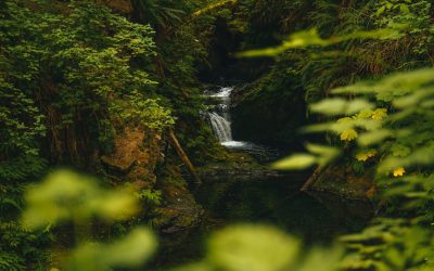
Gabon, located on the west coast of Central Africa, is a country known for its diverse and varied terrain. The landscape of Gabon is characterized by a combination of mountain ranges, valleys, lowlands, and coastal plains, making it a unique and fascinating destination for nature enthusiasts and researchers alike. The topography of Gabon is largely influenced by the Congo Basin, which covers a significant portion of the country and is home to some of the world’s most diverse and pristine rainforests. The terrain of Gabon plays a crucial role in shaping the country’s ecosystems, wildlife, and human settlements, making it an important aspect of the country’s identity and natural heritage. The diverse terrain of Gabon is a result of geological processes that have shaped the land over millions of years. The country is home to a wide range of geological formations, including ancient rock formations, volcanic mountains, and sedimentary basins. The terrain of Gabon is also influenced by its location within the Congo Basin, which is one of the largest tropical rainforest regions in the world. This unique combination of geological features has resulted in a landscape that is rich in biodiversity and natural beauty, making Gabon a truly remarkable destination for those interested in exploring the wonders of the natural world. Summary Gabon’s terrain is diverse, with mountain ranges, valleys, lowlands, and coastal plains. The mountain ranges in Gabon include the Crystal Mountains and the Chaillu Massif, which are important for biodiversity. The valleys and lowlands of Gabon are home to rivers, swamps, and forests, supporting a variety of wildlife. The coastal plains of Gabon are characterized by...
Climate Zones Of Gabon: Different climate regions Of Gabon
Gabon, located on the west coast of Central Africa, is a country known for its rich biodiversity and diverse climate zones. The country is divided into several distinct climate zones, each with its own unique characteristics and weather patterns. Understanding these climate zones is crucial for anyone planning to visit or do business in Gabon, as it can greatly impact travel plans, agricultural practices, and overall quality of life. From the equatorial climate zone in the north to the coastal climate zone in the west and the highland climate zone in the east, Gabon offers a wide range of climates that contribute to its natural beauty and ecological diversity. Summary Gabon has a diverse range of climate zones, each with its own unique characteristics and weather patterns. The Equatorial Climate Zone in Gabon is characterized by high temperatures, heavy rainfall, and high humidity throughout the year. The Tropical Climate Zone experiences distinct wet and dry seasons, with high temperatures and moderate to high rainfall. The Transition Zone in Gabon has a mix of characteristics from both the equatorial and tropical zones, with varying levels of rainfall and temperature. The Coastal Climate Zone in Gabon experiences milder temperatures and lower rainfall compared to other zones, with a more moderate climate influenced by the ocean. Equatorial Climate Zone The equatorial climate zone covers the northern part of Gabon and is characterized by high temperatures, heavy rainfall, and high humidity throughout the year. This region experiences very little variation in temperature, with average highs of around 30°C and lows of around 23°The equatorial zone is also known for its dense rainforests, which...
Political Boundaries of Gabon: Provinces, Districts, or Historical Boundaries.
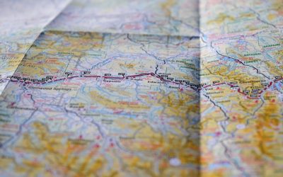
Gabon, a country located on the west coast of Central Africa, is known for its rich biodiversity and diverse culture. The political boundaries of Gabon are defined by its borders with Equatorial Guinea to the northwest, Cameroon to the north, the Republic of the Congo to the east and south, and the Atlantic Ocean to the west. The country covers an area of 267,667 square kilometers and is divided into nine provinces and further subdivided into 50 districts. The political boundaries of Gabon have evolved over time, influenced by historical, geographical, and cultural factors. These boundaries play a crucial role in shaping the governance, administration, and development of the country. Summary Gabon’s political boundaries are defined by its borders with Cameroon, Equatorial Guinea, and the Atlantic Ocean. Gabon is divided into 9 provinces, each with its own administrative capital and governor. The provinces are further divided into 50 districts, each with its own district chief and administrative structure. Gabon’s historical boundaries have been shaped by colonialism and the scramble for Africa by European powers. The political boundaries of Gabon have a significant impact on governance, resource allocation, and infrastructure development. Challenges and controversies surrounding Gabon’s political boundaries include disputes with neighbouring countries and issues of resource exploitation. The future of Gabon’s political boundaries will likely be influenced by regional integration efforts and the need for sustainable development. Provinces of Gabon Gabon is divided into nine provinces, each with its own unique characteristics and cultural heritage. The provinces are Estuaire, Haut-Ogooué, Moyen-Ogooué, Ngounié, Nyanga, Ogooué-Ivindo, Ogooué-Lolo, Ogooué-Maritime, and Woleu-Ntem. Each province is further divided into districts, which are the primary...
Gabon
Gabon (République Gabonaise (Gabonese Republic)) Capital: Libreville Population (Estimated July 2012): 1,608,321 Area: 267,667 km2 or 103,347 mi2 Currency: CFA Franc (CFAF) Official Language: French Political Information: Presidential Republic Official Religion: No Official Religion(approximately 55% – 75% of the population are Christian, with the remainder animist and Muslim less than 1%) Highest Mountain: Mont Bengoué at 1,070m or 3,510 ft GDP Official Exchange Rate (OER is more precise at gauging a countries economic power) (Estimated 2011): $16.7 billion (US$) or (GBP) GDP (OER) Per Capita (per member of the population estimated 2011): (US$) or (GBP) GDP Purchasing Power Parity (PPP is good for gauging living conditions and use of resources but not as accurate as OER. This data has been calculated based on the sum value of all goods and services produced in the country valued at prices prevailing in the United States) (Estimated 2011): $24.28 billion (US$) or (GBP) GDP (PPP) Per Capita (per member of the population estimated 2011): $16,000 (US$) or (GBP) Time Zone (UTC): +1:00 Wildlife: Counties/Provinces/States: Provinces; Estuaire, Haut-Ogooue, Moyen-Ogooue, Ngounie, Nyanga, Ogooue-Ivindo, Ogooue-Lolo, Ogooue-Maritime, Woleu-Ntem Leaders: President Ali Bongo Ondimba with Prime Minister Raymond Ndong Sima. Additional: Gained Independence from France on the 17th of August 1960. Sources: CIA World Fact Book, Encyclopaedia Britannica. Gabon Gabon, officially known as the Gabonese Republic, is a country located on the west coast of Central Africa. It is bordered by Equatorial Guinea to the northwest, Cameroon to the north, the Republic of the Congo on the east and south, and the Atlantic Ocean to the west. The capital city of Gabon is Libreville, which is also the largest city in the country. The official language is French, and the...

Natural Resources of Gabon: Where Natural Resources are located In Gabon
Gabon, located on the west coast of Central Africa, is blessed with a rich abundance of natural resources. The country’s natural resources include forests, minerals, oil and gas, water, wildlife, and biodiversity. These resources play a crucial role in the country’s economy and are vital for the livelihoods of the Gabonese people. The sustainable management of these resources is essential for the long-term development and prosperity of the nation. Gabon’s natural resources have attracted significant attention from both domestic and international investors. The government has implemented policies to promote sustainable development and conservation of these resources, while also seeking to leverage them for economic growth. The country’s natural beauty and diverse ecosystems make it a unique and valuable resource for the world. As such, Gabon has made efforts to balance the exploitation of its resources with conservation efforts to ensure their preservation for future generations. Summary Gabon is rich in natural resources, including forests, minerals, oil and gas, water, and wildlife. The forests in Gabon cover about 85% of the country and are home to a diverse range of plant and animal species. Gabon has significant mineral resources, including manganese, iron, gold, and uranium. The oil and gas industry is a major contributor to Gabon’s economy, with the country being one of the largest oil producers in sub-Saharan Africa. Gabon’s water resources are abundant, with numerous rivers and lakes providing important sources of freshwater for the country. Forest Resources in Gabon Gabon is home to one of the largest intact tropical rainforests in the world, covering approximately 85% of the country’s land area. These forests are a vital natural...

Cultural or Historical Sites of Gabon: Important Cultural Landmarks or Historical Sites in Gabon
Gabon, a country located on the west coast of Central Africa, is home to a rich tapestry of cultural and historical sites that offer a glimpse into the country’s fascinating past. From the lush rainforests to the vibrant cities, Gabon’s cultural and historical sites are a testament to the country’s diverse heritage and the resilience of its people. The country’s history is deeply intertwined with the slave trade, colonialism, and the struggle for independence, and these themes are reflected in the various cultural and historical sites that can be found throughout Gabon. One of the most striking aspects of Gabon’s cultural and historical sites is the way in which they are integrated into the natural landscape. From the dense rainforests to the winding rivers, these sites are not only a testament to the country’s history but also a celebration of its natural beauty. Whether it’s the sacred Ivindo River and the Kongou Falls or the Lopé-Okanda World Heritage Site, Gabon’s cultural and historical sites offer visitors a unique opportunity to explore the country’s history while immersing themselves in its stunning natural surroundings. Summary Gabon is home to a rich cultural and historical heritage, with a variety of sites that showcase the country’s unique history and traditions. The Sacred Ivindo River and the Kongou Falls offer visitors a chance to experience the natural beauty and spiritual significance of these iconic landmarks. The Historical Slave Route in Loango National Park provides a sobering look at Gabon’s role in the transatlantic slave trade and its impact on the country’s history. The Lopé-Okanda World Heritage Site is a must-visit for those interested in...

Cultural or Historical Sites of France: Important Cultural Landmarks or Historical Sites in France
The Eiffel Tower, one of the most iconic landmarks in the world, is a symbol of France’s cultural heritage. Designed by Gustave Eiffel and completed in 1889, the tower was initially met with controversy and criticism, but it has since become a beloved symbol of Paris and France as a whole. Standing at 1,063 feet tall, the Eiffel Tower offers breathtaking panoramic views of the city and has become a must-see attraction for tourists from around the world. The Eiffel Tower’s intricate iron lattice design is a testament to the architectural and engineering prowess of the late 19th century. Its unique structure and graceful curves have inspired artists, architects, and engineers for generations. The tower’s significance goes beyond its architectural beauty; it has become a symbol of romance, adventure, and the enduring spirit of France. Whether it’s illuminated against the night sky or standing tall in the daylight, the Eiffel Tower continues to captivate and inspire all who gaze upon it. Summary The Eiffel Tower is an iconic symbol of France’s cultural heritage, representing the country’s engineering prowess and artistic vision. The Louvre Museum houses some of the world’s most famous art and historical artifacts, making it a must-visit for anyone interested in culture and history. Notre-Dame Cathedral is a stunning example of French Gothic architecture, showcasing the country’s mastery of intricate design and craftsmanship. Mont Saint-Michel is a unique island abbey with deep historical significance, offering visitors a glimpse into France’s medieval past. The Palace of Versailles is a grandiose display of French royalty and history, reflecting the opulence and power of the country’s monarchs. The Louvre Museum:...