World Geography
Geography is the study of the Earth’s landscapes, environments, and the relationships between people and their surroundings. It encompasses both the physical aspects of the Earth, such as its landforms, bodies of water, and climate, as well as the human aspects, including population distribution, cultures, and economies. World geography is a broad field that seeks to understand the complexities of our planet and how humans interact with it. By studying world geography, we can gain a deeper appreciation for the diversity of our planet and the interconnectedness of its various regions.
Geography is a multidisciplinary field that draws on elements of physical science, social science, and humanities. It involves the use of maps, spatial analysis, and geographic information systems (GIS) to understand the Earth’s surface and the processes that shape it. World geography also encompasses the study of human geography, which examines the ways in which people and their activities are distributed across the Earth. By understanding world geography, we can better appreciate the environmental, cultural, and economic challenges facing different regions of the world. This knowledge is crucial for addressing global issues such as climate change, resource management, and international development.
The Five Oceans and Seven Continents
The Earth’s surface is divided into five major oceans: the Pacific, Atlantic, Indian, Southern (or Antarctic), and Arctic Oceans. These vast bodies of water play a crucial role in regulating the Earth’s climate and supporting diverse marine ecosystems. The oceans also serve as important transportation routes and a source of food and other natural resources for human societies around the world.
In addition to the oceans, the Earth’s landmasses are divided into seven continents: Africa, Antarctica, Asia, Europe, North America, Australia (or Oceania), and South America. Each continent has its own unique physical and cultural characteristics, shaped by millions of years of geological processes and human history. From the deserts of Africa to the rainforests of South America, the continents offer a rich tapestry of landscapes and environments for exploration and study.
Major Mountain Ranges and Deserts
The Earth’s surface is also marked by major mountain ranges and deserts that have shaped the planet’s physical and cultural landscapes. The Himalayas, for example, are the highest mountain range in the world and are home to diverse ecosystems and cultures in countries such as India, Nepal, and Bhutan. The Andes in South America, the Rockies in North America, and the Alps in Europe are other prominent mountain ranges that have influenced human settlement patterns and economic activities.
Deserts cover about one-third of the Earth’s land surface and are characterized by low precipitation and extreme temperatures. The Sahara Desert in Africa is the largest hot desert in the world, while the Gobi Desert in Asia is one of the largest cold deserts. Deserts are not only home to unique flora and fauna but have also been important trade routes and cultural crossroads throughout history.
Climate Zones and Biomes
The Earth’s climate is influenced by a variety of factors, including latitude, altitude, ocean currents, and prevailing winds. As a result, the planet is divided into different climate zones, each with its own characteristic weather patterns and ecosystems. The equator, for example, experiences a tropical climate with high temperatures and heavy rainfall, while the polar regions have a cold and dry climate.
These climate zones give rise to different biomes, or large ecological areas characterized by distinct plant and animal communities. The tropical rainforest biome, found near the equator, is home to a diverse array of species and is vital for regulating the Earth’s climate. The grasslands biome, found in regions such as the African savannah and North American prairies, supports grazing animals and has been important for human agriculture throughout history.
Human Geography and Population Distribution
Human geography examines the ways in which people and their activities are distributed across the Earth’s surface. It encompasses topics such as population growth, migration patterns, urbanization, and cultural diversity. Understanding human geography is crucial for addressing global challenges such as poverty, inequality, and environmental degradation.
Population distribution is uneven across the world, with some regions experiencing rapid population growth while others are declining. The majority of the world’s population lives in Asia, particularly in countries such as China and India. Urban areas are also growing rapidly, with more than half of the world’s population now living in cities. This trend has significant implications for infrastructure development, resource management, and social inequality.
Historical and Cultural Geography
Historical geography examines how human activities have shaped the Earth’s landscapes over time. It explores topics such as colonialism, trade routes, and the rise and fall of empires. Cultural geography focuses on how human cultures have developed in different regions of the world and how they interact with their environments.
The Silk Road, for example, was an ancient trade route that connected China with Europe and facilitated the exchange of goods, ideas, and technologies across Eurasia. This historical trade route had a profound impact on the development of cultures and economies along its path. Similarly, cultural geographers study how different societies have adapted to their environments through practices such as agriculture, architecture, and religious beliefs.
The Importance of Geographic Knowledge
Geographic knowledge is crucial for addressing global challenges such as climate change, resource management, and international development. By understanding world geography, we can better appreciate the environmental, cultural, and economic challenges facing different regions of the world. This knowledge is crucial for addressing global issues such as climate change, resource management, and international development.
Geographic knowledge also helps us to understand our interconnectedness with other regions of the world. By studying world geography, we can gain a deeper appreciation for the diversity of our planet and the interconnectedness of its various regions. This understanding can foster a sense of global citizenship and empathy for people from different cultures and backgrounds.
In conclusion, world geography is a complex and multifaceted field that encompasses both physical and human aspects of the Earth’s landscapes. By studying world geography, we can gain a deeper appreciation for the diversity of our planet and the interconnectedness of its various regions. This knowledge is crucial for addressing global challenges such as climate change, resource management, and international development. It also helps us to understand our interconnectedness with other regions of the world and fosters a sense of global citizenship.
FAQs
What is world geography?
World geography is the study of the Earth’s landscapes, environments, and the relationships between people and their environments. It encompasses the physical features of the Earth, as well as the human activity that takes place on it.
Why is world geography important?
World geography is important because it helps us understand the world around us. It provides insights into the physical and human processes that shape our planet, and helps us make informed decisions about how to interact with our environment.
What are the main branches of world geography?
The main branches of world geography include physical geography, which focuses on the Earth’s natural features and processes, and human geography, which examines the relationships between people and their environments.
How does world geography impact our daily lives?
World geography impacts our daily lives in numerous ways, from influencing the weather and climate we experience, to shaping the availability of natural resources and influencing the distribution of populations and cultures around the world.
What are some key concepts in world geography?
Key concepts in world geography include location, place, human-environment interaction, movement, and region. These concepts help geographers understand and interpret the world around them.

Population Density of Argentina
Population density refers to the number of people living in a specific area, usually measured per square kilometer. It is an important indicator of how crowded or sparsely populated an area is. Population density matters because it can have significant implications for various aspects of a country’s development, including infrastructure, resources, and social services. Argentina, the eighth-largest country in the world, has a population density of approximately 16 people per square kilometer. This makes it one of the least densely populated countries in the world. However, despite its low overall population density, Argentina has significant regional variations in population distribution. Understanding these variations and their underlying factors is crucial for understanding Argentina’s social and economic landscape. Summary Argentina has a population density of 16 people per square kilometer. Population density in Argentina has been increasing since the 19th century. Buenos Aires has the highest population density in Argentina, while Patagonia has the lowest. Urbanization and immigration are major factors contributing to high population density in urban areas. High population density areas in Argentina face challenges such as housing shortages and environmental degradation. Historical Overview of Population Density in Argentina Argentina’s population has experienced significant growth over time. In the early 19th century, the country had a relatively small population, with most people concentrated in urban areas such as Buenos Aires. However, with the expansion of agriculture and the influx of immigrants in the late 19th and early 20th centuries, Argentina’s population began to grow rapidly. The period between 1869 and 1914 is known as the “Golden Age” of immigration in Argentina. During this time, millions of immigrants from Europe,...
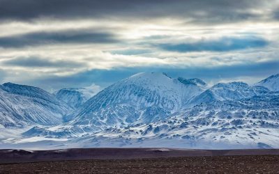
Natural Resources of Argentina: Where Natural Resources are located In Argentina
Argentina’s Natural Resources and Mining Industry: A Hidden Powerhouse of South America Argentina, a nation better known for tango, wine, and football, is increasingly making headlines in the world of mineral resources and mining. Blessed with vast untapped natural resources, Argentina is positioning itself as a global leader in lithium, copper, petroleum, and more. This article offers an in-depth exploration of Argentina’s mining industry, the role of the World Bank, and the impact of foreign investment. Whether you’re a curious reader, investor, or policy watcher, this article is worth your time because it deciphers how Argentina’s mines could fuel the future of the green economy. Article Outline Why Are Argentina’s Natural Resources So Important? What Is the Current State of Mining in Argentina? How Has the World Bank Supported Argentina’s Mining Growth? What Role Does Lithium Play in Argentina’s Future? Is Argentina Rich in Other Mineral Resources? What Is the Impact of Foreign Investment in Mining? How Do Mines Influence Argentina’s GDP and Exports? What Challenges Face the Mining Industry in Argentina? How Are Sustainability and Transparency Addressed in Argentina’s Mining Sector? What Does the Future Hold for Argentina’s Natural Resources? Why Are Argentina’s Natural Resources So Important? Argentina is one of the most resource-rich countries in Latin America, boasting a wealth of mineral resources and energy reserves. From natural gas to petroleum and lithium, Argentina is uniquely positioned to support both regional and global industries, particularly those pivoting to renewable energy and sustainable technology. The World Bank has classified Argentina among the Latin American countries with great potential for economic transformation via natural resources. Notably,...

Cultural or Historical Sites of Argentina: Important Cultural Landmarks or Historical Sites In Argentina
Argentina is a country known for its rich cultural heritage and natural wonders. From the vibrant streets of Buenos Aires to the breathtaking landscapes of Patagonia, Argentina offers a diverse range of experiences for travellers. In this article, we will explore some of the most iconic and enchanting destinations in Argentina, from the historic quarter of Buenos Aires to the mystical ruins of Tiwanaku. Whether you are a history buff, a nature lover, or simply seeking adventure, Argentina has something to offer for everyone. Summary Buenos Aires’ historic quarter offers a glimpse into Argentina’s past Teatro Colón is a must-visit cultural gem in Buenos Aires Iguazu Falls is a magnificent natural wonder of Argentina Bariloche is an enchanting haven for culture and history buffs Tiwanaku’s ruins provide a mystical glimpse into Argentina’s pre-Columbian past The Historic Quarter of Buenos Aires: A Journey Through Argentina’s Past The historic quarter of Buenos Aires is a must-visit destination for anyone interested in Argentina’s history. This area is home to some of the country’s most important landmarks and monuments, including Plaza de Mayo and Casa Rosada. Plaza de Mayo is the main square in Buenos Aires and has been the site of many significant events in Argentina’s history, including the May Revolution in 1810. Casa Rosada, the presidential palace, is located on one side of Plaza de Mayo and is an iconic symbol of Argentina’s political history. The Iconic Teatro Colón: A Cultural Gem of Buenos Aires The Teatro Colón is one of the most prestigious opera houses in the world and a cultural gem of Buenos Aires. Built in 1908, the theater...
Political Boundaries of Antigua and Barbuda: Provinces, Districts, or Historical Boundaries.
Antigua and Barbuda, located in the eastern Caribbean, is a small island nation with a rich history and vibrant culture. Understanding the political boundaries of this country is crucial for effective governance and decision-making. Political boundaries define the territories and jurisdictions within which governments operate, and they play a significant role in shaping the social, economic, and political landscape of a nation. Summary Antigua and Barbuda is a sovereign nation consisting of two major islands and several smaller ones. The country’s political boundaries have evolved over time due to colonization and independence movements. Provinces play a significant role in Antigua and Barbuda’s political system, with each having its own government and leader. The country is divided into six districts, each with its own unique characteristics and challenges. Political boundaries have a significant impact on Antigua and Barbuda’s society, including access to resources and representation in government. Historical Boundaries of Antigua and Barbuda The political boundaries of Antigua and Barbuda have evolved over time due to various historical factors. The islands were originally inhabited by the indigenous Arawak and Carib peoples before being colonized by the Spanish in the late 15th century. The British later established control over the islands in the 17th century, and they remained under British rule until gaining independence in 1981. During the colonial period, Antigua and Barbuda were part of the British West Indies Federation, which included several other Caribbean territories. The boundaries of these territories were often redrawn to suit the needs of the colonial powers, resulting in changes to Antigua and Barbuda’s political boundaries. The Role of Provinces in Antigua and Barbuda’s Political...
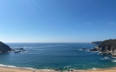
Natural Resources of Antigua and Barbuda: Where Natural Resources are located In Antigua and Barbuda
Antigua and Barbuda, a small island nation located in the Caribbean, is blessed with a variety of natural resources that contribute significantly to its economy and the livelihoods of its people. These resources include minerals, agricultural land, forests, marine resources, and energy sources. The abundance of these resources has played a crucial role in shaping the country’s history and development. Natural resources are essential for the economic growth and development of any nation. In the case of Antigua and Barbuda, these resources provide employment opportunities, contribute to the country’s GDP, and support various industries such as agriculture, tourism, and manufacturing. They also play a vital role in ensuring food security and providing raw materials for industries. Summary Antigua and Barbuda is a small island nation in the Caribbean with a variety of natural resources. The geography of Antigua and Barbuda includes coral reefs, beaches, and hilly terrain. Natural resources in Antigua and Barbuda are located in various parts of the country, including the coast and interior. Mineral resources in Antigua and Barbuda include limestone, clay, and sand. Agricultural resources in Antigua and Barbuda include crops such as sugarcane, bananas, and vegetables. Overview of the Geography of Antigua and Barbuda Antigua and Barbuda consists of two main islands, Antigua and Barbuda, along with several smaller islands. It is located in the eastern Caribbean Sea, southeast of Puerto Rico. The country covers an area of approximately 440 square kilometers (170 square miles). The topography of Antigua is characterized by low-lying limestone formations with some volcanic hills in the southwest. Barbuda, on the other hand, is mostly flat with sandy beaches and...
Climate Zones of Antigua and Barbuda: Different climate regions Of Antigua and Barbuda
Antigua and Barbuda, located in the eastern Caribbean, is a small island nation consisting of two main islands – Antigua and Barbuda – along with several smaller islands. The country is known for its stunning beaches, crystal-clear waters, and vibrant culture. Understanding the climate zones of Antigua and Barbuda is crucial for both visitors and residents, as it helps in planning activities, packing appropriate clothing, and understanding the local environment. Summary Antigua and Barbuda has a variety of climate zones, including tropical, arid, humid, coastal, and inland. Barbuda Island has an arid climate, while Antigua Island has a humid climate. The coastal climate of Antigua and Barbuda is influenced by the sea, while the inland climate is influenced by the terrain. Antigua and Barbuda has a rainy season from June to November and a dry season from December to May. Climate change is a growing concern for Antigua and Barbuda’s ecosystem and future. The Tropical Climate of Antigua and Barbuda Antigua and Barbuda experience a tropical climate, characterized by high temperatures and abundant rainfall throughout the year. The average temperature ranges from 25°C (77°F) to 30°C (86°F), making it an ideal destination for those seeking warm weather. The tropical climate zone is home to a diverse range of flora and fauna, including palm trees, hibiscus flowers, and various species of birds. The Arid Climate of Barbuda Island Barbuda Island, which is located north of Antigua, has an arid climate zone. This means that it receives less rainfall compared to other parts of Antigua and Barbuda. The average temperature on Barbuda ranges from 26°C (79°F) to 31°C (88°F). The arid...
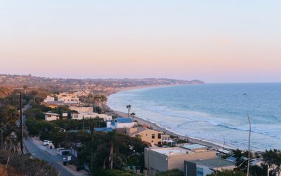
Population Density of Antigua and Barbuda
Antigua and Barbuda, a small island nation located in the Caribbean, has a population density that is of great importance to understand. Population density refers to the number of people living in a specific area, usually measured in square kilometers or square miles. Understanding population density is crucial as it provides insights into the distribution of people within a country, which in turn can have significant implications for social, economic, and environmental factors. Summary Antigua and Barbuda has a population density of 223 people per square kilometre. The country is located in the eastern Caribbean, consisting of two main islands and several smaller ones. Population growth in Antigua and Barbuda has been influenced by colonialism, slavery, and migration. As of 2021, the population of Antigua and Barbuda is estimated to be around 98,000 people. Factors such as limited land availability and economic opportunities contribute to the uneven distribution of population between urban and rural areas. Understanding the Geographical Location of Antigua and Barbuda Antigua and Barbuda consists of two main islands, Antigua and Barbuda, along with several smaller islands. It is located in the eastern Caribbean Sea, southeast of Puerto Rico. The islands are part of the Lesser Antilles, which are a group of islands that form an arc between the Greater Antilles and South America. The geographical location of Antigua and Barbuda has a direct impact on its population density. Being situated in the Caribbean Sea, Antigua and Barbuda have a tropical climate with warm temperatures year-round. This makes the islands an attractive destination for tourists, which in turn can influence population density. Additionally, the islands’ location also...
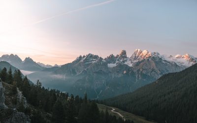
Terrain and Topography of Antigua and Barbuda: mountains, valleys, and plains.
Antigua and Barbuda, located in the eastern Caribbean, is a stunning island nation known for its beautiful beaches and crystal-clear waters. However, beyond its pristine coastline lies a diverse and fascinating terrain that is worth exploring. From its mountainous regions to its valleys and coastal plains, Antigua and Barbuda’s topography plays a crucial role in shaping the island’s climate, biodiversity, and agricultural industry. Understanding the island’s geography is essential for sustainable development and conservation efforts. Summary Antigua and Barbuda’s terrain is diverse, with mountainous regions, valleys, coastal plains, and unique karst topography. The mountainous regions of Antigua and Barbuda offer stunning views and are home to a variety of flora and fauna. The valleys of Antigua and Barbuda are low-lying areas that are important for agriculture and provide habitat for wildlife. The coastal plains of Antigua and Barbuda are home to many of the island’s towns and cities, as well as important ecosystems like mangroves and coral reefs. Antigua and Barbuda’s topography plays a significant role in shaping the climate and weather patterns of the islands. The Mountainous Regions of Antigua and Barbuda Antigua and Barbuda may be known for its beaches, but it also boasts some impressive mountainous areas. The highest point on the island of Antigua is Mount Obama, formerly known as Boggy Peak, which stands at 402 meters (1,319 feet) above sea level. This mountain offers breathtaking views of the surrounding landscape and is a popular hiking destination for both locals and tourists. In addition to Mount Obama, there are several other notable mountains on the island, including Signal Hill and Shirley Heights. These mountains provide...
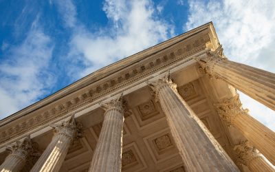
Cultural or Historical Sites of Antigua and Barbuda: Important Cultural Landmarks or Historical Sites In Antigua and Barbuda
Antigua, a small island in the Caribbean, is known for its stunning beaches and crystal-clear waters. However, beyond its natural beauty, Antigua also boasts a rich history that is worth exploring. From colonial architecture to historic naval bases, the island is home to numerous historical sites that offer a glimpse into its past. When visiting Antigua, it is important to take the time to explore these sites and learn about the island’s fascinating history. Summary Nelson’s Dockyard is a UNESCO World Heritage Site and a historic naval base. Betty’s Hope is the oldest sugar plantation on Antigua. St. John’s Cathedral is an iconic landmark of colonial architecture. Devil’s Bridge is a natural wonder and symbol of African slave resistance. The Museum of Antigua and Barbuda preserves the islands’ cultural heritage. Nelson’s Dockyard: A Historic Naval Base and UNESCO World Heritage Site One of the most significant historical sites in Antigua is Nelson’s Dockyard. This historic naval base was established in the 18th century and played a crucial role in the British Navy’s operations in the Caribbean. Today, it is a UNESCO World Heritage Site and a popular tourist attraction. Touring Nelson’s Dockyard allows visitors to step back in time and experience what life was like during the height of the British Empire. The dockyard is home to numerous restored buildings, including the Admiral’s House, which now serves as a museum showcasing the history of the dockyard. Visitors can also explore the ruins of old warehouses and workshops, giving them a sense of the bustling activity that once took place here. Betty’s Hope: The Oldest Sugar Plantation on Antigua Sugar...
Republic of Angola: Natural Resources, Diamond, Mineral Resources and Mining Industry
Republic of Angola: Natural Resources, Diamond, Mineral Resources and Mining Industry Angola, officially known as the Republic of Angola, is a nation rich in natural resources, boasting vast reserves of oil, diamonds, and various minerals. This abundance has positioned Angola as a significant player in the global mining industry. Understanding the natural resources of Angola is crucial for comprehending its economic landscape and the challenges and opportunities that come with resource wealth. Outline What Are Angola’s Primary Natural Resources? How Has Diamond Mining Shaped Angola’s Economy? The Role of Oil in Angola’s Economic Development Exploring Angola’s Iron Ore Reserves The Impact of Natural Resources on the Angolan Economy Challenges in Angola’s Mining Industry The Influence of Portuguese Colonisation on Resource Extraction Post-Civil War Recovery and Resource Management Angola’s Position in Sub-Saharan Africa‘s Resource Landscape Future Prospects for Angola’s Natural Resource Sector 1. What Are Angola’s Primary Natural Resources? Angola is endowed with a variety of natural resources, including petroleum, diamonds, iron ore, phosphates, copper, feldspar, gold, bauxite, and uranium. These resources have been central to the country’s economic activities and export revenues. The petroleum sector is particularly significant, contributing a substantial portion to Angola’s GDP and government revenue. Diamonds also play a crucial role, with Angola being one of the largest producers of diamonds in Africa. The mining of iron ore and other minerals further diversifies the country’s resource base. 2. How Has Diamond Mining Shaped Angola’s Economy? Diamond mining has been a cornerstone of Angola’s economy, especially since the end of the civil war. The country is among the top producers of diamonds globally, with significant...
Political Boundaries of Angola: Provinces, Districts, or Historical Boundaries.
Angola, located in Southern Africa, is a country with rich history and diverse cultures. Understanding Angola’s political boundaries is crucial for comprehending its governance, history, and the challenges faced by its people. Angola shares borders with several countries, including Namibia, Zambia, the Democratic Republic of Congo, and the Republic of Congo. The Atlantic Ocean forms Angola’s western boundary. These political boundaries have played a significant role in shaping Angola’s history and present-day circumstances. Summary Angola’s political boundaries have evolved over time, with the country currently divided into 18 provinces and 164 municipalities. The provincial divisions have historical and cultural significance, with some dating back to the colonial era and others established after independence. Districts are the smallest administrative units in Angola, responsible for providing basic services and governance to local communities. Angola’s historical boundaries have been shaped by colonialism, civil war, and international disputes, with some areas still contested today. The impact of Angola’s political boundaries on its people can be seen in issues such as access to resources, ethnic tensions, and regional disparities in development. Angola’s Provincial Divisions: History and Significance Angola is divided into 18 provinces, each with its own unique characteristics and cultural heritage. The provincial divisions in Angola have a long historical background that dates back to the colonial era. During the Portuguese colonial rule, Angola was divided into three major regions: Angola, Benguela, and Mozambique. These regions were further divided into districts and municipalities. The significance of provincial divisions in Angola’s governance lies in the decentralization of power and resources. Each province has its own government and administration, allowing for local decision-making and development...
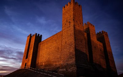
Cultural or Historical Sites of Angola: Important Cultural Landmarks or Historical Sites In Angola
Angola, located on the western coast of Africa, is a country rich in cultural and historical sites. From ancient ruins to colonial architecture, Angola’s heritage tells the story of its diverse past. Preserving these sites is crucial for future generations to understand and appreciate the country’s history and cultural identity. Summary Angola has a rich cultural and historical heritage, with many sites of significance. Luanda, the capital city, has a fascinating history that reflects Angola’s colonial past. The Kongo Kingdom played a significant role in Angola’s history and is still celebrated today. The Great Zimbabwe ruins in Angola are shrouded in mystery and intrigue. The legacy of Portuguese colonialism is still evident in Angola’s culture and architecture. The Rich History of Angola’s Capital City, Luanda Luanda, the capital city of Angola, has a fascinating history that dates back to pre-colonial times. Originally inhabited by the Ambundu people, Luanda became an important trading post for the Portuguese in the 16th century. Over the centuries, it grew into a bustling city with a mix of African, European, and Brazilian influences. One of the key historical sites in Luanda is Fortaleza de São Miguel, a fortress built by the Portuguese in the 16th century to protect their interests in the region. Today, it serves as a museum that showcases the city’s colonial past. Another important site is the National Museum of Slavery, which documents Angola’s role in the transatlantic slave trade and educates visitors about this dark chapter in history. The Significance of the Kongo Kingdom in Angola’s History The Kongo Kingdom played a significant role in shaping Angola’s history. Established in...