World Geography
Geography is the study of the Earth’s landscapes, environments, and the relationships between people and their surroundings. It encompasses both the physical aspects of the Earth, such as its landforms, bodies of water, and climate, as well as the human aspects, including population distribution, cultures, and economies. World geography is a broad field that seeks to understand the complexities of our planet and how humans interact with it. By studying world geography, we can gain a deeper appreciation for the diversity of our planet and the interconnectedness of its various regions.
Geography is a multidisciplinary field that draws on elements of physical science, social science, and humanities. It involves the use of maps, spatial analysis, and geographic information systems (GIS) to understand the Earth’s surface and the processes that shape it. World geography also encompasses the study of human geography, which examines the ways in which people and their activities are distributed across the Earth. By understanding world geography, we can better appreciate the environmental, cultural, and economic challenges facing different regions of the world. This knowledge is crucial for addressing global issues such as climate change, resource management, and international development.
The Five Oceans and Seven Continents
The Earth’s surface is divided into five major oceans: the Pacific, Atlantic, Indian, Southern (or Antarctic), and Arctic Oceans. These vast bodies of water play a crucial role in regulating the Earth’s climate and supporting diverse marine ecosystems. The oceans also serve as important transportation routes and a source of food and other natural resources for human societies around the world.
In addition to the oceans, the Earth’s landmasses are divided into seven continents: Africa, Antarctica, Asia, Europe, North America, Australia (or Oceania), and South America. Each continent has its own unique physical and cultural characteristics, shaped by millions of years of geological processes and human history. From the deserts of Africa to the rainforests of South America, the continents offer a rich tapestry of landscapes and environments for exploration and study.
Major Mountain Ranges and Deserts
The Earth’s surface is also marked by major mountain ranges and deserts that have shaped the planet’s physical and cultural landscapes. The Himalayas, for example, are the highest mountain range in the world and are home to diverse ecosystems and cultures in countries such as India, Nepal, and Bhutan. The Andes in South America, the Rockies in North America, and the Alps in Europe are other prominent mountain ranges that have influenced human settlement patterns and economic activities.
Deserts cover about one-third of the Earth’s land surface and are characterized by low precipitation and extreme temperatures. The Sahara Desert in Africa is the largest hot desert in the world, while the Gobi Desert in Asia is one of the largest cold deserts. Deserts are not only home to unique flora and fauna but have also been important trade routes and cultural crossroads throughout history.
Climate Zones and Biomes
The Earth’s climate is influenced by a variety of factors, including latitude, altitude, ocean currents, and prevailing winds. As a result, the planet is divided into different climate zones, each with its own characteristic weather patterns and ecosystems. The equator, for example, experiences a tropical climate with high temperatures and heavy rainfall, while the polar regions have a cold and dry climate.
These climate zones give rise to different biomes, or large ecological areas characterized by distinct plant and animal communities. The tropical rainforest biome, found near the equator, is home to a diverse array of species and is vital for regulating the Earth’s climate. The grasslands biome, found in regions such as the African savannah and North American prairies, supports grazing animals and has been important for human agriculture throughout history.
Human Geography and Population Distribution
Human geography examines the ways in which people and their activities are distributed across the Earth’s surface. It encompasses topics such as population growth, migration patterns, urbanization, and cultural diversity. Understanding human geography is crucial for addressing global challenges such as poverty, inequality, and environmental degradation.
Population distribution is uneven across the world, with some regions experiencing rapid population growth while others are declining. The majority of the world’s population lives in Asia, particularly in countries such as China and India. Urban areas are also growing rapidly, with more than half of the world’s population now living in cities. This trend has significant implications for infrastructure development, resource management, and social inequality.
Historical and Cultural Geography
Historical geography examines how human activities have shaped the Earth’s landscapes over time. It explores topics such as colonialism, trade routes, and the rise and fall of empires. Cultural geography focuses on how human cultures have developed in different regions of the world and how they interact with their environments.
The Silk Road, for example, was an ancient trade route that connected China with Europe and facilitated the exchange of goods, ideas, and technologies across Eurasia. This historical trade route had a profound impact on the development of cultures and economies along its path. Similarly, cultural geographers study how different societies have adapted to their environments through practices such as agriculture, architecture, and religious beliefs.
The Importance of Geographic Knowledge
Geographic knowledge is crucial for addressing global challenges such as climate change, resource management, and international development. By understanding world geography, we can better appreciate the environmental, cultural, and economic challenges facing different regions of the world. This knowledge is crucial for addressing global issues such as climate change, resource management, and international development.
Geographic knowledge also helps us to understand our interconnectedness with other regions of the world. By studying world geography, we can gain a deeper appreciation for the diversity of our planet and the interconnectedness of its various regions. This understanding can foster a sense of global citizenship and empathy for people from different cultures and backgrounds.
In conclusion, world geography is a complex and multifaceted field that encompasses both physical and human aspects of the Earth’s landscapes. By studying world geography, we can gain a deeper appreciation for the diversity of our planet and the interconnectedness of its various regions. This knowledge is crucial for addressing global challenges such as climate change, resource management, and international development. It also helps us to understand our interconnectedness with other regions of the world and fosters a sense of global citizenship.
FAQs
What is world geography?
World geography is the study of the Earth’s landscapes, environments, and the relationships between people and their environments. It encompasses the physical features of the Earth, as well as the human activity that takes place on it.
Why is world geography important?
World geography is important because it helps us understand the world around us. It provides insights into the physical and human processes that shape our planet, and helps us make informed decisions about how to interact with our environment.
What are the main branches of world geography?
The main branches of world geography include physical geography, which focuses on the Earth’s natural features and processes, and human geography, which examines the relationships between people and their environments.
How does world geography impact our daily lives?
World geography impacts our daily lives in numerous ways, from influencing the weather and climate we experience, to shaping the availability of natural resources and influencing the distribution of populations and cultures around the world.
What are some key concepts in world geography?
Key concepts in world geography include location, place, human-environment interaction, movement, and region. These concepts help geographers understand and interpret the world around them.
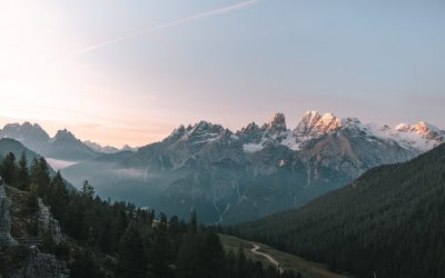
Terrain and Topography of Algeria: mountains, valleys, and plains.
Algeria, the largest country in Africa, is a land of diverse and breathtaking landscapes. From the majestic Atlas Mountains to the vast expanse of the Sahara Desert, Algeria’s terrain is as varied as it is beautiful. Understanding the geography and topography of Algeria is crucial to understanding its culture, economy, and ecology. In this article, we will explore the different regions of Algeria’s terrain and delve into the unique features and significance of each. Summary Algeria’s terrain is diverse, ranging from mountains to deserts to coastal plains. The Atlas Mountains are a majestic range that runs through the country. The Saharan Plateau is a vast expanse of desert terrain that covers much of Algeria. The Tell Atlas is a chain of mountains that runs along the northern coast. The High Plateaus of Algeria offer a diverse landscape with unique flora and fauna. Overview of Algeria’s Terrain and Topography Algeria is located in North Africa, bordered by the Mediterranean Sea to the north, Tunisia and Libya to the east, Niger and Mali to the south, and Morocco and Western Sahara to the west. With an area of approximately 2.38 million square kilometers, it is the tenth-largest country in the world. The diverse terrain of Algeria can be divided into several distinct regions. The Majestic Atlas Mountains of Algeria The Atlas Mountains are a prominent feature of Algeria’s geography. Stretching across several countries in North Africa, including Morocco, Tunisia, and Algeria, they are one of the longest mountain ranges in the world. In Algeria, the Atlas Mountains cover a vast area, running from the northeastern corner of the country to its...
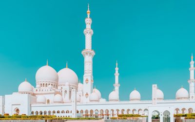
Cultural or Historical Sites of Algeria: Important Cultural Landmarks or Historical Sites In Algeria
Introduction Algeria, located in North Africa, is a country with a rich cultural and historical heritage. From ancient Roman ruins to iconic mosques and historic cities, Algeria offers a wealth of attractions that showcase its diverse history and cultural influences. It is important to preserve and promote Algeria’s heritage to ensure that future generations can appreciate and learn from the country’s past. The Iconic Casbah of Algiers: A UNESCO World Heritage Site One of the most iconic sites in Algeria is the Casbah of Algiers, which is a UNESCO World Heritage Site. The Casbah has a long history dating back to the 17th century and is a symbol of the city’s rich cultural heritage. It is a maze-like complex of narrow streets, traditional houses, and historic buildings. The architecture of the Casbah is a blend of different styles, including Ottoman, Moorish, and French influences. The houses are built with traditional materials such as clay and wood, and many have beautiful courtyards and intricate tile work. The layout of the Casbah reflects its defensive nature, with narrow streets and high walls that were designed to protect the inhabitants from invaders. Within the Casbah, there are several must-see attractions. One of them is the Ketchaoua Mosque, which was originally built as a mosque in the 17th century but was later converted into a cathedral during the French colonial period. Another highlight is the Dar Hassan Pacha, a beautifully restored mansion that now serves as a museum showcasing Algerian art and culture. Visitors can also explore traditional craft shops, where they can buy handmade carpets, pottery, and other local products. Discovering the...
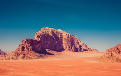
Population Density of Algeria
Algeria, the largest country in Africa, is home to a diverse population. Understanding the population density of Algeria is crucial for sustainable development. Population density refers to the number of people living in a specific area, usually measured in terms of persons per square kilometer. By analyzing population density, policymakers and researchers can gain insights into various aspects of development, such as resource allocation, infrastructure planning, and environmental management. Summary Algeria has a population density of 17 people per square kilometer. Population density in Algeria has fluctuated throughout history due to factors such as migration and political instability. Factors affecting population density in Algeria include climate, natural resources, and economic opportunities. Population density varies greatly across regions in Algeria, with the highest densities in the north and coastal areas. Urban areas in Algeria have much higher population densities than rural areas. High population density in Algeria has both positive and negative impacts on the economy. Managing high population density in Algeria is a challenge due to limited resources and infrastructure. Future projections suggest that population density in Algeria will continue to increase, particularly in urban areas. Algeria’s population density is lower than many other African countries, but still presents challenges for sustainable development. Sustainable development in Algeria will require careful management of population density and its impacts on the economy and environment. Historical Overview of Population Density in Algeria Algeria’s population has experienced significant changes over time. In the early 20th century, the country had a relatively low population density due to its vast size and harsh desert climate. However, with the advent of modern medicine and improvements in...

Discovering Albania’s Climate Zones: Regions of Varied Weather
Albania, located in Southeastern Europe, is a country known for its stunning landscapes, rich history, and vibrant culture. One aspect of Albania that often goes unnoticed is its diverse climate zones. Understanding these climate zones is crucial for travel planning, as it allows visitors to make the most of their trip and experience the country’s weather patterns. Albania’s geography plays a significant role in its climate. The country is bordered by the Adriatic and Ionian Seas to the west and has mountainous regions in the north and east. This combination of coastal and mountainous terrain creates a variety of microclimates throughout the country. Summary Albania has seven distinct climate zones, each with its own unique weather patterns and temperatures. The Mediterranean climate zone along the coast is characterized by hot, dry summers and mild winters with occasional rainfall. The continental climate zone in inland areas experiences hot summers and cold winters with snowfall and occasional thunderstorms. The alpine climate zone in high altitude areas has cool summers and cold winters with heavy snowfall and strong winds. The subtropical climate zone in southern Albania has hot, humid summers and mild winters with occasional rainfall. Climate change is affecting Albania’s weather patterns, with increased temperatures and more frequent extreme weather events. The best time to visit Albania depends on which climate zone you want to experience, but generally the summer months are the most popular for tourists. Albania’s diverse weather and climate zones offer a unique and varied experience for visitors to the country. The Mediterranean Climate Zone: Exploring Albania’s Coastal Regions The coastal regions of Albania fall under the Mediterranean...

Exploring Albania’s Political Boundaries: Provinces, Districts, or History?
Albania, located in Southeastern Europe, is a country with a rich history and diverse cultural heritage. Understanding the political boundaries of Albania is crucial for comprehending its political, social, and economic dynamics. This article aims to provide a comprehensive overview of Albania’s political divisions, exploring their historical evolution, the impact of Ottoman rule, the current provinces and districts, the role of politics in shaping these divisions, the cultural significance of regional identities, the challenges of governance, the economic landscape, and the future prospects for Albania’s political boundaries. Summary Albania’s political boundaries have evolved over time, with provinces and districts playing a significant role in shaping the country’s governance structure. Ottoman rule had a profound impact on Albania’s political boundaries, leading to the creation of new administrative units and the consolidation of power in the hands of local elites. Today, Albania is divided into 12 counties and 61 municipalities, each with its own unique political and cultural identity. Politics plays a crucial role in shaping Albania’s provincial and district divisions, with local and national interests often competing for influence and power. Albania’s regional identities are an important part of the country’s cultural heritage, with each province boasting its own distinct traditions, customs, and dialects. The Historical Evolution of Albania’s Provinces and Districts Albania’s historical provinces and districts have undergone significant changes over time. In ancient times, the region was divided into several tribes and city-states. During the medieval period, various kingdoms and principalities emerged, including the Kingdom of Illyria and the Principality of Arbanon. However, with the arrival of foreign powers such as the Byzantines, Venetians, and Ottomans, Albania’s political...

Albania: Economy & Natural Resources Discovering Natural Resources of Albania
Albania: Economy & Natural Resources Discovering Natural Resources of Albania Albania, located in Southeastern Europe, is a country known for its stunning natural beauty and rich biodiversity. With a diverse geography that includes mountains, coastline, lakes, and rivers, Albania is home to a wide range of natural resources. These resources play a crucial role in the country’s economy and provide numerous benefits to both the environment and its people. Preserving and utilizing these resources sustainably is of utmost importance to ensure their long-term viability. By doing so, Albania can continue to benefit from its natural wealth while also protecting the environment for future generations. Albania, a gem tucked away in the Balkans, is more than just beautiful coastlines and ancient ruins. It is a country endowed with natural resources that could transform the economy of Albania. From vast oil and gas deposits to fertile farmland and hydropower capacity, Albania holds the keys to a more prosperous future. In this article, we’ll explore the natural resources of Albania, how they are utilized, and what challenges and opportunities lie ahead. Outline What Are the Key Natural Resources of Albania? How Important Is the Petroleum Sector to Albania? What Role Does Hydropower Play in the Albanian Economy? What Minerals and Ores Are Found in Albania? How Significant Is the Agricultural Sector in Albania? Can Albania’s Natural Gas Reserves Boost Its Energy Security? What Is the Role of Exports in Albania’s Resource Economy? How Has the Albanian Government Managed Its Resource Sector? What Challenges Hamper Albania’s Resource Utilization? What Does the Future Hold for Natural Resources in Albania? What Are the Key...

Exploring Albania’s Varied Terrain: Mountains, Valleys, and Plains
Albania, a small country located in the Balkan Peninsula, is known for its stunning and varied terrain. From majestic mountains to enchanting valleys and lush plains, Albania offers a diverse landscape that is waiting to be explored. This article will provide an in-depth look at Albania’s terrain and the importance of exploring its natural beauty. Summary Albania’s terrain is diverse and varied, with mountains, valleys, and plains. The mountains of Albania are majestic and offer great opportunities for hiking and trekking. The valleys of Albania are enchanting and perfect for exploring on foot. The plains of Albania are lush and ideal for cycling. Albania’s varied terrain also offers opportunities for skiing, snowboarding, rafting, kayaking, and wildlife watching. The Majestic Mountains of Albania Albania is home to several mountain ranges, including the Albanian Alps, the Korab Mountains, and the Ceraunian Mountains. These mountains offer breathtaking views and are popular destinations for hiking and skiing. The Albanian Alps, also known as the Accursed Mountains, are particularly famous for their rugged beauty and challenging hiking trails. With peaks reaching over 2,500 meters, these mountains provide a thrilling adventure for outdoor enthusiasts. For those who prefer winter sports, the Korab Mountains and the Ceraunian Mountains offer excellent skiing opportunities. The Korab Mountains, located on the border between Albania and North Macedonia, are home to Mount Korab, the highest peak in both countries. The Ceraunian Mountains, on the other hand, stretch along the Albanian Riviera and provide stunning views of the Adriatic Sea. The Enchanting Valleys of Albania Albania’s valleys are equally enchanting and offer a unique experience for hikers and explorers. The Valbona...

Discover Albania’s Rich Cultural and Historical Sites
Albania, a small country located in the Balkans, is a hidden gem when it comes to history and culture. With a rich and diverse past, Albania offers a fascinating journey through time, from ancient ruins to Ottoman architecture, from religious diversity to coastal fortresses. This article will take you on a virtual tour of Albania’s cultural treasures, exploring its history, archaeological sites, UNESCO World Heritage Sites, religious sites, coastal fortresses, national museums, traditional crafts, literary legacy, and cultural festivals. Get ready to be amazed by the wonders of Albania! Summary Albania has a rich and fascinating history that spans thousands of years. The country is home to many ancient wonders, including impressive ruins that offer a glimpse into the past. Albania’s Ottoman legacy is still visible today, with many buildings and cultural traditions influenced by the empire. The country boasts several UNESCO World Heritage Sites, which are a testament to its cultural significance. Albania’s religious diversity is reflected in its many sacred sites, which offer a unique insight into the country’s spiritual traditions. Albania’s Fascinating History: A Journey Through Time Albania’s history dates back thousands of years, with evidence of human habitation in the region as early as the Paleolithic era. Throughout its history, Albania has been influenced by various civilizations and empires, including the Illyrians, Romans, Byzantines, Ottomans, and Communists. Each era has left its mark on the country’s culture and heritage. One of the key events in Albania’s history is the Illyrian Kingdom, which existed from the 3rd century BC to the 2nd century AD. The Illyrians were known for their advanced civilization and skilled craftsmanship. The...

Albania’s Population Density: A Closer Look
Population density refers to the number of people living in a specific area, usually measured per square kilometer. It is an important metric that helps us understand how crowded or sparsely populated a region is. In the case of Albania, understanding its population density is crucial for various reasons. It provides insights into the country’s social and economic dynamics, helps in urban planning and resource allocation, and informs policy decisions related to infrastructure development and sustainable growth. Summary Albania has a population density of 105 people per square kilometer. The country’s landscape is characterized by mountains, hills, and coastal plains. Albania’s population density has fluctuated throughout history due to factors such as migration and political changes. Contributing factors to Albania’s population density include urbanization, economic opportunities, and cultural traditions. Albania’s population is predominantly Albanian, with a median age of 32 and a slightly higher percentage of females than males. Understanding the Geographical Landscape of Albania Albania is a small country located in Southeastern Europe, bordered by Montenegro to the northwest, Kosovo to the northeast, North Macedonia to the east, Greece to the south, and the Adriatic and Ionian Seas to the west. It covers an area of approximately 28,748 square kilometers, making it one of the smallest countries in Europe. Albania’s topography is characterized by a diverse landscape that includes mountains, hills, valleys, and coastal plains. The country is home to the Albanian Alps in the north, which are part of the Dinaric Alps range, as well as several other mountain ranges such as the Korab Mountains and the Ceraunian Mountains. The climate in Albania varies from Mediterranean along...

Albania’s Population Density: A Closer Look
Albania, a small country located in Southeastern Europe, has a population density of approximately 105 people per square kilometer. This makes it one of the most densely populated countries in Europe. Understanding population density is crucial for policymakers and planners as it helps them make informed decisions regarding resource allocation, infrastructure development, and urban planning. Population density refers to the number of people living in a specific area, usually measured in terms of persons per square kilometer. It provides insights into the distribution of the population across a country or region. In the case of Albania, its high population density is a result of various factors such as historical trends, migration patterns, regional variations, and urbanization. Summary Albania has a population density of 105 people per square kilometer. Albania’s population growth has fluctuated over the years, with a peak in the 1980s and a decline in recent years. Migration has had a significant impact on Albania’s population density, with many people leaving the country for better economic opportunities. There are significant regional variations in Albania’s population density, with the north being more densely populated than the south. Urbanization has led to an increase in Albania’s population density, with more people moving to cities in search of work and better living conditions. Historical trends in Albania’s population growth Albania has experienced significant population growth over the years. In the early 20th century, the country had a relatively small population of around 800,000 people. However, by the end of the century, the population had more than tripled to over 3 million. This rapid growth can be attributed to several factors. One...
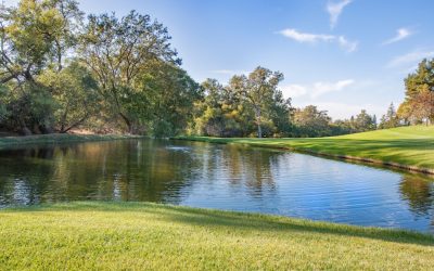
Terrain and Topography Of Afghanistan: mountains, valleys, and plains.
Afghanistan, located in Central Asia, is a country known for its diverse and rugged terrain. The country is landlocked and surrounded by six countries, including Iran, Pakistan, and Tajikistan. Understanding Afghanistan’s geography is crucial for various reasons, including its impact on transportation, communication, agriculture, trade, and cultural heritage. This article will explore the different regions of Afghanistan and their significance. Summary Afghanistan’s terrain and topography is diverse and varied, with mountain ranges, lowland areas, and river valleys. The Hindu Kush Mountain Range is a dominant feature of Afghanistan’s landscape, with peaks reaching over 7,000 meters. The Pamir Mountains are a lesser-known but significant mountain range in Afghanistan, located in the northeast. The Afghan-Tajik Basin is a vast lowland area in northern Afghanistan, bordered by the Hindu Kush and Pamir mountain ranges. The Amu Darya River Valley is a crucial water source for Afghanistan, providing irrigation for agriculture and supporting local communities. The Hindu Kush Mountain Range The Hindu Kush mountain range is one of the most prominent features of Afghanistan’s geography. It stretches across the northeastern part of the country and serves as a natural barrier between Central Asia and South Asia. The range is characterized by its towering peaks, with several exceeding 7,000 meters in height. The Hindu Kush has played a significant role in Afghan history and culture. It has served as a refuge for various ethnic groups and tribes throughout history, providing protection from invasions and external influences. The rugged terrain has also contributed to the development of a strong sense of independence among the Afghan people. The mountain range poses challenges for transportation and communication...
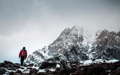
Political Boundaries Of Afghanistan: Provinces, Districts, or Historical Boundaries.
Afghanistan, located in Central Asia, is a landlocked country with a complex history of political boundaries. Understanding these boundaries is crucial for comprehending the country’s political, social, and economic dynamics. Afghanistan shares borders with six countries: Iran to the west, Pakistan to the east and south, Turkmenistan, Uzbekistan, and Tajikistan to the north, and China to the northeast. These borders have been shaped by historical events, colonial influences, and geopolitical considerations. Summary Afghanistan’s political boundaries have been shaped by historical events and external influences. The provinces of Afghanistan have a rich history and cultural significance. Understanding the structure and function of Afghanistan’s districts is crucial for effective governance. The Durand Line remains a contentious issue between Afghanistan and Pakistan. Political boundaries have played a significant role in Afghanistan’s ethnic conflicts and instability. The Provinces of Afghanistan: History and Significance Afghanistan is divided into 34 provinces, each with its own unique history and significance. These provinces have played a crucial role in shaping the country’s political landscape. For example, Herat province in western Afghanistan has historically been a center of trade and cultural exchange due to its strategic location along the Silk Road. It has also been a site of conflict between different ethnic groups and foreign powers. Similarly, Kabul province, which includes the capital city of Kabul, has been the political and cultural center of Afghanistan for centuries. It has witnessed numerous dynasties rise and fall, and has been a hub of political power and economic activity. Other provinces such as Kandahar, Balkh, and Nangarhar also have rich historical significance and continue to play important roles in Afghanistan’s political...