World Geography
Geography is the study of the Earth’s landscapes, environments, and the relationships between people and their surroundings. It encompasses both the physical aspects of the Earth, such as its landforms, bodies of water, and climate, as well as the human aspects, including population distribution, cultures, and economies. World geography is a broad field that seeks to understand the complexities of our planet and how humans interact with it. By studying world geography, we can gain a deeper appreciation for the diversity of our planet and the interconnectedness of its various regions.
Geography is a multidisciplinary field that draws on elements of physical science, social science, and humanities. It involves the use of maps, spatial analysis, and geographic information systems (GIS) to understand the Earth’s surface and the processes that shape it. World geography also encompasses the study of human geography, which examines the ways in which people and their activities are distributed across the Earth. By understanding world geography, we can better appreciate the environmental, cultural, and economic challenges facing different regions of the world. This knowledge is crucial for addressing global issues such as climate change, resource management, and international development.
The Five Oceans and Seven Continents
The Earth’s surface is divided into five major oceans: the Pacific, Atlantic, Indian, Southern (or Antarctic), and Arctic Oceans. These vast bodies of water play a crucial role in regulating the Earth’s climate and supporting diverse marine ecosystems. The oceans also serve as important transportation routes and a source of food and other natural resources for human societies around the world.
In addition to the oceans, the Earth’s landmasses are divided into seven continents: Africa, Antarctica, Asia, Europe, North America, Australia (or Oceania), and South America. Each continent has its own unique physical and cultural characteristics, shaped by millions of years of geological processes and human history. From the deserts of Africa to the rainforests of South America, the continents offer a rich tapestry of landscapes and environments for exploration and study.
Major Mountain Ranges and Deserts
The Earth’s surface is also marked by major mountain ranges and deserts that have shaped the planet’s physical and cultural landscapes. The Himalayas, for example, are the highest mountain range in the world and are home to diverse ecosystems and cultures in countries such as India, Nepal, and Bhutan. The Andes in South America, the Rockies in North America, and the Alps in Europe are other prominent mountain ranges that have influenced human settlement patterns and economic activities.
Deserts cover about one-third of the Earth’s land surface and are characterized by low precipitation and extreme temperatures. The Sahara Desert in Africa is the largest hot desert in the world, while the Gobi Desert in Asia is one of the largest cold deserts. Deserts are not only home to unique flora and fauna but have also been important trade routes and cultural crossroads throughout history.
Climate Zones and Biomes
The Earth’s climate is influenced by a variety of factors, including latitude, altitude, ocean currents, and prevailing winds. As a result, the planet is divided into different climate zones, each with its own characteristic weather patterns and ecosystems. The equator, for example, experiences a tropical climate with high temperatures and heavy rainfall, while the polar regions have a cold and dry climate.
These climate zones give rise to different biomes, or large ecological areas characterized by distinct plant and animal communities. The tropical rainforest biome, found near the equator, is home to a diverse array of species and is vital for regulating the Earth’s climate. The grasslands biome, found in regions such as the African savannah and North American prairies, supports grazing animals and has been important for human agriculture throughout history.
Human Geography and Population Distribution
Human geography examines the ways in which people and their activities are distributed across the Earth’s surface. It encompasses topics such as population growth, migration patterns, urbanization, and cultural diversity. Understanding human geography is crucial for addressing global challenges such as poverty, inequality, and environmental degradation.
Population distribution is uneven across the world, with some regions experiencing rapid population growth while others are declining. The majority of the world’s population lives in Asia, particularly in countries such as China and India. Urban areas are also growing rapidly, with more than half of the world’s population now living in cities. This trend has significant implications for infrastructure development, resource management, and social inequality.
Historical and Cultural Geography
Historical geography examines how human activities have shaped the Earth’s landscapes over time. It explores topics such as colonialism, trade routes, and the rise and fall of empires. Cultural geography focuses on how human cultures have developed in different regions of the world and how they interact with their environments.
The Silk Road, for example, was an ancient trade route that connected China with Europe and facilitated the exchange of goods, ideas, and technologies across Eurasia. This historical trade route had a profound impact on the development of cultures and economies along its path. Similarly, cultural geographers study how different societies have adapted to their environments through practices such as agriculture, architecture, and religious beliefs.
The Importance of Geographic Knowledge
Geographic knowledge is crucial for addressing global challenges such as climate change, resource management, and international development. By understanding world geography, we can better appreciate the environmental, cultural, and economic challenges facing different regions of the world. This knowledge is crucial for addressing global issues such as climate change, resource management, and international development.
Geographic knowledge also helps us to understand our interconnectedness with other regions of the world. By studying world geography, we can gain a deeper appreciation for the diversity of our planet and the interconnectedness of its various regions. This understanding can foster a sense of global citizenship and empathy for people from different cultures and backgrounds.
In conclusion, world geography is a complex and multifaceted field that encompasses both physical and human aspects of the Earth’s landscapes. By studying world geography, we can gain a deeper appreciation for the diversity of our planet and the interconnectedness of its various regions. This knowledge is crucial for addressing global challenges such as climate change, resource management, and international development. It also helps us to understand our interconnectedness with other regions of the world and fosters a sense of global citizenship.
FAQs
What is world geography?
World geography is the study of the Earth’s landscapes, environments, and the relationships between people and their environments. It encompasses the physical features of the Earth, as well as the human activity that takes place on it.
Why is world geography important?
World geography is important because it helps us understand the world around us. It provides insights into the physical and human processes that shape our planet, and helps us make informed decisions about how to interact with our environment.
What are the main branches of world geography?
The main branches of world geography include physical geography, which focuses on the Earth’s natural features and processes, and human geography, which examines the relationships between people and their environments.
How does world geography impact our daily lives?
World geography impacts our daily lives in numerous ways, from influencing the weather and climate we experience, to shaping the availability of natural resources and influencing the distribution of populations and cultures around the world.
What are some key concepts in world geography?
Key concepts in world geography include location, place, human-environment interaction, movement, and region. These concepts help geographers understand and interpret the world around them.

Population Density of Samoa
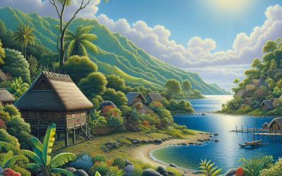
Samoa, an archipelago located in the South Pacific Ocean, is renowned for its stunning natural beauty, rich cultural heritage, and vibrant communities. The population density of Samoa is a significant aspect of its demographic profile, influencing various facets of life on the islands. As of the latest estimates, Samoa has a population density of approximately 70 individuals per square kilometre, which is relatively high for a small island nation. This density is not merely a statistic; it reflects the intricate interplay between the land’s limited resources and the growing needs of its inhabitants. Understanding the nuances of Samoa’s population density is crucial for grasping the challenges and opportunities that arise in such a unique geographical context. The islands of Samoa, comprising Upolu and Savai’i as the largest, are characterised by their mountainous terrain and lush landscapes. This topography plays a pivotal role in shaping settlement patterns and population distribution. The concentration of people in certain areas, particularly around urban centres like Apia, contrasts sharply with the more sparsely populated rural regions. This uneven distribution raises important questions about resource allocation, infrastructure development, and social services. As Samoa navigates the complexities of its demographic landscape, it becomes increasingly vital to explore the factors contributing to its population density and the implications for its future. Summary Samoa’s population density is relatively high, with a population of around 200,000 people living in a land area of 2,842 square kilometers. Factors contributing to Samoa’s population density include limited land availability, cultural preferences for large families, and urbanization trends. Urban areas in Samoa have a higher population density compared to rural areas, with the...

Cultural or Historical Sites of Samoa: Important Cultural Landmarks or Historical Sites In Samoa
Samoa, an archipelago nestled in the heart of the South Pacific, is a treasure trove of cultural and historical significance. Comprising two main islands, Upolu and Savai’i, along with several smaller islets, Samoa boasts a rich tapestry of traditions, customs, and historical narratives that have been woven over centuries. The islands are not merely picturesque landscapes; they are living museums that encapsulate the essence of Samoan identity. From ancient stone structures to vibrant communal gathering places, the cultural and historical sites of Samoa offer a glimpse into the lives of its people, their beliefs, and their enduring connection to the land. These sites serve as a testament to the resilience of Samoan culture, which has thrived despite external influences and challenges throughout history. The significance of these cultural landmarks extends beyond mere aesthetics; they are vital to understanding the social fabric of Samoan society. Each site tells a story, whether it be through the intricate carvings that adorn traditional fale (houses) or the sacred spaces that honour ancestral spirits. Visitors to Samoa are often struck by the palpable sense of history that permeates the air, as well as the warmth and hospitality of the Samoan people who take pride in sharing their heritage. As we delve deeper into the importance of preserving these cultural landmarks, we will uncover the layers of meaning embedded within them and explore how they continue to shape contemporary Samoan life. Summary Samoa’s cultural and historical sites offer a rich insight into the country’s heritage and traditions, making them a must-visit for tourists. Preserving Samoa’s cultural landmarks is crucial for maintaining the country’s identity and...

Natural Resources of Samoa: Where Natural Resources are Located in Samoa
Samoa, an archipelago located in the heart of the South Pacific, is renowned for its stunning landscapes and rich biodiversity. The islands are endowed with a variety of natural resources that play a crucial role in the livelihoods of its inhabitants and the overall economy of the nation. From lush forests and fertile lands to vibrant marine ecosystems, Samoa‘s natural resources are not only vital for sustenance but also for cultural identity and economic development. The interplay between these resources and the local communities highlights the importance of sustainable management practices to ensure their preservation for future generations. The significance of Samoa’s natural resources extends beyond mere economic value; they are deeply intertwined with the cultural heritage and traditions of the Samoan people. The land, sea, and forests are not just physical entities but are imbued with spiritual meaning and historical significance. As such, the management of these resources requires a holistic approach that respects traditional knowledge while integrating modern conservation techniques. This article will explore the various natural resources found in Samoa, including land-based, marine-based, agricultural, forestry, mineral, and renewable energy resources, as well as the pressing need for sustainable management practices to safeguard these invaluable assets. Summary Samoa is rich in natural resources, both on land and in the surrounding marine environment. The land-based natural resources in Samoa include fertile soil for agriculture and forestry resources. Samoa’s marine-based natural resources include a diverse range of fish and other marine life, as well as potential for renewable energy from the ocean. Agricultural natural resources in Samoa are vital for the country’s economy, including crops such as taro, coconut,...
Samoa
Samoa (Malo Sa’oloto Tuto’atasi o Samoa (Samoan); Independent State of Samoa (English)) Capital: Apia Population (Estimated July 2012): 194,320 Area: 2,785km2 or 1,075mi2 Currency: Tala (SAT) Official Language: Samoan and English Political Information: Parliamentary Democracy and Samoan Customs Official Religion: No Official Religion(approximately 59.9% of the population are Protestant, 19.6% are Roman Catholic, 12.7% are Mormon, 4.5% are of other Christian Denominations, 3.2% follow other religious faiths and 0.1% have unspecified religious beliefs) Highest Mountain: Mount Silisili at 1,857m or 6,092ft GDP Official Exchange Rate (OER is more precise at gauging a country’s economic power) (Estimated 2011): $600 million (US$) or (GBP) GDP (OER) Per Capita (per member of the population estimated 2011): $3,000 (US$) or (GBP) GDP Purchasing Power Parity (PPP is good for gauging living conditions and the use of resources but is not as accurate as OER. This data has been calculated based on the sum value of all goods and services produced in the country valued at prices prevailing in the United States) (Estimated 2011): $1.122 billion (US$) or (GBP) GDP (PPP) Per Capita (per member of the population estimated 2011): $6,000 (US$) or (GBP) Time Zone (GMT/UTC): +13:00 Wildlife: Counties/Provinces/States: 11 districts; A’ana, Aiga-i-le-Tai, Atua, Fa’asaleleaga, Gaga’emauga, Gagaifomauga, Palauli, Satupa’itea, Tuamasaga, Va’a-o-Fonoti, Vaisigano Leaders: (Head of State) Tuiatua Tupua Tamasese Efi with Prime Minister Tuilaepa Lupesoliai Sailele Malielegaoi Additional: Gained independence from New Zealand-administered UN trusteeship on the 1st of January 1962. Sources: CIA World Fact Book, Encyclopaedia Britannica. Samoa Samoa, an enchanting archipelago located in the heart of the South Pacific, is a nation that boasts a rich tapestry of culture, history, and natural beauty. Comprising two main...
Population Density of Saint Vincent and the Grenadines
Saint Vincent and the Grenadines, an enchanting archipelago located in the southern Caribbean, is renowned for its stunning landscapes, vibrant culture, and rich history. Comprising the main island of Saint Vincent and a chain of smaller islands known as the Grenadines, this nation boasts a diverse ecosystem that includes lush rainforests, volcanic mountains, and pristine beaches. The capital city, Kingstown, serves as the cultural and economic hub of the country, where colonial architecture meets modern development. The islands are not only a popular tourist destination but also a significant part of the Caribbean’s socio-economic fabric, with agriculture, tourism, and fishing being the primary sectors driving the economy. The population of Saint Vincent and the Grenadines is approximately 110,000, making it one of the more densely populated nations in the Caribbean. This demographic reality is shaped by various factors, including historical migration patterns, economic opportunities, and environmental conditions. The islands’ unique geographical features contribute to both the allure and challenges of living in such a compact space. As the nation grapples with issues related to population density, it becomes increasingly important to understand the underlying factors that influence this phenomenon and its implications for the future of Saint Vincent and the Grenadines. Summary Saint Vincent and the Grenadines is a small Caribbean country with a diverse population and a rich cultural heritage. Factors contributing to population density in the country include limited land availability, economic opportunities, and historical settlement patterns. The population is unevenly distributed across the islands, with the majority residing in the main island of Saint Vincent. High population density has put pressure on infrastructure and resources, leading...
History of Saint Vincent and the Grenadines
The history of the Caribbean is deeply intertwined with the narratives of its early inhabitants, the Indigenous peoples who first settled the islands thousands of years ago. Archaeological evidence suggests that the Arawak and Carib tribes were among the earliest settlers, arriving from South America around 2000 BCE. These groups developed complex societies, engaging in agriculture, fishing, and trade. They cultivated crops such as cassava, sweet potatoes, and maize, which formed the backbone of their diet. The Arawaks were known for their peaceful nature and communal living, while the Caribs were more aggressive, often engaging in conflict with neighbouring tribes. The rich cultural practices of these Indigenous peoples included intricate pottery, vibrant storytelling, and spiritual beliefs that were closely tied to nature, reflecting their deep connection to the land. However, the arrival of European explorers in the late 15th century marked a significant turning point for these Indigenous communities. Christopher Columbus’s landing in 1492 initiated a wave of colonisation that would have devastating effects on the native populations. The introduction of new diseases, to which the Indigenous peoples had no immunity, led to catastrophic declines in their numbers. Additionally, the Europeans’ insatiable quest for land and resources resulted in violent confrontations and the eventual displacement of many Indigenous groups. By the end of the 17th century, most of the original inhabitants had either succumbed to disease or been forced into slavery or exile. This tragic loss of life and culture set the stage for a new era in the Caribbean, one dominated by European powers and marked by profound social and economic transformations. Summary Indigenous peoples inhabited the Caribbean...
Terrain and Topography of Saint Vincent and the Grenadines: mountains, valleys, and plains.
Saint Vincent and the Grenadines, an enchanting archipelago nestled in the Caribbean Sea, is a nation that boasts a rich tapestry of natural beauty and cultural heritage. Comprising the main island of Saint Vincent and a chain of smaller islands known as the Grenadines, this tropical paradise is renowned for its stunning landscapes, vibrant marine life, and warm, welcoming communities. The islands are characterised by their lush greenery, dramatic coastlines, and a plethora of outdoor activities that attract visitors from around the globe. With a population of approximately 110,000 people, the islands are a melting pot of cultures, influenced by African, European, and indigenous Carib traditions, which are reflected in their music, cuisine, and festivals. The geography...

Political Boundaries of Saint Vincent and the Grenadines: Provinces, Districts, or Historical Boundaries.
Saint Vincent and the Grenadines, an enchanting archipelago located in the Caribbean Sea, is a nation that boasts a rich tapestry of culture, history, and natural beauty. Comprising the main island of Saint Vincent and a chain of smaller islands known as the Grenadines, this country is renowned for its stunning landscapes, including lush rainforests, volcanic mountains, and pristine beaches. The capital city, Kingstown, serves as the political and economic hub of the nation, where vibrant markets and colonial architecture reflect the island’s diverse heritage. With a population of approximately 110,000 people, Saint Vincent and the Grenadines is a melting pot of cultures, influenced by African, European, and indigenous Carib traditions. This unique blend is evident in the local cuisine, music, and festivals that celebrate the island’s rich history. The geographical layout of Saint Vincent and the Grenadines plays a significant role in shaping its identity. The main island of Saint Vincent is characterised by its volcanic origin, with the majestic La Soufrière volcano being a prominent feature. The Grenadines, on the other hand, are a collection of smaller islands that vary in size and character, each offering its own unique charm. From the bustling streets of Bequia to the tranquil shores of Mustique, these islands attract tourists from around the globe seeking both adventure and relaxation. The nation’s economy is heavily reliant on tourism, agriculture, and fishing, which are all influenced by its geographical features. As we delve deeper into the historical evolution of political boundaries in this archipelago, we will uncover how these factors have shaped the governance and identity of Saint Vincent and the Grenadines. Summary...
Climate Zones of Saint Vincent and the Grenadines: Different climate regions Of Saint Vincent and the Grenadines
Saint Vincent and the Grenadines, an enchanting archipelago located in the Caribbean Sea, is renowned for its stunning natural beauty and rich cultural heritage. Comprising the main island of Saint Vincent and a chain of smaller islands known as the Grenadines, this nation is a paradise for nature lovers and adventure seekers alike. The islands are characterised by lush landscapes, pristine beaches, and vibrant marine life, making them a popular destination for tourists from around the globe. The capital city, Kingstown, serves as the cultural and economic hub of the country, where colonial architecture meets modern Caribbean life. The islands’ history is steeped in indigenous culture, colonial influences, and a blend of African, European, and East Indian traditions, which have shaped the unique identity of Saint Vincent and the Grenadines. The geographical diversity of Saint Vincent and the Grenadines contributes significantly to its climate, which varies across different regions of the islands. The archipelago is situated in a tropical zone, where climatic conditions are influenced by trade winds, ocean currents, and topographical features. This results in a variety of microclimates that support diverse ecosystems, ranging from coastal areas to mountainous regions. Understanding the different climate zones within Saint Vincent and the Grenadines is essential for appreciating its ecological richness and the lifestyle of its inhabitants. Each climate zone not only shapes the natural environment but also influences agricultural practices, tourism activities, and the overall quality of life for the local population. Summary Saint Vincent and the Grenadines is a small island country located in the Caribbean, known for its stunning natural beauty and diverse climate zones. The Tropical Rainforest...
Natural Resources of Saint Vincent and the Grenadines: Where Natural Resources are located In Saint Vincent and the Grenadines
Saint Vincent and the Grenadines, an enchanting archipelago located in the Caribbean Sea, is a nation that comprises the main island of Saint Vincent and a chain of smaller islands known as the Grenadines. This picturesque country is part of the Lesser Antilles and is situated to the west of Barbados and to the south of Saint Lucia. With a total land area of approximately 389 square kilometres, it is a relatively small nation, yet it boasts a rich tapestry of cultural heritage, natural beauty, and biodiversity. The capital city, Kingstown, serves as the political and economic hub, where colonial architecture meets vibrant markets and lively street life. The population of around 110,000 people is predominantly of African descent, with a mix of East Indian, European, and indigenous Carib influences, contributing to a diverse cultural landscape. The economy...
Cultural or Historical Sites of Saint Vincent and the Grenadines: Important Cultural Landmarks or Historical Sites In Saint Vincent and the Grenadines
Saint Vincent and the Grenadines, an enchanting archipelago located in the Caribbean Sea, is a nation that boasts a rich tapestry of culture, history, and natural beauty. Comprising the main island of Saint Vincent and a chain of smaller islands, including Bequia, Mustique, and Union Island, this nation is renowned for its stunning landscapes, vibrant marine life, and warm, welcoming communities. The capital city, Kingstown, serves as the cultural and economic hub of the country, where colonial architecture meets modern Caribbean life. Visitors are often captivated by the lush greenery, volcanic mountains, and pristine beaches that characterise the islands, making it a popular destination for those seeking both adventure and relaxation. The history of Saint Vincent and the Grenadines is as diverse as its geography. Originally inhabited by the indigenous Carib people, the islands were later colonised by European powers, including the French and British. This colonial past has left an indelible mark on the culture of the islands, evident in the local dialects, cuisine, and festivals that celebrate both African and European heritage. Today, Saint Vincent and the Grenadines is an independent nation that embraces its multicultural identity while promoting sustainable tourism and environmental conservation. The islands are not only a paradise for beach lovers but also a treasure trove for history enthusiasts and nature lovers alike. Summary Saint Vincent and the Grenadines is a stunning Caribbean destination with a rich history and natural beauty. Fort Charlotte offers breathtaking views of Kingstown and the surrounding area, making it a must-visit attraction. The Botanical Gardens are a peaceful oasis with a diverse collection of tropical plants and beautiful landscapes....
Saint Vincent and the Grenadines
Saint Vincent and the Grenadines Capital: Kingstown Population (Estimated July 2012): 103,537 Area: 389.3 km2 or 150.3 mi2 Currency: Eastern Caribbean dollar (EC$) Official Language: English Political Information: Constitutional Monarchy with a Parliamentary Democracy Official Religion: No Official Religion(approximately 75% of the population are Protestant, 13% are Roman Catholic, and 12% have other religious beliefs ) Highest Mountain: La Soufriere at 1,234m or 4,049ft GDP Official Exchange Rate (OER is more precise at gauging a country’s economic power) (Estimated 2011): $700 million (US$) or (GBP) GDP (OER) Per Capita (per member of the population estimated 2011): (US$) or (GBP) GDP Purchasing Power Parity (PPP is good for gauging living conditions and the use of resources but is not as accurate as OER. This data has been calculated based on the sum value of all goods and services produced in the country valued at prices prevailing in the United States) (Estimated 2011): $1.224 billion (US$) or (GBP) GDP (PPP) Per Capita (per member of the population estimated 2011): $11,700 (US$) or (GBP) Time Zone (GMT/UTC): -4:00 Wildlife: Counties/Provinces/States: 6 parishes; Charlotte, Grenadines, Saint Andrew, Saint David, Saint George, Saint Patrick Leaders: H.M. Queen Elizabeth II, represented by Governor-General Sir Frederick Ballantyne with Prime Minister: Ralph Gonsalves Additional: Gained independence from the U.K. on the 27th of October 1979. Sources: CIA World Fact Book, Encyclopaedia Britannica. Saint Vincent and the Grenadines Saint Vincent and the Grenadines, an enchanting archipelago located in the Caribbean Sea, is a nation that boasts a rich tapestry of culture, history, and natural beauty. Comprising the main island of Saint Vincent and a chain of smaller islands known as the Grenadines, this country...