World Geography
Geography is the study of the Earth’s landscapes, environments, and the relationships between people and their surroundings. It encompasses both the physical aspects of the Earth, such as its landforms, bodies of water, and climate, as well as the human aspects, including population distribution, cultures, and economies. World geography is a broad field that seeks to understand the complexities of our planet and how humans interact with it. By studying world geography, we can gain a deeper appreciation for the diversity of our planet and the interconnectedness of its various regions.
Geography is a multidisciplinary field that draws on elements of physical science, social science, and humanities. It involves the use of maps, spatial analysis, and geographic information systems (GIS) to understand the Earth’s surface and the processes that shape it. World geography also encompasses the study of human geography, which examines the ways in which people and their activities are distributed across the Earth. By understanding world geography, we can better appreciate the environmental, cultural, and economic challenges facing different regions of the world. This knowledge is crucial for addressing global issues such as climate change, resource management, and international development.
The Five Oceans and Seven Continents
The Earth’s surface is divided into five major oceans: the Pacific, Atlantic, Indian, Southern (or Antarctic), and Arctic Oceans. These vast bodies of water play a crucial role in regulating the Earth’s climate and supporting diverse marine ecosystems. The oceans also serve as important transportation routes and a source of food and other natural resources for human societies around the world.
In addition to the oceans, the Earth’s landmasses are divided into seven continents: Africa, Antarctica, Asia, Europe, North America, Australia (or Oceania), and South America. Each continent has its own unique physical and cultural characteristics, shaped by millions of years of geological processes and human history. From the deserts of Africa to the rainforests of South America, the continents offer a rich tapestry of landscapes and environments for exploration and study.
Major Mountain Ranges and Deserts
The Earth’s surface is also marked by major mountain ranges and deserts that have shaped the planet’s physical and cultural landscapes. The Himalayas, for example, are the highest mountain range in the world and are home to diverse ecosystems and cultures in countries such as India, Nepal, and Bhutan. The Andes in South America, the Rockies in North America, and the Alps in Europe are other prominent mountain ranges that have influenced human settlement patterns and economic activities.
Deserts cover about one-third of the Earth’s land surface and are characterized by low precipitation and extreme temperatures. The Sahara Desert in Africa is the largest hot desert in the world, while the Gobi Desert in Asia is one of the largest cold deserts. Deserts are not only home to unique flora and fauna but have also been important trade routes and cultural crossroads throughout history.
Climate Zones and Biomes
The Earth’s climate is influenced by a variety of factors, including latitude, altitude, ocean currents, and prevailing winds. As a result, the planet is divided into different climate zones, each with its own characteristic weather patterns and ecosystems. The equator, for example, experiences a tropical climate with high temperatures and heavy rainfall, while the polar regions have a cold and dry climate.
These climate zones give rise to different biomes, or large ecological areas characterized by distinct plant and animal communities. The tropical rainforest biome, found near the equator, is home to a diverse array of species and is vital for regulating the Earth’s climate. The grasslands biome, found in regions such as the African savannah and North American prairies, supports grazing animals and has been important for human agriculture throughout history.
Human Geography and Population Distribution
Human geography examines the ways in which people and their activities are distributed across the Earth’s surface. It encompasses topics such as population growth, migration patterns, urbanization, and cultural diversity. Understanding human geography is crucial for addressing global challenges such as poverty, inequality, and environmental degradation.
Population distribution is uneven across the world, with some regions experiencing rapid population growth while others are declining. The majority of the world’s population lives in Asia, particularly in countries such as China and India. Urban areas are also growing rapidly, with more than half of the world’s population now living in cities. This trend has significant implications for infrastructure development, resource management, and social inequality.
Historical and Cultural Geography
Historical geography examines how human activities have shaped the Earth’s landscapes over time. It explores topics such as colonialism, trade routes, and the rise and fall of empires. Cultural geography focuses on how human cultures have developed in different regions of the world and how they interact with their environments.
The Silk Road, for example, was an ancient trade route that connected China with Europe and facilitated the exchange of goods, ideas, and technologies across Eurasia. This historical trade route had a profound impact on the development of cultures and economies along its path. Similarly, cultural geographers study how different societies have adapted to their environments through practices such as agriculture, architecture, and religious beliefs.
The Importance of Geographic Knowledge
Geographic knowledge is crucial for addressing global challenges such as climate change, resource management, and international development. By understanding world geography, we can better appreciate the environmental, cultural, and economic challenges facing different regions of the world. This knowledge is crucial for addressing global issues such as climate change, resource management, and international development.
Geographic knowledge also helps us to understand our interconnectedness with other regions of the world. By studying world geography, we can gain a deeper appreciation for the diversity of our planet and the interconnectedness of its various regions. This understanding can foster a sense of global citizenship and empathy for people from different cultures and backgrounds.
In conclusion, world geography is a complex and multifaceted field that encompasses both physical and human aspects of the Earth’s landscapes. By studying world geography, we can gain a deeper appreciation for the diversity of our planet and the interconnectedness of its various regions. This knowledge is crucial for addressing global challenges such as climate change, resource management, and international development. It also helps us to understand our interconnectedness with other regions of the world and fosters a sense of global citizenship.
FAQs
What is world geography?
World geography is the study of the Earth’s landscapes, environments, and the relationships between people and their environments. It encompasses the physical features of the Earth, as well as the human activity that takes place on it.
Why is world geography important?
World geography is important because it helps us understand the world around us. It provides insights into the physical and human processes that shape our planet, and helps us make informed decisions about how to interact with our environment.
What are the main branches of world geography?
The main branches of world geography include physical geography, which focuses on the Earth’s natural features and processes, and human geography, which examines the relationships between people and their environments.
How does world geography impact our daily lives?
World geography impacts our daily lives in numerous ways, from influencing the weather and climate we experience, to shaping the availability of natural resources and influencing the distribution of populations and cultures around the world.
What are some key concepts in world geography?
Key concepts in world geography include location, place, human-environment interaction, movement, and region. These concepts help geographers understand and interpret the world around them.

Population Density of Oman
Oman, a nation situated on the south-eastern coast of the Arabian Peninsula, exhibits a comparatively low population density in relation to other countries in the region. With a total land area of approximately 309,500 square kilometres, Oman‘s population density stands at roughly 16 people per square kilometre. This low population density can be attributed to various factors, including the country’s arid and desert landscape, as well as its historical reliance on nomadic lifestyles. However, in recent years, Oman has experienced significant population growth, leading to a gradual increase in population density. Understanding the factors affecting population density in Oman, as well as the impact it has on the country’s infrastructure and resources, is crucial for policymakers and urban planners as they work towards sustainable development and management of the country’s population. Oman’s population density is a complex issue that is influenced by a variety of factors, including geography, climate, economic opportunities, and government policies. As the country continues to develop and urbanise, it is important to consider the implications of increasing population density on various aspects of society, including infrastructure, resources, and quality of life. By examining the challenges and opportunities associated with high population density in Oman, as well as the government’s initiatives to manage and mitigate its effects, we can gain a better understanding of the country’s demographic trends and their implications for the future. Summary Oman has a population density of 16 people per square kilometre, making it one of the lowest in the world. Factors affecting population density in Oman include geography, climate, economic opportunities, and government policies. Urban areas in Oman have higher population...

Cultural or Historical Sites of Oman: Important Cultural Landmarks or Historical Sites In Oman
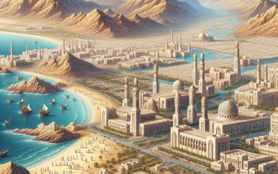
The Sultan Qaboos Grand Mosque stands as a testament to the grandeur of Omani architecture and the rich Islamic heritage of the country. This magnificent mosque, situated in the capital city of Muscat, is a true architectural marvel, blending traditional Omani design elements with modern construction techniques. The mosque’s main prayer hall is adorned with a stunning hand-woven carpet, which holds the Guinness World Record for being the largest hand-loomed carpet in the world. The intricate designs and vibrant colours of the carpet reflect the artistic prowess of Omani craftsmen and serve as a symbol of the country’s rich cultural heritage. The exterior of the mosque is equally impressive, with its grand domes, towering minarets, and intricate geometric patterns adorning the walls and ceilings. The use of white marble and sandstone in the construction of the mosque not only adds to its aesthetic appeal but also reflects the traditional building materials used in Omani architecture. The overall design of the Sultan Qaboos Grand Mosque is a harmonious blend of Islamic architectural elements, such as arches, domes, and calligraphy, with Omani influences, creating a truly unique and awe-inspiring structure that stands as a symbol of Omani pride and heritage. Summary The Sultan Qaboos Grand Mosque is a stunning example of Omani architecture and a symbol of Islamic heritage. Bahla Fort’s UNESCO World Heritage status highlights its significance as a testament to Omani fortification. Nizwa Souq is a historical market that serves as a gathering place for Omani traditions and culture. Al Baleed Archaeological Park offers an insight into Oman’s ancient maritime history and trade connections. Jabrin Castle stands as a...
Oman
Oman (Salṭanat ʿUmān (Sultanate of Oman)) Capital: Muscat Population (Estimated July 2012): 3,090,150 Area: 309,500km2 or 119,500mi2 Currency: Rial Omani (RO) Official Language: Arabic Political Information: Islamic Monarchy Official Religion: Islam(approximately 75% of the population are Ibadhi Muslims with 25% having other religious beliefs including other Muslim denominations and Hinduism ) Highest Mountain: Jabal Shams 3005m or 9,859ft GDP Official Exchange Rate (OER is more precise at gauging a country’s economic power) (Estimated 2011): $66.8 billion (US$) or (GBP) GDP (OER) Per Capita (per member of the population estimated 2011): (US$) or (GBP) GDP Purchasing Power Parity (PPP is good for gauging living conditions and the use of resources but is not as accurate as OER. This data has been calculated based on the sum value of all goods and services produced in the country valued at prices prevailing in the United States) (Estimated 2011): $80.89 billion (US$) or (GBP) GDP (PPP) Per Capita (per member of the population estimated 2011): $26,200 (US$) or (GBP) Time Zone (GMT/UTC): +4:00 Wildlife: Counties/Provinces/States: 5 regions (manatiq, singular – mintaqat) and 4 governorates* (muhafazat, singular – muhafazat) Ad Dakhiliyah, Al Batinah, Al Buraymi*, Al Wusta, Ash Sharqiyah, Az Zahirah, Masqat (Muscat)*, Musandam*, Zufar (Dhofar)* Leaders: Sultan and Prime Minister Qaboos bin Said (Qabus ibn Saʿid) Sources: CIA World Fact Book, Encyclopaedia Britannica. Oman Oman, officially the Sultanate of Oman, is situated on the southeastern coast of the Arabian Peninsula. It shares borders with the United Arab Emirates to the northwest, Saudi Arabia to the west, and Yemen to the southwest. The Arabian Sea lies to the south and east, whilst the Gulf of Oman and the...

Political Boundaries of Norway: Provinces, Districts, or Historical Boundaries.
Norway, a Scandinavian nation in Northern Europe, is renowned for its breathtaking natural landscapes, rich cultural heritage, and robust sense of national identity. The political boundaries of Norway play a crucial role in shaping the country’s governance, administration, and cultural diversity. From counties to municipalities, these boundaries have evolved over centuries, reflecting the nation’s historical, geographical, and cultural complexities. Understanding the political boundaries of Norway is essential for comprehending the country’s administrative structure, regional diversity, and historical significance. The political boundaries of Norway are not merely administrative divisions but also reflect the country’s historical and cultural heritage. These boundaries have evolved over time, influenced by various factors such as geography, historical events, and cultural differences. The counties and municipalities of Norway are not just geographical entities but also represent the diverse cultural and historical identities of the regions they encompass. As such, the political boundaries of Norway are integral to understanding the country’s governance, identity, and regional dynamics. Summary Norway is a country with well-defined political boundaries, which have evolved over time and play a significant role in its governance and identity. The administrative divisions of Norway are known as provinces, each with its own unique characteristics and responsibilities. The geographical and cultural regions of Norway are divided into districts, each with its own distinct identity and traditions. The historical boundaries of Norway have been influenced by various factors and have played a significant role in shaping the country’s identity and governance. The evolution of political boundaries in Norway reflects the country’s changing political, social, and cultural landscape, and has led to challenges and controversies. Provinces of Norway: Administrative...

Climate Zones of Norway: Different climate regions Of Norway
Norway is renowned for its breathtaking natural landscapes, encompassing fjords, mountains and forests. The climate in Norway varies considerably across regions, with the nation being divided into several distinct climate zones. These zones are influenced by factors such as latitude, proximity to the sea and elevation. Comprehending the different climate zones in Norway is crucial for prospective visitors or residents, as it significantly affects the activities and experiences available in each region. From the Arctic climate zone in the north to the temperate climate zone in the south, Norway presents a diverse array of climates and environments for exploration. Summary Norway has a diverse range of climate zones, each with its own unique characteristics and weather patterns. The Arctic climate zone in northern Norway experiences long, cold winters and short, cool summers, with temperatures often dropping below freezing. Central Norway falls within the subarctic climate zone, with cold winters and mild summers, and a significant temperature variation between day and night. Southern Norway has a temperate climate, with mild winters and warm summers, and a relatively stable and predictable weather pattern. The mountainous areas of Norway are characterized by an alpine climate, with cold temperatures and heavy snowfall in the winter, and cool, mild summers. The Arctic Climate Zone in Northern Norway Unique Landscape and Wildlife The landscape is dominated by tundra and permafrost, with sparse vegetation and a harsh, unforgiving environment. Despite the challenging conditions, the Arctic climate zone is home to unique wildlife such as polar bears, reindeer, and arctic foxes. The northern lights, or aurora borealis, are also a major attraction in this region, drawing visitors...

Terrain and Topography of Norway: mountains, valleys, and plains.
Norway is renowned for its remarkable natural splendour, largely attributable to its diverse terrain and topography. Situated in Northern Europe, Norway presents a land of contrasts, featuring a rugged coastline, majestic mountains, deep valleys, and expansive plains. The country’s terrain and topography have been moulded by millions of years of geological processes, including tectonic plate movement, glacial erosion, and volcanic activity. Consequently, Norway’s landscape exhibits incredible variety, offering a wealth of natural wonders to explore and appreciate. The terrain of Norway is characterised by its dramatic fjords, which are deep, narrow inlets of the sea flanked by steep cliffs. These fjords were formed by glacial movement during the last ice age and are a defining feature of Norway’s coastline. In addition to its fjords, Norway is home to several mountain ranges, including the Scandinavian Mountains in the north and the Dovre Mountains in the south. These mountains not only contribute to the country’s natural beauty but also play a crucial role in shaping its climate and providing habitats for a wide variety of flora and fauna. With such diverse and captivating terrain, it is unsurprising that Norway is a popular destination for outdoor enthusiasts and nature lovers from across the globe. Summary Norway’s terrain is characterized by its diverse topography, including mountains, valleys, and plains. The majestic mountains of Norway, such as the Jotunheimen range, offer breathtaking views and challenging hiking opportunities. The stunning valleys of Norway, like the Gudbrandsdalen and the Romsdalen, are known for their picturesque landscapes and rich cultural heritage. The vast plains of Norway, particularly in the southeast, provide fertile land for agriculture and are...

History of Norway
Norway’s history extends to the early settlements of the Stone Age, with archaeological evidence indicating human habitation from approximately 10,000 BCE. The initial inhabitants were hunter-gatherers, succeeded by the arrival of the agricultural Sami people. The Viking Age, commencing around the 8th century, marked a pivotal era in Norway‘s history. Vikings were adept seafarers and traders who embarked from their homeland to explore and conquer new territories. They established settlements across various parts of Europe, including the British Isles, Iceland, and Greenland. This period also witnessed the ascension of powerful chieftains and the development of a complex social structure in Norway. During the Viking Age, Norway was comprised of several small kingdoms, each governed by a local chieftain. These chieftains frequently engaged in power struggles and conflicts, resulting in a fragmented and unstable political landscape. Nevertheless, the Viking Age also saw the emergence of a distinct Norwegian culture and identity, characterised by seafaring traditions, mythology, and language. The Viking legacy continues to influence Norwegian society in the present day, with numerous aspects of their culture evident in modern Norwegian life, from place names to traditional crafts and folklore. Summary Early settlements in Norway date back to the Stone Age, with evidence of Viking Age settlements and trade routes. Unification and Christianization of Norway occurred in the 10th and 11th centuries, bringing the country under the rule of a single king and introducing Christianity. The Kalmar Union in the 14th century saw Norway united with Denmark and Sweden, while the Black Death in the 14th century had a devastating impact on the population. The union with Denmark lasted for over...

Natural Resources of Norway: Where Natural Resources are located In Norway
Norway is a country rich in natural resources, boasting a diverse range of assets that contribute to its economy and overall well-being. From oil and gas reserves in the North Sea to hydroelectric power in the fjords and rivers, Norway possesses a wealth of resources that have been utilised for centuries. In addition to these, the country also features extensive timber and forests in the southern and central regions, mineral deposits in the northern mountains, and abundant fisheries along the coastline. Moreover, Norway is making progress in renewable energy sources such as wind and solar power, further expanding its natural resource portfolio. The abundance of natural resources in Norway has played a significant role in shaping the country’s economy and development. These resources have not only provided a source of income and employment for the Norwegian people but have also contributed to the country’s overall prosperity. Consequently, Norway has become a key player in the global market for various natural resources, particularly in the areas of oil and gas, hydroelectric power, timber, minerals, and fisheries. With a commitment to sustainable practices and environmental conservation, Norway continues to harness its natural resources in a responsible manner, ensuring their availability for future generations. Summary Norway is rich in natural resources, including oil and gas reserves, hydropower, timber, minerals, and fisheries. The North Sea is home to significant oil and gas reserves, making Norway one of the largest oil and gas producers in Europe. The fjords and rivers in Norway provide ample opportunities for hydropower generation, making it a leading renewable energy source in the country. The southern and central regions of...

Cultural or Historical Sites of Norway: Important Cultural Landmarks or Historical Sites In Norway
Norway boasts a rich cultural and historical heritage, with numerous sites showcasing its fascinating past. From the Viking era to the present day, Norway‘s cultural and historical landmarks offer insight into the country’s diverse and vibrant history. These sites are crucial for preserving Norway’s heritage and attract tourists from across the globe who are keen to learn about the nation’s past. Notable examples include the Viking Ship Museum in Oslo, Nidaros Cathedral in Trondheim, and the Arctic Cathedral in Tromsø. Each site possesses a unique narrative and stands as a testament to Norway’s rich cultural tapestry. Norway’s cultural and historical sites play a vital role in preserving the country’s heritage and educating future generations about its history. These landmarks serve as reminders of Norway’s past and the events that have shaped the nation into its present form. They also provide visitors with an opportunity to learn about Norwegian culture, traditions, and customs, offering a deeper understanding of the country and its people. Whether exploring ancient Viking ships, admiring medieval cathedrals, or experiencing the unique architecture of stave churches, Norway’s cultural and historical sites offer an immersive experience that allows visitors to connect with the country’s rich heritage. Summary Norway is home to a rich tapestry of cultural and historical sites that offer a glimpse into its fascinating past. The Viking Ship Museum in Oslo houses remarkably well-preserved Viking ships and artefacts, providing insight into the seafaring prowess of the Vikings. The Nidaros Cathedral in Trondheim is a stunning example of Gothic architecture and an important pilgrimage site in Norway. The Bryggen Wharf in Bergen is a UNESCO World Heritage...

Population Density of Norway
Norway, a Scandinavian nation renowned for its striking natural landscapes, possesses a comparatively low population density in relation to numerous other European countries. Encompassing a total land area of over 385,000 square kilometres, Norway is home to just over 5 million inhabitants, resulting in a population density of approximately 14 people per square kilometre. This sparse population distribution is primarily attributed to the country’s rugged terrain, characterised by mountains, fjords and forests that dominate much of the landscape. The majority of Norway’s populace is concentrated in urban areas, particularly in the southern region of the country, where the capital city of Oslo is situated. Despite its overall low population density, Norway confronts unique challenges and opportunities pertaining to population distribution and urbanisation. Norway’s population density has considerable implications for the nation’s economy, infrastructure and environment. As the country continues to develop and urbanise, comprehending the factors influencing population density, regional variations and the impact on infrastructure and services is crucial for policymakers and urban planners. Furthermore, considering the environmental and sustainability ramifications of high population density is essential for ensuring the long-term well-being of both the populace and the natural environment in Norway. Summary Norway has a relatively low population density compared to other European countries, with most of its population concentrated in urban areas. Factors influencing population density in Norway include natural geography, economic opportunities, and government policies. There are significant regional variations in population density, with the highest densities found in urban areas and along the coast. High population density in urban areas can strain infrastructure and services, leading to challenges in transportation, housing, and healthcare. The...

Navigating North Macedonia’s Political Boundaries: Provinces, Districts, or Historical Divisions?
North Macedonia, a landlocked country in the Balkan Peninsula, possesses a distinctive political structure that has developed over centuries. The nation achieved independence from Yugoslavia in 1991 and has since endeavoured to establish a stable and effective political system. North Macedonia‘s political structure is founded on a parliamentary democracy, with a President serving as head of state and a Prime Minister as head of government. The country is divided into several administrative units, including provinces and districts, each playing a significant role in the nation’s governance. The political structure of North Macedonia is crucial in shaping the country’s policies, laws and overall governance, and understanding its complexities is essential for comprehending the nation’s functioning. The political structure of North Macedonia comprises a intricate network of institutions, laws and administrative divisions that collaborate to govern the country. The President is elected by popular vote and serves as commander-in-chief of the armed forces, represents the country in international affairs and appoints the Prime Minister. The Prime Minister, conversely, is the head of government and is responsible for managing the country’s day-to-day affairs. The Parliament, known as the Sobranie, is North Macedonia’s legislative body and is tasked with enacting laws, overseeing the government and representing the interests of the people. The political structure of North Macedonia also includes local government units, such as municipalities and communes, which have their own elected officials and administrative responsibilities. Comprehending North Macedonia’s political structure is vital for understanding the nation’s functioning and its impact on citizens’ lives. Summary North Macedonia’s political structure is a parliamentary democracy with a President as the head of state and a...

The Historical Journey of North Macedonia
The ancient kingdom of Paeonia was situated in the region of present-day North Macedonia and portions of western Bulgaria and northern Greece. The Paeonians were an ancient Indo-European people who settled in the area around the 6th century BC. They were renowned for their skilled craftsmanship, particularly in metalworking, and their distinctive artistic style, which incorporated elements of Greek and Thracian art. The Paeonians were also accomplished warriors and were frequently employed as mercenaries by the ancient Greek city-states. The kingdom of Paeonia reached its zenith under the reign of King Audoleon in the 4th century BC. Audoleon expanded the kingdom’s territory and established diplomatic relations with the ancient Greek city-states. However, the kingdom eventually fell under the control of the Macedonian Empire, first under Philip II and subsequently under his son, Alexander the Great. Following Alexander’s death, the region came under the control of the Seleucid Empire and later the Roman Empire. The legacy of the ancient kingdom of Paeonia remains visible in the region today, with archaeological sites such as the ancient city of Stobi and the ruins of the ancient Paeonian capital, Bylazora, attracting visitors from across the globe. The ancient kingdom of Paeonia played a significant role in the history of the Balkans and left a lasting impact on the culture and heritage of the region. The Paeonians were known for their unique artistic style and skilled craftsmanship, which influenced the art and culture of the ancient Greek city-states. The kingdom’s strategic location also made it a key player in the power struggles of the ancient world, as it was often caught between the competing...