World Geography
Geography is the study of the Earth’s landscapes, environments, and the relationships between people and their surroundings. It encompasses both the physical aspects of the Earth, such as its landforms, bodies of water, and climate, as well as the human aspects, including population distribution, cultures, and economies. World geography is a broad field that seeks to understand the complexities of our planet and how humans interact with it. By studying world geography, we can gain a deeper appreciation for the diversity of our planet and the interconnectedness of its various regions.
Geography is a multidisciplinary field that draws on elements of physical science, social science, and humanities. It involves the use of maps, spatial analysis, and geographic information systems (GIS) to understand the Earth’s surface and the processes that shape it. World geography also encompasses the study of human geography, which examines the ways in which people and their activities are distributed across the Earth. By understanding world geography, we can better appreciate the environmental, cultural, and economic challenges facing different regions of the world. This knowledge is crucial for addressing global issues such as climate change, resource management, and international development.
The Five Oceans and Seven Continents
The Earth’s surface is divided into five major oceans: the Pacific, Atlantic, Indian, Southern (or Antarctic), and Arctic Oceans. These vast bodies of water play a crucial role in regulating the Earth’s climate and supporting diverse marine ecosystems. The oceans also serve as important transportation routes and a source of food and other natural resources for human societies around the world.
In addition to the oceans, the Earth’s landmasses are divided into seven continents: Africa, Antarctica, Asia, Europe, North America, Australia (or Oceania), and South America. Each continent has its own unique physical and cultural characteristics, shaped by millions of years of geological processes and human history. From the deserts of Africa to the rainforests of South America, the continents offer a rich tapestry of landscapes and environments for exploration and study.
Major Mountain Ranges and Deserts
The Earth’s surface is also marked by major mountain ranges and deserts that have shaped the planet’s physical and cultural landscapes. The Himalayas, for example, are the highest mountain range in the world and are home to diverse ecosystems and cultures in countries such as India, Nepal, and Bhutan. The Andes in South America, the Rockies in North America, and the Alps in Europe are other prominent mountain ranges that have influenced human settlement patterns and economic activities.
Deserts cover about one-third of the Earth’s land surface and are characterized by low precipitation and extreme temperatures. The Sahara Desert in Africa is the largest hot desert in the world, while the Gobi Desert in Asia is one of the largest cold deserts. Deserts are not only home to unique flora and fauna but have also been important trade routes and cultural crossroads throughout history.
Climate Zones and Biomes
The Earth’s climate is influenced by a variety of factors, including latitude, altitude, ocean currents, and prevailing winds. As a result, the planet is divided into different climate zones, each with its own characteristic weather patterns and ecosystems. The equator, for example, experiences a tropical climate with high temperatures and heavy rainfall, while the polar regions have a cold and dry climate.
These climate zones give rise to different biomes, or large ecological areas characterized by distinct plant and animal communities. The tropical rainforest biome, found near the equator, is home to a diverse array of species and is vital for regulating the Earth’s climate. The grasslands biome, found in regions such as the African savannah and North American prairies, supports grazing animals and has been important for human agriculture throughout history.
Human Geography and Population Distribution
Human geography examines the ways in which people and their activities are distributed across the Earth’s surface. It encompasses topics such as population growth, migration patterns, urbanization, and cultural diversity. Understanding human geography is crucial for addressing global challenges such as poverty, inequality, and environmental degradation.
Population distribution is uneven across the world, with some regions experiencing rapid population growth while others are declining. The majority of the world’s population lives in Asia, particularly in countries such as China and India. Urban areas are also growing rapidly, with more than half of the world’s population now living in cities. This trend has significant implications for infrastructure development, resource management, and social inequality.
Historical and Cultural Geography
Historical geography examines how human activities have shaped the Earth’s landscapes over time. It explores topics such as colonialism, trade routes, and the rise and fall of empires. Cultural geography focuses on how human cultures have developed in different regions of the world and how they interact with their environments.
The Silk Road, for example, was an ancient trade route that connected China with Europe and facilitated the exchange of goods, ideas, and technologies across Eurasia. This historical trade route had a profound impact on the development of cultures and economies along its path. Similarly, cultural geographers study how different societies have adapted to their environments through practices such as agriculture, architecture, and religious beliefs.
The Importance of Geographic Knowledge
Geographic knowledge is crucial for addressing global challenges such as climate change, resource management, and international development. By understanding world geography, we can better appreciate the environmental, cultural, and economic challenges facing different regions of the world. This knowledge is crucial for addressing global issues such as climate change, resource management, and international development.
Geographic knowledge also helps us to understand our interconnectedness with other regions of the world. By studying world geography, we can gain a deeper appreciation for the diversity of our planet and the interconnectedness of its various regions. This understanding can foster a sense of global citizenship and empathy for people from different cultures and backgrounds.
In conclusion, world geography is a complex and multifaceted field that encompasses both physical and human aspects of the Earth’s landscapes. By studying world geography, we can gain a deeper appreciation for the diversity of our planet and the interconnectedness of its various regions. This knowledge is crucial for addressing global challenges such as climate change, resource management, and international development. It also helps us to understand our interconnectedness with other regions of the world and fosters a sense of global citizenship.
FAQs
What is world geography?
World geography is the study of the Earth’s landscapes, environments, and the relationships between people and their environments. It encompasses the physical features of the Earth, as well as the human activity that takes place on it.
Why is world geography important?
World geography is important because it helps us understand the world around us. It provides insights into the physical and human processes that shape our planet, and helps us make informed decisions about how to interact with our environment.
What are the main branches of world geography?
The main branches of world geography include physical geography, which focuses on the Earth’s natural features and processes, and human geography, which examines the relationships between people and their environments.
How does world geography impact our daily lives?
World geography impacts our daily lives in numerous ways, from influencing the weather and climate we experience, to shaping the availability of natural resources and influencing the distribution of populations and cultures around the world.
What are some key concepts in world geography?
Key concepts in world geography include location, place, human-environment interaction, movement, and region. These concepts help geographers understand and interpret the world around them.

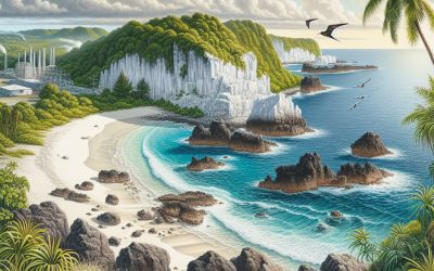
Terrain and Topography of Nauru: mountains, valleys, and plains.
Nauru, a diminutive island nation situated in the Pacific Ocean, is renowned for its distinctive and varied terrain and topography. The island is characterised by its craggy coastline, low-lying valleys and flat plains, rendering it a captivating destination for geologists and nature enthusiasts alike. The terrain of Nauru is a consequence of its geological history, which has moulded the island into the striking landscape it is today. From its unique geology to the effects of phosphate mining, Nauru’s terrain and topography recount a narrative of the island’s past and present. Nauru’s terrain comprises a combination of coastal cliffs, low-lying valleys and flat plains, creating a diverse and compelling landscape. The island’s coastline is rugged and rocky, with dramatic cliffs that overlook the pellucid waters of the Pacific Ocean. Inland, the terrain transitions to low-lying valleys that harbour lush vegetation and distinctive wildlife. The flat plains of Nauru are punctuated by phosphate mining sites, a testament to the island’s history of phosphate extraction. The terrain and topography of Nauru are not only visually impressive but also provide valuable insights into the island’s geological past. Summary Nauru is a small island country with a unique terrain and topography. The geology of Nauru is primarily composed of phosphate deposits, making it a unique geological formation. Unlike many other countries, Nauru does not have any mountains within its borders. The low-lying valleys of Nauru are a prominent feature of the island’s landscape. The flat plains of Nauru make up a significant portion of the country’s terrain. The Unique Geology of Nauru Volcanic Origins Over time, coral reefs formed around the island, adding to...

History of Nauru
Nauru, a diminutive island situated in the Pacific Ocean, was initially inhabited by Micronesian and Polynesian peoples approximately 3,000 years ago. These early inhabitants led a modest existence, primarily dependent on fishing and agriculture for their sustenance. The island remained comparatively secluded until European explorers arrived in the latter part of the 18th century. The first European to set foot on Nauru was the British sea captain John Fearn in 1798. However, it was not until the 19th century that Nauru’s destiny would be irrevocably altered by the arrival of foreign powers. In the late 19th century, Nauru became a German protectorate as part of the German colonial empire. The Germans established a trading post on the island and commenced the exploitation of its phosphate deposits, which would subsequently become a significant source of wealth for the island. The German presence on Nauru also precipitated substantial changes to the island’s culture and society, as European influence began to reshape traditional ways of life. This period of colonisation laid the foundation for Nauru’s future as a key participant in the global phosphate industry. Summary Nauru was first settled by Micronesian and Polynesian people around 1000 B.C. Phosphate mining began in the late 19th century and was dominated by German companies until World War I. Nauru was occupied by the British during World War I and administered as a League of Nations mandate. During World War II, Nauru was occupied by Japan and heavily bombed by the Allies. Nauru gained independence in 1968 and has faced economic challenges due to the depletion of phosphate reserves and environmental issues related to mining....

Natural Resources of Nauru: Where Natural Resources are located In Nauru
Nauru, a diminutive island nation situated in the Pacific Ocean, is renowned for its abundant natural resources. The country’s economy has historically been heavily dependent on the extraction and exportation of phosphate, which has served as a primary source of revenue for the nation. In addition to phosphate, Nauru is endowed with plentiful marine resources, agricultural potential and renewable energy sources. However, the exploitation of these resources has also resulted in environmental degradation and depletion. Consequently, there is an increasing necessity for sustainable management and conservation of Nauru’s natural resources to ensure the long-term welfare of the country and its inhabitants. Nauru’s natural resources have played a pivotal role in shaping the country’s history and economy. The exploitation of phosphate deposits has been the principal driver of economic growth for numerous years, with the mining industry dominating the nation’s economy. However, the overexploitation of phosphate has led to environmental degradation, including land erosion and loss of biodiversity. In recent years, there has been a shift towards diversifying the economy and exploring alternative sources of revenue, such as marine resources, agriculture and renewable energy. The sustainable management of these resources is crucial for Nauru’s future development and prosperity. Summary Nauru is a small island country in the Pacific Ocean with limited natural resources. The island is known for its extensive phosphate deposits, which have been a major source of revenue for the country. Nauru also has rich marine resources, including fish and other seafood, which are important for the local economy and food security. Agricultural resources in Nauru are limited due to the island’s small size and arid climate, but...

Cultural or Historical Sites of Nauru: Important Cultural Landmarks or Historical Sites In Nauru
Nauru, a diminutive island nation situated in the Pacific Ocean, boasts a rich and diverse cultural heritage, as evidenced by its numerous historical and cultural landmarks. The island’s distinctive history and traditional customs have moulded its cultural landscape, rendering it a captivating destination for those keen on exploring the intersection of history, culture and natural beauty. From ancient sacred sites to colonial-era relics, Nauru‘s cultural and historical sites provide insight into the island’s past and its enduring traditions. The cultural and historical sites of Nauru are not only vital for preserving the island’s heritage but also for attracting tourists and fostering cultural exchange. As such, they play a crucial role in the island’s economy and identity. This article shall examine the traditional cultural landmarks, the significance of historical sites, the impact of colonial history, the importance of sacred sites, and the efforts to preserve and protect Nauru’s cultural and historical heritage. Additionally, it shall discuss the future of these sites and the challenges they face in an ever-changing world. Summary Nauru is home to a rich cultural and historical heritage, with a variety of sites that showcase its unique traditions and history. Traditional cultural landmarks in Nauru include ancient rock formations, ceremonial sites, and traditional meeting places that hold great significance for the local community. Historical sites in Nauru play a crucial role in preserving the island’s past and educating future generations about its heritage and identity. Nauru’s colonial history has left a lasting impact on its cultural landmarks, with many sites reflecting the influence of European settlers and their interactions with the indigenous population. Sacred sites and indigenous...

Population Density of Nauru
Nauru, officially the Republic of Nauru, is a small island nation situated in the Pacific Ocean. It ranks as the world’s third-smallest country by land area, encompassing a mere 21 square kilometres. Despite its diminutive size, Nauru boasts a relatively high population density, with approximately 10,000 inhabitants residing on the island. The country is renowned for its abundant phosphate deposits, which have served as a primary source of revenue for the nation. However, the exploitation of these resources has significantly impacted the environment and contributed to the island’s high population density. Nauru possesses a rich cultural heritage and a complex history. The island was originally inhabited by Micronesian and Polynesian peoples and was first encountered by Europeans in the late 18th century. Subsequently, it was colonised by Germany, the United Kingdom, and Australia before achieving independence in 1968. Presently, Nauru faces numerous challenges stemming from its limited size and high population density, including environmental degradation, resource scarcity, and socio-economic issues. Understanding the factors contributing to this high population density and its impact on the country is crucial for addressing these challenges and ensuring a sustainable future for Nauru. Summary Nauru is a small island country in the Pacific with a high population density. Factors contributing to high population density in Nauru include limited land area and urbanization. High population density in Nauru has led to environmental degradation and strain on resources. Challenges of high population density in Nauru include limited infrastructure and social issues. Efforts to manage population density in Nauru include urban planning and sustainable development initiatives. Factors contributing to high population density Historical Exploitation of Phosphate Deposits...
Nauru
Nauru (Naoero (Nauruan) (Republic of Nauru)) Capital: No Official Capital but Parliament Buildings are located in Yaren Population (Estimated July 2012): 9,378 Area: 21.2km2 or 8.2mi2 Currency: Australian Dollar ($A) Official Language: Nauruan Political Information: Republic Official Religion: No Official Religion(approximately 45.8% of the population are Protestant, 33.2% are Roman Catholic, 14.1% follow other faiths, 4.5% have no religious beliefs and 2.4% have unspecified religious beliefs) Highest Point: Unnamed Area at 61m or 200ft GDP Official Exchange Rate (OER is more precise at gauging a country’s economic power) (Estimated 2011): (US$) or (GBP) GDP (OER) Per Capita (per member of the population estimated 2011): (US$) or (GBP) GDP Purchasing Power Parity (PPP is good for gauging living conditions and use of resources but not as accurate as OER. This data has been calculated based on the sum value of all goods and services produced in the country valued at prices prevailing in the United States) (Estimated 2005): $60 million (US$) or (GBP) GDP (PPP) Per Capita (per member of the population estimated 2005): $5,000 (US$) or (GBP) Time Zone (GMT/UTC): +12:00 Wildlife: Counties/Provinces/States: 14 districts; Aiwo, Anabar, Anetan, Anibare, Baiti, Boe, Buada, Denigomodu, Ewa, Ijuw, Meneng, Nibok, Uaboe, Yaren Leaders: President Sprent Dabwido. Additional: Gained independence from the Australia, New Zealand and UK administered UN trusteeship on the 31st January 1968. Sources: CIA World Fact Book, Encyclopaedia Britannica. Nauru Nauru, officially the Republic of Nauru, is a small island nation situated in the Pacific Ocean. It is the world’s third-smallest country, encompassing a mere 21 square kilometres. Despite its diminutive size, Nauru boasts a rich and diverse culture, history and natural beauty that render it an intriguing destination for travellers. The country is located...

Political Boundaries of Namibia: Provinces, Districts, or Historical Boundaries.
Namibia, situated in southern Africa, boasts a rich history and diverse culture. The nation’s political boundaries have undergone changes over time, influencing its governance and administration. Upon gaining independence from South Africa in 1990, Namibia established its own political boundaries to effectively govern the country. These boundaries are crucial for administration, delineating areas of jurisdiction and governmental authority. Moreover, they significantly shape Namibia’s social, economic and cultural landscape. A thorough understanding of Namibia’s political boundaries is essential for comprehending the country’s governance and administrative structure. Namibia shares borders with Angola to the north, Zambia and Zimbabwe to the northeast, Botswana to the east, and South Africa to the south and east. Additionally, the country possesses a western coastline along the Atlantic Ocean. These international borders define Namibia’s political boundaries and play a pivotal role in shaping the nation’s relations with neighbouring countries. Namibia’s political boundaries are not solely defined by international borders but also by internal administrative divisions, including regions and constituencies. These internal boundaries are vital for effective governance and administration, facilitating the decentralisation of power and resources to various parts of the country. In essence, Namibia’s political boundaries are integral to its governance, administration and international relations. Summary Namibia’s political boundaries were established during the colonial era and have evolved over time. The country is divided into 14 regions, each with its own unique characteristics and cultural diversity. Within these regions, there are 121 constituencies, each with its own distinct identity and political representation. Namibia’s historical boundaries have been shaped by colonialism, apartheid, and the struggle for independence. The political boundaries of Namibia have had a significant...

Climate Zones of Namibia: Different climate regions Of Namibia
Namibia, situated in south-western Africa, is renowned for its diverse and distinctive climate zones. The nation’s climate is influenced by its proximity to the Atlantic Ocean, the Kalahari Desert, and the varying elevations across the terrain. Namibia can be categorised into five primary climate zones, each with its own unique characteristics and weather patterns. These climate zones comprise the coastal desert climate, the arid and semi-arid climate of the inland regions, the subtropical climate of the northern regions, and the highland climate of the central plateau. Each of these climate zones plays a vital role in shaping Namibia’s ecosystems, wildlife, and the lifestyle of its inhabitants. Namibia’s climate zones are not only diverse but also have a considerable impact on the country’s economy, agriculture, and tourism. Comprehending the unique characteristics of each climate zone is crucial for anyone intending to visit or conduct business in Namibia. From the harsh and unforgiving conditions of the coastal desert to the lush and fertile landscapes of the northern regions, Namibia’s climate zones offer a captivating insight into the country’s natural diversity. Summary Namibia has diverse climate zones, including coastal desert, arid and semi-arid, subtropical, and highland climates. The coastal desert climate of Namibia is characterized by low rainfall, high temperatures, and dense fog. Inland regions of Namibia experience arid and semi-arid climates with low rainfall and high temperatures, leading to desert and savannah landscapes. The northern regions of Namibia have a subtropical climate with higher rainfall and lush vegetation, supporting diverse wildlife and ecosystems. Namibia’s central plateau has a highland climate with cooler temperatures and higher rainfall, supporting unique flora and fauna....

Terrain and Topography of Namibia: mountains, valleys, and plains.
Namibia, situated in south-western Africa, is renowned for its diverse and striking landscapes. The terrain of Namibia comprises a mixture of deserts, mountains, valleys and plains, rendering it an ideal destination for nature enthusiasts and adventure seekers. The topography of Namibia is dominated by the Namib Desert, one of the world’s oldest and driest deserts, as well as the Kalahari Desert in the east. These vast deserts are juxtaposed with the imposing mountains of the Namib-Naukluft National Park and the Fish River Canyon, which ranks among the largest canyons globally. The country’s distinctive landforms and geological features, such as the renowned red sand dunes of Sossusvlei and the desolate Skeleton Coast, contribute to the allure of Namibia’s terrain. With such a varied and captivating landscape, Namibia presents a wealth of opportunities for exploration and discovery. Namibia’s terrain bears witness to the natural forces that have moulded the country over millions of years. The rugged and arid landscapes are the result of tectonic activity, erosion and climatic changes that have occurred over millennia. The country’s topography is also influenced by the presence of ancient rock formations, volcanic activity and the meandering courses of rivers that have carved their way through the land. The varied terrain of Namibia provides a habitat for a wide range of flora and fauna, each adapted to survive in the harsh and unforgiving environment. From the towering sand dunes of the Namib Desert to the rocky outcrops of Damaraland, Namibia’s terrain is a testament to the resilience and adaptability of life in extreme conditions. A deeper exploration of Namibia’s diverse landscapes reveals the unique features that...

Population Density of Namibia
Namibia, a country situated in southern Africa, is renowned for its expansive and varied landscapes, encompassing the Namib Desert, the Kalahari Desert, and the Etosha National Park. With a total land area of 825,615 square kilometres, Namibia ranks among the least densely populated countries globally. According to the World Bank, Namibia’s population density is estimated at approximately 3.07 people per square kilometre, placing it amongst the lowest worldwide. The majority of Namibia’s populace is concentrated in the northern regions, particularly around the capital city of Windhoek and the coastal town of Swakopmund. The sparse population density in Namibia is largely attributed to its arid and semi-arid climate, which renders vast swathes of the country unsuitable for human habitation and agriculture. Despite its low population density, Namibia faces various challenges related to population distribution and density, which have significant implications for the country’s development and environmental sustainability. Namibia’s population density is influenced by a variety of factors, including its geography, climate, and historical settlement patterns. The country’s arid and semi-arid climate, characterised by low rainfall and high temperatures, limits the availability of water and arable land, making it difficult to support large populations in certain areas. Consequently, the majority of Namibia’s population is concentrated in the northern regions, where there is relatively more fertile land and access to water sources. Additionally, Namibia’s history of colonialism and apartheid has played a significant role in shaping its population distribution. During the colonial era, the German and South African authorities established settlements and infrastructure in certain areas, leading to the concentration of population in specific regions. This historical legacy continues to influence population...

History of Namibia
Namibia, situated in southern Africa, possesses a rich history spanning millennia. The earliest known inhabitants of the region were the San people, also referred to as the Bushmen, who are thought to have occupied the area for over 20,000 years. The San were hunter-gatherers, leading a nomadic lifestyle and depending on the land’s natural resources for sustenance. They demonstrated exceptional proficiency in tracking and hunting game, as well as gathering edible flora. The San people have left behind a substantial legacy of rock art, with thousands of rock paintings and engravings discovered throughout Namibia, offering insight into their way of life and spiritual beliefs. In addition to the San, the Khoikhoi people also resided in Namibia, primarily in the western regions of the country. The Khoikhoi were pastoralists, rearing livestock such as cattle and sheep, and were renowned for their expertise in animal husbandry. They lived in small, mobile groups, migrating with their herds in search of grazing land. The Khoikhoi also maintained a rich oral tradition, transmitting stories and legends through generations. Both the San and the Khoikhoi have played a significant role in shaping Namibia’s cultural and historical landscape, and their descendants continue to preserve their traditions and heritage to this day. Summary Early inhabitants of Namibia were the San, Khoekhoe, and Bantu-speaking peoples, who left behind rock art and evidence of their hunter-gatherer and pastoralist lifestyles. European colonization and German rule in Namibia led to the displacement and mistreatment of the indigenous population, including the Herero and Nama peoples, in events such as the Herero and Namaqua genocide. South African rule and the struggle for independence...

Natural Resources of Namibia: Where Natural Resources are located In Namibia
Namibia, a country situated in southern Africa, is renowned for its diverse and plentiful natural resources. The nation possesses substantial mineral deposits, water sources, wildlife, arable land, and energy reserves. These natural assets play a pivotal role in the country’s economy and provide sustenance for numerous Namibians. The judicious utilisation and preservation of these resources are paramount to ensuring the long-term prosperity of the nation and its citizenry. Namibia’s natural resources have been instrumental in fostering economic growth and development. The mining sector, in particular, has been a significant contributor to the country’s GDP, with minerals such as diamonds, uranium, and copper serving as major exports. The nation’s water resources, including its rivers and subterranean aquifers, are vital for agriculture, industry, and human consumption. Namibia’s varied wildlife and biodiversity are also crucial for tourism, which is a substantial source of revenue for the country. The agricultural sector ensures food security and provides employment for many Namibians, whilst the country’s energy resources, including solar and wind power, have the potential to meet the nation’s growing energy demands. It is imperative for Namibia to manage and conserve these natural resources sustainably to guarantee their availability for future generations. Summary Namibia is rich in natural resources, including minerals, water, wildlife, agriculture, and energy sources. The country’s mineral resources include diamonds, uranium, and copper, making it a key player in the global mining industry. Namibia faces water scarcity, with the majority of its water resources coming from the ephemeral rivers and underground aquifers. The country is home to diverse wildlife and biodiversity, with conservation efforts focused on protecting endangered species and habitats. Agriculture...