World Geography
Geography is the study of the Earth’s landscapes, environments, and the relationships between people and their surroundings. It encompasses both the physical aspects of the Earth, such as its landforms, bodies of water, and climate, as well as the human aspects, including population distribution, cultures, and economies. World geography is a broad field that seeks to understand the complexities of our planet and how humans interact with it. By studying world geography, we can gain a deeper appreciation for the diversity of our planet and the interconnectedness of its various regions.
Geography is a multidisciplinary field that draws on elements of physical science, social science, and humanities. It involves the use of maps, spatial analysis, and geographic information systems (GIS) to understand the Earth’s surface and the processes that shape it. World geography also encompasses the study of human geography, which examines the ways in which people and their activities are distributed across the Earth. By understanding world geography, we can better appreciate the environmental, cultural, and economic challenges facing different regions of the world. This knowledge is crucial for addressing global issues such as climate change, resource management, and international development.
The Five Oceans and Seven Continents
The Earth’s surface is divided into five major oceans: the Pacific, Atlantic, Indian, Southern (or Antarctic), and Arctic Oceans. These vast bodies of water play a crucial role in regulating the Earth’s climate and supporting diverse marine ecosystems. The oceans also serve as important transportation routes and a source of food and other natural resources for human societies around the world.
In addition to the oceans, the Earth’s landmasses are divided into seven continents: Africa, Antarctica, Asia, Europe, North America, Australia (or Oceania), and South America. Each continent has its own unique physical and cultural characteristics, shaped by millions of years of geological processes and human history. From the deserts of Africa to the rainforests of South America, the continents offer a rich tapestry of landscapes and environments for exploration and study.
Major Mountain Ranges and Deserts
The Earth’s surface is also marked by major mountain ranges and deserts that have shaped the planet’s physical and cultural landscapes. The Himalayas, for example, are the highest mountain range in the world and are home to diverse ecosystems and cultures in countries such as India, Nepal, and Bhutan. The Andes in South America, the Rockies in North America, and the Alps in Europe are other prominent mountain ranges that have influenced human settlement patterns and economic activities.
Deserts cover about one-third of the Earth’s land surface and are characterized by low precipitation and extreme temperatures. The Sahara Desert in Africa is the largest hot desert in the world, while the Gobi Desert in Asia is one of the largest cold deserts. Deserts are not only home to unique flora and fauna but have also been important trade routes and cultural crossroads throughout history.
Climate Zones and Biomes
The Earth’s climate is influenced by a variety of factors, including latitude, altitude, ocean currents, and prevailing winds. As a result, the planet is divided into different climate zones, each with its own characteristic weather patterns and ecosystems. The equator, for example, experiences a tropical climate with high temperatures and heavy rainfall, while the polar regions have a cold and dry climate.
These climate zones give rise to different biomes, or large ecological areas characterized by distinct plant and animal communities. The tropical rainforest biome, found near the equator, is home to a diverse array of species and is vital for regulating the Earth’s climate. The grasslands biome, found in regions such as the African savannah and North American prairies, supports grazing animals and has been important for human agriculture throughout history.
Human Geography and Population Distribution
Human geography examines the ways in which people and their activities are distributed across the Earth’s surface. It encompasses topics such as population growth, migration patterns, urbanization, and cultural diversity. Understanding human geography is crucial for addressing global challenges such as poverty, inequality, and environmental degradation.
Population distribution is uneven across the world, with some regions experiencing rapid population growth while others are declining. The majority of the world’s population lives in Asia, particularly in countries such as China and India. Urban areas are also growing rapidly, with more than half of the world’s population now living in cities. This trend has significant implications for infrastructure development, resource management, and social inequality.
Historical and Cultural Geography
Historical geography examines how human activities have shaped the Earth’s landscapes over time. It explores topics such as colonialism, trade routes, and the rise and fall of empires. Cultural geography focuses on how human cultures have developed in different regions of the world and how they interact with their environments.
The Silk Road, for example, was an ancient trade route that connected China with Europe and facilitated the exchange of goods, ideas, and technologies across Eurasia. This historical trade route had a profound impact on the development of cultures and economies along its path. Similarly, cultural geographers study how different societies have adapted to their environments through practices such as agriculture, architecture, and religious beliefs.
The Importance of Geographic Knowledge
Geographic knowledge is crucial for addressing global challenges such as climate change, resource management, and international development. By understanding world geography, we can better appreciate the environmental, cultural, and economic challenges facing different regions of the world. This knowledge is crucial for addressing global issues such as climate change, resource management, and international development.
Geographic knowledge also helps us to understand our interconnectedness with other regions of the world. By studying world geography, we can gain a deeper appreciation for the diversity of our planet and the interconnectedness of its various regions. This understanding can foster a sense of global citizenship and empathy for people from different cultures and backgrounds.
In conclusion, world geography is a complex and multifaceted field that encompasses both physical and human aspects of the Earth’s landscapes. By studying world geography, we can gain a deeper appreciation for the diversity of our planet and the interconnectedness of its various regions. This knowledge is crucial for addressing global challenges such as climate change, resource management, and international development. It also helps us to understand our interconnectedness with other regions of the world and fosters a sense of global citizenship.
FAQs
What is world geography?
World geography is the study of the Earth’s landscapes, environments, and the relationships between people and their environments. It encompasses the physical features of the Earth, as well as the human activity that takes place on it.
Why is world geography important?
World geography is important because it helps us understand the world around us. It provides insights into the physical and human processes that shape our planet, and helps us make informed decisions about how to interact with our environment.
What are the main branches of world geography?
The main branches of world geography include physical geography, which focuses on the Earth’s natural features and processes, and human geography, which examines the relationships between people and their environments.
How does world geography impact our daily lives?
World geography impacts our daily lives in numerous ways, from influencing the weather and climate we experience, to shaping the availability of natural resources and influencing the distribution of populations and cultures around the world.
What are some key concepts in world geography?
Key concepts in world geography include location, place, human-environment interaction, movement, and region. These concepts help geographers understand and interpret the world around them.

Polar Climate Zones
Polar climate zones are among the most extreme and inhospitable environments on Earth. These regions are situated near the Earth’s poles, encompassing the Arctic in the northern hemisphere and the Antarctic in the southern hemisphere. The polar climate is characterised by exceptionally cold temperatures, with prolonged, severe winters and brief, cool summers. The polar regions are also renowned for their vast expanses of ice and snow, including ice caps, glaciers, and icebergs. These areas harbour a unique ecosystem that has adapted to the extreme conditions, rendering them some of the most fascinating and significant environments on the planet. Polar climate zones are also crucial for regulating the Earth’s climate and weather patterns. The ice and snow in these regions reflect sunlight, aiding in the regulation of the Earth’s temperature and climate. Moreover, the cold, dense air in the polar regions helps to drive ocean currents and atmospheric circulation, which in turn influence global weather patterns. As such, the polar climate zones play a vital role in maintaining the balance of the Earth’s climate and are essential for the health of the planet as a whole. Summary Polar climate zones are characterized by extremely cold temperatures and minimal precipitation, with two main types: the polar ice cap and the tundra. The characteristics of polar climates include long, harsh winters, short summers, and a lack of trees and shrubs due to the cold and dry conditions. The flora and fauna of polar regions have adapted to survive in extreme conditions, with species such as polar bears, penguins, and mosses being well-suited to the environment. Human impact on polar climate zones includes...
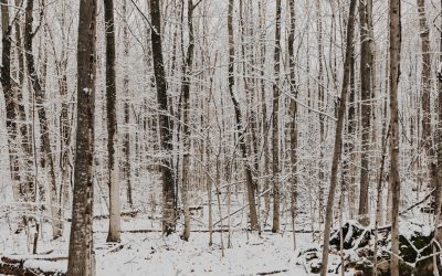
Subarctic or Boreal (Dfc, Dfd): Very cold winters and short, cool summers, with moderate precipitation.
The Subarctic or Boreal climate is a distinctive and varied region spanning the northern hemisphere, encompassing parts of North America, Europe and Asia. This climate is characterised by prolonged, cold winters and brief, mild summers, rendering it one of the coldest climates on Earth. The Subarctic climate is typically found in areas north of the 50th parallel, where the average temperature in the warmest month is below 10°C. The Boreal climate, conversely, is found in slightly warmer regions, with average temperatures in the warmest month ranging from 10-22°C. Despite the harsh conditions, the Subarctic and Boreal regions are home to a wide variety of flora and fauna, as well as indigenous communities that have adapted to the challenging environment over centuries. The Subarctic and Boreal climates are defined by their extended, cold winters and short, mild summers. The winters are often marked by heavy snowfall and freezing temperatures, whilst the summers are relatively brief and cool. The climate is influenced by its high latitude, as well as its proximity to large bodies of water, such as the Arctic Ocean and the North Atlantic. These factors contribute to the extreme temperature variations and weather patterns that are typical of the Subarctic and Boreal regions. Despite the challenging conditions, these climates support a diverse range of ecosystems, including boreal forests, tundra and wetlands, which are home to a wide variety of plant and animal species. The unique climate and ecosystems of the Subarctic and Boreal regions have also shaped the way in which human communities have adapted to and interacted with their environment over time. Summary The Subarctic or Boreal climate...

Humid Continental (Dfa, Dfb): Warm to hot summers, cold winters, and significant precipitation year-round.
The humid continental climate, designated as Dfa and Dfb in the Köppen climate classification, is a climate type typically found in the interior of continents, away from the moderating influence of large bodies of water. This climate is characterised by four distinct seasons, with warm to hot summers and cold winters. The Dfa subtype experiences hot summers, whilst the Dfb subtype has warm summers. The transition between seasons can be quite dramatic, with significant temperature variations throughout the year. This climate type is found in regions such as the Great Plains in North America, parts of Eastern Europe, and parts of East Asia. The humid continental climate is influenced by air masses from both polar and tropical regions, leading to a wide range of temperatures and weather patterns. The presence of large landmasses allows for significant temperature fluctuations, with cold air masses from the north and warm air masses from the south impacting the region. The lack of a moderating influence from large bodies of water means that the climate can be quite variable and unpredictable, with rapid changes in weather conditions. The Dfa and Dfb subtypes are characterised by their distinct summer temperatures, with Dfa experiencing hotter summers and Dfb experiencing warmer summers. These variations in temperature have significant impacts on the environment, agriculture, and human activities in these regions. Summary Humid Continental Climate (Dfa, Dfb) is characterized by warm to hot summers and cold winters, with year-round precipitation. The climate is known for its distinct four seasons, with significant temperature variations throughout the year. Warm to hot summers in humid continental climate can lead to heatwaves, droughts,...
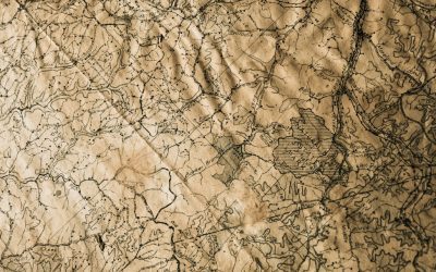
Continental Climate Zones
Continental climate zones are characterised by their distinct seasonal variations in temperature, with warm summers and cold winters. These climate zones are typically found in the interior regions of large landmasses, away from the moderating influence of the ocean. The absence of nearby bodies of water means that continental climate zones experience greater temperature extremes compared to maritime climate zones. This results in warm, dry summers and cold, snowy winters. Continental climate zones can be found in various parts of the world, including North America, Europe and Asia. The unique characteristics of continental climate zones have a significant impact on the natural environment, vegetation, wildlife and human activities in these regions. Understanding the specific features of continental climate zones is crucial for developing effective strategies for agriculture, conservation and sustainable development in these areas. Summary Continental climate zones are characterized by large temperature variations between summer and winter, and low precipitation throughout the year. The characteristics of continental climate zones include hot summers, cold winters, and a wide daily temperature range. Vegetation in continental climate zones is adapted to the harsh conditions, with grasslands, shrubs, and drought-resistant plants being common. Continental climate zones can have a significant impact on agriculture, with challenges such as water scarcity and extreme temperatures affecting crop growth. Wildlife in continental climate zones includes species adapted to the harsh conditions, such as bison, wolves, and prairie dogs. Characteristics of Continental Climate Zones Seasonal Temperature Contrasts The sharp contrast between summer and winter temperatures is a defining feature of continental climate zones. In addition to temperature variations, continental climate zones also experience distinct seasonal changes in...

Oceanic or Maritime (Cfb, Cfc): Mild summers and winters with precipitation year-round, common in coastal regions.
The oceanic or maritime climate, also known as the Cfb climate, is a type of climate heavily influenced by the proximity of large bodies of water, such as oceans or seas. This climate is typically found in coastal regions, particularly on the western coasts of continents, where the prevailing winds blow from the ocean onto the land. The oceanic climate is characterised by relatively mild temperatures, with cool summers and mild winters, and high levels of precipitation throughout the year. This climate is often associated with lush, green landscapes and is known for its temperate and humid conditions. The oceanic climate is influenced by the presence of ocean currents, which help to moderate temperatures and create a relatively stable climate. The presence of large bodies of water also leads to high levels of humidity and frequent cloud cover, which contributes to the high levels of precipitation in these regions. The oceanic climate is often contrasted with continental climates, which are characterised by more extreme temperature variations and lower levels of precipitation. Overall, the oceanic climate is known for its moderate and relatively stable weather patterns, making it an ideal environment for a diverse range of vegetation and wildlife. Summary Oceanic or maritime climate is influenced by the proximity of large bodies of water, resulting in mild temperatures and high levels of precipitation. Cfb climate is characterized by mild winters, cool summers, and relatively even distribution of rainfall throughout the year. Cfc climate is similar to Cfb but with colder temperatures, especially in the winter, and a shorter growing season. Coastal regions with Cfb climate include western Europe, parts of...

Humid Subtropical (Cfa, Cwa): Hot, humid summers with mild winters; rainfall throughout the year.
The humid subtropical climate is a type of climate characterised by hot, humid summers and mild winters. This climate is typically found in the southeastern parts of the United States, as well as in parts of East Asia, Australia, and South America. The humid subtropical climate is influenced by maritime tropical air masses from the Atlantic Ocean and Gulf of Mexico, which bring warm, moist air to the region. This climate is known for its distinct seasons, with hot and humid summers and mild winters. The average annual temperature in humid subtropical regions ranges from 20°C to 27°C, making it a warm and pleasant climate for most of the year. The humid subtropical climate is also known for its high levels of precipitation throughout the year, with rainfall occurring in all seasons. This climate is influenced by the movement of the subtropical high-pressure belt, which brings moist air from the oceans to the land. The combination of warm temperatures and high levels of precipitation creates a lush and diverse ecosystem, with a wide variety of plant and animal species. The humid subtropical climate is an important and unique climate type that supports a rich and diverse ecosystem, as well as human life in many parts of the world. Summary Humid subtropical climate is characterized by hot, humid summers and mild winters, with rainfall throughout the year. The climate supports a diverse range of vegetation and wildlife, including lush forests and a variety of animal species. Hot, humid summers in humid subtropical regions can have a significant impact on human health and well-being, leading to heat-related illnesses and discomfort. Mild...
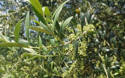
Mediterranean (Csa, Csb): Hot, dry summers and mild, wet winters.
The Mediterranean climate is a distinctive weather pattern found in regions bordering the Mediterranean Sea, as well as in other parts of the world such as California, Chile and South Africa. This climate is characterised by hot, dry summers and mild, wet winters. The Mediterranean climate is influenced by subtropical high-pressure systems and the westerlies, which bring moisture from the ocean during the winter months. The combination of these factors results in a distinct climate that has a significant impact on the environment, agriculture and human life in the affected regions. The Mediterranean climate is renowned for its pleasant, sunny weather during the summer months, making it a popular tourist destination. However, the climate also presents challenges for the people and ecosystems that inhabit these regions. Understanding the characteristics and impact of the Mediterranean climate is crucial for developing strategies to mitigate its effects and adapt to its unique challenges. Summary The Mediterranean climate is characterized by hot, dry summers and mild, wet winters, and is found in regions bordering the Mediterranean Sea, as well as in parts of California, South Africa, and Australia. The Mediterranean climate is known for its long growing season, which is ideal for the cultivation of crops such as olives, grapes, and citrus fruits. The impact of the Mediterranean climate on agriculture can be both positive and negative, with the potential for droughts and wildfires posing significant challenges for farmers. The challenges of the Mediterranean climate for wildlife and ecosystems include the risk of desertification, loss of biodiversity, and increased vulnerability to invasive species. Human adaptation to the Mediterranean climate has involved the development...
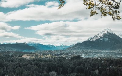
Temperate Climate Zones
Temperate climate zones are areas of the Earth that experience moderate temperatures and distinct seasons. These zones are situated between the tropics and the polar regions, typically between 30 and 60 degrees latitude in both the northern and southern hemispheres. The temperate climate is characterised by mild summers and winters, with moderate rainfall throughout the year. This type of climate is conducive to a wide variety of plant and animal life, rendering temperate zones some of the most diverse and productive ecosystems on the planet. Temperate climate zones can be found in various locations around the world, including parts of North America, Europe, Asia, and Australia. These regions are home to a wide range of habitats, including forests, grasslands, and coastal areas. The temperate climate is also favourable for agriculture, making these zones important for food production. However, human activity has had a significant impact on temperate climate zones, resulting in habitat destruction and loss of biodiversity. Conservation efforts are underway to protect these valuable ecosystems and ensure their preservation for future generations. Summary Temperate climate zones are known for their moderate temperatures and distinct seasons, making them ideal for a variety of plant and animal life. These climate zones are characterised by their four distinct seasons: spring, summer, autumn, and winter, each with its own unique weather patterns and environmental changes. The flora and fauna in temperate climate zones are diverse and include a wide range of species, from deciduous trees and shrubs to mammals, birds, and insects. Human activities such as deforestation, urbanisation, and pollution have had a significant impact on temperate climate zones, leading to habitat...

Steppe (BSh, BSk): Semi-arid regions with more rainfall than deserts, supporting grasslands.
The steppe ecosystem is a vast, grassy plain that stretches across Eurasia and North America. It is characterised by its dry climate, with low annual precipitation and extreme temperature fluctuations. The steppe is home to a diverse array of plant and animal species that have adapted to the harsh environmental conditions. The vegetation in the steppe consists mainly of grasses, herbs and shrubs, which provide food and shelter for the wildlife that inhabits the region. The steppe ecosystem plays a crucial role in maintaining the balance of the Earth’s ecosystems and is an important habitat for many endangered species. Understanding the unique characteristics of the steppe ecosystem is essential for conservation efforts and sustainable management of this valuable natural resource. The steppe ecosystem is a unique and important part of the Earth’s natural environment. It is a vast, open grassland that covers large areas of Eurasia and North America. The steppe is characterised by its dry climate, with low annual precipitation and extreme temperature fluctuations. This harsh environment has shaped the flora and fauna of the steppe, leading to the evolution of species that are well adapted to survive in these challenging conditions. The steppe is home to a diverse array of plant and animal species, including grasses, herbs, shrubs and large herbivores such as wild horses and antelope. The steppe ecosystem is an important habitat for many endangered species, making it a crucial area for conservation efforts. Understanding the unique characteristics of the steppe ecosystem is essential for protecting this valuable natural resource for future generations. Summary Steppe ecosystems are vast grasslands found in semi-arid regions, characterised by...

Desert (BWh, BWk): Hot deserts (BWh) and cold deserts (BWk), characterized by very low precipitation.
Deserts are intriguing and varied ecosystems that encompass approximately one-fifth of the Earth’s terrestrial surface. These regions are defined by their arid conditions, featuring minimal precipitation and elevated evaporation rates. Deserts are categorised into distinct climate types, with the BWh and BWk classifications being the most prevalent. The BWh climate, also referred to as hot desert climate, is characterised by exceedingly high temperatures and scarce rainfall. These areas are typically situated in subtropical latitudes, where the descending air of the Hadley cell generates dry and hot conditions. Conversely, the BWk climate, known as the cold desert climate, is distinguished by low temperatures and sparse vegetation. These regions are frequently found at higher latitudes and elevations, where cold air and moisture deficiency create harsh living conditions. The BWh and BWk climates possess unique attributes that differentiate them from one another. Whilst both experience minimal precipitation, the BWh climate is renowned for its sweltering temperatures, often surpassing 40°C during the day and dropping considerably at night. In contrast, the BWk climate undergoes extreme temperature fluctuations, with hot summers and frigid winters. Comprehending the characteristics of these desert climates is essential for appreciating the challenges and adaptations of the flora, fauna, and human populations that inhabit these regions. Summary BWh and BWk climates are characterized by extreme dryness and high temperatures, making them challenging environments for life to thrive. Hot deserts (BWh) such as the Sahara and the Arabian Desert are the hottest and driest regions on Earth, with unique adaptations of plants and animals to survive in these harsh conditions. Cold deserts (BWk) like the Gobi Desert and the Great Basin...

Dry (Arid and Semi-Arid) Climate Zones
Arid and semi-arid regions, commonly referred to as dry climate zones, are characterised by minimal precipitation and elevated evaporation rates. These areas are distributed globally, encompassing the deserts of the Middle East and North Africa, as well as the semi-arid grasslands of the American Midwest. The scarcity of water in these regions poses distinct challenges for both the natural environment and human inhabitants. It is essential to comprehend the characteristics, flora and fauna, challenges, and anthropogenic impact on these areas to develop sustainable practices and conservation efforts aimed at protecting these fragile ecosystems. Summary Dry climate zones are characterized by low precipitation and high evaporation rates, leading to arid and semi-arid conditions. Arid climate zones are extremely dry with little to no vegetation, while semi-arid climate zones have slightly more precipitation and can support some plant life. Flora and fauna in dry climate zones have adapted to survive in harsh conditions, with many species having specialized features such as water-storing capabilities and heat resistance. Challenges in dry climate zones include water scarcity, desertification, and extreme temperatures, leading to the need for adaptations such as water conservation and drought-resistant crops. Human impact on dry climate zones includes overgrazing, deforestation, and urbanization, leading to further degradation of the environment and loss of biodiversity. Conservation and sustainable practices are essential for preserving these fragile ecosystems. Characteristics of Arid Climate Zones Vegetation in Arid Zones Vegetation in these areas is often sparse and adapted to conserve water, with plants having small leaves or spines to reduce water loss through transpiration. Animal Life in Arid Zones Animal life in arid zones is also adapted...

Tropical Savanna (Aw): Warm temperatures with distinct wet and dry seasons.
Tropical savanna climate, also known as Aw climate, is a type of climate typically found in regions near the equator. This climate is characterised by distinct wet and dry seasons, with the wet season typically occurring in the summer months and the dry season in the winter months. The temperature in tropical savanna regions remains relatively high throughout the year, with little variation between seasons. The average temperature in these regions ranges from 20°C to 30°C. The annual rainfall in tropical savanna climates is moderate, typically ranging from 750 to 1250 mm per year. This type of climate is commonly found in regions such as parts of Africa, South America, and Australia. Tropical savanna climates are known for their unique weather patterns, which have a significant impact on the ecosystems and wildlife in these regions. The distinct wet and dry seasons create a dynamic environment that supports a diverse range of plant and animal species. The combination of high temperatures and moderate rainfall provides ideal conditions for the growth of grasses and shrubs, which are characteristic of savanna landscapes. The seasonal changes in weather also play a crucial role in shaping the behaviour and life cycles of the wildlife that inhabit these regions. Overall, tropical savanna climates are an important and fascinating part of the Earth’s diverse range of climates. Summary Tropical Savanna (Aw) Climate is characterized by distinct wet and dry seasons, with average monthly temperatures above 18°C throughout the year. The characteristics of Tropical Savanna Climate include a long dry season, short wet season, and a significant temperature variation between the two seasons. Weather patterns in Tropical...