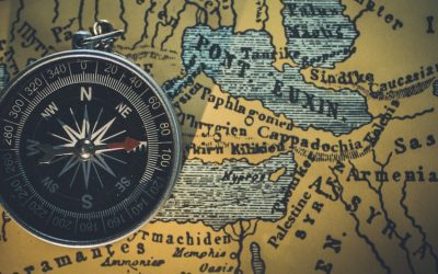
Explore the World Through Geography, Natural Resources & Daily History
Clear, reliable and engaging guides that help you understand our planet — from UK geography education to global natural resources and On This Day history events.
Explore, discover, and learn about the wonders of our world! At Earth Site, we’re passionate about bringing geography, history, and science to life for curious minds of all ages. Whether you’re delving into historical events, uncovering the mysteries of the natural world, or seeking interactive resources, you’re in the right place.
Here, you can uncover the stories behind historical events, explore the natural wonders of our planet, and gain valuable insights into how the Earth’s systems shape our daily lives. From the towering peaks of mountain ranges to the far-reaching impacts of human innovation, we aim to make every topic both engaging and informative.
Start your journey of discovery with us today, and let’s make learning an adventure!
What We Cover
Earth Site brings together engaging and accessible educational content designed to help you understand the world, its history, and its natural systems.
🌍 Geography Education (UK & Worldwide)
We publish clear, easy-to-understand geography resources for students, teachers and curious learners. Our guides support geography education in the UK and cover physical geography, climate, ecosystems, population, and global development.
⛏️ Natural Resources & Environmental Geography
Explore detailed country profiles covering natural resources, mining, energy, geology and global environmental challenges. We show how nations manage minerals, water, land and ecosystems, and why these resources matter.
📅 On This Day in History
Every day has a story. Our On This Day history series features major events, anniversaries, traditions, and cultural milestones from around the world — with timelines, context, and fun facts.
TIMELINE
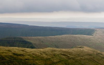
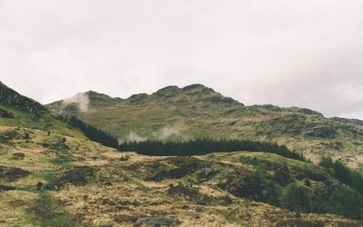
Terrain and Topography of Saint Kitts and Nevis: mountains, valleys, and plains.
Saint Kitts and Nevis, a twin-island nation nestled in the Caribbean Sea, is a veritable gem that boasts a rich tapestry of natural beauty, cultural heritage, and historical significance. This enchanting archipelago, the smallest country in the Western Hemisphere, is renowned for its stunning landscapes, which range from majestic mountains to lush valleys and serene plains. The islands are not only a paradise for tourists seeking sun-soaked beaches and vibrant marine life but also a treasure trove of biodiversity and ecological wonders. The unique geographical features of Saint Kitts and Nevis have played a pivotal role in shaping the islands’ ecosystems, influencing both the flora and fauna that thrive here, as well as the cultural practices of its inhabitants. The allure of Saint Kitts and Nevis extends beyond its picturesque scenery; it is steeped in a rich history that reflects the confluence of indigenous cultures, colonial influences, and the resilience of its people. The islands were originally inhabited by the Carib and Arawak peoples before European colonisation introduced new dynamics to the region. Today, the legacy of this complex history is evident in the vibrant traditions, music, and culinary delights that characterise the islands. As we delve deeper into the diverse terrain of Saint Kitts and Nevis, we will uncover how its majestic mountains, lush valleys, and serene plains not only define the physical landscape but also contribute to the cultural identity and environmental sustainability of this remarkable nation. Summary Saint Kitts and Nevis is a stunning Caribbean island nation known for its diverse terrain and topography. The majestic mountains of Saint Kitts and Nevis offer breathtaking views and...
Climate Zones of Saint Kitts and Nevis: Different climate regions Of Saint Kitts and Nevis
Saint Kitts and Nevis, a twin-island nation nestled in the Caribbean Sea, is renowned for its stunning landscapes, rich history, and vibrant culture. This small yet captivating country is the smallest sovereign state in the Western Hemisphere, both in terms of area and population. The islands are characterised by their lush greenery, volcanic mountains, and pristine beaches, making them a popular destination for tourists seeking both relaxation and adventure. The capital city, Basseterre, located on Saint Kitts, serves as the political and economic hub of the nation, while Nevis, known for its tranquil atmosphere and historical significance, offers a more laid-back experience. The islands’ unique geographical features and cultural heritage contribute to their appeal, drawing visitors from around the globe. The climate of Saint Kitts and Nevis plays a pivotal role in shaping the lifestyle of its inhabitants and the experiences of its visitors. The islands are situated within a tropical climate zone, which influences not only the natural environment but also the agricultural practices and tourism industry. The diverse climatic conditions across the islands create a rich tapestry of ecosystems, ranging from lush rainforests to arid landscapes. Understanding these climatic zones is essential for appreciating the ecological diversity of Saint Kitts and Nevis, as well as for recognising the challenges and opportunities they present for sustainable development. As we delve into the various climate zones that characterise this enchanting nation, we will uncover how they impact both the local populace and the thriving tourism sector. Summary Saint Kitts and Nevis is a small island nation in the Caribbean known for its beautiful beaches and lush landscapes. The tropical...
Political Boundaries of Saint Kitts and Nevis: Provinces, Districts, or Historical Boundaries.
Saint Kitts and Nevis, a twin-island nation nestled in the Caribbean Sea, is renowned for its stunning landscapes, rich history, and vibrant culture. This small yet significant country, which is the smallest sovereign state in the Western Hemisphere both in terms of area and population, comprises two volcanic islands: Saint Kitts, the larger of the two, and Nevis, which lies to the southeast. The islands are characterised by lush rainforests, pristine beaches, and a mountainous terrain that offers breathtaking views of the surrounding ocean. The capital city, Basseterre, located on Saint Kitts, serves as the political and economic hub of the nation, while Charlestown, the capital of Nevis, is known for its colonial architecture and historical significance. The unique blend of African, European, and indigenous influences has shaped the cultural identity of Saint Kitts and Nevis, making it a fascinating destination for tourists and a vibrant home for its residents. The nation’s economy is primarily driven by tourism, agriculture, and financial services. The picturesque landscapes and warm climate attract visitors from around the globe, eager to experience the islands’ natural beauty and rich cultural heritage. The sugar industry once dominated the economy, but as this sector declined, the government shifted its focus towards developing tourism and offshore banking. This transition has not only diversified the economy but has also led to increased investment in infrastructure and services. Despite its small size, Saint Kitts and Nevis plays a significant role in regional politics and is a member of various international organisations, including the United Nations and the Organisation of Eastern Caribbean States. The islands’ strategic location has historically made them...
History of Saint Kitts and Nevis
Before the arrival of European explorers, the islands of Saint Kitts and Nevis were inhabited by indigenous peoples, primarily the Arawaks and Caribs. The Arawaks, who were the first to settle in the region, are believed to have arrived around 2000 BC, bringing with them a rich culture that revolved around agriculture, fishing, and pottery. They cultivated crops such as cassava, sweet potatoes, and maize, which formed the backbone of their diet. Their society was organised into small, semi-nomadic communities that thrived on the natural resources available to them. The Arawaks were known for their intricate pottery and basket weaving, which showcased their artistic skills and connection to the land. However, their peaceful existence was disrupted by the arrival of the more aggressive Caribs, who migrated from South America around 1200 AD. The Caribs were skilled warriors and seafarers, and they quickly established dominance over the Arawaks, leading to significant cultural exchanges and conflicts. The Caribs brought with them a different way of life that was more militaristic and hierarchical than that of the Arawaks. They were adept at fishing and hunting, utilising canoes for transportation and trade between islands. Their society was structured around chiefdoms, with leaders known as “caciques” who held significant power and influence. The Caribs also engaged in warfare with neighbouring tribes, which allowed them to expand their territory and control over resources. The arrival of Europeans in the late 15th century marked a turning point for these indigenous populations. The introduction of new diseases by European explorers decimated the native populations, leading to a dramatic decline in their numbers. By the time the British...
Population Density of Saint Kitts and Nevis
Saint Kitts and Nevis, a twin-island nation nestled in the Caribbean Sea, is renowned for its stunning landscapes, rich history, and vibrant culture. The islands, which are the smallest sovereign state in the Western Hemisphere, boast a unique blend of natural beauty and historical significance. Saint Kitts, the larger of the two islands, is characterised by its lush mountains and volcanic terrain, while Nevis, known for its picturesque beaches and charming colonial architecture, offers a more tranquil atmosphere. Together, they form a nation that is not only a popular tourist destination but also a fascinating case study in demographic trends and population dynamics. The islands’ population, though relatively small, is a tapestry of diverse cultures and ethnicities, reflecting centuries of colonial influence and migration. The demographic landscape of Saint Kitts and Nevis is shaped by various factors, including historical events, economic opportunities, and social structures. As the nation grapples with modern challenges such as urbanisation and environmental sustainability, understanding the intricacies of its population density becomes increasingly important. Population density, defined as the number of people living per unit area, serves as a critical indicator of how resources are allocated and how communities develop. In the context of Saint Kitts and Nevis, examining population density reveals insights into the islands’ social fabric, economic viability, and future prospects. This article delves into the nuances of population density in this Caribbean nation, exploring its historical trends, current implications, and future outlook. Summary Saint Kitts and Nevis is a small island nation in the Caribbean with a rich history and unique culture. The population density of Saint Kitts and Nevis is relatively...

Natural Resources of Saint Kitts and Nevis: Where Natural Resources are located In Saint Kitts and Nevis
Saint Kitts and Nevis, a twin-island nation nestled in the Caribbean Sea, is renowned for its stunning landscapes, vibrant culture, and rich biodiversity. The natural resources of this small nation are not only vital for its economy but also play a crucial role in sustaining the livelihoods of its inhabitants. The islands boast a variety of resources, ranging from fertile agricultural land to abundant marine life, all of which contribute to the unique character and resilience of this nation. As the world increasingly turns its attention to sustainable practices, the management and conservation of these resources have become paramount, ensuring that future generations can continue to benefit from the natural wealth that Saint Kitts and Nevis has to offer. The islands’ geographical features, including volcanic mountains, lush rainforests, and pristine coastlines, create a diverse ecosystem that supports a wide array of flora and fauna. This natural diversity is not only a source of beauty but also a foundation for economic activities such as agriculture, fishing, and tourism. However, the delicate balance between utilising these resources and preserving them for future generations poses significant challenges. As climate change and human activity threaten the integrity of these ecosystems, it becomes increasingly important to explore the various natural resources available in Saint Kitts and Nevis and to understand their potential for sustainable development. Summary Saint Kitts and Nevis is a small island nation in the Caribbean with rich natural resources. The agricultural resources of Saint Kitts and Nevis include sugar cane, bananas, and livestock. The mineral resources of Saint Kitts and Nevis are limited, with deposits of volcanic stone and sand. The...
Cultural or Historical Sites of Saint Kitts and Nevis: Important Cultural Landmarks or Historical Sites In Saint Kitts and Nevis
Nestled on the verdant hills of St. Kitts, Brimstone Hill Fortress National Park stands as a testament to the island’s rich colonial history and military architecture. This UNESCO World Heritage Site, often referred to as the “Gibraltar of the West Indies,” boasts an impressive array of fortifications that date back to the 17th and 18th centuries. The fortress was constructed by the British to protect their interests in the Caribbean, and its strategic location offers breathtaking panoramic views of the surrounding landscape, including the Caribbean Sea and neighbouring islands. Visitors to Brimstone Hill can explore its well-preserved ramparts, bastions, and barracks, which provide a fascinating glimpse into the past. The site is not only a historical marvel but also a natural wonder, with lush greenery enveloping the stone structures, creating a picturesque setting that enchants all who visit. Walking through the fortress, one can almost hear the echoes of history reverberating through its walls. The site is home to several interpretive displays that narrate the story of its construction and the various battles fought over its control. The impressive architecture reflects the ingenuity of military engineers of the time, with thick stone walls designed to withstand cannon fire and a layout that maximises defensive capabilities. As visitors ascend to the highest points of the fortress, they are rewarded with stunning vistas that stretch across the horizon, making it an ideal spot for photography enthusiasts and nature lovers alike. The combination of historical significance and natural beauty makes Brimstone Hill Fortress National Park a must-visit destination for anyone seeking to understand the cultural heritage of St. Kitts. Summary Brimstone Hill...

Saint Kitts and Nevis
Saint Kitts and Nevis (Federation of Saint Kitts and Nevis) Capital: Basseterre Population (Estimated July 2012): 50,726 Area: 269km2 or 104mi2 Currency: Eastern Caribbean Dollar (EC$) Official Language: English Political Information: Constitutional Monarchy with a democratic Parliament Official Religion: No Official Religion(mainly Anglican, other Protestant, Roman Catholic) Highest Mountain: Mount Liamuiga at 1,156m or 3,793ft GDP Official Exchange Rate (OER is more precise at gauging a country’s economic power) (Estimated 2011): $700 million (US$) or (GBP) GDP (OER) Per Capita (per member of the population estimated 2011): (US$) or (GBP) GDP Purchasing Power Parity (PPP is good for gauging living conditions and use of resources but is not as accurate as OER. This data has been calculated based on the sum value of all goods and services produced in the country valued at prices prevailing in the United States) (Estimated 2011): $918 million (US$) or (GBP) GDP (PPP) Per Capita (per member of the population estimated in 2011): $700 million (US$) or (GBP) Time Zone (GMT/UTC): -4:00 Wildlife: Counties/Provinces/States: 14 parishes; Christ Church Nichola Town, Saint Anne Sandy Point, Saint George Basseterre, Saint George Gingerland, Saint James Windward, Saint John Capesterre, Saint John Figtree, Saint Mary Cayon, Saint Paul Capesterre, Saint Paul Charlestown, Saint Peter Basseterre, Saint Thomas Lowland, Saint Thomas Middle Island, Trinity Palmetto Point Leaders: H.M. Queen Elizabeth II, represented by Governor-General Sir Cuthbert Sebastian and Prime Minister Denzil Douglas Sources: CIA World Fact Book, Encyclopaedia Britannica. Saint Kitts and Nevis Saint Kitts and Nevis, a twin-island nation nestled in the Caribbean Sea, is a gem that often escapes the attention of many travellers. This enchanting destination, known for its lush landscapes...

Political Boundaries of Rwanda: Provinces, Districts, or Historical Boundaries.
Political boundaries serve as the framework within which a nation operates, delineating the areas of governance, administration, and jurisdiction. In Rwanda, a country that has undergone significant transformation over the past few decades, these boundaries are not merely lines on a map; they are deeply intertwined with the nation’s history, culture, and socio-political dynamics. The geographical layout of Rwanda, often referred to as the “Land of a Thousand Hills,” presents unique challenges and opportunities for governance. The political boundaries established within this mountainous terrain have evolved over time, reflecting the changing needs and aspirations of its people. Understanding these boundaries is crucial for comprehending the broader context of Rwandan society, particularly in light of its tumultuous past and ambitious future. The significance of political boundaries in Rwanda extends beyond administrative convenience; they are emblematic of the nation’s identity and unity. Following the devastating genocide in 1994, Rwanda has made remarkable strides towards reconciliation and nation-building, with political boundaries playing a pivotal role in this process. The delineation of provinces and districts has facilitated local governance and decentralisation, allowing for more tailored approaches to development and community engagement. As Rwanda continues to forge its path towards economic growth and social cohesion, the examination of its political boundaries reveals insights into the complexities of governance in a post-conflict society. This article will delve into the structure and function of Rwanda’s provinces and districts, explore the historical context of its boundaries, and consider the challenges and prospects that lie ahead. Summary Rwanda’s political boundaries have evolved over time and have significant historical and cultural significance. The provinces in Rwanda play a crucial...

History of Rwanda
Before the advent of European colonisation, Rwanda was a well-established kingdom with a rich tapestry of culture and governance. The Kingdom of Rwanda, which emerged in the 15th century, was characterised by a complex social structure and a sophisticated political system. The monarchy, led by the Mwami, was central to the kingdom’s identity, wielding both spiritual and temporal authority. The Tutsi, Hutu, and Twa peoples coexisted within this framework, each contributing to the kingdom’s agricultural economy and cultural life. The Tutsi, often seen as the ruling elite, were primarily cattle herders, while the Hutu were predominantly farmers. This division of labour fostered a symbiotic relationship that was crucial for the kingdom’s prosperity. The dynasties that ruled Rwanda during this period were marked by intricate alliances and rivalries, which shaped the political landscape and laid the groundwork for future conflicts. The socio-political dynamics of pre-colonial Rwanda were further complicated by the introduction of external influences, particularly from neighbouring regions. Trade routes facilitated interactions with other kingdoms and cultures, enriching Rwandan society with new ideas and practices. The kingdom’s strategic location allowed it to become a hub for trade in goods such as salt, iron, and agricultural products. This economic vitality contributed to the centralisation of power under the Mwami, who was seen as a unifying figure amidst the diverse ethnic groups. However, this centralisation also sowed the seeds of discord, as competition for power and resources intensified among the ruling classes. The historical narratives of this period are often romanticised, yet they reveal a society that was both dynamic and fragile, setting the stage for the tumultuous events that would...

Climate Zones of Rwanda: Different climate regions Of Rwanda
Rwanda, often referred to as the “Land of a Thousand Hills,” is a small, landlocked country located in East Africa. Its unique topography and geographical position contribute to a diverse array of climate zones, each with its own distinct characteristics. The interplay between altitude and latitude creates a microclimate that varies significantly across the country, influencing not only the weather patterns but also the flora and fauna that thrive in these environments. Rwanda‘s climate is predominantly influenced by its proximity to the equator, yet the elevation of its terrain leads to cooler temperatures than one might expect in a tropical region. This fascinating combination results in a rich tapestry of ecosystems, making Rwanda a remarkable case study in climate diversity. The classification of Rwanda’s climate zones can be broadly divided into five main categories: tropical rainforest, subtropical highlands, savannah, semi-arid, and alpine. Each zone presents unique climatic conditions that shape the landscape and the livelihoods of the people who inhabit them. Understanding these climate zones is crucial for appreciating the ecological and agricultural dynamics of Rwanda. As we delve deeper into each climate zone, we will explore how these environments not only define the natural beauty of the country but also play a pivotal role in its agricultural practices and biodiversity. The intricate relationship between climate and ecology in Rwanda serves as a reminder of the delicate balance that sustains life in this vibrant nation. Summary Rwanda has diverse climate zones, each with its own unique characteristics and impact on the country’s biodiversity and agriculture. The Tropical Rainforest Climate Zone in Rwanda is characterised by high temperatures, heavy rainfall,...

Terrain and Topography of Rwanda: mountains, valleys, and plains.
Rwanda, often referred to as the “Land of a Thousand Hills,” is a nation characterised by its stunningly diverse terrain and topography. Nestled in East Africa, this small yet captivating country boasts a landscape that ranges from rolling hills and majestic mountains to lush valleys and expansive plains. The geographical features of Rwanda are not merely aesthetic; they play a crucial role in shaping the culture, economy, and daily lives of its inhabitants. The interplay between elevation and climate creates microclimates that support a rich variety of flora and fauna, making Rwanda a unique ecological haven. This intricate tapestry of landforms has not only influenced the historical development of the region but continues to impact its socio-economic dynamics today. The topography of Rwanda is predominantly hilly, with elevations that can reach up to 4,507 metres at the peak of Mount Karisimbi, one of the Virunga Mountains. The country’s landscape is punctuated by numerous lakes, rivers, and wetlands, which contribute to its rich biodiversity. The interplay between these geographical features creates a mosaic of ecosystems that support both terrestrial and aquatic life. Furthermore, the elevation variations lead to distinct climatic zones, which in turn affect agricultural practices and settlement patterns. Understanding Rwanda’s terrain is essential for appreciating its cultural heritage and the resilience of its people, who have adapted to thrive in this challenging yet beautiful environment. Summary Rwanda’s terrain is characterised by a diverse landscape of mountains, valleys, and plains. The majestic mountains of Rwanda, including the Virunga Mountains, offer breathtaking views and are home to the endangered mountain gorillas. The beautiful valleys of Rwanda are fertile and lush,...