Explore the World Through Geography, Natural Resources & Daily History
Clear, reliable and engaging guides that help you understand our planet — from UK geography education to global natural resources and On This Day history events.
Explore, discover, and learn about the wonders of our world! At Earth Site, we’re passionate about bringing geography, history, and science to life for curious minds of all ages. Whether you’re delving into historical events, uncovering the mysteries of the natural world, or seeking interactive resources, you’re in the right place.
Here, you can uncover the stories behind historical events, explore the natural wonders of our planet, and gain valuable insights into how the Earth’s systems shape our daily lives. From the towering peaks of mountain ranges to the far-reaching impacts of human innovation, we aim to make every topic both engaging and informative.
Start your journey of discovery with us today, and let’s make learning an adventure!
What We Cover
Earth Site brings together engaging and accessible educational content designed to help you understand the world, its history, and its natural systems.
🌍 Geography Education (UK & Worldwide)
We publish clear, easy-to-understand geography resources for students, teachers and curious learners. Our guides support geography education in the UK and cover physical geography, climate, ecosystems, population, and global development.
⛏️ Natural Resources & Environmental Geography
Explore detailed country profiles covering natural resources, mining, energy, geology and global environmental challenges. We show how nations manage minerals, water, land and ecosystems, and why these resources matter.
📅 On This Day in History
Every day has a story. Our On This Day history series features major events, anniversaries, traditions, and cultural milestones from around the world — with timelines, context, and fun facts.
TIMELINE
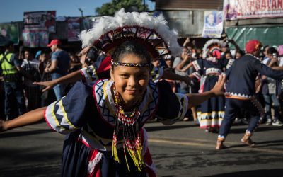
Cultural or Historical Sites of Eswatini: Important Cultural Landmarks or Historical Sites in Eswatini
Eswatini, formerly known as Swaziland, is a small landlocked country in Southern Africa known for its rich cultural heritage and stunning natural landscapes. The country is home to a number of cultural and historical sites that offer visitors a glimpse into the traditional way of life and the history of the Swazi people. From the Great Usuthu River and the Mantenga Falls to the Mantenga Cultural Village and the King Sobhuza II Memorial Park, Eswatini’s cultural and historical sites are a testament to the country’s vibrant past and its enduring traditions. Whether you’re interested in learning about the Swazi monarchy, exploring traditional Swazi architecture, or experiencing the country’s diverse wildlife, Eswatini’s cultural and historical sites have something to offer for every type of traveller. Eswatini’s cultural and historical sites are not only important for preserving the country’s heritage, but they also play a crucial role in promoting tourism and economic development. These sites attract visitors from all over the world, providing an opportunity for cultural exchange and economic growth. By showcasing the country’s rich history and traditions, Eswatini’s cultural and historical sites help to create a greater understanding and appreciation of the Swazi culture. Additionally, these sites contribute to the preservation of traditional crafts, music, and dance, ensuring that these important aspects of Swazi culture are passed down to future generations. Overall, Eswatini’s cultural and historical sites are an integral part of the country’s identity and offer a unique opportunity for visitors to immerse themselves in the rich tapestry of Swazi culture and history. Summary Eswatini is home to a rich cultural and historical heritage, with many sites that...
Population Density of Eswatini
Eswatini, formerly known as Swaziland, is a small landlocked country located in Southern Africa. It is bordered by South Africa to the west and Mozambique to the east. With a total area of just over 17,000 square kilometers, Eswatini is one of the smallest countries in Africa. Despite its size, Eswatini is home to a diverse population and a rich cultural heritage. The country is known for its stunning landscapes, including the majestic mountains of the Drakensberg range and the picturesque valleys of the Lowveld region. Eswatini is also famous for its traditional ceremonies and festivals, which are an integral part of the country’s cultural identity. The capital city of Eswatini is Mbabane, while the largest city is Manzini. Eswatini has a mixed economy, with agriculture, manufacturing, and services playing key roles in the country’s development. Summary Eswatini, formerly known as Swaziland, is a small landlocked country in Southern Africa. Population density refers to the number of people living in a specific area, usually measured in square kilometres. Factors affecting population density in Eswatini include topography, climate, economic opportunities, and government policies. The population in Eswatini is unevenly distributed, with the majority of people living in the western and central regions of the country. High population density in urban areas can lead to increased pressure on resources and infrastructure, while low population density in rural areas can impact access to services and development. What is Population Density? Population density refers to the number of people living in a given area, usually expressed as the number of individuals per square kilometer. It is a key demographic indicator that provides insights...

Climate Zones Of Estonia: Different climate regions Of Estonia
Estonia, a small country in Northern Europe, is known for its diverse climate zones. The country is divided into four main climate regions: coastal, continental, maritime, and subarctic. Each of these regions has its own unique characteristics and influences the weather patterns and environmental conditions in the country. Estonia’s climate is greatly influenced by its proximity to the Baltic Sea and the Gulf of Finland, as well as its northern latitude. The combination of these factors results in a wide range of temperatures, precipitation levels, and weather patterns throughout the year. Understanding the different climate zones in Estonia is essential for understanding the country’s environment, agriculture, and overall way of life. Summary Estonia has four main climate zones: coastal, continental, maritime, and subarctic. The coastal climate region experiences mild winters and cool summers due to the influence of the Baltic Sea. The continental climate region has cold winters and warm summers, with large temperature variations throughout the year. The maritime climate region has mild winters and cool summers, with high humidity and frequent precipitation. The subarctic climate region has short, cool summers and long, cold winters with heavy snowfall. Coastal Climate Region The coastal climate region in Estonia is characterized by mild winters and cool summers. This region is heavily influenced by the Baltic Sea, which helps to moderate temperatures throughout the year. The proximity to the sea also results in higher levels of precipitation, particularly during the autumn and winter months. The coastal region is home to a variety of plant and animal species that thrive in the moist and temperate climate. The mild temperatures and ample rainfall...

Political Boundaries of Estonia: Provinces, Districts, or Historical Boundaries.
Estonia, a small country in Northern Europe, is known for its rich history and unique political boundaries. The country is bordered by the Gulf of Finland to the north, the Baltic Sea to the west, Latvia to the south, and Russia to the east. Estonia’s political boundaries have evolved over the centuries, influenced by various historical, cultural, and geopolitical factors. The country is divided into 15 counties, which are further divided into municipalities and parishes. These political boundaries play a crucial role in shaping the governance and administration of the country, as well as its cultural and social dynamics. Estonia’s political boundaries have been shaped by its complex history, which includes periods of foreign rule and occupation. The country has been influenced by various empires and kingdoms, including the Swedish, Danish, German, and Russian. These influences have left a lasting impact on Estonia’s political boundaries, as well as its cultural and linguistic diversity. The country’s unique position at the crossroads of Eastern and Western Europe has also played a significant role in shaping its political boundaries. Estonia’s strategic location has made it a coveted territory throughout history, leading to numerous border changes and territorial disputes. As a result, Estonia’s political boundaries have been subject to constant evolution and adaptation, reflecting the country’s dynamic and diverse heritage. Summary Estonia’s political boundaries are defined by its borders with Russia, Latvia, and the Baltic Sea. The country is divided into 15 counties, each with its own government and administrative structure. Within these counties, there are 79 municipalities, which are further divided into 213 administrative units. Estonia’s historical boundaries have shifted over time...

Terrain and Topography of Estonia: mountains, valleys, and plains.
Estonia, a small country in Northern Europe, is known for its diverse and unique terrain and topography. The country is characterized by its flat coastal lowlands, rolling plains, hilly landscapes, and numerous rivers and valleys. The terrain of Estonia has been shaped by various geological processes over millions of years, resulting in a landscape that is both beautiful and diverse. From the coastal areas to the inland regions, Estonia’s terrain offers a wide range of natural features that make it a fascinating destination for nature lovers and outdoor enthusiasts. Estonia’s terrain is largely influenced by its location on the eastern coast of the Baltic Sea. The country is bordered by Latvia to the south and Russia to the east, and its coastline stretches for over 3,700 kilometers, making it the longest coastline of any Baltic state. The terrain of Estonia is also influenced by its glacial history, with much of the landscape being shaped by the movement of glaciers during the last Ice Age. As a result, Estonia’s terrain is characterized by a mix of flat coastal lowlands, rolling plains, and hilly landscapes, creating a diverse and varied topography that is unique to the region. With its rich geological history and diverse natural features, Estonia’s terrain offers a wealth of opportunities for exploration and discovery. Summary Estonia’s terrain is characterized by a diverse landscape of coastal lowlands, plains, hills, valleys, and river systems. The coastal lowland and plains of Estonia are located in the northern part of the country and are known for their sandy beaches and limestone cliffs. The hilly landscape of Estonia is found in the southern...

History of Estonia
Estonia’s history dates back to the early settlements of the indigenous Finno-Ugric tribes, such as the Estonians, Livonians, and Setos. These tribes lived in the region for thousands of years, developing their own unique culture and traditions. The Viking Age, which began in the late 8th century, had a significant impact on Estonia’s history. The Vikings, known for their seafaring and trading skills, established trade routes along the Baltic Sea and made contact with the indigenous tribes of Estonia. This contact led to cultural exchange and the introduction of new technologies and ideas to the region. During the Viking Age, Estonia became a target for Viking raids, leading to conflicts between the indigenous tribes and the Viking invaders. The Vikings established settlements along the coast of Estonia and engaged in trade with the local population. This period of contact with the Vikings had a lasting impact on Estonia’s culture and language, with many words of Scandinavian origin being incorporated into the Estonian language. The Viking Age also saw the establishment of the first towns and trading centers in Estonia, laying the foundation for the region’s future development as a hub for trade and commerce. Summary Early settlements in Estonia date back to around 8500 BC, and the Viking Age brought significant influence and trade to the region. The medieval period saw the Teutonic Order establish control over Estonia, leading to centuries of German influence and rule. Swedish and Russian rule followed, with Estonia becoming a part of the Russian Empire in the early 18th century. Estonia declared independence in 1918, leading to the Estonian War of Independence against Soviet...

Natural Resources of Estonia: Where Natural Resources are located In Estonia
Estonia, a small country in Northern Europe, is blessed with a diverse range of natural resources that have played a significant role in shaping its economy and culture. From lush forests and abundant water resources to valuable mineral deposits and fertile agricultural land, Estonia’s natural resources have been a source of wealth and sustenance for its people for centuries. The country’s strategic location on the Baltic Sea has also made it a hub for trade and commerce, further enhancing the importance of its natural resources. In this article, we will explore the various natural resources that Estonia is endowed with and their impact on the country’s development and prosperity. Summary Estonia is rich in natural resources, including forests, oil shale, peat, water resources, agricultural land, and biodiversity. Forests and timber are a significant natural resource in Estonia, covering over half of the country’s land area and providing economic and environmental benefits. Oil shale is a key energy resource in Estonia, used for electricity production and heating, but it also poses environmental challenges due to its high carbon emissions. Estonia has significant peat and mineral deposits, which are important for the country’s economy and provide opportunities for sustainable resource management. Water resources and wetlands are abundant in Estonia, supporting diverse ecosystems and providing important habitats for wildlife. Forests and Timber Estonia is home to extensive forests that cover over half of its land area, making it one of the most forested countries in Europe. The country’s forests are predominantly composed of pine, spruce, birch, and aspen trees, which not only provide a habitat for diverse wildlife but also serve as...

Cultural or Historical Sites of Estonia: Important Cultural Landmarks or Historical Sites in Estonia
Estonia, a small Baltic country in Northern Europe, is a land of rich cultural and historical heritage. From medieval old towns to pristine national parks, Estonia offers a diverse range of cultural and historical sites that showcase the country’s unique identity and traditions. The country’s tumultuous history, marked by periods of foreign rule and occupation, has shaped its cultural landscape, resulting in a fascinating blend of influences from various European powers. This article will explore some of Estonia’s most significant cultural and historical sites, shedding light on the country’s rich heritage and the stories behind these iconic landmarks. Summary Estonia is home to a wealth of cultural and historical sites that showcase its rich heritage. The Old Town of Tallinn is a UNESCO World Heritage Site, offering a glimpse into Estonia’s medieval past. Lahemaa National Park is a treasure trove of natural beauty and cultural heritage, preserving Estonia’s diverse landscapes and historical sites. The Song Festival Grounds are a testament to Estonia’s musical and cultural traditions, hosting the renowned Estonian Song Festival. The Kumu Art Museum is a must-visit for art enthusiasts, displaying Estonia’s artistic heritage and contemporary works. The Old Town of Tallinn: A UNESCO World Heritage Site The Old Town of Tallinn, Estonia’s capital city, is a well-preserved medieval gem that has earned its place as a UNESCO World Heritage Site. With its cobblestone streets, historic buildings, and imposing city walls, the Old Town is a living testament to Estonia’s medieval past. The town’s origins date back to the 13th century when it was established by the crusading knights of the Teutonic Order. Over the centuries, Tallinn...

Population Density of Estonia
Population density refers to the number of people living in a specific area, usually measured in square kilometres or square miles. It is an important demographic indicator that provides insights into the distribution of people within a given region. Population density can vary widely from one place to another, and it is influenced by a variety of factors such as geographical features, economic opportunities, and social and cultural factors. Understanding population density is crucial for urban planning, resource allocation, and the provision of public services. Summary Population density refers to the number of people living per square kilometre in a specific area. Factors affecting population density in Estonia include economic opportunities, natural resources, and infrastructure development. Urban areas in Estonia have higher population density compared to rural areas, where the population is more dispersed. Historical trends show fluctuations in population density in Estonia due to factors such as war, migration, and economic changes. Population density in Estonia has a significant impact on the demand for infrastructure and services, such as transportation, healthcare, and education. Factors Affecting Population Density in Estonia Estonia, a small Baltic country in Northern Europe, has a population density of around 30 people per square kilometre. This relatively low population density can be attributed to several factors. Firstly, Estonia has a significant amount of forested land, accounting for nearly half of its territory. This limits the amount of habitable land available for settlement, thereby affecting population distribution. Additionally, the country has a history of emigration, particularly during the Soviet era, which has contributed to a decrease in population density. Economic opportunities also play a role in...
Eritrea
Eritrea (State of Eritrea) Capital: Asmara Population (Estimated July 2012): 6,086,495 Area: 121,144 km2 or 46,774 mi2 Currency: Nakfa (Nfa) Official Language: Tigrinya, Arabic or English Political Information: Single party Provisional Government Official Religion: No Official Religion (Predominantly Muslim, Coptic Christian, Roman Catholic, Protestant) Highest Mountain: Dega at 3047m or 9997ft GDP Official Exchange Rate (OER is more precise at gauging a countries economic power) (Estimated 2011): $2.6 billion (US$) or (GBP) GDP (OER) Per Capita (per member of the population estimated 2011): (US$) or (GBP) GDP Purchasing Power Parity (PPP is good for gauging living conditions and use of resources but not as accurate as OER. This data has been calculated based on the sum value of all goods and services produced in the country valued at prices prevailing in the United States) (Estimated 2011): $3.978 billion (US$) or (GBP) GDP (PPP) Per Capita (per member of the population estimated 2011): $700 (US$) or (GBP) Time Zone (GMT/UTC): +3:00 Wildlife: Counties/Provinces/States: 6 regions (zobatat, singular – zoba); Anseba, Debub (South), Debubawi K’eyih Bahri (Southern Red Sea), Gash Barka, Ma’akel (Central), Semenawi Keyih Bahri (Northern Red Sea) Leaders: President Isaias Afewerki Sources: CIA World Fact Book, Encyclopaedia Britannica. Eritrea Eritrea, officially known as the State of Eritrea, is a country located in the Horn of Africa. It is bordered by Sudan to the west, Ethiopia to the south, and Djibouti to the southeast. The northeastern and eastern parts of the country have a coastline along the Red Sea. Asmara, the capital city, is situated in the central highlands and is known for its well-preserved Italian colonial architecture. Eritrea gained independence from Ethiopia in 1993 after a long and...
Political Boundaries of Eritrea: Provinces, Districts, or Historical Boundaries.
Eritrea, located in the Horn of Africa, is a country with a rich history and diverse cultural heritage. The political boundaries of Eritrea have evolved over time, influenced by colonialism, independence movements, and geopolitical factors. The country is bordered by Sudan to the west, Ethiopia to the south, and Djibouti to the southeast, with a coastline along the Red Sea to the east. Eritrea’s political boundaries have been a source of both pride and contention, shaping the country’s governance, development, and international relations. Understanding the complexities of Eritrea’s political boundaries is essential for comprehending the country’s history and current challenges. Eritrea’s political boundaries have been shaped by a combination of historical, cultural, and geopolitical factors. The country’s diverse ethnic groups and linguistic communities have contributed to the complexity of its political divisions. Eritrea’s borders have been influenced by colonial powers, including Italy and Britain, as well as by the struggle for independence from Ethiopia. The legacy of these historical forces continues to impact Eritrea’s political boundaries and has contributed to ongoing challenges and controversies. As Eritrea seeks to navigate its future, the issue of political boundaries remains a central concern for the country’s governance and development. Summary Eritrea’s political boundaries have been influenced by colonialism and independence, shaping the country’s administrative divisions. The administrative divisions of Eritrea are divided into six provinces, each with its own unique characteristics and governance structure. Within the provinces, there are districts that further subdivide the regions, each with its own local government and administrative functions. The historical boundaries of Eritrea have been a source of challenges and controversies, impacting the country’s governance and...
Climate Zones Of Eritrea: Different climate regions Of Eritrea
Eritrea, located in the Horn of Africa, is a country with diverse climate zones due to its varied topography and geographical location. The country can be divided into five main climate regions: the coastal region, the highlands region, the lowlands region, the semi-arid region, and the arid region. Each of these regions has its own unique climate, vegetation, and wildlife, making Eritrea a country of great ecological diversity. Understanding these climate zones is crucial for various reasons, including agriculture, tourism, and conservation efforts. By understanding the different climate zones in Eritrea, it becomes possible to appreciate the country’s natural beauty and to develop sustainable strategies for development and preservation. Summary Eritrea has diverse climate zones, including coastal, highlands, lowlands, semi-arid, and arid regions. The coastal climate region experiences hot and humid weather, with minimal temperature fluctuations throughout the year. The highlands climate region is characterised by cooler temperatures and significant rainfall, making it suitable for agriculture. The lowlands climate region is hot and dry, with very little rainfall and high temperatures, posing challenges for agriculture and water availability. The semi-arid and arid climate regions experience minimal rainfall and high temperatures, making agriculture difficult and water scarcity a significant issue. Understanding Eritrea’s climate zones is crucial for effective agricultural planning, resource management, and infrastructure development. The Coastal Climate Region The coastal region of Eritrea is characterized by its hot and humid climate, with temperatures often exceeding 40 degrees Celsius during the summer months. The region experiences very little rainfall, with most of it occurring during the winter months. The vegetation in this region is adapted to the arid conditions, with...