Explore the World Through Geography, Natural Resources & Daily History
Clear, reliable and engaging guides that help you understand our planet — from UK geography education to global natural resources and On This Day history events.
Explore, discover, and learn about the wonders of our world! At Earth Site, we’re passionate about bringing geography, history, and science to life for curious minds of all ages. Whether you’re delving into historical events, uncovering the mysteries of the natural world, or seeking interactive resources, you’re in the right place.
Here, you can uncover the stories behind historical events, explore the natural wonders of our planet, and gain valuable insights into how the Earth’s systems shape our daily lives. From the towering peaks of mountain ranges to the far-reaching impacts of human innovation, we aim to make every topic both engaging and informative.
Start your journey of discovery with us today, and let’s make learning an adventure!
What We Cover
Earth Site brings together engaging and accessible educational content designed to help you understand the world, its history, and its natural systems.
🌍 Geography Education (UK & Worldwide)
We publish clear, easy-to-understand geography resources for students, teachers and curious learners. Our guides support geography education in the UK and cover physical geography, climate, ecosystems, population, and global development.
⛏️ Natural Resources & Environmental Geography
Explore detailed country profiles covering natural resources, mining, energy, geology and global environmental challenges. We show how nations manage minerals, water, land and ecosystems, and why these resources matter.
📅 On This Day in History
Every day has a story. Our On This Day history series features major events, anniversaries, traditions, and cultural milestones from around the world — with timelines, context, and fun facts.
TIMELINE

Political Boundaries of The Bahamas: Provinces, Districts, or Historical Boundaries.
Political boundaries are defined as the lines that separate one political entity from another. In the case of The Bahamas, these boundaries are crucial for the governance of the country. They determine the jurisdiction of different levels of government, from the national level down to the local level. Political boundaries also play a role in defining the rights and responsibilities of citizens within those jurisdictions. The importance of political boundaries in governance cannot be overstated. They provide a framework for the distribution of power and resources, as well as for the implementation of policies and laws. Political boundaries help to establish order and structure within a country, allowing for effective administration and decision-making. Without clear and well-defined boundaries, there would be confusion and chaos, making it difficult for governments to function properly. Summary The Bahamas is divided into provinces and districts, each with its own unique history and significance. Political boundaries in The Bahamas have evolved over time, shaped by historical events and societal changes. The first political boundaries in The Bahamas were established in the late 18th century, and have since undergone significant changes. Political boundaries have a significant impact on Bahamian society, shaping governance and community identity. The future of political boundaries in The Bahamas remains uncertain, but their significance in governance and society is undeniable. The Bahamas Provinces: An Overview The Bahamas is divided into three provinces: New Providence, Grand Bahama, and the Family Islands. Each province has its own distinct characteristics and historical background. New Providence is the most populous province and is home to the capital city, Nassau. It is known for its vibrant...
Climate Zones of The Bahamas: Different Climate Regions Of The Bahamas
The Bahamas, located in the Atlantic Ocean, is an archipelago consisting of more than 700 islands and cays. Its location in the tropics gives it a warm and sunny climate throughout the year, making it a popular destination for tourists seeking sun, sand, and sea. However, it is important to understand the different climate zones within The Bahamas in order to effectively plan for tourism and agriculture. Understanding climate zones is crucial for tourism as it helps visitors know what to expect in terms of weather conditions during their stay. It also allows tourism operators to tailor their offerings based on the climate of a particular region. Similarly, for agriculture, knowing the climate zones helps farmers determine which crops are suitable for cultivation and when to plant and harvest them. Summary The Bahamas has two main climate zones: tropical marine and subtropical. The tropical marine climate is characterized by warm temperatures, high humidity, and frequent rainfall. The subtropical climate is cooler and drier, with less rainfall and more seasonal temperature variations. The dry season in The Bahamas is from November to April, with lower humidity and cooler temperatures. The wet season in The Bahamas is from May to October, with higher humidity and warmer temperatures. Tropical Marine Climate of The Bahamas The majority of The Bahamas experiences a tropical marine climate. This climate is characterized by warm temperatures throughout the year, with little seasonal variation. The average temperature ranges from 70°F (21°C) in winter to 86°F (30°C) in summer. The islands in this region also receive abundant rainfall, with an average annual precipitation of 40-60 inches. Regions such as...
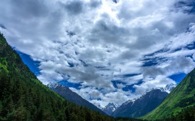
Terrain and Topography of The Bahamas: mountains, valleys, and plains.
The Bahamas is a stunning archipelago located in the Atlantic Ocean, consisting of over 700 islands and cays. Its geography is diverse and unique, with a combination of mountain ranges, valleys, plains, plateaus, and blue holes. Understanding the terrain and topography of The Bahamas is crucial for various reasons, including tourism, ecosystem preservation, and climate change adaptation. In this article, we will explore the different topographical features of The Bahamas and their significance. Summary The Bahamas is an archipelago made up of over 700 islands and cays. The highest point in The Bahamas is only 63 meters above sea level. The Great Bahama Bank is a vast plain that covers over half of the country’s land area. The Andros Island Plateau is a unique landscape that features both wetlands and pine forests. The Blue Holes of The Bahamas are geological wonders that offer a glimpse into the country’s past. The Bahamas’ Mountain Ranges: An Overview The Bahamas is home to two mountain ranges: the Tropic of Cancer Range and the Mayaguana Range. The Tropic of Cancer Range is the highest range in The Bahamas, reaching heights of up to 206 feet (63 meters). It is located on the island of Great Inagua and runs parallel to the Tropic of Cancer. The Mayaguana Range, on the other hand, is located on the island of Mayaguana and reaches heights of up to 100 feet (30 meters). These mountain ranges were formed millions of years ago through tectonic activity and volcanic eruptions. Over time, erosion and weathering have shaped these ranges into their current form. The geological history of these mountain ranges...
Population Density of The Bahamas
The Bahamas is an archipelago located in the Atlantic Ocean, consisting of more than 700 islands and cays. It is known for its stunning beaches, crystal-clear waters, and vibrant marine life, making it a popular tourist destination. The Bahamas has a unique culture influenced by its African, European, and indigenous roots. With a population of approximately 400,000 people, the country has a relatively low population density compared to other nations. Population density refers to the number of individuals per unit of area. In the case of The Bahamas, it is calculated by dividing the total population by the total land area. As of 2021, the population density of The Bahamas is around 39 people per square kilometer. This relatively low population density can be attributed to various factors such as the geographic location and size of the country, climate and natural resources, economic opportunities and migration, as well as government policies and regulations. Summary The Bahamas is an archipelago nation with a population density of 39 people per square kilometre. Factors affecting population density in The Bahamas include geography, climate, and economic opportunities. Historical trends show that population density has increased steadily since the 1950s, with the majority of the population concentrated in urban areas. Population distribution across the islands of The Bahamas is uneven, with the majority of the population residing on New Providence Island. Urbanization has had a significant impact on population density in The Bahamas, with increased migration to urban areas leading to overcrowding and strain on resources. Factors Affecting Population Density in The Bahamas a) Geographic location and size of the country: The Bahamas is...
Population Density of The Bahamas
The Bahamas is an archipelago located in the Atlantic Ocean, consisting of more than 700 islands and cays. It is a popular tourist destination known for its stunning beaches, crystal-clear waters, and vibrant marine life. The country has a rich cultural heritage influenced by African, European, and indigenous peoples. With a total land area of approximately 13,878 square kilometers, The Bahamas has a population density of around 39 people per square kilometer. Population density refers to the number of individuals living in a specific area, usually measured in terms of persons per square kilometer. It is an important indicator of how crowded or sparsely populated an area is. In the case of The Bahamas, the population density is relatively low compared to other countries, mainly due to its large land area and scattered population across multiple islands. Summary The Bahamas is a small island nation with a high population density. Factors such as geography, climate, and economic opportunities influence population density in The Bahamas. The population of The Bahamas has grown rapidly since the 1950s, with urban areas experiencing the highest growth rates. Tourism is a major contributor to population density in The Bahamas, particularly in urban areas. Managing population density in The Bahamas is a complex challenge that requires sustainable strategies and policies. Factors influencing population density in The Bahamas Several factors contribute to the population density in The Bahamas: 1. Geographic location and size: The Bahamas is located in a strategic position between North America and the Caribbean, making it an attractive destination for trade and tourism. Its large land area allows for the distribution of the...

Cultural or Historical Sites of The Bahamas: Important Cultural Landmarks or Historical Sites In The Bahamas
The Bahamas is a country rich in history and culture, with a fascinating past that has shaped its present. From the days of piracy and slavery to its colonial heritage and vibrant art scene, The Bahamas offers a wealth of historical sites and museums for visitors to explore. These sites not only provide a glimpse into the country’s past, but also serve as important reminders of the struggles and triumphs that have shaped the nation. In this article, we will take a closer look at some of the most significant historical sites and museums in The Bahamas, and why it is important to visit them. Summary The Pirates of Nassau Museum offers a captivating glimpse into the world of piracy during the Golden Age. The Pompey Museum of Slavery and Emancipation serves as a poignant reminder of The Bahamas’ history with slavery. The Queen’s Staircase is a powerful symbol of Bahamian resistance and fortitude. The Government House boasts impressive architecture and a rich history. The National Art Gallery of The Bahamas celebrates the country’s unique art and culture. The Pirates of Nassau Museum: A Fascinating Insight into the Golden Age of Piracy The Bahamas has a long history of piracy, with the islands serving as a haven for notorious pirates during the Golden Age of Piracy in the 17th and 18th centuries. The Pirates of Nassau Museum offers visitors a chance to step back in time and experience this thrilling era firsthand. The museum is located in downtown Nassau, just steps away from the bustling harbour where pirates once roamed. Inside the museum, visitors can explore interactive exhibits that...

Environment and Natural Resources of the Bahamas
Environment and Natural Resources of the Bahamas The Bahamas, an archipelago located in the Atlantic Ocean, is blessed with a wealth of natural resources. From its abundant fisheries to its rich mineral deposits, lush forests, fertile agricultural lands, expansive coral reefs, pristine beaches, and geothermal potential, the country is truly a treasure trove of natural wonders. These resources play a vital role in the country’s economy and environment, providing livelihoods for its people and attracting tourists from around the world. However, it is crucial to ensure the sustainable use of these resources to safeguard their long-term availability and protect the delicate balance of the ecosystem. Summary The Bahamas is rich in natural resources, including fisheries, mineral deposits, forests, agricultural lands, coral reefs, beaches, geothermal potential, and renewable energy sources. The abundant fisheries of the Bahamas provide a significant source of income and food for the country. The rich mineral deposits of the Bahamas include salt, aragonite, and aggregate, which are important for construction and other industries. The lush forests of the Bahamas are home to a variety of plant and animal species and provide important ecosystem services. The fertile agricultural lands of the Bahamas support the production of crops such as citrus, tomatoes, and pineapples, as well as livestock. The expansive coral reefs of the Bahamas are a major tourist attraction and provide important habitat for marine life. The pristine beaches of the Bahamas are also a major draw for tourists and provide important nesting sites for sea turtles. The geothermal potential of The Bahamas could provide a sustainable source of energy for the country. The renewable...
Climate Zones of Azerbaijan: Regional Variations in Weather
Azerbaijan is a country located in the South Caucasus region of Eurasia. It is bordered by the Caspian Sea to the east, Russia to the north, Georgia to the northwest, Armenia to the west, and Iran to the south. The country has a diverse geography, with a combination of mountains, plains, and coastal areas. This diverse geography contributes to the presence of different climate zones throughout Azerbaijan. Climate zones are areas with distinct weather patterns and characteristics. They are determined by factors such as temperature, precipitation, and atmospheric pressure. Understanding climate zones is important as it helps us understand the different ecosystems and habitats that exist within a country or region. It also helps us understand how climate change may impact these areas differently. Summary Azerbaijan has a diverse range of climate zones, including humid subtropical, semi-arid, highland, continental, and Mediterranean. The country’s geography plays a significant role in determining its climate zones, with factors such as altitude and proximity to the Caspian Sea influencing temperature and precipitation patterns. The humid subtropical climate zone is characterized by hot summers and mild winters, with high levels of rainfall throughout the year. The semi-arid climate zone experiences hot summers and cold winters, with low levels of rainfall and high evaporation rates. The highland climate zone is characterized by cooler temperatures and higher precipitation levels, while the continental climate zone experiences extreme temperature variations throughout the year. The Mediterranean climate zone is found in the Nakhchivan Autonomous Republic and is characterized by mild, wet winters and hot, dry summers. There are regional variations in temperature and precipitation within each climate zone, with...
Azerbaijan’s Political Boundaries: Provinces, Districts, or Historical Lines?
Azerbaijan, located in the South Caucasus region of Eurasia, is a country with a rich history and diverse cultural heritage. It is bordered by the Caspian Sea to the east, Russia to the north, Georgia to the northwest, Armenia to the west, and Iran to the south. Throughout its history, Azerbaijan has been influenced by various empires and has experienced changes in its political boundaries. Political boundaries play a crucial role in defining a country’s identity, as they determine its territorial extent and shape its governance and administration. Summary Azerbaijan’s political boundaries have evolved over time, with changes in administrative divisions and the creation of new provinces and districts. Provinces in Azerbaijan are divided into districts, each with its own government and administrative structure. Historical lines, such as the border with Armenia, play an important role in Azerbaijan’s political boundaries and governance. Challenges to Azerbaijan’s political boundaries include territorial disputes with neighboring countries and ethnic tensions within the country. The impact of political boundaries on Azerbaijan’s economy is significant, with different regions having varying levels of development and resources. The Evolution of Azerbaijan’s Administrative Divisions The administrative divisions of Azerbaijan have evolved over time, reflecting the country’s historical and political changes. During the Soviet era, Azerbaijan was divided into eleven administrative divisions known as oblasts. However, after gaining independence in 1991, Azerbaijan restructured its administrative divisions and adopted a system of provinces and districts. Provinces in Azerbaijan: A Brief Overview Provinces, also known as regions or rayons, are the primary administrative divisions in Azerbaijan. There are currently 66 provinces in the country, each with its own capital city. The...
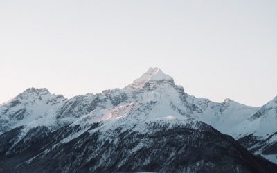
Azerbaijan’s Varied Landscape: Mountains, Valleys, and Plains
Azerbaijan, located in the South Caucasus region of Eurasia, is a country known for its diverse topography. From majestic mountains to scenic valleys and vast plains, Azerbaijan offers a wide range of natural landscapes that attract tourists from all over the world. This article will explore the different types of landscapes in Azerbaijan and their significance in the country’s culture, economy, and infrastructure. Additionally, we will discuss the importance of conservation efforts to protect Azerbaijan’s varied landscape. Summary Azerbaijan boasts a diverse topography, including mountains, valleys, plains, and unique geological formations. The Caucasus Mountains are a majestic feature of Azerbaijan’s landscape and play a significant role in the country’s economy. The scenic valleys of Azerbaijan are important for agriculture and tourism, offering stunning views and cultural experiences. The vast plains of the country are crucial for transportation and infrastructure, connecting cities and facilitating trade. Conservation efforts are underway to protect Azerbaijan’s varied landscape and preserve its natural beauty for future generations. The Majestic Caucasus Mountains The Caucasus Mountains are a prominent feature of Azerbaijan’s landscape. Stretching across several countries, including Azerbaijan, Georgia, and Russia, these mountains are known for their majestic beauty and rich biodiversity. In Azerbaijan, the Caucasus Mountains play a significant role in shaping the country’s climate and providing a habitat for various plant and animal species. For tourists, the Caucasus Mountains offer a plethora of outdoor activities and breathtaking views. Popular mountain destinations in Azerbaijan include Shahdag National Park, Tufandag Ski Resort, and Khinalig Village. Shahdag National Park is a popular destination for hiking, skiing, and wildlife spotting. Tufandag Ski Resort offers skiing and snowboarding opportunities...

Azerbaijan’s Population Density: A Closer Look
Azerbaijan, a country located in the South Caucasus region of Eurasia, has a population density of approximately 120 people per square kilometer. This makes it one of the most densely populated countries in the region. Understanding population density is crucial for policymakers and researchers as it provides insights into various aspects of society, such as urbanization, migration patterns, ethnic diversity, and environmental impacts. By studying population density, we can gain a better understanding of how these factors shape Azerbaijan’s social and economic landscape. Summary Azerbaijan has a population density of 120 people per square kilometer. Population density in Azerbaijan has increased steadily since the 1950s. The capital city of Baku has the highest population density in Azerbaijan. Rural areas in Azerbaijan have a lower population density than urban areas. Azerbaijan’s population density is expected to continue to increase in the future. Historical Context: How Population Density Has Changed Over Time Over the years, Azerbaijan’s population density has undergone significant changes. In the early 20th century, the country experienced a rapid increase in population density due to high birth rates and limited emigration opportunities. However, during the Soviet era, many Azerbaijanis migrated to other parts of the Soviet Union, resulting in a decline in population density. After gaining independence in 1991, Azerbaijan witnessed a period of economic growth and stability, leading to an increase in population density. The country’s population grew rapidly, fueled by natural growth and immigration from neighboring countries. Today, Azerbaijan continues to experience steady population growth, albeit at a slower pace. Factors that have influenced population density changes include economic opportunities, political stability, and social factors. For...
Azerbaijan: Ecology and Natural Resources
Azerbaijan and Its Rich Natural Resources: Ecology and Natural Resources Azerbaijan is a land of striking contrasts, where the majestic Caucasus mountains meet the Caspian Sea, and vast reserves of energy resources coexist with efforts toward environmental protection. This article explores the natural resources of Azerbaijan, its ecological policies, and the vital role played by the Ministry of Ecology and Natural Resources in managing the nation’s wealth. Whether you’re curious about oil and gas, water resources, or the government’s green agenda, this is a comprehensive guide worth your time. 📚 Article Outline What Makes Azerbaijan Unique in Terms of Natural Resources? How Does the Ministry of Ecology and Natural Resources Operate? What Role Does the Caspian Sea Play in Azerbaijan’s Resource Economy? Oil and Gas: The Backbone of Production in Azerbaijan What Are the Key Mineral Resources in the Country? How Significant Are Azerbaijan’s Water Resources? What Environmental Protection Efforts Exist in the Republic of Azerbaijan? How Are Natural Resources Affecting Azerbaijan’s GDP? What is the Historical Role of the Absheron Peninsula? What Are the Challenges and Future Directions for Sustainability? 1. What Makes Azerbaijan Unique in Terms of Natural Resources? Azerbaijan is renowned for its wealth of natural resources, especially oil and gas, which have shaped its geopolitical and economic relevance. Strategically located between Eastern Europe and Western Asia, the Republic of Azerbaijan sits atop rich deposits that have attracted foreign interest since the beginning of the 20th century. The natural resources of Azerbaijan include not just hydrocarbons but also iron ore, pyrite, chalcopyrite, and zeolite raw materials found in regions such as Gobustan, Shamkir, and Ordubad. These...