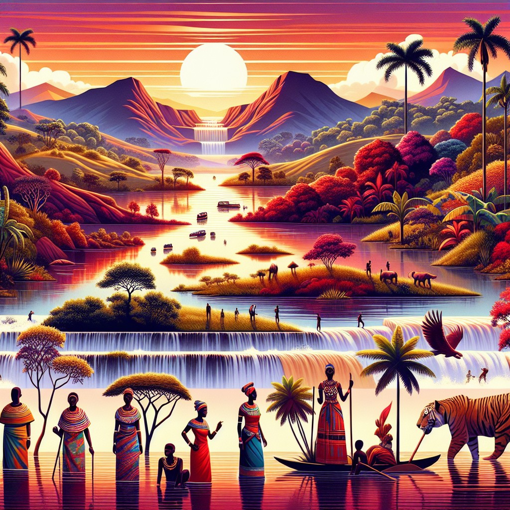
Angola, located on the western coast of Southern Africa, is a country known for its diverse and stunning terrain. From majestic mountains to vast plains, Angola’s topography offers a wealth of natural beauty and resources. Understanding Angola’s terrain and topography is crucial for various reasons, including agriculture, economy, and tourism. By exploring the different aspects of Angola’s geography, we can gain a deeper appreciation for the country’s natural wonders and the opportunities they present.
Summary
- Angola’s terrain is diverse and varied, with mountains, valleys, plains, and unique geology.
- The majestic mountains of Angola offer stunning views and opportunities for exploration.
- The valleys of Angola are rich in biodiversity and offer unique opportunities for agriculture and tourism.
- The vast plains of Angola are home to a variety of wildlife and offer opportunities for ranching and agriculture.
- Angola’s unique geology, including diamonds and oil reserves, has played a significant role in the country’s economy.
The Majestic Mountains of Angola
Angola is home to several mountain ranges that add to the country’s breathtaking landscape. The most prominent mountain range is the Serra da Chela, located in the southwest region of Angola. This range stretches for approximately 200 kilometers and reaches elevations of up to 2,620 meters at its highest peak, Mount Moco. Mount Moco is not only the highest peak in Angola but also the highest in all of Southern Africa.
Another notable mountain range in Angola is the Serra da Leba, famous for its stunning winding road that offers panoramic views of the surrounding valleys. The range reaches elevations of up to 1,845 meters at its highest point. These mountains have played a significant role in Angola’s history and culture. They have provided natural barriers and strategic advantages in times of conflict, as well as inspiration for local folklore and traditions.
Exploring the Valleys of Angola
Angola’s valleys are scattered throughout the country and offer a diverse range of landscapes and ecosystems. One notable valley is the Cuanza Valley, located in central Angola. This valley is known for its fertile soil and is a major agricultural region in the country. It is home to vast plantations of coffee, sugarcane, and other crops that contribute significantly to Angola’s economy.
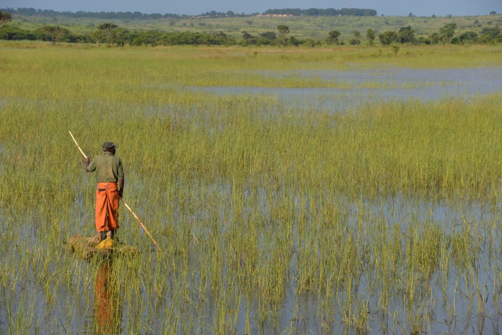
The Okavango Valley, located in the southern part of Angola, is another important valley. It is part of the Okavango Delta, one of the largest inland deltas in the world. This unique ecosystem supports a rich variety of wildlife, including elephants, lions, and hippos. The Okavango Delta is a popular tourist destination and attracts visitors from around the world who come to experience its natural beauty and wildlife.
The Vast Plains of Angola
Angola’s plains cover a significant portion of the country’s terrain and are essential for agriculture and economic development. The most extensive plain in Angola is the Cuando Cubango Plain, located in the southeast region. This plain is characterized by its flat landscape and is ideal for farming and cattle grazing. It is also home to several national parks, such as the Bicuar National Park, which supports a diverse range of wildlife.
The Benguela Plain, located along the western coast of Angola, is another important plain. It stretches for approximately 1,000 kilometers and is known for its rich agricultural potential. The Benguela Plain is a major producer of crops such as maize, wheat, and tobacco, contributing significantly to Angola’s food security and economy.
The Unique Geology of Angola’s Terrain
Angola’s terrain is shaped by its unique geology, which has resulted in the formation of various mineral resources. The country is rich in mineral deposits such as diamonds, oil, gold, copper, and iron ore. These resources have played a crucial role in Angola’s economy, with diamonds being one of the country’s main exports.
The diamond industry in Angola has faced challenges in the past due to conflicts and illegal mining activities. However, efforts have been made to regulate the industry and ensure that it contributes to sustainable development in the country. Angola’s mineral resources have the potential to drive economic growth and provide opportunities for job creation and infrastructure development.
The Impact of Angola’s Topography on Climate
Angola’s topography has a significant influence on its climate, resulting in diverse climate zones across the country. The coastal regions experience a tropical climate, characterized by high temperatures and humidity. Inland areas, particularly those at higher elevations, have a more temperate climate with cooler temperatures.
The different climate zones in Angola have implications for agriculture and tourism. Coastal regions are suitable for growing crops such as bananas and citrus fruits, while higher elevations are ideal for coffee and tea plantations. Understanding the climate patterns in different regions of Angola is crucial for effective agricultural planning and resource management.
The Role of Rivers in Angola’s Topography
Angola is blessed with several major rivers that play a vital role in its topography, economy, and culture. The most significant river in Angola is the Cuanza River, which flows for approximately 960 kilometers through the central part of the country. The Cuanza River is an important water source for irrigation and hydroelectric power generation.
Another notable river is the Zambezi River, which forms part of Angola’s border with Zambia. The Zambezi River is famous for its spectacular Victoria Falls, one of the Seven Natural Wonders of the World. These falls attract tourists from around the world and contribute to Angola’s tourism industry.
The Biodiversity of Angola’s Terrain
Angola’s varied terrain supports a rich diversity of flora and fauna. The country is home to several endemic species, meaning they are found nowhere else in the world. One example is the Giant Sable Antelope, a critically endangered species that is native to Angola. Efforts are being made to protect and preserve these unique species and their habitats.
Angola’s forests are also important for biodiversity conservation. The Maiombe Forest, located in the northwest region of Angola, is one of the largest remaining blocks of tropical rainforest in Africa. It supports a wide range of plant and animal species, including primates, birds, and reptiles. Protecting Angola’s biodiversity is crucial for maintaining the ecological balance and ensuring the long-term sustainability of the country’s natural resources.
Human Settlements in Angola’s Varied Topography
Angola’s population is distributed unevenly across its varied topography. The majority of the population is concentrated in urban areas, particularly in the coastal regions. Luanda, the capital city, is the most populous city in Angola and serves as the country’s economic and administrative center.
Living in different terrains presents both challenges and opportunities for the population. Coastal regions offer access to trade and economic opportunities, but they are also vulnerable to natural disasters such as floods and storms. Inland areas may have limited access to infrastructure and services but offer opportunities for agriculture and natural resource extraction.
Understanding Angola’s settlement patterns is crucial for development planning and ensuring equitable access to resources and services for all citizens.
Challenges and Opportunities of Angola’s Terrain and Topography
Angola’s terrain and topography present both challenges and opportunities for the country’s development. The diverse landscapes offer opportunities for agriculture, tourism, and natural resource extraction. However, there are also challenges such as managing water resources, protecting biodiversity, and ensuring sustainable land use practices.
To leverage its geography for development, Angola needs to invest in infrastructure development, sustainable agriculture practices, and conservation efforts. This requires collaboration between government agencies, local communities, and international partners. By harnessing the potential of its terrain and topography while preserving its natural beauty and resources, Angola can achieve sustainable development that benefits all its citizens.
In conclusion, Angola’s terrain and topography are a testament to the country’s natural beauty and resources. From majestic mountains to vast plains, Angola offers a diverse range of landscapes that have shaped its history, culture, and economy. Understanding Angola’s terrain is crucial for effective resource management, climate adaptation, and sustainable development. By embracing the challenges and opportunities presented by its geography, Angola can pave the way for a prosperous and sustainable future.
FAQs
What is the terrain and topography of Angola?
Angola has a diverse terrain and topography, with mountains, valleys, and plains. The country is located in southwestern Africa and has a coastline along the Atlantic Ocean.
What are the major mountain ranges in Angola?
The major mountain ranges in Angola are the Serra da Chela, the Serra da Leba, and the Serra da Mocidade. These mountain ranges are located in the central and southern parts of the country.
What are the major valleys in Angola?
The major valleys in Angola are the Cuanza Valley, the Cuando Valley, and the Zambezi Valley. These valleys are located in the central and eastern parts of the country and are important for agriculture and transportation.
What are the major plains in Angola?
The major plains in Angola are the coastal plain and the interior plateau. The coastal plain is located along the Atlantic Ocean and is home to the capital city of Luanda. The interior plateau is located in the central part of the country and is an important agricultural region.
How does the terrain and topography of Angola affect the country?
The terrain and topography of Angola have a significant impact on the country’s economy and society. The mountains, valleys, and plains provide different opportunities for agriculture, mining, and transportation. The coastal plain is home to the majority of the population and is the center of economic activity, while the interior plateau is an important agricultural region. The country’s rugged terrain also makes it difficult to develop infrastructure and access remote areas.