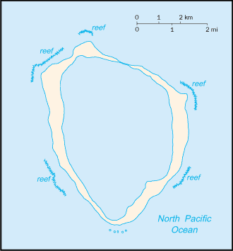
Clipperton Island
(Île de Clipperton or Île de la Passion (French), Isla de la Pasión (Spanish))

Population: Uninhabited
Area: 5km2 or 2mi2
Political Information: French Overseas Possession
Highest Point: Rocher Clipperton at 29 meters or 95 ft
Discovery: Named After John Clipperton, the English mutineer and pirate, who used the Island in 1705.
Time Zone (GMT/UTC): -8:00
Leaders: Brice Hortefeux Administers the Island as the current Minister of Overseas France (Ministre de l’Outre-Mer).
Sources: CIA World Fact Book, Encyclopaedia Britannica.
No Results Found
The page you requested could not be found. Try refining your search, or use the navigation above to locate the post.


