World Geography
Geography is the study of the Earth’s landscapes, environments, and the relationships between people and their surroundings. It encompasses both the physical aspects of the Earth, such as its landforms, bodies of water, and climate, as well as the human aspects, including population distribution, cultures, and economies. World geography is a broad field that seeks to understand the complexities of our planet and how humans interact with it. By studying world geography, we can gain a deeper appreciation for the diversity of our planet and the interconnectedness of its various regions.
Geography is a multidisciplinary field that draws on elements of physical science, social science, and humanities. It involves the use of maps, spatial analysis, and geographic information systems (GIS) to understand the Earth’s surface and the processes that shape it. World geography also encompasses the study of human geography, which examines the ways in which people and their activities are distributed across the Earth. By understanding world geography, we can better appreciate the environmental, cultural, and economic challenges facing different regions of the world. This knowledge is crucial for addressing global issues such as climate change, resource management, and international development.
The Five Oceans and Seven Continents
The Earth’s surface is divided into five major oceans: the Pacific, Atlantic, Indian, Southern (or Antarctic), and Arctic Oceans. These vast bodies of water play a crucial role in regulating the Earth’s climate and supporting diverse marine ecosystems. The oceans also serve as important transportation routes and a source of food and other natural resources for human societies around the world.
In addition to the oceans, the Earth’s landmasses are divided into seven continents: Africa, Antarctica, Asia, Europe, North America, Australia (or Oceania), and South America. Each continent has its own unique physical and cultural characteristics, shaped by millions of years of geological processes and human history. From the deserts of Africa to the rainforests of South America, the continents offer a rich tapestry of landscapes and environments for exploration and study.
Major Mountain Ranges and Deserts
The Earth’s surface is also marked by major mountain ranges and deserts that have shaped the planet’s physical and cultural landscapes. The Himalayas, for example, are the highest mountain range in the world and are home to diverse ecosystems and cultures in countries such as India, Nepal, and Bhutan. The Andes in South America, the Rockies in North America, and the Alps in Europe are other prominent mountain ranges that have influenced human settlement patterns and economic activities.
Deserts cover about one-third of the Earth’s land surface and are characterized by low precipitation and extreme temperatures. The Sahara Desert in Africa is the largest hot desert in the world, while the Gobi Desert in Asia is one of the largest cold deserts. Deserts are not only home to unique flora and fauna but have also been important trade routes and cultural crossroads throughout history.
Climate Zones and Biomes
The Earth’s climate is influenced by a variety of factors, including latitude, altitude, ocean currents, and prevailing winds. As a result, the planet is divided into different climate zones, each with its own characteristic weather patterns and ecosystems. The equator, for example, experiences a tropical climate with high temperatures and heavy rainfall, while the polar regions have a cold and dry climate.
These climate zones give rise to different biomes, or large ecological areas characterized by distinct plant and animal communities. The tropical rainforest biome, found near the equator, is home to a diverse array of species and is vital for regulating the Earth’s climate. The grasslands biome, found in regions such as the African savannah and North American prairies, supports grazing animals and has been important for human agriculture throughout history.
Human Geography and Population Distribution
Human geography examines the ways in which people and their activities are distributed across the Earth’s surface. It encompasses topics such as population growth, migration patterns, urbanization, and cultural diversity. Understanding human geography is crucial for addressing global challenges such as poverty, inequality, and environmental degradation.
Population distribution is uneven across the world, with some regions experiencing rapid population growth while others are declining. The majority of the world’s population lives in Asia, particularly in countries such as China and India. Urban areas are also growing rapidly, with more than half of the world’s population now living in cities. This trend has significant implications for infrastructure development, resource management, and social inequality.
Historical and Cultural Geography
Historical geography examines how human activities have shaped the Earth’s landscapes over time. It explores topics such as colonialism, trade routes, and the rise and fall of empires. Cultural geography focuses on how human cultures have developed in different regions of the world and how they interact with their environments.
The Silk Road, for example, was an ancient trade route that connected China with Europe and facilitated the exchange of goods, ideas, and technologies across Eurasia. This historical trade route had a profound impact on the development of cultures and economies along its path. Similarly, cultural geographers study how different societies have adapted to their environments through practices such as agriculture, architecture, and religious beliefs.
The Importance of Geographic Knowledge
Geographic knowledge is crucial for addressing global challenges such as climate change, resource management, and international development. By understanding world geography, we can better appreciate the environmental, cultural, and economic challenges facing different regions of the world. This knowledge is crucial for addressing global issues such as climate change, resource management, and international development.
Geographic knowledge also helps us to understand our interconnectedness with other regions of the world. By studying world geography, we can gain a deeper appreciation for the diversity of our planet and the interconnectedness of its various regions. This understanding can foster a sense of global citizenship and empathy for people from different cultures and backgrounds.
In conclusion, world geography is a complex and multifaceted field that encompasses both physical and human aspects of the Earth’s landscapes. By studying world geography, we can gain a deeper appreciation for the diversity of our planet and the interconnectedness of its various regions. This knowledge is crucial for addressing global challenges such as climate change, resource management, and international development. It also helps us to understand our interconnectedness with other regions of the world and fosters a sense of global citizenship.
FAQs
What is world geography?
World geography is the study of the Earth’s landscapes, environments, and the relationships between people and their environments. It encompasses the physical features of the Earth, as well as the human activity that takes place on it.
Why is world geography important?
World geography is important because it helps us understand the world around us. It provides insights into the physical and human processes that shape our planet, and helps us make informed decisions about how to interact with our environment.
What are the main branches of world geography?
The main branches of world geography include physical geography, which focuses on the Earth’s natural features and processes, and human geography, which examines the relationships between people and their environments.
How does world geography impact our daily lives?
World geography impacts our daily lives in numerous ways, from influencing the weather and climate we experience, to shaping the availability of natural resources and influencing the distribution of populations and cultures around the world.
What are some key concepts in world geography?
Key concepts in world geography include location, place, human-environment interaction, movement, and region. These concepts help geographers understand and interpret the world around them.

Natural Resources of Mauritius: Where Natural Resources are Located in Mauritius
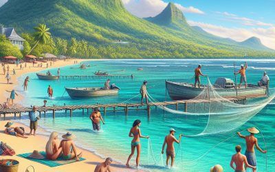
Mauritius, a small island nation situated in the Indian Ocean, possesses a diverse array of natural resources. The country’s natural assets encompass agricultural land, marine resources, mineral deposits, renewable energy sources, and rich wildlife and biodiversity. These resources play a vital role in the nation’s economy and provide livelihoods for numerous Mauritians. The Mauritian government has acknowledged the significance of sustainable management and conservation of these natural resources to ensure their long-term viability and support the country’s development. Mauritius is renowned for its fertile agricultural land, which supports various crops such as sugarcane, tea, fruits and vegetables. The nation’s agricultural resources are crucial for food security and contribute substantially to the economy through exports. In addition to agriculture, Mauritius is surrounded by abundant marine resources, including fish stocks and other marine life. The country’s marine resources sustain the fishing industry and provide a source of livelihood for many coastal communities. Moreover, Mauritius is endowed with mineral resources such as sand, clay and limestone, which are utilised in construction and manufacturing industries. Additionally, the country has been making progress in harnessing renewable energy resources such as solar and wind power to reduce its dependence on fossil fuels and mitigate the impacts of climate change. Lastly, Mauritius is home to a diverse range of wildlife and biodiversity, including endemic species that are found nowhere else in the world. These natural assets attract tourists and contribute to the country’s growing ecotourism industry. Overall, Mauritius’ natural resources are essential for the nation’s development and well-being, and their sustainable management is crucial for the future. Summary Mauritius is rich in natural resources including agricultural,...

Cultural or Historical Sites of Mauritius: Important Cultural Landmarks or Historical Sites in Mauritius
Mauritius, an island nation situated in the Indian Ocean, is a diverse cultural hub with a complex historical background. The island’s recorded history commences in the 16th century with its discovery by Portuguese explorers. Subsequently, it was colonised by the Dutch, French and British, each leaving an indelible mark on the island’s cultural landscape and heritage. The heterogeneous population of Mauritius reflects its historical narrative, comprising individuals of Indian, African, Chinese and European descent who coexist in relative harmony. This cultural diversity is manifested in the island’s culinary traditions, musical expressions and festive celebrations, rendering Mauritius a distinctive and dynamic destination for travellers keen to explore a rich tapestry of traditions and customs. The island’s history is significantly influenced by the legacy of slavery and indentured labour, which has profoundly shaped its culture and society. The abolition of slavery in the 19th century precipitated the importation of indentured labourers from India, China and Africa, thereby altering the island’s demographic composition and cultural milieu. Present-day Mauritius is a flourishing multicultural society, characterised by a unique amalgamation of traditions and customs that have been preserved and celebrated over centuries. From its striking natural landscapes to its rich cultural heritage, Mauritius offers visitors an engaging journey through time and fosters a deep appreciation for its history and culture. Summary Mauritius has a rich history and culture, shaped by colonialism, slavery, and indentured labour. Aapravasi Ghat is a UNESCO World Heritage Site that played a significant role in the history of indentured labour in Mauritius. Château de Labourdonnais offers a glimpse into the island’s colonial past through its stately mansion and gardens. Ganga...
Mauritius
Mauritius (Republic of Mauritius) Capital: Port Louis Population (Estimated July 2012): 1,313,095 Area: 2,040km2 or 788mi2 Currency: Mauritian Rupee (Mau Re; Plural Mau Rs) Official Language: English Political Information: Parliamentary Republic Official Religion: No Official Religion(approximately 48% of the population are Hindu, 23.6% are Roman Catholic, 16.6% are Muslim, 8.6% follow other Christian denominations, 2.8% follow other religions and 0.4% have no religious beliefs) Highest Mountain: Mont Piton 828m or 2717ft GDP Official Exchange Rate (OER is more precise at gauging a country’s economic power) (Estimated 2011): $11 billion (US$) or (GBP) GDP (OER) Per Capita (per member of the population estimated 2011): (US$) or (GBP) GDP Purchasing Power Parity (PPP is good for gauging living conditions and the use of resources but is not as accurate as OER. This data has been calculated based on the sum value of all goods and services produced in the country valued at prices prevailing in the United States) (Estimated 2011): $19.28 billion (US$) or (GBP) GDP (PPP) Per Capita (per member of the population estimated 2011): $15,000 (US$) or (GBP) Time Zone (GMT/UTC): +4:00 Wildlife: Counties/Provinces/States: 9 districts and 3 dependencies*; Agalega Islands*, Black River, Cargados Carajos Shoals*, Flacq, Grand Port, Moka, Pamplemousses, Plaines Wilhems, Port Louis, Riviere du Rempart, Rodrigues*, Savanne Leaders: President Sir Anerood Jugnauth, with Prime Minister Navin Ramgoolam. Additional: Gained independence from the UK on the 12th of March 1968. Sources: CIA World Fact Book, Encyclopaedia Britannica. Mauritius Mauritius is an island nation situated in the Indian Ocean, renowned for its picturesque beaches, dynamic culture and rich historical background. The country is characterised by a diverse blend of cultural influences from India, Africa, Europe and China, resulting in a...

Political Boundaries of Mauritania: Provinces, Districts, or Historical Boundaries.
Mauritania is a nation situated in the Maghreb region of Northwest Africa. It is bounded by the Atlantic Ocean to the west, Western Sahara to the north and northwest, Algeria to the northeast, Mali to the east and southeast, and Senegal to the southwest. The country encompasses an area of approximately 1,030,700 square kilometres, rendering it the eleventh largest country in Africa. Mauritania’s political boundaries have been moulded by a complex history of colonialism, tribal conflicts, and geopolitical interests. The nation is divided into 15 regions, which are further subdivided into 44 departments. These political boundaries have played a significant role in shaping the country’s history, culture, and society. The political boundaries of Mauritania have been a subject of controversy and conflict, particularly in relation to its border with Western Sahara. The country’s borders have been a source of tension and dispute, with ongoing conflicts over territorial claims and resource rights. Mauritania’s political boundaries have also been influenced by its colonial history, having been under French colonial rule until it gained independence in 1960. The legacy of colonialism has had a lasting impact on the political boundaries of Mauritania, shaping its internal divisions and external relations. A thorough understanding of the historical and contemporary context of Mauritania’s political boundaries is essential for comprehending the country’s complex geopolitical dynamics. Summary Mauritania’s political boundaries have evolved over time, shaping the country’s current geopolitical landscape. The country is divided into 15 administrative regions, each further divided into districts and communes. Historical boundaries of Mauritania have been influenced by colonial powers and tribal affiliations. The evolution of political boundaries in Mauritania has been...

Climate Zones Of Mauritania: Different climate regions Of Mauritania
Mauritania, situated in the western region of the African continent, is a nation characterised by diverse climate zones. The country is divided into six primary climate zones, each possessing distinct characteristics and environmental conditions. These climate zones encompass the Saharan, Sahelian, Sudanese, Coastal, and Mountainous zones. Each zone exerts a considerable influence on the country’s landscape, vegetation, and overall climate. A comprehensive understanding of these climate zones is essential for appreciating the environmental diversity and challenges faced by Mauritania. The varied climate zones in Mauritania are a consequence of its geographical location and topography. The nation is bordered by the Atlantic Ocean to the west, which influences the coastal climate zone, whilst the Sahara Desert dominates the northern regions, creating the Saharan climate zone. The diverse climate zones have a significant impact on the country’s agriculture, wildlife, and the livelihoods of its inhabitants. It is crucial to examine each climate zone in detail to comprehend the unique characteristics and challenges encountered by Mauritania. Summary Mauritania has a diverse range of climate zones, each with its own unique characteristics and impact on the country. The Saharan climate zone covers the northern part of Mauritania and is characterized by extremely hot and dry conditions, with very little rainfall. The Sahelian climate zone is located in the central part of the country and experiences a semi-arid climate with more rainfall than the Saharan zone, supporting some vegetation and agriculture. The Sudanese climate zone in the south has a more tropical climate with higher rainfall, supporting more diverse vegetation and agricultural activities. The coastal climate zone along the Atlantic coast experiences a maritime...

Terrain and Topography of Mauritania: mountains, valleys, and plains.
Mauritania, situated in the western region of the African continent, is renowned for its diverse terrain and topography. The landscape of Mauritania comprises a mixture of deserts, mountains, plateaus, valleys and coastal plains, rendering it a geographically intriguing country. The terrain of Mauritania plays a crucial role in influencing the country’s climate, natural resources and overall biodiversity. An understanding of Mauritania’s varied topography is essential for appreciating the country’s natural beauty and recognising its environmental significance. Mauritania’s terrain is the result of geological processes that have moulded the land over millions of years. The country’s topography reflects its complex geological history, with various landforms contributing to its diverse landscape. From the lofty peaks of the Atlas Mountains to the vast expanse of the Sahara Desert, Mauritania’s terrain presents a rich tapestry of natural features that make it a unique and captivating destination for explorers and nature enthusiasts alike. Summary Mauritania’s terrain and topography are diverse, ranging from mountains and plateaus to deserts and coastal plains. The Atlas Mountains are the most prominent mountain range in Mauritania, running through the northern part of the country. The Senegal River Valley is a significant valley in Mauritania, providing fertile land for agriculture. The Adrar Plateau is a notable plateau in Mauritania, known for its rocky landscape and sand dunes. The Sahara Desert covers a large portion of Mauritania, making it one of the country’s most prominent geographical features. The coastal plains of Mauritania are located along the Atlantic Ocean, providing important habitats for wildlife and fishing communities. Mauritania’s diverse terrain and topography make it a unique and fascinating country to explore. The...

History of Mauritania
Mauritania, situated in the western region of the African continent, possesses a rich history dating back to ancient times. The area now known as Mauritania was once home to several ancient civilisations, including the Ghana Empire, the Almoravid dynasty, and the Mali Empire. These early civilisations were renowned for their advanced agricultural practices, trade networks, and cultural achievements. The Ghana Empire, in particular, was a powerful and wealthy kingdom that controlled much of the region’s gold and salt trade. The Almoravid dynasty, which emerged in the 11th century, was known for its expansionist policies and its role in spreading Islam throughout the region. The Mali Empire, which reached its peak in the 14th century, was a major centre of trade and Islamic scholarship. These early civilisations laid the foundation for the cultural, religious, and economic development of Mauritania. Moreover, the ancient civilisations of Mauritania were also known for their impressive architectural and artistic achievements. The region is home to several ancient archaeological sites, including the ancient city of Chinguetti, which is known for its well-preserved medieval architecture and manuscripts. The city of Oualata is another important archaeological site, known for its intricate mud-brick architecture and historical significance. These ancient civilisations left behind a rich legacy of art, architecture, and cultural traditions that continue to influence Mauritanian society to this day. The early civilisations of Mauritania played a crucial role in shaping the region’s history and culture, laying the groundwork for the development of the modern Mauritanian state. Summary Early civilizations in Mauritania date back to the 3rd century BC, with the Berber and Bafour people establishing settlements and trade...

Population Density of Mauritania
Mauritania, situated in the western region of the African continent, is renowned for its expansive and varied landscape, encompassing the Sahara Desert in the north and the Sahel region in the south. Boasting a total land area of approximately 1,030,700 square kilometres, Mauritania ranks among the largest countries in Africa. Despite its considerable size, Mauritania’s population density is notably low, with an estimated population of around 4.5 million inhabitants. This equates to a population density of roughly 4.4 persons per square kilometre, rendering Mauritania one of the most sparsely populated countries globally. The distribution of the populace across the nation is uneven, with the majority residing in the southern regions, particularly along the Senegal River and in the capital city of Nouakchott. The low population density in Mauritania is influenced by a multitude of factors, including environmental conditions, economic opportunities and historical patterns of settlement. Summary Mauritania has a low population density, with most of its population concentrated in the southern regions. Factors influencing population distribution in Mauritania include access to water, arable land, and economic opportunities. Urban population density is higher in Mauritania’s capital, Nouakchott, while rural population density is higher in the southern regions. High population density in urban areas strains infrastructure and resources, leading to challenges in providing basic services. Opportunities for high population density in Mauritania include potential economic growth and development, if managed effectively. Factors Influencing Population Distribution in Mauritania Water and Arable Land The majority of the population is concentrated in the southern regions of the country, where the Senegal River provides a vital source of water for agriculture and human consumption. The...

Cultural or Historical Sites of Mauritania: Important Cultural Landmarks or Historical Sites in Mauritania
The ancient city of Chinguetti, situated in the Adrar region of Mauritania, is a historical treasure trove. Established in the 13th century, Chinguetti flourished as a prominent centre of Islamic scholarship and commerce. The city’s rich heritage is reflected in its well-preserved architecture, including ancient mosques, libraries and traditional dwellings constructed of mud and stone. Chinguetti served as a crucial stop along the trans-Saharan trade route, and its former prosperity and influence are still evident in the grandeur of its edifices and their intricate embellishments. The city’s narrow thoroughfares and alleyways bear witness to its ancient origins, evoking a sense of time travel as one traverses them. Chinguetti’s prominence as a hub of Islamic learning is manifest in its numerous libraries, which house an extensive collection of ancient manuscripts. These documents encompass a broad spectrum of subjects, including theology, law, astronomy and medicine, offering valuable insights into the intellectual and cultural life of the city. The city’s mosques, such as the Friday Mosque, are architectural marvels in their own right, featuring intricate carvings and geometric patterns. Chinguetti’s rich history and cultural heritage render it an essential destination for history enthusiasts and those keen to explore the ancient roots of Islamic civilisation. The Ancient City of Chinguetti presents a captivating destination for both history aficionados and adventure seekers. Its well-preserved architecture and rich cultural heritage provide a unique glimpse into the history of Islamic civilisation in West Africa. From its ancient mosques and libraries to its narrow streets and alleyways, Chinguetti stands as a living testament to the region’s vibrant past. Visitors to the city can immerse themselves in its...

Natural Resources of Mauritania: Where Natural Resources are Located in Mauritania
Mauritania, situated in West Africa, possesses a wealth of natural resources. The diverse array of resources encompasses mineral deposits, petroleum and natural gas reserves, fisheries, marine resources, agricultural land and renewable energy potential. These resources play a pivotal role in the nation’s economy and offer opportunities for development and growth. The exploitation and management of these resources are crucial for the sustainable development of the country and the welfare of its citizens. Mauritania’s natural resources have the potential to contribute substantially to the country’s economic growth and development. However, the sustainable management and conservation of these resources are essential to ensure their long-term viability. The Mauritanian government has endeavoured to develop policies and strategies to promote the sustainable use of natural resources whilst also addressing environmental concerns. By comprehending the various natural resources in Mauritania and their potential, it is possible to explore how they can be harnessed for the benefit of the country and its populace. Summary Mauritania is rich in natural resources, including minerals, petroleum, natural gas, fisheries, agriculture, and renewable energy potential. The country’s mineral resources include iron ore, gold, copper, gypsum, and phosphate, making it a key player in the global mining industry. Mauritania has significant petroleum and natural gas reserves, with exploration and production activities being carried out by international companies. The fisheries and marine resources in Mauritania are vital to the economy, providing employment and contributing to food security. Agriculture is a key sector in Mauritania, with the country producing a variety of crops and livestock to support its population and economy. Mineral Resources in Mauritania The Mining Sector’s Economic Significance The mining...
Mauritania
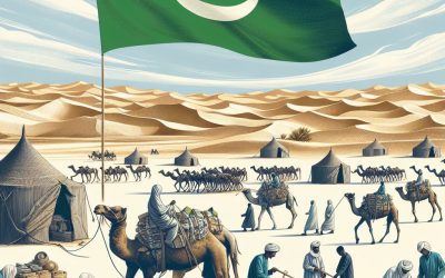
Mauritania (Al-Jumhūriyyah al-Islāmiyyah al-Mūrītāniyyah (Arabic) (Islamic Republic of Mauritania)) Capital: Nouakchott Population (Estimated July 2012): 3,359,185 Area: 1,030,700km2 or 398,000mi2 Currency: Ouguiya (UM) Official Language: Arabic Political Information: Islamic Republic Official Religion: Islam(approximately 100% of the population are followers of the Muslim Faith) Highest Mountain: Kediet Ijill 910m or 2,985ft GDP Official Exchange Rate (OER is more precise at gauging a country’s economic power) (Estimated 2011): $4 billion (US$) or (GBP) GDP (OER) Per Capita (per member of the population estimated 2011): (US$) or (GBP) GDP Purchasing Power Parity (PPP is good for gauging living conditions and the use of resources but is not as accurate as OER. This data has been calculated based on the sum value of all goods and services produced in the country valued at prices prevailing in the United States) (Estimated 2011): $7.242 billion (US$) or (GBP) GDP (PPP) Per Capita (per member of the population estimated 2011): $2,200 (US$) or (GBP) Time Zone (GMT/UTC): GMT Wildlife: Counties/Provinces/States: 13 regions (wilayas, singular – wilaya); Adrar, Assaba, Brakna, Dakhlet Nouadhibou, Gorgol, Guidimaka, Hodh ech Chargui, Hodh El Gharbi, Inchiri, Nouakchott, Tagant, Tiris Zemmour, Trarza Leaders: President Mohamed Ould Abdel Aziz, with Prime Minister Moulaye Ould Mohamed Laghdaf Additional: Gained independence from France on the 28th of November 1960. Sources: CIA World Fact Book, Encyclopaedia Britannica. Mauritania Mauritania is a country situated in the western region of the African continent. It shares borders with the Atlantic Ocean to the west, Western Sahara to the north and northwest, Algeria to the northeast, Mali to the east and southeast, and Senegal to the southwest. The capital and largest city is Nouakchott. Arabic serves as the official language, whilst the Mauritanian...

Climate Zones Of Marshall Islands: Different climate regions Of Marshall Islands
The Marshall Islands, situated in the central Pacific Ocean, comprise a collection of atolls and islands dispersed across an extensive area. The climate of the Marshall Islands is characterised as tropical, with consistently warm temperatures and elevated humidity levels throughout the year. The archipelago is divided into distinct climate zones, each exhibiting its own unique characteristics and meteorological patterns. These climate zones exert a considerable influence on the environment, flora, and fauna of the Marshall Islands, whilst also shaping the lifestyle of its inhabitants. Summary Marshall Islands have a diverse range of climate zones, each with its own unique characteristics and impacts on the environment and people. The Equatorial Climate Zone in Marshall Islands is characterized by high temperatures, high humidity, and consistent rainfall throughout the year. The Tropical Rainforest Climate Zone experiences heavy rainfall and high humidity, supporting lush vegetation and diverse wildlife. The Tropical Monsoon Climate Zone has a distinct wet and dry season, with heavy rainfall and strong winds during the wet season. The Tropical Savanna Climate Zone in Marshall Islands has a wet season and a dry season, with less rainfall than the rainforest zone and more open grasslands. The Semi-arid Climate Zone experiences low rainfall and high temperatures, leading to challenges for agriculture and water resources. The different climate zones in Marshall Islands have significant impacts on agriculture, biodiversity, and the livelihoods of the people, highlighting the importance of understanding and adapting to these diverse environments. Equatorial Climate Zone Temperature and Rainfall The average temperature in this zone ranges from 26°C to 32°C, with little variation between seasons. The equatorial climate zone experiences heavy...