World Geography
Geography is the study of the Earth’s landscapes, environments, and the relationships between people and their surroundings. It encompasses both the physical aspects of the Earth, such as its landforms, bodies of water, and climate, as well as the human aspects, including population distribution, cultures, and economies. World geography is a broad field that seeks to understand the complexities of our planet and how humans interact with it. By studying world geography, we can gain a deeper appreciation for the diversity of our planet and the interconnectedness of its various regions.
Geography is a multidisciplinary field that draws on elements of physical science, social science, and humanities. It involves the use of maps, spatial analysis, and geographic information systems (GIS) to understand the Earth’s surface and the processes that shape it. World geography also encompasses the study of human geography, which examines the ways in which people and their activities are distributed across the Earth. By understanding world geography, we can better appreciate the environmental, cultural, and economic challenges facing different regions of the world. This knowledge is crucial for addressing global issues such as climate change, resource management, and international development.
The Five Oceans and Seven Continents
The Earth’s surface is divided into five major oceans: the Pacific, Atlantic, Indian, Southern (or Antarctic), and Arctic Oceans. These vast bodies of water play a crucial role in regulating the Earth’s climate and supporting diverse marine ecosystems. The oceans also serve as important transportation routes and a source of food and other natural resources for human societies around the world.
In addition to the oceans, the Earth’s landmasses are divided into seven continents: Africa, Antarctica, Asia, Europe, North America, Australia (or Oceania), and South America. Each continent has its own unique physical and cultural characteristics, shaped by millions of years of geological processes and human history. From the deserts of Africa to the rainforests of South America, the continents offer a rich tapestry of landscapes and environments for exploration and study.
Major Mountain Ranges and Deserts
The Earth’s surface is also marked by major mountain ranges and deserts that have shaped the planet’s physical and cultural landscapes. The Himalayas, for example, are the highest mountain range in the world and are home to diverse ecosystems and cultures in countries such as India, Nepal, and Bhutan. The Andes in South America, the Rockies in North America, and the Alps in Europe are other prominent mountain ranges that have influenced human settlement patterns and economic activities.
Deserts cover about one-third of the Earth’s land surface and are characterized by low precipitation and extreme temperatures. The Sahara Desert in Africa is the largest hot desert in the world, while the Gobi Desert in Asia is one of the largest cold deserts. Deserts are not only home to unique flora and fauna but have also been important trade routes and cultural crossroads throughout history.
Climate Zones and Biomes
The Earth’s climate is influenced by a variety of factors, including latitude, altitude, ocean currents, and prevailing winds. As a result, the planet is divided into different climate zones, each with its own characteristic weather patterns and ecosystems. The equator, for example, experiences a tropical climate with high temperatures and heavy rainfall, while the polar regions have a cold and dry climate.
These climate zones give rise to different biomes, or large ecological areas characterized by distinct plant and animal communities. The tropical rainforest biome, found near the equator, is home to a diverse array of species and is vital for regulating the Earth’s climate. The grasslands biome, found in regions such as the African savannah and North American prairies, supports grazing animals and has been important for human agriculture throughout history.
Human Geography and Population Distribution
Human geography examines the ways in which people and their activities are distributed across the Earth’s surface. It encompasses topics such as population growth, migration patterns, urbanization, and cultural diversity. Understanding human geography is crucial for addressing global challenges such as poverty, inequality, and environmental degradation.
Population distribution is uneven across the world, with some regions experiencing rapid population growth while others are declining. The majority of the world’s population lives in Asia, particularly in countries such as China and India. Urban areas are also growing rapidly, with more than half of the world’s population now living in cities. This trend has significant implications for infrastructure development, resource management, and social inequality.
Historical and Cultural Geography
Historical geography examines how human activities have shaped the Earth’s landscapes over time. It explores topics such as colonialism, trade routes, and the rise and fall of empires. Cultural geography focuses on how human cultures have developed in different regions of the world and how they interact with their environments.
The Silk Road, for example, was an ancient trade route that connected China with Europe and facilitated the exchange of goods, ideas, and technologies across Eurasia. This historical trade route had a profound impact on the development of cultures and economies along its path. Similarly, cultural geographers study how different societies have adapted to their environments through practices such as agriculture, architecture, and religious beliefs.
The Importance of Geographic Knowledge
Geographic knowledge is crucial for addressing global challenges such as climate change, resource management, and international development. By understanding world geography, we can better appreciate the environmental, cultural, and economic challenges facing different regions of the world. This knowledge is crucial for addressing global issues such as climate change, resource management, and international development.
Geographic knowledge also helps us to understand our interconnectedness with other regions of the world. By studying world geography, we can gain a deeper appreciation for the diversity of our planet and the interconnectedness of its various regions. This understanding can foster a sense of global citizenship and empathy for people from different cultures and backgrounds.
In conclusion, world geography is a complex and multifaceted field that encompasses both physical and human aspects of the Earth’s landscapes. By studying world geography, we can gain a deeper appreciation for the diversity of our planet and the interconnectedness of its various regions. This knowledge is crucial for addressing global challenges such as climate change, resource management, and international development. It also helps us to understand our interconnectedness with other regions of the world and fosters a sense of global citizenship.
FAQs
What is world geography?
World geography is the study of the Earth’s landscapes, environments, and the relationships between people and their environments. It encompasses the physical features of the Earth, as well as the human activity that takes place on it.
Why is world geography important?
World geography is important because it helps us understand the world around us. It provides insights into the physical and human processes that shape our planet, and helps us make informed decisions about how to interact with our environment.
What are the main branches of world geography?
The main branches of world geography include physical geography, which focuses on the Earth’s natural features and processes, and human geography, which examines the relationships between people and their environments.
How does world geography impact our daily lives?
World geography impacts our daily lives in numerous ways, from influencing the weather and climate we experience, to shaping the availability of natural resources and influencing the distribution of populations and cultures around the world.
What are some key concepts in world geography?
Key concepts in world geography include location, place, human-environment interaction, movement, and region. These concepts help geographers understand and interpret the world around them.
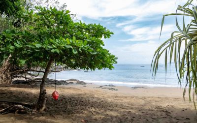
Climate Zones Of Maldives: Different climate regions Of Maldives
The Maldives, an archipelagic nation situated in the Indian Ocean, exhibits diverse climate zones owing to its geographical position and topography. The country’s climate is predominantly influenced by monsoon winds and the surrounding ocean, resulting in distinct climatic regions across the islands. The Maldives‘ climate can be broadly classified into equatorial, tropical monsoon, semi-arid, and subtropical zones. Each of these climate zones possesses a unique set of characteristics that significantly impact the environment, flora and fauna, and tourism industry of the Maldives. A comprehensive understanding of these varied climate zones is crucial for both residents and visitors to adequately prepare for the prevailing weather conditions and to fully appreciate the natural diversity of the archipelago. Summary The Maldives has a diverse range of climate zones, including equatorial, tropical monsoon, semi-arid, and subtropical. The equatorial climate zone in the Maldives is characterized by high temperatures, heavy rainfall, and high humidity throughout the year. The tropical monsoon climate zone experiences distinct wet and dry seasons, with heavy rainfall and strong winds during the wet season. The semi-arid climate zone in the Maldives has low rainfall and high temperatures, leading to dry and arid conditions. The subtropical climate zone is characterized by mild temperatures and moderate rainfall, creating a more temperate climate compared to other zones in the Maldives. Equatorial Climate Zone Climate Characteristics The equatorial climate zone in the Maldives is typified by high temperatures, heavy rainfall, and consistent humidity throughout the year. This climate zone is influenced by the Intertropical Convergence Zone (ITCZ), which brings warm, moist air to the region. The equatorial climate zone experiences minimal temperature variations, with...

Terrain and Topography of Maldives: mountains, valleys, and plains.
The Maldives, an archipelago situated in the Indian Ocean, is renowned for its exceptional natural splendour and distinctive topography. Comprising 26 atolls and over 1,000 coral islands, the Maldives is a low-lying nation with an average ground level of merely 1.5 metres above sea level, rendering it the lowest country on Earth. The terrain of the Maldives is characterised by its flat and sandy landscape, with the highest point in the country reaching a mere 2.4 metres above sea level. The topography of the Maldives is largely influenced by its geological formation as a result of coral reef growth and the subsequent submergence of volcanic islands. This has resulted in a unique and diverse landscape that is unparalleled worldwide. The Maldives’ topography is also heavily influenced by its location within the Indian Ocean, which has shaped its climate and weather patterns. The country experiences a tropical monsoon climate, with distinct wet and dry seasons. The topography of the Maldives plays a crucial role in shaping its ecosystems, including its coral reefs, mangrove forests, and lagoons, which are vital to the country’s biodiversity and marine life. The unique terrain and topography of the Maldives have also had a significant impact on the culture and society of the country, influencing everything from traditional architecture to livelihoods and cultural practices. Summary The Maldives is an archipelago consisting of 26 atolls and over 1,000 coral islands, with a terrain primarily made up of low-lying islands and coral reefs. Unlike many other countries, the Maldives is devoid of mountains, with the highest point being only 2.4 meters above sea level. The unique topography of...
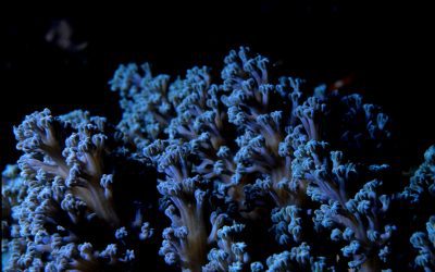
History of Maldives
Malaysia possesses a rich and diverse history dating back to ancient times. The early settlement of the Malay Peninsula can be traced to the 1st century AD, with evidence of trade and cultural exchange with the Indian subcontinent. The Malay Peninsula’s strategic location for trade attracted various ethnic groups, including the Malays, Chinese and Indians. Early Malay kingdoms, such as Langkasuka and Srivijaya, played a significant role in shaping the cultural and political landscape of the region. The colonisation of Malaysia began in the 15th century when the Portuguese arrived in Malacca in 1511. They established a strong presence in the region and exerted their influence over the local population. However, their rule was short-lived, as the Dutch ousted them in 1641. The Dutch East India Company, known as the VOC, took control of Malacca and expanded their influence to other parts of the Malay Peninsula. Dutch colonisation brought about significant changes in the region, including the introduction of new agricultural practices and the establishment of trading posts. Summary Early settlement and colonization in the Maldives dates back to ancient times, with influences from various cultures such as Indian, Sri Lankan, and Arab. Islamic influence and the establishment of the Sultanate in the 12th century shaped the cultural and religious identity of the Maldives. Portuguese and Dutch occupation in the 16th and 17th centuries brought significant changes to the Maldives, including the introduction of Christianity and the decline of the Sultanate. The Maldives became a British protectorate in the 19th century and gained independence in 1965, marking a new era in its political history. Modern political history in the...
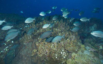
Natural Resources of Maldives: Where Natural Resources are located In Maldives
The Maldives, an archipelago comprising 26 atolls in the Indian Ocean, is renowned for its exceptional natural beauty and rich biodiversity. The nation’s natural resources play a vital role in supporting its economy and providing livelihoods for its inhabitants. The Maldives possesses an abundance of natural resources, including fisheries, marine resources, coral reefs, renewable energy sources, mineral resources and agricultural resources. These assets are essential for the sustenance of the Maldivian people and serve as a significant attraction for international tourists. However, the sustainable management and conservation of these natural resources are crucial to ensure their long-term viability and to safeguard the delicate ecosystem of the Maldives. The Maldives is heavily dependent on its natural resources, particularly its fisheries and marine resources, which have been the foundation of the country’s economy for centuries. The nation’s unique geographical location and rich marine biodiversity make it an ideal fishing destination. The Maldives is renowned for its tuna fisheries, which have been a primary source of income for the local population. In recent years, the government has undertaken efforts to modernise the fishing industry and promote sustainable fishing practices to ensure the long-term viability of this vital resource. Furthermore, the country’s marine resources, including its vibrant coral reefs and diverse marine life, are a major attraction for tourists, contributing significantly to the nation’s economy. However, the increasing pressures of overfishing and climate change pose substantial threats to the sustainability of these resources, rendering conservation efforts all the more crucial. Summary Maldives is a small island nation with limited natural resources, making sustainable management crucial for its survival. Fisheries and marine resources play...
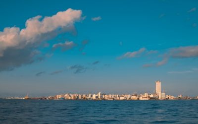
Cultural or Historical Sites of Maldives: Important Cultural Landmarks or Historical Sites in Maldives
The Maldives, an archipelago comprising 26 atolls in the Indian Ocean, is renowned for its exceptional natural beauty, unspoilt beaches and opulent resorts. Beyond its picturesque landscapes, the Maldives possesses a rich cultural and historical heritage spanning millennia. The nation’s history is a complex tapestry interwoven with influences from diverse cultures, religions and traditions, rendering it a captivating destination for those keen to explore the convergence of history, culture and religion. The Maldives’ extensive and intricate history has moulded its distinctive cultural identity. From ancient Buddhist temples to Islamic architecture, the country’s heritage reflects the myriad influences that have shaped its evolution over the centuries. Consequently, the Maldives is home to a wealth of historical sites, artefacts and traditions that provide insight into its rich and vibrant past. This article shall examine the cultural and historical significance of the Maldives, exploring its ancient Buddhist temples, Islamic influence, national museum, traditional dance and music, and efforts to preserve its cultural heritage. Summary The Maldives is a culturally rich country with a deep historical significance, influenced by both Buddhism and Islam. The ancient Buddhist temples in the Maldives offer a glimpse into the island’s rich religious heritage, with intricate carvings and historical significance. Islam has had a profound impact on Maldivian culture and architecture, shaping the country’s traditions and way of life. The Maldivian National Museum is a treasure trove of artifacts and historical items, showcasing the country’s rich cultural heritage. The Hukuru Miskiy is the oldest mosque in the Maldives, offering a fascinating insight into the country’s Islamic history and architecture. The Ancient Buddhist Temples of Maldives: Exploring the Island’s...

Population Density of Maldives
The Maldives, a tropical archipelago situated in the Indian Ocean, comprises 26 atolls and more than 1,000 coral islands. Renowned for its pristine waters, alabaster beaches and diverse marine ecosystems, the Maldives attracts numerous tourists and is famed for its opulent resorts and overwater accommodations. Malé, the capital city, holds the distinction of being the world’s most densely populated urban centre, with over 50,000 inhabitants occupying a mere 5.7 square kilometres. The nation’s total population stands at approximately 530,000, rendering it one of the most densely populated countries globally. The Maldives’ population density is roughly 1,188 persons per square kilometre, substantially exceeding the worldwide average. This high concentration of inhabitants in the Maldives engenders both difficulties and prospects for the nation, influencing various facets of life, including environmental concerns, infrastructure development and economic growth. Summary The Maldives is an island nation in the Indian Ocean known for its stunning beaches, coral reefs, and luxury resorts. Factors contributing to the high population density in the Maldives include limited land availability, urbanization, and economic opportunities in the capital city of Male. High population density in the Maldives has led to environmental challenges such as waste management, water scarcity, and pressure on natural resources. Challenges of high population density in the Maldives include strain on infrastructure, limited access to healthcare and education, but also opportunities for economic growth and innovation. Population density varies across different regions of the Maldives, with the capital city of Male being the most densely populated area. Factors contributing to the population density Geographical Constraints The limited land area of the Maldives, comprising small, low-lying islands, restricts the...

Political Boundaries of Malaysia: Provinces, Districts, or Historical Boundaries.
Malaysia is a Southeast Asian nation situated on the Malay Peninsula and the island of Borneo. It is organised as a federal constitutional monarchy comprising thirteen states and three federal territories. The political boundaries of Malaysia are determined by its geographical position, historical developments, and administrative divisions. The country shares land borders with Thailand, Indonesia, and Brunei, as well as maritime borders with Vietnam, the Philippines, and Singapore. Malaysia’s political boundaries are essential for the country’s governance and administration, as they influence the distribution of resources, representation, and decision-making processes at various governmental levels. The political boundaries of Malaysia are also shaped by its diverse population, which includes various ethnic groups such as Malays, Chinese, Indians, and indigenous peoples. This diversity has influenced the country’s political landscape and led to the establishment of policies and institutions aimed at fostering unity and harmony amongst its citizens. The political boundaries of Malaysia play a crucial role in shaping the nation’s identity, governance, and international relations. A thorough understanding of the provinces, states, districts, and local government structures is vital for comprehending the complexities of Malaysia’s political boundaries and their impact on the country’s development and future. Summary Malaysia’s political boundaries are defined by its geographical location and historical agreements with neighbouring countries. The country is divided into 13 states and 3 federal territories, each with its own government and administrative structure. Districts and local government play a crucial role in the governance and development of Malaysia, with each state being further divided into districts. Malaysia’s historical boundaries have evolved over time due to colonial influences, international treaties, and geopolitical changes. The...

Climate Zones Of Malaysia: Different Climate Regions Of Malaysia
Malaysia, situated in Southeast Asia, is renowned for its diverse culture, rich history and captivating natural landscapes. The nation’s distinctive climate is influenced by its equatorial location and the surrounding seas. Malaysia experiences a tropical climate, characterised by elevated temperatures and humidity throughout the annum. The country can be categorised into several distinct climate zones, each exhibiting unique characteristics and weather patterns. Comprehension of these climate zones is crucial for prospective visitors or residents of Malaysia, as it significantly affects travel arrangements, outdoor pursuits and general comfort. Summary Malaysia has a diverse climate due to its location near the equator and its varied topography. The Tropical Rainforest Climate in Malaysia is characterized by high temperatures and heavy rainfall throughout the year. The Tropical Monsoon Climate in Malaysia experiences distinct wet and dry seasons, with heavy rainfall during the monsoon season. The Tropical Savanna Climate in Malaysia has a distinct dry season and a wet season, with less rainfall compared to the rainforest and monsoon climates. The Highland Climate in Malaysia is cooler and experiences more variation in temperature, with lower humidity compared to the lowland areas. Tropical Rainforest Climate in Malaysia Tropical Rainforest Climate One of the most prominent climate zones in Malaysia is the tropical rainforest climate, which is prevalent in the western part of the country, including the states of Sarawak and Sabah on the island of Borneo. This climate zone is characterised by high levels of rainfall throughout the year, with no distinct dry season. The temperatures in this region remain consistently warm, with little variation between seasons. A Haven for Biodiversity and Wildlife The lush...

Terrain and Topography of Malaysia: mountains, valleys, and plains.
Malaysia, situated in South-East Asia, is renowned for its diverse and striking terrain and topography. The nation comprises two primary regions: Peninsular Malaysia and Malaysian Borneo, each possessing distinct geographical features. Peninsular Malaysia is characterised by its mountainous landscape, whilst Malaysian Borneo is notable for its dense rainforests and rugged terrain. The country also encompasses numerous islands, each with its own unique topographical characteristics. Malaysia’s terrain and topography significantly influence the nation’s climate, biodiversity and human activities. From towering mountains to verdant plains, Malaysia’s varied landscape offers an abundance of natural beauty and resources. Summary Malaysia’s terrain and topography are diverse, ranging from mountains to lowlands and plains. The majestic mountains of Malaysia, such as Mount Kinabalu and Gunung Mulu, offer breathtaking views and challenging hikes. The valleys and lowlands of Malaysia are home to lush rainforests, rivers, and diverse wildlife. The lush plains of Malaysia are important for agriculture and are home to a variety of flora and fauna. The terrain and topography of Malaysia greatly influence its climate, with the highlands experiencing cooler temperatures and the lowlands being hot and humid. The Majestic Mountains of Malaysia Mountain Ranges of Peninsular Malaysia The Titiwangsa Range, also known as the Main Range, runs from the north to the south of Peninsular Malaysia, forming a natural boundary between the east and west coasts. This mountain range is home to several peaks, including Mount Tahan, the highest peak in Peninsular Malaysia. The Banjaran Bintang Range, located in the northern part of Peninsular Malaysia, is known for its rugged terrain and dense rainforests. Mountain Ranges of Malaysian Borneo The Crocker Range, located...

Natural Resources of Malaysia: Where Natural Resources are Located in Malaysia
Malaysia possesses a wealth of natural resources, rendering it one of the most resource-abundant nations in Southeast Asia. The country’s diverse array of resources, spanning from verdant rainforests to mineral deposits and coastal regions, plays a pivotal role in its economic development. This natural bounty has significantly contributed to Malaysia‘s growth and prosperity, establishing it as a notable participant in the global marketplace. The nation’s strategic geographical position, coupled with its rich natural endowments, has elevated Malaysia to a prominent position in international trade and commerce. For centuries, Malaysia’s natural resources have served as a wellspring of sustenance and livelihood for its populace. The country’s natural wealth has also attracted foreign investment and trade, bolstering its economic expansion. Beyond economic opportunities, these resources have been instrumental in shaping Malaysia’s cultural and social fabric. The judicious management and conservation of Malaysia’s natural resources are paramount for the nation’s future development and prosperity. This article shall examine the biodiversity of Malaysian rainforests, the country’s mineral wealth, the significance of its agricultural resources, its oil and gas reserves, and the distinctive natural resources found in Malaysia’s coastal areas. Additionally, it will address the conservation and sustainable management practices pertaining to Malaysia’s natural resources. Summary Malaysia is blessed with a diverse range of natural resources, including rainforests, minerals, agricultural land, oil and gas reserves, and coastal areas. The Malaysian rainforests are home to a rich biodiversity, with a wide variety of plant and animal species, some of which are endemic to the region. Malaysia’s mineral resources, including tin, gold, and iron ore, have played a significant role in the country’s economic development. The...

Cultural or Historical Sites of Malaysia: Important Cultural Landmarks or Historical Sites in Malaysia
Malaysia is home to a diverse range of cultural and historical sites that have been recognised by UNESCO as World Heritage Sites. These sites are of significant importance to both Malaysia and the world, representing the country’s rich and diverse history. The UNESCO World Heritage Sites in Malaysia include the historical city of George Town in Penang, the archaeological heritage of the Lenggong Valley, the Melaka and George Town historic cities of the Straits of Malacca, and the Gunung Mulu National Park in Sarawak. These sites are notable not only for their historical and cultural significance but also for their natural beauty and ecological importance. The UNESCO World Heritage Sites of Malaysia serve as a testament to the country’s rich history and cultural diversity. These sites have been meticulously preserved and protected to ensure their continued value for future generations. The historical city of George Town in Penang, for instance, is a living testament to Malaysia’s multicultural history, showcasing a unique blend of Chinese, Indian, and Malay influences. The archaeological heritage of the Lenggong Valley provides valuable insights into the prehistoric past of the region, whilst the Melaka and George Town historic cities of the Straits of Malacca highlight the crucial role these cities played in the maritime trade routes of the region. The Gunung Mulu National Park in Sarawak, conversely, exemplifies Malaysia’s natural beauty, featuring limestone karst formations, caves, and diverse ecosystems. These UNESCO World Heritage Sites are of global significance, representing the shared heritage of humanity. Summary Malaysia is home to four UNESCO World Heritage Sites, including the cities of George Town and Melaka, the archaeological heritage...

History of Malaysia
Malaysia’s history is rich and diverse, with roots extending to ancient times. The region’s early civilisations can be traced to the Malay Kingdoms, established as early as the 2nd century BCE. These kingdoms, including Langkasuka and Srivijaya, were renowned for their sophisticated trade networks and maritime expertise, which facilitated their growth and prosperity. The Malay Kingdoms were also influenced by Indian and Chinese cultures, contributing to the development of a distinctive Malay culture and identity. In the 15th century, the Malacca Sultanate emerged as a formidable maritime empire in the region. Under Sultan Mansur Shah’s leadership, Malacca became a significant trading centre, attracting merchants from across the globe. The Sultanate’s strategic position on the Strait of Malacca enabled it to dominate the lucrative spice trade and establish diplomatic relations with neighbouring kingdoms. The Malacca Sultanate’s influence extended beyond the Malay Peninsula, reaching as far as the Indonesian archipelago and the Philippines. Summary Early civilizations in Malaysia date back to the 1st century AD, with the rise of powerful kingdoms such as Srivijaya and Majapahit. Colonial rule by the Portuguese, Dutch, and British significantly shaped Malaysia’s history, leading to a struggle for independence in the mid-20th century. The formation of Malaysia in 1963 brought together Malaya, Singapore, Sabah, and Sarawak, but Singapore later separated in 1965. Malaysia’s economic development and industrialization have transformed the country into a major player in the global economy, particularly in the manufacturing and technology sectors. Malaysia’s cultural diversity and rich heritage are evident in its vibrant mix of Malay, Chinese, Indian, and indigenous traditions, languages, and customs. Colonial Rule and Independence The Establishment of British...