World Geography
Geography is the study of the Earth’s landscapes, environments, and the relationships between people and their surroundings. It encompasses both the physical aspects of the Earth, such as its landforms, bodies of water, and climate, as well as the human aspects, including population distribution, cultures, and economies. World geography is a broad field that seeks to understand the complexities of our planet and how humans interact with it. By studying world geography, we can gain a deeper appreciation for the diversity of our planet and the interconnectedness of its various regions.
Geography is a multidisciplinary field that draws on elements of physical science, social science, and humanities. It involves the use of maps, spatial analysis, and geographic information systems (GIS) to understand the Earth’s surface and the processes that shape it. World geography also encompasses the study of human geography, which examines the ways in which people and their activities are distributed across the Earth. By understanding world geography, we can better appreciate the environmental, cultural, and economic challenges facing different regions of the world. This knowledge is crucial for addressing global issues such as climate change, resource management, and international development.
The Five Oceans and Seven Continents
The Earth’s surface is divided into five major oceans: the Pacific, Atlantic, Indian, Southern (or Antarctic), and Arctic Oceans. These vast bodies of water play a crucial role in regulating the Earth’s climate and supporting diverse marine ecosystems. The oceans also serve as important transportation routes and a source of food and other natural resources for human societies around the world.
In addition to the oceans, the Earth’s landmasses are divided into seven continents: Africa, Antarctica, Asia, Europe, North America, Australia (or Oceania), and South America. Each continent has its own unique physical and cultural characteristics, shaped by millions of years of geological processes and human history. From the deserts of Africa to the rainforests of South America, the continents offer a rich tapestry of landscapes and environments for exploration and study.
Major Mountain Ranges and Deserts
The Earth’s surface is also marked by major mountain ranges and deserts that have shaped the planet’s physical and cultural landscapes. The Himalayas, for example, are the highest mountain range in the world and are home to diverse ecosystems and cultures in countries such as India, Nepal, and Bhutan. The Andes in South America, the Rockies in North America, and the Alps in Europe are other prominent mountain ranges that have influenced human settlement patterns and economic activities.
Deserts cover about one-third of the Earth’s land surface and are characterized by low precipitation and extreme temperatures. The Sahara Desert in Africa is the largest hot desert in the world, while the Gobi Desert in Asia is one of the largest cold deserts. Deserts are not only home to unique flora and fauna but have also been important trade routes and cultural crossroads throughout history.
Climate Zones and Biomes
The Earth’s climate is influenced by a variety of factors, including latitude, altitude, ocean currents, and prevailing winds. As a result, the planet is divided into different climate zones, each with its own characteristic weather patterns and ecosystems. The equator, for example, experiences a tropical climate with high temperatures and heavy rainfall, while the polar regions have a cold and dry climate.
These climate zones give rise to different biomes, or large ecological areas characterized by distinct plant and animal communities. The tropical rainforest biome, found near the equator, is home to a diverse array of species and is vital for regulating the Earth’s climate. The grasslands biome, found in regions such as the African savannah and North American prairies, supports grazing animals and has been important for human agriculture throughout history.
Human Geography and Population Distribution
Human geography examines the ways in which people and their activities are distributed across the Earth’s surface. It encompasses topics such as population growth, migration patterns, urbanization, and cultural diversity. Understanding human geography is crucial for addressing global challenges such as poverty, inequality, and environmental degradation.
Population distribution is uneven across the world, with some regions experiencing rapid population growth while others are declining. The majority of the world’s population lives in Asia, particularly in countries such as China and India. Urban areas are also growing rapidly, with more than half of the world’s population now living in cities. This trend has significant implications for infrastructure development, resource management, and social inequality.
Historical and Cultural Geography
Historical geography examines how human activities have shaped the Earth’s landscapes over time. It explores topics such as colonialism, trade routes, and the rise and fall of empires. Cultural geography focuses on how human cultures have developed in different regions of the world and how they interact with their environments.
The Silk Road, for example, was an ancient trade route that connected China with Europe and facilitated the exchange of goods, ideas, and technologies across Eurasia. This historical trade route had a profound impact on the development of cultures and economies along its path. Similarly, cultural geographers study how different societies have adapted to their environments through practices such as agriculture, architecture, and religious beliefs.
The Importance of Geographic Knowledge
Geographic knowledge is crucial for addressing global challenges such as climate change, resource management, and international development. By understanding world geography, we can better appreciate the environmental, cultural, and economic challenges facing different regions of the world. This knowledge is crucial for addressing global issues such as climate change, resource management, and international development.
Geographic knowledge also helps us to understand our interconnectedness with other regions of the world. By studying world geography, we can gain a deeper appreciation for the diversity of our planet and the interconnectedness of its various regions. This understanding can foster a sense of global citizenship and empathy for people from different cultures and backgrounds.
In conclusion, world geography is a complex and multifaceted field that encompasses both physical and human aspects of the Earth’s landscapes. By studying world geography, we can gain a deeper appreciation for the diversity of our planet and the interconnectedness of its various regions. This knowledge is crucial for addressing global challenges such as climate change, resource management, and international development. It also helps us to understand our interconnectedness with other regions of the world and fosters a sense of global citizenship.
FAQs
What is world geography?
World geography is the study of the Earth’s landscapes, environments, and the relationships between people and their environments. It encompasses the physical features of the Earth, as well as the human activity that takes place on it.
Why is world geography important?
World geography is important because it helps us understand the world around us. It provides insights into the physical and human processes that shape our planet, and helps us make informed decisions about how to interact with our environment.
What are the main branches of world geography?
The main branches of world geography include physical geography, which focuses on the Earth’s natural features and processes, and human geography, which examines the relationships between people and their environments.
How does world geography impact our daily lives?
World geography impacts our daily lives in numerous ways, from influencing the weather and climate we experience, to shaping the availability of natural resources and influencing the distribution of populations and cultures around the world.
What are some key concepts in world geography?
Key concepts in world geography include location, place, human-environment interaction, movement, and region. These concepts help geographers understand and interpret the world around them.

Population Density of Malaysia
Population density refers to the number of people living in a specific area, typically measured per square kilometre. It is a crucial demographic indicator that offers insights into the distribution of people within a country or region. In Malaysia, population density plays a significant role in shaping the social, economic and environmental landscape of the nation. Understanding population density is essential for urban planning, resource allocation and policy-making. Malaysia, with its diverse population and varied geographical features, presents an intriguing case study for examining population density and its implications. The concept of population density is not merely about the number of people living in a particular area, but also about the spatial distribution of the population. It is influenced by various factors such as natural resources, economic opportunities, infrastructure and government policies. In Malaysia, population density varies significantly across different regions, with urban areas experiencing higher population density compared to rural areas. This has implications for resource management, environmental sustainability and social development. In this article, we shall explore the factors affecting population density in Malaysia, the distribution of population density across different states and the impact of population density on infrastructure and resources. We shall also discuss future projections of population density in Malaysia and the government policies and initiatives aimed at managing population density. Summary Population density refers to the number of people living per square kilometre and is an important indicator of the distribution of population in a specific area. Factors affecting population density in Malaysia include economic opportunities, infrastructure development, and government policies. Urban areas in Malaysia have higher population density compared to rural areas...
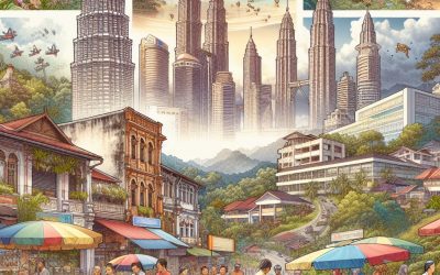
Malaysia
Malaysia Capital: Kuala Lumpur Population (Estimated July 2012): 29,179,952 Area: 330,804km2 or 127,724mi2 Currency: Ringgit (RM) Official Language: Malay Political Information: Federal Constitutional Elective Monarchy and Parliamentary Democracy Official Religion: Islam(approximately 60.4% of the population are Muslim, 19.2% are Buddhist, 9.1% are Christian, 6.3% are Hindu, 2.6% have traditional Chinese Religious beliefs, 1.5% have other religious beliefs and 0.8% have no religious beliefs) Highest Mountain: Mount Kinabalu 4,095m or 13,435 ft GDP Official Exchange Rate (OER is more precise at gauging a country’s economic power) (Estimated 2011): $247.6 billion (US$) or (GBP) GDP (OER) Per Capita (per member of the population estimated 2011): (US$) or (GBP) GDP Purchasing Power Parity (PPP is good for gauging living conditions and the use of resources but is not as accurate as OER. This data has been calculated based on the sum value of all goods and services produced in the country valued at prices prevailing in the United States) (Estimated 2011): $447 billion (US$) or (GBP) GDP (PPP) Per Capita (per member of the population estimated 2011): $15,600 (US$) or (GBP) Time Zone (GMT/UTC): +8:00 Wildlife: Counties/Provinces/States: 13 states (negeri-negeri, singular – negeri) Johor, Kedah, Kelantan, Melaka, Negeri Sembilan, Pahang, Perak, Perlis, Pulau Pinang, Sabah, Sarawak, Selangor, Terengganu; and 1 federal territory (Wilayah Persekutuan) with three components, city of Kuala Lumpur, Labuan, and Putrajaya Leaders: King Abdul Halim with Prime Minister Najib Tun Razak. Additional: Gained independence from the U.K. on the 31st of August 1957. Sources: CIA World Fact Book, Encyclopaedia Britannica. Malaysia Malaysia is a diverse nation situated in Southeast Asia, renowned for its cultural heritage, natural beauty and bustling urban centres. The country comprises two primary land areas, Peninsular Malaysia and Malaysian Borneo,...

Political Boundaries of Malawi: Provinces, Districts, or Historical Boundaries.
Malawi, a landlocked nation in south-eastern Africa, is renowned for its rich cultural heritage and striking natural landscapes. The political boundaries of Malawi are delineated by its borders with Zambia to the west, Tanzania to the north and north-east, and Mozambique to the east, south, and south-west. The country’s political boundaries also encompass the waters of Lake Malawi, which constitutes a significant portion of its eastern border. These boundaries have been shaped by a complex history of colonialism, independence, and regional geopolitics, and they continue to play a crucial role in shaping the nation’s governance and administration. The political boundaries of Malawi are not solely defined by its international borders but also by its internal administrative divisions. The country is divided into three regions – Northern, Central, and Southern – each with its own distinct cultural and geographical characteristics. Within these regions, Malawi is further subdivided into 28 districts, each with its own administrative and political structures. These boundaries have evolved over time, reflecting changes in governance, population distribution, and economic development. Understanding the regions and districts of Malawi is essential for comprehending the country’s political landscape and the challenges it faces in governance and development. Summary Malawi’s political boundaries have evolved over time, shaping the country’s administrative divisions and governance structure. Malawi is divided into three regions, which are further subdivided into 28 districts, each with its own administrative and political boundaries. The historical boundaries of Malawi have been influenced by colonial rule and subsequent independence, leading to changes in the country’s territorial divisions. The evolution of Malawi’s political boundaries reflects the country’s journey towards self-governance and the...

Climate Zones Of Malawi: Different climate regions Of Malawi
Malawi, a landlocked nation in south-eastern Africa, is renowned for its varied climate zones, each possessing distinct characteristics that significantly influence the country’s agriculture and tourism sectors. The nation’s climate is shaped by its topography, with the Great Rift Valley traversing the country and the presence of Lake Malawi, one of Africa’s largest lakes. These geographical features contribute to the diversity in climate across different regions of the country, resulting in a spectrum of climate zones ranging from tropical to semi-arid. A comprehensive understanding of these climate zones is essential for effective agricultural planning and the development of tourism in Malawi. Summary Malawi has diverse climate zones, each with its own unique characteristics and implications for agriculture and tourism. The tropical climate zone in Malawi is characterised by high temperatures and heavy rainfall, making it suitable for growing a variety of crops such as maize, tobacco, and tea. The subtropical climate zone experiences milder temperatures and less rainfall, making it ideal for fruit and vegetable production, as well as livestock farming. The highland climate zone in Malawi has cooler temperatures and lower rainfall, making it suitable for growing crops such as potatoes, wheat, and barley. The semi-arid climate zone in Malawi experiences low rainfall and high temperatures, posing challenges for agriculture but offering opportunities for tourism, particularly in the country’s national parks and wildlife reserves. The coastal climate zone in Malawi is characterised by warm temperatures and high humidity, making it suitable for tourism activities such as beach holidays and water sports. Tropical Climate Zone Characteristics of the Tropical Climate Zone The tropical climate zone in Malawi is marked...

Terrain and Topography of Malawi: mountains, valleys, and plains.
Malawi, a landlocked country in south-eastern Africa, is renowned for its diverse and striking terrain and topography. The nation shares borders with Zambia to the west, Tanzania to the north and north-east, and Mozambique to the east, south and south-west. Malawi‘s landscape is characterised by a variety of geographical features, including imposing mountains, deep valleys, expansive plains and a remarkable lake. The terrain and topography of Malawi play a pivotal role in shaping the country’s climate, ecosystems and human activities. From the towering peaks of the Mulanje Massif to the fertile valleys of the Shire River, Malawi’s terrain and topography offer an abundance of natural beauty and resources. Malawi’s terrain and topography are the result of geological processes that have shaped the landscape over millions of years. The country is part of the East African Rift system, which has created a diverse range of landforms, including mountains, plateaux and rift valleys. The Great Rift Valley runs through the western part of Malawi, creating a series of deep valleys and escarpments. In the east, the country is dominated by the vast Lake Malawi, which is one of the largest and deepest lakes in the world. The diverse terrain and topography of Malawi provide a rich tapestry of natural wonders that attract visitors from around the globe. Summary Malawi’s terrain and topography is diverse, ranging from mountains and valleys to vast plains. The majestic mountains of Malawi, including Mount Mulanje and the Nyika Plateau, offer stunning views and unique ecosystems. Exploring the valleys of Malawi, such as the Great Rift Valley, provides opportunities to discover rich biodiversity and fertile land. The...

Natural Resources of Malawi: Where Natural Resources are Located in Malawi
Malawi, a landlocked nation situated in south-eastern Africa, possesses a wealth of natural resources. These include arable land, mineral deposits, forests, water bodies and diverse fauna. These resources are integral to the country’s economy and the livelihoods of its inhabitants. Whilst Malawi‘s natural assets have the potential to foster sustainable development and enhance the quality of life for its citizens, it is imperative that these resources are managed and utilised responsibly to ensure their long-term viability and to prevent environmental deterioration. The judicious stewardship of Malawi’s natural resources is paramount for the nation’s future prosperity and ecological balance. Summary Malawi is rich in natural resources, including agriculture, mining, forestry, water, and wildlife. Agriculture is the main source of livelihood for the majority of Malawi’s population. Malawi has significant mineral resources, including uranium, coal, and rare earth minerals. The forestry sector in Malawi faces challenges such as deforestation and illegal logging. Malawi has abundant water resources and potential for hydropower generation. Agriculture and Farming in Malawi The Main Crops of Malawi The main crops grown in Malawi include maize, tobacco, tea, sugarcane, cotton, and various fruits and vegetables. Farming Practices in Malawi Small-scale subsistence farming is prevalent in rural areas, while larger commercial farms focus on cash crops for export. The government has implemented various agricultural policies and programmes to promote sustainable farming practices, increase productivity, and improve food security. However, challenges such as land degradation, climate change, and limited access to modern farming techniques and inputs continue to hinder the full potential of agriculture in Malawi. Challenges and Opportunities in Agricultural Development Agricultural development in Malawi presents both challenges...

Cultural or Historical Sites of Malawi: Important Cultural Landmarks or Historical Sites in Malawi
Malawi, a landlocked nation in south-eastern Africa, boasts a rich cultural and historical heritage. The country’s diverse landscape features numerous sites that offer insight into its past, ranging from ancient ruins to colonial-era settlements. These locations not only demonstrate the historical significance of the region but also provide a window into the cultural traditions and customs that have shaped Malawian identity. Notable sites include the Chongoni Rock Art Area, a UNESCO World Heritage Site featuring prehistoric paintings, and the Livingstonia Mission, established in the late 19th century by Scottish missionaries. Each site presents a distinct narrative of Malawi’s history and cultural legacy. It is worth noting, however, that the Great Zimbabwe Ruins are not located in Malawi but in neighbouring Zimbabwe, and thus should not be included in a discussion of Malawian historical sites. Summary Malawi is home to a rich tapestry of cultural and historical sites that offer a glimpse into the country’s diverse past. The Great Zimbabwe Ruins, a UNESCO World Heritage Site, stand as a testament to the ancient civilization that once thrived in the region. Chongoni Rock Art Area provides a fascinating window into Malawi’s prehistoric past, with its collection of rock paintings and engravings. Livingstonia is a historical missionary settlement that played a significant role in the country’s colonial and religious history. Lake Malawi National Park is a unique blend of cultural and natural heritage, offering a stunning landscape and a rich cultural heritage. The Great Zimbabwe Ruins: A UNESCO World Heritage Site Ancient Engineering Marvel This UNESCO World Heritage Site is one of the most important archaeological sites in Africa, with its massive...

History of Malawi
Malawi, a landlocked country in south-eastern Africa, possesses a rich and diverse history dating back to the pre-colonial era. The region now known as Malawi was inhabited by various Bantu-speaking tribes, including the Chewa, Nyanja, Tumbuka, Yao, and Lomwe, amongst others. These tribes maintained distinct cultures, traditions, and social structures. They were predominantly agricultural communities, relying on farming for sustenance. The Chewa, for instance, were renowned for their adept farming techniques and intricate religious and cultural practices. The pre-colonial era in Malawi was characterised by the rise and fall of various kingdoms and chiefdoms. One of the most prominent was the Maravi Kingdom, established by the Chewa people in the 15th century. The Maravi Kingdom was notable for its robust military and political organisation, as well as its vibrant trade networks with neighbouring regions. The kingdom’s capital, Zomba, served as a hub of economic and cultural activity. Another significant kingdom was the Yao Kingdom, located in the southern part of present-day Malawi. The Yao people were skilled traders and warriors, and their kingdom played a crucial role in the region’s trade routes. The pre-colonial era in Malawi was also marked by the arrival of Arab traders and the spread of Islam in certain parts of the country. Arab traders established trade links with local communities, exchanging goods such as ivory, gold, and slaves. This interaction with Arab traders had a significant impact on the cultural and religious landscape of Malawi, particularly in the southern and eastern regions. In summary, the pre-colonial era in Malawi was a period of considerable diversity and dynamism, with various kingdoms and chiefdoms coexisting and...

Population Density of Malawi
Malawi, a landlocked country in south-eastern Africa, is characterised by its high population density. With a population exceeding 18 million, Malawi ranks amongst the most densely populated nations in Africa. The population density is estimated at approximately 203 people per square kilometre, placing it among the most densely populated countries globally. This high population density is predominantly concentrated in the southern and central regions of Malawi, where the majority of inhabitants reside. The rapid population growth has resulted in increased pressure on the country’s resources and infrastructure, presenting significant challenges for sustainable development. The high population density in Malawi stems from various factors, including elevated fertility rates, limited access to family planning services, and insufficient education and awareness regarding population control. Furthermore, the country’s dependence on agriculture as the primary source of livelihood has contributed to the high population density, as families tend to have more children to assist with farming activities. The combination of these factors has led to a rapid increase in population, straining the country’s limited resources and infrastructure. Consequently, Malawi faces numerous challenges in managing and controlling its population density to ensure sustainable development and improve the quality of life for its citizens. Summary Malawi has a high population density, with an average of 203 people per square kilometre. Factors contributing to Malawi’s population density include high fertility rates, limited access to family planning, and rural-to-urban migration. The high population density in Malawi puts a strain on infrastructure, leading to overcrowding in cities, inadequate housing, and pressure on healthcare and education services. Challenges of high population density in Malawi include food and water scarcity, environmental...

Malawi
Malawi (Republic of Malawi) Capital: Lilongwe Population (Estimated July 2012): 16,323,044 Area: 118,484 km2 or 45,747 mi2 Currency: Malawian Kwacha (MK) Official Language: Chichewa Political Information: Multi-Party Democracy Official Religion: No Official Religion (approximately 82.7% of the population are Christian, 13% are Muslim, 1.9% follow other religions and 2.5% have no religious Beliefs) Highest Mountain: Mulanje Peak at 3,002m or 9,848ft GDP Official Exchange Rate (OER is more precise at gauging a country’s economic power) (Estimated 2011): $5.7 billion (US$) or (GBP) GDP (OER) Per Capita (per member of the population estimated 2011): (US$) or (GBP) GDP Purchasing Power Parity (PPP is good for gauging living conditions and the use of resources but is not as accurate as OER. This data has been calculated based on the sum value of all goods and services produced in the country valued at prices prevailing in the United States) (Estimated 2011): $13.77 billion (US$) or (GBP) GDP (PPP) Per Capita (per member of the population estimated 2011): $900 (US$) or (GBP) Time Zone (GMT/UTC): -5:00 Wildlife: Counties/Provinces/States: 14 parishes; Clarendon, Hanover, Kingston, Manchester, Portland, Saint Andrew, Saint Ann, Saint Catherine, Saint Elizabeth, Saint James, Saint Mary, Saint Thomas, Trelawny, Westmorelandnote: for local government purposes, Kingston and Saint Andrew were amalgamated in 1923 into the present single corporate body known as the Kingston and Saint Andrew Corporation Leaders: H.M. Queen Elizabeth II with Governor-General Sir Patrick Allen and Prime Minister Portia Simpson-Miller Additional: Gained Independence from the UK on the 6th of August 1962. Sources: CIA World Fact Book, Encyclopaedia Britannica. Malawi Malawi, officially the Republic of Malawi, is a landlocked country situated in southeastern Africa. It shares borders with Zambia to the northwest, Tanzania to the northeast and...

Population Density of Madagascar
Madagascar, the fourth largest island globally, boasts a unique and diverse population. With an estimated population exceeding 26 million people, Madagascar has a population density of approximately 46 people per square kilometre. The population density in Madagascar is unevenly distributed, with the majority concentrated in the central highlands and along the coasts. This uneven distribution of population has significant implications for the country’s development and resource management. Understanding the factors influencing population distribution and the impact of population density on infrastructure and resources is crucial for addressing the challenges and opportunities associated with high population density in Madagascar. Madagascar’s population density is influenced by various factors, including geography, climate, and historical settlement patterns. The central highlands, with their fertile soil and temperate climate, have historically attracted a large proportion of the population. In contrast, the arid southern region and the dense rainforests in the east have lower population densities due to less favourable living conditions. Additionally, the coastal areas, with their access to trade and fishing, have also attracted significant populations. These factors have led to a concentration of people in certain regions, whilst other areas remain sparsely populated. Understanding these factors is essential for developing effective policies to manage population density and promote sustainable development in Madagascar. Summary Madagascar has a population density of 46 people per square kilometre, making it one of the lowest in Africa. Factors such as climate, topography, and historical settlement patterns influence population distribution in Madagascar. Urban areas in Madagascar have higher population density compared to rural areas, leading to challenges in infrastructure and resource management. High population density in Madagascar puts pressure...

History of Madagascar
Madagascar, the fourth largest island globally, boasts a rich and diverse history spanning over 2,000 years. Seafaring people from Southeast Asia first settled the island circa 500 CE. These early settlers, known as the Malagasy, introduced their Austronesian language and culture, which continue to influence the island’s society today. The Malagasy people established small kingdoms and chiefdoms across the island, each with its own distinct customs and traditions. The island’s strategic location in the Indian Ocean rendered it an attractive destination for traders and explorers worldwide. Arab traders were the first to arrive in Madagascar in the 9th century, introducing Islam and establishing trade networks along the coast. The Arabs also brought new crops, such as rice and bananas, which became staples of the Malagasy diet. The arrival of the Arabs significantly impacted the island’s culture, religion and economy. Summary Early settlement in Madagascar dates back to around 500 AD, with the arrival of Austronesian peoples from Southeast Asia. The Arabs and Swahili traders arrived in Madagascar around the 7th century, influencing the culture and language of the island. European exploration and colonization began in the 16th century, with the Portuguese, Dutch, and French all establishing trading posts on the island. The Merina Kingdom, established in the 16th century, became the dominant political and cultural force in Madagascar. French colonization began in the late 19th century, leading to Madagascar becoming a French colony until gaining independence in 1960. Arrival of the Arabs and the Swahili The Swahili Culture’s Lasting Impact The Swahili culture had a lasting impact on Madagascar, influencing everything from language and religion to architecture and cuisine....