World Geography
Geography is the study of the Earth’s landscapes, environments, and the relationships between people and their surroundings. It encompasses both the physical aspects of the Earth, such as its landforms, bodies of water, and climate, as well as the human aspects, including population distribution, cultures, and economies. World geography is a broad field that seeks to understand the complexities of our planet and how humans interact with it. By studying world geography, we can gain a deeper appreciation for the diversity of our planet and the interconnectedness of its various regions.
Geography is a multidisciplinary field that draws on elements of physical science, social science, and humanities. It involves the use of maps, spatial analysis, and geographic information systems (GIS) to understand the Earth’s surface and the processes that shape it. World geography also encompasses the study of human geography, which examines the ways in which people and their activities are distributed across the Earth. By understanding world geography, we can better appreciate the environmental, cultural, and economic challenges facing different regions of the world. This knowledge is crucial for addressing global issues such as climate change, resource management, and international development.
The Five Oceans and Seven Continents
The Earth’s surface is divided into five major oceans: the Pacific, Atlantic, Indian, Southern (or Antarctic), and Arctic Oceans. These vast bodies of water play a crucial role in regulating the Earth’s climate and supporting diverse marine ecosystems. The oceans also serve as important transportation routes and a source of food and other natural resources for human societies around the world.
In addition to the oceans, the Earth’s landmasses are divided into seven continents: Africa, Antarctica, Asia, Europe, North America, Australia (or Oceania), and South America. Each continent has its own unique physical and cultural characteristics, shaped by millions of years of geological processes and human history. From the deserts of Africa to the rainforests of South America, the continents offer a rich tapestry of landscapes and environments for exploration and study.
Major Mountain Ranges and Deserts
The Earth’s surface is also marked by major mountain ranges and deserts that have shaped the planet’s physical and cultural landscapes. The Himalayas, for example, are the highest mountain range in the world and are home to diverse ecosystems and cultures in countries such as India, Nepal, and Bhutan. The Andes in South America, the Rockies in North America, and the Alps in Europe are other prominent mountain ranges that have influenced human settlement patterns and economic activities.
Deserts cover about one-third of the Earth’s land surface and are characterized by low precipitation and extreme temperatures. The Sahara Desert in Africa is the largest hot desert in the world, while the Gobi Desert in Asia is one of the largest cold deserts. Deserts are not only home to unique flora and fauna but have also been important trade routes and cultural crossroads throughout history.
Climate Zones and Biomes
The Earth’s climate is influenced by a variety of factors, including latitude, altitude, ocean currents, and prevailing winds. As a result, the planet is divided into different climate zones, each with its own characteristic weather patterns and ecosystems. The equator, for example, experiences a tropical climate with high temperatures and heavy rainfall, while the polar regions have a cold and dry climate.
These climate zones give rise to different biomes, or large ecological areas characterized by distinct plant and animal communities. The tropical rainforest biome, found near the equator, is home to a diverse array of species and is vital for regulating the Earth’s climate. The grasslands biome, found in regions such as the African savannah and North American prairies, supports grazing animals and has been important for human agriculture throughout history.
Human Geography and Population Distribution
Human geography examines the ways in which people and their activities are distributed across the Earth’s surface. It encompasses topics such as population growth, migration patterns, urbanization, and cultural diversity. Understanding human geography is crucial for addressing global challenges such as poverty, inequality, and environmental degradation.
Population distribution is uneven across the world, with some regions experiencing rapid population growth while others are declining. The majority of the world’s population lives in Asia, particularly in countries such as China and India. Urban areas are also growing rapidly, with more than half of the world’s population now living in cities. This trend has significant implications for infrastructure development, resource management, and social inequality.
Historical and Cultural Geography
Historical geography examines how human activities have shaped the Earth’s landscapes over time. It explores topics such as colonialism, trade routes, and the rise and fall of empires. Cultural geography focuses on how human cultures have developed in different regions of the world and how they interact with their environments.
The Silk Road, for example, was an ancient trade route that connected China with Europe and facilitated the exchange of goods, ideas, and technologies across Eurasia. This historical trade route had a profound impact on the development of cultures and economies along its path. Similarly, cultural geographers study how different societies have adapted to their environments through practices such as agriculture, architecture, and religious beliefs.
The Importance of Geographic Knowledge
Geographic knowledge is crucial for addressing global challenges such as climate change, resource management, and international development. By understanding world geography, we can better appreciate the environmental, cultural, and economic challenges facing different regions of the world. This knowledge is crucial for addressing global issues such as climate change, resource management, and international development.
Geographic knowledge also helps us to understand our interconnectedness with other regions of the world. By studying world geography, we can gain a deeper appreciation for the diversity of our planet and the interconnectedness of its various regions. This understanding can foster a sense of global citizenship and empathy for people from different cultures and backgrounds.
In conclusion, world geography is a complex and multifaceted field that encompasses both physical and human aspects of the Earth’s landscapes. By studying world geography, we can gain a deeper appreciation for the diversity of our planet and the interconnectedness of its various regions. This knowledge is crucial for addressing global challenges such as climate change, resource management, and international development. It also helps us to understand our interconnectedness with other regions of the world and fosters a sense of global citizenship.
FAQs
What is world geography?
World geography is the study of the Earth’s landscapes, environments, and the relationships between people and their environments. It encompasses the physical features of the Earth, as well as the human activity that takes place on it.
Why is world geography important?
World geography is important because it helps us understand the world around us. It provides insights into the physical and human processes that shape our planet, and helps us make informed decisions about how to interact with our environment.
What are the main branches of world geography?
The main branches of world geography include physical geography, which focuses on the Earth’s natural features and processes, and human geography, which examines the relationships between people and their environments.
How does world geography impact our daily lives?
World geography impacts our daily lives in numerous ways, from influencing the weather and climate we experience, to shaping the availability of natural resources and influencing the distribution of populations and cultures around the world.
What are some key concepts in world geography?
Key concepts in world geography include location, place, human-environment interaction, movement, and region. These concepts help geographers understand and interpret the world around them.
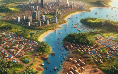
Cote d’Ivoire – Ivory Coast
Cote d’Ivoire – Ivory Coast (République de Côte d’Ivoire (Republic of Côte d’Ivoire [Ivory Coast])) Capital: Yamoussoukro Population (Estimated July 2012): 21,952,093 Area: 320,803 km2 or 123,863 mi2 Currency: CFA franc (CFAF) Official Language: French Political Information: Presidential Republic Official Religion: No Official Religion (approximately 38.6% of the population are Muslim, 32.8% are Christian, 11.9% have indigenous beliefs and 16.7% have no religious beliefs) Highest Mountain: Monts Nimba at 1,752m or 5,748ft GDP Official Exchange Rate (OER is more precise at gauging a countries economic power) (Estimated 2011): $23.8 billion (US$) or (GBP) GDP (OER) Per Capita (per member of the population estimated 2011): (US$) or (GBP) GDP Purchasing Power Parity (PPP is good for gauging living conditions and use of resources but not as accurate as OER. This data has been calculated based on the sum value of all goods and services produced in the country valued at prices prevailing in the United States) (Estimated 2011): $35.6 billion (US$) or (GBP) GDP (PPP) Per Capita (per member of the population estimated 2011): $1,600 (US$) or (GBP) Time Zone (GMT/UTC): GMT Wildlife: Counties/Provinces/States: regions; Agneby, Bafing, Bas-Sassandra, Denguele, Dix-Huit Montagnes, Fromager, Haut-Sassandra, Lacs, Lagunes, Marahoue, Moyen-Cavally, Moyen-Comoe, N’zi-Comoe, Savanes, Sud-Bandama, Sud-Comoe, Vallee du Bandama, Worodougou, Zanzan Leaders: President Alassane Ouattara with Guillaume Soro as Prime minister. Additional: Gained Independence from France on the 7th of August 1960 Sources: CIA World Fact Book, Encyclopaedia Britannica. Côte d’lvoire Côte d’lvoire, also known as Ivory Coast, is a country located in West Africa. It is known for its rich diversity and vibrant culture. With a population of over 25 million people, Côte d’Ivoire is home to more than 60...

Climate Zones Of Costa Rica: Different climate regions Of Costa Rica
Introduction to Costa Rica’s Climate Zones Costa Rica, located in Central America, is known for its stunning natural beauty and diverse ecosystems. From lush rainforests to pristine beaches, this small country offers a wide range of climates and landscapes. Understanding the different climate zones in Costa Rica is essential for both travelers and residents, as it can greatly impact the activities and experiences available in each region. Costa Rica’s geography plays a significant role in its climate variations. The country is divided into several distinct regions, each with its own unique climate characteristics. These climate zones are determined by factors such as altitude, proximity to the coast, and prevailing winds. By understanding these climate zones, visitors can plan their trips accordingly and make the most of their time in Costa Rica. The Tropical Wet Climate Zone The tropical wet climate zone is characterized by high temperatures and abundant rainfall throughout the year. This climate zone is found in the lowland areas along the Caribbean coast and parts of the Pacific coast. The average annual rainfall in these regions can exceed 100 inches, making them some of the wettest areas in Costa Rica. In the tropical wet climate zone, temperatures remain relatively constant throughout the year, with average highs ranging from 80 to 90 degrees Fahrenheit. Humidity levels are also high, creating a hot and sticky environment. The wettest months are typically September and October, while the driest months are February and March. The best time to visit the tropical wet climate zone is during the dry season, which runs from December to April. During this time, rainfall is minimal,...

Climate Zones Of Costa Rica: Different climate regions Of Costa Rica
Costa Rica, located in Central America, is known for its stunning natural beauty and diverse ecosystems. The country is home to a wide range of climate zones, each with its own unique characteristics and biodiversity. From tropical rainforests to cloud forests, highlands to coastal areas, Costa Rica offers a variety of climates for visitors to explore. Understanding these different climate zones is crucial for planning a trip to Costa Rica and experiencing the country’s rich natural wonders. Summary Costa Rica has diverse climate zones, each with unique characteristics and biodiversity. The tropical rainforest climate zone is hot and humid, with high rainfall and dense vegetation. The humid subtropical climate zone has a wet season and a dry season, with cooler temperatures than the rainforest zone. The tropical dry forest climate zone has a distinct dry season, with deciduous trees and shrubs adapted to the lack of rainfall. The cloud forest climate zone is cooler and wetter than the rainforest zone, with a unique ecosystem of mosses, ferns, and epiphytes. The highland climate zone has cooler temperatures and distinct seasons, with agriculture and ecotourism as major industries. The coastal climate zone has a tropical savanna climate, with hot temperatures and a dry season, and is home to many marine species. Climate zones affect Costa Rica’s biodiversity, with each zone supporting different plant and animal species. The best times to visit each climate zone vary, with some zones having peak tourist seasons during the dry season and others during the wet season. Climate change is impacting Costa Rica’s climate zones, with changes in rainfall patterns and temperatures affecting ecosystems and biodiversity....

Political Boundaries of Costa Rica: Provinces, Districts, or Historical Boundaries.
Costa Rica, a small country located in Central America, is known for its stunning natural beauty, rich biodiversity, and commitment to environmental conservation. However, behind this idyllic image lies a complex political system with various levels of governance and administrative divisions. In this article, we will explore the political boundaries of Costa Rica and their significance in shaping the country’s governance, society, culture, and economic development. Summary Costa Rica is divided into seven provinces, each with its own capital city and local government. Districts are the smallest administrative units in Costa Rica, with each province containing several districts. Historical boundaries of Costa Rica have evolved over time, with changes in political power and territorial disputes. Political boundaries have played a significant role in shaping Costa Rican culture and society, with regional identities and traditions emerging. The management of political boundaries in Costa Rica presents both challenges and opportunities for economic development and governance. Overview of Costa Rica’s Political Boundaries Political boundaries refer to the lines that demarcate different administrative divisions within a country. In Costa Rica, these boundaries are divided into three main levels: provinces, districts, and cantons. Provinces are the highest level of political division and there are seven provinces in Costa Rica: San Jose, Alajuela, Cartago, Heredia, Guanacaste, Puntarenas, and Limon. Each province is further divided into districts, which are then subdivided into cantons. A map of Costa Rica’s political boundaries provides a visual representation of these divisions. It shows the borders between provinces and the location of districts within each province. This map is an essential tool for understanding the administrative structure of Costa Rica and...

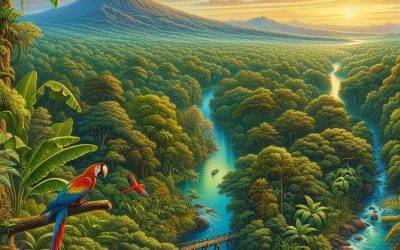
Terrain and Topography of Costa Rica: mountains, valleys, and plains.
Costa Rica, located in Central America, is a country known for its stunning natural beauty and diverse topography. From majestic mountain ranges to lush valleys and vast plains, the country’s landscape is shaped by its unique geography. The topography of Costa Rica plays a crucial role in determining the country’s climate, as well as providing opportunities for adventure, agriculture, and wildlife conservation. Summary Costa Rica’s topography is incredibly diverse, featuring majestic mountain ranges, lush valleys, and vast plains. The mountain ranges of Costa Rica play a crucial role in the country’s biodiversity, providing a habitat for a wide range of plant and animal species. The valleys of Costa Rica are known for their fertile soil and are often used for agriculture, making them a vital part of the country’s economy. The plains of Costa Rica are a unique landscape, home to a variety of wildlife and offering opportunities for adventure tourism. Costa Rica’s topography has a significant impact on the country’s climate, with different regions experiencing different weather patterns. The Majestic Mountain Ranges of Costa Rica Costa Rica is home to several mountain ranges that stretch across the country. The most prominent of these is the Cordillera Central, which runs through the center of the country and includes several active volcanoes. The highest peak in Costa Rica, Cerro Chirripó, is located in this range and offers breathtaking views from its summit. The Talamanca Range, located in the southern part of the country, is another notable mountain range in Costa Rica. This range is home to the country’s second-highest peak, Mount Kamuk, as well as the famous Chirripó National Park....

Natural Resources of Costa Rica: Where Natural Resources are Located in Costa Rica
Costa Rica, located in Central America, is a country known for its stunning natural beauty and rich biodiversity. With a diverse range of ecosystems, including rainforests, cloud forests, mangroves, and coral reefs, Costa Rica is home to an incredible array of plant and animal species. These natural resources are not only important for the country’s economy, but also for its culture and identity. The natural resources of Costa Rica play a vital role in the country’s economy. Tourism, which is largely driven by the country’s natural beauty and biodiversity, is one of the main sources of revenue for Costa Rica. The country attracts millions of visitors each year who come to explore its national parks, go hiking in its forests, and enjoy its pristine beaches. Additionally, Costa Rica’s natural resources also contribute to other sectors of the economy, such as agriculture and renewable energy. Summary Costa Rica is home to a vast array of natural resources, including biodiversity hotspots, forests, marine life, minerals, agriculture, water, and renewable energy. The country’s forests are crucial for maintaining biodiversity, regulating the climate, and providing ecosystem services such as water filtration and soil conservation. Costa Rica’s marine resources are rich in biodiversity, with over 7,000 species of marine plants and animals, making it a prime location for ecotourism and sustainable fishing practices. While Costa Rica has potential for mineral resource development, it must balance economic growth with environmental protection to avoid negative impacts on natural resources and local communities. Agriculture is a key economic sector in Costa Rica, but sustainable practices must be implemented to prevent soil degradation, deforestation, and water pollution. Biodiversity...

Cultural or Historical Sites of Costa Rica: Important Cultural Landmarks or Historical Sites in Costa Rica
Costa Rica is a country known for its stunning natural beauty, but it also has a rich cultural heritage that is worth exploring. From ancient civilizations to colonial architecture, from national parks to coffee plantations, Costa Rica offers a wide range of cultural experiences for visitors to enjoy. In this article, we will take a closer look at the various aspects of Costa Rica’s cultural heritage and the sites that showcase its history and traditions. Summary Costa Rica has a rich cultural heritage that includes ancient civilizations, colonial architecture, national parks, coffee, art, religion, music, dance, and indigenous communities. Archaeological sites like Guayabo and Finca 6 offer insights into the pre-Columbian cultures of Costa Rica, such as the Diquis and the Boruca. Colonial-era buildings like the National Theatre and the Orosi Church showcase the Spanish influence on Costa Rican architecture and history. National parks like Corcovado and Tortuguero are not only natural wonders but also cultural symbols of conservation and sustainability in Costa Rica. Coffee plantations like Doka and Britt provide a glimpse into the history and production of one of Costa Rica’s most famous exports, as well as the social and economic impact of coffee on the country. Discovering the Ancient Civilizations of Costa Rica: Archaeological Sites to Visit Costa Rica was once home to several ancient civilizations, including the Chibcha, the Boruca, and the Diquis. These civilizations left behind a wealth of archaeological sites that provide insight into their way of life. One of the most significant sites is Guayabo National Monument, which was once a thriving city and is now a UNESCO World Heritage Site. Visitors...

History of Costa Rica
Costa Rica, a small country located in Central America, has a rich and diverse history that has shaped its present-day society. From its early indigenous inhabitants to the arrival of Spanish conquistadors, the struggle for independence, and the birth of modern Costa Rica, understanding the country’s past is crucial in comprehending its present and future. This article will provide a comprehensive overview of Costa Rica’s history, highlighting key events, figures, and their impact on the country’s development. Summary Pre-Columbian Era: Indigenous people inhabited Costa Rica for thousands of years before European arrival. Spanish Colonization: The Spanish arrived in the 16th century, bringing disease and violence to the indigenous population. The Struggle for Independence: Costa Rica gained independence from Spain in 1821, but faced political instability and conflict. The Coffee Boom: Coffee production brought economic growth and social change to Costa Rica in the 19th century. The Civil War of 1948: The civil war led to the establishment of a democratic government and modernization of Costa Rica. Pre-Columbian Era: The Early Inhabitants of Costa Rica Before the arrival of European explorers, Costa Rica was home to several indigenous groups, including the Chibcha, Boruca, and Guaymí. These groups had their own unique cultural practices and beliefs, which were deeply rooted in their connection to nature and the land. They lived in small agricultural communities and practiced subsistence farming, relying on crops such as maize, beans, and squash. The arrival of Spanish colonizers in the 16th century had a devastating impact on the indigenous populations of Costa Rica. Many were enslaved or killed by diseases brought by the Europeans, such as smallpox....

Population Density of Costa Rica
Costa Rica, a small country located in Central America, is known for its rich biodiversity and stunning natural landscapes. Despite its small size, Costa Rica has a relatively high population density compared to other countries in the region. Population density refers to the number of people living in a specific area, usually measured in square kilometers or square miles. In the case of Costa Rica, its population density is around 97 people per square kilometer. The significance of population density lies in its impact on various aspects of a country’s development and sustainability. A high population density can put pressure on resources such as land, water, and infrastructure. It can also affect the quality of life for individuals living in densely populated areas, as overcrowding can lead to issues such as traffic congestion, pollution, and limited access to public services. Understanding the population density of Costa Rica is crucial for policymakers and urban planners to make informed decisions about resource allocation and sustainable development. Summary Costa Rica has a population density of 97 people per square kilometer, making it one of the most densely populated countries in Central America. The country’s geographical features, including its mountain ranges and coastal plains, have a significant impact on population distribution. The majority of Costa Rica’s population is concentrated in the Central Valley region, which includes the capital city of San Jose. Urbanization has led to significant population growth in Costa Rica’s cities, with over 60% of the population now living in urban areas. Despite the trend towards urbanization, rural areas still play an important role in Costa Rica’s economy and culture. The...
Costa Rica
Costa Rica (República de Costa Rica (Republic of Costa Rica)) Capital: San José Population (Estimated July 2012): 4,636,348 Area: 51,100 km2 or 19,730 mi2 Currency: Costa Rican Colón (₡) Official Language: Spanish Political Information: Constitutional Democracy Official Religion: Roman Catholicism (approximately 76.3% of the population are Roman Catholic, 13.7% are Evangelical, 1.3% are Jehovas Witnesses, 4.5% have other religious beliefs and 3.2% have no religious beliefs) Highest Mountain: Cerro Chirripo at 3,810m or 12,500ft GDP Official Exchange Rate (OER is more precise at gauging a countries economic power) (Estimated 2011): $40 billion (US$) or (GBP) GDP (OER) Per Capita (per member of the population estimated 2011): (US$) or (GBP) GDP Purchasing Power Parity (PPP is good for gauging living conditions and use of resources but not as accurate as OER. This data has been calculated based on the sum value of all goods and services produced in the country valued at prices prevailing in the United States) (Estimated 2011): $54.47 billion (US$) or (GBP) GDP (PPP) Per Capita (per member of the population estimated 2011): $11,500 (US$) or (GBP) Time Zone (GMT/UTC): -6:00 Wildlife: Counties/Provinces/States: provinces (provincias, singular – provincia); Alajuela, Cartago, Guanacaste, Heredia, Limon, Puntarenas, San Jose Leaders: Laura Chinchilla is the current President of Costa Rica with Alfio Piva as 1st Vice President and Luis Liberman as 2nd Vice President. Sources: CIA World Fact Book, Encyclopaedia Britannica. Costa Rica Costa Rica, located in Central America, is a small country known for its stunning natural beauty and biodiversity. Bordered by Nicaragua to the north and Panama to the south, Costa Rica is a land of lush rainforests, towering volcanoes, and pristine beaches. With a population of around...

Political Boundaries of the Republic of the Congo Brazzaville: Provinces, Districts, or Historical Boundaries.
The Republic of the Congo Brazzaville, commonly referred to as Congo-Brazzaville, is a country located in Central Africa. It is bordered by Gabon to the west, Cameroon and the Central African Republic to the north, the Democratic Republic of the Congo to the east, and Angola and the Atlantic Ocean to the south. With an area of approximately 342,000 square kilometers, it is one of the smaller countries in Africa. Understanding the political boundaries of Congo-Brazzaville is crucial for various reasons, including governance, administration, and resource management. Summary The Republic of the Congo Brazzaville is divided into 12 administrative departments. The provinces of the Republic of the Congo Brazzaville are further divided into districts and communes. The political boundaries of the Republic of the Congo Brazzaville were established during the colonial era. Districts play an important role in the political boundaries of the Republic of the Congo Brazzaville. Colonialism had a significant impact on the political boundaries of the Republic of the Congo Brazzaville. Understanding the Administrative Divisions of the Republic of the Congo Brazzaville Congo-Brazzaville is divided into administrative divisions known as departments. There are a total of 12 departments in the country, each headed by a prefect. The central government in Brazzaville has authority over these departments and is responsible for their governance and administration. However, there are also local authorities within each department that play a significant role in decision-making and implementation of policies at the local level. The central government in Brazzaville is responsible for national policies, legislation, and overall governance of the country. It has authority over key sectors such as defense, foreign affairs,...

Climate Zones Of Republic of the Congo Brazzaville: Different climate regions Of Republic of the Congo Brazzaville
The Republic of the Congo Brazzaville, also known as Congo-Brazzaville, is a country located in Central Africa. It is bordered by Gabon, Cameroon, the Central African Republic, the Democratic Republic of the Congo, and Angola. The country has a diverse climate due to its geographical location and topography. Understanding the different climate zones in the Republic of the Congo Brazzaville is crucial for various reasons, including agriculture, economic development, and environmental conservation. Summary Republic of the Congo Brazzaville has a diverse range of climate zones, including equatorial, tropical savanna, humid subtropical, semi-arid, arid, coastal, and mountain. The equatorial climate zone is characterized by high temperatures, heavy rainfall, and high humidity, making it ideal for rainforest vegetation. The tropical savanna climate zone has distinct wet and dry seasons, with grasslands and scattered trees dominating the landscape. The humid subtropical climate zone experiences mild winters and hot summers, with abundant rainfall and fertile soils. The semi-arid climate zone has low rainfall and high temperatures, with vegetation adapted to drought conditions. The impact of these climate zones on agriculture and the economy is significant, with crops and livestock varying depending on the region. Climate change is expected to have a significant impact on the climate zones of Republic of the Congo Brazzaville, with potential changes in rainfall patterns and temperatures affecting agriculture and the economy. Equatorial Climate Zone The equatorial climate zone is characterized by high temperatures and heavy rainfall throughout the year. This climate zone is found in the northern part of the Republic of the Congo Brazzaville, including areas such as Likouala and Cuvette. The equatorial rainforest is one of...