World Geography
Geography is the study of the Earth’s landscapes, environments, and the relationships between people and their surroundings. It encompasses both the physical aspects of the Earth, such as its landforms, bodies of water, and climate, as well as the human aspects, including population distribution, cultures, and economies. World geography is a broad field that seeks to understand the complexities of our planet and how humans interact with it. By studying world geography, we can gain a deeper appreciation for the diversity of our planet and the interconnectedness of its various regions.
Geography is a multidisciplinary field that draws on elements of physical science, social science, and humanities. It involves the use of maps, spatial analysis, and geographic information systems (GIS) to understand the Earth’s surface and the processes that shape it. World geography also encompasses the study of human geography, which examines the ways in which people and their activities are distributed across the Earth. By understanding world geography, we can better appreciate the environmental, cultural, and economic challenges facing different regions of the world. This knowledge is crucial for addressing global issues such as climate change, resource management, and international development.
The Five Oceans and Seven Continents
The Earth’s surface is divided into five major oceans: the Pacific, Atlantic, Indian, Southern (or Antarctic), and Arctic Oceans. These vast bodies of water play a crucial role in regulating the Earth’s climate and supporting diverse marine ecosystems. The oceans also serve as important transportation routes and a source of food and other natural resources for human societies around the world.
In addition to the oceans, the Earth’s landmasses are divided into seven continents: Africa, Antarctica, Asia, Europe, North America, Australia (or Oceania), and South America. Each continent has its own unique physical and cultural characteristics, shaped by millions of years of geological processes and human history. From the deserts of Africa to the rainforests of South America, the continents offer a rich tapestry of landscapes and environments for exploration and study.
Major Mountain Ranges and Deserts
The Earth’s surface is also marked by major mountain ranges and deserts that have shaped the planet’s physical and cultural landscapes. The Himalayas, for example, are the highest mountain range in the world and are home to diverse ecosystems and cultures in countries such as India, Nepal, and Bhutan. The Andes in South America, the Rockies in North America, and the Alps in Europe are other prominent mountain ranges that have influenced human settlement patterns and economic activities.
Deserts cover about one-third of the Earth’s land surface and are characterized by low precipitation and extreme temperatures. The Sahara Desert in Africa is the largest hot desert in the world, while the Gobi Desert in Asia is one of the largest cold deserts. Deserts are not only home to unique flora and fauna but have also been important trade routes and cultural crossroads throughout history.
Climate Zones and Biomes
The Earth’s climate is influenced by a variety of factors, including latitude, altitude, ocean currents, and prevailing winds. As a result, the planet is divided into different climate zones, each with its own characteristic weather patterns and ecosystems. The equator, for example, experiences a tropical climate with high temperatures and heavy rainfall, while the polar regions have a cold and dry climate.
These climate zones give rise to different biomes, or large ecological areas characterized by distinct plant and animal communities. The tropical rainforest biome, found near the equator, is home to a diverse array of species and is vital for regulating the Earth’s climate. The grasslands biome, found in regions such as the African savannah and North American prairies, supports grazing animals and has been important for human agriculture throughout history.
Human Geography and Population Distribution
Human geography examines the ways in which people and their activities are distributed across the Earth’s surface. It encompasses topics such as population growth, migration patterns, urbanization, and cultural diversity. Understanding human geography is crucial for addressing global challenges such as poverty, inequality, and environmental degradation.
Population distribution is uneven across the world, with some regions experiencing rapid population growth while others are declining. The majority of the world’s population lives in Asia, particularly in countries such as China and India. Urban areas are also growing rapidly, with more than half of the world’s population now living in cities. This trend has significant implications for infrastructure development, resource management, and social inequality.
Historical and Cultural Geography
Historical geography examines how human activities have shaped the Earth’s landscapes over time. It explores topics such as colonialism, trade routes, and the rise and fall of empires. Cultural geography focuses on how human cultures have developed in different regions of the world and how they interact with their environments.
The Silk Road, for example, was an ancient trade route that connected China with Europe and facilitated the exchange of goods, ideas, and technologies across Eurasia. This historical trade route had a profound impact on the development of cultures and economies along its path. Similarly, cultural geographers study how different societies have adapted to their environments through practices such as agriculture, architecture, and religious beliefs.
The Importance of Geographic Knowledge
Geographic knowledge is crucial for addressing global challenges such as climate change, resource management, and international development. By understanding world geography, we can better appreciate the environmental, cultural, and economic challenges facing different regions of the world. This knowledge is crucial for addressing global issues such as climate change, resource management, and international development.
Geographic knowledge also helps us to understand our interconnectedness with other regions of the world. By studying world geography, we can gain a deeper appreciation for the diversity of our planet and the interconnectedness of its various regions. This understanding can foster a sense of global citizenship and empathy for people from different cultures and backgrounds.
In conclusion, world geography is a complex and multifaceted field that encompasses both physical and human aspects of the Earth’s landscapes. By studying world geography, we can gain a deeper appreciation for the diversity of our planet and the interconnectedness of its various regions. This knowledge is crucial for addressing global challenges such as climate change, resource management, and international development. It also helps us to understand our interconnectedness with other regions of the world and fosters a sense of global citizenship.
FAQs
What is world geography?
World geography is the study of the Earth’s landscapes, environments, and the relationships between people and their environments. It encompasses the physical features of the Earth, as well as the human activity that takes place on it.
Why is world geography important?
World geography is important because it helps us understand the world around us. It provides insights into the physical and human processes that shape our planet, and helps us make informed decisions about how to interact with our environment.
What are the main branches of world geography?
The main branches of world geography include physical geography, which focuses on the Earth’s natural features and processes, and human geography, which examines the relationships between people and their environments.
How does world geography impact our daily lives?
World geography impacts our daily lives in numerous ways, from influencing the weather and climate we experience, to shaping the availability of natural resources and influencing the distribution of populations and cultures around the world.
What are some key concepts in world geography?
Key concepts in world geography include location, place, human-environment interaction, movement, and region. These concepts help geographers understand and interpret the world around them.
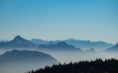
Terrain and Topography of Eritrea: mountains, valleys, and plains.
Eritrea, located in the Horn of Africa, is a country known for its diverse and stunning terrain. The topography of Eritrea is characterized by a combination of mountains, valleys, and plains, making it a unique and visually captivating landscape. The country is bordered by the Red Sea to the east, which has a significant influence on its climate and topography. Eritrea’s terrain plays a crucial role in shaping its climate, biodiversity, and even its history and culture. Understanding the different aspects of Eritrea’s terrain and topography is essential to appreciate the country’s natural beauty and its impact on the lives of its people. Summary Eritrea’s terrain is diverse, ranging from mountains to valleys and vast plains. The spectacular mountains of Eritrea offer breathtaking views and unique ecosystems. The breathtaking valleys of Eritrea are home to diverse flora and fauna. The vast plains of Eritrea provide important agricultural and grazing land. Eritrea’s diverse terrain has a significant impact on its climate, influencing temperature and rainfall patterns. The Spectacular Mountains of Eritrea Eritrea is home to a series of spectacular mountain ranges that dominate its landscape. The most prominent of these is the Ethiopian Highlands, which extend into Eritrea and form the central part of the country. The highest peak in Eritrea is Mount Soira, standing at an impressive 3,018 meters above sea level. The mountains not only provide breathtaking views but also play a crucial role in the country’s climate and water resources. The steep slopes and rugged terrain of the mountains make them a challenging yet rewarding destination for hikers and adventure seekers. The mountains also hold cultural significance...
History of Eritrea
Eritrea, located in the Horn of Africa, has a rich and diverse history that dates back to ancient times. The region was home to several powerful kingdoms, including the Kingdom of D’mt and the Kingdom of Aksum, which were influential in the trade routes that connected Africa with the Middle East and Asia. These kingdoms were known for their advanced agricultural practices, sophisticated architecture, and strong trade networks. The Aksumite Kingdom, in particular, was a major player in the Red Sea trade, controlling key ports and dominating the trade of goods such as ivory, gold, and slaves. The region’s strategic location made it a target for various colonizers throughout history. In the 7th century, the rise of Islam brought Arab traders and settlers to the region, influencing the local culture and religion. Later, the Ottoman Empire established control over parts of Eritrea, further shaping the region’s cultural and political landscape. The Italian colonization of Eritrea in the late 19th century marked a significant turning point in the country’s history, as it led to a period of intense struggle for independence and self-determination. The ancient kingdoms of Eritrea left a lasting legacy on the region, shaping its culture, language, and traditions. The influence of these kingdoms can still be seen in the architecture of ancient ruins, the local language of Ge’ez, and the traditional practices of the Eritrean people. The colonization of Eritrea by various powers has also had a profound impact on the country, shaping its modern identity and fueling its quest for independence. Summary Ancient Kingdoms and Colonization: Eritrea has a rich history of ancient kingdoms and was...
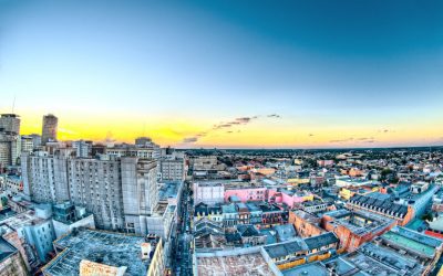
Population Density of Eritrea
Eritrea is a small country located in the Horn of Africa, bordered by Sudan, Ethiopia, and Djibouti. With a population of over 6 million people, Eritrea is one of the most densely populated countries in Africa. The country has a diverse landscape, ranging from the highlands in the central region to the coastal plains along the Red Sea. Eritrea has a rich cultural heritage, with nine recognized ethnic groups and a history of colonization and struggle for independence. The country gained independence from Ethiopia in 1993 after a long and bloody war, and since then, it has been working towards rebuilding its economy and infrastructure. Summary Eritrea is a country located in the Horn of Africa, with a population of around 3.5 million people. Population density refers to the number of people living per square kilometre, and in Eritrea, it is relatively low at 35 people per square kilometre. Factors affecting population density in Eritrea include climate, topography, and economic opportunities. The majority of the population in Eritrea is concentrated in the highland areas, with the lowest population density in the western lowlands. High population density in Eritrea presents challenges such as pressure on resources and infrastructure, but also opportunities for economic growth and development. Understanding Population Density Population density refers to the number of people living in a given area, usually measured in square kilometers. It is an important indicator of the distribution of people within a country and can have significant implications for social, economic, and environmental factors. High population density can lead to increased competition for resources, strain on infrastructure, and pressure on the environment. On...
Equatorial Guinea
Equatorial Guinea (República de Guinea Ecuatorial (Spanish); République du Guinée Équatoriale (French) (Republic of Equatorial Guinea)) Capital: Malabo Population (Estimated July 2012): 685,991 Area: 28,051 km2 or 10,831 mi2 Currency: CFA franc (CFAF) Official Language: Spanish; French Political Information: Unitary Presidential Republic Official Religion: No Official Religion Highest Mountain: Pico Basile at 3,008m or 9,869ft GDP Official Exchange Rate (OER is more precise at gauging a countries economic power) (Estimated 2011): $19.4 billion (US$) or (GBP) GDP (OER) Per Capita (per member of the population estimated 2011): (US$) or (GBP) GDP Purchasing Power Parity (PPP is good for gauging living conditions and use of resources but not as accurate as OER. This data has been calculated based on the sum value of all goods and services produced in the country valued at prices prevailing in the United States) (Estimated 2011): $26.11 billion (US$) or (GBP) GDP (PPP) Per Capita (per member of the population estimated 2011): $19,300 (US$) or (GBP) Time Zone (GMT/UTC): +1:00 Wildlife: Counties/Provinces/States: 7 provinces (provincias, singular – provincia); Annobon, Bioko Norte, Bioko Sur, Centro Sur, Kie-Ntem, Litoral, Wele-Nzas Leaders: President Teodoro Obiang Nguema Mbasogo with Ignacio Milam Tang as Prime Minister. Additional: Gained Independence from Spain on the 12th of October 1968. Sources: CIA World Fact Book, Encyclopaedia Britannica. Equatorial Guinea Equatorial Guinea is a small country located on the west coast of Central Africa. It is made up of a mainland region, known as Rio Muni, and several islands, the largest of which is Bioko Island. The country is bordered by Cameroon to the north and Gabon to the south and east, with the Gulf of Guinea to the west. Equatorial Guinea...

Political Boundaries of Equatorial Guinea: Provinces, Districts, or Historical Boundaries.
Equatorial Guinea is a small country located on the west coast of Central Africa. It is bordered by Cameroon to the north and Gabon to the south and east, with the Gulf of Guinea to the west. The country is made up of a mainland region, known as Rio Muni, and several islands, the largest of which is Bioko Island. Equatorial Guinea’s political boundaries have evolved over time, influenced by colonial powers and the country’s own internal political dynamics. The current political boundaries of Equatorial Guinea were established after gaining independence from Spain in 1968. The country is divided into two regions, the mainland region of Rio Muni and the insular region consisting of Bioko Island and several smaller islands. These regions are further divided into provinces and districts, each with its own administrative boundaries. Equatorial Guinea’s political boundaries have played a significant role in shaping the country’s governance and administration. The diverse geographical features of the country, including dense rainforests, coastal plains, and volcanic islands, have influenced the distribution of population and economic activities. The political boundaries have also been a source of contention and conflict, particularly in relation to resource allocation and representation. Understanding the political boundaries of Equatorial Guinea is crucial for comprehending the country’s social, economic, and political dynamics. Summary Equatorial Guinea is a small country located in Central Africa, with political boundaries that have evolved over time. The country is divided into two provinces, namely Bioko Norte and Centro Sur, each with its own unique characteristics and challenges. Within these provinces, there are several districts that play a crucial role in the governance and...

Climate Zones of Equatorial Guinea: Different climate regions Of Equatorial Guinea
Equatorial Guinea is a small country located on the west coast of Central Africa. Despite its small size, the country is home to a diverse range of climate zones, each with its own unique characteristics and environmental significance. The country’s climate can be broadly categorized into four main zones: equatorial, coastal, continental, and montane. Each of these zones plays a crucial role in shaping the country’s natural environment, biodiversity, and the livelihoods of its people. Understanding the distinct features of each climate zone is essential for appreciating the country’s rich natural heritage and for developing sustainable strategies for environmental conservation and management. Summary Equatorial Guinea has four main climate zones: equatorial, coastal, continental, and montane. The equatorial climate is characterised by high temperatures, heavy rainfall, and high humidity throughout the year. The coastal climate experiences milder temperatures and lower rainfall due to the influence of the Atlantic Ocean. The continental region has a more pronounced dry season and lower humidity compared to the equatorial and coastal zones. The montane climate is found in the elevated areas of Equatorial Guinea and is characterised by cooler temperatures and lower humidity. Climate change poses a significant threat to Equatorial Guinea’s diverse climate zones, including increased temperatures, changes in rainfall patterns, and potential impacts on biodiversity. It is crucial to take proactive measures to protect and preserve Equatorial Guinea’s diverse climate zones, including sustainable land use practices and conservation efforts. Equatorial Guinea’s Equatorial Climate The equatorial climate zone in Equatorial Guinea is characterized by high temperatures, heavy rainfall, and high humidity throughout the year. This climate zone is located near the equator and...

History of Equatorial Guinea
The history of Venezuela dates back to around 15,000 BC when the first indigenous people settled in the region. These early settlers were hunter-gatherers and lived in small communities. The arrival of the Spanish in the 16th century marked the beginning of the colonization of Venezuela. The Spanish conquistadors, led by Christopher Columbus, arrived in the region in 1498 and claimed it for the Spanish crown. They established the first permanent Spanish settlement in Venezuela in 1522, and over the next few decades, more settlements were established, and the indigenous population was subjugated and forced to work in mines and plantations. The Spanish colonization had a profound impact on the indigenous population, as diseases brought by the Europeans decimated their numbers, and they were also subjected to forced labor and exploitation. The Spanish also brought African slaves to work in the plantations, further shaping the ethnic and cultural makeup of Venezuela. The Spanish colonial period lasted for over 300 years, during which time Venezuela became a major producer of cocoa, coffee, and sugar, which were exported to Europe. This period also saw the emergence of a distinct Venezuelan identity, blending European, African, and indigenous influences. Summary Early settlement and colonization in British English language refers to the initial arrival and establishment of British settlers in a new territory. Spanish colonial rule in British English language refers to the period when Spain governed and controlled the territory as a colony. Independence and post-colonial era in British English language refers to the time when the territory gained independence from colonial rule and the subsequent period of development and change. Political instability...

Terrain and Topography of Equatorial Guinea: mountains, valleys, and plains.
Equatorial Guinea is a small country located on the west coast of Central Africa, consisting of a mainland region and several islands. The terrain and topography of Equatorial Guinea are incredibly diverse, with a combination of mountain ranges, valleys, lowlands, and coastal plains. The mainland region is dominated by lush rainforests, while the islands are characterized by volcanic landscapes and sandy beaches. The country’s unique geography has a significant impact on its climate, biodiversity, and human settlements. The diverse terrain and topography of Equatorial Guinea are a result of its location at the intersection of the African and South American tectonic plates. This geological activity has led to the formation of mountain ranges, deep valleys, and fertile lowlands. The country’s coastal plains are influenced by its proximity to the Atlantic Ocean, with mangrove swamps and estuaries providing important habitats for marine life. The varied terrain and topography of Equatorial Guinea make it a fascinating and ecologically rich destination for nature enthusiasts and researchers alike. Summary Equatorial Guinea’s terrain is diverse, with mountain ranges, valleys, lowlands, and coastal plains. The mountain ranges of Equatorial Guinea include the Rio Muni and the Biafran ranges, which impact the country’s climate and biodiversity. The valleys and lowlands of Equatorial Guinea are home to rivers and dense rainforests, supporting a wide variety of flora and fauna. The coastal plains of Equatorial Guinea are characterized by mangroves and estuaries, providing important habitats for marine life. The diverse terrain and topography of Equatorial Guinea have a significant impact on the country’s climate, biodiversity, human settlements, agriculture, and conservation efforts. The Mountain Ranges of Equatorial Guinea Equatorial...

Natural Resources of Equatorial Guinea: Where Natural Resources are located In Equatorial Guinea
Equatorial Guinea is a small country located on the west coast of Central Africa, consisting of a mainland region and several islands. Despite its small size, the country is rich in natural resources, including oil and gas reserves, timber and forest resources, mineral deposits, agricultural resources, water resources, and fisheries. These natural resources play a significant role in the country’s economy and provide employment opportunities for its population. However, the exploitation of these resources also presents challenges in terms of sustainable management and conservation. Equatorial Guinea’s government has made efforts to develop policies and regulations to ensure the responsible use of its natural resources while also promoting conservation and environmental protection. The country’s natural resources have attracted foreign investment and have contributed to its economic growth. However, the overreliance on oil and gas exports has made the economy vulnerable to fluctuations in global oil prices. In recent years, the government has sought to diversify the economy by promoting other sectors such as agriculture, tourism, and fisheries. Sustainable management of natural resources is crucial for the long-term development of Equatorial Guinea, and the government has recognised the importance of balancing economic growth with environmental conservation. With proper management and conservation efforts, Equatorial Guinea can harness its natural resources for sustainable development and improve the livelihoods of its people. Summary Equatorial Guinea is rich in natural resources including oil, gas, timber, minerals, agricultural land, water, and fisheries. The country’s oil and gas reserves have been a major driver of its economy, making it one of the largest oil producers in sub-Saharan Africa. Equatorial Guinea also has significant timber and forest resources,...

Cultural or Historical Sites of Equatorial Guinea: Important Cultural Landmarks or Historical Sites In Equatorial Guinea
Equatorial Guinea, a small country located on the west coast of Central Africa, is home to a rich and diverse cultural heritage that reflects its complex history of colonialism, slavery, and independence. The country’s cultural and historical sites offer a fascinating glimpse into its past, from the influence of Spanish colonialism to the remnants of the slave trade. Equatorial Guinea’s unique blend of African and European influences is evident in its architecture, art, and traditions, making it a compelling destination for those interested in exploring the intersection of different cultures. In this article, we will delve into some of the most significant cultural and historical sites in Equatorial Guinea, from the iconic Malabo Cathedral to the remote islands that hold the secrets of the country’s past. Equatorial Guinea’s cultural and historical sites are not only important for preserving the country’s heritage but also for promoting tourism and economic development. By showcasing its rich history and diverse cultural traditions, Equatorial Guinea can attract visitors from around the world and provide opportunities for local communities to benefit from tourism. Additionally, preserving these sites is crucial for maintaining a sense of national identity and pride, as they serve as reminders of the country’s resilience and ability to overcome adversity. As we explore the various cultural and historical sites in Equatorial Guinea, it becomes clear that they are not just relics of the past, but living testaments to the country’s enduring spirit and cultural vibrancy. Summary Equatorial Guinea is home to a rich cultural and historical heritage, with a variety of sites that showcase the country’s diverse influences and history. The Malabo Cathedral...

Population Density of Equatorial Guinea
Equatorial Guinea, a small country located on the west coast of Central Africa, is known for its high population density. With an area of just 28,051 square kilometres, Equatorial Guinea is one of the smallest countries in Africa, yet it has a population of over 1.4 million people, resulting in a population density of over 50 people per square kilometre. This high population density is primarily concentrated in the mainland region, particularly in the capital city of Malabo and the largest city, Bata. The country’s population density is significantly higher than the African average, which is around 45 people per square kilometre. This high population density presents both challenges and opportunities for Equatorial Guinea, impacting various aspects of the country’s infrastructure, resources, and socio-economic development. Summary Equatorial Guinea has one of the highest population densities in Africa, with an average of 45.9 people per square kilometre. Factors contributing to Equatorial Guinea’s high population density include urbanisation, limited arable land, and a high fertility rate. The population density varies across different regions of Equatorial Guinea, with the mainland having a higher density than the islands. High population density in Equatorial Guinea puts pressure on infrastructure, healthcare, and natural resources, leading to challenges in providing adequate services. The government of Equatorial Guinea is implementing policies and initiatives to manage population density, including urban planning and family planning programs. Factors contributing to Equatorial Guinea’s high population density Several factors contribute to Equatorial Guinea’s high population density. One of the primary factors is the country’s urbanisation trend, with a significant portion of the population residing in urban areas. The urban population has been...

Population Density of El Salvador
El Salvador, the smallest and most densely populated country in Central America, is home to a population of over 6.4 million people. With a land area of just 21,041 square kilometers, the country has a population density of approximately 313 people per square kilometer, making it one of the most densely populated countries in the world. The high population density in El Salvador is primarily concentrated in urban areas, with the capital city of San Salvador being the most densely populated city in the country. The population density in El Salvador has significant implications for the country’s infrastructure, services, and environment, and understanding the factors influencing population density and its impact is crucial for effective policy-making and planning. Summary El Salvador has a high population density, with over 300 people per square kilometre, making it the most densely populated country in Central America. Factors influencing population density in El Salvador include urbanisation, limited arable land, and high birth rates. The majority of the population in El Salvador is concentrated in urban areas, leading to significant urban-rural population distribution disparities. High population density in El Salvador puts a strain on infrastructure and services, leading to challenges in providing adequate healthcare, education, and housing. The environmental and social implications of high population density in El Salvador include deforestation, soil degradation, and increased competition for resources, leading to social inequality and poverty. Factors Influencing Population Density in El Salvador Several factors contribute to the high population density in El Salvador. One of the primary drivers is urbanization, with a significant portion of the population migrating from rural areas to urban centers in...