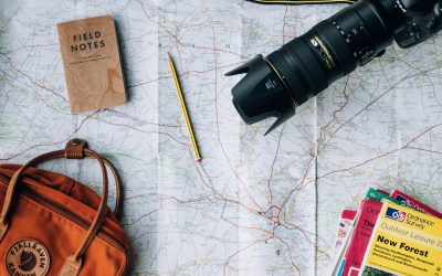
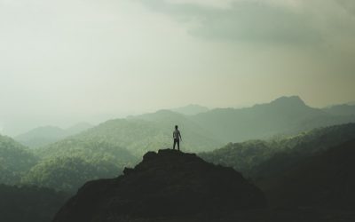
World Geography
Geography is the study of the Earth’s landscapes, environments, and the relationships between people and their surroundings. It encompasses both the physical aspects of the Earth, such as its landforms, bodies of water, and climate, as well as the human aspects, including population distribution, cultures, and economies. World geography is a broad field that seeks to understand the complexities of our planet and how humans interact with it. By studying world geography, we can gain a deeper appreciation for the diversity of our planet and the interconnectedness of its various regions.
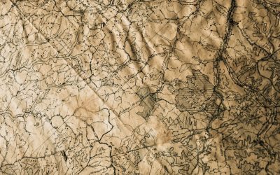
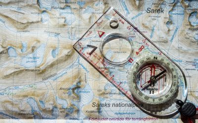
Geography is a multidisciplinary field that draws on elements of physical science, social science, and humanities. It involves the use of maps, spatial analysis, and geographic information systems (GIS) to understand the Earth’s surface and the processes that shape it. World geography also encompasses the study of human geography, which examines the ways in which people and their activities are distributed across the Earth. By understanding world geography, we can better appreciate the environmental, cultural, and economic challenges facing different regions of the world. This knowledge is crucial for addressing global issues such as climate change, resource management, and international development.
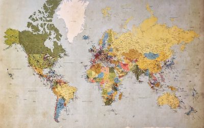
The Five Oceans and Seven Continents
The Earth’s surface is divided into five major oceans: the Pacific, Atlantic, Indian, Southern (or Antarctic), and Arctic Oceans. These vast bodies of water play a crucial role in regulating the Earth’s climate and supporting diverse marine ecosystems. The oceans also serve as important transportation routes and a source of food and other natural resources for human societies around the world.
In addition to the oceans, the Earth’s landmasses are divided into seven continents: Africa, Antarctica, Asia, Europe, North America, Australia (or Oceania), and South America. Each continent has its own unique physical and cultural characteristics, shaped by millions of years of geological processes and human history. From the deserts of Africa to the rainforests of South America, the continents offer a rich tapestry of landscapes and environments for exploration and study.
Major Mountain Ranges and Deserts
The Earth’s surface is also marked by major mountain ranges and deserts that have shaped the planet’s physical and cultural landscapes. The Himalayas, for example, are the highest mountain range in the world and are home to diverse ecosystems and cultures in countries such as India, Nepal, and Bhutan. The Andes in South America, the Rockies in North America, and the Alps in Europe are other prominent mountain ranges that have influenced human settlement patterns and economic activities.
Deserts cover about one-third of the Earth’s land surface and are characterized by low precipitation and extreme temperatures. The Sahara Desert in Africa is the largest hot desert in the world, while the Gobi Desert in Asia is one of the largest cold deserts. Deserts are not only home to unique flora and fauna but have also been important trade routes and cultural crossroads throughout history.
Climate Zones and Biomes
The Earth’s climate is influenced by a variety of factors, including latitude, altitude, ocean currents, and prevailing winds. As a result, the planet is divided into different climate zones, each with its own characteristic weather patterns and ecosystems. The equator, for example, experiences a tropical climate with high temperatures and heavy rainfall, while the polar regions have a cold and dry climate.
These climate zones give rise to different biomes, or large ecological areas characterized by distinct plant and animal communities. The tropical rainforest biome, found near the equator, is home to a diverse array of species and is vital for regulating the Earth’s climate. The grasslands biome, found in regions such as the African savannah and North American prairies, supports grazing animals and has been important for human agriculture throughout history.
Human Geography and Population Distribution
Human geography examines the ways in which people and their activities are distributed across the Earth’s surface. It encompasses topics such as population growth, migration patterns, urbanization, and cultural diversity. Understanding human geography is crucial for addressing global challenges such as poverty, inequality, and environmental degradation.
Population distribution is uneven across the world, with some regions experiencing rapid population growth while others are declining. The majority of the world’s population lives in Asia, particularly in countries such as China and India. Urban areas are also growing rapidly, with more than half of the world’s population now living in cities. This trend has significant implications for infrastructure development, resource management, and social inequality.
Historical and Cultural Geography
Historical geography examines how human activities have shaped the Earth’s landscapes over time. It explores topics such as colonialism, trade routes, and the rise and fall of empires. Cultural geography focuses on how human cultures have developed in different regions of the world and how they interact with their environments.
The Silk Road, for example, was an ancient trade route that connected China with Europe and facilitated the exchange of goods, ideas, and technologies across Eurasia. This historical trade route had a profound impact on the development of cultures and economies along its path. Similarly, cultural geographers study how different societies have adapted to their environments through practices such as agriculture, architecture, and religious beliefs.
The Importance of Geographic Knowledge
Geographic knowledge is crucial for addressing global challenges such as climate change, resource management, and international development. By understanding world geography, we can better appreciate the environmental, cultural, and economic challenges facing different regions of the world. This knowledge is crucial for addressing global issues such as climate change, resource management, and international development.
Geographic knowledge also helps us to understand our interconnectedness with other regions of the world. By studying world geography, we can gain a deeper appreciation for the diversity of our planet and the interconnectedness of its various regions. This understanding can foster a sense of global citizenship and empathy for people from different cultures and backgrounds.
In conclusion, world geography is a complex and multifaceted field that encompasses both physical and human aspects of the Earth’s landscapes. By studying world geography, we can gain a deeper appreciation for the diversity of our planet and the interconnectedness of its various regions. This knowledge is crucial for addressing global challenges such as climate change, resource management, and international development. It also helps us to understand our interconnectedness with other regions of the world and fosters a sense of global citizenship.
FAQs
What is world geography?
World geography is the study of the Earth’s landscapes, environments, and the relationships between people and their environments. It encompasses the physical features of the Earth, as well as the human activity that takes place on it.
Why is world geography important?
World geography is important because it helps us understand the world around us. It provides insights into the physical and human processes that shape our planet, and helps us make informed decisions about how to interact with our environment.
What are the main branches of world geography?
The main branches of world geography include physical geography, which focuses on the Earth’s natural features and processes, and human geography, which examines the relationships between people and their environments.
How does world geography impact our daily lives?
World geography impacts our daily lives in numerous ways, from influencing the weather and climate we experience, to shaping the availability of natural resources and influencing the distribution of populations and cultures around the world.
What are some key concepts in world geography?
Key concepts in world geography include location, place, human-environment interaction, movement, and region. These concepts help geographers understand and interpret the world around them.

History of Benin
The Kingdom of Benin, located in present-day Nigeria, was one of the most powerful and influential states in African history. It existed from the 13th century until the late 19th century and played a significant role in shaping the political, economic, and cultural landscape of West Africa. The kingdom was known for its sophisticated political structure, thriving trade networks, and exceptional artistic achievements. However, it also faced challenges such as conflicts with European powers and the devastating impact of the transatlantic slave trade. Despite these challenges, the legacy of the Kingdom of Benin continues to endure, with efforts being made to preserve its cultural heritage and promote development in modern-day Benin. Summary The Kingdom of Benin was founded in the 13th century and was located in what is now Nigeria. Benin’s monarchy was highly centralized and the Oba held significant political power. Benin’s economy was based on trade, agriculture, and art, with the kingdom producing intricate bronze sculptures. The arrival of Europeans in the 15th century led to conflict and the eventual colonization of Benin. Benin experienced a golden age in the 16th century, with a flourishing of art, culture, and diplomacy. The Kingdom of Benin: Origins and Early History The Kingdom of Benin was founded around the 13th century by the Edo people. According to oral tradition, the first Oba (king) of Benin was Eweka I, who established his rule over the region. The early political structure of Benin was highly centralized, with power concentrated in the hands of the Oba. The Oba was considered a divine ruler and held absolute authority over his subjects. The kingdom was...

Terrain and Topography of Benin: mountains, valleys, and plains.
Benin, located in West Africa, is a country with a diverse and varied terrain. It is bordered by Togo to the west, Nigeria to the east, Burkina Faso to the north, and the Atlantic Ocean to the south. The country’s geography is characterized by mountains, valleys, coastal plains, plateaus, and river basins. Understanding the terrain and topography of Benin is crucial as it plays a significant role in shaping the country’s ecology, economy, and cultural heritage. Summary Benin has a diverse terrain and topography, ranging from mountainous regions to coastal plains and plateaus. The Atakora Mountains are a natural wonder of Benin, with peaks reaching over 6000 feet. Valleys in Benin are low-lying regions of the country, with the Pendjari Valley serving as a haven for wildlife. The coastal plains of Benin are a thriving agricultural region, while the Niger River Basin is a major source of water and agriculture. The Zou Plateau is a hub for economic activities in Benin, showcasing the country’s potential for growth and development. Overview of Benin’s Mountainous Regions Benin is home to several mountainous regions that contribute to its unique landscape. The mountains in Benin are primarily located in the northern part of the country, near the border with Togo. These regions are characterized by rugged terrain, steep slopes, and lush vegetation. The mountainous areas of Benin are important for their ecological significance as they provide habitats for a variety of plant and animal species. They also play a crucial role in the country’s economy, particularly in terms of tourism and agriculture. The Atakora Mountains: A Natural Wonder of Benin One of the...

Climate Zones of Benin: Different Climate Regions Of Benin
Benin, located in West Africa, is a country known for its diverse geography and climate. From the coastal areas to the north, Benin experiences a range of climate zones that have a significant impact on its agriculture and economy. Understanding these climate zones is crucial for farmers and policymakers to make informed decisions about crop selection and agricultural practices. In this article, we will explore the different climate zones in Benin, their characteristics, and the crops grown in each zone. Summary Benin has a diverse range of climate zones, including tropical, subtropical, equatorial, dry, humid, semi-arid, savannah, and coastal. The tropical climate zone is characterized by high temperatures and rainfall, with two distinct rainy seasons. The subtropical climate zone experiences cooler temperatures and less rainfall than the tropical zone, with a single rainy season. The equatorial climate zone has high temperatures and rainfall throughout the year, with no distinct dry season. The dry climate zone is characterized by low rainfall and high temperatures, with a single rainy season. Climate change is expected to have significant impacts on Benin’s climate zones, including increased temperatures, changes in rainfall patterns, and more frequent extreme weather events. The Tropical Climate Zone of Benin The tropical climate zone is characterized by high temperatures and abundant rainfall throughout the year. This climate zone covers a large part of southern Benin, including cities like Cotonou and Porto-Novo. The average temperature in this zone ranges from 25 to 30 degrees Celsius, with high humidity levels. In the tropical climate zone, crops such as bananas, pineapples, cocoa, and palm oil are grown. These crops thrive in the warm...
Political Boundaries of Benin: Provinces, Districts, or Historical Boundaries.
Benin, officially known as the Republic of Benin, is a country located in West Africa. It is bordered by Togo to the west, Nigeria to the east, Burkina Faso and Niger to the north, and the Atlantic Ocean to the south. Understanding the political boundaries of Benin is crucial for various reasons. Firstly, it helps in understanding the country’s governance structure and how power is distributed among different regions. Secondly, it provides insights into the historical and cultural factors that have shaped Benin’s political landscape. Lastly, it helps in analyzing the challenges and opportunities that arise from these boundaries for the country’s future development. Summary Benin’s political boundaries have evolved over time, from pre-colonial era to present day. Colonial era had a significant impact on Benin’s political landscape, with new boundaries and administrative divisions. Benin is currently divided into 12 provinces, each with its own administrative structure. Districts serve as local government structures within provinces, with elected officials and traditional authorities playing a role. Ethnic and regional tensions pose challenges to Benin’s political boundaries, with border disputes having implications for integration or fragmentation. Historical Boundaries of Benin: Pre-colonial Era In the pre-colonial era, Benin was a powerful kingdom with well-defined political boundaries. The kingdom of Benin was located in what is now southern Nigeria and southwestern Benin. It was ruled by a monarch known as the Oba, who held absolute power. The kingdom had a complex administrative system with various levels of political authority. The formation of political boundaries in pre-colonial Benin was influenced by several factors. Firstly, geographical features such as rivers and mountains played a role in...
Natural Resources of Benin: Where Natural Resources are Located in Benin
Natural Resources of Benin: Where Natural Resources are Located in Benin Benin, located in West Africa, is a country known for its rich and diverse natural resources. With a total land area of approximately 112,622 square kilometers, Benin is bordered by Togo to the west, Nigeria to the east, Burkina Faso and Niger to the north, and the Atlantic Ocean to the south. This geographical location provides Benin with a variety of natural resources, including agricultural land, minerals, water bodies, forests, energy sources, marine resources, and wildlife. Summary Benin has a variety of natural resources including agricultural, mineral, water, forest, energy, marine, and wildlife resources. Agriculture is the largest sector of Benin’s economy, with crops such as cotton, maize, and cassava being major exports. Mineral resources in Benin include limestone, marble, and gold, but the sector is largely underdeveloped. Benin has abundant water resources, including the Niger and Mono rivers, but access to clean water remains a challenge. Forest resources in Benin are threatened by deforestation and illegal logging, but efforts are being made to promote sustainable forestry practices. Energy resources in Benin are largely untapped, with the majority of the population relying on traditional biomass for cooking and heating. Benin’s marine resources include fish and shrimp, but overfishing and pollution are major threats to the sector. Wildlife resources in Benin include elephants, hippos, and primates, but poaching and habitat loss are major challenges. Benin’s natural resources have significant potential for tourism, but infrastructure and marketing efforts are needed to fully capitalize on this potential. Challenges facing Benin’s natural resource management include inadequate funding, weak governance, and climate change...
Cultural or Historical Sites of Benin: Important Cultural Landmarks or Historical Sites In Benin
Benin, located in West Africa, is a country with a rich cultural and historical heritage. From its ancient kingdoms to its vibrant traditions, Benin offers a wealth of experiences for those interested in exploring and learning about its past. By visiting the magnificent royal palaces, sacred forests, museums, historical sites, and authentic villages, visitors can gain a deeper understanding of Benin’s history and culture. Summary Benin has a rich cultural and historical heritage that is worth exploring. The royal palaces of Benin offer a glimpse into the kingdom’s past and are magnificent to behold. The sacred forests of Benin are an important part of the country’s traditional beliefs and practices. The Benin National Museum is a treasure trove of artifacts and artworks that showcase the country’s history and culture. The slave route and memorial are important sites that commemorate the tragic history of the transatlantic slave trade. The Magnificent Royal Palaces of Benin The royal palaces of Benin are not only architectural marvels but also hold great significance in the country’s history. These palaces were once the residences of the powerful kings of the Dahomey Kingdom, which ruled over Benin from the 17th to the 19th century. The palaces were not only symbols of power but also centers of administration and cultural activities. One notable palace to visit is the Royal Palace of Abomey, a UNESCO World Heritage Site. This palace complex consists of several interconnected buildings that showcase the grandeur and opulence of the Dahomey Kingdom. Each building has its own unique purpose, such as housing the king’s wives or serving as a place for religious ceremonies. The...

History of Belgium
Belgium, located in Western Europe, has a rich and complex history that spans thousands of years. From its early settlements and Roman invasion to its role in the European Union, understanding Belgium’s history is crucial to understanding its culture, politics, and society. This article will provide a comprehensive overview of Belgium’s history, highlighting key events and their impact on the country. Summary Belgium was settled by various tribes before the Roman invasion in 57 BC. The Flemish cities rose to power under Burgundian rule in the 15th century. The Spanish Habsburgs ruled Belgium during the Eighty Years’ War, leading to a divide between the north and south. The Austrian Netherlands saw the rise of the Enlightenment and the spread of new ideas. The Belgian Revolution in 1830 led to the formation of the Kingdom of Belgium. The Industrial Revolution brought about social and economic changes, leading to the rise of socialism. Belgium was occupied by Germany during World War I and played a key role in World War II, including the Battle of the Bulge. Post-war rebuilding led to the formation of the European Union, with Belgium as a founding member. The Early Settlements and Roman Invasion of Belgium Belgium’s history dates back to prehistoric times, with evidence of human settlements as early as the Paleolithic era. The region was inhabited by various Celtic tribes before the Roman invasion in the 1st century BC. The Romans established several settlements in what is now Belgium, including the city of Tournai. The Roman invasion had a significant impact on Belgium, bringing with it new infrastructure, trade routes, and cultural influences. The...
Population Density of Belize
Population density refers to the number of people living in a specific area, usually measured in terms of persons per square kilometer or square mile. It is an important indicator of how crowded or sparsely populated an area is and can provide insights into various social, economic, and environmental factors. In the case of Belize, a small country located in Central America, population density plays a significant role in shaping its development and sustainability. Belize’s population density is unique due to its small land area and diverse geography. With a total land area of approximately 22,970 square kilometers, Belize is one of the smallest countries in the region. However, despite its size, Belize has a relatively low population density compared to its neighboring countries. This is primarily due to its abundance of natural resources and protected areas, which limit the amount of land available for human settlement. Summary Belize has a relatively low population density compared to other countries in the region. Population density in Belize is calculated by dividing the total population by the land area. Belize’s total population is around 400,000, with a growth rate of 1.9% per year. The majority of Belize’s population lives in urban areas, with only 20% in rural areas. Factors influencing population density in Belize include economic opportunities, infrastructure, and natural resources. How Population Density is Calculated in Belize Population density is calculated by dividing the total population of an area by its land area. In the case of Belize, the formula used to calculate population density is as follows: Population Density = Total Population / Land Area The data sources used...
Terrain and Topography of Belize: mountains, valleys, and plains.
Belize, located on the eastern coast of Central America, is a small country with a diverse and unique terrain. It is bordered by Mexico to the north and Guatemala to the west and south. With an area of approximately 22,970 square kilometers, Belize may be small in size, but it is rich in natural beauty and biodiversity. Understanding Belize’s terrain and topography is crucial for appreciating the country’s diverse ecosystems and the activities it offers. Summary Belize’s terrain and topography is diverse and includes mountain ranges, valleys, coastal plains, barrier reefs, karst landscapes, and lowlands. The Maya and Cockscomb Mountains offer opportunities for hiking and exploring ancient Maya ruins. The Macal and Belize River Valleys are home to lush vegetation and wildlife, and offer activities such as river tubing and kayaking. The coastal plains of Belize are ideal for agriculture and tourism, with popular destinations such as Placencia and Hopkins. The barrier reef and atolls offer world-class snorkeling and diving opportunities, with diverse marine life and underwater caves to explore. The Mountain Ranges of Belize: Exploring the Maya and Cockscomb Mountains Belize is home to two main mountain ranges: the Maya Mountains and the Cockscomb Mountains. The Maya Mountains, located in the southern part of the country, are part of the larger Central American mountain system. They are characterized by rugged peaks, deep valleys, and dense rainforests. The highest peak in Belize, Victoria Peak, can be found in this range. The Cockscomb Mountains, also known as the Jaguar Preserve, are located in southern Belize as well. This protected area is home to a large population of jaguars and other...
Climate Zones of Belize: Different climate regions Of Belize
Belize, a small country located in Central America, is known for its diverse geography and climate. It is bordered by Mexico to the north, Guatemala to the west and south, and the Caribbean Sea to the east. The country’s climate is influenced by its proximity to the equator, the Caribbean Sea, and the surrounding landmasses. Understanding the different climate zones in Belize is important for various reasons, including agriculture, tourism, and conservation efforts. Summary Belize has a diverse range of climate zones, including tropical rainforest, subtropical, tropical monsoon, humid subtropical, arid, semi-arid, highland, and coastal. The tropical rainforest climate in Belize is characterized by high temperatures and rainfall throughout the year, with a wet season from May to November. The subtropical climate in Belize has mild winters and hot summers, with moderate rainfall throughout the year. The tropical monsoon climate in Belize has a distinct wet and dry season, with heavy rainfall from June to November and a dry season from December to May. The impacts of climate change on Belize’s climate zones include rising sea levels, increased frequency and intensity of extreme weather events, and changes in precipitation patterns. Tropical Rainforest Climate in Belize One of the main climate zones in Belize is the tropical rainforest climate. This climate is characterized by high temperatures and abundant rainfall throughout the year. The average temperature in this zone ranges from 24°C to 27°C (75°F to 81°F), with little variation between seasons. The rainfall is evenly distributed throughout the year, with an average annual precipitation of 2,000 to 4,000 millimeters (79 to 157 inches). Regions in Belize that have a tropical...
Political Boundaries of Belize: Provinces, Districts, or Historical Boundaries.
Belize, a small country located in Central America, is known for its stunning natural beauty and rich cultural heritage. However, beneath its picturesque landscapes lies a complex web of political boundaries that have shaped the country’s history and continue to influence its governance. Understanding these political boundaries is crucial for comprehending Belize’s political and economic landscape. Summary Belize is a country with distinct political boundaries that have evolved over time. The country is divided into six provinces, each with its own unique characteristics and governance structure. Within each province, there are multiple districts that play a crucial role in local governance and decision-making. The historical boundaries of Belize have had a significant impact on the country’s modern-day politics and governance. As Belize continues to develop and grow, there are both challenges and opportunities for the future of its political boundaries. Belize’s Provinces: An Overview Belize is divided into six provinces, each with its own unique characteristics and historical background. The provinces are Belize District, Cayo District, Corozal District, Orange Walk District, Stann Creek District, and Toledo District. The Belize District is home to the country’s largest city, Belize City, and serves as the economic and political hub of the country. It has a rich colonial history and was once the capital of British Honduras. Today, it remains an important center for commerce and tourism. Cayo District, located in the western part of Belize, is known for its lush rainforests and Mayan ruins. It is a popular destination for eco-tourism and adventure activities such as hiking and cave exploration. The district also has a significant agricultural sector, with farming and...
Natural Resources of Belize: Where Natural Resources are located In Belize
Natural Resources of Belize: A Treasure of Tropical Wealth Belize is a small country with a rich tapestry of natural resources, from lush forests and fertile agricultural lands to marine resources and mineral deposits. Understanding the natural resources of Belize isn’t just about recognizing what the land provides, but also appreciating the role these resources play in Belize’s economy, culture, and future. This article is worth reading for anyone interested in sustainable development, tourism, and the environment, as it explores how the Ministry of Natural Resources works to protect and manage these assets for present and future generations. What Makes Belize’s Natural Resources So Unique? Belize is located in Central America and boasts a diverse climate and geography, including coastal regions, rainforests, and the famous Belize Barrier Reef. These features contribute to the country’s natural resources and support the biodiversity that makes Belize a global environmental hotspot. How Does the Ministry of Natural Resources Manage Belize Land? The Ministry of Natural Resources undertakes the immense responsibility of managing land and resources in Belize. Through land management initiatives and policies for sustainable development, the ministry works diligently to improve the quality of life for present and future generations of Belizeans. Protection and sustainable use of Belize land is crucial to preventing environmental degradation and promoting economic stability. What Are the Key Forest Resources in Belize? Forests in Belize, particularly in the Maya Mountains, are rich in biodiversity and provide valuable timber resources such as mahogany and logwood. The forest sector is a key contributor to the timber industry in Belize, and responsible forestry practices ensure the sustainable harvesting of...