World Geography
Geography is the study of the Earth’s landscapes, environments, and the relationships between people and their surroundings. It encompasses both the physical aspects of the Earth, such as its landforms, bodies of water, and climate, as well as the human aspects, including population distribution, cultures, and economies. World geography is a broad field that seeks to understand the complexities of our planet and how humans interact with it. By studying world geography, we can gain a deeper appreciation for the diversity of our planet and the interconnectedness of its various regions.
Geography is a multidisciplinary field that draws on elements of physical science, social science, and humanities. It involves the use of maps, spatial analysis, and geographic information systems (GIS) to understand the Earth’s surface and the processes that shape it. World geography also encompasses the study of human geography, which examines the ways in which people and their activities are distributed across the Earth. By understanding world geography, we can better appreciate the environmental, cultural, and economic challenges facing different regions of the world. This knowledge is crucial for addressing global issues such as climate change, resource management, and international development.
The Five Oceans and Seven Continents
The Earth’s surface is divided into five major oceans: the Pacific, Atlantic, Indian, Southern (or Antarctic), and Arctic Oceans. These vast bodies of water play a crucial role in regulating the Earth’s climate and supporting diverse marine ecosystems. The oceans also serve as important transportation routes and a source of food and other natural resources for human societies around the world.
In addition to the oceans, the Earth’s landmasses are divided into seven continents: Africa, Antarctica, Asia, Europe, North America, Australia (or Oceania), and South America. Each continent has its own unique physical and cultural characteristics, shaped by millions of years of geological processes and human history. From the deserts of Africa to the rainforests of South America, the continents offer a rich tapestry of landscapes and environments for exploration and study.
Major Mountain Ranges and Deserts
The Earth’s surface is also marked by major mountain ranges and deserts that have shaped the planet’s physical and cultural landscapes. The Himalayas, for example, are the highest mountain range in the world and are home to diverse ecosystems and cultures in countries such as India, Nepal, and Bhutan. The Andes in South America, the Rockies in North America, and the Alps in Europe are other prominent mountain ranges that have influenced human settlement patterns and economic activities.
Deserts cover about one-third of the Earth’s land surface and are characterized by low precipitation and extreme temperatures. The Sahara Desert in Africa is the largest hot desert in the world, while the Gobi Desert in Asia is one of the largest cold deserts. Deserts are not only home to unique flora and fauna but have also been important trade routes and cultural crossroads throughout history.
Climate Zones and Biomes
The Earth’s climate is influenced by a variety of factors, including latitude, altitude, ocean currents, and prevailing winds. As a result, the planet is divided into different climate zones, each with its own characteristic weather patterns and ecosystems. The equator, for example, experiences a tropical climate with high temperatures and heavy rainfall, while the polar regions have a cold and dry climate.
These climate zones give rise to different biomes, or large ecological areas characterized by distinct plant and animal communities. The tropical rainforest biome, found near the equator, is home to a diverse array of species and is vital for regulating the Earth’s climate. The grasslands biome, found in regions such as the African savannah and North American prairies, supports grazing animals and has been important for human agriculture throughout history.
Human Geography and Population Distribution
Human geography examines the ways in which people and their activities are distributed across the Earth’s surface. It encompasses topics such as population growth, migration patterns, urbanization, and cultural diversity. Understanding human geography is crucial for addressing global challenges such as poverty, inequality, and environmental degradation.
Population distribution is uneven across the world, with some regions experiencing rapid population growth while others are declining. The majority of the world’s population lives in Asia, particularly in countries such as China and India. Urban areas are also growing rapidly, with more than half of the world’s population now living in cities. This trend has significant implications for infrastructure development, resource management, and social inequality.
Historical and Cultural Geography
Historical geography examines how human activities have shaped the Earth’s landscapes over time. It explores topics such as colonialism, trade routes, and the rise and fall of empires. Cultural geography focuses on how human cultures have developed in different regions of the world and how they interact with their environments.
The Silk Road, for example, was an ancient trade route that connected China with Europe and facilitated the exchange of goods, ideas, and technologies across Eurasia. This historical trade route had a profound impact on the development of cultures and economies along its path. Similarly, cultural geographers study how different societies have adapted to their environments through practices such as agriculture, architecture, and religious beliefs.
The Importance of Geographic Knowledge
Geographic knowledge is crucial for addressing global challenges such as climate change, resource management, and international development. By understanding world geography, we can better appreciate the environmental, cultural, and economic challenges facing different regions of the world. This knowledge is crucial for addressing global issues such as climate change, resource management, and international development.
Geographic knowledge also helps us to understand our interconnectedness with other regions of the world. By studying world geography, we can gain a deeper appreciation for the diversity of our planet and the interconnectedness of its various regions. This understanding can foster a sense of global citizenship and empathy for people from different cultures and backgrounds.
In conclusion, world geography is a complex and multifaceted field that encompasses both physical and human aspects of the Earth’s landscapes. By studying world geography, we can gain a deeper appreciation for the diversity of our planet and the interconnectedness of its various regions. This knowledge is crucial for addressing global challenges such as climate change, resource management, and international development. It also helps us to understand our interconnectedness with other regions of the world and fosters a sense of global citizenship.
FAQs
What is world geography?
World geography is the study of the Earth’s landscapes, environments, and the relationships between people and their environments. It encompasses the physical features of the Earth, as well as the human activity that takes place on it.
Why is world geography important?
World geography is important because it helps us understand the world around us. It provides insights into the physical and human processes that shape our planet, and helps us make informed decisions about how to interact with our environment.
What are the main branches of world geography?
The main branches of world geography include physical geography, which focuses on the Earth’s natural features and processes, and human geography, which examines the relationships between people and their environments.
How does world geography impact our daily lives?
World geography impacts our daily lives in numerous ways, from influencing the weather and climate we experience, to shaping the availability of natural resources and influencing the distribution of populations and cultures around the world.
What are some key concepts in world geography?
Key concepts in world geography include location, place, human-environment interaction, movement, and region. These concepts help geographers understand and interpret the world around them.

Terrain and Topography of Cyprus: mountains, valleys, and plains.
Cyprus, the third largest island in the Mediterranean, is known for its stunning landscapes and diverse terrain. From mountains to plains, and from coastlines to forests, Cyprus offers a wide range of natural wonders to explore. Understanding the geography of a destination is crucial for travellers, as it allows them to plan their activities and make the most of their time. In this article, we will take a closer look at the different regions of Cyprus and highlight their unique features and importance. Summary Cyprus has a diverse terrain and topography, ranging from mountains to plains and peninsulas. The Troodos Mountains are a natural wonder, with stunning landscapes and unique flora and fauna. The Kyrenia Range is a coastal gem, offering breathtaking views of the Mediterranean Sea. The Mesaoria Plain is the breadbasket of Cyprus, with fertile soil and a rich agricultural history. The Akamas Peninsula is a wilderness paradise, home to rare species and untouched natural beauty. The Troodos Mountains: A Natural Wonder The Troodos Mountains, located in the central part of Cyprus, are a true natural wonder. This mountain range is home to the highest peak on the island, Mount Olympus, which stands at an impressive 1,952 meters. The Troodos Mountains are known for their rugged beauty, with deep valleys, dense forests, and picturesque villages scattered throughout. One of the highlights of the Troodos Mountains is the network of hiking trails that crisscross the region. These trails offer breathtaking views of the surrounding landscape and allow visitors to explore the diverse flora and fauna of the area. In addition to hiking, the Troodos Mountains are also a...

Climate Zones Of Cyprus: Different climate regions Of Cyprus
Cyprus, the third largest island in the Mediterranean, is known for its diverse climate zones. Understanding these climate zones is crucial for various industries such as tourism and agriculture. With its strategic location between Europe, Asia, and Africa, Cyprus experiences a range of climates, from Mediterranean to desert. Each climate zone has its own unique characteristics and influences the daily lives of the people living there. Summary Cyprus has a diverse range of climate zones, including Mediterranean, semi-arid, subtropical, alpine, coastal, mountainous, and desert. The Mediterranean climate region is the most common in Cyprus, with hot, dry summers and mild, wet winters. The semi-arid climate region is characterized by hot, dry summers and cool, wet winters, and is found in the central and eastern parts of the island. The subtropical climate region is found in the southern coastal areas of Cyprus, with hot, humid summers and mild winters. The alpine climate region is found in the Troodos Mountains, with cold, snowy winters and mild summers. Understanding the climate zones of Cyprus is important for tourism and agriculture, as different regions are suited to different crops and activities. Factors affecting the climate zones of Cyprus include latitude, altitude, proximity to the sea, and prevailing winds. The coastal climate region is influenced by sea breezes and has milder temperatures than inland regions. The mountainous climate region is cooler and wetter than other regions, with snowfall in winter. The desert climate region is found in the eastern part of the island and is characterized by hot, dry conditions. Mediterranean Climate Region of Cyprus The Mediterranean climate zone is the most dominant in...

Political Boundaries of Cyprus: Provinces, Districts, or Historical Boundaries.
Political boundaries are the lines that separate different political entities, such as countries, states, provinces, or districts. These boundaries define the jurisdictional authority of a particular government and determine the extent of its control over a specific territory. In the case of Cyprus, an island country located in the Eastern Mediterranean, its political boundaries have been a subject of contention and dispute for many years. Cyprus is a divided island with a complex political history. The island has been inhabited for thousands of years and has been under the control of various empires and civilizations, including the Greeks, Romans, Byzantines, and Ottomans. In 1878, Cyprus was placed under British administration as a result of the Congress of Berlin. It remained a British colony until it gained independence in 1960. Summary Cyprus has a complex political boundary system, with provinces, districts, and municipalities. The island has a long history of political division, with conflicts between Greek and Turkish Cypriots. There are six provinces in Cyprus, each with its own distinct characteristics and economic strengths. The districts of Cyprus are further divided into municipalities, which play an important role in local governance. The political boundaries of Cyprus have changed significantly over time, with the most recent division occurring in 1974. Historical Background of Cyprus’ Political Boundaries Cyprus has a long and complex history that has shaped its political boundaries over time. The island has been inhabited since prehistoric times and has been under the control of various empires and civilizations throughout its history. The Greeks, Romans, Byzantines, and Ottomans have all ruled over Cyprus at different points in time. The colonization...

Natural Resources of Cyprus: Where Natural Resources are located In Cyprus
Cyprus, located in the eastern Mediterranean Sea, is a beautiful island known for its rich natural resources. The island’s geography is diverse, with mountains, plains, and a stunning coastline. The climate is Mediterranean, characterized by hot, dry summers and mild, wet winters. These natural features have contributed to the abundance of resources found in Cyprus. Natural resources play a crucial role in the economy and society of Cyprus. They provide employment opportunities, contribute to economic growth, and support various industries. Additionally, these resources are essential for meeting the energy needs of the island’s population. Cyprus has a long history of utilizing its natural resources, and their sustainable management is vital for the future development of the country. Summary Cyprus has a variety of natural resources including mineral deposits, natural gas reserves, agricultural resources, water resources, forests and woodlands, wildlife and biodiversity, renewable energy sources, coastal and marine resources. Copper and iron are the main mineral deposits found in Cyprus, with copper being the island’s most important export. Cyprus has significant natural gas reserves in its exclusive economic zone, which are expected to contribute to the country’s energy security and economic growth. Agriculture is an important sector in Cyprus, with citrus fruits, potatoes, and grapes being the main crops grown on the island. Cyprus faces water scarcity issues, with the majority of its water resources coming from underground aquifers. The government is implementing measures to promote sustainable water management practices. Cyprus’ forests and woodlands cover around 17% of the island’s land area and are home to a variety of plant and animal species. Cyprus has a rich biodiversity, with over...

Cultural or Historical Sites of Cyprus: Important Cultural Landmarks or Historical Sites in Cyprus
Cyprus is an island with a rich history and cultural heritage that dates back thousands of years. Located in the eastern Mediterranean, it has been influenced by various civilizations throughout its history, including the Greeks, Romans, Byzantines, and Ottomans. The island is home to numerous historical sites that provide a glimpse into its past and help us understand the development of Cypriot society over the centuries. Historical sites are crucial in understanding Cyprus’ past because they offer tangible evidence of the people who lived there and the societies they built. These sites provide insights into their daily lives, beliefs, and cultural practices. By exploring these ancient ruins, visitors can gain a deeper appreciation for Cyprus’ rich history and cultural heritage. Summary Kourion offers a glimpse into Cyprus’ ancient past with its impressive ruins and mosaics. The Tombs of the Kings in Paphos are a fascinating archaeological site with underground tombs and intricate carvings. Kyrenia Castle is a medieval fortress with a rich history, offering stunning views of the coast. Hala Sultan Tekke is a significant Islamic shrine in Larnaca, attracting visitors from all over the world. St. Hilarion Castle is a picturesque ruin with a fascinating history, said to have inspired the castle in Disney’s Snow White. The Ancient City of Kourion: A Glimpse into Cyprus’ Rich History The ancient city of Kourion is located on the southwestern coast of Cyprus, near the modern city of Limassol. It was one of the most important city-kingdoms in Cyprus during the Hellenistic and Roman periods. The city was inhabited from the 13th century BC until it was destroyed by an earthquake...

Population Density of Cyprus
Population density refers to the number of people living in a specific area, usually measured per square kilometer. It is an important indicator of how crowded or sparsely populated an area is, and it can have significant implications for various aspects of society, including infrastructure, resources, and social services. In this blog post, we will explore the population density in Cyprus, examining how the population is distributed across the island, the factors that influence population density, and the impact of immigration on population density. We will also discuss the relationship between population density and economic development, compare Cyprus’ population density with other European countries, and look at future projections and the challenges and opportunities of managing population density in Cyprus. Summary Cyprus has a population density of 131 people per square kilometre. The majority of the population is concentrated in the southern coastal areas of the island. Factors affecting population density include economic opportunities, climate, and infrastructure. Urban areas have a higher population density than rural areas. Nicosia, Limassol, and Larnaca are the major cities with the highest population density. Overview of Population Density in Cyprus Population density in Cyprus is defined as the number of people per square kilometer. As of 2021, the current population density in Cyprus is approximately 130 people per square kilometer. This places Cyprus in the middle range compared to other European countries. For example, countries like Belgium and the Netherlands have much higher population densities, while countries like Sweden and Finland have lower population densities. Population Distribution Across Cyprus The population in Cyprus is not evenly distributed across the island. The majority of...

History of Cyprus
Cyprus, an island located in the eastern Mediterranean Sea, has a rich history and cultural heritage that dates back thousands of years. From ancient civilizations to modern times, Cyprus has been influenced by various cultures and empires, leaving behind a legacy that is still evident today. This article will provide a comprehensive overview of Cyprus’ history, from its ancient beginnings to its current status as a member of the European Union. Summary Cyprus has a rich history dating back to Mycenaean settlements and Persian rule. Alexander the Great and the Ptolemaic Dynasty played a significant role in the Hellenistic period of Cyprus. Christianity and Arab invasions marked the Roman and Byzantine era of Cyprus. The Crusades and the Lusignan Dynasty brought Latin rule to Cyprus. Ottoman Cyprus saw conquest and eventual British occupation. Cyprus in Ancient Times: From Mycenaean Settlements to Persian Rule The history of Cyprus can be traced back to the Bronze Age, when the island was settled by Mycenaean Greeks. These early settlers established thriving city-kingdoms and engaged in trade with other Mediterranean civilizations. However, in the 6th century BC, Cyprus came under Persian rule and became part of the Achaemenid Empire. During this time, the island experienced significant cultural and economic development, with Persian influence shaping its art, architecture, and trade networks. The Hellenistic Period: Alexander the Great and the Ptolemaic Dynasty In 333 BC, Alexander the Great conquered Cyprus and incorporated it into his vast empire. The island became part of the Hellenistic world and experienced a period of Greek cultural influence. After Alexander’s death, Cyprus came under the control of the Ptolemaic dynasty,...
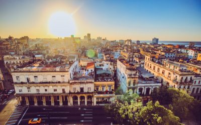
Climate Zones Of Cuba: Different climate regions Of Cuba
Cuba, the largest island in the Caribbean, is known for its diverse geography and climate. The country is located in the tropical region, which means it experiences warm temperatures throughout the year. However, due to its size and topography, Cuba is home to several distinct climate zones. Understanding these climate zones is crucial for various reasons, including agriculture and tourism. Summary Cuba has a diverse range of climate zones due to its location in the Caribbean. The tropical climate zone is the most prevalent in Cuba, with high temperatures and humidity year-round. The subtropical climate zone is characterized by mild winters and hot summers, with occasional hurricanes. The semi-arid climate zone experiences low rainfall and high temperatures, making it difficult for agriculture. The mountainous climate zone has cooler temperatures and higher rainfall, making it ideal for coffee and tobacco production. The coastal climate zone is influenced by sea breezes and has high humidity, while the rainforest climate zone is characterized by heavy rainfall. The seasonal climate zone experiences distinct wet and dry seasons, with hurricanes possible during the wet season. Cuba’s microclimates vary within each climate zone, affecting local agriculture and tourism. The impact of climate zones on Cuba’s agriculture and tourism is significant, with some areas more suitable for certain crops and activities than others. Tropical Climate Zone of Cuba The tropical climate zone is the most dominant in Cuba, covering a significant portion of the island. This zone is characterized by high temperatures and humidity throughout the year. The average temperature in this zone ranges from 24 to 27 degrees Celsius (75 to 81 degrees Fahrenheit). The...
Natural Resources of Cuba: Where Natural Resources are located In Cuba
Cuba is a country rich in natural resources, from its mineral deposits to its vast forests and agricultural lands. These resources play a crucial role in the country’s economy and provide opportunities for sustainable development. However, it is important to manage these resources in a sustainable manner to ensure their long-term availability and to minimize negative environmental impacts. This article will provide an overview of Cuba’s natural resources, their importance to the economy, and the need for sustainable resource management. Summary Cuba has a diverse range of natural resources, including minerals, forests, agriculture, marine life, renewable energy, water, and biodiversity. The country’s mineral deposits are concentrated in the eastern region, with nickel being the most significant resource. Cuba’s forests cover over 25% of the country and provide valuable timber resources, including mahogany and cedar. Agriculture is a vital sector in Cuba, with fertile lands producing crops such as sugar, tobacco, and coffee. Cuba’s coastal waters are rich in marine life, including fish, lobster, and shrimp, making it an important industry for the country. Overview of Cuba’s Natural Resources Cuba is located in the Caribbean Sea, with a tropical climate that supports a diverse range of natural resources. The country is blessed with an abundance of natural resources, including minerals, forests, agricultural lands, coastal waters, renewable energy sources, water resources, biodiversity, and wildlife. The geographical location and climate of Cuba contribute to its natural resource endowment. The country’s tropical climate provides favorable conditions for the growth of forests and agricultural crops. Additionally, Cuba’s location in the Caribbean Sea makes it rich in marine resources. These natural resources are of great...
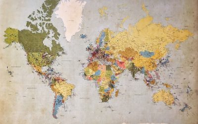
Political Boundaries of Cuba: Provinces, Districts, or Historical Boundaries.
Cuba is a country located in the Caribbean, known for its rich history, vibrant culture, and unique political system. Understanding Cuba’s political boundaries is crucial for anyone interested in studying or visiting the country. The political system in Cuba is a socialist republic, with the Communist Party of Cuba being the only legal political party. The President of Cuba is both the head of state and the head of government, and the National Assembly of People’s Power is the highest legislative body. Understanding political boundaries is important because it helps to provide context and insight into how a country is governed and organized. It allows us to understand the different levels of government and how they interact with each other. Additionally, understanding political boundaries can help us understand the cultural and social differences that exist within a country. Summary Cuba is divided into 15 provinces and one special municipality. Each province is further divided into municipalities and districts. The political boundaries of Cuba have evolved over time, reflecting changes in government and society. Provincial governments in Cuba play a significant role in local administration and economic development. Municipalities in Cuba have their own elected officials and are responsible for providing basic services to their communities. Provinces of Cuba: History and Overview Cuba is divided into 15 provinces and one special municipality, which is the Isle of Youth. The provinces have a long history that dates back to the colonial period when Cuba was under Spanish rule. The provinces were originally established as administrative divisions by the Spanish colonial government. Each province in Cuba has its own unique characteristics and...
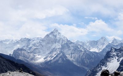
Terrain and Topography of Cuba: mountains, valleys, and plains.
Cuba, the largest island in the Caribbean, is known for its stunning landscapes and diverse terrain. From its mountain ranges to its valleys, plains, coastlines, and unique karst formations, Cuba offers a wealth of natural beauty to explore. Understanding Cuba’s terrain is essential for appreciating its ecological significance, historical importance, and the impact it has on the country’s climate and ecosystems. Cuba’s geography is characterized by a mix of mountains, valleys, plains, and coastal regions. The island is located in the Caribbean Sea, south of the United States and east of Mexico. It stretches over 1,200 kilometers from east to west and covers an area of approximately 110,860 square kilometers. The diverse terrain of Cuba is a result of its geological history, which includes volcanic activity, tectonic movements, and erosion. Understanding Cuba’s terrain is important for several reasons. Firstly, it allows us to appreciate the country’s natural beauty and biodiversity. Cuba is home to a wide range of ecosystems, including forests, wetlands, mangroves, and coral reefs. Each of these ecosystems is influenced by the specific characteristics of the terrain in which they are found. Secondly, understanding Cuba’s terrain helps us understand its history and cultural significance. Many of Cuba’s mountains and valleys have played important roles in historical events and revolutions. By exploring these landscapes, we can gain a deeper understanding of Cuba’s past and its people. Summary Cuba’s terrain and topography is diverse and unique, featuring mountain ranges, valleys, plains, coastal regions, and karst landscapes. The Sierra Maestra and Sierra del Rosario mountain ranges offer stunning views and historical significance. The Viñales and Yumuri valleys are picturesque and...

History of Cuba
Cuba, a Caribbean island nation located just south of the United States, has a rich and complex history that spans centuries. From its indigenous peoples to its colonization by the Spanish, and from its involvement in the transatlantic slave trade to its struggle for independence, Cuba’s past is filled with significant events and influential figures. Understanding Cuba’s history is crucial for comprehending the country’s present challenges and the legacy of its revolutionary past. Summary Indigenous peoples inhabited Cuba before the arrival of Columbus. Spanish colonialism brought conquest and exploitation to Cuba. Cuba played a significant role in the transatlantic slave trade due to the sugar trade. The Ten Years’ War was Cuba’s first attempt at gaining independence from Spain. The Spanish-American War led to the United States’ intervention in Cuba and eventual control over the country. Pre-Columbian era: The indigenous peoples of Cuba Before the arrival of Christopher Columbus in 1492, Cuba was inhabited by indigenous peoples known as the Taíno. The Taíno were part of the larger Arawak-speaking indigenous groups that populated the Caribbean islands. They lived in small villages and practiced agriculture, growing crops such as maize, yucca, and sweet potatoes. The Taíno also had a complex social structure, with chiefs ruling over different territories. The arrival of European colonizers had a devastating impact on the indigenous populations of Cuba. The Spanish brought diseases such as smallpox, measles, and influenza, to which the Taíno had no immunity. This led to a significant decline in their numbers, with many dying from these diseases or being killed by the Spanish in their quest for gold and other resources. By...