World Geography
Geography is the study of the Earth’s landscapes, environments, and the relationships between people and their surroundings. It encompasses both the physical aspects of the Earth, such as its landforms, bodies of water, and climate, as well as the human aspects, including population distribution, cultures, and economies. World geography is a broad field that seeks to understand the complexities of our planet and how humans interact with it. By studying world geography, we can gain a deeper appreciation for the diversity of our planet and the interconnectedness of its various regions.
Geography is a multidisciplinary field that draws on elements of physical science, social science, and humanities. It involves the use of maps, spatial analysis, and geographic information systems (GIS) to understand the Earth’s surface and the processes that shape it. World geography also encompasses the study of human geography, which examines the ways in which people and their activities are distributed across the Earth. By understanding world geography, we can better appreciate the environmental, cultural, and economic challenges facing different regions of the world. This knowledge is crucial for addressing global issues such as climate change, resource management, and international development.
The Five Oceans and Seven Continents
The Earth’s surface is divided into five major oceans: the Pacific, Atlantic, Indian, Southern (or Antarctic), and Arctic Oceans. These vast bodies of water play a crucial role in regulating the Earth’s climate and supporting diverse marine ecosystems. The oceans also serve as important transportation routes and a source of food and other natural resources for human societies around the world.
In addition to the oceans, the Earth’s landmasses are divided into seven continents: Africa, Antarctica, Asia, Europe, North America, Australia (or Oceania), and South America. Each continent has its own unique physical and cultural characteristics, shaped by millions of years of geological processes and human history. From the deserts of Africa to the rainforests of South America, the continents offer a rich tapestry of landscapes and environments for exploration and study.
Major Mountain Ranges and Deserts
The Earth’s surface is also marked by major mountain ranges and deserts that have shaped the planet’s physical and cultural landscapes. The Himalayas, for example, are the highest mountain range in the world and are home to diverse ecosystems and cultures in countries such as India, Nepal, and Bhutan. The Andes in South America, the Rockies in North America, and the Alps in Europe are other prominent mountain ranges that have influenced human settlement patterns and economic activities.
Deserts cover about one-third of the Earth’s land surface and are characterized by low precipitation and extreme temperatures. The Sahara Desert in Africa is the largest hot desert in the world, while the Gobi Desert in Asia is one of the largest cold deserts. Deserts are not only home to unique flora and fauna but have also been important trade routes and cultural crossroads throughout history.
Climate Zones and Biomes
The Earth’s climate is influenced by a variety of factors, including latitude, altitude, ocean currents, and prevailing winds. As a result, the planet is divided into different climate zones, each with its own characteristic weather patterns and ecosystems. The equator, for example, experiences a tropical climate with high temperatures and heavy rainfall, while the polar regions have a cold and dry climate.
These climate zones give rise to different biomes, or large ecological areas characterized by distinct plant and animal communities. The tropical rainforest biome, found near the equator, is home to a diverse array of species and is vital for regulating the Earth’s climate. The grasslands biome, found in regions such as the African savannah and North American prairies, supports grazing animals and has been important for human agriculture throughout history.
Human Geography and Population Distribution
Human geography examines the ways in which people and their activities are distributed across the Earth’s surface. It encompasses topics such as population growth, migration patterns, urbanization, and cultural diversity. Understanding human geography is crucial for addressing global challenges such as poverty, inequality, and environmental degradation.
Population distribution is uneven across the world, with some regions experiencing rapid population growth while others are declining. The majority of the world’s population lives in Asia, particularly in countries such as China and India. Urban areas are also growing rapidly, with more than half of the world’s population now living in cities. This trend has significant implications for infrastructure development, resource management, and social inequality.
Historical and Cultural Geography
Historical geography examines how human activities have shaped the Earth’s landscapes over time. It explores topics such as colonialism, trade routes, and the rise and fall of empires. Cultural geography focuses on how human cultures have developed in different regions of the world and how they interact with their environments.
The Silk Road, for example, was an ancient trade route that connected China with Europe and facilitated the exchange of goods, ideas, and technologies across Eurasia. This historical trade route had a profound impact on the development of cultures and economies along its path. Similarly, cultural geographers study how different societies have adapted to their environments through practices such as agriculture, architecture, and religious beliefs.
The Importance of Geographic Knowledge
Geographic knowledge is crucial for addressing global challenges such as climate change, resource management, and international development. By understanding world geography, we can better appreciate the environmental, cultural, and economic challenges facing different regions of the world. This knowledge is crucial for addressing global issues such as climate change, resource management, and international development.
Geographic knowledge also helps us to understand our interconnectedness with other regions of the world. By studying world geography, we can gain a deeper appreciation for the diversity of our planet and the interconnectedness of its various regions. This understanding can foster a sense of global citizenship and empathy for people from different cultures and backgrounds.
In conclusion, world geography is a complex and multifaceted field that encompasses both physical and human aspects of the Earth’s landscapes. By studying world geography, we can gain a deeper appreciation for the diversity of our planet and the interconnectedness of its various regions. This knowledge is crucial for addressing global challenges such as climate change, resource management, and international development. It also helps us to understand our interconnectedness with other regions of the world and fosters a sense of global citizenship.
FAQs
What is world geography?
World geography is the study of the Earth’s landscapes, environments, and the relationships between people and their environments. It encompasses the physical features of the Earth, as well as the human activity that takes place on it.
Why is world geography important?
World geography is important because it helps us understand the world around us. It provides insights into the physical and human processes that shape our planet, and helps us make informed decisions about how to interact with our environment.
What are the main branches of world geography?
The main branches of world geography include physical geography, which focuses on the Earth’s natural features and processes, and human geography, which examines the relationships between people and their environments.
How does world geography impact our daily lives?
World geography impacts our daily lives in numerous ways, from influencing the weather and climate we experience, to shaping the availability of natural resources and influencing the distribution of populations and cultures around the world.
What are some key concepts in world geography?
Key concepts in world geography include location, place, human-environment interaction, movement, and region. These concepts help geographers understand and interpret the world around them.

Climate Zones of Comoros: Different climate regions Of Comoros
Comoros, a small archipelago located off the eastern coast of Africa in the Indian Ocean, is known for its diverse geography and unique climate zones. The country consists of four main islands – Grande Comore, Mohéli, Anjouan, and Mayotte – each with its own distinct climate characteristics. Understanding these climate zones is crucial for both agriculture and tourism, as they play a significant role in determining what crops can be grown and what attractions can be enjoyed. Summary Comoros has a diverse range of climate zones, including tropical wet, semi-arid, subtropical, and mountainous. The coastal regions experience a tropical wet climate, with high humidity and rainfall throughout the year. The central plateau has a semi-arid climate, with hot temperatures and limited rainfall. The highlands have a subtropical climate, with cooler temperatures and more rainfall than the coastal regions. The volcanic islands have a mountainous climate, with cooler temperatures and higher rainfall due to their elevation. Understanding the Different Climate Regions of Comoros Comoros can be divided into four main climate regions: the tropical wet climate of the coastal regions, the semi-arid climate of the central plateau, the subtropical climate of the highlands, and the mountainous climate of the volcanic islands. These regions are influenced by various factors such as altitude, proximity to the ocean, and topography. The Tropical Wet Climate of the Coastal Regions The coastal regions of Comoros experience a tropical wet climate characterized by high temperatures and abundant rainfall throughout the year. The average annual rainfall in these areas ranges from 1,500 to 3,000 millimeters. This climate is ideal for the growth of lush vegetation and supports...

Natural Resources of Comoros: Where Natural Resources are located In Comoros
Comoros, officially known as the Union of the Comoros, is a small archipelago located in the Indian Ocean off the eastern coast of Africa. It consists of three main islands – Grande Comore, Mohéli, and Anjouan – as well as numerous smaller islands. The country is known for its rich natural resources, which include agricultural land, mineral deposits, marine resources, forests, water sources, renewable energy potential, and unique wildlife. Summary Comoros is a small island nation with a variety of natural resources. Agriculture is the mainstay of the economy, with crops like vanilla, cloves, and ylang-ylang being major exports. Mineral resources in Comoros include deposits of rare earth metals, gold, and copper. The marine resources of Comoros are abundant, with fish and seafood being important sources of food and income. Forests in Comoros are under threat from deforestation, but efforts are being made to protect them and promote sustainable use. Agricultural Resources of Comoros Agriculture plays a vital role in the economy of Comoros, employing a significant portion of the population and contributing to food security and export earnings. The main crops grown in Comoros include vanilla, cloves, ylang-ylang, coconuts, bananas, and cassava. These crops have significant economic importance for the country, with vanilla and cloves being major export commodities. However, the agricultural sector in Comoros faces several challenges. Limited access to modern farming techniques and technologies hinders productivity and efficiency. The lack of infrastructure, such as irrigation systems and storage facilities, also poses challenges to farmers. Additionally, climate change and unpredictable weather patterns affect crop yields and increase the vulnerability of farmers to natural disasters. Mineral Resources in...

History of Comoros
The Comoros Islands, officially known as the Union of the Comoros, is an archipelago located in the Indian Ocean off the eastern coast of Africa. It is comprised of four main islands: Grande Comore, Mohéli, Anjouan, and Mayotte. The islands are known for their stunning natural beauty, with lush forests, volcanic landscapes, and pristine beaches. The population of the Comoros is estimated to be around 850,000 people. The official languages spoken are Comorian, French, and Arabic. Comorian is a Bantu language with influences from Arabic and French. The majority of the population is Sunni Muslim. The history of the Comoros dates back to ancient times, with evidence of human settlement on the islands as early as the 6th century. Arab traders began arriving in the 10th century and had a significant influence on the islands’ culture and religion. The islands were later colonized by European powers, including the Portuguese and the French. Summary The Comoros Islands have a rich history of early settlement and colonization by Arab traders, Portuguese explorers, and French colonizers. The struggle for independence and formation of the Union of the Comoros was marked by political turmoil and coups in the post-independence era. Economic development and challenges in the 21st century have been a major concern for the Comoros, with a focus on improving infrastructure and attracting foreign investment. Comorian culture and traditions are deeply rooted in Islamic beliefs and practices, with a strong emphasis on family and community values. Environmental issues and conservation efforts are also a key concern for the Comoros, with efforts to protect the islands’ unique biodiversity and natural resources. Early Settlement...

Cultural or Historical Sites of Comoros: Important Cultural Landmarks or Historical Sites In Comoros
Comoros, officially known as the Union of the Comoros, is a small island nation located off the eastern coast of Africa in the Indian Ocean. Comprising of three main islands – Grande Comore, Mohéli, and Anjouan – as well as several smaller islands, Comoros is known for its rich cultural and historical heritage. The country has a diverse population with influences from African, Arab, and French cultures, making it a unique and vibrant destination. Preserving cultural and historical sites is of utmost importance in order to maintain the identity and heritage of a nation. These sites serve as a window into the past, allowing us to understand and appreciate the traditions, customs, and achievements of our ancestors. They also play a crucial role in attracting tourists and promoting sustainable tourism, which can contribute to the economic development of the country. By preserving these sites, we ensure that future generations can learn from and be inspired by the history and culture of their homeland. Summary Comoros is an island nation with a rich cultural and historical heritage. The Grand Mosque of Moroni is an iconic religious and architectural marvel. Mutsamudu Old Town is a living museum of Swahili culture and architecture. Mount Karthala is a sacred volcano with historical and cultural significance. The Coelacanth is a prehistoric fish species with cultural and scientific importance. The Iconic Grand Mosque of Moroni: A Religious and Architectural Marvel The Grand Mosque of Moroni is one of the most iconic landmarks in Comoros. Located in the capital city of Moroni on the island of Grande Comore, this mosque holds great religious and architectural significance....

Population Density of Comoros
Comoros is a small archipelago located off the eastern coast of Africa, in the Indian Ocean. It consists of three main islands – Grande Comore, Mohéli, and Anjouan – as well as several smaller islands. With a total land area of just 2,235 square kilometers, Comoros is one of the smallest countries in Africa. Despite its small size, Comoros has a rich cultural heritage and is known for its beautiful beaches and diverse marine life. Population density refers to the number of people living in a given area, usually measured per square kilometer. It is an important indicator of a country’s demographics and can provide insights into various aspects of its society, economy, and environment. In the case of Comoros, understanding its population density is crucial for assessing the challenges and opportunities that the country faces in terms of sustainable development. Summary Comoros is a small island nation with a high population density of over 400 people per square kilometer. Population density is an important measure of the number of people living in a given area and can impact economic and social development. Factors affecting population density in Comoros include limited land availability, high fertility rates, and urbanization. Historical trends show a steady increase in population density in Comoros, with the highest density in urban areas. The current population density in Comoros is a challenge for sustainable development, with implications for the environment and economy. Understanding Population Density and its Importance Population density is a measure of how crowded or sparsely populated an area is. It is calculated by dividing the total population of an area by its land...

Population Density of Comoros
Comoros is a small archipelago located off the eastern coast of Africa, in the Indian Ocean. It consists of four main islands: Grande Comore, Mohéli, Anjouan, and Mayotte. The country has a rich history and culture, with influences from African, Arab, and French traditions. Comoros gained independence from France in 1975 and has since faced various challenges, including political instability and economic struggles. Summary Comoros is a small island nation located in the Indian Ocean. Population density is the number of people living in a specific area, usually measured in persons per square kilometer. Comoros has a population density of 467 people per square kilometer, making it one of the most densely populated countries in Africa. Factors affecting population density in Comoros include limited land availability, high fertility rates, and urbanization. Urban population density in Comoros is much higher than rural population density, with the capital city of Moroni being the most densely populated area. Definition of Population Density Population density refers to the number of people living in a specific area, usually measured per square kilometer or square mile. It is calculated by dividing the total population of an area by its land area. Population density is an important indicator of how crowded or sparsely populated an area is. It can provide insights into the social, economic, and environmental conditions of a region. Population Density of Comoros Comoros has a relatively high population density compared to other countries in the region. As of 2021, the estimated population density of Comoros is around 450 people per square kilometer. This is significantly higher than the global average population density of...
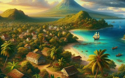
Comoros
Comoros (Udzima wa Komori (Comorian); Jumhūrīyat al-Qamar al-Muttaḥidah (Arabic); Union des Comores (French); (Union of the Comoros)) Capital of Comoros: Moroni Population (Estimated July 2012): 737,284 Area: 1,862 km2 or 719 mi2 Currency: Comorian franc (CF) Official Language: Comorian (Shikomor); Arabic; French Political Information: Federal Republic Official Religion: Islam(approximately 98% of the population are Sunni Muslim and 2% are Roman Catholic) Highest Mountain: Karthala on GDP Official Exchange Rate (OER is more precise at gauging a countries economic power) (Estimated 2011): $600 million (US$) or (GBP) GDP (OER) Per Capita (per member of the population estimated 2011): (US$) or (GBP) GDP Purchasing Power Parity (PPP is good for gauging living conditions and use of resources but not as accurate as OER. This data has been calculated based on the sum value of all goods and services produced in the country valued at prices prevailing in the United States) (Estimated 2011): $816 million (US$) or (GBP) GDP (PPP) Per Capita (per member of the population estimated 2011): $1,200 (US$) or (GBP) Time Zone (GMT/UTC): +3:00 Wildlife: Counties/Provinces/States: 3 islands and 4 municipalities*; Grande Comore (N’gazidja), Anjouan (Ndzuwani), Domoni*, Fomboni*, Moheli (Mwali), Moroni*, Moutsamoudou* Leaders: Ikililou Dhoinine as President with Fouad Mohadji, Mohamed Ali Soilih and Nourdine Bourhane as Vice President. Additional: Independence from France on the 6th of July 1975. Sources: CIA World Fact Book, Encyclopaedia Britannica. Comoros Comoros, officially known as the Union of the Comoros, is a small island nation located in the Indian Ocean off the eastern coast of Africa. It is composed of four main islands: Grande Comore, Mohéli, Anjouan, and Mayotte. The country has a total land area of approximately 2,235...

Climate Zones of Colombia: Different climate regions Of Colombia
Colombia, located in the northwestern part of South America, is a country known for its diverse geography and climate. It is bordered by the Caribbean Sea to the north, the Pacific Ocean to the west, and is home to the Andes Mountains which run through the country. Due to its unique geographical features, Colombia experiences a wide range of climate zones, each with its own distinct characteristics. Understanding these climate zones is crucial for various reasons, including agriculture, tourism, and conservation efforts. Summary Colombia has a diverse range of climate zones due to its location near the equator and varying elevations. The Tropical Rainforest Climate Zone is characterized by high temperatures, heavy rainfall, and lush vegetation. The Tropical Monsoon Climate Zone experiences distinct wet and dry seasons, with heavy rainfall during the wet season. The Tropical Savanna Climate Zone has a dry season and a wet season, with grasslands and scattered trees. The Desert Climate Zone is hot and dry, with little vegetation and sparse populations. The Subtropical Highland Climate Zone has cooler temperatures and more rainfall than lower elevations, with forests and agriculture. The Alpine Tundra Climate Zone is found at high elevations and experiences freezing temperatures and snow. The Coastal Climate Zone has warm temperatures and high humidity, with beaches and mangroves. The Polar Climate Zone is found in the highest elevations and experiences freezing temperatures and snow year-round. Climate change is affecting the climate zones of Colombia, with changes in rainfall patterns and temperatures impacting agriculture and ecosystems. The Tropical Rainforest Climate Zone in Colombia One of the most prominent climate zones in Colombia is the...

Political Boundaries of Colombia: Provinces, Districts, or Historical Boundaries.
Political boundaries are the lines that separate different territories or regions within a country. These boundaries play a crucial role in governance as they define the jurisdiction and authority of different administrative units. In Colombia, political boundaries are essential for the effective functioning of the government and the distribution of power and resources. Summary Colombia is divided into administrative divisions known as provinces and districts. There are 32 provinces in Colombia, each with its own governor and assembly. The districts of Colombia are Bogotá, Cartagena, and Santa Marta, each with its own mayor and council. Colombia’s historical boundaries have been shaped by colonialism, wars, and territorial disputes. Political boundaries in Colombia have a significant impact on governance, economy, and society. Overview of Colombia’s Administrative Divisions Colombia has a three-tiered administrative system consisting of departments, municipalities, and localities. The departments are the highest level of administrative division and there are 32 departments in total. Each department is further divided into municipalities, which are the second level of administrative division. Finally, municipalities are divided into localities, which are the smallest administrative units. The roles and responsibilities of each level vary. Departments have their own governor and administrative bodies responsible for overseeing public services, infrastructure development, and economic planning within their jurisdiction. Municipalities have mayors and local councils that handle local governance, including education, healthcare, and public safety. Localities, on the other hand, have local administrators who focus on community-level issues such as sanitation, transportation, and public spaces. Understanding the Provinces of Colombia Colombia’s provinces are an important part of its administrative divisions. There are 32 provinces in total, each with its...

Terrain and Topography of Colombia: mountains, valleys, and plains.
Introduction Colombia is a country known for its diverse and stunning landscapes. From the towering peaks of the Andes Mountains to the lush rainforests of the Amazon, Colombia offers a wide range of terrain and topography for travelers and adventurers to explore. Understanding Colombia’s geography is essential for anyone planning a trip to this beautiful country, as it will help them make the most of their time and experience all that Colombia has to offer. The Andes Mountains The Andes Mountains are a prominent feature of Colombia’s geography, running through the western part of the country. These mountains are not only breathtakingly beautiful, but they also hold great significance for Colombia. The Andes are home to some of Colombia’s most popular destinations, such as Bogotá and Medellín. These cities offer a unique blend of modernity and history, with vibrant cultural scenes and stunning architecture. In addition to the cities, the Andes Mountains offer a plethora of outdoor activities for adventure enthusiasts. Hiking is a popular activity in this region, with numerous trails that lead to stunning viewpoints and hidden waterfalls. For those who prefer winter sports, there are also ski resorts in the Andes where visitors can hit the slopes and enjoy the snow. The Sierra Nevada de Santa Marta The Sierra Nevada de Santa Marta is the world’s highest coastal mountain range, located in northern Colombia. This unique geographical feature is home to a diverse range of flora and fauna that cannot be found anywhere else in the world. The Sierra Nevada is known for its cloud forests, which are home to numerous endemic species of plants and...

History of Colombia
Colombia, located in the northwest corner of South America, is a country with a rich and complex history. From its indigenous peoples to Spanish colonization, from independence to civil war and drug cartels, Colombia’s past has shaped its present in profound ways. Understanding Colombia’s history is crucial for comprehending the challenges and opportunities the country faces today. Summary Indigenous peoples inhabited Colombia before the arrival of the Spanish. Spanish conquest and colonial rule brought about significant changes in Colombian society. Colombia gained independence in the early 19th century and formed a republic. Conservative and liberal parties dominated Colombian politics for much of the 20th century. The Colombian civil war, known as La Violencia, resulted in the deaths of hundreds of thousands of people. Drug cartels rose to power in Colombia in the 1980s and 1990s, but have since declined. Colombia played a significant role in the Cold War and the War on Drugs. The Colombian peace process has involved negotiations with guerrilla groups. Contemporary Colombian politics face challenges and opportunities. Colombia has a rich cultural heritage in music, art, and literature. Pre-Columbian Era: The Indigenous Peoples of Colombia Before the arrival of the Spanish, Colombia was home to a diverse array of indigenous groups. These groups, such as the Muisca, Tayrona, and Quimbaya, had their own unique cultures, traditions, and ways of life. The Muisca, for example, were known for their advanced agricultural practices and their use of gold in religious ceremonies. The Tayrona built impressive stone structures and had a complex social hierarchy. However, the arrival of the Spanish in the 16th century had a devastating impact on...

Natural Resources of Colombia: Where Natural Resources are located In Colombia
Colombia is a country blessed with an abundance of natural resources, making it one of the richest countries in terms of natural wealth. From its mineral deposits to its oil and gas reserves, from its diverse forests and jungles to its fertile agricultural lands, Colombia has a wide range of resources that contribute significantly to its economy. These resources not only provide economic opportunities but also play a crucial role in sustaining the country’s ecosystem and biodiversity. Summary Colombia is rich in natural resources, including minerals, oil and gas, forests and jungles, agriculture, water, and coastal and marine resources. The country has abundant mineral deposits, including gold, silver, copper, and coal, which are important for its economy. Colombia has significant oil and gas reserves, with exploration and production ongoing in various regions. The country’s forests and jungles are home to a diverse range of plant and animal species, making them important for biodiversity conservation. Agriculture is a key sector in Colombia’s natural resource economy, with coffee, bananas, and flowers among its top exports. An Overview of Colombia’s Natural Resources Colombia is located in the northwestern part of South America, bordered by the Caribbean Sea to the north and the Pacific Ocean to the west. Its geographical location and diverse climate make it home to a wide range of natural resources. The country experiences a variety of climates, ranging from tropical rainforests in the Amazon basin to cooler highlands in the Andes Mountains. Colombia’s natural resources can be broadly categorized into minerals, oil and gas, forests and jungles, agriculture, water resources, and coastal and marine resources. Each of these resources...