World Geography
Geography is the study of the Earth’s landscapes, environments, and the relationships between people and their surroundings. It encompasses both the physical aspects of the Earth, such as its landforms, bodies of water, and climate, as well as the human aspects, including population distribution, cultures, and economies. World geography is a broad field that seeks to understand the complexities of our planet and how humans interact with it. By studying world geography, we can gain a deeper appreciation for the diversity of our planet and the interconnectedness of its various regions.
Geography is a multidisciplinary field that draws on elements of physical science, social science, and humanities. It involves the use of maps, spatial analysis, and geographic information systems (GIS) to understand the Earth’s surface and the processes that shape it. World geography also encompasses the study of human geography, which examines the ways in which people and their activities are distributed across the Earth. By understanding world geography, we can better appreciate the environmental, cultural, and economic challenges facing different regions of the world. This knowledge is crucial for addressing global issues such as climate change, resource management, and international development.
The Five Oceans and Seven Continents
The Earth’s surface is divided into five major oceans: the Pacific, Atlantic, Indian, Southern (or Antarctic), and Arctic Oceans. These vast bodies of water play a crucial role in regulating the Earth’s climate and supporting diverse marine ecosystems. The oceans also serve as important transportation routes and a source of food and other natural resources for human societies around the world.
In addition to the oceans, the Earth’s landmasses are divided into seven continents: Africa, Antarctica, Asia, Europe, North America, Australia (or Oceania), and South America. Each continent has its own unique physical and cultural characteristics, shaped by millions of years of geological processes and human history. From the deserts of Africa to the rainforests of South America, the continents offer a rich tapestry of landscapes and environments for exploration and study.
Major Mountain Ranges and Deserts
The Earth’s surface is also marked by major mountain ranges and deserts that have shaped the planet’s physical and cultural landscapes. The Himalayas, for example, are the highest mountain range in the world and are home to diverse ecosystems and cultures in countries such as India, Nepal, and Bhutan. The Andes in South America, the Rockies in North America, and the Alps in Europe are other prominent mountain ranges that have influenced human settlement patterns and economic activities.
Deserts cover about one-third of the Earth’s land surface and are characterized by low precipitation and extreme temperatures. The Sahara Desert in Africa is the largest hot desert in the world, while the Gobi Desert in Asia is one of the largest cold deserts. Deserts are not only home to unique flora and fauna but have also been important trade routes and cultural crossroads throughout history.
Climate Zones and Biomes
The Earth’s climate is influenced by a variety of factors, including latitude, altitude, ocean currents, and prevailing winds. As a result, the planet is divided into different climate zones, each with its own characteristic weather patterns and ecosystems. The equator, for example, experiences a tropical climate with high temperatures and heavy rainfall, while the polar regions have a cold and dry climate.
These climate zones give rise to different biomes, or large ecological areas characterized by distinct plant and animal communities. The tropical rainforest biome, found near the equator, is home to a diverse array of species and is vital for regulating the Earth’s climate. The grasslands biome, found in regions such as the African savannah and North American prairies, supports grazing animals and has been important for human agriculture throughout history.
Human Geography and Population Distribution
Human geography examines the ways in which people and their activities are distributed across the Earth’s surface. It encompasses topics such as population growth, migration patterns, urbanization, and cultural diversity. Understanding human geography is crucial for addressing global challenges such as poverty, inequality, and environmental degradation.
Population distribution is uneven across the world, with some regions experiencing rapid population growth while others are declining. The majority of the world’s population lives in Asia, particularly in countries such as China and India. Urban areas are also growing rapidly, with more than half of the world’s population now living in cities. This trend has significant implications for infrastructure development, resource management, and social inequality.
Historical and Cultural Geography
Historical geography examines how human activities have shaped the Earth’s landscapes over time. It explores topics such as colonialism, trade routes, and the rise and fall of empires. Cultural geography focuses on how human cultures have developed in different regions of the world and how they interact with their environments.
The Silk Road, for example, was an ancient trade route that connected China with Europe and facilitated the exchange of goods, ideas, and technologies across Eurasia. This historical trade route had a profound impact on the development of cultures and economies along its path. Similarly, cultural geographers study how different societies have adapted to their environments through practices such as agriculture, architecture, and religious beliefs.
The Importance of Geographic Knowledge
Geographic knowledge is crucial for addressing global challenges such as climate change, resource management, and international development. By understanding world geography, we can better appreciate the environmental, cultural, and economic challenges facing different regions of the world. This knowledge is crucial for addressing global issues such as climate change, resource management, and international development.
Geographic knowledge also helps us to understand our interconnectedness with other regions of the world. By studying world geography, we can gain a deeper appreciation for the diversity of our planet and the interconnectedness of its various regions. This understanding can foster a sense of global citizenship and empathy for people from different cultures and backgrounds.
In conclusion, world geography is a complex and multifaceted field that encompasses both physical and human aspects of the Earth’s landscapes. By studying world geography, we can gain a deeper appreciation for the diversity of our planet and the interconnectedness of its various regions. This knowledge is crucial for addressing global challenges such as climate change, resource management, and international development. It also helps us to understand our interconnectedness with other regions of the world and fosters a sense of global citizenship.
FAQs
What is world geography?
World geography is the study of the Earth’s landscapes, environments, and the relationships between people and their environments. It encompasses the physical features of the Earth, as well as the human activity that takes place on it.
Why is world geography important?
World geography is important because it helps us understand the world around us. It provides insights into the physical and human processes that shape our planet, and helps us make informed decisions about how to interact with our environment.
What are the main branches of world geography?
The main branches of world geography include physical geography, which focuses on the Earth’s natural features and processes, and human geography, which examines the relationships between people and their environments.
How does world geography impact our daily lives?
World geography impacts our daily lives in numerous ways, from influencing the weather and climate we experience, to shaping the availability of natural resources and influencing the distribution of populations and cultures around the world.
What are some key concepts in world geography?
Key concepts in world geography include location, place, human-environment interaction, movement, and region. These concepts help geographers understand and interpret the world around them.

Political Boundaries of Burkina Faso: Provinces, Districts, or Historical Boundaries.
Burkina Faso, a landlocked country in West Africa, is known for its rich cultural heritage and diverse ethnic groups. Understanding the political boundaries of Burkina Faso is crucial for comprehending the country’s governance and development. Political boundaries define the territorial limits within which a government exercises its authority and provide a framework for administrative divisions and governance structures. Summary Burkina Faso is a country with defined political boundaries that have evolved over time. The country is divided into 13 provinces, each with its own unique characteristics and challenges. Understanding the districts within each province is crucial for effective governance and development. Burkina Faso’s historical boundaries have been shaped by colonialism and post-independence political changes. Political boundaries play a significant role in shaping Burkina Faso’s society, economy, and ethnic diversity. Provinces of Burkina Faso: An Overview Burkina Faso is divided into 13 provinces, each with its own distinct characteristics and administrative structures. These provinces include Balé, Bam, Banwa, Bazèga, Bougouriba, Boulgou, Boulkiemdé, Comoé, Ganzourgou, Gnagna, Gourma, Houet, and Ioba. Each province has its own capital city and is further divided into districts. The provinces play a crucial role in Burkina Faso’s governance as they serve as administrative units responsible for implementing government policies and programs at the local level. They also have their own elected officials who represent the interests of their respective provinces in the national government. Mapping Burkina Faso’s Districts: A Comprehensive Guide Burkina Faso’s districts are the second level of administrative divisions within the country. Each province is further divided into districts, which are responsible for implementing government policies and programs at the local level. There are...

Cultural or Historical Sites of Burkina Faso: Important Cultural Landmarks or Historical Sites In Burkina Faso
Burkina Faso, a landlocked country in West Africa, may not be the first destination that comes to mind when thinking about tourism. However, this vibrant nation is home to a rich cultural heritage and stunning natural landscapes that are waiting to be explored. From ancient ruins to contemporary art events, Burkina Faso offers a diverse range of attractions that showcase its unique history and traditions. In this article, we will delve into some of the must-visit sites in Burkina Faso, highlighting their significance and providing visitor information and tips. Summary Loropéni is a UNESCO World Heritage Site in Burkina Faso with ancient ruins. The Grand Mosque of Bobo-Dioulasso is a symbol of Islamic architecture in West Africa. The Royal Palace of Ouagadougou is a historical monument of Burkina Faso’s traditional kingship. The National Museum of Music showcases Burkina Faso’s rich musical heritage. The Nazinga Game Ranch is a wildlife sanctuary and tourist attraction. The Ruins of Loropéni: A UNESCO World Heritage Site in Burkina Faso The Ruins of Loropéni, located in the southern part of Burkina Faso, is a UNESCO World Heritage Site that dates back to the 11th century. These ruins are the remains of an ancient fortress that was once part of the trans-Saharan trade route. The site is of great historical and archaeological significance, as it provides insights into the region’s past and its connections with other civilizations. The Ruins of Loropéni feature stone walls and towers that were built without mortar, showcasing the architectural skills of the people who inhabited the area centuries ago. The site also includes a burial ground and other structures that...

Natural Resources of Burkina Faso: And Their Powerful Mineral Mining Industry
Natural Resources of Burkina Faso: And Their Powerful Mineral Mining Industry Burkina Faso, a landlocked country in the heart of the Sahel region, is fast becoming a focal point in Africa’s mining industry. Despite facing political and economic hurdles, including recent military coups, the country is rich in mineral wealth—particularly gold, which has placed it among the top gold producers on the African continent. This article explores the natural resources of Burkina Faso, their economic significance, and how the mining industry is reshaping the nation’s destiny. This is a must-read for anyone interested in Africa’s development, resource economics, or the geopolitics of natural wealth. Learn how Burkina Faso’s buried treasures are driving its GDP, changing local communities, and catching the eye of the World Bank, the African Development Bank, and the International Monetary Fund. Article Outline 1. Why Is Burkina Faso Emerging as a Mining Powerhouse in West Africa? 2. What Are the Key Minerals Found in Burkina Faso? 3. How Central Is Gold to the Economy of Burkina Faso? 4. What Role Does the Mining Industry Play in Burkina Faso’s GDP? 5. Who Are the Major Players in Burkina Faso’s Mining Sector? 6. What Is the Legal Framework for Mining in Burkina Faso? 7. How Do Mining Activities Affect Local Communities? 8. How Is Water and Sanitation Linked to Mining Operations? 9. What Are the Security Challenges in Mining Regions? 10. What Does the Future Hold for Burkina Faso’s Mining Industry? 1. Why Is Burkina Faso Emerging as a Mining Powerhouse in West Africa? Burkina Faso has rapidly evolved from a relatively unknown mining destination into a...

Population Density of Bulgaria
Bulgaria, located in Southeast Europe, has a population density of approximately 65 people per square kilometer. With a total land area of 110,994 square kilometers and a population of around 7 million people, Bulgaria is considered to have a relatively low population density compared to other European countries. However, understanding population density is crucial for policymakers and citizens alike as it provides insights into the distribution of people across the country and can help inform decisions related to infrastructure development, resource allocation, and urban planning. Summary Bulgaria has a population density of 64 people per square kilometer. Population density is calculated by dividing the total population by the total land area. Bulgaria’s population density is lower than the European Union average. The population density in Bulgaria is unevenly distributed, with higher densities in urban areas. Factors affecting population density in Bulgaria include economic opportunities and natural resources. How is Population Density Calculated in Bulgaria? Population density is calculated by dividing the total population of a country or region by its land area. In the case of Bulgaria, the formula would be: Population Density = Total Population / Land Area. The total population can be obtained from national census data or estimates provided by statistical agencies, while the land area can be determined using geographic information systems (GIS) or other mapping tools. Data sources for population density in Bulgaria include the National Statistical Institute (NSI), which conducts regular censuses and surveys to collect demographic information. The NSI provides data on population size and distribution at various administrative levels, including municipalities and regions. Other sources of data include Eurostat, the statistical...

History of Bulgaria
Bulgaria, located in Southeast Europe, has a rich and diverse history that spans thousands of years. From its early settlements by Thracian and Slavic tribes to its time under Ottoman rule and eventual independence, Bulgaria has faced numerous challenges and triumphs throughout its history. This blog post aims to provide a comprehensive overview of Bulgaria’s history, highlighting its significant moments and contributions to the world. Summary Bulgaria’s early settlements date back to the Neolithic period, with evidence of Thracian tribes and Greek colonies. The First Bulgarian Empire rose to power in the 7th century under Khan Asparuh, establishing a strong military and political presence in the Balkans. Tsar Simeon I led Bulgaria’s Golden Age in the 10th century, expanding its territory and promoting education and culture. Bulgaria struggled for independence under Ottoman rule, with several uprisings and a successful war of liberation in 1877-78. Bulgaria’s modern state formed after World War II, with a transition to democracy in the 1990s and integration into the European Union in 2007. Bulgaria played a role in both World War I and II, with significant losses and political changes. The Communist era brought social and economic changes to Bulgaria, with a transition to democracy in 1989. Bulgaria’s integration into the European Union has brought economic benefits and opportunities for growth. Bulgaria’s cultural heritage includes Thracian artifacts, medieval architecture, and contributions to literature and music. Challenges and opportunities in Bulgaria’s future include economic development, political stability, and preserving its cultural heritage. The Early Settlements of Bulgaria Bulgaria’s history dates back to ancient times when it was inhabited by Thracian tribes. These tribes were known...

Terrain and Topography of Bulgaria: mountains, valleys, and plains.
Introduction Bulgaria, located in Southeastern Europe, is a country known for its diverse and stunning landscape. From towering mountains to fertile plains and a beautiful coastline along the Black Sea, Bulgaria offers a wide range of natural wonders to explore. Understanding the country’s terrain and topography is essential for appreciating its beauty and experiencing all that it has to offer. The Rila Mountains The Rila Mountains, located in southwestern Bulgaria, are the highest mountain range in the country. The highest peak in Bulgaria, Musala, stands at an impressive 2,925 meters (9,596 feet) above sea level. The Rila Mountains are known for their alpine beauty, with snow-capped peaks, glacial lakes, and lush green meadows. The range is a popular destination for hiking enthusiasts, with numerous trails that cater to different skill levels. In the winter months, the Rila Mountains transform into a winter wonderland, with ski resorts offering a variety of slopes for skiing and snowboarding. The Balkan Mountains Running through the heart of Bulgaria is the Balkan Mountains, also known as the Stara Planina. This mountain range holds great historical significance and cultural importance for the country. It served as a natural barrier between different regions of Bulgaria throughout history and played a crucial role in shaping the country’s identity. The Balkan Mountains are home to diverse flora and fauna, with several protected areas and nature reserves. The range is also known for its natural wonders, including impressive waterfalls and caves that attract visitors from all over the world. The Rhodope Mountains The Rhodope Mountains, located in southern Bulgaria, are a mystical range steeped in legends and natural beauty....

Climate Zones of Bulgaria: Different climate regions Of Bulgaria
Bulgaria, located in Southeast Europe, is a country known for its diverse geography and climate. It is bordered by Romania to the north, Serbia and North Macedonia to the west, Greece and Turkey to the south, and the Black Sea to the east. This unique location gives Bulgaria a variety of climate zones, ranging from continental to Mediterranean, alpine, transitional, and coastal. Understanding these climate zones is crucial for various industries and individuals, as it affects agriculture, tourism, and daily life in different regions of the country. Summary Bulgaria has five main climate zones: Continental, Mediterranean, Alpine, Transitional, and Coastal. The Continental region has cold winters and hot summers, with low precipitation. The Mediterranean region has mild winters and hot summers, with moderate precipitation. The Alpine region has cold winters and cool summers, with high precipitation. The Transitional region has a mix of Continental and Mediterranean climates, with moderate precipitation. The Continental Climate Region of Bulgaria The continental climate region of Bulgaria is characterized by cold winters and hot summers. The average temperature in winter ranges from -1°C to -6°C (30°F to 21°F), while in summer it can reach up to 25°C to 30°C (77°F to 86°F). This region experiences distinct seasons, with spring and autumn being relatively short. Cities such as Sofia, Plovdiv, and Veliko Tarnovo are located in the continental climate region of Bulgaria. These cities experience cold winters with occasional snowfall and hot summers with temperatures often exceeding 30°C (86°F). The continental climate region is also known for its temperature extremes, with temperatures dropping below freezing in winter and reaching over 40°C (104°F) in summer. One...

Political Boundaries of Bulgaria: Provinces, Districts, or Historical Boundaries.
Bulgaria, located in Southeast Europe, is a country with rich history and diverse culture. Like any other country, Bulgaria has political boundaries that define its territories and administrative divisions. These boundaries play a significant role in shaping the country’s governance, culture, and society. In this article, we will explore the different types of political boundaries in Bulgaria, including provinces, districts, and historical boundaries. We will also discuss the impact of these boundaries on Bulgaria’s culture, economy, foreign relations, and its relationship with the European Union. Summary Bulgaria is divided into 28 provinces, each with its own governor and administrative center. The province system in Bulgaria is responsible for implementing national policies and managing local affairs. Bulgaria’s 265 districts are responsible for providing public services and maintaining infrastructure within their boundaries. Bulgaria’s historical boundaries have shifted over time due to wars, treaties, and political changes. Bulgaria’s political boundaries have a significant impact on its culture, economy, and foreign relations. Overview of Bulgaria’s Political Boundaries: Provinces, Districts, and Historical Boundaries Bulgaria is divided into 28 provinces, which are further divided into 265 municipalities. The provinces serve as administrative divisions and are responsible for implementing national policies and programs at the regional level. Each province has its own governor who is appointed by the central government. The provinces play a crucial role in ensuring effective governance and service delivery to the citizens. In addition to provinces, Bulgaria is also divided into districts. There are 28 districts in total, each corresponding to a province. The districts are responsible for overseeing the implementation of national policies and programs at the local level. They work...

Cultural or Historical Sites of Bulgaria: Important Cultural Landmarks or Historical Sites In Bulgaria
Bulgaria is a country with a rich cultural and historical heritage that spans thousands of years. From ancient Roman ruins to medieval fortresses, Bulgaria is home to numerous cultural sites that offer a glimpse into its fascinating past. Exploring these sites not only allows visitors to appreciate the country’s history and culture, but also provides an opportunity to immerse oneself in the beauty and grandeur of Bulgarian architecture, art, and folklore. Summary The Rila Monastery is a must-visit cultural site in Bulgaria. Plovdiv’s ancient Roman ruins are worth exploring. The Alexander Nevsky Cathedral is a symbol of Bulgarian history and culture. The Thracian Tomb of Kazanlak is a UNESCO World Heritage Site. The Etar Architectural-Ethnographic Complex showcases Bulgaria’s rich folklore. The Magnificent Rila Monastery: A Must-Visit Cultural Site in Bulgaria One of the most iconic cultural sites in Bulgaria is the Rila Monastery. Located in the Rila Mountains, this monastery is not only a spiritual center for Bulgarian Orthodox Christians, but also a UNESCO World Heritage Site. Founded in the 10th century by Saint Ivan of Rila, the monastery has played a significant role in preserving Bulgarian culture and spirituality throughout the centuries. The Rila Monastery is renowned for its stunning architecture and intricate artwork. The main church, known as the Nativity of the Virgin, features beautiful frescoes that depict scenes from the Bible and the lives of saints. The monastery also houses a museum that displays a collection of religious artifacts, including icons, manuscripts, and woodcarvings. When visiting the Rila Monastery, it is important to dress modestly and respectfully. Visitors should also be prepared for crowds, especially during...

Natural Resources of Bulgaria: Geography of Natural Resources in Bulgaria
Natural Resources of Bulgaria: Geography of Natural Resources in Bulgaria Discover how the geography and natural resources of Bulgaria shape its economy and global standing.Bulgaria, located in southeastern Europe, is a country rich in diverse geography and abundant natural resources. From the mineral-laden Balkan Mountains to fertile plains and the resource-rich Black Sea coast, Bulgaria’s natural wealth plays a crucial role in shaping its agriculture, energy sector, and mining industry. This article explores the natural resources of Bulgaria, shedding light on their economic and environmental significance and revealing why this lesser-known European nation deserves more world attention. Article Outline 1. Where is Bulgaria, and Why Is Its Geography So Important? 2. What Are Bulgaria’s Major Natural Resources? 3. How Rich Are Bulgaria’s Mineral Resources? 4. Does Bulgaria Have Oil and Natural Gas Reserves? 5. How Does Coal Factor into Bulgaria’s Energy Sector? 6. What Is the Role of Agriculture in Bulgaria’s Economy? 7. How Does the Black Sea Influence Bulgaria’s Economy and Resources? 8. What Role Do Forests and National Parks Play in Bulgaria’s Environment? 9. How Does the Geography Affect Bulgaria’s Biodiversity and Ecosystem? 10. What Challenges and Opportunities Does Bulgaria Face Regarding Its Natural Resources? 1. Where is Bulgaria, and Why Is Its Geography So Important? Bulgaria is located in southeastern Europe, bordered by Romania to the north, the Black Sea to the east, and mountainous terrain to the south and west. Its diverse geography includes the Balkan Mountains, Rhodope Mountains, and the Rila Mountains, which dominate southern Bulgaria, while the Danube Plain stretches across northern Bulgaria. This diverse terrain impacts everything from agriculture to mining....
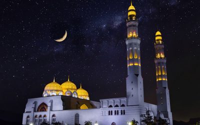
Cultural or Historical Sites of Brunei: Important Cultural Landmarks or Historical Sites In Brunei
Introduction Brunei, a small Southeast Asian nation on the island of Borneo, is known for its rich history and vibrant culture. With a history dating back to the 7th century, Brunei has a wealth of heritage that deserves to be preserved and showcased. From its royal regalia to its Islamic identity, Brunei’s cultural landmarks are a testament to its past and a source of pride for its people. In this article, we will explore some of the most significant cultural landmarks in Brunei and discuss the importance of preserving and showcasing them. The Royal Regalia Museum: A Showcase of Brunei’s Rich Heritage The Royal Regalia Museum in Brunei is a testament to the country’s rich royal heritage. Established in 1992, the museum houses a collection of royal regalia, including the crown jewels, ceremonial attire, and gifts received by the Sultan of Brunei. The museum provides visitors with a glimpse into the opulent world of Brunei’s monarchy and showcases the country’s cultural traditions. One of the highlights of the museum is the Sultan’s throne room, where visitors can see the intricately designed golden throne used during official ceremonies. The museum also features exhibits on Brunei’s history, including displays on the country’s oil industry and its role in international diplomacy. The Royal Regalia Museum plays an important role in preserving Brunei’s royal heritage. By showcasing the regalia and artifacts associated with the monarchy, the museum helps to educate both locals and tourists about Brunei’s rich history and cultural traditions. It also serves as a source of national pride for Bruneians, reminding them of their country’s royal legacy. The Omar Ali Saifuddien...
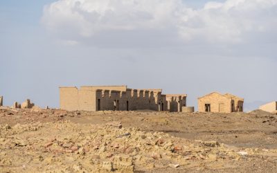
Natural Resources of Brunei: Where Natural Resources are located In Brunei Darussalam
Natural Resources of Brunei Darussalam: Fueling the Economy of Brunei Brunei, officially known as the Nation of Brunei, the Abode of Peace, is a small country located on the island of Borneo in Southeast Asia. It is bordered by Malaysia and the South China Sea. Despite its small size, Brunei is blessed with abundant natural resources that have played a significant role in shaping its economy and development. Brunei Darussalam is a small but wealthy country on the island of Borneo, best known for its abundant natural resources, especially oil and gas. Despite its modest size, Brunei wields considerable economic power thanks to its vast reserves of petroleum and natural gas. In this article, we explore the full spectrum of the resources of Brunei, diving deep into its energy dominance, rich biodiversity, and emerging opportunities for sustainable development. Whether you’re curious about Brunei’s natural gas, its GDP, or its future prospects beyond fossil fuels, this comprehensive guide is packed with valuable insights. Summary Brunei has a variety of natural resources including oil and gas, forests, minerals, fisheries, agriculture, water, and renewable energy. Oil and gas reserves are the most significant natural resource in Brunei, accounting for the majority of the country’s GDP and exports. Brunei’s forests are also important, covering over 70% of the country’s land area and providing valuable ecosystem services. Mineral resources in Brunei are limited, but include deposits of gold, copper, and other metals. Fisheries and aquatic resources are important for both subsistence and commercial purposes, with a variety of fish and shellfish species found in Brunei’s waters. Oil and Gas Reserves in Brunei One of the...