World Geography
Geography is the study of the Earth’s landscapes, environments, and the relationships between people and their surroundings. It encompasses both the physical aspects of the Earth, such as its landforms, bodies of water, and climate, as well as the human aspects, including population distribution, cultures, and economies. World geography is a broad field that seeks to understand the complexities of our planet and how humans interact with it. By studying world geography, we can gain a deeper appreciation for the diversity of our planet and the interconnectedness of its various regions.
Geography is a multidisciplinary field that draws on elements of physical science, social science, and humanities. It involves the use of maps, spatial analysis, and geographic information systems (GIS) to understand the Earth’s surface and the processes that shape it. World geography also encompasses the study of human geography, which examines the ways in which people and their activities are distributed across the Earth. By understanding world geography, we can better appreciate the environmental, cultural, and economic challenges facing different regions of the world. This knowledge is crucial for addressing global issues such as climate change, resource management, and international development.
The Five Oceans and Seven Continents
The Earth’s surface is divided into five major oceans: the Pacific, Atlantic, Indian, Southern (or Antarctic), and Arctic Oceans. These vast bodies of water play a crucial role in regulating the Earth’s climate and supporting diverse marine ecosystems. The oceans also serve as important transportation routes and a source of food and other natural resources for human societies around the world.
In addition to the oceans, the Earth’s landmasses are divided into seven continents: Africa, Antarctica, Asia, Europe, North America, Australia (or Oceania), and South America. Each continent has its own unique physical and cultural characteristics, shaped by millions of years of geological processes and human history. From the deserts of Africa to the rainforests of South America, the continents offer a rich tapestry of landscapes and environments for exploration and study.
Major Mountain Ranges and Deserts
The Earth’s surface is also marked by major mountain ranges and deserts that have shaped the planet’s physical and cultural landscapes. The Himalayas, for example, are the highest mountain range in the world and are home to diverse ecosystems and cultures in countries such as India, Nepal, and Bhutan. The Andes in South America, the Rockies in North America, and the Alps in Europe are other prominent mountain ranges that have influenced human settlement patterns and economic activities.
Deserts cover about one-third of the Earth’s land surface and are characterized by low precipitation and extreme temperatures. The Sahara Desert in Africa is the largest hot desert in the world, while the Gobi Desert in Asia is one of the largest cold deserts. Deserts are not only home to unique flora and fauna but have also been important trade routes and cultural crossroads throughout history.
Climate Zones and Biomes
The Earth’s climate is influenced by a variety of factors, including latitude, altitude, ocean currents, and prevailing winds. As a result, the planet is divided into different climate zones, each with its own characteristic weather patterns and ecosystems. The equator, for example, experiences a tropical climate with high temperatures and heavy rainfall, while the polar regions have a cold and dry climate.
These climate zones give rise to different biomes, or large ecological areas characterized by distinct plant and animal communities. The tropical rainforest biome, found near the equator, is home to a diverse array of species and is vital for regulating the Earth’s climate. The grasslands biome, found in regions such as the African savannah and North American prairies, supports grazing animals and has been important for human agriculture throughout history.
Human Geography and Population Distribution
Human geography examines the ways in which people and their activities are distributed across the Earth’s surface. It encompasses topics such as population growth, migration patterns, urbanization, and cultural diversity. Understanding human geography is crucial for addressing global challenges such as poverty, inequality, and environmental degradation.
Population distribution is uneven across the world, with some regions experiencing rapid population growth while others are declining. The majority of the world’s population lives in Asia, particularly in countries such as China and India. Urban areas are also growing rapidly, with more than half of the world’s population now living in cities. This trend has significant implications for infrastructure development, resource management, and social inequality.
Historical and Cultural Geography
Historical geography examines how human activities have shaped the Earth’s landscapes over time. It explores topics such as colonialism, trade routes, and the rise and fall of empires. Cultural geography focuses on how human cultures have developed in different regions of the world and how they interact with their environments.
The Silk Road, for example, was an ancient trade route that connected China with Europe and facilitated the exchange of goods, ideas, and technologies across Eurasia. This historical trade route had a profound impact on the development of cultures and economies along its path. Similarly, cultural geographers study how different societies have adapted to their environments through practices such as agriculture, architecture, and religious beliefs.
The Importance of Geographic Knowledge
Geographic knowledge is crucial for addressing global challenges such as climate change, resource management, and international development. By understanding world geography, we can better appreciate the environmental, cultural, and economic challenges facing different regions of the world. This knowledge is crucial for addressing global issues such as climate change, resource management, and international development.
Geographic knowledge also helps us to understand our interconnectedness with other regions of the world. By studying world geography, we can gain a deeper appreciation for the diversity of our planet and the interconnectedness of its various regions. This understanding can foster a sense of global citizenship and empathy for people from different cultures and backgrounds.
In conclusion, world geography is a complex and multifaceted field that encompasses both physical and human aspects of the Earth’s landscapes. By studying world geography, we can gain a deeper appreciation for the diversity of our planet and the interconnectedness of its various regions. This knowledge is crucial for addressing global challenges such as climate change, resource management, and international development. It also helps us to understand our interconnectedness with other regions of the world and fosters a sense of global citizenship.
FAQs
What is world geography?
World geography is the study of the Earth’s landscapes, environments, and the relationships between people and their environments. It encompasses the physical features of the Earth, as well as the human activity that takes place on it.
Why is world geography important?
World geography is important because it helps us understand the world around us. It provides insights into the physical and human processes that shape our planet, and helps us make informed decisions about how to interact with our environment.
What are the main branches of world geography?
The main branches of world geography include physical geography, which focuses on the Earth’s natural features and processes, and human geography, which examines the relationships between people and their environments.
How does world geography impact our daily lives?
World geography impacts our daily lives in numerous ways, from influencing the weather and climate we experience, to shaping the availability of natural resources and influencing the distribution of populations and cultures around the world.
What are some key concepts in world geography?
Key concepts in world geography include location, place, human-environment interaction, movement, and region. These concepts help geographers understand and interpret the world around them.
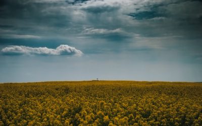
Natural Resources of Brunei: Where Natural Resources are located In Brunei
Brunei, officially known as the Nation of Brunei, the Abode of Peace, is a small country located on the island of Borneo in Southeast Asia. It is bordered by Malaysia and the South China Sea. Despite its small size, Brunei is blessed with abundant natural resources that have played a significant role in shaping its economy and development. Summary Brunei has a variety of natural resources including oil and gas, timber and forest, mining and minerals, agriculture, fisheries and aquatic, biodiversity and wildlife, renewable energy, and land and water resources. Brunei’s oil and gas reserves are the main source of revenue for the country and have been exploited since the 1920s. Timber and forest resources in Brunei are managed sustainably, with strict regulations in place to protect the environment and biodiversity. Brunei has significant mineral resources, including gold, copper, and iron, but mining activities are limited due to environmental concerns. Agriculture is an important sector in Brunei, with rice, fruits, and vegetables being the main crops grown. The country also has a thriving aquaculture industry. Oil and Gas Reserves in Brunei One of the most significant natural resources in Brunei is its vast reserves of oil and gas. Brunei has been producing oil since 1929 and is currently the ninth-largest producer of oil in Southeast Asia. The country’s oil reserves are estimated to be around 1.1 billion barrels, making it one of the wealthiest nations in the world per capita. The importance of oil and gas to Brunei’s economy cannot be overstated. Oil and gas exports account for more than 90% of Brunei’s total exports and contribute significantly to...
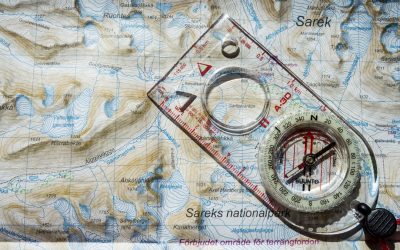
Political Boundaries of Brunei: Provinces, Districts, or Historical Boundaries.
Brunei, officially known as the Nation of Brunei, the Abode of Peace, is a small sovereign state located on the island of Borneo in Southeast Asia. It is bordered by the South China Sea to the north and shares land borders with Malaysia. Brunei has a unique political system, with an absolute monarchy and a Sultan as its head of state. The country is divided into several administrative divisions, including provinces and districts, which play a crucial role in its governance. Summary Brunei’s political boundaries have evolved over time, with historical, administrative, provincial, and district divisions. Districts play a crucial role in Brunei’s governance, with each district having its own district office and officer. Provincial boundaries are significant in Brunei, as they determine the allocation of resources and development projects. Colonialism has had a lasting impact on Brunei’s political boundaries, with the country being divided into British protectorates in the 19th century. Understanding Brunei’s political boundaries is important for navigating the country’s governance and history. Historical Boundaries of Brunei Brunei has a rich history that dates back centuries. In the past, Brunei’s territory extended beyond its current borders and included parts of present-day Malaysia and the Philippines. However, over time, Brunei lost much of its territory due to territorial disputes with neighbouring countries. One of the most significant territorial disputes involving Brunei is the dispute with Malaysia over the ownership of the island of Borneo. Both countries claim sovereignty over certain parts of the island, leading to tensions and occasional conflicts. The dispute remains unresolved to this day. Administrative Divisions of Brunei Brunei is divided into four administrative divisions:...
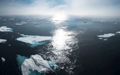
Climate Zones of Brunei: Different climate regions Of Brunei
Brunei, a small country located on the island of Borneo in Southeast Asia, is known for its rich biodiversity and diverse climate zones. The country’s geography is characterized by dense rainforests, mountain ranges, and coastal areas. Brunei experiences a tropical climate with high humidity and temperatures throughout the year. Understanding Brunei’s climate zones is crucial for various reasons, including conservation efforts, tourism planning, and mitigating the effects of climate change. Summary Brunei has a diverse range of climate zones, including tropical rainforest, tropical monsoon, equatorial, subtropical highland, semi-arid, arid, Mediterranean, and polar. The tropical rainforest climate zone in Brunei is characterized by high temperatures, high humidity, and heavy rainfall throughout the year. The tropical monsoon climate zone in Brunei experiences distinct wet and dry seasons, with heavy rainfall during the wet season and lower temperatures during the dry season. The equatorial climate zone in Brunei has high temperatures and rainfall throughout the year, with no distinct dry season. The subtropical highland climate zone in Brunei has cooler temperatures and lower humidity, with distinct seasons and occasional frost. Climate change is affecting Brunei’s climate zones, with rising temperatures and changing rainfall patterns posing a threat to the country’s ecosystems and economy. The Tropical Rainforest Climate Zone in Brunei One of the prominent climate zones in Brunei is the tropical rainforest climate zone. This zone is characterized by high temperatures, heavy rainfall, and high humidity throughout the year. The average annual rainfall in this zone can exceed 3,000 millimeters. The rainforests in this climate zone are home to a wide variety of flora and fauna. Some examples of flora found in...
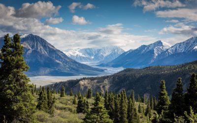
Terrain and Topography of Brunei: mountains, valleys, and plains.
Brunei, a small sovereign state located on the island of Borneo in Southeast Asia, is known for its diverse and unique terrain and topography. The country is characterized by its mountain ranges, valleys, plains, rivers, waterways, and coastal areas. Understanding the geography of Brunei is crucial for various reasons, including environmental conservation, sustainable development, and disaster management. Summary Brunei’s terrain and topography are diverse and varied, with mountain ranges, valleys, plains, coastal areas, and waterways. The mountain ranges of Brunei are home to unique flora and fauna, and offer opportunities for hiking and exploration. The valleys of Brunei are characterized by their lush vegetation and winding rivers, and are important for agriculture and biodiversity. The plains of Brunei are home to important ecosystems, including mangroves and peat swamps, and are vulnerable to climate change and human activity. Climate plays a significant role in shaping Brunei’s terrain and topography, with heavy rainfall and tropical storms affecting the landscape. The Mountain Ranges of Brunei: A Closer Look Brunei is home to several mountain ranges, including the Bukit Pagon Range, the Temburong Range, and the Belait Range. These mountain ranges are characterized by their steep slopes, dense forests, and rich biodiversity. The highest peak in Brunei is Bukit Pagon, which stands at an impressive 1,850 meters above sea level. The mountain ranges of Brunei play a vital role in the country’s ecosystem. They act as a natural barrier, protecting the inland areas from strong winds and storms. The dense forests on the slopes of these mountains are home to a wide variety of plant and animal species, many of which are endemic...
History of Brunei
Brunei, officially known as the Nation of Brunei, the Abode of Peace, is a small country located on the island of Borneo in Southeast Asia. Despite its small size, Brunei has a rich and fascinating history that spans over centuries. Understanding Brunei’s history is important as it provides insights into the country’s cultural heritage, political system, and economic development. This article aims to provide a comprehensive overview of Brunei’s history, from its early settlements to its present-day status as an oil-rich nation. Summary Brunei’s early history dates back to the 7th century and lasted until the 15th century. Islam arrived in Brunei during the 15th century and lasted until the 17th century. Brunei’s golden age occurred during the 16th century and lasted until the 18th century. European powers arrived in Brunei during the 16th century and lasted until the 19th century. British influence in Brunei occurred during the 19th century and lasted until the early 20th century. Brunei’s Early History: From the 7th Century to the 15th Century Brunei’s early history can be traced back to the 7th century when it was inhabited by indigenous tribes. These early settlements were influenced by Hinduism and Buddhism, which were brought to the region through trade with India and other Southeast Asian countries. The influence of these religions can still be seen in Brunei’s architecture and cultural practices. During this period, Brunei also engaged in trade with China and other Southeast Asian countries. The strategic location of Brunei on the maritime trade routes made it an important trading hub. The people of Brunei traded goods such as spices, gold, and ceramics, which...
Population Density of Brunei
Brunei, officially known as the Nation of Brunei, the Abode of Peace, is a small sovereign state located on the island of Borneo in Southeast Asia. It is bordered by Malaysia and the South China Sea. With a total land area of approximately 5,765 square kilometers, Brunei is one of the smallest countries in the world. Despite its small size, Brunei has a relatively large population compared to its land area. Population density refers to the number of people living in a specific area, usually measured per square kilometer. It is an important indicator of how crowded or sparsely populated an area is. Understanding population density is crucial for policymakers and urban planners as it helps them make informed decisions about resource allocation, infrastructure development, and social services provision. Summary Brunei has a small population of approximately 460,000 people. Population density is the number of people living in a specific area, usually measured in square kilometres. Urban areas in Brunei have a higher population density than rural areas. Factors affecting population density in Brunei include economic opportunities, infrastructure, and government policies. Managing population density is crucial for sustainable development in Brunei. Understanding Population Density and its Importance Population density is calculated by dividing the total population of an area by its land area. It provides valuable insights into how people are distributed across a given territory. High population density indicates that there are many people living in a small area, while low population density suggests that there are fewer people spread out over a larger area. Population density plays a significant role in various aspects of life. It affects...
Natural Resources of Brazil: Where Natural Resources are Located in Brazil
Natural Resources of Brazil: Where Natural Resources are Located in Brazil Brazil, the world’s fifth-largest country by area, is a land blessed with a variety of natural resources that not only shape its economy but also have far-reaching impacts on the global climate and trade. From its hydroelectric power infrastructure to the lush Amazon rainforest, Brazil’s abundant renewable and biological resources make it a powerhouse in Latin America. This article dives deep into the natural resources of Brazil, how they’re managed, and their significance on both local and international levels, especially through the lens of institutions like the World Bank. Whether you’re interested in hydropower, mining, agriculture, or renewable energy, this article is worth reading for a comprehensive understanding of how Brazil leverages its vast natural heritage to remain a major power in the modern world. Article Outline 1. What Makes Brazil So Rich in Natural Resources? 2. How Important Is Hydroelectric Power in Brazil? 3. What Role Does the Amazon Rainforest Play in Brazil’s Economy? 4. Why Are Brazil’s Mineral Reserves So Strategic? 5. How Does Brazil Balance Energy Production with Environmental Concerns? 6. What Are Brazil’s Major Agricultural Products and Their Global Impact? 7. How Does the Brazilian Government Manage Its Natural Resources? 8. What Are the Challenges Facing Brazil’s Renewable Energy Future? 9. How Do Water Bodies and Rivers Contribute to Brazil’s Energy Potential? 10. What Is the Role of the World Bank in Developing Brazil’s Resource Sectors? 1. What Makes Brazil So Rich in Natural Resources? Brazil’s vast land area includes a rich mosaic of ecosystems and climates that support an impressive variety of...

Political Boundaries of Brazil: Provinces, Districts, or Historical Boundaries.
Brazil, the largest country in South America, is known for its vibrant culture, diverse landscapes, and rich history. One aspect of Brazil that often goes unnoticed but is of great importance is its political boundaries. These boundaries define the country’s territorial limits and play a crucial role in shaping its governance and development. In this article, we will explore Brazil’s political boundaries in detail, examining their historical significance, the evolution of the provincial system, the role of districts and municipalities, territorial disputes, and the impact on regional development. By understanding Brazil’s political boundaries, we can gain a deeper insight into the country’s complex political landscape. Summary Brazil’s political boundaries are divided into 26 states and one federal district. The provincial system in Brazil has evolved over time, with changes in the number and size of provinces. Understanding Brazil’s districts is important for navigating the country’s complex political system. Brazil’s political boundaries have historical significance, reflecting the country’s colonial past and territorial expansion. The formation and governance of Brazil’s provinces vary, with some having more autonomy than others. Brazil’s Political Boundaries: An Overview Brazil shares borders with ten neighboring countries, including Argentina, Bolivia, Colombia, Guyana, Paraguay, Peru, Suriname, Uruguay, Venezuela, and French Guiana. These borders are defined by natural features such as rivers and mountains and are crucial for maintaining peaceful relations with its neighbors. The country is also divided into 26 states and one federal district, which is home to the capital city of Brasília. Each state has its own government and is responsible for local governance within its borders. The federal government plays a significant role in defining...

Cultural or Historical Sites of Brazil: Important Cultural Landmarks or Historical Sites In Brazil
Brazil is a country known for its rich cultural heritage and diverse history. From its indigenous roots to its colonial past, Brazil’s history has shaped its architecture, art, and traditions. This article will explore the various aspects of Brazil’s cultural heritage, including its colonial architecture, ancient ruins, historic churches, museums and art galleries, national parks, iconic landmarks, festivals, Afro-Brazilian culture, Portuguese influence, and historical sites of resistance. By delving into these different facets of Brazil’s heritage, we can gain a deeper understanding and appreciation for the country’s vibrant culture. Summary Brazil’s colonial architecture boasts a rich history that reflects the country’s diverse cultural influences. Ancient ruins of Brazil’s indigenous peoples offer a glimpse into the country’s pre-colonial past and cultural heritage. Brazil’s historic churches and cathedrals hold significant religious and cultural importance for the country’s people. Museums and art galleries in Brazil offer a fascinating insight into the country’s art, history, and culture. Brazil’s national parks and protected areas are crucial for preserving the country’s unique biodiversity and natural beauty. The Rich History of Brazil’s Colonial Architecture Brazil’s colonial period had a significant impact on its architecture. The Portuguese arrived in Brazil in the 16th century and established colonies along the coast. They brought with them their architectural styles, which were influenced by the Renaissance and Baroque movements in Europe. Examples of colonial architecture can be found in cities such as Salvador and Olinda. Salvador, the capital of the state of Bahia, is known for its well-preserved colonial architecture. The historic center of Salvador, known as Pelourinho, is a UNESCO World Heritage site and is home to numerous colonial...

Climate Zones of Brazil: Different climate regions Of Brazil
Brazil, the largest country in South America, is known for its diverse geography and rich natural resources. This diversity is also reflected in its climate zones, which vary from hot and humid in the north to mild and wet in the southeast. Understanding these climate zones is important for both travelers and residents alike, as it can help them prepare for the weather conditions they may encounter. Summary Brazil has a diverse range of climate zones, each with its own unique weather patterns and characteristics. The tropical climate zone in the north is hot and humid, while the subtropical climate zone in the south has milder temperatures. The semi-arid climate zone in the northeast is dry and hot, while the equatorial climate zone in the Amazon is rainy and humid. The highland climate zone has cool temperatures in the mountainous regions, while the coastal climate zone has warm and wet weather along the coastline. Climate change is having a significant impact on Brazil’s climate zones, presenting challenges for the country’s economy and environment. The Tropical Climate Zone: Hot and Humid Weather in the North The tropical climate zone covers most of the northern region of Brazil, including the states of Amazonas, Pará, and Roraima. This region experiences high temperatures and humidity year-round, with average temperatures ranging from 25 to 30 degrees Celsius (77 to 86 degrees Fahrenheit). The rainy season in this zone typically occurs from December to May, with heavy rainfall and occasional thunderstorms. The hot and humid weather in the north can be challenging for travelers who are not accustomed to such conditions. It is important to...

Terrain and Topography of Brazil: mountains, valleys, and plains.
Brazil is a country known for its diverse and stunning topography. From majestic mountains to vast plains, lush rainforests to beautiful beaches, Brazil offers a wide range of landscapes that attract tourists from all over the world. Understanding Brazil’s geography is important not only for those who wish to explore its natural wonders, but also for those who want to understand the country’s culture and history. In this article, we will take a closer look at Brazil’s diverse topography and explore the activities and attractions that each region has to offer. Summary Brazil’s topography is incredibly diverse, with a range of landscapes from mountains to plains to wetlands. The majestic mountains of Brazil offer stunning views and opportunities for hiking and adventure. The Amazon Basin is a unique landscape with unparalleled biodiversity and cultural significance. The Brazilian highlands feature rolling hills and plateaus, as well as important agricultural regions. The coastal regions of Brazil offer beautiful beaches and cliffs, while the Cerrado and Pantanal showcase unique ecosystems. The Majestic Mountains of Brazil Brazil is home to several mountain ranges, each with its own unique beauty and charm. One of the most famous mountain ranges in Brazil is the Serra da Mantiqueira, located in the southeastern part of the country. This mountain range is known for its stunning landscapes, with peaks reaching over 2,000 meters in height. The Serra da Mantiqueira offers a variety of activities for outdoor enthusiasts, including hiking, rock climbing, and horseback riding. Visitors can also enjoy the breathtaking views from the top of the mountains or relax in one of the many charming towns nestled in...

History of Brazil
Brazil, the largest country in South America, has a rich and complex history that has shaped its present-day society and culture. From its pre-colonial indigenous peoples to its colonial period under Portuguese rule, Brazil’s past is filled with significant events and influences. Understanding Brazil’s history is crucial for comprehending the challenges and opportunities that the country faces today. By examining the various periods and key moments in Brazil’s past, we can gain insights into the factors that have shaped its economy, society, and political landscape. Summary Indigenous peoples were the original inhabitants of Brazil before the arrival of the Portuguese. Brazil’s colonial period was marked by Portuguese rule and the exploitation of resources. Brazil played a significant role in the Atlantic slave trade, with millions of Africans brought over as slaves. Brazil gained independence from Portugal in the 19th century, establishing a monarchy under Pedro II. Brazil has experienced political turmoil and instability, including a military dictatorship and struggles for democracy. Pre-colonial Brazil: The Indigenous Peoples Before the arrival of the Portuguese in the 16th century, Brazil was home to a diverse array of indigenous peoples. These indigenous groups had their own unique cultures, languages, and ways of life. They lived off the land, engaging in hunting, fishing, and agriculture. The indigenous peoples of Brazil had a deep connection to nature and believed in the spiritual significance of their surroundings. However, the arrival of European colonizers had a devastating impact on Brazil’s indigenous populations. The Portuguese brought diseases such as smallpox, measles, and influenza, which decimated indigenous communities who had no immunity to these diseases. Additionally, the colonizers forcibly...