World Geography
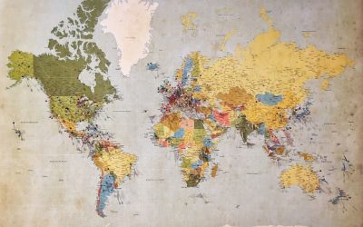
Geography is the study of the Earth’s landscapes, environments, and the relationships between people and their surroundings. It encompasses both the physical aspects of the Earth, such as its landforms, bodies of water, and climate, as well as the human aspects, including population distribution, cultures, and economies. World geography is a broad field that seeks to understand the complexities of our planet and how humans interact with it. By studying world geography, we can gain a deeper appreciation for the diversity of our planet and the interconnectedness of its various regions.
Geography is a multidisciplinary field that draws on elements of physical science, social science, and humanities. It involves the use of maps, spatial analysis, and geographic information systems (GIS) to understand the Earth’s surface and the processes that shape it. World geography also encompasses the study of human geography, which examines the ways in which people and their activities are distributed across the Earth. By understanding world geography, we can better appreciate the environmental, cultural, and economic challenges facing different regions of the world. This knowledge is crucial for addressing global issues such as climate change, resource management, and international development.
The Five Oceans and Seven Continents
The Earth’s surface is divided into five major oceans: the Pacific, Atlantic, Indian, Southern (or Antarctic), and Arctic Oceans. These vast bodies of water play a crucial role in regulating the Earth’s climate and supporting diverse marine ecosystems. The oceans also serve as important transportation routes and a source of food and other natural resources for human societies around the world.
In addition to the oceans, the Earth’s landmasses are divided into seven continents: Africa, Antarctica, Asia, Europe, North America, Australia (or Oceania), and South America. Each continent has its own unique physical and cultural characteristics, shaped by millions of years of geological processes and human history. From the deserts of Africa to the rainforests of South America, the continents offer a rich tapestry of landscapes and environments for exploration and study.
Major Mountain Ranges and Deserts
The Earth’s surface is also marked by major mountain ranges and deserts that have shaped the planet’s physical and cultural landscapes. The Himalayas, for example, are the highest mountain range in the world and are home to diverse ecosystems and cultures in countries such as India, Nepal, and Bhutan. The Andes in South America, the Rockies in North America, and the Alps in Europe are other prominent mountain ranges that have influenced human settlement patterns and economic activities.
Deserts cover about one-third of the Earth’s land surface and are characterized by low precipitation and extreme temperatures. The Sahara Desert in Africa is the largest hot desert in the world, while the Gobi Desert in Asia is one of the largest cold deserts. Deserts are not only home to unique flora and fauna but have also been important trade routes and cultural crossroads throughout history.
Climate Zones and Biomes
The Earth’s climate is influenced by a variety of factors, including latitude, altitude, ocean currents, and prevailing winds. As a result, the planet is divided into different climate zones, each with its own characteristic weather patterns and ecosystems. The equator, for example, experiences a tropical climate with high temperatures and heavy rainfall, while the polar regions have a cold and dry climate.
These climate zones give rise to different biomes, or large ecological areas characterized by distinct plant and animal communities. The tropical rainforest biome, found near the equator, is home to a diverse array of species and is vital for regulating the Earth’s climate. The grasslands biome, found in regions such as the African savannah and North American prairies, supports grazing animals and has been important for human agriculture throughout history.
Human Geography and Population Distribution
Human geography examines the ways in which people and their activities are distributed across the Earth’s surface. It encompasses topics such as population growth, migration patterns, urbanization, and cultural diversity. Understanding human geography is crucial for addressing global challenges such as poverty, inequality, and environmental degradation.
Population distribution is uneven across the world, with some regions experiencing rapid population growth while others are declining. The majority of the world’s population lives in Asia, particularly in countries such as China and India. Urban areas are also growing rapidly, with more than half of the world’s population now living in cities. This trend has significant implications for infrastructure development, resource management, and social inequality.
Historical and Cultural Geography
Historical geography examines how human activities have shaped the Earth’s landscapes over time. It explores topics such as colonialism, trade routes, and the rise and fall of empires. Cultural geography focuses on how human cultures have developed in different regions of the world and how they interact with their environments.
The Silk Road, for example, was an ancient trade route that connected China with Europe and facilitated the exchange of goods, ideas, and technologies across Eurasia. This historical trade route had a profound impact on the development of cultures and economies along its path. Similarly, cultural geographers study how different societies have adapted to their environments through practices such as agriculture, architecture, and religious beliefs.
The Importance of Geographic Knowledge
Geographic knowledge is crucial for addressing global challenges such as climate change, resource management, and international development. By understanding world geography, we can better appreciate the environmental, cultural, and economic challenges facing different regions of the world. This knowledge is crucial for addressing global issues such as climate change, resource management, and international development.
Geographic knowledge also helps us to understand our interconnectedness with other regions of the world. By studying world geography, we can gain a deeper appreciation for the diversity of our planet and the interconnectedness of its various regions. This understanding can foster a sense of global citizenship and empathy for people from different cultures and backgrounds.
In conclusion, world geography is a complex and multifaceted field that encompasses both physical and human aspects of the Earth’s landscapes. By studying world geography, we can gain a deeper appreciation for the diversity of our planet and the interconnectedness of its various regions. This knowledge is crucial for addressing global challenges such as climate change, resource management, and international development. It also helps us to understand our interconnectedness with other regions of the world and fosters a sense of global citizenship.
FAQs
What is world geography?
World geography is the study of the Earth’s landscapes, environments, and the relationships between people and their environments. It encompasses the physical features of the Earth, as well as the human activity that takes place on it.
Why is world geography important?
World geography is important because it helps us understand the world around us. It provides insights into the physical and human processes that shape our planet, and helps us make informed decisions about how to interact with our environment.
What are the main branches of world geography?
The main branches of world geography include physical geography, which focuses on the Earth’s natural features and processes, and human geography, which examines the relationships between people and their environments.
How does world geography impact our daily lives?
World geography impacts our daily lives in numerous ways, from influencing the weather and climate we experience, to shaping the availability of natural resources and influencing the distribution of populations and cultures around the world.
What are some key concepts in world geography?
Key concepts in world geography include location, place, human-environment interaction, movement, and region. These concepts help geographers understand and interpret the world around them.
Climate Zones of Angola: Different Climate Regions Of Angola
Angola, located on the west coast of southern Africa, is a country known for its diverse geography and climate. The country is characterized by a wide range of climate zones, each with its own unique characteristics and ecosystems. From tropical savannas to coastal deserts, Angola’s climate zones offer a variety of landscapes and opportunities for both its people and its economy. Summary Angola has a diverse range of climate zones, including tropical savanna, semi-arid, subtropical highland, humid subtropical, and coastal desert. The tropical savanna region covers most of Angola and experiences a wet and dry season, with temperatures ranging from 20-30°C. The semi-arid region is located in the south and east of Angola and experiences hot and dry conditions, with temperatures reaching up to 40°C. The subtropical highland region has cooler temperatures due to its higher altitude, with temperatures ranging from 10-20°C. The humid subtropical region experiences high levels of rainfall and humidity, with temperatures ranging from 20-30°C. Factors influencing Angola’s climate zones include latitude, altitude, ocean currents, and prevailing winds. Angola’s climate zones have a significant impact on agriculture and the economy, with the tropical savanna region being the most suitable for farming. Climate change is affecting Angola’s climate zones, with increased temperatures and changes in rainfall patterns. Angola’s diverse climate zones are significant for the country’s biodiversity and provide opportunities for tourism and economic development. Tropical savanna climate region The tropical savanna climate region in Angola is characterized by hot temperatures and distinct wet and dry seasons. This climate zone covers a large portion of the country, particularly in the central and northern regions. Cities such as...
Terrain and Topography of Angola: mountains, valleys, and plains.
Angola, located on the western coast of Southern Africa, is a country known for its diverse and stunning terrain. From majestic mountains to vast plains, Angola’s topography offers a wealth of natural beauty and resources. Understanding Angola’s terrain and topography is crucial for various reasons, including agriculture, economy, and tourism. By exploring the different aspects of Angola’s geography, we can gain a deeper appreciation for the country’s natural wonders and the opportunities they present. Summary Angola’s terrain is diverse and varied, with mountains, valleys, plains, and unique geology. The majestic mountains of Angola offer stunning views and opportunities for exploration. The valleys of Angola are rich in biodiversity and offer unique opportunities for agriculture and tourism. The vast plains of Angola are home to a variety of wildlife and offer opportunities for ranching and agriculture. Angola’s unique geology, including diamonds and oil reserves, has played a significant role in the country’s economy. The Majestic Mountains of Angola Angola is home to several mountain ranges that add to the country’s breathtaking landscape. The most prominent mountain range is the Serra da Chela, located in the southwest region of Angola. This range stretches for approximately 200 kilometers and reaches elevations of up to 2,620 meters at its highest peak, Mount Moco. Mount Moco is not only the highest peak in Angola but also the highest in all of Southern Africa. Another notable mountain range in Angola is the Serra da Leba, famous for its stunning winding road that offers panoramic views of the surrounding valleys. The range reaches elevations of up to 1,845 meters at its highest point. These mountains have...
Population Density of Angola
Angola, located in Southern Africa, is a country with a diverse population and varying population density across its regions. Understanding population density is crucial for policymakers and stakeholders as it helps in planning and implementing effective policies and programs. Population density refers to the number of people living in a specific area, usually measured in terms of persons per square kilometer. By analyzing population density, we can gain insights into the distribution of resources, infrastructure needs, and social services required to meet the needs of the population. Summary Angola has a population density of 26 people per square kilometer. Angola’s population has grown rapidly since the 1950s due to improved healthcare and infrastructure. The majority of Angola’s population is concentrated in the northern and coastal regions. Urbanization has led to a significant increase in population density in Angola’s major cities. Angola’s high population density poses challenges for managing resources and providing basic services. Historical Overview of Angola’s Population Angola has a rich history that has influenced its population growth over the years. The country experienced significant population growth during the colonial period when it was under Portuguese rule. The Portuguese brought in large numbers of settlers and forced laborers from other African countries, resulting in an increase in the population. However, this growth was not evenly distributed across the country, with coastal areas experiencing higher population densities compared to the interior regions. Current Population Trends in Angola As of 2021, Angola has an estimated population of around 33 million people. The country has experienced steady population growth over the years, with an average annual growth rate of around 2%....
Political Boundaries of Andorra: Provinces, Districts, or Historical Boundaries.
Andorra, a small landlocked country in the Pyrenees Mountains, is known for its stunning landscapes and unique political structure. With a total area of just 468 square kilometers, Andorra is one of the smallest countries in Europe. Despite its size, Andorra has a rich history and a distinct identity that is shaped by its political boundaries. Political boundaries play a crucial role in defining a country’s identity. They determine the territory over which a government has jurisdiction and control, and they help to establish a sense of belonging and unity among the people who live within those boundaries. In the case of Andorra, its political boundaries have been instrumental in shaping its governance, economy, and culture. Summary Andorra is a small country located in the Pyrenees Mountains between France and Spain. The country is divided into seven provinces, each with its own unique characteristics and attractions. Andorra’s districts are important administrative divisions that help to govern the country and provide services to its citizens. The historical boundaries of Andorra have changed over time, reflecting the country’s complex political history. Andorra’s borders with France and Spain have played a significant role in shaping the country’s culture, economy, and political landscape. The Provinces of Andorra: A Brief Overview Andorra is divided into seven provinces, each with its own unique characteristics and significance. These provinces are Canillo, Encamp, Ordino, La Massana, Andorra la Vella, Sant Julià de Lòria, and Escaldes-Engordany. Canillo is the largest province in terms of land area and is known for its picturesque landscapes and ski resorts. Encamp is located in the central part of Andorra and is home...
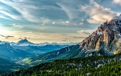
Natural Resources of Andorra: Where Natural Resources are Located in Andorra
Exploring the Natural Resources of Andorra: A Unique Insight into the Geography and Economy of a Mountain Nation Nestled in the eastern Pyrenees between France and Spain, Andorra is a landlocked country with an intriguing geographical and economic profile. Though often overlooked due to its small land area, Andorra is rich in unique natural features and cultural history. This article explores the natural resources of Andorra, how they influence the economy of Andorra, and what makes the geography of Andorra distinct. Whether you’re a student, researcher, or simply curious, this deep dive into the natural resource potential and terrain of Andorra is well worth the read. Article Outline What Makes the Geography of Andorra Unique? How Do Andorra’s Natural Resources Shape Its Economy? What Role Does Tourism Play in Andorra’s Development? Is Andorra Rich in Water Resources? Does Andorra Have Any Valuable Mineral Resources? How Has the History of Andorra Shaped Its Land Use? How Do Andorrans Benefit from the Country’s Geography? What Is the Role of the Andorran Government in Managing Resources? How Is the Economy of Andorra Diversified? What Are the Main Challenges Andorra Faces? What Makes the Geography of Andorra Unique? Andorra is a small, landlocked country in the eastern Pyrenees mountain range, bordered by France and Spain. Its mountainous landscape is dominated by deep valleys, rugged peaks, and rivers that shape its physical and economic structure. The geography of Andorra defines much of its identity. Covering only 468 square kilometers of land area, Andorra has very limited arable land. The valley systems formed by rivers like the Valira River support the...
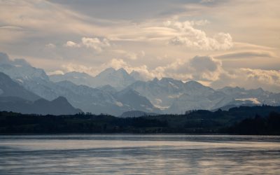
Terrain and Topography of Andorra: mountains, valleys, and plains.
Andorra, a small landlocked country nestled in the Pyrenees Mountains between France and Spain, boasts a unique terrain and topography that sets it apart from its neighboring countries. With an area of just 468 square kilometers, Andorra is one of the smallest countries in Europe. Despite its size, Andorra’s landscape is diverse and captivating, offering visitors a wide range of natural wonders to explore. The terrain and topography of Andorra have played a significant role in shaping the country’s landscape. The country is characterized by its rugged mountains, deep valleys, expansive plains, and even glaciers. These geographical features have not only influenced the climate and vegetation of the region but also shaped the culture, history, and economy of Andorra. Summary Andorra’s unique terrain and topography make it a fascinating destination for tourists. Mountains dominate Andorra’s landscape, with the Pyrenees connecting it to France and Spain. Valleys provide low-lying areas in Andorra, with the Madriu-Perafita-Claror Valley being a UNESCO World Heritage Site. Plains are lesser-known areas of Andorra, with the Gran Valira Valley being the main river basin. Glaciers add to Andorra’s frozen terrain, while its climate and vegetation are influenced by its terrain and topography. Mountains: The Dominant Feature of Andorra’s Landscape Mountains dominate the landscape of Andorra, with the country being home to several mountain ranges. The highest peak in Andorra is Coma Pedrosa, standing at an impressive 2,942 meters above sea level. Other notable mountain ranges include the Pyrenees Mountains, which form the natural border between France and Spain. The mountains hold great significance in Andorra’s culture and history. They have provided a natural barrier that has...
Climate Zones of Andorra: Different climate regions Of Andorra
Andorra, a small landlocked country in the Pyrenees Mountains between France and Spain, is known for its stunning landscapes and diverse climate zones. Despite its small size, Andorra is home to four distinct climate zones: Alpine, Mediterranean, Continental, and Subarctic. Each zone has its own unique characteristics, flora and fauna, and popular activities for tourists. Understanding these climate zones is important for both tourists and locals alike, as it allows for better planning and appreciation of the country’s natural beauty. Summary Andorra has four distinct climate zones: Alpine, Mediterranean, Continental, and Subarctic. The Alpine climate zone is characterized by cold temperatures and heavy snowfall, while the Mediterranean climate zone is warm and dry. The Continental climate zone experiences hot summers and cold winters, while the Subarctic climate zone is the coldest and receives the most precipitation. Elevation plays a significant role in determining which climate zone a particular area falls into. Climate change is having an impact on Andorra’s climate zones, with rising temperatures and changing precipitation patterns. The Alpine Climate Zone of Andorra The Alpine climate zone in Andorra is characterized by high altitudes and cold temperatures. This zone is found in the highest parts of the country, including the peaks of the Pyrenees Mountains. The Alpine zone experiences long, snowy winters and short, cool summers. The average annual temperature in this zone is around 5 degrees Celsius. Flora in the Alpine zone of Andorra includes hardy plants such as alpine flowers, mosses, and lichens. Trees are scarce due to the harsh conditions, but some coniferous trees like spruce and fir can be found at lower elevations. Fauna...
Population Density of Andorra
Andorra, officially known as the Principality of Andorra, is a small landlocked country located in the eastern Pyrenees mountains between France and Spain. With an area of just 468 square kilometers, it is one of the smallest countries in Europe. Despite its small size, Andorra has a unique population density that sets it apart from other countries. Population density refers to the number of people living in a given area, usually measured in terms of persons per square kilometer. It is an important indicator of how crowded or sparsely populated an area is. In the case of Andorra, its population density is relatively low compared to other European countries due to its small size and mountainous terrain. Summary Andorra has a small population of around 77,000 people, making it one of the smallest countries in Europe. The population density of Andorra has fluctuated throughout history, with periods of growth and decline. Factors influencing population density in Andorra include geography, economic development, and immigration policies. Andorra has a relatively young population, with a high proportion of foreign-born residents. Urbanization has led to increased population density in Andorra’s urban areas, while rural areas have experienced depopulation. Historical Overview of Andorra’s Population Density Throughout history, Andorra’s population has experienced fluctuations due to various factors. In the early 20th century, the country had a relatively small population, with only a few thousand inhabitants. However, with the advent of tourism in the mid-20th century, Andorra experienced a significant increase in population. The growth in population was mainly driven by economic opportunities offered by the tourism industry. The country’s tax haven status and duty-free shopping...
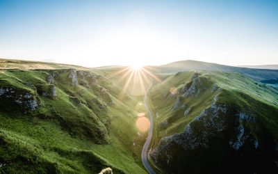
Cultural or Historical Sites of Andorra: Important Cultural Landmarks or Historical Sites In Andorra
Andorra, a small landlocked country nestled in the Pyrenees Mountains between France and Spain, is known for its stunning natural beauty. However, what many people may not realize is that Andorra also has a rich cultural heritage that dates back centuries. From its unique location and history to its ancient churches and chapels, magnificent castles and fortresses, and fascinating museums, Andorra offers a wealth of cultural experiences for visitors to explore. In this article, we will take a journey through Andorra’s rich cultural heritage, uncovering the history behind its landmarks, exploring its iconic cultural sites, and delving into the significance of its art and architecture. Join us as we discover the hidden gems of Andorra’s cultural heritage. Summary Andorra has a rich cultural heritage that is worth exploring. The country’s landmarks have fascinating histories that are worth uncovering. Andorra’s iconic cultural sites are a must-visit for anyone interested in the country’s culture. The ancient churches and chapels of Andorra are a testament to the country’s religious history. Andorra’s castles and fortresses are magnificent structures that are worth exploring. Discovering the Rich Cultural Heritage of Andorra Andorra’s unique location and history have played a significant role in shaping its cultural heritage. Situated between France and Spain, Andorra has been influenced by both Catalan and French cultures. The Catalan influence is particularly strong, as Catalan is the official language of Andorra and Catalan traditions are deeply ingrained in the country’s customs and celebrations. This blend of cultures has created a unique identity for Andorra, one that is reflected in its art, architecture, cuisine, and festivals. Preserving Andorra’s cultural heritage is of...
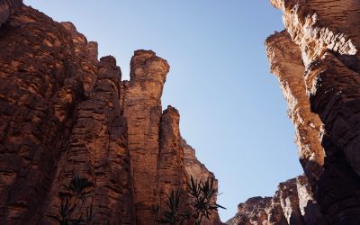
Natural Resources of Algeria: Unlocking the Natural Wealth of Algeria: Oil, Gas, and Beyond
Natural Resources of Algeria: Unlocking the Natural Wealth of Algeria: Oil, Gas, and Beyond Algeria, a nation rich in energy reserves and minerals, stands as a powerhouse in North Africa thanks to its abundant natural resources. From its vast oil and gas fields to significant mineral deposits and renewable energy potential, Algeria is pivotal in the global resource economy. This article delves deep into the natural resources of Algeria, how they shape its economy, and what the future may hold as the country aims to diversify and strengthen its industries. Whether you’re an investor, policy maker, or just curious about resource-rich nations, this article provides critical insights into Algeria’s economic backbone. Outline What Makes Algeria Rich in Natural Resources? How Important Are Oil and Gas to the Algerian Economy? What Are Algeria’s Major Natural Gas Reserves? Where Are the Key Oil Fields Located in Algeria? What Other Mineral Resources Are Found in Algeria? Is Helium a Game-Changer for Algeria’s Resource Portfolio? How Is Algeria Approaching Renewable Energy Development? What Is the Role of the Mining Sector in Algeria? Can Algeria Diversify Its Economy Beyond Hydrocarbons? How Do Algeria’s Water and Fishing Resources Fit into the Picture? 1. What Makes Algeria Rich in Natural Resources? Algeria is one of the largest countries in Africa by land area, and much of this vast territory is rich in natural resources. From the heart of the Sahara to the coastline along the Mediterranean Sea, Algeria is home to substantial deposits of petroleum, natural gas, and valuable minerals like phosphate, zinc, and iron ore. These resources make Algeria a significant energy supplier...
Political Boundaries of Algeria: Provinces, Districts, or Historical Boundaries.
Political boundaries are the lines that separate one political entity from another, such as countries, provinces, or districts. These boundaries play a crucial role in a country’s governance and development, as they define the jurisdiction and authority of the government. In the case of Algeria, a country located in North Africa, its political boundaries have evolved over time due to various historical, colonial, and ethnic factors. Algeria is a country with a rich history and diverse population. It is bordered by several countries including Tunisia, Libya, Niger, Mali, Mauritania, Western Sahara, Morocco, and the Mediterranean Sea. These political boundaries have shaped Algeria’s governance and development, as they determine the country’s territorial integrity and influence its relationships with neighboring countries. Summary Algeria is a country in North Africa with distinct political boundaries. The country is divided into 48 provinces, each with its own unique boundaries. Within each province, there are multiple districts that also have their own boundaries. Algeria’s historical boundaries have been shaped by various factors, including colonialism and ethnic diversity. Maintaining political boundaries in Algeria remains a challenge, but they are crucial for the country’s development. Overview of Algeria’s Provincial Boundaries Provincial boundaries in Algeria refer to the divisions within the country that are responsible for local governance and administration. There are currently 48 provinces in Algeria, each with its own capital city. These provinces are further divided into municipalities and districts. The role of provinces in Algeria’s governance and administration is significant. They are responsible for implementing national policies at the local level, providing public services such as education and healthcare, and promoting economic development in their...
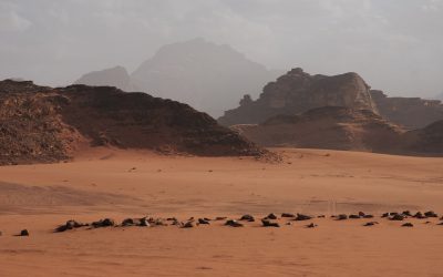
Climate Zones of Algeria: Different climate regions Of Algeria
Algeria, located in North Africa, is the largest country on the continent and is known for its diverse geography and climate. The country stretches from the Mediterranean Sea in the north to the Sahara Desert in the south, and its climate zones vary greatly across its vast expanse. Understanding these climate zones is crucial for various sectors, including agriculture, tourism, and conservation. Summary Algeria has five main climate zones: Saharan, Mediterranean, Highland, Steppe, and Coastal. The Saharan climate zone covers about 80% of Algeria and is characterized by extreme heat and aridity. The Mediterranean climate zone is found along the northern coast and experiences mild, wet winters and hot, dry summers. The Highland climate zone is located in the Atlas Mountains and has cooler temperatures and more precipitation than other regions. The Steppe climate zone is semi-arid and covers the central plateau, while the Coastal climate zone is characterized by mild temperatures and high humidity. Climate variations in Algeria’s mountainous regions can lead to significant differences in temperature and precipitation. The impact of climate zones on Algeria’s agriculture is significant, with certain crops only able to grow in specific regions. Climate change is expected to have a significant impact on Algeria’s climate zones in the future. Despite the challenges posed by climate variability, Algeria’s diverse climate zones offer unique opportunities for tourism and economic development. Overall, Algeria’s climate zones demonstrate the country’s rich natural diversity and highlight the importance of sustainable management practices. The Saharan Climate Zone of Algeria The Saharan climate zone covers a significant portion of Algeria, particularly in the southern regions. This zone is characterized by...