World Geography
Geography is the study of the Earth’s landscapes, environments, and the relationships between people and their surroundings. It encompasses both the physical aspects of the Earth, such as its landforms, bodies of water, and climate, as well as the human aspects, including population distribution, cultures, and economies. World geography is a broad field that seeks to understand the complexities of our planet and how humans interact with it. By studying world geography, we can gain a deeper appreciation for the diversity of our planet and the interconnectedness of its various regions.
Geography is a multidisciplinary field that draws on elements of physical science, social science, and humanities. It involves the use of maps, spatial analysis, and geographic information systems (GIS) to understand the Earth’s surface and the processes that shape it. World geography also encompasses the study of human geography, which examines the ways in which people and their activities are distributed across the Earth. By understanding world geography, we can better appreciate the environmental, cultural, and economic challenges facing different regions of the world. This knowledge is crucial for addressing global issues such as climate change, resource management, and international development.
The Five Oceans and Seven Continents
The Earth’s surface is divided into five major oceans: the Pacific, Atlantic, Indian, Southern (or Antarctic), and Arctic Oceans. These vast bodies of water play a crucial role in regulating the Earth’s climate and supporting diverse marine ecosystems. The oceans also serve as important transportation routes and a source of food and other natural resources for human societies around the world.
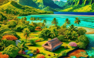
In addition to the oceans, the Earth’s landmasses are divided into seven continents: Africa, Antarctica, Asia, Europe, North America, Australia (or Oceania), and South America. Each continent has its own unique physical and cultural characteristics, shaped by millions of years of geological processes and human history. From the deserts of Africa to the rainforests of South America, the continents offer a rich tapestry of landscapes and environments for exploration and study.
Major Mountain Ranges and Deserts
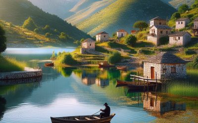
The Earth’s surface is also marked by major mountain ranges and deserts that have shaped the planet’s physical and cultural landscapes. The Himalayas, for example, are the highest mountain range in the world and are home to diverse ecosystems and cultures in countries such as India, Nepal, and Bhutan. The Andes in South America, the Rockies in North America, and the Alps in Europe are other prominent mountain ranges that have influenced human settlement patterns and economic activities.
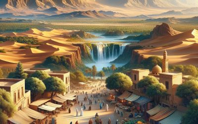
Deserts cover about one-third of the Earth’s land surface and are characterized by low precipitation and extreme temperatures. The Sahara Desert in Africa is the largest hot desert in the world, while the Gobi Desert in Asia is one of the largest cold deserts. Deserts are not only home to unique flora and fauna but have also been important trade routes and cultural crossroads throughout history.
Climate Zones and Biomes
The Earth’s climate is influenced by a variety of factors, including latitude, altitude, ocean currents, and prevailing winds. As a result, the planet is divided into different climate zones, each with its own characteristic weather patterns and ecosystems. The equator, for example, experiences a tropical climate with high temperatures and heavy rainfall, while the polar regions have a cold and dry climate.
These climate zones give rise to different biomes, or large ecological areas characterized by distinct plant and animal communities. The tropical rainforest biome, found near the equator, is home to a diverse array of species and is vital for regulating the Earth’s climate. The grasslands biome, found in regions such as the African savannah and North American prairies, supports grazing animals and has been important for human agriculture throughout history.
Human Geography and Population Distribution
Human geography examines the ways in which people and their activities are distributed across the Earth’s surface. It encompasses topics such as population growth, migration patterns, urbanization, and cultural diversity. Understanding human geography is crucial for addressing global challenges such as poverty, inequality, and environmental degradation.
Population distribution is uneven across the world, with some regions experiencing rapid population growth while others are declining. The majority of the world’s population lives in Asia, particularly in countries such as China and India. Urban areas are also growing rapidly, with more than half of the world’s population now living in cities. This trend has significant implications for infrastructure development, resource management, and social inequality.
Historical and Cultural Geography
Historical geography examines how human activities have shaped the Earth’s landscapes over time. It explores topics such as colonialism, trade routes, and the rise and fall of empires. Cultural geography focuses on how human cultures have developed in different regions of the world and how they interact with their environments.
The Silk Road, for example, was an ancient trade route that connected China with Europe and facilitated the exchange of goods, ideas, and technologies across Eurasia. This historical trade route had a profound impact on the development of cultures and economies along its path. Similarly, cultural geographers study how different societies have adapted to their environments through practices such as agriculture, architecture, and religious beliefs.
The Importance of Geographic Knowledge
Geographic knowledge is crucial for addressing global challenges such as climate change, resource management, and international development. By understanding world geography, we can better appreciate the environmental, cultural, and economic challenges facing different regions of the world. This knowledge is crucial for addressing global issues such as climate change, resource management, and international development.
Geographic knowledge also helps us to understand our interconnectedness with other regions of the world. By studying world geography, we can gain a deeper appreciation for the diversity of our planet and the interconnectedness of its various regions. This understanding can foster a sense of global citizenship and empathy for people from different cultures and backgrounds.
In conclusion, world geography is a complex and multifaceted field that encompasses both physical and human aspects of the Earth’s landscapes. By studying world geography, we can gain a deeper appreciation for the diversity of our planet and the interconnectedness of its various regions. This knowledge is crucial for addressing global challenges such as climate change, resource management, and international development. It also helps us to understand our interconnectedness with other regions of the world and fosters a sense of global citizenship.
FAQs
What is world geography?
World geography is the study of the Earth’s landscapes, environments, and the relationships between people and their environments. It encompasses the physical features of the Earth, as well as the human activity that takes place on it.
Why is world geography important?
World geography is important because it helps us understand the world around us. It provides insights into the physical and human processes that shape our planet, and helps us make informed decisions about how to interact with our environment.
What are the main branches of world geography?
The main branches of world geography include physical geography, which focuses on the Earth’s natural features and processes, and human geography, which examines the relationships between people and their environments.
How does world geography impact our daily lives?
World geography impacts our daily lives in numerous ways, from influencing the weather and climate we experience, to shaping the availability of natural resources and influencing the distribution of populations and cultures around the world.
What are some key concepts in world geography?
Key concepts in world geography include location, place, human-environment interaction, movement, and region. These concepts help geographers understand and interpret the world around them.
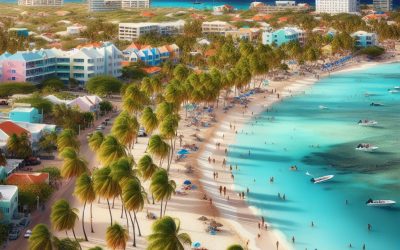
Aruba
Aruba Capital: Oranjestad Population (Estimated July 2012): 107,635 Area: 193km2 or 75mi2 Currency: Aruban Florin (AF.) Official Language: Dutch; Papiamentu Political Information: Autonomous State of the Netherlands with Parliamentary Democracy Official Religion: No Official Religion (approximately 80.8% of the population are Roman Catholic, 7.8% are Protestant, 1.5% are Jehovah’s Witnesses, 5.1% have other religious beliefs and 4.6% have no or unspecified religious beliefs) Highest Point: Ceru Jamanota at 188m or 617ft GDP Official Exchange Rate (OER is more precise at gauging a countries economic power) (Estimated 2009): $2.516 (US$) or £1.89 billion(GBP) GDP (OER) Per Capita (per member of the population estimated 2011): $25,300 (US$) or £18,956 (GBP) GDP Purchasing Power Parity (PPP is good for gauging living conditions and use of resources but not as accurate as OER. This data has been calculated based on the sum value of all goods and services produced in the country valued at prices prevailing in the United States) (Estimated 2009): $2.516 (US$) or £1.89 billion(GBP) GDP (PPP) Per Capita (per member of the population estimated 2011): $25,300 (US$) or £18,956 (GBP) Time Zone (GMT/UTC): -4:00 Leaders: King WILLEM-ALEXANDER of the Netherlands (since 30 April 2013); represented by Governor General Alfonso BOEKHOUDT (since 1 January 2017); Prime Minister Evelyn WEVER-CROES (since 17 November 2017) Sources: CIA World Fact Book, Encyclopaedia...
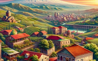
Armenia
Armenia (Hayastani Hanrapetut’yun (Republic of Armenia)) Capital: Yerevan Population (Estimated July 2012): 2,970,495 Area: 29,743 km2 or 11,484 mi2 Currency: Armenian Dram (AMD) Official Language: Armenian Political Information: Parliamentary Republic Official Religion: No Official Religion (approximately 94.7% of the population Armenian Apostolic, 4% have other Christian beliefs and 1.3% are Yezidi) Highest Mountain: Aragats Lerrnagagat at 4,090m or 13,419ft GDP Official Exchange Rate (OER is more precise at gauging a countries economic power) (Estimated 2017): $11.04 billion (US$) or £8.27 billion (GBP) GDP (OER) Per Capita (per member of the population estimated 2016): $3,614 (US$) or £2,707 (GBP) GDP Purchasing Power Parity (PPP is good for gauging living conditions and use of resources but not as accurate as OER. This data has been calculated based on the sum value of all goods and services produced in the country valued at prices prevailing in the United States) (Estimated 2017): $27.21 billion (US$) or £20.39 billion(GBP) GDP (PPP) Per Capita (per member of the population estimated 2017): $9,100 (US$) or £6,818 (GBP) Time Zone (GMT/UTC): +4:00 Counties/Provinces/States: Provinces (marzer, singular – marz); Aragatsotn, Ararat, Armavir, Geghark’unik’, Kotayk’, Lorri, Shirak, Syunik’, Tavush, Vayots’ Dzor, Yerevan Leaders: President Armen SARKISSIAN (since 9 April 2018); Prime Minister Nikol PASHINYAN (since 8 May 2018); First Deputy Prime Minister Ararat MIRZOYAN (since 11 May 2018) Sources: CIA World Fact Book, Encyclopaedia Britannica, Armenia, a small landlocked country in the South Caucasus region of Eurasia, is a hidden gem waiting to be discovered. With its rich history, vibrant culture, and breathtaking landscapes, Armenia offers a unique and unforgettable experience for...
Argentina
Argentina (República Argentina (Argentine Republic)) Capital: Buenos Aires Population (Estimated July 2012): 42,192,494 Area: 2,780,403km2 or 1,073,520mi2 Currency: Peso (ARS) Official Language: Spanish Political Information: Federal Republic Official Religion: No Official Religion (approximately 92% of the population are Roman Catholic, 2% are Protestant, 2% are Jewish and 4% have alternate other religious beliefs) Highest Mountain: Cerro Aconcagua at 6,960m or 22834ft GDP Official Exchange Rate (OER is more precise at gauging a countries economic power) (Estimated 2011): $435.2 billion (US$) or £261.12 billion(GBP) GDP (OER) Per Capita (per member of the population estimated 2011): (US$) or (GBP) GDP Purchasing Power Parity (PPP is good for gauging living conditions and use of resources but not as accurate as OER. This data has been calculated based on the sum value of all goods and services produced in the country valued at prices prevailing in the United States) (Estimated 2011): $709.7 billion (US$) or £425.82 billion(GBP) GDP (PPP) Per Capita (per member of the population estimated 2011): $17,400 (US$) or £10,440 (GBP) Time Zone (GMT/UTC): -3:00 Counties/Provinces/States: Provinces (provincias, singular – provincia) and 1 autonomous city*; Buenos Aires, Catamarca, Chaco, Chubut, Ciudad Autonoma de Buenos Aires*, Cordoba, Corrientes, Entre Rios, Formosa, Jujuy, La Pampa, La Rioja, Mendoza, Misiones, Neuquen, Rio Negro, Salta, San Juan, San Luis, Santa Cruz, Santa Fe, Santiago del Estero, Tierra del Fuego – Antartida e Islas del Atlantico Sur (Tierra del Fuego), Tucuman Leaders: President Cristina Fernandez De Kirchner (since 10 December 2007); Vice President Amado Boudou Additional: Argentina is the eighth largest country in the world and has the highest mountain in the...
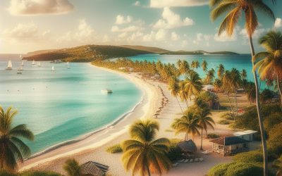
Antigua and Barbuda
Antigua and Barbuda Commonwealth Member since the 1st of November 1981. Capital: Saint John’s Population (Estimated July 2012): 89,018 Area: 442km2 or 171mi2 Currency: Eastern Caribbean Dollar (EC$) Official Language: English Political Information: Constitutional Monarchy with Democratic Parliament Official Religion: No Official Religion (approximately 76.4% of the population are Protestant, 10.4% are Roman Catholic, 7.4% have other religious beliefs and 5.8% have no or unspecified religious beliefs) Highest Mountain: Mount Obama (formerly Boggy Peak) at 402m or 1,319 ft GDP Official Exchange Rate (OER is more precise at gauging a countries economic power) (Estimated 2011): $1.3 billion (US$) or £780 million(GBP) GDP Purchasing Power Parity (PPP is good for gauging living conditions and use of resources but not as accurate as OER. This data has been calculated based on the sum value of all goods and services produced in the country valued at prices prevailing in the United States) (Estimated 2011): $1.734 billion (US$) or £1.040 billion (GBP) GDP (PPP) Per Capita (per member of the population estimated 2011): $22,100 (US$) or £13,260(GBP) Time Zone (GMT/UTC): -4:00 Counties/Provinces/States: 6 parishes and 2 dependencies*; Barbuda*, Redonda*, Saint George, Saint John, Saint Mary, Saint Paul, Saint Peter, Saint Philip Leaders: H.M. Queen Elizabeth II represented by Governor General Louisse Lake-Tack; Prime Minister Winston Baldwin Spencer Sources: CIA World Fact Book, Encyclopaedia Britannica, Antigua and Barbuda, located in the heart of the Caribbean, is a popular tourist destination known for its stunning beaches, crystal-clear waters, and vibrant culture. Comprising two main islands, Antigua and Barbuda, this small nation has a rich history as a former British colony...
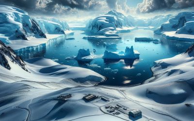
Antarctica
Antarctica Population (Estimated July 2012): 1,000-5,000 non Permanent but 0 Permanent. Area: 280,000km2 or 108,109mi2 (ice-free); 13,720,000 km2 or 5,297,321mi2 ice-covered Highest Mountain: Vinson Massif at 4,897m or...
Anguilla
Anguilla Capital: The Valley Population (Estimated July 2012): 15,423 Area: 91km2 or 35mi2 Currency: East Caribbean Dollar (XCD) Official Language: English Political Information: British Overseas Territory Official Religion: No Official Religion (approximately 83.1% of the population are Protestant, 5.7% are Roman Catholic, 1.7% have other Christian beliefs, 5.2% have different religious beliefs and 4.3% have no or unspecified religious beliefs) Highest Point: Crocus Hill at 65m or 213ft GDP Official Exchange Rate (OER is more precise at gauging a countries economic power) (Estimated 2009): $175.4 million (US$) or £105,240,000(GBP) GDP (OER) Per Capita (per member of the population estimated 2011): (US$) or (GBP) GDP Purchasing Power Parity (PPP is good for gauging living conditions and use of resources but not as accurate as OER. This data has been calculated based on the sum value of all goods and services produced in the country valued at prices prevailing in the United States) (Estimated 2009): $175.4 million (US$) or £105,240,000(GBP) GDP (PPP) Per Capita (per member of the population estimated 2008): $12,200 (US$) or £7,320(GBP) Time Zone (GMT/UTC): -4:00 Leaders: H.M. Queen Elizabeth II represented Governor Christina SCOTT; Chief Minister Hubert Hughes Sources: CIA World Fact Book, Encyclopaedia...
Angola
Angola (República de Angola (Republic of Angola)) Capital: Luanda Population (Estimated July 2012): 18,056,072 Area: 1,246,700km2 or 481,354 mi2 Currency: Kwanza (AOA) Official Language: Portuguese Political Information: Multiparty Presidential Republic Official Religion: No Official Religion (approximately 47% of the population have indigenous religious beliefs, 38% are Roman Catholic and 15% are Protestant) Highest Mountain: Mount Mocco (Morro de Moco) at 2,620m or 8596 Largest River: The Congo at 4,344km GDP Official Exchange Rate (OER is more precise at gauging a countries economic power) (Estimated 2011): $99.3 billion (US$) or £59,580 million(GBP) GDP (OER) Per Capita (per member of the population estimated 2011): (US$) or (GBP) GDP Purchasing Power Parity (PPP is good for gauging living conditions and use of resources but not as accurate as OER. This data has been calculated based on the sum value of all goods and services produced in the country valued at prices prevailing in the United States) (Estimated 2011): $115.9 billion (US$) or £69,540 million(GBP) GDP (PPP) Per Capita (per member of the population estimated 2011): $5,900 (US$) or £3,540(GBP) Time Zone (GMT/UTC): +1:00 Counties/Provinces/States: Provinces (provincias, singular – provincia); Bengo, Benguela, Bie, Cabinda, Kwando Kubango, Kwanza Norte, Kwanza Sul, Cunene, Huambo, Huila, Luanda, Lunda Norte, Lunda Sul, Malanje, Moxico, Namibe, Uige, Zaire Leaders: President Jose Eduardo Dos Santos; Vice President Fernando “Nando” da Piedade Dias Dos Santos Sources: CIA World Fact Book, Encyclopaedia Britannica, Angola, officially known as the Republic of Angola, is a country located in Southern Africa. It is bordered by Namibia to the south, Zambia to the east, and the Democratic Republic of the Congo to the...
Andorra
Andorra (Principat d’Andorra (Principality of Andorra)) Capital: Andorra la Vella Population (Estimated July 2012): 68,061 Area: 464km2 or 179mi2 Currency: Euro (€) Official Language: Catalan Political Information: Parliamentary Co-Principality Official Religion: No Official Religion (but predominantly Roman Catholic) Highest Mountain: Pic de Coma Pedrosa at 2,946m or 9,665ft Largest River: the Segre 265km GDP Purchasing Power Parity (PPP is good for gauging living conditions and use of resources but not as accurate as OER. This data has been calculated based on the sum value of all goods and services produced in the country valued at prices prevailing in the United States) (Estimated 2011): $3.169 billion (US$) or £1,901 million(GBP) GDP (PPP) Per Capita (per member of the population estimated 2011): $37,200 (US$) or £22,320(GBP) Time Zone (GMT/UTC): +1:00 Counties/Provinces/States: Parishes (parroquies, singular – parroquia); Andorra la Vella, Canillo, Encamp, Escaldes-Engordany, La Massana, Ordino, Sant Julia de Loria Leaders: French Co-prince Francois HOLLANDE (represented by Christian Fremont); Spanish Co-prince Archbishop Joan-Enric Vives i Sicilia (represented by Nemesi Marques i Oste); Executive Council President (or Cap de Govern) Antoni Marti Petit Additional: In 2007 Andorra had the highest age of Life expectancy at 83.5 years. Sources: CIA World Fact Book, Encyclopaedia Britannica, Andorra, a small landlocked country nestled in the Pyrenees Mountains between Spain and France, may not be on everyone’s travel radar. However, this tiny nation is full of surprises and offers a unique blend of Spanish and French influence, stunning natural landscapes, and a rich history. Despite its small size, Andorra has a lot to offer visitors, making it a must-visit destination for...
American Samoa
American Samoa (Amerika Samoa) Capital: Pago Pago Population (Estimated July 2012): 68,061 Area: 200km2 or 77mi2 Currency: United States Dollar (U.S.$) Official Language: English; Samoan Political Information: Unincorporated and unorganized territory of the US Official Religion: No Official Religion (approximately 50% of the population is Christian Congregationalist, 20% are Roman Catholic and 30% are either protestant or have other religious beliefs) Highest Mountain: Lata Mountain at 964m or 3162 feet GDP Official Exchange Rate (OER is more precise at gauging a countries economic power) (Estimated 2005): $462.2 million (US$) or (GBP) GDP (OER) Per Capita (per member of the population estimated 2011): (US$) or (GBP) GDP Purchasing Power Parity (PPP is good for gauging living conditions and use of resources but not as accurate as OER. This data has been calculated based on the sum value of all goods and services produced in the country valued at prices prevailing in the United States) (Estimated 2007): $575.3 million (US$) or (GBP) GDP (PPP) Per Capita (per member of the population estimated 2007): $8,000 (US$) or (GBP) Time Zone (GMT/UTC): -11:00 Counties/Provinces/States: three districts and two islands at the second order; Eastern, Manu’a, Rose Island, Swains Island, Western Leaders: President Donald Trump; Governor Togiola Tulafono Sources: CIA World Fact Book, Encyclopaedia...
Algeria
Algeria (Al-Jumhūriyyah al-Jazāʾiriyyah al-Dīmuqrāṭiyyah al-Shaʿbiyyah (People’s Democratic Republic of Algeria)) Capital: Algiers Population (Estimated July 2012): 35,406,303 Area: 2,381,741km2 or 919,595mi2 Currency: Algerian Dinar (DA) Official Language: Arabic Political Information: Presidential Republic Official Religion: Islam (with approximately 99% of the population are Sunni Muslim and 1% are Christian or Jewish) Highest Mountain: Tahat at 3,003m or 9852ft Largest River: Chelif River at 700km long GDP Official Exchange Rate (OER is more precise at gauging a countries economic power) (Estimated 2011): $183.4 billion (US$) or £110,040 million (GBP) GDP (OER) Per Capita (per member of the population estimated 2011): (US$) or (GBP) GDP Purchasing Power Parity (PPP is good for gauging living conditions and use of resources but not as accurate as OER. This data has been calculated based on the sum value of all goods and services produced in the country valued at prices prevailing in the United States) (Estimated 2011): $264.1 billion (US$) or £158,460 million(GBP) GDP (PPP) Per Capita (per member of the population estimated 2011): $7,200 (US$) or £4,320(GBP) Time Zone (GMT/UTC): +1:00 Counties/Provinces/States: Provinces (wilayat, singular – wilaya); Adrar, Ain Defla, Ain Temouchent, Alger, Annaba, Batna, Bechar, Bejaia, Biskra, Blida, Bordj Bou Arreridj, Bouira, Boumerdes, Chlef, Constantine, Djelfa, El Bayadh, El Oued, El Tarf, Ghardaia, Guelma, Illizi, Jijel, Khenchela, Laghouat, Mascara, Medea, Mila, Mostaganem, M’Sila, Naama, Oran, Ouargla, Oum el Bouaghi, Relizane, Saida, Setif, Sidi Bel Abbes, Skikda, Souk Ahras, Tamanghasset, Tebessa, Tiaret, Tindouf, Tipaza, Tissemsilt, Tizi Ouzou, Tlemcen Leaders: President Abdelaziz Bouteflika Sources: CIA World Fact Book, Encyclopaedia Britannica, Algeria, located in North Africa, is the largest country on the continent...
Albania
Albania (Republika e Shqipërisë (republic of Albania)) Capital: Tirana (Tiranë) Population (Estimated July 2012): 3,002,859 Area: 28,748km2 or 11,100mi2 Currency: Lek Official Language: Albanian Political Information: Parliamentary Republic Official Religion: No Official Religion (but approximately 70% of the population is Muslim, 20% are Albanian Orthodox and 10% are Roman Catholic) Highest Mountain: Mount Korab (Maja e Korabit (Golem Korab)) at 2,764m or 9,068ft Largest River: River Drin GDP Official Exchange Rate (OER is more precise at gauging a countries economic power) (Estimated 2011): $13.3 billion (US$) or £7,980,000 million(GBP) GDP (OER) Per Capita (per member of the population estimated 2011): (US$) or (GBP) GDP Purchasing Power Parity (PPP is good for gauging living conditions and use of resources but not as accurate as OER. This data has been calculated based on the sum value of all goods and services produced in the country valued at prices prevailing in the United States) (Estimated 2011): $24.99 billion (US$) or £14,994 million(GBP) GDP (PPP) Per Capita (per member of the population estimated 2011): $7,800 (US$) or £4,680 (GBP) Time Zone (GMT/UTC): +1:00 Counties/Provinces/States: 37 municipalities (komunat/opstine, singular – komuna/opstina); Decan/Decani, Dragash/Dragas, Ferizaj/Urosevac, Fushe Kosove/Kosovo Polje, Gjakove/Dakovica, Gjilan/Gnjilane, Gllogovc/Glogovac, Gracanice/Gracanica, Hani i Elezit/Deneral Jankovic, Istog/Istok, Junik, Kacanik/Kacanik, Kamenice/Kamenica, Kline/Klina, Kllokot/Klokot, Leposaviq/Leposavic, Lipjan/Lipljan, Malisheve/Malisevo, Mamushe/Mamusa, Mitrovice/Mitrovica, Novoberde/Novo Brdo, Obiliq/Obilic, Partesh/Partes, Peje/Pec, Podujeve/Podujevo, Prishtine/Pristina, Prizren, Rahovec/Orahovac, Ranillug/Ranilug, Shterpce/Strpce, Shtime/Stimlje, Skenderaj/Srbica, Suhareke/Suva Reka, Viti/Vitina, Vushtrri/Vucitrn, Zubin Potok, Zvecan/Zvecan Leaders: President Bujar Nishani; Prime Minister Edi Rama Sources: CIA World Fact Book, Encyclopaedia Britannica, Albania, located in Southeastern Europe, is a country with a rich history and vibrant culture. It is bordered by Montenegro to...
Akrotiri and Dhekelia
Akrotiri and Dhekelia Capital: Episkopi Population (Estimated July 2012): 7,000 Cypriots and 7,500 British Military and Families. Area: 256km2 or 99mi2 Currency: Euro Official Language: English and Greek Political Information: Sovereign Base Area (U.K.) Official Religion: No Official Religion Economy: All goods and services are imported and funded by the government of the United Kingdom. Time Zone (GMT/UTC): + 2:00 Leaders: H.M. Queen Elizabeth II; Administrator Air Vice Marshall Graham Stacey. Sources: CIA World Fact Book, and Encyclopaedia...