World Geography
Geography is the study of the Earth’s landscapes, environments, and the relationships between people and their surroundings. It encompasses both the physical aspects of the Earth, such as its landforms, bodies of water, and climate, as well as the human aspects, including population distribution, cultures, and economies. World geography is a broad field that seeks to understand the complexities of our planet and how humans interact with it. By studying world geography, we can gain a deeper appreciation for the diversity of our planet and the interconnectedness of its various regions.
Geography is a multidisciplinary field that draws on elements of physical science, social science, and humanities. It involves the use of maps, spatial analysis, and geographic information systems (GIS) to understand the Earth’s surface and the processes that shape it. World geography also encompasses the study of human geography, which examines the ways in which people and their activities are distributed across the Earth. By understanding world geography, we can better appreciate the environmental, cultural, and economic challenges facing different regions of the world. This knowledge is crucial for addressing global issues such as climate change, resource management, and international development.
The Five Oceans and Seven Continents
The Earth’s surface is divided into five major oceans: the Pacific, Atlantic, Indian, Southern (or Antarctic), and Arctic Oceans. These vast bodies of water play a crucial role in regulating the Earth’s climate and supporting diverse marine ecosystems. The oceans also serve as important transportation routes and a source of food and other natural resources for human societies around the world.
In addition to the oceans, the Earth’s landmasses are divided into seven continents: Africa, Antarctica, Asia, Europe, North America, Australia (or Oceania), and South America. Each continent has its own unique physical and cultural characteristics, shaped by millions of years of geological processes and human history. From the deserts of Africa to the rainforests of South America, the continents offer a rich tapestry of landscapes and environments for exploration and study.
Major Mountain Ranges and Deserts
The Earth’s surface is also marked by major mountain ranges and deserts that have shaped the planet’s physical and cultural landscapes. The Himalayas, for example, are the highest mountain range in the world and are home to diverse ecosystems and cultures in countries such as India, Nepal, and Bhutan. The Andes in South America, the Rockies in North America, and the Alps in Europe are other prominent mountain ranges that have influenced human settlement patterns and economic activities.
Deserts cover about one-third of the Earth’s land surface and are characterized by low precipitation and extreme temperatures. The Sahara Desert in Africa is the largest hot desert in the world, while the Gobi Desert in Asia is one of the largest cold deserts. Deserts are not only home to unique flora and fauna but have also been important trade routes and cultural crossroads throughout history.
Climate Zones and Biomes
The Earth’s climate is influenced by a variety of factors, including latitude, altitude, ocean currents, and prevailing winds. As a result, the planet is divided into different climate zones, each with its own characteristic weather patterns and ecosystems. The equator, for example, experiences a tropical climate with high temperatures and heavy rainfall, while the polar regions have a cold and dry climate.
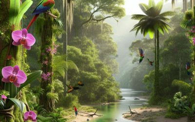
These climate zones give rise to different biomes, or large ecological areas characterized by distinct plant and animal communities. The tropical rainforest biome, found near the equator, is home to a diverse array of species and is vital for regulating the Earth’s climate. The grasslands biome, found in regions such as the African savannah and North American prairies, supports grazing animals and has been important for human agriculture throughout history.
Human Geography and Population Distribution
Human geography examines the ways in which people and their activities are distributed across the Earth’s surface. It encompasses topics such as population growth, migration patterns, urbanization, and cultural diversity. Understanding human geography is crucial for addressing global challenges such as poverty, inequality, and environmental degradation.
Population distribution is uneven across the world, with some regions experiencing rapid population growth while others are declining. The majority of the world’s population lives in Asia, particularly in countries such as China and India. Urban areas are also growing rapidly, with more than half of the world’s population now living in cities. This trend has significant implications for infrastructure development, resource management, and social inequality.
Historical and Cultural Geography
Historical geography examines how human activities have shaped the Earth’s landscapes over time. It explores topics such as colonialism, trade routes, and the rise and fall of empires. Cultural geography focuses on how human cultures have developed in different regions of the world and how they interact with their environments.
The Silk Road, for example, was an ancient trade route that connected China with Europe and facilitated the exchange of goods, ideas, and technologies across Eurasia. This historical trade route had a profound impact on the development of cultures and economies along its path. Similarly, cultural geographers study how different societies have adapted to their environments through practices such as agriculture, architecture, and religious beliefs.
The Importance of Geographic Knowledge
Geographic knowledge is crucial for addressing global challenges such as climate change, resource management, and international development. By understanding world geography, we can better appreciate the environmental, cultural, and economic challenges facing different regions of the world. This knowledge is crucial for addressing global issues such as climate change, resource management, and international development.
Geographic knowledge also helps us to understand our interconnectedness with other regions of the world. By studying world geography, we can gain a deeper appreciation for the diversity of our planet and the interconnectedness of its various regions. This understanding can foster a sense of global citizenship and empathy for people from different cultures and backgrounds.
In conclusion, world geography is a complex and multifaceted field that encompasses both physical and human aspects of the Earth’s landscapes. By studying world geography, we can gain a deeper appreciation for the diversity of our planet and the interconnectedness of its various regions. This knowledge is crucial for addressing global challenges such as climate change, resource management, and international development. It also helps us to understand our interconnectedness with other regions of the world and fosters a sense of global citizenship.
FAQs
What is world geography?
World geography is the study of the Earth’s landscapes, environments, and the relationships between people and their environments. It encompasses the physical features of the Earth, as well as the human activity that takes place on it.
Why is world geography important?
World geography is important because it helps us understand the world around us. It provides insights into the physical and human processes that shape our planet, and helps us make informed decisions about how to interact with our environment.
What are the main branches of world geography?
The main branches of world geography include physical geography, which focuses on the Earth’s natural features and processes, and human geography, which examines the relationships between people and their environments.
How does world geography impact our daily lives?
World geography impacts our daily lives in numerous ways, from influencing the weather and climate we experience, to shaping the availability of natural resources and influencing the distribution of populations and cultures around the world.
What are some key concepts in world geography?
Key concepts in world geography include location, place, human-environment interaction, movement, and region. These concepts help geographers understand and interpret the world around them.

Climate Zones of Suriname: Exploring Suriname’s Varied Climates
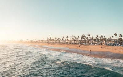
Suriname, a small yet ecologically rich country located on the northeastern coast of South America, boasts a remarkable diversity of climate zones. This diversity is largely attributed to its geographical position, topography, and the influence of various climatic systems. The country is bordered by the Atlantic Ocean to the north, Brazil to the south, and French Guiana to the east, which collectively contribute to its unique weather patterns. Suriname‘s climate can be broadly categorised into several distinct zones, each characterised by its own temperature ranges, precipitation levels, and seasonal variations. Understanding these climate zones is essential for appreciating the rich biodiversity and cultural practices that thrive within this South American gem. The climate of Suriname is predominantly tropical, with high humidity and temperatures that typically hover around 27 to 30 degrees Celsius throughout the year. However, the interplay of different climatic influences creates a mosaic of microclimates across the country. From the lush tropical rainforests that dominate the interior to the drier savanna regions in the south, each zone supports a unique array of flora and fauna. This article delves into the various climate zones of Suriname, exploring their characteristics, implications for biodiversity, and the impact on human activities. Summary Suriname has a diverse range of climate zones, including tropical rainforest, savanna, tropical monsoon, subtropical, highland, and coastal climates. The tropical rainforest climate in Suriname is characterized by high temperatures, heavy rainfall, and lush vegetation, making it a biodiverse and ecologically rich region. The savanna climate in Suriname features a dry season and a wet season, with grasslands and scattered trees dominating the landscape. Suriname’s tropical monsoon climate experiences...
Exploring Suriname’s Cultural and Historical Sites
Suriname, a small yet vibrant nation located on the northeastern coast of South America, is a treasure trove of cultural and historical significance. With a rich tapestry woven from the threads of its indigenous peoples, colonial past, and diverse immigrant communities, Suriname offers a unique glimpse into the confluence of various cultures. The country’s historical sites are not merely remnants of the past; they are living narratives that reflect the struggles, triumphs, and everyday lives of its people. From the bustling streets of Paramaribo to the serene landscapes of its interior, each site tells a story that contributes to the national identity. The significance of these cultural and historical sites extends beyond mere tourism; they are vital for understanding Suriname’s complex history. The influences of indigenous tribes, European colonisers, African slaves, and Asian indentured labourers have all left indelible marks on the nation’s cultural landscape. As such, these sites serve as important educational resources, offering insights into the diverse heritage that shapes contemporary Surinamese society. Visitors to Suriname are not just observers; they become participants in a living history that continues to evolve. Summary Suriname is home to a rich cultural and historical heritage, with a unique blend of indigenous, colonial, and religious influences. The Historic Inner City of Paramaribo is a UNESCO World Heritage Site, showcasing the country’s colonial architecture and vibrant cultural scene. Visitors can immerse themselves in the indigenous cultures and traditions of Suriname, learning about the customs and beliefs of the country’s diverse ethnic groups. Exploring the plantation and slavery history of Suriname offers a sobering look at the country’s past, with opportunities to visit...
Exploring Suriname’s Diverse Terrain: Mountains, Valleys, and Plains
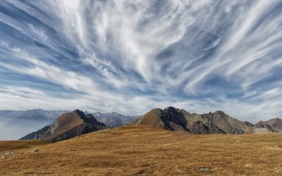
Suriname, a small yet captivating country located on the northeastern coast of South America, is renowned for its extraordinary and varied terrain. Spanning approximately 163,000 square kilometres, it is bordered by French Guiana to the south, Brazil to the southwest, and Guyana to the west. The nation is characterised by its rich tapestry of ecosystems, ranging from dense rainforests and majestic mountains to expansive savannahs and coastal plains. This diversity is not merely a geographical feature; it is a vital component of Suriname‘s identity, influencing its culture, economy, and the lives of its inhabitants. The country’s landscape is predominantly shaped by its tropical climate, which fosters an abundance of flora and fauna. Suriname’s terrain is a mosaic of natural wonders, including the Amazon rainforest, which covers a significant portion of the country. This lush environment is home to countless species of plants and animals, many of which are endemic to the region. The interplay between the various geographical features creates a unique ecological balance that supports both terrestrial and aquatic life. As one traverses the country, the dramatic shifts in scenery—from towering mountains to serene valleys—offer a glimpse into the intricate relationship between nature and the people who inhabit this remarkable land. Summary Suriname’s diverse terrain offers a range of landscapes, from mountains to valleys and plains. The Tumuc-Humac Mountains stand majestically, offering stunning views and challenging hikes. The lush valleys of Suriname are a sight to behold, with their vibrant greenery and diverse flora and fauna. The vast plains of the coastal region provide a different kind of beauty, with their open spaces and unique ecosystems. Voltzberg and...
Exploring the Fascinating History of Suriname
Suriname, a small nation located on the northeastern coast of South America, is home to a rich tapestry of Indigenous cultures that have thrived for thousands of years. The original inhabitants of this land include several distinct groups, such as the Arawaks, Caribs, and the Wayana, each with their own unique languages, traditions, and social structures. The Arawaks, known for their agricultural practices, cultivated crops like cassava and maize, while the Caribs were renowned for their seafaring skills and warrior culture. The Wayana, residing primarily in the interior regions, maintained a more nomadic lifestyle, relying on hunting and gathering in the dense rainforests. The Indigenous peoples of Suriname have a profound connection to their environment, which is reflected in their spiritual beliefs and cultural practices. Many tribes view the forest as a living entity, imbued with spirits that guide and protect them. This reverence for nature is evident in their art, music, and oral traditions, which often celebrate the flora and fauna of the region. Despite facing significant challenges from external forces throughout history, including colonisation and resource exploitation, these communities have demonstrated remarkable resilience. Today, they continue to advocate for their rights and strive to preserve their cultural heritage in the face of modernisation and environmental threats. Summary The Indigenous Peoples of Suriname have a rich and diverse cultural heritage, including the Arawak, Carib, and Warao tribes. The Colonial Period saw Dutch settlement and the establishment of plantations, leading to the importation of African slaves to work on the sugar, coffee, and cocoa plantations. Slavery had a profound impact on Suriname’s history, shaping its economy, society, and culture...
Exploring Suriname’s Population Density
Suriname, a small nation located on the northeastern coast of South America, is characterised by its unique geographical and demographic features. With a total land area of approximately 163,820 square kilometres, it is one of the least densely populated countries in the world, boasting a population of around 600,000 inhabitants. This results in a population density of roughly 3.7 people per square kilometre, which starkly contrasts with many other nations globally. The low population density can be attributed to Suriname‘s vast expanses of rainforest and its relatively small urban centres, which together create a complex tapestry of human habitation. The distribution of Suriname’s population is not uniform; it is heavily concentrated in certain areas while vast regions remain sparsely populated. The capital city, Paramaribo, is home to a significant portion of the population, serving as the political, economic, and cultural hub of the country. This urban concentration highlights the challenges and opportunities that arise from such demographic patterns. Understanding the nuances of Suriname’s population density is essential for addressing issues related to urban planning, resource allocation, and sustainable development. Summary Suriname has a relatively low population density compared to other countries, with most of its population concentrated in the coastal areas. Factors affecting population distribution in Suriname include geography, infrastructure, and economic opportunities. The urban population in Suriname is growing, leading to increased pressure on infrastructure and services in urban areas. Suriname’s ethnic diversity contributes to the country’s population density, with different ethnic groups settling in specific regions. Challenges of population density in Suriname include urban sprawl, strain on resources, and the need for sustainable development to manage population...
Suriname
Suriname (Republiek Suriname (Republic of Suriname)) Capital: Paramaribo Population (Estimated July 2012): 560,157 Area: 163,820km2 or 63,251mi2 Currency: Suriname Dollar (SRD) Official Language: Dutch Political Information: Democratic Republic Official Religion: No Official Religion(approximately 27.4% of the population are Hindu, 25.2% are Protestant, 22.8% are Roman Catholic, 19.6% are Muslim and 5% have Indigenous beliefs) Highest Mountain: Juliana Top (Mountain Peak) at 1,280m or 4,199ft GDP Official Exchange Rate (OER is more precise at gauging a country’s economic power) (Estimated 2011): $3.79 billion (US$) or (GBP) GDP (OER) Per Capita (per member of the population estimated 2011): (US$) or (GBP) GDP Purchasing Power Parity (PPP is good for gauging living conditions and the use of resources but is not as accurate as OER. This data has been calculated based on the sum value of all goods and services produced in the country valued at prices prevailing in the United States) (Estimated 2011): $5.125 billion (US$) or (GBP) GDP (PPP) Per Capita (per member of the population estimated 2011): $9,600 (US$) or (GBP) Time Zone (GMT/UTC): -3:00 Wildlife: Counties/Provinces/States: 10 districts (distrikten, singular – distrikt); Brokopondo, Commewijne, Coronie, Marowijne, Nickerie, Para, Paramaribo, Saramacca, Sipaliwini, Wanica Leaders: President Dési Delano Bouterse; Vice President Robert Ameerali Additional: Gained independence from the Netherlands on the 25th of November 1975. Sources: CIA World Fact Book, Encyclopaedia Britannica. Suriname Suriname, a small nation located on the northeastern coast of South America, is bordered by the Atlantic Ocean to the north, French Guiana to the east, Brazil to the south, and Guyana to the west. The country covers an area of approximately 163,820 square kilometres, making it one of the smallest countries on...

Political Boundaries of Sudan: Provinces, Districts, or Historical Boundaries.
Sudan, a nation located in the northeastern region of Africa, is characterised by its complex political boundaries that have evolved over centuries. These boundaries are not merely lines on a map; they represent a tapestry of historical, cultural, and social dynamics that have shaped the nation. The political landscape of Sudan is influenced by a myriad of factors, including colonial legacies, ethnic diversity, and ongoing conflicts. Understanding these boundaries is crucial for comprehending the current political climate and the challenges that the country faces. The delineation of Sudan’s political boundaries has been a contentious issue, often reflecting the struggles for power and identity among its diverse population. The country has experienced significant changes in its territorial integrity, particularly with the secession of South Sudan in 2011, which marked a pivotal moment in its history. This event not only altered the geographical landscape but also had profound implications for governance, resource distribution, and national unity. As such, an exploration of Sudan’s political boundaries reveals much about the nation’s past and present, as well as its potential future. Summary Sudan’s political boundaries have evolved over time and have significant implications for governance and administration. Sudan is divided into 18 provinces, each with its own unique characteristics and challenges. Districts play a crucial role in the administration and governance of Sudan, serving as the primary unit of local government. The historical boundaries of Sudan have been shaped by colonialism, conflict, and negotiations, leading to ongoing challenges and controversies. Understanding Sudan’s political boundaries is essential for effective governance, administration, and future prospects for the country. Overview of Sudan’s Provinces Sudan is administratively divided...

Climate Zones of Sudan: Different Climate Regions Of Sudan
Sudan, a vast country located in northeastern Africa, is characterised by a diverse range of climate zones that reflect its geographical and topographical variations. Spanning from the arid deserts of the north to the tropical regions in the south, Sudan‘s climate is influenced by several factors, including latitude, altitude, and proximity to the Nile River. The country can be broadly divided into three primary climate zones: the arid climate of Northern Sudan, the semi-arid climate of Central Sudan, and the tropical climate of Southern Sudan. Each of these zones presents unique environmental conditions that shape the livelihoods, agricultural practices, and socio-economic dynamics of the populations residing within them. Understanding these climate zones is crucial for several reasons. Firstly, they play a significant role in determining agricultural productivity, which is vital for food security in a country where a large portion of the population relies on subsistence farming. Secondly, the varying climates influence water availability, biodiversity, and the overall health of ecosystems. Lastly, as Sudan faces the challenges posed by climate change, comprehending these distinct climatic regions becomes essential for developing effective adaptation strategies and policies aimed at mitigating adverse impacts on communities and natural resources. Summary Sudan’s climate is divided into three main zones: arid in the north, semi-arid in the central region, and tropical in the south. Northern Sudan experiences extremely hot and dry conditions, with very little rainfall and high evaporation rates. Central Sudan has a semi-arid climate with slightly more rainfall than the north, but still faces water scarcity and desertification. Southern Sudan has a tropical climate with high temperatures and heavy rainfall, leading to lush...

Terrain and Topography of Sudan: mountains, valleys, and plains.
Sudan, the third-largest country in Africa, boasts a remarkably diverse terrain and topography that reflects its rich geological history and climatic variations. Stretching from the arid deserts of the north to the lush riverine landscapes of the south, Sudan‘s geography is a tapestry woven from a multitude of natural features. The country is characterised by vast stretches of desert, mountain ranges, plateaus, and fertile plains, each contributing to its ecological diversity and cultural richness. This geographical variety not only shapes the livelihoods of its inhabitants but also influences the flora and fauna that thrive within its borders. The terrain of Sudan is predominantly defined by its arid climate, particularly in the northern regions where the Sahara Desert dominates. However, as one moves southward, the landscape transforms dramatically, revealing a mosaic of ecosystems that support agriculture, pastoralism, and wildlife. The interplay between these contrasting environments creates a unique setting for understanding the historical and contemporary challenges faced by the nation, including issues related to water management, land use, and environmental conservation. This article delves into the significant geographical features of Sudan, exploring how they interact to form a complex and dynamic landscape. Summary Sudan’s terrain is diverse, ranging from deserts to mountains and plains. The Great Escarpment and the Red Sea Hills dominate the eastern part of Sudan’s landscape. The Nubian Desert and the Bayuda Desert are vast arid regions in the northern part of Sudan. The Nile River and its floodplains are central to Sudan’s geography and support agriculture and wildlife. The Darfur Plateau and the Marrah Mountains are located in the western part of Sudan and offer a...

Natural Resources of Sudan: Where Natural Resources are Located in Sudan
Sudan, a country located in the northeastern region of Africa, is endowed with a wealth of natural resources that have the potential to significantly contribute to its economic development. The vast landscapes of Sudan encompass diverse ecosystems, rich mineral deposits, extensive agricultural land, and substantial oil and gas reserves. These resources not only provide opportunities for economic growth but also pose challenges in terms of sustainable management and equitable distribution. The interplay between these natural assets and the socio-political landscape of Sudan has shaped its development trajectory, making it imperative to understand the full scope of its natural resources. The significance of Sudan’s natural resources extends beyond mere economic metrics; they are deeply intertwined with the livelihoods of millions of Sudanese citizens. Agriculture remains a cornerstone of the economy, while the discovery of oil in the late 20th century transformed the nation’s financial landscape. However, the management of these resources has often been marred by conflict, mismanagement, and environmental degradation. As Sudan navigates its path towards stability and growth, a comprehensive understanding of its natural resources is essential for fostering sustainable development and improving the quality of life for its people. Summary Sudan is rich in natural resources, including oil and gas reserves, mineral deposits, agricultural resources, water resources, wildlife, and renewable energy sources. Sudan has significant oil and gas reserves, with the potential for further exploration and development in the future. The country also has abundant mineral deposits, including gold, iron ore, and copper, which contribute to its mining industry. Sudan’s agricultural resources and farming sector play a crucial role in the country’s economy, with a focus on...

History of Sudan
The Kingdom of Kush, which thrived from approximately 1070 BC to 350 AD, was a powerful and influential state located in what is now modern-day Sudan. This ancient kingdom emerged as a significant player in the region, particularly after the decline of the New Kingdom of Egypt. The Kushites established their capital at Napata, which became a centre of political and religious life. The Kushites were known for their impressive pyramids, which were built as royal tombs, and their unique blend of Egyptian and indigenous African cultures. The pyramids at Meroë, another capital of Kush, are particularly notable for their distinctive architectural style, which differs from the more famous pyramids of Giza. Kushite society was marked by a complex social structure and a rich cultural heritage. The kingdom was ruled by a series of powerful monarchs, many of whom were buried in elaborate tombs adorned with intricate carvings and hieroglyphs. The Kushites were also skilled artisans, producing exquisite pottery, jewellery, and textiles. Their economy was bolstered by agriculture, trade, and the exploitation of natural resources such as gold and iron. The Kingdom of Kush maintained a dynamic relationship with Egypt, at times conquering it and at other times being influenced by its culture. This interplay between the two civilisations contributed to the development of a unique Kushite identity that blended elements from both cultures. Summary The Kingdom of Kush was an ancient Sudanese kingdom known for its wealth and power, with its capital at Meroe. The Arab conquest and Islamic influence in Sudan led to the spread of Islam and the Arabization of the region. Ottoman and Egyptian rule...

Cultural or Historical Sites of Sudan: Important Cultural Landmarks or Historical Sites In Sudan
Sudan, a nation steeped in a rich tapestry of history and culture, boasts an array of historical sites that reflect its diverse heritage. From the ancient kingdoms of Nubia to the Islamic empires that flourished in the region, Sudan‘s cultural landscape is a testament to its long-standing significance in the annals of human civilization. The country is home to numerous archaeological treasures, many of which remain relatively undiscovered or underappreciated by the wider world. This article delves into some of the most remarkable cultural and historical sites in Sudan, each offering a unique glimpse into the past and the enduring legacy of its people. The significance of these sites extends beyond mere tourism; they are vital for understanding the complex interplay of cultures that have shaped Sudan over millennia. The remnants of ancient civilisations, religious monuments, and colonial architecture all contribute to a narrative that is both intricate and compelling. As we explore these sites, we uncover stories of power, faith, and resilience that continue to resonate in contemporary Sudanese society. Each location serves as a reminder of the country’s historical depth and the importance of preserving its cultural heritage for future generations. Summary Sudan is home to a wealth of cultural and historical sites that offer a glimpse into the country’s rich and diverse past. The Pyramids of Meroe are an ancient Nubian burial ground, showcasing the impressive architectural and cultural achievements of the region. The National Museum of Sudan plays a crucial role in preserving the country’s history, housing a vast collection of artefacts and treasures. Jebel Barkal is a sacred mountain and temple complex that holds...