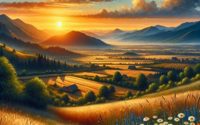
World Geography
Geography is the study of the Earth’s landscapes, environments, and the relationships between people and their surroundings. It encompasses both the physical aspects of the Earth, such as its landforms, bodies of water, and climate, as well as the human aspects, including population distribution, cultures, and economies. World geography is a broad field that seeks to understand the complexities of our planet and how humans interact with it. By studying world geography, we can gain a deeper appreciation for the diversity of our planet and the interconnectedness of its various regions.
Geography is a multidisciplinary field that draws on elements of physical science, social science, and humanities. It involves the use of maps, spatial analysis, and geographic information systems (GIS) to understand the Earth’s surface and the processes that shape it. World geography also encompasses the study of human geography, which examines the ways in which people and their activities are distributed across the Earth. By understanding world geography, we can better appreciate the environmental, cultural, and economic challenges facing different regions of the world. This knowledge is crucial for addressing global issues such as climate change, resource management, and international development.
The Five Oceans and Seven Continents
The Earth’s surface is divided into five major oceans: the Pacific, Atlantic, Indian, Southern (or Antarctic), and Arctic Oceans. These vast bodies of water play a crucial role in regulating the Earth’s climate and supporting diverse marine ecosystems. The oceans also serve as important transportation routes and a source of food and other natural resources for human societies around the world.
In addition to the oceans, the Earth’s landmasses are divided into seven continents: Africa, Antarctica, Asia, Europe, North America, Australia (or Oceania), and South America. Each continent has its own unique physical and cultural characteristics, shaped by millions of years of geological processes and human history. From the deserts of Africa to the rainforests of South America, the continents offer a rich tapestry of landscapes and environments for exploration and study.
Major Mountain Ranges and Deserts
The Earth’s surface is also marked by major mountain ranges and deserts that have shaped the planet’s physical and cultural landscapes. The Himalayas, for example, are the highest mountain range in the world and are home to diverse ecosystems and cultures in countries such as India, Nepal, and Bhutan. The Andes in South America, the Rockies in North America, and the Alps in Europe are other prominent mountain ranges that have influenced human settlement patterns and economic activities.
Deserts cover about one-third of the Earth’s land surface and are characterized by low precipitation and extreme temperatures. The Sahara Desert in Africa is the largest hot desert in the world, while the Gobi Desert in Asia is one of the largest cold deserts. Deserts are not only home to unique flora and fauna but have also been important trade routes and cultural crossroads throughout history.
Climate Zones and Biomes
The Earth’s climate is influenced by a variety of factors, including latitude, altitude, ocean currents, and prevailing winds. As a result, the planet is divided into different climate zones, each with its own characteristic weather patterns and ecosystems. The equator, for example, experiences a tropical climate with high temperatures and heavy rainfall, while the polar regions have a cold and dry climate.
These climate zones give rise to different biomes, or large ecological areas characterized by distinct plant and animal communities. The tropical rainforest biome, found near the equator, is home to a diverse array of species and is vital for regulating the Earth’s climate. The grasslands biome, found in regions such as the African savannah and North American prairies, supports grazing animals and has been important for human agriculture throughout history.
Human Geography and Population Distribution
Human geography examines the ways in which people and their activities are distributed across the Earth’s surface. It encompasses topics such as population growth, migration patterns, urbanization, and cultural diversity. Understanding human geography is crucial for addressing global challenges such as poverty, inequality, and environmental degradation.
Population distribution is uneven across the world, with some regions experiencing rapid population growth while others are declining. The majority of the world’s population lives in Asia, particularly in countries such as China and India. Urban areas are also growing rapidly, with more than half of the world’s population now living in cities. This trend has significant implications for infrastructure development, resource management, and social inequality.
Historical and Cultural Geography
Historical geography examines how human activities have shaped the Earth’s landscapes over time. It explores topics such as colonialism, trade routes, and the rise and fall of empires. Cultural geography focuses on how human cultures have developed in different regions of the world and how they interact with their environments.
The Silk Road, for example, was an ancient trade route that connected China with Europe and facilitated the exchange of goods, ideas, and technologies across Eurasia. This historical trade route had a profound impact on the development of cultures and economies along its path. Similarly, cultural geographers study how different societies have adapted to their environments through practices such as agriculture, architecture, and religious beliefs.
The Importance of Geographic Knowledge
Geographic knowledge is crucial for addressing global challenges such as climate change, resource management, and international development. By understanding world geography, we can better appreciate the environmental, cultural, and economic challenges facing different regions of the world. This knowledge is crucial for addressing global issues such as climate change, resource management, and international development.
Geographic knowledge also helps us to understand our interconnectedness with other regions of the world. By studying world geography, we can gain a deeper appreciation for the diversity of our planet and the interconnectedness of its various regions. This understanding can foster a sense of global citizenship and empathy for people from different cultures and backgrounds.
In conclusion, world geography is a complex and multifaceted field that encompasses both physical and human aspects of the Earth’s landscapes. By studying world geography, we can gain a deeper appreciation for the diversity of our planet and the interconnectedness of its various regions. This knowledge is crucial for addressing global challenges such as climate change, resource management, and international development. It also helps us to understand our interconnectedness with other regions of the world and fosters a sense of global citizenship.
FAQs
What is world geography?
World geography is the study of the Earth’s landscapes, environments, and the relationships between people and their environments. It encompasses the physical features of the Earth, as well as the human activity that takes place on it.
Why is world geography important?
World geography is important because it helps us understand the world around us. It provides insights into the physical and human processes that shape our planet, and helps us make informed decisions about how to interact with our environment.
What are the main branches of world geography?
The main branches of world geography include physical geography, which focuses on the Earth’s natural features and processes, and human geography, which examines the relationships between people and their environments.
How does world geography impact our daily lives?
World geography impacts our daily lives in numerous ways, from influencing the weather and climate we experience, to shaping the availability of natural resources and influencing the distribution of populations and cultures around the world.
What are some key concepts in world geography?
Key concepts in world geography include location, place, human-environment interaction, movement, and region. These concepts help geographers understand and interpret the world around them.

Exploring North Macedonia’s Diverse Terrain: Mountains, Valleys, and Plains
North Macedonia, situated in the centre of the Balkan Peninsula, is renowned for its diverse and striking terrain. The country’s landscape encompasses towering mountains, picturesque valleys and tranquil plains, offering a broad spectrum of natural environments. This varied topography not only provides visual appeal but also presents numerous opportunities for outdoor pursuits and exploration. The natural beauty and diverse terrain of North Macedonia make it an ideal destination for nature enthusiasts and those seeking adventure. The varied terrain of North Macedonia is a consequence of its distinctive geographical position and geological past. The nation is home to several mountain ranges, including the Šar Mountains, the Osogovo Mountains and the Bistra Mountain, which afford spectacular vistas and challenging hiking routes. In addition to its mountainous regions, North Macedonia features attractive valleys, such as the Pelagonia Valley and the Polog Valley, noted for their fertile soil and scenic landscapes. The country’s placid plains, including the Ovče Pole and the Pelagonia Plain, provide a serene contrast to its craggy mountains and verdant valleys. With such a diverse landscape, North Macedonia offers attractions to suit a wide range of visitors. Summary North Macedonia boasts a diverse terrain, offering a range of natural landscapes to explore and enjoy. The majestic mountains of North Macedonia provide stunning views and opportunities for hiking, climbing, and winter sports. The beautiful valleys of North Macedonia are home to lush greenery, picturesque villages, and fertile agricultural land. The serene plains of North Macedonia offer peaceful and tranquil surroundings, perfect for relaxation and birdwatching. North Macedonia’s national parks and protected areas are vital for preserving the country’s natural beauty and...

Exploring North Macedonia’s Diverse Climate Zones
North Macedonia, a landlocked country in the Balkan Peninsula, is renowned for its diverse climate zones. The nation’s geographical position and topography contribute to the presence of several distinct climate types, ranging from Mediterranean to Alpine. These climate zones significantly influence the country’s weather patterns, vegetation and agricultural practices. Understanding the different climate zones in North Macedonia is crucial for those interested in exploring the country’s natural beauty and diverse landscapes. The climate zones in North Macedonia are influenced by its topography, which includes mountains, valleys and lakes. The country’s proximity to the Mediterranean Sea also plays a role in shaping its climate. Consequently, North Macedonia experiences a wide range of temperatures, precipitation levels and weather patterns throughout the year. From the warm, sunny shores of Lake Ohrid to the snow-capped peaks of Mount Korab, each region in North Macedonia offers a unique climate experience. This article will explore the various climate zones in North Macedonia and their distinct characteristics. Summary North Macedonia has a diverse range of climate zones, influenced by its geographical location and topography. The Mediterranean climate in North Macedonia is characterized by hot, dry summers and mild, wet winters, making it ideal for agriculture and tourism. The Continental climate in North Macedonia brings hot summers and cold winters, with significant temperature variations throughout the year. The Mountainous climate in North Macedonia is marked by cooler temperatures and heavy snowfall in the winter, attracting winter sports enthusiasts. The Subtropical climate in North Macedonia is found in the southern region, with hot summers and mild winters, creating a unique microclimate for the area. The Mediterranean Climate of...

Exploring North Macedonia’s Population Density
North Macedonia, a small landlocked country in the Balkan Peninsula, has a population density of approximately 82 people per square kilometre. The country’s total population is around 2.1 million, with the majority of the population residing in urban areas. The population density in North Macedonia is unevenly distributed, with the western part of the country being more densely populated than the eastern part. This non-uniform distribution of population density is influenced by various factors such as topography, climate, economic opportunities, and historical developments. Understanding the population density and its distribution in North Macedonia is crucial for policymakers and urban planners to effectively manage the country’s resources and infrastructure. The population density in North Macedonia has been influenced by historical and geographical factors. The country’s mountainous terrain and rugged landscape have limited the availability of arable land, leading to uneven population distribution. Additionally, historical events such as wars, migrations, and political changes have also played a significant role in shaping the population density in different regions of the country. As a result, some areas have higher population densities due to better economic opportunities and infrastructure, whilst others have lower densities due to geographical constraints and historical developments. It is important to analyse these factors to understand the current population distribution and plan for future developments in North Macedonia. Summary North Macedonia has a population density of 82 people per square kilometre, making it one of the least densely populated countries in Europe. Factors influencing population distribution in North Macedonia include historical and cultural factors, economic opportunities, and natural geography. The urban population in North Macedonia is increasing, with over half...

Discovering North Macedonia’s Natural Resources: Locations Revealed
North Macedonia, a landlocked country in the Balkan Peninsula, possesses a diverse array of natural resources that contribute to its economic development and environmental sustainability. From substantial mineral deposits to verdant forests, plentiful water resources, and agricultural potential, North Macedonia‘s natural resources play a vital role in shaping the country’s landscape and providing opportunities for growth and prosperity. With its strategic location and varied topography encompassing mountains, valleys, and plains, North Macedonia’s natural resources have been a source of wealth and sustenance for its inhabitants for centuries. The country’s natural resources have also garnered interest from investors and researchers, who are eager to explore and utilise the potential of these resources for sustainable development. As North Macedonia continues to modernise and diversify its economy, the responsible management and conservation of its natural resources are of utmost importance. This article shall examine the substantial mineral deposits, verdant forests, plentiful water resources, agricultural potential, renewable energy sources, and the efforts to preserve and sustain North Macedonia’s natural resources. Summary North Macedonia is rich in natural resources, including mineral deposits, lush forests, water resources, agricultural potential, and renewable energy sources. The country is known for its rich mineral deposits, including chromium, lead, zinc, and copper, which contribute significantly to its economy. North Macedonia’s lush forests and national parks offer diverse flora and fauna, making it a popular destination for nature enthusiasts and eco-tourists. The abundance of water resources in North Macedonia, including rivers, lakes, and springs, provides opportunities for hydroelectric power generation and irrigation for agriculture. North Macedonia has great agricultural potential, with fertile soil and suitable climate for growing a variety...

Discovering North Macedonia’s Cultural and Historical Sites
North Macedonia boasts a rich cultural and historical heritage, with a diverse array of sites reflecting its captivating past. From ancient cities to Ottoman influences, monasteries to archaeological sites, North Macedonia presents a wealth of cultural and historical experiences for visitors to explore. The country’s strategic location at the crossroads of Europe, Asia and Africa has contributed to its rich and diverse cultural heritage, rendering it an intriguing destination for history enthusiasts and cultural explorers alike. The cultural and historical sites of North Macedonia offer insight into the country’s complex and diverse history, from its ancient roots to more recent influences. Visitors can explore the remnants of ancient civilisations, experience the legacy of the Ottoman Empire and marvel at the architectural wonders of monasteries and churches. The country’s archaeological sites provide a window into its past, whilst its national parks and natural heritage offer an opportunity to appreciate the stunning landscapes that have shaped North Macedonia’s history and culture. Moreover, the traditional music and dance of North Macedonia provide a vibrant and immersive experience of the country’s living cultural traditions. This article shall delve into the rich tapestry of North Macedonia’s cultural and historical sites, offering an in-depth exploration of the country’s fascinating heritage. Summary North Macedonia is home to a rich cultural and historical heritage, with a diverse range of sites to explore. The ancient city of Heraclea Lyncestis offers a fascinating glimpse into the past, with well-preserved ruins and mosaics to discover. The Ottoman influence in North Macedonia is evident in its architecture, cuisine, and traditions, providing a unique cultural experience for visitors. The monasteries and churches...
North Macedonia
North Macedonia (Formerly The Republic of Macedonia) Capital: Skopje Population (Estimated July 2012): 2,082,370 Area: 25,713 km2 or 9,928 mi2 Currency: Macedonian Denar (MKD) Official Language: Macedonian and Albanian Political Information: Parliamentary Republic Official Religion: No Official Religion(approximately 64.7% of the population are Macedonian Orthodox, 33.3% are Muslim and 2% have other religious beliefs) Highest Mountain: Mount Korab at 2,764m or 9,068ft GDP Official Exchange Rate (OER is more precise at gauging a country’s economic power) (Estimated 2011): $9.8 billion (US$) or (GBP) GDP (OER) Per Capita (per member of the population estimated 2011): (US$) or (GBP) GDP Purchasing Power Parity (PPP is good for gauging living conditions and the use of resources but is not as accurate as OER. This data has been calculated based on the sum value of all goods and services produced in the country valued at prices prevailing in the United States) (Estimated 2011): $21.39 billion (US$) or (GBP) GDP (PPP) Per Capita (per member of the population estimated 2011): $10,400 (US$) or (GBP) Time Zone (GMT/UTC): +1:00 Wildlife: Counties/Provinces/States: 84 municipalities (opstini, singular – opstina); Aerodrom (Skopje), Aracinovo, Berovo, Bitola, Bogdanci, Bogovinje, Bosilovo, Brvenica, Butel (Skopje), Cair (Skopje), Caska, Centar (Skopje), Centar Zupa, Cesinovo, Cucer Sandevo, Debar, Debarca, Delcevo, Demir Hisar, Demir Kapija, Dojran, Dolneni, Dorce Petrov (Gjorce Petrov) (Skopje), Drugovo, Gazi Baba (Skopje), Gevgelija, Gostivar, Gradsko, Ilinden, Jegunovce, Karbinci, Karpos (Skopje), Kavadarci, Kicevo, Kisela Voda (Skopje), Kocani, Konce, Kratovo, Kriva Palanka, Krivogastani, Krusevo, Kumanovo, Lipkovo, Lozovo, Makedonska Kamenica, Makedonski Brod, Mavrovo i Rostusa, Mogila, Negotino, Novaci, Novo Selo, Ohrid, Oslomej, Pehcevo, Petrovec, Plasnica, Prilep, Probistip, Radovis, Rankovce, Resen, Rosoman, Saraj (Skopje), Sopiste, Staro Nagoricane, Stip, Struga, Strumica, Studenicani, Suto Orizari (Skopje), Sveti Nikole, Tearce, Tetovo, Valandovo,...

Political Boundaries of Nigeria: Provinces, Districts, or Historical Boundaries.
Nigeria, situated in West Africa, is a nation with diverse political boundaries that have evolved over time. The political boundaries of Nigeria are defined by its 36 states and the Federal Capital Territory, which houses the capital city, Abuja. These boundaries are crucial for the governance and administration of the country, as they determine the allocation of resources, representation in government, and the delivery of public services. Nigeria’s political boundaries also play a significant role in shaping the country’s cultural, social, and economic landscape. Understanding the intricacies of Nigeria’s political boundaries is essential for comprehending the country’s complex political dynamics and the challenges it faces in maintaining territorial integrity and national unity. Nigeria’s political boundaries are not only defined by its states and the Federal Capital Territory but also by its numerous local government areas (LGAs) within each state. These LGAs serve as the administrative units responsible for delivering basic services to the local population. The delineation of these political boundaries has a direct impact on the distribution of power and resources within the country. Furthermore, Nigeria’s political boundaries are also influenced by historical, ethnic, and cultural factors, which have contributed to the complexity of its territorial organisation. As such, Nigeria’s political boundaries are a reflection of its diverse and multifaceted society, making them a crucial aspect of the country’s political landscape. Summary Nigeria’s political boundaries are defined by its 36 states and the Federal Capital Territory, each with its own local government areas. The country is divided into six geopolitical zones, each comprising several states and serving as a basis for administrative and political organization. Nigeria’s political boundaries...

Natural Resources of Nigeria: Where Natural Resources are located In Nigeria
Nigeria possesses a diverse array of natural resources, rendering it one of the wealthiest nations in terms of natural endowments. The country’s resources encompass oil and gas reserves, mineral deposits, agricultural assets, water resources, forestry, and renewable energy sources. These natural resources play a pivotal role in Nigeria‘s economy, generating employment opportunities, contributing to the gross domestic product, and supporting various industries. Despite this abundance, Nigeria faces challenges in effectively utilising and managing these resources for sustainable development. The natural resources of Nigeria have the potential to drive economic growth and development; however, the country has grappled with issues such as corruption, mismanagement, and environmental degradation. It is imperative for Nigeria to develop sustainable strategies for the exploitation and management of its natural resources to ensure long-term benefits for its populace and the environment. This article will examine the various natural resources in Nigeria, their significance, and the challenges and opportunities they present for the country’s development. Summary Nigeria is rich in natural resources, including oil and gas, minerals, agricultural land, water, forests, and renewable energy sources. The country has the largest oil and gas reserves in Africa, making it a major player in the global energy market. Nigeria is also abundant in mineral resources such as coal, tin, and iron ore, which contribute to its economy and industrial development. The agricultural sector in Nigeria is diverse, with fertile land and a variety of crops, making it a significant contributor to the country’s economy. Nigeria has ample water resources, including rivers and lakes, which are essential for agriculture, industry, and domestic use. Oil and Gas Reserves in Nigeria The...

Climate Zones of Nigeria: Different climate regions Of Nigeria
Nigeria, situated in West Africa, possesses diverse climate zones that significantly influence its weather patterns, agriculture and economy. The country can be divided into five primary climate zones: tropical wet and dry climate in the south, tropical monsoon climate in the central region, semi-arid climate in the north, highland climate in Plateau State, and coastal climate in the Niger Delta region. Each of these climate zones exhibits distinct characteristics and impacts on the environment and inhabitants. A comprehensive understanding of these climate zones is essential for analysing Nigeria‘s agricultural practices, economic activities and overall development. The climate zones of Nigeria are influenced by several factors, including its proximity to the equator, the presence of mountain ranges and the influence of the Atlantic Ocean. The country experiences two primary seasons: the wet season, which occurs from April to October, and the dry season, which spans from November to March. The distribution of rainfall and temperature varies across the different climate zones, resulting in diverse ecosystems and agricultural practices. The impact of these climate zones on Nigeria’s agriculture and economy is substantial, as they determine the types of crops that can be cultivated, the availability of water resources and the overall productivity of the land. A thorough understanding of the unique characteristics of each climate zone is crucial for developing sustainable agricultural practices and economic policies that can support the country’s development. Summary Nigeria has diverse climate zones, ranging from tropical wet and dry in the south to semi-arid in the north. Southern Nigeria experiences a tropical wet and dry climate, with distinct wet and dry seasons. Central Nigeria has a...

Terrain and Topography of Nigeria: mountains, valleys, and plains.
Nigeria, situated in West Africa, is a nation with diverse and varied terrain and topography. The landscape of Nigeria is characterised by a mixture of mountains, plateaus, valleys, plains and coastal areas. The country’s terrain is a result of geological processes that have shaped the land over millions of years. Nigeria’s terrain and topography play a significant role in shaping the country’s climate, agriculture and natural resources. Understanding the diverse terrain and topography of Nigeria is crucial for appreciating the country’s natural beauty and understanding the challenges and opportunities it presents. Nigeria’s terrain and topography are a reflection of its geological history and the forces that have shaped the land over time. The country is home to a wide range of landforms, including mountains, plateaus, valleys, plains and coastal areas. The diverse terrain and topography of Nigeria are a result of tectonic activity, volcanic eruptions, erosion and sedimentation. The Great Rift Valley, mountain ranges and coastal plains are some of the prominent features that define Nigeria’s landscape. The country’s terrain and topography have a significant impact on its climate, biodiversity and natural resources. Understanding Nigeria’s terrain and topography is essential for managing its natural resources and conserving its diverse ecosystems. Summary Nigeria’s terrain and topography are diverse, ranging from mountains and plateaus to coastal plains and savannah grasslands. The Great Rift Valley and plateaus in Nigeria are significant geographical features that contribute to the country’s diverse landscape. The Jos Plateau and other mountain ranges in Nigeria offer unique ecosystems and natural resources. The Niger Delta and coastal plains are important for agriculture, fishing, and oil production in Nigeria. The...

History of Nigeria
Nigeria boasts a rich and diverse history dating back to ancient times. The pre-colonial era was characterised by the existence of various kingdoms and empires, each with its own unique culture, traditions and governance systems. These kingdoms, such as the Nri Kingdom, the Benin Empire and the Hausa city-states, thrived in different parts of what is now known as Nigeria. The Nri Kingdom, located in present-day Anambra State, was renowned for its complex political system and religious practices. It was a highly influential kingdom that played a significant role in the political and religious affairs of the region. The Benin Empire, situated in present-day Edo State, was famous for its sophisticated art and bronze casting techniques. The empire had a well-organised political structure and a powerful military that enabled it to expand its influence across the region. The Hausa city-states, located in the northern part of Nigeria, were known for their vibrant trade networks and Islamic culture. These pre-colonial kingdoms and empires had their own systems of governance, trade and cultural practices. They engaged in trade with neighbouring regions and developed advanced agricultural and craft industries. The pre-colonial era of Nigeria was a time of great cultural and economic prosperity, with each kingdom contributing to the overall development of the region. The pre-colonial era of Nigeria was characterised by a rich tapestry of cultures, traditions and political systems. The various kingdoms and empires that existed during this time contributed to the diverse and vibrant history of Nigeria. The legacy of these ancient societies continues to influence the cultural landscape of modern-day Nigeria. Summary Pre-colonial Nigeria was characterized by a...

Population Density of Nigeria
Nigeria, situated in West Africa, is the most populous nation on the continent and the seventh most populous globally. With an estimated population exceeding 200 million inhabitants, Nigeria‘s population density ranks amongst the highest in Africa, averaging 215 people per square kilometre. The country’s population has been expanding rapidly, and projections indicate that it will surpass the United States to become the world’s third most populous nation by 2050. This swift population growth has resulted in high population density in urban areas, exerting pressure on infrastructure, resources and the environment. It is crucial to comprehend the factors contributing to Nigeria’s high population density, its distribution across the country and its impact on infrastructure and resources to address the challenges and opportunities associated with this demographic trend. Nigeria’s high population density stems from various factors, including elevated fertility rates, declining mortality rates and rural-to-urban migration. The country’s fertility rate is amongst the highest globally, with an average of 5.3 children per woman. Whilst efforts have been made to promote family planning and reduce fertility rates, cultural and religious factors continue to influence reproductive behaviour. Moreover, advancements in healthcare and sanitation have led to a decline in mortality rates, resulting in a rapidly growing population. Urbanisation has also contributed to Nigeria’s high population density, as people migrate from rural areas to cities in search of improved economic opportunities. This influx of people into urban areas has placed immense pressure on infrastructure and services, leading to overcrowding and inadequate housing in numerous cities. Understanding these factors is essential for developing policies and initiatives to manage Nigeria’s high population density and its impact...