World Geography
Geography is the study of the Earth’s landscapes, environments, and the relationships between people and their surroundings. It encompasses both the physical aspects of the Earth, such as its landforms, bodies of water, and climate, as well as the human aspects, including population distribution, cultures, and economies. World geography is a broad field that seeks to understand the complexities of our planet and how humans interact with it. By studying world geography, we can gain a deeper appreciation for the diversity of our planet and the interconnectedness of its various regions.
Geography is a multidisciplinary field that draws on elements of physical science, social science, and humanities. It involves the use of maps, spatial analysis, and geographic information systems (GIS) to understand the Earth’s surface and the processes that shape it. World geography also encompasses the study of human geography, which examines the ways in which people and their activities are distributed across the Earth. By understanding world geography, we can better appreciate the environmental, cultural, and economic challenges facing different regions of the world. This knowledge is crucial for addressing global issues such as climate change, resource management, and international development.
The Five Oceans and Seven Continents
The Earth’s surface is divided into five major oceans: the Pacific, Atlantic, Indian, Southern (or Antarctic), and Arctic Oceans. These vast bodies of water play a crucial role in regulating the Earth’s climate and supporting diverse marine ecosystems. The oceans also serve as important transportation routes and a source of food and other natural resources for human societies around the world.
In addition to the oceans, the Earth’s landmasses are divided into seven continents: Africa, Antarctica, Asia, Europe, North America, Australia (or Oceania), and South America. Each continent has its own unique physical and cultural characteristics, shaped by millions of years of geological processes and human history. From the deserts of Africa to the rainforests of South America, the continents offer a rich tapestry of landscapes and environments for exploration and study.
Major Mountain Ranges and Deserts
The Earth’s surface is also marked by major mountain ranges and deserts that have shaped the planet’s physical and cultural landscapes. The Himalayas, for example, are the highest mountain range in the world and are home to diverse ecosystems and cultures in countries such as India, Nepal, and Bhutan. The Andes in South America, the Rockies in North America, and the Alps in Europe are other prominent mountain ranges that have influenced human settlement patterns and economic activities.
Deserts cover about one-third of the Earth’s land surface and are characterized by low precipitation and extreme temperatures. The Sahara Desert in Africa is the largest hot desert in the world, while the Gobi Desert in Asia is one of the largest cold deserts. Deserts are not only home to unique flora and fauna but have also been important trade routes and cultural crossroads throughout history.
Climate Zones and Biomes
The Earth’s climate is influenced by a variety of factors, including latitude, altitude, ocean currents, and prevailing winds. As a result, the planet is divided into different climate zones, each with its own characteristic weather patterns and ecosystems. The equator, for example, experiences a tropical climate with high temperatures and heavy rainfall, while the polar regions have a cold and dry climate.
These climate zones give rise to different biomes, or large ecological areas characterized by distinct plant and animal communities. The tropical rainforest biome, found near the equator, is home to a diverse array of species and is vital for regulating the Earth’s climate. The grasslands biome, found in regions such as the African savannah and North American prairies, supports grazing animals and has been important for human agriculture throughout history.
Human Geography and Population Distribution
Human geography examines the ways in which people and their activities are distributed across the Earth’s surface. It encompasses topics such as population growth, migration patterns, urbanization, and cultural diversity. Understanding human geography is crucial for addressing global challenges such as poverty, inequality, and environmental degradation.
Population distribution is uneven across the world, with some regions experiencing rapid population growth while others are declining. The majority of the world’s population lives in Asia, particularly in countries such as China and India. Urban areas are also growing rapidly, with more than half of the world’s population now living in cities. This trend has significant implications for infrastructure development, resource management, and social inequality.
Historical and Cultural Geography
Historical geography examines how human activities have shaped the Earth’s landscapes over time. It explores topics such as colonialism, trade routes, and the rise and fall of empires. Cultural geography focuses on how human cultures have developed in different regions of the world and how they interact with their environments.
The Silk Road, for example, was an ancient trade route that connected China with Europe and facilitated the exchange of goods, ideas, and technologies across Eurasia. This historical trade route had a profound impact on the development of cultures and economies along its path. Similarly, cultural geographers study how different societies have adapted to their environments through practices such as agriculture, architecture, and religious beliefs.
The Importance of Geographic Knowledge
Geographic knowledge is crucial for addressing global challenges such as climate change, resource management, and international development. By understanding world geography, we can better appreciate the environmental, cultural, and economic challenges facing different regions of the world. This knowledge is crucial for addressing global issues such as climate change, resource management, and international development.
Geographic knowledge also helps us to understand our interconnectedness with other regions of the world. By studying world geography, we can gain a deeper appreciation for the diversity of our planet and the interconnectedness of its various regions. This understanding can foster a sense of global citizenship and empathy for people from different cultures and backgrounds.
In conclusion, world geography is a complex and multifaceted field that encompasses both physical and human aspects of the Earth’s landscapes. By studying world geography, we can gain a deeper appreciation for the diversity of our planet and the interconnectedness of its various regions. This knowledge is crucial for addressing global challenges such as climate change, resource management, and international development. It also helps us to understand our interconnectedness with other regions of the world and fosters a sense of global citizenship.
FAQs
What is world geography?
World geography is the study of the Earth’s landscapes, environments, and the relationships between people and their environments. It encompasses the physical features of the Earth, as well as the human activity that takes place on it.
Why is world geography important?
World geography is important because it helps us understand the world around us. It provides insights into the physical and human processes that shape our planet, and helps us make informed decisions about how to interact with our environment.
What are the main branches of world geography?
The main branches of world geography include physical geography, which focuses on the Earth’s natural features and processes, and human geography, which examines the relationships between people and their environments.
How does world geography impact our daily lives?
World geography impacts our daily lives in numerous ways, from influencing the weather and climate we experience, to shaping the availability of natural resources and influencing the distribution of populations and cultures around the world.
What are some key concepts in world geography?
Key concepts in world geography include location, place, human-environment interaction, movement, and region. These concepts help geographers understand and interpret the world around them.

Climate Zones of Paraguay: Different climate regions Of Paraguay
Paraguay, a landlocked country in South America, is characterised by diverse climate zones. The nation is divided into six primary climate regions, each with distinct characteristics and weather patterns. These climate zones encompass the tropical climate of the Chaco region, the subtropical climate of the eastern region, the humid pampas climate of the central region, the semi-arid climate of the Gran Chaco region, and the highland climate of the Paraná Plateau. Each of these climate zones plays a crucial role in shaping Paraguay‘s landscape, flora and fauna, making it a significant area of interest for naturalists and researchers. The diverse climate zones of Paraguay are influenced by a combination of factors, including its geographical location, topography and proximity to major bodies of water. Understanding these climate zones is essential for those seeking to explore the natural beauty and biodiversity of Paraguay. This article will examine each of these climate zones, exploring their unique characteristics and the impact they have on the country’s environment and ecosystems. By gaining a deeper understanding of Paraguay’s climate zones, one can appreciate the rich tapestry of natural wonders that this South American nation offers. Summary Paraguay has diverse climate zones, including tropical, subtropical, humid pampas, semiarid, and highland climates. The Chaco region experiences a tropical climate with high temperatures and distinct wet and dry seasons. The Eastern region has a subtropical climate with hot summers, mild winters, and abundant rainfall throughout the year. The Central region has a humid pampas climate with hot summers, mild winters, and significant rainfall, making it suitable for agriculture. The Gran Chaco region has a semiarid climate with low...

Political Boundaries of Paraguay: Provinces, Districts, or Historical Boundaries.
Paraguay, a landlocked country in South America, shares borders with Argentina to the south and southwest, Brazil to the east and northeast, and Bolivia to the northwest. These neighbouring countries define Paraguay‘s political boundaries and significantly influence its geopolitical landscape. The country’s political boundaries have evolved over time, shaped by historical events, territorial disputes and diplomatic negotiations. Understanding these boundaries is crucial for comprehending Paraguay’s administrative divisions, governance structure and historical context. Paraguay’s political boundaries are not solely defined by its international borders but also by its internal administrative divisions, including departments and districts. These internal boundaries play a vital role in the country’s governance and administration, as they delineate the jurisdiction of local authorities, electoral districts and administrative regions. The interplay between internal and external political boundaries profoundly impacts Paraguay’s political, social and economic dynamics. This article will explore the departments and districts of Paraguay, examine its historical boundaries and assess the impact of these political boundaries on the country’s governance. Summary Paraguay is a landlocked country in South America, bordered by Argentina, Brazil, and Bolivia. The country is divided into 17 administrative regions known as departments, each with its own capital city. Within these departments, there are 250 districts, each with its own local government and administrative structure. Paraguay’s historical boundaries have shifted over time due to conflicts and treaties with neighbouring countries. The political boundaries of Paraguay have a significant impact on governance, resource allocation, and local administration. The future of Paraguay’s political boundaries may be influenced by geopolitical changes and internal reforms. Provinces of Paraguay Paraguay is divided into 17 administrative divisions known as provinces,...

History of Paraguay
Paraguay possesses a rich history extending back to the pre-Columbian era, with archaeological evidence indicating human habitation for over 10,000 years. The indigenous peoples of Paraguay, particularly the Guarani, were the original inhabitants of the region and have significantly influenced the country’s culture and traditions. The Guarani were adept agriculturists, cultivating crops such as maize, cassava and sweet potatoes. They were also renowned for their sophisticated pottery and weaving techniques. Their society was organised into small, autonomous communities with a complex social structure emphasising kinship and communal living. The Guarani language, which remains widely spoken in Paraguay today, is a distinctive feature of their culture. Their linguistic and cultural practices have had an enduring impact on the country, with many Paraguayans strongly identifying with their indigenous heritage. The Guarani also possessed a rich spiritual tradition, believing in a pantheon of deities and spirits governing the natural world. Their religious practices encompassed elaborate ceremonies and rituals, often involving music, dance and the consumption of hallucinogenic substances. Whilst the arrival of the Spanish would later profoundly affect the indigenous peoples of Paraguay, their legacy continues to be an integral component of the country’s identity. Summary Pre-Columbian Paraguay was inhabited by various indigenous peoples, including the Guarani, who had a rich cultural and agricultural heritage. Spanish colonization and the establishment of Jesuit missions in the 17th century had a significant impact on the indigenous population and their way of life. Paraguay’s war of independence from Spain in the early 19th century led to the formation of an independent nation with a unique blend of indigenous and European influences. The Paraguayan War in...

Population Density of Paraguay
Population density refers to the number of people living in a specific area, typically measured in square kilometres or square miles. It is a crucial demographic indicator that provides insights into the distribution of people within a country or region. In Paraguay, population density varies significantly across different areas, with the majority of the population concentrated in urban centres. Understanding population density is essential for policymakers and urban planners as it influences various aspects of society, including infrastructure development, resource allocation and environmental sustainability. Paraguay, a landlocked country in South America, has a population density of approximately 17 people per square kilometre. This places it among the countries with low population density globally. However, despite the overall low population density, there are significant variations within the country, with densely populated urban areas and sparsely populated rural regions. Factors such as geography, climate and economic opportunities play a crucial role in shaping population density patterns in Paraguay. Summary Population density refers to the number of people living in a specific area, usually measured in square kilometres or square miles. Factors affecting population density in Paraguay include geographical features, economic opportunities, and government policies. Urban areas in Paraguay have higher population density compared to rural areas, leading to challenges in infrastructure and resource allocation. High population density can strain infrastructure and resources, leading to issues such as traffic congestion, housing shortages, and environmental degradation. Paraguay’s population density is lower compared to many other countries, but efforts to manage and control population density are still important for sustainable development. Factors Affecting Population Density in Paraguay Several factors contribute to the population density...

Natural Resources of Paraguay: Where Natural Resources are Located in Paraguay
Paraguay, a landlocked country in South America, possesses abundant natural resources that contribute significantly to its economy. The nation’s natural assets encompass agricultural land, mineral deposits, water bodies, forests and energy sources. These resources play a crucial role in the country’s economic development and provide employment opportunities for a substantial portion of the population. Paraguay‘s natural resources are diverse and plentiful, making it an attractive destination for investors and businesses seeking to capitalise on the country’s wealth of natural assets. Paraguay’s natural resources have been a driving force behind the country’s economic growth, particularly in the agricultural sector. The fertile soil and favourable climate have established Paraguay as a major producer and exporter of agricultural products such as soya beans, maize, wheat and cattle. In addition to agriculture, Paraguay also boasts significant mineral deposits, including iron ore, manganese, limestone and clay. These mineral resources have the potential to further boost the country’s economy through mining and export activities. Furthermore, Paraguay’s water resources, including rivers and aquifers, provide ample opportunities for hydroelectric power generation and irrigation, contributing to the country’s energy and agricultural sectors. With proper management and conservation efforts, Paraguay’s natural resources can continue to drive sustainable economic development and improve the livelihoods of its people. Summary Paraguay is rich in natural resources, including agricultural, mineral, water, forest, and energy resources. The country’s agricultural resources are diverse and include soybeans, corn, wheat, and cattle. Paraguay has significant mineral resources, including iron ore, manganese, limestone, and clay. Water resources in Paraguay are abundant, with the Paraguay River and the Paraná River providing ample water for irrigation and hydroelectric power generation....

Cultural or Historical Sites of Paraguay: Important Cultural Landmarks or Historical Sites In Paraguay
Paraguay, a landlocked country in South America, boasts a wealth of cultural and historical sites that provide insight into its rich and diverse heritage. From Jesuit missions to architectural marvels, Paraguay‘s cultural and historical landmarks serve as a testament to its intriguing past and vibrant present. The nation’s distinctive blend of indigenous, Spanish and Guarani influences is evident in its architecture, art and traditions, making it a noteworthy destination for history enthusiasts and cultural scholars. Paraguay’s cultural and historical sites reflect its complex history, which extends back to pre-Columbian times. The country’s indigenous peoples, such as the Guarani, have made a lasting impact on Paraguay’s cultural landscape, with their language, traditions and craftsmanship remaining prevalent to this day. The arrival of Spanish conquistadors in the 16th century ushered in a new era of cultural exchange, resulting in the fusion of European and indigenous influences that is apparent in Paraguay’s architecture and art. The Jesuit missions, in particular, exemplify this unique blend of cultures, showcasing the architectural skill and religious zeal of the Jesuit priests who sought to convert the indigenous peoples to Christianity. Consequently, Paraguay’s cultural and historical sites offer a compelling glimpse into the country’s multicultural heritage and the enduring legacy of its indigenous peoples. Summary Paraguay is home to a rich cultural and historical heritage, with a variety of sites that showcase its unique identity. The Jesuit Missions of La Santísima Trinidad del Paraná and Jesús de Tavarangue are UNESCO World Heritage Sites, offering a glimpse into the country’s colonial past. The National Pantheon of the Heroes is a significant monument honouring Paraguay’s military and political figures,...
How Rivers Shape the Landscape: Erosion and Deposition
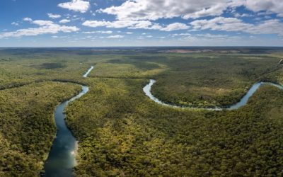
Rivers are potent agents of erosion, continually moulding and remoulding the Earth’s surface. As water flows downstream, it collects sediment and rocks, eroding them and transporting them along its course. This erosional process can form deep valleys, canyons, and gorges over millions of years. The water’s force, combined with the abrasive action of the sediment it carries, can cut through solid rock, leaving behind evidence of the river’s strength. Moreover, rivers erode the landscape through hydraulic action, whereby the force of the water wears away at the riverbanks and bed. This can be particularly pronounced during periods of high flow, such as during a flood. The sheer force of the water can dislodge rocks and sediment, further contributing to the erosion process. Over time, this relentless action can create wide river valleys and floodplains, as the river continues to shape the terrain around it. Summary Rivers have the power to erode the earth’s surface over time, shaping the landscape and creating new features. Deposition is the process by which rivers build and shape the land, depositing sediment and creating new landforms. Meandering and oxbow lakes are a result of the impact of rivers on the landscape, showcasing the dynamic nature of river systems. River valleys are formed and evolve over time, showcasing the long-term impact of rivers on the landscape. Rivers play a crucial role in creating canyons and gorges, carving out impressive features in the earth’s surface. Deposition: How Rivers Build and Shape the Land River Deposition and Landscape Shaping This deposition can build up over time, creating new land and shaping the landscape in the process. Moreover,...
Paraguay
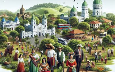
Paraguay (República del Paraguay (Spanish); Tetä Paraguáype (Guaraní) (Republic of Paraguay)) Capital: Asunción Population (Estimated July 2012): 6,541,591 Area: 406,752km2 or 157,048mi2 Currency: Guaraní (Plural Guaranies) Official Language: Spanish and Guaraní Political Information: Presidential Republic Official Religion: No Official Religion(approximately 89.6% of the population are Roman Catholic, 6.2% are Protestant, 1.1% have other Christian beliefs, 1.9 have other religious beliefs and 1.1% have no religious beliefs) Highest Mountain: Cerro Pero at 842m or 2,762ft GDP Official Exchange Rate (OER is more precise at gauging a country’s economic power) (Estimated 2011): $22.3 billion (US$) or (GBP) GDP (OER) Per Capita (per member of the population estimated 2011): (US$) or (GBP) GDP Purchasing Power Parity (PPP is good for gauging living conditions and the use of resources but is not as accurate as OER. This data has been calculated based on the sum value of all goods and services produced in the country valued at prices prevailing in the United States) (Estimated 2011): $36.21 billion (US$) or (GBP) GDP (PPP) Per Capita (per member of the population estimated 2011): $5,500 (US$) or (GBP) Time Zone (GMT/UTC): -4:00 Wildlife: Counties/Provinces/States: 17 departments (departamentos, singular – departamento) and 1 capital city*; Alto Paraguay, Alto Parana, Amambay, Asuncion*, Boqueron, Caaguazu, Caazapa, Canindeyu, Central, Concepcion, Cordillera, Guaira, Itapua, Misiones, Neembucu, Paraguari, Presidente Hayes, San Pedro Leaders: President Fernando Lugo with Vice President Federico Franco. Additional: Gained independence from Spain on the 14th of May 1811. Sources: CIA World Fact Book, Encyclopaedia Britannica. Paraguay Paraguay, a landlocked country in South America, is often referred to as the “Heart of South America” due to its central location on the continent. It is...
Best Places to Visit for Geography Enthusiasts
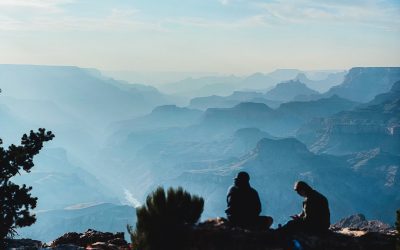
When it comes to geographical wonders, there are numerous awe-inspiring locations around the world that merit exploration. From the magnificent Grand Canyon in the United States to the remarkable Great Barrier Reef in Australia, there is an abundance of natural beauty to observe. The Grand Canyon, situated in Arizona, is an immense geological formation that extends for over 446 kilometres and is up to 29 kilometres wide in some areas. It stands as a testament to the power of erosion and natural forces, with its intricate layers of rock revealing millions of years of Earth’s history. The Great Barrier Reef, conversely, is the world’s largest coral reef system, stretching over 2,300 kilometres and comprising thousands of individual reefs and islands. It is a UNESCO World Heritage site and is home to an extraordinary diversity of marine life, making it essential viewing for any nature enthusiast. Another geographical wonder that ought not to be overlooked is the Amazon Rainforest in South America. Spanning across nine countries, including Brazil, Peru, and Colombia, the Amazon is the largest tropical rainforest in the world and is home to an estimated 390 billion individual trees. It is also one of the most biodiverse regions on the planet, with millions of species of plants, animals, and insects inhabiting it. The Amazon River, which flows through the rainforest, is the largest river by discharge volume in the world and plays a crucial role in the region’s ecosystem. Exploring the Amazon Rainforest provides a unique opportunity to witness the wonders of nature at close quarters and to appreciate the importance of preserving these vital ecosystems for future...

Mountain Formation: How Are Mountains Created?
Mountains are amongst the most impressive natural features on Earth, and they have captivated human interest for centuries. The process of mountain formation is complex and involves various geological forces and processes. The creation of these majestic landforms is primarily influenced by the movement of tectonic plates, volcanic activity and erosion. Plate tectonics play a crucial role in mountain formation, as the collision or divergence of tectonic plates can result in the uplift of rock and the creation of mountain ranges. Volcanic activity can also contribute to mountain formation through the accumulation of lava and ash, forming volcanic mountains. Additionally, erosion shapes mountains over time, carving out valleys and creating distinctive features. Understanding these processes provides insight into the formation and evolution of these remarkable geological structures. Summary Mountains are formed through various geological processes such as plate tectonics, volcanic activity, erosion, compression, and tension. Plate tectonics play a crucial role in the formation of mountains by the movement and collision of tectonic plates. Volcanic activity can lead to the formation of mountains through the accumulation of lava and volcanic materials. Erosion, caused by natural elements such as wind and water, can also contribute to the formation of mountains over time. Compression and tension are key factors in the formation of folded and fault-block mountains, respectively, highlighting the ongoing process of mountain formation. Plate Tectonics and Mountain Building The Collision of Tectonic Plates When two tectonic plates collide, the immense pressure and force can lead to the formation of mountains. This process, known as orogeny, occurs in several ways. In some cases, two plates may collide head-on, causing the...

Climate Zones of Papua New Guinea: Different climate regions Of Papua New Guinea
Papua New Guinea, situated in the southwestern Pacific Ocean, is renowned for its diverse and distinctive climate zones, which exert a considerable influence on the nation’s biodiversity. The climate in Papua New Guinea can be classified into six primary zones: highland, coastal, island, lowland, rainforest and mountain. Each of these climate zones possesses its own unique characteristics, which play a pivotal role in shaping the country’s flora and fauna. A thorough comprehension of these climate zones is crucial for understanding Papua New Guinea’s rich biodiversity and the conservation challenges it faces. Summary Papua New Guinea has diverse climate zones, including highland, coastal, island, lowland, and rainforest zones. The highland climate zone is characterised by cool temperatures and high rainfall, making it suitable for agriculture and horticulture. The coastal climate zone experiences high temperatures and humidity, with a distinct wet and dry season, making it ideal for tropical crops and fishing. The island climate zone is influenced by oceanic conditions, with warm temperatures and moderate rainfall, supporting diverse marine life and ecosystems. The lowland climate zone has hot and humid conditions, with heavy rainfall, creating ideal conditions for tropical rainforests and diverse wildlife. Highland Climate Zone The highland climate zone in Papua New Guinea is characterized by cool temperatures and high rainfall. This climate zone is found in the central mountainous region of the country, where elevations can reach up to 4,500 meters above sea level. The highland climate zone is home to a diverse range of flora and fauna, including unique species of birds, mammals, and plants. The cool temperatures and high rainfall create ideal conditions for the growth...

Political Boundaries of Papua New Guinea: Provinces, Districts, or Historical Boundaries.
Papua New Guinea is a nation situated in the southwestern Pacific Ocean. It is renowned for its cultural diversity, striking landscapes and abundant biodiversity. The country comprises the eastern half of New Guinea island, along with numerous smaller islands. Papua New Guinea is a sovereign state with a parliamentary democracy and is divided into several political boundaries that aid in governing the country. These boundaries play a vital role in the administration and governance of the nation, having evolved over time to reflect the country’s intricate history and diverse cultural landscape. The political boundaries of Papua New Guinea are crucial for the effective governance and administration of the country. They serve to define the jurisdiction of various levels of government, from national to local. These boundaries also play a significant role in resource allocation, public service delivery and representation of diverse communities within the country. A thorough understanding of Papua New Guinea’s political boundaries is essential for comprehending the country’s governance structure and the complexities of its diverse cultural and geographical landscape. Summary Papua New Guinea is a diverse country with complex political boundaries that have evolved over time. The country is divided into 22 provinces and the National Capital District, each with its own administrative divisions. Historical boundaries and cultural regions play a significant role in shaping the political landscape of Papua New Guinea. Districts and local governance are crucial for effective administration and service delivery within the country. Challenges and controversies surrounding political boundaries in Papua New Guinea highlight the need for ongoing dialogue and resolution. Provinces and Administrative Divisions Papua New Guinea is divided into 22...