Explore the World Through Geography, Natural Resources & Daily History
Clear, reliable and engaging guides that help you understand our planet — from UK geography education to global natural resources and On This Day history events.
Explore, discover, and learn about the wonders of our world! At Earth Site, we’re passionate about bringing geography, history, and science to life for curious minds of all ages. Whether you’re delving into historical events, uncovering the mysteries of the natural world, or seeking interactive resources, you’re in the right place.
Here, you can uncover the stories behind historical events, explore the natural wonders of our planet, and gain valuable insights into how the Earth’s systems shape our daily lives. From the towering peaks of mountain ranges to the far-reaching impacts of human innovation, we aim to make every topic both engaging and informative.
Start your journey of discovery with us today, and let’s make learning an adventure!
What We Cover
Earth Site brings together engaging and accessible educational content designed to help you understand the world, its history, and its natural systems.
🌍 Geography Education (UK & Worldwide)
We publish clear, easy-to-understand geography resources for students, teachers and curious learners. Our guides support geography education in the UK and cover physical geography, climate, ecosystems, population, and global development.
⛏️ Natural Resources & Environmental Geography
Explore detailed country profiles covering natural resources, mining, energy, geology and global environmental challenges. We show how nations manage minerals, water, land and ecosystems, and why these resources matter.
📅 On This Day in History
Every day has a story. Our On This Day history series features major events, anniversaries, traditions, and cultural milestones from around the world — with timelines, context, and fun facts.
TIMELINE

Population Density of Mozambique
Mozambique, situated in south-eastern Africa, is a nation with a diverse and swiftly expanding population. With an estimated population exceeding 30 million inhabitants, Mozambique ranks among the most densely populated countries in Africa. The population density of Mozambique is approximately 37 people per square kilometre, with the majority of the populace residing in the southern and central regions of the country. The population density in Mozambique has been steadily increasing over the years, largely due to high birth rates and improved healthcare leading to longer life expectancy. This has resulted in a number of challenges and opportunities for the country, which will be explored in this article. Mozambique’s population density is influenced by a variety of factors, including geographical features, economic opportunities, and government policies. The distribution of the population is not uniform across the country, with higher population densities in urban areas and along the coast, whilst rural areas tend to have lower population densities. The impact of this population distribution is felt in various aspects of the country’s infrastructure and resources, as well as in the social and economic development of the nation. This article will delve into the factors influencing population density in Mozambique and the implications for the country’s future development. Summary Mozambique has a population density of 37 people per square kilometre, with the majority of the population living in rural areas. Factors influencing population density in Mozambique include natural resources, climate, and historical settlement patterns. Urban population distribution is increasing due to rural-urban migration, leading to challenges in providing infrastructure and resources in urban areas. High population density in Mozambique puts pressure on...

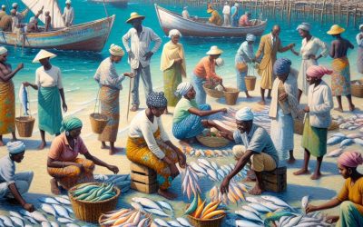
Natural Resources of Mozambique: Where Natural Resources are located In Mozambique
Mozambique, a country situated in south-eastern Africa, is renowned for its abundant and varied natural resources. The nation possesses a broad spectrum of resources, encompassing minerals, agriculture, energy, water and forests. These resources are integral to the country’s economy and provide sustenance for a substantial portion of the populace. Whilst Mozambique‘s natural resources have the capacity to propel economic growth and development, they also face challenges such as unsustainable exploitation and environmental degradation. The Mozambican government has been endeavouring to implement sustainable management and conservation practices to ensure the long-term viability of these resources and to benefit the nation’s inhabitants. The natural resources of Mozambique are a fundamental driver of the country’s economy, with the potential to contribute significantly to its development. The nation’s mineral resources, including coal, natural gas and precious metals, have attracted considerable investment from both domestic and international enterprises. Moreover, Mozambique’s agricultural sector is a major contributor to the country’s economy, with a diverse range of crops including cashew nuts, sugarcane and cotton. The country also possesses plentiful energy resources, including hydropower and natural gas, which have the potential to meet both domestic and regional energy demands. Furthermore, Mozambique’s water resources, including its extensive coastline and numerous rivers, provide opportunities for fisheries and aquaculture. The country’s forest resources are also substantial, with vast areas of woodland and tropical forests that support biodiversity and provide valuable timber and non-timber forest products. However, the sustainable management and conservation of these resources are essential to ensure their long-term viability and to prevent environmental degradation. Summary Mozambique is rich in natural resources, including minerals, agriculture, energy, water, and forests....

Cultural or Historical Sites of Mozambique: Important Cultural Landmarks or Historical Sites In Mozambique
Mozambique, situated on the south-eastern coast of Africa, is a nation abundant in cultural and historical heritage. From ancient ruins to colonial fortresses, and from UNESCO World Heritage Sites to modern engineering feats, Mozambique presents a diverse array of attractions for history enthusiasts and cultural explorers. The country’s history is a tapestry interwoven with threads of ancient civilisations, colonial influences and modern developments, rendering it a captivating destination for those keen to delve into the past and experience the present. This article shall explore some of Mozambique’s most significant cultural and historical sites, elucidating their importance and the narratives they convey about the country’s rich heritage. Summary Mozambique is home to a rich cultural and historical heritage, with a variety of sites that showcase its diverse past. The Island of Mozambique is a UNESCO World Heritage Site, known for its well-preserved colonial architecture and historical significance. The Great Zimbabwe Ruins stand as a testament to Mozambique’s ancient history, with impressive stone structures that date back to the 11th century. The National Museum of Mozambique plays a crucial role in preserving the country’s cultural heritage, housing a collection of artefacts and exhibits that tell the story of its people. The Fort of São Sebastião is a symbol of Mozambique’s colonial history, offering a glimpse into the country’s past under Portuguese rule. The Island of Mozambique: A UNESCO World Heritage Site A Rich Cultural Heritage This small island was once the capital of Portuguese East Africa and served as an important trading post in the Indian Ocean trade network. The island’s architecture reflects its diverse cultural influences, with Arab, Indian, and...
Mozambique
Mozambique (República de Moçambique (Republic of Mozambique)) Capital: Maputo Population (Estimated July 2012): 23,515,934 Area: 799,380km2 or 308,642mi2 Currency: Metical (Mtn; Plural Meticais) Official Language: Portuguese Political Information: Presidential Republic Official Religion: No Official Religion(approximately 28.4% of the population are Catholic, 27.7% are Protestant, 18.7% have no religious beliefs, 17.9% are Muslim and 7.2% follow other faiths) Highest Mountain: Monte Binga at 2,436m or 7,992ft GDP Official Exchange Rate (OER is more precise at gauging a countries economic power) (Estimated 2011): $12.1 billion (US$) or (GBP) GDP (OER) Per Capita (per member of the population estimated 2011): (US$) or (GBP) GDP Purchasing Power Parity (PPP is good for gauging living conditions and use of resources but not as accurate as OER. This data has been calculated based on the sum value of all goods and services produced in the country valued at prices prevailing in the United States) (Estimated 2011): $23.87 billion (US$) or (GBP) GDP (PPP) Per Capita (per member of the population estimated 2011): $1,100 (US$) or (GBP) Time Zone (GMT/UTC): +2:00 Wildlife: Counties/Provinces/States: 10 provinces (provincias, singular – provincia), 1 city (cidade)*; Cabo Delgado, Gaza, Inhambane, Manica, Maputo, Cidade de Maputo*, Nampula, Niassa, Sofala, Tete, Zambezia Leaders: President Armando Guebuza with Prime Minister Aires Bonifacio Ali. Additional: Gained independence from Portugal on the 25th of June 1990. Sources: CIA World Fact Book, Encyclopaedia Britannica. Mozambique Mozambique, situated in south-eastern Africa, is a nation renowned for its picturesque coastline along the Indian Ocean, diverse fauna, and rich cultural heritage. The capital city, Maputo, is a thriving metropolis featuring a blend of colonial and contemporary architecture, bustling markets, and a dynamic arts scene. The country achieved independence from Portugal in 1975...

Austria-Hungary: The Austro-Hungarian Empire and Austrian Empire
Austria-Hungary: The Austro-Hungarian Empire and Austrian Empire The Austro-Hungarian Empire, also known as the Dual Monarchy, was a significant state in Central Europe from 1867 to 1918. It was established through an agreement between the Austrian Empire and the Kingdom of Hungary, resulting in a dual monarchy with a shared monarch and common institutions. The empire was a multi-ethnic and multi-cultural entity, comprising a diverse array of peoples and territories, including Austrians, Hungarians, Czechs, Slovaks, Poles, Ukrainians, Romanians, Croats, Serbs, and others. The empire was a key player in European politics and had a considerable influence on the region’s history, culture, and economy. Its dissolution following the First World War marked the end of an era and had extensive consequences for the future of Europe. The Austro-Hungarian Empire was a complex political entity that played a crucial role in shaping the history of Central Europe. Its unique dual monarchy system, which united two distinct kingdoms under a single ruler, was an innovative attempt to manage the diverse ethnic and cultural groups within its borders. The empire’s capital, Vienna, was a thriving cultural and intellectual centre, attracting artists, writers, musicians, and thinkers from across Europe. The empire’s demise after the First World War had a profound impact on the region, leading to the redrawing of national borders and the emergence of new nation-states. The legacy of the Austro-Hungarian Empire continues to influence the modern-day countries that emerged from its dissolution, shaping their politics, culture, and identity. Summary The Austro-Hungarian Empire was a multi-ethnic dual monarchy in Central Europe, consisting of Austria and Hungary. The empire was formed in 1867...

Political Boundaries of Morocco: Provinces, Districts, or Historical Boundaries.
Morocco, situated in North Africa, boasts a rich history and diverse cultural heritage. The political boundaries of Morocco have evolved throughout the centuries, influenced by historical events, colonial rule, and internal administrative reforms. The nation is bounded by the Atlantic Ocean to the west and the Mediterranean Sea to the north, whilst sharing land borders with Algeria to the east and southeast, and Western Sahara to the south. Morocco’s political boundaries are not solely defined by its international borders but also by its internal administrative divisions, comprising regions, provinces, and prefectures. A thorough understanding of Morocco’s political boundaries is crucial for comprehending the country’s governance structure, historical legacy, and present-day challenges. The Kingdom’s territorial claims, particularly regarding Western Sahara, remain a subject of international debate and have significant implications for regional geopolitics. Summary Morocco’s political boundaries have evolved over time, influenced by historical, administrative, and local governance factors. The administrative divisions of Morocco are organized into provinces, each with its own local governance structure. The historical boundaries of Morocco have left a lasting influence and legacy on the country’s political landscape. The evolution of Morocco’s political boundaries reflects the country’s changing geopolitical and administrative needs. Challenges and controversies surrounding Morocco’s political boundaries highlight the significance and complexity of the country’s territorial integrity. Provinces of Morocco: Administrative Divisions Decentralising Governance The administrative divisions of Morocco play a crucial role in decentralising governance and ensuring effective public administration across the country. The provinces vary in size, population, and economic activity, reflecting the diverse geographical and social landscape of Morocco. From the bustling urban centres of Casablanca and Rabat to the rural...

Climate Zones of Morocco: Different climate regions Of Morocco
Morocco, situated in North Africa, is renowned for its diverse climate zones. The nation’s climate is influenced by its proximity to the Atlantic Ocean and Mediterranean Sea, as well as its mountainous terrain and desert landscapes. These factors contribute to the formation of several distinct climate zones across the country, each with its own unique characteristics and impact on the local environment, culture and agriculture. The various climate zones in Morocco comprise the Mediterranean climate of Northern Morocco, the arid climate of Central and Southern Morocco, the highland climate of the Atlas Mountains, the coastal climate of Western Morocco and the desert climate of Eastern Morocco. Each of these climate zones plays a crucial role in shaping the country’s natural landscape, biodiversity and way of life for its inhabitants. Understanding these climate zones is essential for appreciating the diversity and richness of Morocco’s environment and culture. Summary Northern Morocco has a Mediterranean climate with mild, wet winters and hot, dry summers. Central and Southern Morocco experience an arid climate with very little rainfall and high temperatures. The Atlas Mountains have a highland climate with cooler temperatures and more precipitation, making it suitable for agriculture. Western Morocco has a coastal climate with moderate temperatures and high humidity, influenced by the Atlantic Ocean. Eastern Morocco has a desert climate with extremely high temperatures and very little rainfall. The Mediterranean Climate of Northern Morocco Climate Characteristics The average annual rainfall in this area ranges from 600 to 1000 millimetres, with most of it falling during the winter months. Flora and Fauna The Mediterranean climate of Northern Morocco supports a diverse range of...

Natural Resources of Morocco: Where Natural Resources are located In Morocco
Morocco, situated in North Africa, is renowned for its diverse and plentiful natural resources. The nation’s wealth encompasses mineral deposits, agricultural lands, water sources, energy reserves, forests and marine resources. This varied natural landscape has significantly influenced Morocco‘s economic growth and development. The country’s strategic position, with coastlines along both the Atlantic Ocean and Mediterranean Sea, has contributed to its abundant marine resources. Furthermore, Morocco’s diverse climate and topography have enabled the exploitation of a wide array of natural resources. This text shall examine the various natural resources present in Morocco and their impact on the nation’s economy and development. Summary Morocco is rich in natural resources, including minerals, agriculture, water, energy, forests, and marine resources. The country is a leading producer of phosphates and also has significant reserves of other minerals such as zinc, lead, and copper. Morocco’s agricultural resources are diverse, with the country being a major producer of cereals, fruits, and vegetables. Water resources in Morocco are limited, leading to challenges in water management and conservation. Morocco has been investing in renewable energy sources such as solar and wind power to reduce its dependence on imported fossil fuels. The country’s forest resources are important for biodiversity, carbon sequestration, and providing livelihoods for local communities. Morocco’s marine resources include a rich variety of fish and seafood, supporting the country’s important fishing industry. Mineral Resources in Morocco Phosphates: A Key Export The mining industry in Morocco has been a major contributor to the country’s economy, providing employment opportunities and generating revenue through exports. Diverse Mineral Reserves In addition to phosphates, Morocco also has substantial reserves of lead, zinc,...

Cultural or Historical Sites of Morocco: Important Cultural Landmarks or Historical Sites In Morocco
Morocco boasts a rich tapestry of history and culture, evidenced by its diverse array of cultural and historical sites that showcase its unique heritage. From ancient cities to remarkable architectural wonders, Morocco‘s cultural and historical sites offer visitors a glimpse into the nation’s fascinating past and vibrant present. The country’s blend of Berber, Arab and European influences is reflected in these sites, serving as a testament to Morocco’s multifaceted heritage. The cultural and historical sites of Morocco mirror the nation’s long and complex history, which has been moulded by various cultures and civilisations. From the ancient Roman ruins of Volubilis to the bustling medinas of cities such as Fez and Marrakech, these sites provide a captivating insight into Morocco’s past. With their impressive architecture, vibrant culture and rich history, Morocco’s cultural and historical sites are essential destinations for any traveller seeking to explore the nation’s distinctive heritage. Summary Morocco is home to a rich tapestry of cultural and historical sites, offering visitors a glimpse into its diverse heritage. The ancient city of Fez, a UNESCO World Heritage Site, is a treasure trove of historical and architectural wonders. The Kasbah of Ait Benhaddou showcases the stunning beauty of Moroccan architecture and has been featured in numerous films and TV shows. The vibrant hub of culture and history, the Medina of Marrakech, is a must-visit for those seeking an authentic Moroccan experience. The Roman ruins of Volubilis provide a fascinating insight into Morocco’s ancient past, with well-preserved mosaics and structures. The Ancient City of Fez: A UNESCO World Heritage Site A Blend of Old and New The ancient city of Fez...

Terrain and Topography of Morocco: mountains, valleys, and plains.
The Atlas Mountains are a formidable range spanning Morocco, Algeria and Tunisia, extending over 2,500 kilometres. This mountain range comprises three principal sections: the High Atlas, the Middle Atlas and the Anti-Atlas. The High Atlas is the most renowned and loftiest section, with summits exceeding 4,000 metres in elevation. The Middle Atlas is notable for its dense woodlands and fertile valleys, whilst the Anti-Atlas is characterised by its arid and rocky terrain. The Atlas Mountains are not only a remarkable natural feature but also a crucial component of the region’s ecosystem. The mountains serve as a barrier to the Sahara Desert, impeding its advancement towards the fertile plains to the north. They also play a vital role in regulating the region’s climate, capturing moisture from the Atlantic Ocean and creating a unique microclimate that supports diverse flora and fauna. The Atlas Mountains are also home to several Berber communities, who have adapted to the challenging terrain and continue to maintain their traditional way of life. The mountains are a popular destination for ramblers and nature enthusiasts, offering a range of outdoor activities such as trekking, mountain biking and birdwatching. With its striking landscapes, rich biodiversity and cultural significance, the Atlas Mountains are a truly impressive range that captivates all who visit. Summary The Atlas Mountains are a majestic range that stretches across North Africa, offering stunning views and diverse landscapes. The Rif Mountains in the north of Morocco are known for their beauty and unique flora and fauna. The High Plateaus of Morocco are vast and diverse, offering a range of ecosystems and natural beauty. The Draa Valley is...

History of Morocco
Morocco possesses a rich and diverse history dating back to antiquity. The region was originally inhabited by the Berber people, renowned for their nomadic lifestyle and skilled craftsmanship. The Berbers were the indigenous inhabitants of North Africa and exerted a significant influence on the culture and traditions of the region. They were adept in agriculture, metalworking and pottery, and their legacy remains evident in contemporary Moroccan society. In addition to the Berbers, Morocco was also influenced by the Phoenicians, a seafaring civilisation from the eastern Mediterranean. The Phoenicians established trading posts along the Moroccan coast and had a substantial impact on the region’s economy and culture. They introduced new crops, such as olives and grapes, and contributed to the development of the region’s maritime trade. The Phoenicians also founded the city of Carthage, which became a major centre of trade and commerce in the ancient world. The influence of the Phoenicians remains visible in the architecture and language of present-day Morocco. Summary Ancient Morocco was inhabited by Berbers and later influenced by the Phoenicians. The Islamic conquest led to the establishment of the Idrisid Dynasty in Morocco. The Almoravid and Almohad Empires were influential in shaping the history and culture of Morocco. The Marinid and Wattasid Dynasties were significant in the medieval history of Morocco. European influence and the Barbary Coast played a major role in shaping Morocco’s history and culture. Islamic Conquest and the Idrisid Dynasty The Founding of the Idrisid Dynasty The Idrisid Dynasty was founded by Idris I, who is considered to be the first ruler of Morocco. He established his capital in the city of...

Population Density of Morocco
Population density refers to the number of people living in a specific area, typically measured per square kilometre or square mile. It is a crucial demographic indicator that provides insights into the distribution of people within a country or region. Understanding population density is essential for urban planning, resource allocation and the development of infrastructure. In Morocco, population density varies significantly across different regions, with the majority of the population concentrated in urban areas. This concentration has implications for social, economic and environmental factors, making it imperative to examine the factors affecting population density in Morocco, the distribution of population in urban and rural areas, and the impact of population density on infrastructure and resources. Summary Population density refers to the number of people living in a specific area, usually measured in square kilometres or square miles. Factors affecting population density in Morocco include natural resources, climate, economic opportunities, and government policies. The distribution of population in Morocco is uneven, with the majority of people living in urban areas compared to rural areas. High population density can put a strain on infrastructure and resources, leading to challenges in providing adequate services and amenities. Government policies and initiatives in Morocco aim to manage population density through urban planning, resource management, and sustainable development strategies. Factors Affecting Population Density in Morocco Urbanisation and Economic Opportunities Urbanisation is a significant driver of population density, with people migrating from rural areas to cities in search of better economic opportunities and improved living standards. The coastal regions, such as Casablanca and Rabat, attract a large number of migrants due to their economic activities and...