Explore the World Through Geography, Natural Resources & Daily History
Clear, reliable and engaging guides that help you understand our planet — from UK geography education to global natural resources and On This Day history events.
Explore, discover, and learn about the wonders of our world! At Earth Site, we’re passionate about bringing geography, history, and science to life for curious minds of all ages. Whether you’re delving into historical events, uncovering the mysteries of the natural world, or seeking interactive resources, you’re in the right place.
Here, you can uncover the stories behind historical events, explore the natural wonders of our planet, and gain valuable insights into how the Earth’s systems shape our daily lives. From the towering peaks of mountain ranges to the far-reaching impacts of human innovation, we aim to make every topic both engaging and informative.
Start your journey of discovery with us today, and let’s make learning an adventure!
What We Cover
Earth Site brings together engaging and accessible educational content designed to help you understand the world, its history, and its natural systems.
🌍 Geography Education (UK & Worldwide)
We publish clear, easy-to-understand geography resources for students, teachers and curious learners. Our guides support geography education in the UK and cover physical geography, climate, ecosystems, population, and global development.
⛏️ Natural Resources & Environmental Geography
Explore detailed country profiles covering natural resources, mining, energy, geology and global environmental challenges. We show how nations manage minerals, water, land and ecosystems, and why these resources matter.
📅 On This Day in History
Every day has a story. Our On This Day history series features major events, anniversaries, traditions, and cultural milestones from around the world — with timelines, context, and fun facts.
TIMELINE

Population Density of Chile
Chile, a long and narrow country located in South America, has a population density of approximately 24 people per square kilometer. This makes it one of the least densely populated countries in the region. Understanding population density is crucial for economic and social development as it helps policymakers and planners make informed decisions about resource allocation, infrastructure development, and social services provision. Summary Chile has a population density of 24 people per square kilometer, making it one of the least densely populated countries in South America. Chile’s population growth has been influenced by historical events such as the War of the Pacific and the Great Depression. Population density varies greatly across Chile’s regions, with the central region being the most densely populated. The majority of Chile’s population lives in urban areas, with Santiago being the largest city. Factors such as natural disasters, economic opportunities, and government policies can influence population density in Chile. Historical Overview of Chile’s Population Growth Chile’s population has experienced significant growth over the years. In the early 19th century, the population was around 1 million people. By the mid-20th century, it had reached 6 million, and today it stands at over 18 million. Several factors have contributed to this population growth, including improvements in healthcare and sanitation, increased life expectancy, and declining mortality rates. Regional Variations in Population Density Population density in Chile varies significantly across different regions. The central region, which includes the capital city of Santiago, has the highest population density, with over 400 people per square kilometer. This is due to its economic opportunities and better access to services. In contrast, the...

Cultural or Historical Sites of Chile: Important Cultural Landmarks or Historical Sites In Chile
Chile is a country rich in cultural and historical significance. From its pre-Columbian past to its colonial era and beyond, Chile’s heritage is diverse and fascinating. It is important to preserve and promote Chile’s heritage in order to maintain a connection to the past, celebrate the country’s unique identity, and educate future generations about its history. Summary Chile boasts a rich cultural and historical heritage, with a variety of sites to explore. The Atacama Desert offers a glimpse into Chile’s pre-Columbian past, with ancient ruins and rock art. Santiago’s historic centre is a must-visit for those interested in Chile’s colonial era, with stunning architecture and museums. Easter Island is a mystical land of Moai statues, offering a unique cultural experience. Valparaiso is a bohemian city with a rich maritime history, perfect for exploring on foot. The Atacama Desert: A Window to Chile’s Pre-Columbian Past The Atacama Desert, located in northern Chile, is a region of great historical significance. It was home to several pre-Columbian cultures, including the Tiwanaku and Inca civilizations. These cultures left behind a wealth of archaeological sites that provide insight into their way of life. One notable archaeological site in the Atacama Desert is the ancient city of Chan Chan. This UNESCO World Heritage site was the capital of the Chimú civilization and is known for its intricate adobe architecture. Another important site is the Pukará de Quitor, a fortress built by the Atacameño people to defend against Inca invasions. Santiago’s Historic Centre: A Journey Through Chile’s Colonial Era Santiago, the capital city of Chile, has a rich colonial history that can be explored through its...

Climate Zones of Chad: Different climate regions Of Chad
Chad, located in Central Africa, is a landlocked country known for its diverse geography and climate. Understanding the different climate zones in Chad is crucial for various reasons, including agriculture, biodiversity conservation, tourism, and the well-being of its people. The country can be divided into four main climate zones: the Saharan climate zone in the north, the Sahelian climate zone in the central region, the Sudanian climate zone in the south, and the Guinean climate zone in the southwest. Each of these regions has unique characteristics and challenges that shape the lives of its inhabitants. Summary Chad has four main climate zones: Saharan, Sahelian, Sudanian, and Guinean. The Saharan climate zone in northern Chad is hot and dry, with temperatures reaching up to 50°C. The Sahelian climate zone in central Chad is semi-arid, with short rainy seasons and long dry seasons. The Sudanian climate zone in southern Chad has wet and dry seasons, with rainfall ranging from 600-900mm per year. The Guinean climate zone in the southwest is humid and rainy, with rainfall averaging over 1,000mm per year. The Saharan Climate Zone: Hot and Dry Weather in Northern Chad The Saharan climate zone covers a significant portion of northern Chad and is characterized by extremely hot and dry weather conditions. This region experiences high temperatures throughout the year, with little to no rainfall. The lack of water makes it challenging for vegetation to thrive, resulting in a sparse and arid landscape dominated by sand dunes and rocky terrain. The harsh climate of the Saharan zone poses significant challenges for both flora and fauna. Vegetation is limited to drought-resistant plants...

Political Boundaries of Chad: Provinces, Districts, or Historical Boundaries.
Chad, officially known as the Republic of Chad, is a landlocked country located in Central Africa. It is bordered by Libya to the north, Sudan to the east, the Central African Republic to the south, Cameroon and Nigeria to the southwest, and Niger to the west. With an area of approximately 1.28 million square kilometers, Chad is the fifth largest country in Africa. Understanding Chad’s political boundaries is crucial for various reasons, including governance, national identity, and regional stability. Summary Chad is divided into 23 regions and 61 departments for administrative purposes. The country’s historical boundaries have been shaped by various empires and colonial powers. Chad’s political boundaries have evolved over time, with changes made to accommodate ethnic and linguistic groups. Local governance in Chad is carried out through districts, which are overseen by elected officials. Traditional leaders play a significant role in Chad’s political boundaries, particularly in rural areas. Understanding Chad’s Administrative Structure: Provinces and Regions Chad is divided into 23 administrative divisions, which are further categorized into 23 provinces and 61 departments. The provinces are grouped into three regions: the North Region, the Central Region, and the South Region. Each province is headed by a governor who is appointed by the president of Chad. The regions are also headed by governors who oversee the provinces within their respective regions. The administrative divisions in Chad play a crucial role in governance and service delivery. They serve as a means of decentralization, allowing for more effective administration and decision-making at the local level. The provinces and regions have their own administrative structures and are responsible for various aspects of...

Terrain and Topography of Chad: mountains, valleys, and plains.
Chad, located in Central Africa, is a landlocked country known for its diverse and unique terrain and topography. The country is characterized by a variety of geographical features, including mountains, valleys, plains, deserts, plateaus, lakes, and rivers. Understanding Chad’s terrain and topography is crucial for various reasons, including its impact on the country’s ecology, agriculture, water resources, and natural resources. Summary Chad’s terrain and topography is diverse, ranging from mountains and plateaus to deserts and plains. The Tibesti and Ennedi ranges are the two major mountain ranges in Chad, with peaks reaching over 3,000 meters. The Bahr el Ghazal and Chari River Valleys are important agricultural areas in Chad, with fertile soil and access to water. The Sahelian and Sudanian Plains are the most populated areas in Chad, with a mix of agriculture and pastoralism. The Sahara and Borkou Deserts cover much of northern Chad, with harsh conditions and limited resources. Mountains of Chad: The Tibesti and Ennedi Ranges Chad is home to two prominent mountain ranges: the Tibesti and Ennedi ranges. The Tibesti range is located in the northern part of the country and is known for its volcanic peaks and rugged terrain. Mount Emi Koussi, the highest peak in Chad, is situated in the Tibesti range. The Ennedi range, on the other hand, is located in the northeast and is famous for its stunning rock formations and ancient cave paintings. These mountain ranges play a significant role in Chad’s ecology and culture. They provide a habitat for various plant and animal species that are adapted to the harsh conditions of the mountains. The mountains also serve as...

History of Chad
Chad, officially known as the Republic of Chad, is a landlocked country located in Central Africa. It is bordered by Libya to the north, Sudan to the east, the Central African Republic to the south, Cameroon and Nigeria to the southwest, and Niger to the west. Chad holds great significance in Africa due to its strategic location and its history of political instability and conflict. Understanding Chad’s history is crucial for comprehending the current events and challenges that the country faces today. Summary Chad has a rich history dating back to pre-colonial times. French colonization of Chad was marked by exploitation and resistance movements. Chad gained independence in 1960 but has since experienced political instability and civil wars. Chad has played a significant role in regional conflicts, including the ongoing crisis in the Sahel. Economic and social development in Chad remains a challenge, with poverty and inequality persisting. Pre-Colonial Era in Chad Before European colonization, Chad was home to various ethnic groups and kingdoms. The major ethnic groups in Chad include the Sara, Kanembu, Arab, and Tubu. These groups had their own distinct cultures, languages, and political systems. The Kanem-Bornu Empire, which was located in present-day Chad and Nigeria, was one of the most powerful kingdoms in Central Africa during the pre-colonial era. Trade and cultural exchange played a significant role in Chad before European arrival. The trans-Saharan trade route passed through Chad, connecting North Africa with West Africa. This trade route facilitated the exchange of goods such as salt, gold, ivory, and slaves. It also brought about cultural interactions between different ethnic groups in Chad and beyond. French...

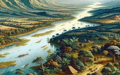
Natural Resources of Chad: Where Natural Resources are located In Chad
Chad, located in Central Africa, is a landlocked country known for its vast and diverse natural resources. With a total area of approximately 1.3 million square kilometers, Chad is home to a variety of mineral resources, agricultural resources, water resources, forest resources, and renewable energy resources. These resources play a crucial role in the country’s economy and have the potential to contribute to sustainable development. Summary Chad has a variety of natural resources including mineral resources, agricultural resources, water resources, forest resources, renewable energy resources, and wildlife. Oil and gas are the main mineral resources in Chad, with the country being one of the largest oil producers in Africa. Chad also has significant deposits of gold, uranium, and bauxite, which are important for the country’s mining industry. Cotton, livestock, and fishing are the main agricultural resources in Chad, with Lake Chad and rivers providing important water resources for irrigation and fishing. Chad’s forest resources include timber and wildlife, which are important for the country’s economy and biodiversity. Mineral Resources in Chad: Oil and Gas One of the most significant natural resources in Chad is its oil and gas reserves. The country has proven oil reserves estimated at around 1.5 billion barrels, making it one of the largest oil producers in sub-Saharan Africa. The oil industry in Chad has experienced significant growth since the discovery of oil in the Doba Basin in the early 2000s. The oil and gas industry in Chad has had a profound impact on the country’s economy. It has contributed to economic growth, job creation, and increased government revenue through taxes and royalties. The revenue generated...

Population Density of Chad
Chad, located in Central Africa, is a landlocked country with a diverse population. Understanding the population density of Chad is crucial for policymakers and researchers to effectively plan and implement development strategies. Population density refers to the number of people living in a specific area, usually measured in terms of persons per square kilometer. In the case of Chad, it is important to analyze the population density at both national and regional levels to gain a comprehensive understanding of the country’s demographic landscape. Summary Chad has a population density of 11.3 people per square kilometer, making it one of the least densely populated countries in Africa. The population density of Chad has been influenced by historical events such as colonization and conflicts, as well as environmental factors like drought and desertification. Regional variations in Chad’s population density exist, with the highest densities found in the southern regions and the lowest in the northern regions. Urbanization has led to an increase in Chad’s population density, with the capital city of N’Djamena being the most densely populated area in the country. Rural-urban migration has also contributed to the population density in Chad, with many people moving to urban areas in search of better economic opportunities. Historical Overview of Chad’s Population Density Over the years, Chad has experienced significant changes in its population density. In the early 20th century, the population density was relatively low due to factors such as limited infrastructure and harsh environmental conditions. However, with advancements in healthcare and improvements in living conditions, the population density has steadily increased. The population growth rate has also been influenced by factors...

Cultural or Historical Sites of Chad: Important Cultural Landmarks or Historical Sites In Chad
Chad, located in Central Africa, is a country with a rich cultural and natural heritage that is often overlooked by tourists. The tourism industry in Chad is still in its infancy, but there is great potential for growth and development. Promoting Chad’s cultural and natural heritage is not only important for attracting tourists, but also for preserving and celebrating the country’s unique identity. Summary The Ennedi Plateau in Chad is a UNESCO World Heritage Site, known for its stunning rock formations and ancient rock art. The Guelta d’Archei is a natural wonder and cultural landmark in Chad, famous for its freshwater pool and the camels that gather there. The Tomb of Toumai is a prehistoric site in Chad, where the remains of one of the earliest known human ancestors were discovered. The Sara People’s Traditional Villages offer a window into Chad’s cultural heritage, showcasing traditional architecture and way of life. The Zakouma National Park in Chad is a conservation area with historical significance, home to a diverse range of wildlife and important archaeological sites. The Ennedi Plateau: A UNESCO World Heritage Site in Chad The Ennedi Plateau is a stunning landscape located in northeastern Chad. It was designated as a UNESCO World Heritage Site in 2016 due to its outstanding universal value. The plateau is characterized by its dramatic sandstone formations, deep canyons, and rock arches. It is also home to a diverse range of wildlife, including the endangered dama gazelle and Barbary sheep. Tourists visiting the Ennedi Plateau can engage in a variety of activities, such as hiking, rock climbing, and wildlife spotting. The plateau offers breathtaking views...
Central African Republic
Central African Republic (République Centrafricaine (Central African Republic)) Capital: Bangui Population (Estimated July 2012): 5,057,208 Area: 622,436 km2 or 240,324 mi2 Currency: CFA franc (CFAF) Official Language: French; Sango Political Information: Republic Official Religion: No Official Religion (approximately 35% of the population have indigenous beliefs, 25% are Protestant, 25% are Roman Catholic and 15% are Muslim) Highest Mountain: Mont Ngaoui at 1,420m or 4,659ft GDP Official Exchange Rate (OER is more precise at gauging a country’s economic power) (Estimated 2011): $2.3 billion (US$) or (GBP) GDP (OER) Per Capita (per member of the population estimated 2011): (US$) or (GBP) GDP Purchasing Power Parity (PPP is good for gauging living conditions and use of resources but not as accurate as OER. This data has been calculated based on the sum value of all goods and services produced in the country valued at prices prevailing in the United States) (Estimated 2011): $3.672 billion (US$) or (GBP) GDP (PPP) Per Capita (per member of the population estimated 2011): $800 (US$) or (GBP) GDP Official Exchange Rate (OER is more precise at gauging a countries economic power) (Estimated 2011): $2.3 billion (US$) or (GBP) GDP (OER) Per Capita (per member of the population estimated 2011): (US$) or (GBP) GDP Purchasing Power Parity (PPP is good for gauging living conditions and use of resources but not as accurate as OER. This data has been calculated based on the sum value of all goods and services produced in the country valued at prices prevailing in the United States) (Estimated 2011): $3.672 billion (US$) or (GBP) GDP (PPP) Per Capita (per member of the population estimated 2011): $800 (US$) or (GBP) Time Zone (GMT/UTC): +1:00 Wildlife: Counties/Provinces/States: 14 prefectures...

Political Boundaries of Central African Republic: Provinces, Districts, or Historical Boundaries.
The Central African Republic (CAR) is a landlocked country located in Central Africa. It is bordered by Chad to the north, Sudan to the northeast, South Sudan to the east, the Democratic Republic of the Congo and the Republic of the Congo to the south, and Cameroon to the west. With an area of approximately 622,984 square kilometers, it is one of the largest countries in Africa. Understanding the political boundaries of CAR is crucial for various reasons, including effective governance, economic development, and conflict resolution. Summary Central African Republic is divided into 16 administrative prefectures and one autonomous commune. The country’s political boundaries have been shaped by colonialism and post-independence conflicts. The administrative divisions have evolved over time, with changes made to better reflect the needs of the population. Political boundaries play a crucial role in the governance of Central African Republic, with local authorities responsible for implementing national policies. Managing political boundaries in Central African Republic is challenging due to limited resources and ongoing conflict. The Administrative Divisions of Central African Republic: Provinces and Districts The administrative divisions of CAR are divided into two main categories: provinces and districts. There are 16 provinces in total, each headed by a governor appointed by the president. The provinces are further divided into districts, which are headed by prefects appointed by the central government. The districts are then divided into sub-prefectures and municipalities. The provinces in CAR include Bamingui-Bangoran, Basse-Kotto, Haute-Kotto, Haut-Mbomou, Kemo, Lobaye, Mambere-Kadei, Mbomou, Nana-Grebizi, Nana-Mambere, Ombella-Mpoko, Ouaka, Ouham, Ouham-Pende, Sangha-Mbaere, and Vakaga. Each province has its own unique characteristics and challenges. The History of the Political Boundaries...

Terrain and Topography of Central African Republic: mountains, valleys, and plains.
Introduction The Central African Republic is a landlocked country located in the heart of Africa. It is known for its diverse geography, which includes plateaus, basins, mountains, rivers, and savannahs. Understanding the country’s geography is crucial for various reasons, including economic development, agriculture, transportation, trade, mining, wildlife conservation, and timber industry. In this article, we will explore the different regions of the Central African Republic and discuss their characteristics and importance. The Central African Plateau The Central African Plateau is located in the southern part of the country and covers a significant portion of its land area. It stretches from the border with Cameroon to the border with Sudan and has an average elevation of around 1,000 meters. The plateau is characterized by rolling hills, grasslands, and scattered forests. The plateau plays a vital role in the country’s economy as it is rich in mineral resources such as gold, diamonds, uranium, and iron ore. These resources contribute to the country’s mining industry and provide employment opportunities for many people. Additionally, the plateau’s fertile soil supports agriculture, with crops such as maize, millet, sorghum, and cassava being grown in the region. The Chad Basin The Chad Basin is located in the northern part of the Central African Republic and extends into neighboring countries such as Chad and Sudan. It is a large depression that covers an area of approximately 500,000 square kilometers. The landscape of the basin is characterized by flat plains and marshy areas. The Chad Basin is of great importance to the country’s agriculture as it provides fertile soil for farming. The basin is home to several rivers...