Explore the World Through Geography, Natural Resources & Daily History
Clear, reliable and engaging guides that help you understand our planet — from UK geography education to global natural resources and On This Day history events.
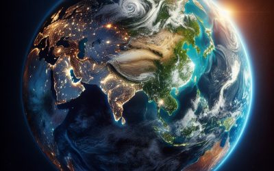
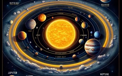
Explore, discover, and learn about the wonders of our world! At Earth Site, we’re passionate about bringing geography, history, and science to life for curious minds of all ages. Whether you’re delving into historical events, uncovering the mysteries of the natural world, or seeking interactive resources, you’re in the right place.
Here, you can uncover the stories behind historical events, explore the natural wonders of our planet, and gain valuable insights into how the Earth’s systems shape our daily lives. From the towering peaks of mountain ranges to the far-reaching impacts of human innovation, we aim to make every topic both engaging and informative.
Start your journey of discovery with us today, and let’s make learning an adventure!
What We Cover
Earth Site brings together engaging and accessible educational content designed to help you understand the world, its history, and its natural systems.
🌍 Geography Education (UK & Worldwide)
We publish clear, easy-to-understand geography resources for students, teachers and curious learners. Our guides support geography education in the UK and cover physical geography, climate, ecosystems, population, and global development.
⛏️ Natural Resources & Environmental Geography
Explore detailed country profiles covering natural resources, mining, energy, geology and global environmental challenges. We show how nations manage minerals, water, land and ecosystems, and why these resources matter.
📅 On This Day in History
Every day has a story. Our On This Day history series features major events, anniversaries, traditions, and cultural milestones from around the world — with timelines, context, and fun facts.
TIMELINE
Natural Resources of South Africa: Where Natural Resources are Located in South Africa
South Africa is a nation endowed with a rich tapestry of natural resources that play a pivotal role in its economy and the livelihoods of its people. The country’s diverse geography, ranging from arid deserts to lush coastal regions, has fostered a variety of ecosystems that support an array of natural assets. These resources not only contribute to the economic framework of the nation but also hold cultural significance for many communities. The interplay between these resources and the socio-economic landscape of South Africa is complex, as they are both a source of wealth and a focal point for environmental challenges. The significance of South Africa’s natural resources extends beyond mere economic metrics; they are integral to the identity and heritage of its people. The land is steeped in history, with indigenous communities having relied on these resources for centuries. As the country navigates the challenges of modernisation and globalisation, the sustainable management of its natural resources has become increasingly critical. This article delves into the various categories of natural resources found in South Africa, exploring their contributions to the economy, their environmental implications, and the ongoing efforts to ensure their sustainability for future generations. Summary South Africa is rich in natural resources, including minerals, agriculture, water, energy, forests, and wildlife. The country is a leading producer of minerals such as gold, platinum, and diamonds, contributing significantly to its economy. South Africa’s agricultural resources are diverse, with a focus on crops such as maize, wheat, and sugarcane, as well as livestock farming. Water resources in South Africa are crucial for agriculture, industry, and domestic use, with the country facing...
Political Boundaries of South Africa: Provinces, Districts, or Historical Boundaries.
Political boundaries are fundamental to the governance and administrative organisation of any nation, and South Africa is no exception. The country’s political landscape is shaped by a complex interplay of historical, social, and economic factors that have influenced the delineation of its...
Climate Zones of South Africa: Different Climate Regions Of South Africa
South Africa is a nation characterised by its remarkable geographical diversity, which in turn gives rise to a wide array of climate zones. The country’s climate is influenced by its topography, ocean currents, and prevailing winds, resulting in distinct climatic regions that vary significantly from one another. From the lush, temperate areas of the Western Cape to the arid expanses of the Kalahari...
Cultural or Historical Sites of South Africa: Important Cultural Landmarks or Historical Sites In South Africa
South Africa is a nation steeped in a rich tapestry of cultural and historical narratives, each thread woven from the diverse experiences of its people. The country is home to a multitude of sites that reflect its complex past, from ancient civilisations to the struggles against colonialism and apartheid. These sites not only serve as reminders of the trials and tribulations faced by various communities but also celebrate the resilience and spirit of the South African populace. Visitors to South Africa are often struck by the profound stories embedded in its landscapes, monuments, and museums, each offering a unique perspective on the nation’s journey through time. The significance of these cultural and historical sites extends beyond mere tourism; they are vital for education and understanding. They provide insights into the social, political, and economic forces that have shaped South Africa. By exploring these locations, one can gain a deeper appreciation for the country’s diversity and the ongoing efforts towards reconciliation and unity. From the stark realities of apartheid to the ancient roots of humanity, South Africa’s historical sites are a testament to its multifaceted identity, inviting both locals and international visitors to engage with its past. Summary South Africa is home to a rich tapestry of cultural and historical sites that offer a glimpse into the country’s diverse heritage. Robben Island stands as a powerful symbol of South Africa’s struggle for freedom and the triumph of the human spirit over adversity. The Cradle of Humankind provides a fascinating insight into South Africa’s paleontological history, with its wealth of ancient fossils and archaeological treasures. The Apartheid Museum serves as a...
Terrain and Topography of South Africa: mountains, valleys, and plains.
South Africa is a land of remarkable contrasts, where diverse landscapes converge to create a unique tapestry of natural beauty. The country’s terrain is characterised by a variety of geographical features, ranging from rugged mountains and expansive plateaus to lush valleys and arid deserts. This diversity not only shapes the physical environment but also influences the climate, flora, and fauna of the region. The topography...
History of South Africa
Long before the arrival of European settlers, the land that is now known as South Africa was inhabited by a variety of indigenous peoples, each with their own distinct cultures, languages, and social structures. The San people, also known as Bushmen, were among the earliest inhabitants, known for their hunter-gatherer lifestyle and intricate rock art that can still be seen in various locations across the country. Their deep connection to the land is reflected in their spiritual beliefs and practices, which emphasise harmony with nature. The Khoikhoi, another indigenous group, were pastoralists who raised livestock and engaged in trade with the San and later with European settlers. These early societies were rich in tradition and knowledge, with complex social systems and a profound understanding of their environment. As time progressed, the Bantu-speaking peoples migrated southward from central Africa, bringing with them agricultural practices and ironworking technology. This migration led to the establishment of various kingdoms and chiefdoms, such as the Xhosa and Zulu nations. The Zulu Kingdom, under the leadership of Shaka Zulu in the early 19th century, became particularly notable for its military organisation and expansionist policies. The interactions between these indigenous groups were not always peaceful; conflicts over resources and territory were common. However, they also engaged in trade and cultural exchanges that enriched their societies. The rich tapestry of indigenous cultures laid the foundation for South Africa‘s diverse identity, which would later be challenged by European colonisation. Summary Early settlements in South Africa were established by indigenous peoples such as the Khoikhoi and San, who had a rich and diverse culture. The Dutch East India Company...
Population Density of South Africa
Population density, defined as the number of individuals living per unit area, serves as a critical indicator of demographic trends and socio-economic conditions within a country. In South Africa, a nation characterised by its diverse cultures, languages, and landscapes, population density varies significantly across different regions. The country, with a total land area of approximately 1.22 million square kilometres, has an estimated population of over 60 million people. This results in an average population density of around 49 people per square kilometre, but this figure masks considerable disparities between urban and rural areas, as well as among provinces. Understanding population density in South Africa is essential for grasping the complexities of its social fabric and economic landscape. The distribution of people across the country influences everything from infrastructure development and resource allocation to social services and environmental sustainability. As urbanisation continues to rise, particularly in metropolitan areas, the implications of population density become increasingly pronounced, necessitating a closer examination of the factors that shape these patterns and their broader impacts on society. Summary South Africa has a diverse population with varying population densities across the country. Factors such as economic opportunities, infrastructure, and historical settlement patterns influence population density in South Africa. The distribution of population density in South Africa is uneven, with higher concentrations in urban areas. Urban population density in South Africa is higher than rural population density, leading to different social and economic dynamics. High population density in South Africa impacts infrastructure, healthcare, and social services, presenting both challenges and opportunities for the country. Factors influencing Population Density in South Africa Economic Opportunity and Internal Migration...
South Africa
South Africa (Republic of South Africa) Capital: Pretoria (Administrative); Bloemfontein (judicial); Cape Town (legislative) Population (Estimated July 2012): 48,810,427 Area: 1,220,813km2 or 471,359mi2 Currency: Rand (R) Official Languages: IsiZulu 23.82%, IsiXhosa 17.64%, Afrikaans 13.35%, Sepedi 9.39%, English 8.2%, Setswana 8.2%, Sesotho 7.93%, Xitsonga 4.44%, siSwati 2.66%, Tshivenda 2.28%, isiNdebele 1.59% Political Information: Parliamentary Republic Official Religion: No Official Religion(approximately 36.6% of the population are Protestant, 7.1% are Roman Catholic, 36% have other Christian beliefs, 5.2% have other or unspecified religious beliefs and 15.1% have no religious beliefs) Highest Mountain: Mafadi Mountain at 3,450m or 11,319ft GDP Official Exchange Rate (OER is more precise at gauging a country’s economic power) (Estimated 2011): $408.1 billion (US$) or (GBP) GDP (OER) Per Capita (per member of the population estimated 2011): (US$) or (GBP) GDP Purchasing Power Parity (PPP is good for gauging living conditions and the use of resources but is not as accurate as OER. This data has been calculated based on the sum value of all goods and services produced in the country valued at prices prevailing in the United States) (Estimated 2011): $562.2 billion (US$) or (GBP) GDP (PPP) Per Capita (per member of the population estimated 2011): $11,100 (US$) or (GBP) Time Zone (GMT/UTC): +2:00 Wildlife: Counties/Provinces/States: 9 provinces; Eastern Cape, Free State, Gauteng, KwaZulu-Natal, Limpopo, Mpumalanga, Northern Cape, North-West, Western Cape Leaders: President Jacob Zuma; Deputy President Kgalema Motlanthe Additional: The Union of South Africa formed from four British colonies: Cape Colony, Natal, Transvaal, and Orange Free State on the 31st of May 1910. Sources: CIA World Fact Book, Encyclopaedia Britannica. South Africa South Africa, often referred to as the “Rainbow Nation,” is a country...
Political Boundaries of Somalia: Provinces, Districts, or Historical Boundaries.
Political boundaries serve as the framework within which a nation operates, influencing governance, resource distribution, and social cohesion. In Somalia, the delineation of these boundaries is particularly complex, shaped by a confluence of historical, cultural, and geopolitical factors. The country, located in the Horn of Africa, has experienced significant turmoil and fragmentation since the collapse of its central government in 1991. This disintegration has led to a re-evaluation of political boundaries, with various factions and clans vying for control over territories that have historically been fluid and contested. Understanding Somalia’s political boundaries requires an appreciation of the intricate interplay between historical legacies and contemporary realities. The nation is not merely defined by its geographical borders but also by the social and political dynamics that exist within them. As such, the exploration of Somalia’s political boundaries reveals a landscape marked by conflict, resilience, and ongoing negotiations for power and identity among its diverse populations. Summary Somalia’s political boundaries have been shaped by a complex history of colonialism, clan affiliations, and administrative divisions. Historical boundaries of Somalia have been influenced by colonial powers such as Britain, Italy, and France, leading to a fragmented and contested territory. Somalia is currently divided into 18 administrative regions, each with its own unique challenges and controversies. The impact of colonialism on Somalia’s political boundaries has led to ongoing disputes and challenges in defining and maintaining territorial integrity. The role of clan and tribal affiliations continues to play a significant role in shaping Somalia’s political boundaries, leading to complex power dynamics and governance issues. Historical Boundaries of Somalia The historical boundaries of Somalia are deeply rooted...
Climate Zones of Somalia: Different climate regions Of Somalia
Somalia, located in the Horn of Africa, is a nation characterised by its diverse climate zones, which are shaped by its geographical features and the influence of the Indian Ocean. The country spans a variety of climatic conditions, ranging from arid deserts to temperate highlands, each with its unique ecological characteristics and challenges. Understanding these climate zones is crucial for comprehending the socio-economic dynamics of Somalia, as they directly affect agriculture, water resources, and the livelihoods of its people. The climate of Somalia is predominantly influenced by the Intertropical Convergence Zone (ITCZ), which shifts north and south with the seasons, bringing varying amounts of rainfall. The country experiences two main seasons: the dry season and the rainy season, with the latter being further divided into the Gu (April to June) and Deyr (October to December) seasons. This climatic variability plays a significant role in shaping the agricultural practices and pastoral lifestyles that are prevalent in different regions of Somalia. As we delve deeper into the specific climate zones, it becomes evident how these factors intertwine with the cultural and economic fabric of Somali society. Summary Somalia has diverse climate zones including arid and semi-arid regions, coastal climate, highland climate, and interiors and plateau regions. The arid and semi-arid regions of Somalia experience very low rainfall and high temperatures, making them prone to drought and desertification. The coastal climate of Somalia is influenced by the Indian Ocean, resulting in high humidity and relatively moderate temperatures. The highland climate of Somalia is characterised by cooler temperatures and higher rainfall, supporting agriculture and livestock rearing. The interiors and plateau regions of Somalia...
Terrain and Topography of Somalia: mountains, valleys, and plains.
Somalia, located in the Horn of Africa, is a nation characterised by its diverse and complex terrain. Stretching along the eastern coast of Africa, it boasts a unique topography that ranges from arid plains to rugged mountains, and from expansive plateaus to deep valleys. This geographical diversity not only shapes the physical landscape but also influences the socio-economic activities of its inhabitants. The interplay between the land and the people is profound, as the terrain dictates agricultural practices, settlement patterns, and even cultural identities. The country’s topography is largely defined by its position on the African tectonic plate, which has resulted in a variety of geological formations. The Somali Peninsula is bordered by the Indian Ocean to the east, while the Gulf of Aden lies to the north. This coastal location contributes to a range of climatic conditions that further enhance the complexity of its landscape. Understanding Somalia’s terrain is essential for grasping the challenges and opportunities that arise in this region, particularly in relation to agriculture, climate adaptation, and sustainable development. Summary Somalia’s terrain is diverse, with mountain ranges, valleys, rifts, plains, and plateaus. The mountain ranges in Somalia include the Ogo Mountains and the Cal Madow range. The valleys and rifts in Somalia are formed by tectonic activity, such as the East African Rift. The plains and plateaus of Somalia are important for agriculture and livestock grazing. Somalia’s terrain and topography have a significant impact on the country’s climate, influencing rainfall patterns and temperatures. The Mountain Ranges of Somalia The mountain ranges of Somalia are among the most striking features of its topography. The most prominent range...
Natural Resources of Somalia: Where Natural Resources are located In Somalia
Somalia, located in the Horn of Africa, is a nation endowed with a wealth of natural resources that have the potential to significantly contribute to its economic development. The country’s geographical position, bordered by the Indian Ocean to the east, provides it with extensive marine resources, while its diverse landscapes encompass arid plains, fertile highlands, and mineral-rich regions. Despite facing numerous challenges, including political instability and infrastructural deficits, Somalia’s natural resources present a promising avenue for economic growth and development. The potential of Somalia’s natural resources is vast and varied. From oil and gas reserves to rich fisheries and agricultural land, these resources could play a pivotal role in transforming the economy. However, the effective management and sustainable exploitation of these resources remain critical. The interplay between environmental conservation and economic development is particularly significant in Somalia, where the need for sustainable practices is underscored by the challenges posed by climate change and resource depletion. Understanding the scope of these resources is essential for both local communities and international stakeholders aiming to engage with Somalia’s economic landscape. Summary Somalia is rich in natural resources including oil and gas reserves, fisheries, minerals, agriculture, and renewable energy sources. The country has significant potential for oil and gas exploration, with estimated reserves of over 100 billion barrels of oil. Somalia’s coastline of over 3,300 kilometers provides abundant fisheries and marine resources, supporting the livelihoods of many coastal communities. The country also has untapped mineral and mining resources, including uranium, iron ore, tin, and gypsum. Agriculture is a key sector in Somalia, with fertile land and suitable climate for the production of crops...