Explore the World Through Geography, Natural Resources & Daily History
Clear, reliable and engaging guides that help you understand our planet — from UK geography education to global natural resources and On This Day history events.
Explore, discover, and learn about the wonders of our world! At Earth Site, we’re passionate about bringing geography, history, and science to life for curious minds of all ages. Whether you’re delving into historical events, uncovering the mysteries of the natural world, or seeking interactive resources, you’re in the right place.
Here, you can uncover the stories behind historical events, explore the natural wonders of our planet, and gain valuable insights into how the Earth’s systems shape our daily lives. From the towering peaks of mountain ranges to the far-reaching impacts of human innovation, we aim to make every topic both engaging and informative.
Start your journey of discovery with us today, and let’s make learning an adventure!
What We Cover
Earth Site brings together engaging and accessible educational content designed to help you understand the world, its history, and its natural systems.
🌍 Geography Education (UK & Worldwide)
We publish clear, easy-to-understand geography resources for students, teachers and curious learners. Our guides support geography education in the UK and cover physical geography, climate, ecosystems, population, and global development.
⛏️ Natural Resources & Environmental Geography
Explore detailed country profiles covering natural resources, mining, energy, geology and global environmental challenges. We show how nations manage minerals, water, land and ecosystems, and why these resources matter.
📅 On This Day in History
Every day has a story. Our On This Day history series features major events, anniversaries, traditions, and cultural milestones from around the world — with timelines, context, and fun facts.
TIMELINE
Understanding the Köppen Climate Classification: A Global Perspective
The Köppen Climate Classification System, developed by German botanist and climatologist Wladimir Köppen in 1884, is one of the most widely utilised climate classification systems globally. It is predicated on the notion that vegetation is the most accurate expression of climate, and it categorises climates into five primary groups based on temperature and precipitation patterns. The system has undergone continuous updates and modifications since its inception, and it remains an indispensable tool for comprehending and categorising the world’s diverse climates. The Köppen Climate Classification System is founded on the principle that different climates can be identified by the types of vegetation that flourish within them. Köppen employed this concept to develop a system that categorises climates based on average monthly and annual temperatures, as well as precipitation levels. The system utilises letters to represent different climate types, with each letter denoting a specific range of temperature and precipitation patterns. This classification system has been widely adopted by scientists, geographers, and climatologists to understand and communicate the complexities of the world’s climates. Summary The Köppen Climate Classification System is a widely used method of categorising the world’s climates based on temperature and precipitation patterns. The five major climate groups in the Köppen classification are tropical, dry, temperate, continental, and polar, each with distinct characteristics and subcategories. Understanding the subcategories within the Köppen Climate Classification, such as the different types of tropical climates or the variations within the temperate climate group, provides a more detailed picture of global climate patterns. Examples of different climate zones around the world include the tropical rainforests of the Amazon, the arid deserts of the Sahara,...
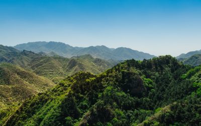
Highland or Alpine Climate (H): Varies depending on elevation, typically cooler and wetter than surrounding lowlands.
The highland climate is characterised by its distinctive weather patterns and environmental conditions, which are influenced by the altitude and topography of the region. Highland areas are typically found at higher elevations, such as mountains, plateaux, and hills, and are known for their cooler temperatures and more extreme weather conditions compared to lowland areas. The climate in highland regions can vary greatly depending on factors such as latitude, proximity to the coast, and prevailing wind patterns. These areas often experience rapid changes in weather, including sudden temperature drops, strong winds, and heavy precipitation. The highland climate also tends to have a shorter growing season and a greater temperature variation between day and night. Highland climates are found all over the world, from the Andes in South America to the Scottish Highlands in Europe, and the Himalayas in Asia. These regions are often home to unique ecosystems and biodiversity due to their isolation and harsh environmental conditions. The highland climate presents both challenges and opportunities for human habitation, agriculture, and tourism, making it an area of great interest for researchers and environmentalists. Summary Highland climate is characterized by cool temperatures, high precipitation, and rugged terrain, making it a challenging environment for both flora and fauna. The flora in highland climate includes hardy plants such as heather and moss, while the fauna includes animals like mountain goats and eagles that have adapted to the harsh conditions. Human adaptation to highland climate includes the use of traditional building materials like stone and thatch, as well as the development of hardy livestock breeds and agricultural practices suited to the environment. Challenges of living...
Highland Climate Zones
Highland climate zones are characterised by their high elevation and cooler temperatures compared to lowland areas. These zones are typically found in mountainous regions around the world, such as the Andes in South America, the Himalayas in Asia, and the Alps in Europe. The climate in these areas is influenced by factors such as altitude, latitude, and topography, resulting in unique environmental conditions. Highland climate zones are known for their rugged terrain, diverse ecosystems, and extreme weather patterns, making them both challenging and fascinating environments to study. Highland climate zones are often divided into different subtypes based on their specific characteristics, such as alpine, subalpine, and montane climates. These subtypes can vary in terms of temperature, precipitation, and vegetation, but they all share the common trait of being located at higher elevations. The unique combination of factors in highland climate zones creates a habitat that is home to a wide variety of plant and animal species, many of which are specially adapted to the harsh conditions found in these environments. Understanding the characteristics of highland climate zones is essential for conservation efforts and for mitigating the impact of human activities on these fragile ecosystems. Summary Highland climate zones are characterized by their high altitude, low temperatures, and unique ecosystems. These zones are home to a variety of flora and fauna that have adapted to the harsh conditions, including hardy plants and animals with thick fur or feathers. The challenges in highland climate zones include extreme weather, limited food sources, and competition for resources among species. Human impact on highland climate zones includes deforestation, overgrazing, and pollution, which threaten the...
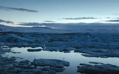
Ice Cap (EF): Extremely cold year-round with no vegetation; ice sheets and glaciers.
Ice caps are substantial masses of ice that cover the Earth’s polar regions. They are found in Antarctica and Greenland, as well as in smaller areas in the Arctic. These ice caps comprise ice sheets and glaciers, which are formed from compacted snow that has accumulated over millennia. The extremely cold temperatures in these regions prevent the ice from melting, allowing it to accumulate and form massive ice caps. These ice caps play a crucial role in regulating the Earth’s climate and are home to a diverse range of wildlife and flora. However, they are also highly vulnerable to the effects of climate change and human activity, making them a focus of conservation efforts and scientific research. Ice caps are not only important for their role in regulating the Earth’s climate, but they also provide valuable insights into the Earth’s history. The layers of ice in these caps contain records of past climate conditions, atmospheric composition, and even evidence of ancient civilisations. As such, they are a vital resource for scientists studying climate change and the Earth’s geological history. Additionally, ice caps are also important for their role in reflecting sunlight back into space, helping to regulate the Earth’s temperature. This makes them a crucial part of the Earth’s climate system and highlights the importance of protecting them from further degradation. Summary Ice caps are large masses of ice and snow that cover the polar regions of the Earth, including Greenland and Antarctica. The climate in ice caps is extremely cold and dry, with temperatures often reaching well below freezing and very little precipitation. Ice sheets and glaciers are...
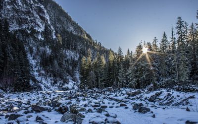
Tundra (ET): Extremely cold winters, cool summers, and very little precipitation.
The tundra is a distinctive and intriguing ecosystem found in the world’s coldest regions, including the Arctic and Antarctic. It is characterised by its exceptionally cold temperatures, low precipitation, and permafrost, which is a layer of permanently frozen soil. The tundra is also notable for its vast, treeless landscapes and is home to a variety of plant and animal species that have adapted to survive in this harsh environment. Despite its challenging conditions, the tundra plays a crucial role in the global ecosystem and is an important area for scientific research and conservation efforts. The tundra can be divided into two main types: the Arctic tundra, which is found in the Northern Hemisphere, and the Antarctic tundra, which is found in the Southern Hemisphere. The Arctic tundra is located in Alaska, Canada, Scandinavia, and Russia, whilst the Antarctic tundra is found in Antarctica. Both types of tundra share similar characteristics, including cold temperatures, short growing seasons, and a lack of trees due to the permafrost. The tundra is also home to a variety of unique wildlife, including caribou, musk oxen, Arctic foxes, and polar bears. The tundra is an important ecosystem that provides valuable habitat for these species and many others, making it a vital part of global biodiversity. Summary The tundra ecosystem is a unique and fragile environment characterised by low temperatures, permafrost, and a short growing season. The climate of the tundra is cold and dry, with temperatures often below freezing and little precipitation, leading to the formation of permafrost. The flora and fauna of the tundra have adapted to survive in harsh conditions, with plants like...
Polar Climate Zones
Polar climate zones are among the most extreme and inhospitable environments on Earth. These regions are situated near the Earth’s poles, encompassing the Arctic in the northern hemisphere and the Antarctic in the southern hemisphere. The polar climate is characterised by exceptionally cold temperatures, with prolonged, severe winters and brief, cool summers. The polar regions are also renowned for their vast expanses of ice and snow, including ice caps, glaciers, and icebergs. These areas harbour a unique ecosystem that has adapted to the extreme conditions, rendering them some of the most fascinating and significant environments on the planet. Polar climate zones are also crucial for regulating the Earth’s climate and weather patterns. The ice and snow in these regions reflect sunlight, aiding in the regulation of the Earth’s temperature and climate. Moreover, the cold, dense air in the polar regions helps to drive ocean currents and atmospheric circulation, which in turn influence global weather patterns. As such, the polar climate zones play a vital role in maintaining the balance of the Earth’s climate and are essential for the health of the planet as a whole. Summary Polar climate zones are characterized by extremely cold temperatures and minimal precipitation, with two main types: the polar ice cap and the tundra. The characteristics of polar climates include long, harsh winters, short summers, and a lack of trees and shrubs due to the cold and dry conditions. The flora and fauna of polar regions have adapted to survive in extreme conditions, with species such as polar bears, penguins, and mosses being well-suited to the environment. Human impact on polar climate zones includes...
Subarctic or Boreal (Dfc, Dfd): Very cold winters and short, cool summers, with moderate precipitation.
The Subarctic or Boreal climate is a distinctive and varied region spanning the northern hemisphere, encompassing parts of North America, Europe and Asia. This climate is characterised by prolonged, cold winters and brief, mild summers, rendering it one of the coldest climates on Earth. The Subarctic climate is typically found in areas north of the 50th parallel, where the average temperature in the warmest month is below 10°C. The Boreal climate, conversely, is found in slightly warmer regions, with average temperatures in the warmest month ranging from 10-22°C. Despite the harsh conditions, the Subarctic and Boreal regions are home to a wide variety of flora and fauna, as well as indigenous communities that have adapted to the challenging environment over centuries. The Subarctic and Boreal climates are defined by their extended, cold winters and short, mild summers. The winters are often marked by heavy snowfall and freezing temperatures, whilst the summers are relatively brief and cool. The climate is influenced by its high latitude, as well as its proximity to large bodies of water, such as the Arctic Ocean and the North Atlantic. These factors contribute to the extreme temperature variations and weather patterns that are typical of the Subarctic and Boreal regions. Despite the challenging conditions, these climates support a diverse range of ecosystems, including boreal forests, tundra and wetlands, which are home to a wide variety of plant and animal species. The unique climate and ecosystems of the Subarctic and Boreal regions have also shaped the way in which human communities have adapted to and interacted with their environment over time. Summary The Subarctic or Boreal climate...
Humid Continental (Dfa, Dfb): Warm to hot summers, cold winters, and significant precipitation year-round.
The humid continental climate, designated as Dfa and Dfb in the Köppen climate classification, is a climate type typically found in the interior of continents, away from the moderating influence of large bodies of water. This climate is characterised by four distinct seasons, with warm to hot summers and cold winters. The Dfa subtype experiences hot summers, whilst the Dfb subtype has warm summers. The transition between seasons can be quite dramatic, with significant temperature variations throughout the year. This climate type is found in regions such as the Great Plains in North America, parts of Eastern Europe, and parts of East Asia. The humid continental climate is influenced by air masses from both polar and tropical regions, leading to a wide range of temperatures and weather patterns. The presence of large landmasses allows for significant temperature fluctuations, with cold air masses from the north and warm air masses from the south impacting the region. The lack of a moderating influence from large bodies of water means that the climate can be quite variable and unpredictable, with rapid changes in weather conditions. The Dfa and Dfb subtypes are characterised by their distinct summer temperatures, with Dfa experiencing hotter summers and Dfb experiencing warmer summers. These variations in temperature have significant impacts on the environment, agriculture, and human activities in these regions. Summary Humid Continental Climate (Dfa, Dfb) is characterized by warm to hot summers and cold winters, with year-round precipitation. The climate is known for its distinct four seasons, with significant temperature variations throughout the year. Warm to hot summers in humid continental climate can lead to heatwaves, droughts,...
Continental Climate Zones
Continental climate zones are characterised by their distinct seasonal variations in temperature, with warm summers and cold winters. These climate zones are typically found in the interior regions of large landmasses, away from the moderating influence of the ocean. The absence of nearby bodies of water means that continental climate zones experience greater temperature extremes compared to maritime climate zones. This results in warm, dry summers and cold, snowy winters. Continental climate zones can be found in various parts of the world, including North America, Europe and Asia. The unique characteristics of continental climate zones have a significant impact on the natural environment, vegetation, wildlife and human activities in these regions. Understanding the specific features of continental climate zones is crucial for developing effective strategies for agriculture, conservation and sustainable development in these areas. Summary Continental climate zones are characterized by large temperature variations between summer and winter, and low precipitation throughout the year. The characteristics of continental climate zones include hot summers, cold winters, and a wide daily temperature range. Vegetation in continental climate zones is adapted to the harsh conditions, with grasslands, shrubs, and drought-resistant plants being common. Continental climate zones can have a significant impact on agriculture, with challenges such as water scarcity and extreme temperatures affecting crop growth. Wildlife in continental climate zones includes species adapted to the harsh conditions, such as bison, wolves, and prairie dogs. Characteristics of Continental Climate Zones Seasonal Temperature Contrasts The sharp contrast between summer and winter temperatures is a defining feature of continental climate zones. In addition to temperature variations, continental climate zones also experience distinct seasonal changes in...
Oceanic or Maritime (Cfb, Cfc): Mild summers and winters with precipitation year-round, common in coastal regions.
The oceanic or maritime climate, also known as the Cfb climate, is a type of climate heavily influenced by the proximity of large bodies of water, such as oceans or seas. This climate is typically found in coastal regions, particularly on the western coasts of continents, where the prevailing winds blow from the ocean onto the land. The oceanic climate is characterised by relatively mild temperatures, with cool summers and mild winters, and high levels of precipitation throughout the year. This climate is often associated with lush, green landscapes and is known for its temperate and humid conditions. The oceanic climate is influenced by the presence of ocean currents, which help to moderate temperatures and create a relatively stable climate. The presence of large bodies of water also leads to high levels of humidity and frequent cloud cover, which contributes to the high levels of precipitation in these regions. The oceanic climate is often contrasted with continental climates, which are characterised by more extreme temperature variations and lower levels of precipitation. Overall, the oceanic climate is known for its moderate and relatively stable weather patterns, making it an ideal environment for a diverse range of vegetation and wildlife. Summary Oceanic or maritime climate is influenced by the proximity of large bodies of water, resulting in mild temperatures and high levels of precipitation. Cfb climate is characterized by mild winters, cool summers, and relatively even distribution of rainfall throughout the year. Cfc climate is similar to Cfb but with colder temperatures, especially in the winter, and a shorter growing season. Coastal regions with Cfb climate include western Europe, parts of...
Humid Subtropical (Cfa, Cwa): Hot, humid summers with mild winters; rainfall throughout the year.
The humid subtropical climate is a type of climate characterised by hot, humid summers and mild winters. This climate is typically found in the southeastern parts of the United States, as well as in parts of East Asia, Australia, and South America. The humid subtropical climate is influenced by maritime tropical air masses from the Atlantic Ocean and Gulf of Mexico, which bring warm, moist air to the region. This climate is known for its distinct seasons, with hot and humid summers and mild winters. The average annual temperature in humid subtropical regions ranges from 20°C to 27°C, making it a warm and pleasant climate for most of the year. The humid subtropical climate is also known for its high levels of precipitation throughout the year, with rainfall occurring in all seasons. This climate is influenced by the movement of the subtropical high-pressure belt, which brings moist air from the oceans to the land. The combination of warm temperatures and high levels of precipitation creates a lush and diverse ecosystem, with a wide variety of plant and animal species. The humid subtropical climate is an important and unique climate type that supports a rich and diverse ecosystem, as well as human life in many parts of the world. Summary Humid subtropical climate is characterized by hot, humid summers and mild winters, with rainfall throughout the year. The climate supports a diverse range of vegetation and wildlife, including lush forests and a variety of animal species. Hot, humid summers in humid subtropical regions can have a significant impact on human health and well-being, leading to heat-related illnesses and discomfort. Mild...
Mediterranean (Csa, Csb): Hot, dry summers and mild, wet winters.
The Mediterranean climate is a distinctive weather pattern found in regions bordering the Mediterranean Sea, as well as in other parts of the world such as California, Chile and South Africa. This climate is characterised by hot, dry summers and mild, wet winters. The Mediterranean climate is influenced by subtropical high-pressure systems and the westerlies, which bring moisture from the ocean during the winter months. The combination of these factors results in a distinct climate that has a significant impact on the environment, agriculture and human life in the affected regions. The Mediterranean climate is renowned for its pleasant, sunny weather during the summer months, making it a popular tourist destination. However, the climate also presents challenges for the people and ecosystems that inhabit these regions. Understanding the characteristics and impact of the Mediterranean climate is crucial for developing strategies to mitigate its effects and adapt to its unique challenges. Summary The Mediterranean climate is characterized by hot, dry summers and mild, wet winters, and is found in regions bordering the Mediterranean Sea, as well as in parts of California, South Africa, and Australia. The Mediterranean climate is known for its long growing season, which is ideal for the cultivation of crops such as olives, grapes, and citrus fruits. The impact of the Mediterranean climate on agriculture can be both positive and negative, with the potential for droughts and wildfires posing significant challenges for farmers. The challenges of the Mediterranean climate for wildlife and ecosystems include the risk of desertification, loss of biodiversity, and increased vulnerability to invasive species. Human adaptation to the Mediterranean climate has involved the development...

