Explore the World Through Geography, Natural Resources & Daily History
Clear, reliable and engaging guides that help you understand our planet — from UK geography education to global natural resources and On This Day history events.
Explore, discover, and learn about the wonders of our world! At Earth Site, we’re passionate about bringing geography, history, and science to life for curious minds of all ages. Whether you’re delving into historical events, uncovering the mysteries of the natural world, or seeking interactive resources, you’re in the right place.
Here, you can uncover the stories behind historical events, explore the natural wonders of our planet, and gain valuable insights into how the Earth’s systems shape our daily lives. From the towering peaks of mountain ranges to the far-reaching impacts of human innovation, we aim to make every topic both engaging and informative.
Start your journey of discovery with us today, and let’s make learning an adventure!
What We Cover
Earth Site brings together engaging and accessible educational content designed to help you understand the world, its history, and its natural systems.
🌍 Geography Education (UK & Worldwide)
We publish clear, easy-to-understand geography resources for students, teachers and curious learners. Our guides support geography education in the UK and cover physical geography, climate, ecosystems, population, and global development.
⛏️ Natural Resources & Environmental Geography
Explore detailed country profiles covering natural resources, mining, energy, geology and global environmental challenges. We show how nations manage minerals, water, land and ecosystems, and why these resources matter.
📅 On This Day in History
Every day has a story. Our On This Day history series features major events, anniversaries, traditions, and cultural milestones from around the world — with timelines, context, and fun facts.
TIMELINE

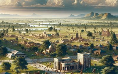
History of Nigeria
Nigeria boasts a rich and diverse history dating back to ancient times. The pre-colonial era was characterised by the existence of various kingdoms and empires, each with its own unique culture, traditions and governance systems. These kingdoms, such as the Nri Kingdom, the Benin Empire and the Hausa city-states, thrived in different parts of what is now known as Nigeria. The Nri Kingdom, located in present-day Anambra State, was renowned for its complex political system and religious practices. It was a highly influential kingdom that played a significant role in the political and religious affairs of the region. The Benin Empire, situated in present-day Edo State, was famous for its sophisticated art and bronze casting techniques. The empire had a well-organised political structure and a powerful military that enabled it to expand its influence across the region. The Hausa city-states, located in the northern part of Nigeria, were known for their vibrant trade networks and Islamic culture. These pre-colonial kingdoms and empires had their own systems of governance, trade and cultural practices. They engaged in trade with neighbouring regions and developed advanced agricultural and craft industries. The pre-colonial era of Nigeria was a time of great cultural and economic prosperity, with each kingdom contributing to the overall development of the region. The pre-colonial era of Nigeria was characterised by a rich tapestry of cultures, traditions and political systems. The various kingdoms and empires that existed during this time contributed to the diverse and vibrant history of Nigeria. The legacy of these ancient societies continues to influence the cultural landscape of modern-day Nigeria. Summary Pre-colonial Nigeria was characterized by a...

Population Density of Nigeria
Nigeria, situated in West Africa, is the most populous nation on the continent and the seventh most populous globally. With an estimated population exceeding 200 million inhabitants, Nigeria‘s population density ranks amongst the highest in Africa, averaging 215 people per square kilometre. The country’s population has been expanding rapidly, and projections indicate that it will surpass the United States to become the world’s third most populous nation by 2050. This swift population growth has resulted in high population density in urban areas, exerting pressure on infrastructure, resources and the environment. It is crucial to comprehend the factors contributing to Nigeria’s high population density, its distribution across the country and its impact on infrastructure and resources to address the challenges and opportunities associated with this demographic trend. Nigeria’s high population density stems from various factors, including elevated fertility rates, declining mortality rates and rural-to-urban migration. The country’s fertility rate is amongst the highest globally, with an average of 5.3 children per woman. Whilst efforts have been made to promote family planning and reduce fertility rates, cultural and religious factors continue to influence reproductive behaviour. Moreover, advancements in healthcare and sanitation have led to a decline in mortality rates, resulting in a rapidly growing population. Urbanisation has also contributed to Nigeria’s high population density, as people migrate from rural areas to cities in search of improved economic opportunities. This influx of people into urban areas has placed immense pressure on infrastructure and services, leading to overcrowding and inadequate housing in numerous cities. Understanding these factors is essential for developing policies and initiatives to manage Nigeria’s high population density and its impact...

Cultural or Historical Sites of Nigeria: Important Cultural Landmarks or Historical Sites In Nigeria
Nigeria boasts a rich cultural and historical heritage, with numerous sites showcasing the nation’s diverse and vibrant past. From ancient cities to sacred groves, Nigeria‘s cultural and historical landmarks offer insight into the country’s history and the traditions that have shaped its present. These sites hold significant historical, cultural and spiritual value for the Nigerian people. They stand as a testament to the nation’s varied heritage and continue to be important attractions for visitors from across the globe. Nigeria’s cultural and historical sites reflect the country’s complex history, with influences from various ethnic groups and colonial powers. These locations provide a unique opportunity to explore Nigeria’s past and gain a deeper understanding of its cultural heritage. Each site, from ancient cities to sacred groves, presents its own narrative and offers distinct insights into Nigeria’s history and traditions. Notable examples include the ancient city of Benin and the Osun-Osogbo Sacred Grove, which exemplify Nigeria’s rich cultural heritage and are essential visits for those interested in history and culture. Summary Nigeria is home to a rich tapestry of cultural and historical sites that showcase the country’s diverse heritage and traditions. The Ancient City of Benin is famous for its impressive bronze sculptures and ancient walls, offering a glimpse into the kingdom’s historical significance. The Osun-Osogbo Sacred Grove is a UNESCO World Heritage site, known for its sacred forests, shrines, and sculptures dedicated to the Yoruba goddess of fertility. The Sukur Cultural Landscape is a testament to the architectural and cultural achievements of the Sukur people, featuring terraced fields and a palace complex. The Kano City Walls are an important symbol of...
Nigeria
Nigeria (Federal Republic of Nigeria) Capital: Abuja Population (Estimated July 2012): 170,123,740 Area: 923,768km2 or 356,669mi2 Currency: Nigerian naira (₦) Official Language: English Political Information: Federal Republic Official Religion: No Official Religion (approximately 50% of the population are Muslim, 40% are Christian and 10% have Indigenous beliefs) Highest Mountain: Maisajeh Hill (mountain) at 1,593m or 5,226ft GDP Official Exchange Rate (OER is more precise at gauging a country’s economic power) (Estimated 2011): $247.1 billion (US$) or (GBP) GDP (OER) Per Capita (per member of the population estimated 2011): (US$) or (GBP) GDP Purchasing Power Parity (PPP is good for gauging living conditions and the use of resources but is not as accurate as OER. This data has been calculated based on the sum value of all goods and services produced in the country valued at prices prevailing in the United States) (Estimated 2011): $414.5 billion (US$) or (GBP) GDP (PPP) Per Capita (per member of the population estimated 2011): $2,600 (US$) or (GBP) Time Zone (GMT/UTC): +1:00 Wildlife: Counties/Provinces/States: 36 states and 1 territory*; Abia, Adamawa, Akwa Ibom, Anambra, Bauchi, Bayelsa, Benue, Borno, Cross River, Delta, Ebonyi, Edo, Ekiti, Enugu, Federal Capital Territory*, Gombe, Imo, Jigawa, Kaduna, Kano, Katsina, Kebbi, Kogi, Kwara, Lagos, Nassarawa, Niger, Ogun, Ondo, Osun, Oyo, Plateau, Rivers, Sokoto, Taraba, Yobe, Zamfara Leaders: President Goodluck Jonathan and Vice President Mohammed Namadi SAMBO Additional: Gained independence from the U.K. on the 1st of October 1960. Sources: CIA World Fact Book, Encyclopaedia Britannica. Nigeria Nigeria, officially the Federal Republic of Nigeria, is a country situated in West Africa. It is the most populous nation in Africa and the seventh most populous globally, with...
Future of Coastal Cities: Threats from Rising Sea Levels in Oceanic Climate Zones
Rising sea levels in oceanic climate zones are a significant and pressing issue exacerbated by climate change. Oceanic climate zones, characterised by their proximity to the ocean, are particularly vulnerable to the impacts of rising sea levels. As global temperatures continue to rise, polar ice caps and glaciers are melting at an accelerated rate, causing sea levels to rise. This phenomenon poses a serious threat to coastal cities and communities, as well as to critical infrastructure such as ports, roads, and buildings. The implications of rising sea levels in oceanic climate zones are far-reaching and require urgent attention and action. The impact of rising sea levels in oceanic climate zones is not limited to coastal areas alone. It also has the potential to disrupt marine ecosystems, leading to loss of biodiversity and threatening the livelihoods of communities that depend on marine resources. Additionally, the increased frequency and intensity of storm surges and coastal flooding can result in widespread damage to property and infrastructure, as well as loss of life. The implications of rising sea levels in oceanic climate zones are not only environmental but also economic and social, making it a complex and multi-faceted issue that requires a comprehensive approach to address. Summary Rising sea levels in oceanic climate zones are a growing concern due to climate change and melting polar ice caps. Coastal cities and infrastructure are at risk of flooding and erosion, leading to potential economic and social impacts. Potential solutions and adaptation strategies include coastal defences, land use planning, and sustainable urban design. Economic and social implications of rising sea levels include displacement of communities, loss...

Highlighting the challenges of water scarcity in desert and semi-arid zones and explore innovative solutions for sustainable living.
Water scarcity is a critical issue in desert and semi-arid zones, where water availability is constrained due to low rainfall and high evaporation rates. These regions support diverse ecosystems and communities, all of which depend on water for survival. The limited water supply in these areas has widespread consequences, impacting not only local populations but also the delicate equilibrium of ecosystems. As water demand increases due to population growth and climate change, it is imperative to address water scarcity in these regions through sustainable management practices and innovative solutions. The effects of water scarcity in desert and semi-arid zones are multifaceted, influencing both human settlements and the natural environment. Communities in these regions often struggle to access clean and safe drinking water, resulting in health problems and diminished quality of life. Agriculture, a crucial source of livelihood for many in these areas, also suffers due to water scarcity, leading to food insecurity and economic difficulties. Ecosystems in desert and semi-arid zones are likewise under threat, as water scarcity can result in habitat degradation and loss of biodiversity. It is evident that addressing water scarcity in these regions is essential for the welfare of both people and the environment. Summary Water scarcity is a pressing issue in desert and semi-arid zones, impacting both communities and ecosystems. Traditional water management practices have been crucial in these regions, but innovative solutions are needed for sustainable water management. Technology plays a significant role in mitigating water scarcity, offering potential solutions for sustainable water management. Community engagement and education are essential for promoting sustainable living and addressing water scarcity in these regions. Addressing water...

Water Scarcity in Arid Climate Zones: Innovative Solutions
Water scarcity in arid climate zones has a significant impact on the environment, economy and well-being of communities. These regions, characterised by limited rainfall and high evaporation rates, face considerable challenges in meeting the water needs of their populations. The shortage of water resources affects agriculture, industry and domestic use, resulting in reduced crop yields, constrained economic growth and increased competition for water. Moreover, the lack of access to clean and safe drinking water can have serious health implications, leading to waterborne diseases and malnutrition. The depletion of groundwater reserves and degradation of ecosystems further exacerbate the impact of water scarcity, posing a threat to biodiversity and the sustainability of natural resources. The consequences of water scarcity in arid climate zones are extensive and require urgent attention to mitigate its effects. The lack of water impedes agricultural productivity, leading to food insecurity and poverty among rural communities. Industries reliant on water for production face operational challenges, affecting employment and economic growth. Furthermore, the scarcity of water resources can lead to conflicts over access to water, exacerbating social tensions and political instability. Addressing water scarcity in arid climate zones is crucial for sustainable development and the well-being of communities, necessitating innovative solutions and collaborative efforts to ensure access to clean and safe water for all. Summary Water scarcity in arid climate zones has a significant impact on communities, agriculture, and the environment, leading to increased competition for limited water resources. Innovative water conservation techniques such as drip irrigation, greywater recycling, and xeriscaping are crucial for managing water scarcity in arid climate zones. Desalination technology offers a promising solution for water...
Glacial Retreat and Its Impact on Highland and Polar Zones
Glacial retreat refers to the process of glaciers shrinking and receding due to the effects of climate change. This phenomenon is a direct result of global warming, which has caused a rise in temperatures and subsequently led to the melting of ice in polar and highland regions. Glacial retreat is a significant indicator of climate change and has far-reaching implications for ecosystems, water resources, biodiversity, and human societies. As glaciers continue to melt at an alarming rate, it is crucial to understand the impact of this phenomenon on the environment and to develop strategies to mitigate its effects. Glacial retreat is a natural process that has occurred throughout Earth’s history, but the current rate of retreat is unprecedented. The Intergovernmental Panel on Climate Change (IPCC) has reported that glaciers are losing mass at an accelerating rate, with significant implications for sea level rise and water availability. The primary cause of glacial retreat is the increase in greenhouse gas emissions, which trap heat in the Earth’s atmosphere and lead to a rise in global temperatures. As a result, glaciers are melting at an alarming rate, leading to the loss of freshwater resources, changes in ecosystems, and increased risks of natural disasters such as glacial lake outburst floods. It is essential to understand the impact of glacial retreat on various ecosystems and to develop strategies to mitigate its effects. Summary Glacial retreat is the process of glaciers shrinking and melting due to rising temperatures, leading to significant environmental impacts. Highland ecosystems are experiencing changes in vegetation, water availability, and wildlife habitats due to glacial retreat, affecting biodiversity and ecosystem stability. Polar...
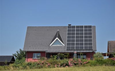
Exploring how different climate zones affect the potential for renewable energy sources like solar, wind, and hydropower.
Climate zones play a crucial role in determining the potential for renewable energy sources. These zones are defined by a combination of factors such as temperature, precipitation and wind patterns. Understanding the unique characteristics of each climate zone is essential for harnessing the full potential of renewable energy sources. Renewable energy, such as solar, wind and hydropower, offers a sustainable alternative to traditional fossil fuels and has the potential to mitigate the impacts of climate change. By tapping into the natural resources available in different climate zones, we can reduce our reliance on non-renewable energy sources and move towards a more sustainable future. Renewable energy sources are abundant in various climate zones around the world, offering a diverse range of opportunities for harnessing clean energy. Solar energy is particularly abundant in arid and tropical climate zones, whilst wind energy is more prevalent in coastal and high-altitude regions. Hydropower, on the other hand, is abundant in areas with high levels of precipitation and river systems. By understanding the unique characteristics of each climate zone, we can identify the most suitable renewable energy sources and technologies for each region, ultimately maximising their potential and contributing to a more sustainable energy future. Summary Climate zones play a crucial role in determining the potential for renewable energy sources such as solar, wind, and hydropower. Solar energy potential is highest in tropical and desert climate zones, making them ideal for large-scale solar power projects. Wind energy potential is greatest in coastal and open plain climate zones, offering significant opportunities for harnessing wind power. Hydropower potential is abundant in mountainous and riverine climate zones, providing...
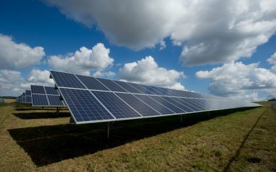
Climate Zones and Global Energy Needs: Solar, Wind, and Hydropower Potential
Climate zones are geographical areas that share similar weather patterns and climatic conditions. These zones are determined by factors such as temperature, precipitation and humidity. There are several different climate classification systems, but the most widely used is the Köppen climate classification, which divides the world into five primary climate groups: tropical, dry, temperate, continental and polar. Tropical climate zones are typically found near the equator and are characterised by high temperatures and heavy rainfall throughout the year. Dry climate zones, conversely, experience very little precipitation and are often found in desert regions. Temperate climate zones have moderate temperatures and distinct seasons, whilst continental climate zones have hot summers and cold winters. Finally, polar climate zones are characterised by extremely cold temperatures and little to no vegetation. Understanding climate zones is crucial for assessing the potential for renewable energy sources such as solar, wind and hydropower. Different climate zones offer unique opportunities and challenges for harnessing these renewable energy sources, making it essential to consider the specific characteristics of each zone when developing energy strategies. Summary Climate zones are determined by factors such as temperature, precipitation, and vegetation, and can be classified into categories such as tropical, temperate, and polar. Solar power potential is highest in tropical and desert climate zones due to the abundance of sunlight, making these areas ideal for solar energy production. Wind power potential is greatest in coastal and open plain climate zones, where strong and consistent winds can be harnessed for energy generation. Hydropower potential is highest in mountainous and riverine climate zones, where the presence of water bodies and elevation differences allow for...
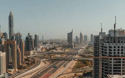
Discussing the challenges of balancing environmental protection with urban sprawl in temperate climate regions.
Urban sprawl is a phenomenon that has been increasing in temperate climate regions, as cities continue to expand and develop. This rapid growth of urban areas has significant implications for the environment, often resulting in the destruction of natural habitats and the loss of biodiversity. In temperate climate regions, where the climate is generally mild and the landscape is typically characterised by forests, grasslands, and wetlands, urban sprawl can have particularly detrimental effects on the environment. As cities grow, they encroach upon these natural areas, leading to habitat fragmentation and loss. This can have serious consequences for the flora and fauna that depend on these habitats for their survival, resulting in a decline in biodiversity. Furthermore, urban sprawl can also lead to increased water and air pollution, as well as the loss of green spaces and agricultural land. Consequently, it is essential to consider the environmental impact of urban sprawl in temperate climate regions and to develop strategies for sustainable urban development that can help to mitigate these effects. Urban sprawl is a complex issue that requires careful consideration of its environmental impact in temperate climate regions. As cities continue to expand, they often encroach upon natural habitats, leading to habitat fragmentation and loss. This can have serious consequences for the plants and animals that rely on these habitats for their survival, resulting in a decline in biodiversity. Additionally, urban sprawl can also lead to increased water and air pollution, as well as the loss of green spaces and agricultural land. Therefore, it is crucial to consider the environmental impact of urban sprawl in temperate climate regions and to...

Temperate Zones: Balancing Nature and Urbanization
Temperate zones are regions of the Earth situated between the tropics and the polar circles. These areas are characterised by moderate temperatures, distinct seasons and a diverse range of flora and fauna. The temperate zones harbour a variety of ecosystems, including forests, grasslands and wetlands, which support a rich array of plant and animal species. These regions are also significant for agriculture, providing fertile soil and a suitable climate for cultivating crops. The temperate zones are densely populated, with numerous major cities and urban areas located within them. Consequently, these regions face considerable challenges related to urbanisation, environmental degradation and the conservation of natural resources. It is essential to strike a balance between human development and the preservation of the unique ecosystems and biodiversity found in temperate zones. Summary Temperate zones are regions with moderate climate and distinct seasons, and are home to diverse ecosystems and species. Urbanization in temperate zones has led to habitat loss, pollution, and fragmentation of natural areas, impacting biodiversity and ecosystem functioning. Conservation efforts in temperate zones include protected areas, restoration projects, and sustainable land management practices to preserve and restore natural habitats. Biodiversity in temperate zones is rich and includes a wide variety of plant and animal species, many of which are endemic and at risk of extinction. Sustainable development in temperate zones involves balancing economic growth with environmental protection, promoting green infrastructure and sustainable resource management. The Impact of Urbanization on Temperate Zones The Destruction of Natural Habitats The expansion of urban areas results in the destruction of forests, wetlands, and other vital habitats. This can have a catastrophic impact on the...