Botswana, located in Southern Africa, is a landlocked country known for its diverse and stunning terrain. From the vast Kalahari Desert to the lush Okavango Delta, Botswana offers a range of landscapes that are not only visually captivating but also play a crucial role in the country’s ecosystem and economy. Understanding the geography of Botswana is essential for appreciating its natural beauty and the importance of preserving its resources.
Summary
- Botswana’s terrain and topography is diverse and unique, featuring everything from deserts to grasslands.
- The Kalahari Desert is a dominant feature of Botswana’s landscape, covering over 70% of the country.
- The Tsodilo Hills are a sacred site in Botswana, featuring over 4,500 rock paintings and engravings.
- The Makgadikgadi Salt Pans are a unique topographical feature, covering an area larger than Switzerland.
- The Okavango Delta is an oasis in the heart of Botswana, home to a diverse array of wildlife and plant species.
The Kalahari Desert
The Kalahari Desert is one of the largest deserts in the world, covering an area of approximately 900,000 square kilometers. It spans across Botswana, Namibia, and South Africa, with the majority of it located in Botswana. Despite its name, the Kalahari is not a true desert as it receives more rainfall than a typical desert. It is characterized by its red sand dunes, sparse vegetation, and unique wildlife.
The Kalahari Desert is home to a variety of animals that have adapted to survive in this harsh environment. Some of the iconic species found here include meerkats, gemsbok, springbok, and the elusive black-maned Kalahari lion. The desert also supports a rich birdlife, with over 200 species recorded in the region. Exploring the Kalahari offers visitors a chance to witness these incredible creatures in their natural habitat.
The Tsodilo Hills
The Tsodilo Hills are a UNESCO World Heritage Site located in northwestern Botswana. They hold great significance to the San people, who consider them sacred and believe that they are the resting place of their ancestors. The hills are made up of four main quartzite rock formations, known as the Male Hill, Female Hill, Child Hill, and Hill of the Gods.
The Tsodilo Hills are also home to one of the largest concentrations of rock art in the world. These ancient paintings and engravings depict various animals, humans, and spiritual beings, providing a glimpse into the rich cultural history of the region. Visitors can explore the hills on guided hikes and camping trips, immersing themselves in the natural beauty and cultural heritage of the area.
The Makgadikgadi Salt Pans
The Makgadikgadi Salt Pans are a vast network of salt flats located in northeastern Botswana. They are remnants of an ancient lake that once covered a large portion of the country. The pans are known for their stark white landscape, stretching as far as the eye can see. During the wet season, the pans transform into a shallow lake, attracting a multitude of migratory birds and other wildlife.
The Makgadikgadi Salt Pans are home to a variety of animals, including zebras, wildebeests, and flamingos. The area is also known for its unique species such as the brown hyena and the elusive aardvark. In addition to its wildlife, the pans hold cultural significance for the indigenous people of Botswana. The San people have inhabited this region for thousands of years and have a deep connection to the land.
The Okavango Delta
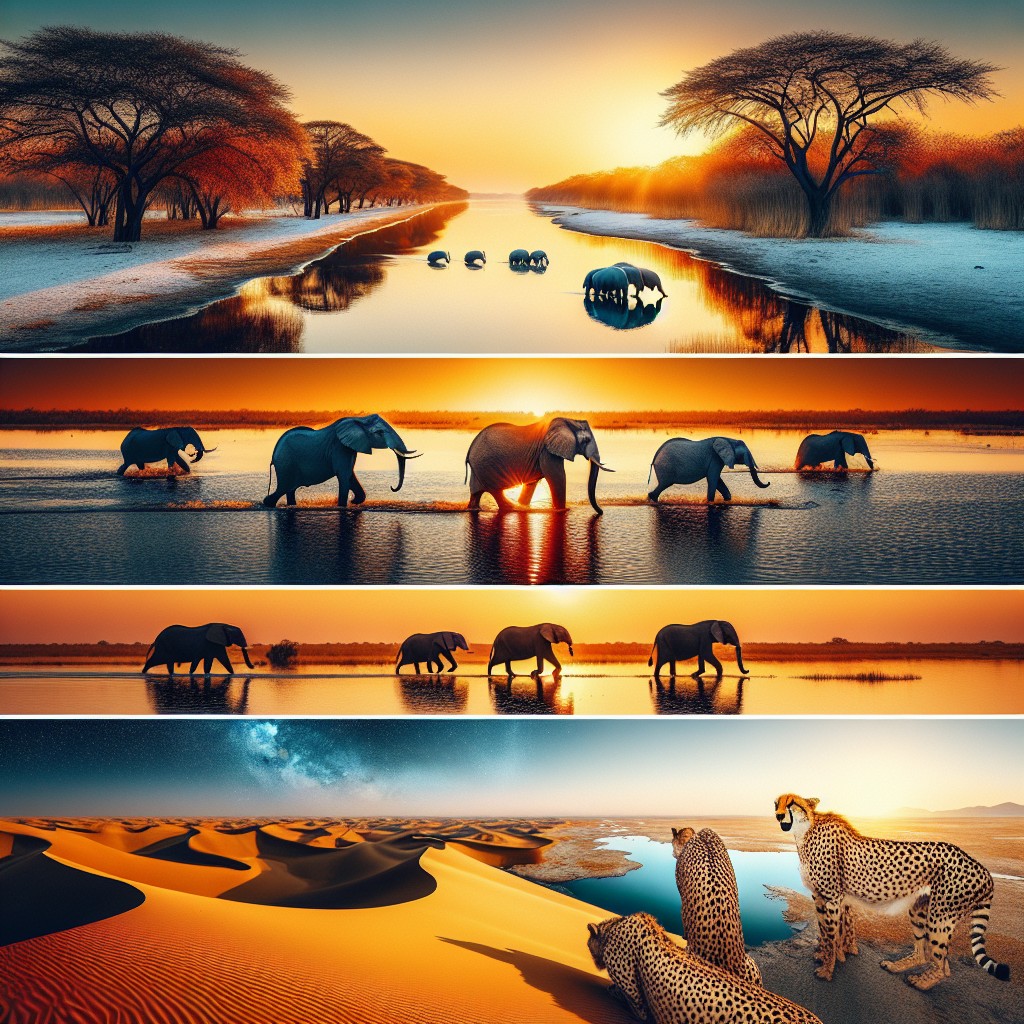
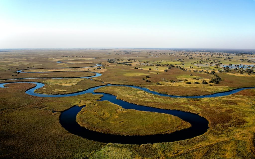
The Okavango Delta is one of Botswana’s most iconic natural wonders. It is the largest inland delta in the world, covering an area of approximately 15,000 square kilometers. The delta is formed by the Okavango River, which originates in Angola and flows into Botswana, creating a unique ecosystem that supports a diverse range of wildlife.
The Okavango Delta is home to an abundance of wildlife, including elephants, lions, hippos, and crocodiles. It is also a haven for birdwatchers, with over 400 species recorded in the area. Exploring the delta can be done through various activities such as mokoro (traditional canoe) safaris, game drives, and walking safaris. The delta offers a truly immersive experience, allowing visitors to get up close and personal with nature.
The Limpopo River Valley
The Limpopo River Valley is located in eastern Botswana, forming part of the country’s border with South Africa and Zimbabwe. It is the second-longest river in Southern Africa and plays a vital role in Botswana’s economy. The river provides water for irrigation, supporting agriculture and livestock farming in the region.
The Limpopo River Valley is home to a diverse range of wildlife, including elephants, giraffes, and various antelope species. It is also a popular destination for birdwatching, with over 400 species recorded in the area. Visitors can explore the valley through guided game drives and boat cruises, offering a chance to spot these incredible creatures in their natural habitat.
The Central Plateau
The Central Plateau is located in the central part of Botswana and covers a vast area of approximately 200,000 square kilometers. It is characterized by its flat terrain and sparse vegetation, making it an ideal habitat for a variety of wildlife. The plateau is home to several national parks and game reserves, offering visitors ample opportunities for wildlife viewing.
The Central Plateau is known for its diverse range of animals, including elephants, lions, zebras, and wildebeests. It is also home to several endangered species such as the African wild dog and the black rhinoceros. Exploring the plateau through guided game drives and walking safaris allows visitors to witness these incredible creatures in their natural habitat.
The Tswapong Hills
The Tswapong Hills are a range of hills located in eastern Botswana. They cover an area of approximately 2,500 square kilometers and are known for their unique geological features. The hills are made up of granite and sandstone formations, creating a stunning landscape that is popular among hikers and nature enthusiasts.
The Tswapong Hills offer a range of hiking and camping opportunities, allowing visitors to explore the area’s natural beauty at their own pace. The hills are also home to a variety of wildlife, including baboons, monkeys, and various bird species. Exploring the Tswapong Hills provides a chance to connect with nature and appreciate the geological wonders of the region.
The Selinda Spillway
The Selinda Spillway is a seasonal waterway located in northern Botswana. It connects the Okavango Delta to the Linyanti Swamps, forming an important link in the country’s ecosystem. During the wet season, the spillway fills with water, attracting a variety of wildlife and providing a lifeline for many species.
The Selinda Spillway offers a range of activities for visitors, including canoe safaris, walking safaris, and game drives. Exploring the area allows visitors to witness the incredible diversity of wildlife that relies on this waterway for survival. It also provides an opportunity to learn about the delicate balance of nature and the importance of preserving these ecosystems.
The Chobe River
The Chobe River is located in northern Botswana and forms part of the country’s border with Namibia. It is one of Africa’s most iconic rivers and plays a crucial role in Botswana’s wildlife conservation efforts. The river provides a vital water source for animals in the region, attracting large herds of elephants, buffalos, and other wildlife.
The Chobe River offers a range of activities for visitors, including boat cruises, game drives, and fishing trips. Exploring the river allows visitors to witness the incredible diversity of wildlife that congregates along its banks. It also provides an opportunity to learn about the importance of sustainable tourism and conservation efforts in protecting these fragile ecosystems.
Botswana’s diverse terrain and topography make it a truly unique destination for nature lovers and adventure seekers. From the vast Kalahari Desert to the lush Okavango Delta, the country offers a range of landscapes that are not only visually captivating but also play a crucial role in the country’s ecosystem and economy. Understanding the geography of Botswana is essential for appreciating its natural beauty and the importance of preserving its resources. By exploring these diverse landscapes and engaging in sustainable tourism practices, visitors can contribute to the conservation efforts and ensure that future generations can continue to enjoy the wonders of Botswana.
FAQs
What is the terrain and topography of Botswana?
Botswana is a landlocked country located in Southern Africa. The terrain of Botswana is mostly flat, with some areas of low-lying hills and plateaus. The country is dominated by the Kalahari Desert, which covers most of the central and southwestern parts of the country.
Are there any mountains in Botswana?
Botswana is a relatively flat country, and there are no major mountain ranges in the country. However, there are some isolated hills and small mountain ranges in the eastern and southeastern parts of the country, such as the Tswapong Hills and the Bakwena Hills.
What are the major valleys in Botswana?
Botswana has several major valleys, including the Okavango Delta, the Limpopo River Valley, and the Makgadikgadi Pans. The Okavango Delta is the largest inland delta in the world and is home to a diverse range of wildlife, including elephants, lions, and hippos.
What are the major plains in Botswana?
Botswana has several major plains, including the Kalahari Plains, the Makgadikgadi Salt Pans, and the Central Botswana Plateau. The Kalahari Plains cover most of the central and southwestern parts of the country and are home to a variety of wildlife, including lions, cheetahs, and giraffes.
How does the terrain and topography of Botswana affect its climate?
The terrain and topography of Botswana play a significant role in shaping the country’s climate. The Kalahari Desert, which covers most of the country, is a hot and dry region with low rainfall. The Okavango Delta, on the other hand, is a wetland area with a more humid climate. The country’s flat terrain also means that there are few natural barriers to the movement of air masses, which can lead to extreme temperatures and weather conditions.