Cape Verde’s Population Density: A Closer Look
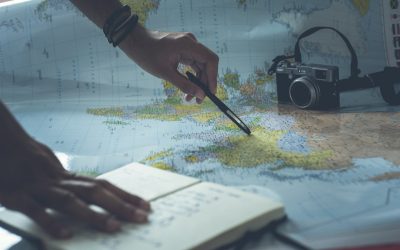
Cape Verde is an archipelago located off the northwest coast of Africa in the Atlantic Ocean. It consists of ten islands and several islets, with a total land area of approximately 4,033 square kilometers. The country is known for its beautiful beaches, vibrant...
Exploring the Fascinating History of Cape Verde
Cape Verde, officially known as the Republic of Cabo Verde, is an archipelago located off the coast of West Africa in the Atlantic Ocean. It consists of ten islands and five islets, with a total population of approximately 550,000 people. The islands are known for...
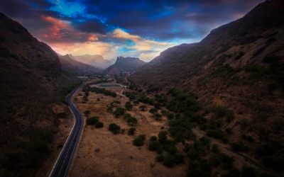
Exploring Cape Verde’s Varied Terrain: Mountains, Valleys, and Plains
Cape Verde, an archipelago located off the coast of West Africa, is known for its diverse and stunning terrain. The country is made up of ten islands and several islets, each with its own unique geography and topography. From majestic mountains to lush valleys, vast...
Cape Verde’s Climate Zones: Diverse Regions to Explore
Cape Verde, an archipelago located off the coast of West Africa, is known for its diverse climate zones. The country consists of ten islands, each with its own unique geography and climate. Understanding the different climate zones is essential for travelers who want...
Cape Verde’s Political Boundaries: Provinces, Districts, or Historical Limits?
Cape Verde, officially known as the Republic of Cabo Verde, is an archipelago located off the coast of West Africa. It consists of ten main islands and several smaller ones, with a total land area of approximately 4,033 square kilometers. Understanding Cape...
Cape Verde’s Natural Resources: Locations and Details
Cape Verde, officially known as the Republic of Cabo Verde, is an archipelago located off the coast of West Africa. Despite its small size and population, Cape Verde is rich in natural resources that play a crucial role in the country’s economy and development....
Cape Verde’s Cultural and Historical Landmarks: Must-Visit Sites
Cape Verde, an archipelago located off the coast of West Africa, is a country rich in cultural heritage. Its unique history and geographical location have resulted in a diverse and vibrant culture that is influenced by various African, European, and Caribbean...

Population Density of Burundi
Burundi, a small landlocked country in East Africa, is known for its high population density. With a population of over 11 million people, Burundi has one of the highest population densities in Africa, with an average of 463 people per square kilometer. Understanding...

History of Burundi
Burundi, a small landlocked country in East Africa, has a rich and complex history that spans thousands of years. From its early inhabitants to the arrival of the Tutsi and Hutu peoples, the rise of the Burundian monarchy, and the impact of European colonization,...
Terrain and Topography of Burundi: mountains, valleys, and plains.
Burundi, a small landlocked country in East Africa, is known for its diverse and stunning terrain. Nestled between Rwanda, Tanzania, and the Democratic Republic of Congo, Burundi is home to majestic mountains, lush valleys, fertile plains, the Great Rift Valley,...
Political Boundaries of Burundi: Provinces, Districts, or Historical Boundaries.
Burundi, a landlocked country located in East Africa, is known for its rich history and diverse culture. It shares borders with Rwanda to the north, Tanzania to the east and south, and the Democratic Republic of the Congo to the west. Understanding the political...
Climate Zones of Burundi: Different climate regions Of Burundi
Burundi, a landlocked country located in East Africa, is known for its diverse geography and climate. The country is situated on the eastern edge of the Albertine Rift, which is part of the Great Rift Valley. This geographical location gives rise to a variety of...