World Geography
Geography is the study of the Earth’s landscapes, environments, and the relationships between people and their surroundings. It encompasses both the physical aspects of the Earth, such as its landforms, bodies of water, and climate, as well as the human aspects, including population distribution, cultures, and economies. World geography is a broad field that seeks to understand the complexities of our planet and how humans interact with it. By studying world geography, we can gain a deeper appreciation for the diversity of our planet and the interconnectedness of its various regions.
Geography is a multidisciplinary field that draws on elements of physical science, social science, and humanities. It involves the use of maps, spatial analysis, and geographic information systems (GIS) to understand the Earth’s surface and the processes that shape it. World geography also encompasses the study of human geography, which examines the ways in which people and their activities are distributed across the Earth. By understanding world geography, we can better appreciate the environmental, cultural, and economic challenges facing different regions of the world. This knowledge is crucial for addressing global issues such as climate change, resource management, and international development.
The Five Oceans and Seven Continents
The Earth’s surface is divided into five major oceans: the Pacific, Atlantic, Indian, Southern (or Antarctic), and Arctic Oceans. These vast bodies of water play a crucial role in regulating the Earth’s climate and supporting diverse marine ecosystems. The oceans also serve as important transportation routes and a source of food and other natural resources for human societies around the world.
In addition to the oceans, the Earth’s landmasses are divided into seven continents: Africa, Antarctica, Asia, Europe, North America, Australia (or Oceania), and South America. Each continent has its own unique physical and cultural characteristics, shaped by millions of years of geological processes and human history. From the deserts of Africa to the rainforests of South America, the continents offer a rich tapestry of landscapes and environments for exploration and study.
Major Mountain Ranges and Deserts
The Earth’s surface is also marked by major mountain ranges and deserts that have shaped the planet’s physical and cultural landscapes. The Himalayas, for example, are the highest mountain range in the world and are home to diverse ecosystems and cultures in countries such as India, Nepal, and Bhutan. The Andes in South America, the Rockies in North America, and the Alps in Europe are other prominent mountain ranges that have influenced human settlement patterns and economic activities.
Deserts cover about one-third of the Earth’s land surface and are characterized by low precipitation and extreme temperatures. The Sahara Desert in Africa is the largest hot desert in the world, while the Gobi Desert in Asia is one of the largest cold deserts. Deserts are not only home to unique flora and fauna but have also been important trade routes and cultural crossroads throughout history.
Climate Zones and Biomes
The Earth’s climate is influenced by a variety of factors, including latitude, altitude, ocean currents, and prevailing winds. As a result, the planet is divided into different climate zones, each with its own characteristic weather patterns and ecosystems. The equator, for example, experiences a tropical climate with high temperatures and heavy rainfall, while the polar regions have a cold and dry climate.
These climate zones give rise to different biomes, or large ecological areas characterized by distinct plant and animal communities. The tropical rainforest biome, found near the equator, is home to a diverse array of species and is vital for regulating the Earth’s climate. The grasslands biome, found in regions such as the African savannah and North American prairies, supports grazing animals and has been important for human agriculture throughout history.
Human Geography and Population Distribution
Human geography examines the ways in which people and their activities are distributed across the Earth’s surface. It encompasses topics such as population growth, migration patterns, urbanization, and cultural diversity. Understanding human geography is crucial for addressing global challenges such as poverty, inequality, and environmental degradation.
Population distribution is uneven across the world, with some regions experiencing rapid population growth while others are declining. The majority of the world’s population lives in Asia, particularly in countries such as China and India. Urban areas are also growing rapidly, with more than half of the world’s population now living in cities. This trend has significant implications for infrastructure development, resource management, and social inequality.
Historical and Cultural Geography
Historical geography examines how human activities have shaped the Earth’s landscapes over time. It explores topics such as colonialism, trade routes, and the rise and fall of empires. Cultural geography focuses on how human cultures have developed in different regions of the world and how they interact with their environments.
The Silk Road, for example, was an ancient trade route that connected China with Europe and facilitated the exchange of goods, ideas, and technologies across Eurasia. This historical trade route had a profound impact on the development of cultures and economies along its path. Similarly, cultural geographers study how different societies have adapted to their environments through practices such as agriculture, architecture, and religious beliefs.
The Importance of Geographic Knowledge
Geographic knowledge is crucial for addressing global challenges such as climate change, resource management, and international development. By understanding world geography, we can better appreciate the environmental, cultural, and economic challenges facing different regions of the world. This knowledge is crucial for addressing global issues such as climate change, resource management, and international development.
Geographic knowledge also helps us to understand our interconnectedness with other regions of the world. By studying world geography, we can gain a deeper appreciation for the diversity of our planet and the interconnectedness of its various regions. This understanding can foster a sense of global citizenship and empathy for people from different cultures and backgrounds.
In conclusion, world geography is a complex and multifaceted field that encompasses both physical and human aspects of the Earth’s landscapes. By studying world geography, we can gain a deeper appreciation for the diversity of our planet and the interconnectedness of its various regions. This knowledge is crucial for addressing global challenges such as climate change, resource management, and international development. It also helps us to understand our interconnectedness with other regions of the world and fosters a sense of global citizenship.
FAQs
What is world geography?
World geography is the study of the Earth’s landscapes, environments, and the relationships between people and their environments. It encompasses the physical features of the Earth, as well as the human activity that takes place on it.
Why is world geography important?
World geography is important because it helps us understand the world around us. It provides insights into the physical and human processes that shape our planet, and helps us make informed decisions about how to interact with our environment.
What are the main branches of world geography?
The main branches of world geography include physical geography, which focuses on the Earth’s natural features and processes, and human geography, which examines the relationships between people and their environments.
How does world geography impact our daily lives?
World geography impacts our daily lives in numerous ways, from influencing the weather and climate we experience, to shaping the availability of natural resources and influencing the distribution of populations and cultures around the world.
What are some key concepts in world geography?
Key concepts in world geography include location, place, human-environment interaction, movement, and region. These concepts help geographers understand and interpret the world around them.

Cultural or Historical Sites of Malta: Important Cultural Landmarks or Historical Sites in Malta
Malta, a small island nation in the Mediterranean, boasts a wealth of cultural and historical sites dating back millennia. The country’s rich history is evident in its well-preserved temples, palaces and cathedrals, making it a popular destination for history enthusiasts and cultural explorers. From megalithic temples to the Grand Master’s Palace, Malta offers a fascinating journey through time, showcasing the legacy of its ancient civilisations and the influence of various conquerors and rulers. The unique blend of architectural styles and the intricate details of the island’s cultural and historical sites make Malta a must-visit destination for those interested in delving into the past and experiencing the beauty of ancient craftsmanship. Malta’s cultural and historical sites are not only a testament to the island’s rich heritage but also a reflection of the diverse influences that have shaped its identity over the centuries. From the Phoenicians and Romans to the Knights of St John and the British Empire, Malta has been a melting pot of cultures, each leaving its mark on the island’s architecture, art and traditions. The preservation of these sites demonstrates the Maltese people’s commitment to safeguarding their history and sharing it with the world. As visitors explore these sites, they are not only admiring the beauty of ancient structures but also immersing themselves in the stories of the people who built them and the events that unfolded within their walls. Malta’s cultural and historical sites offer a glimpse into the island’s past, allowing visitors to connect with its rich heritage and gain a deeper understanding of its significance in the broader context of Mediterranean history. Summary Malta is...

Natural Resources of Malta: Where Natural Resources are Located in Malta
Malta, a small archipelago in the Mediterranean Sea, is renowned for its rich history, striking landscapes and vibrant culture. Despite its diminutive size, Malta possesses a variety of natural resources that play a crucial role in the country’s economy and environment. From limestone and salt to fertile soil and marine resources, Malta’s natural assets are diverse and valuable. Understanding and managing these resources is essential for the sustainable development of the country. Malta’s natural resources have been utilised for centuries, shaping the island’s history and culture. The extraction of limestone, for instance, has been a significant industry in Malta for thousands of years, with the stone being used to construct the island’s iconic architecture, including the ancient temples and the medieval city of Mdina. Moreover, Malta’s salt pans have been in operation since Roman times, providing a valuable resource for both local consumption and export. The island’s fertile soil has also supported agriculture for generations, allowing for the cultivation of crops such as tomatoes, potatoes and grapes. Furthermore, Malta’s marine resources, including fish and shellfish, have long been an important source of food and livelihood for the local population. As such, Malta’s natural resources have played a fundamental role in shaping the island’s identity and sustaining its people. Summary Malta’s natural resources include limestone, arable land, and fish. The geographical distribution of natural resources in Malta is limited due to its small size and lack of freshwater sources. Natural resources play a significant role in Malta’s economy, particularly in the construction and tourism sectors. The exploitation of natural resources in Malta has led to environmental degradation and loss of...
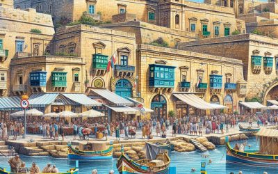
Malta
Malta (Repubblika ta’ Malta (Maltese); Republic of Malta (English)) Capital: Valletta Population (Estimated July 2012): 409,836 Area: 316km2 or 122mi2 Currency: Euro (€) Official Language: Maltese and English Political Information: Parliamentary Republic Official Religion: Roman Catholic(with approximately 98% of the population of the Roman Catholic faith). Highest Point: Għajn Abdul (hill) at 168m or 551ft GDP Official Exchange Rate (OER is more precise at gauging a country’s economic power) (Estimated 2011): $8.7 billion (US$) or (GBP) GDP (OER) Per Capita (per member of the population estimated 2011): (US$) or (GBP) GDP Purchasing Power Parity (PPP is good for gauging living conditions and the use of resources but is not as accurate as OER. This data has been calculated based on the sum value of all goods and services produced in the country valued at prices prevailing in the United States) (Estimated 2011): $10.91 billion (US$) or (GBP) GDP (PPP) Per Capita (per member of the population estimated 2011): $25,700 (US$) or (GBP) Time Zone (GMT/UTC): +1:00 Wildlife: Counties/Provinces/States: 68 localities (Il-lokalita); Attard, Balzan, Birgu, Birkirkara, Birzebbuga, Bormla, Dingli, Fgura, Floriana, Fontana, Ghajnsielem, Gharb, Gharghur, Ghasri Ghaxaq, Gudja, Gzira, Hamrun, Iklin, Imdina, Imgarr, Imqabba, Imsida, Imtarfa, Isla, Kalkara, Kercem, Kirkop, Lija, Luqa, Marsa, Marsaskala, Marsaxlokk, Mellieha, Mosta, Munxar, Nadur, Naxxar, Paola, Pembroke, Pieta, Qala, Qormi, Qrendi, Rabat, Rabat (Ghawdex), Safi, San Giljan/Saint Julian, San Gwann/Saint John, San Lawrenz/Saint Lawrence, Sannat, San Pawl il-Bahar/Saint Paul’s Bay, Santa Lucija/Saint Lucia, Santa Venera/Saint Venera, Siggiewi, Sliema, Swieqi, Tarxien, Ta’ Xbiex, Valletta, Xaghra, Xewkija, Xghajra, Zabbar, Zebbug, Zebbug (Ghawdex), Zejtun, Zurrieq Leaders: President George Abela with Prime Minister Lawrence Gonzi. Additional: Gained independence from the U.K. on the 21st of September 1964. Sources: CIA World Fact...

Climate Zones Of Mali: Different climate regions Of Mali
Mali, a landlocked nation in West Africa, is characterised by diverse climate zones, each possessing distinct features that significantly influence the environment and livelihoods of its inhabitants. The country is divided into three primary climate zones: the Sahelian Zone in the north, the Sudanian Zone in the central region, and the Sudano-Guinean Zone in the south. These climate zones are shaped by various factors, including latitude, altitude, and the presence of natural features such as the Niger River and the Sahara Desert. A comprehensive understanding of these climate zones is essential for assessing the challenges and opportunities faced by the Malian population, particularly in relation to agriculture, water resources, and sustainable development. Summary Mali’s climate is divided into three main zones: Sahelian, Sudanian, and Sudano-Guinean. The Sahelian Zone in the north is dry and hot, with very little rainfall. The Sudanian Zone in the central region is transitional, with more moderate temperatures and rainfall. The Sudano-Guinean Zone in the south receives the most rainfall and has a more tropical climate. The different climate zones in Mali have a significant impact on agriculture and livelihoods, influencing the types of crops that can be grown and the availability of water. Sahelian Zone: The Dry and Hot Northern Region Challenging Environment This region is prone to frequent droughts and desertification, making it a challenging environment for agriculture and livelihoods. The local population has traditionally relied on nomadic pastoralism and subsistence farming, but the harsh climate and environmental degradation have made it increasingly difficult to sustain these livelihoods. As a result, many communities in the Sahelian Zone face food insecurity and poverty, and...

Political Boundaries of Mali: Provinces, Districts, or Historical Boundaries.
Mali, a landlocked nation in West Africa, boasts a rich history and diverse cultural heritage. The political boundaries of Mali have undergone significant transformations throughout the centuries, influencing the country’s governance and administration. The present-day political boundaries of Mali were established during the colonial period and have since experienced modifications due to various historical, social and political factors. A thorough understanding of Mali’s political boundaries is essential for comprehending the nation’s governance, administration and socio-economic dynamics. This article shall examine the provinces and districts of Mali, the historical boundaries of the country, the evolution of its political boundaries, the challenges and controversies surrounding them, the impact of these boundaries on governance and administration, and the future prospects for Mali’s political boundaries. Summary Mali’s political boundaries have evolved over time, shaping the country’s governance and administration. The country is divided into 10 regions, further divided into 56 cercles, and then into communes. Mali’s historical boundaries have been influenced by the empires of Ghana, Mali, and Songhai, as well as French colonial rule. The evolution of Mali’s political boundaries has been influenced by factors such as colonialism, ethnic diversity, and conflicts. Challenges and controversies surrounding Mali’s political boundaries include ethnic tensions, separatist movements, and border disputes with neighbouring countries. Provinces and Districts of Mali Administrative Regions of Mali The administrative regions of Mali include Kayes, Koulikoro, Sikasso, Ségou, Mopti, Tombouctou, Gao, Kidal, Ménaka, and Taoudénit. These regions are further divided into cercles and communes, each with its own administrative and governance structures. The provinces and districts of Mali play a crucial role in the country’s governance and administration, as they are...

Terrain and Topography of Mali: mountains, valleys, and plains.
Mali, situated in West Africa, is a landlocked nation renowned for its diverse and varied terrain. The country’s topography is characterised by a combination of mountains, valleys, basins, plains and plateaus, rendering it a captivating and unique landscape. Mali‘s terrain is shaped by the Sahara Desert in the north, the Sahel region in the south, and the Niger River, which traverses the country from east to west. This diverse topography significantly influences the climate, human settlements and agriculture in Mali. A comprehensive understanding of Mali’s terrain and topography is essential for appreciating the country’s natural beauty and recognising the challenges and opportunities it presents. Summary Mali’s terrain is diverse, with a mix of mountains, valleys, basins, plains, and plateaus. The Hombori and Adrar des Ifoghas mountain ranges are the most prominent in Mali. The Senegal and Niger rivers create important valleys and basins in Mali. The plains and plateaus of Mali are crucial for agriculture and human settlements. Mali’s varied terrain greatly influences its climate, from the Saharan desert in the north to the tropical savannas in the south. The Mountain Ranges of Mali The Adrar des Ifoghas Range The Adrar des Ifoghas range, situated in the north-eastern part of the country, is one of the most prominent mountain ranges in Mali. It is known for its rugged terrain, deep canyons, and towering peaks, including Mount Tamgak and Mount Greboun. Other Notable Mountain Ranges The Hombori Mountains, situated in central Mali, are another notable mountain range in the country. These mountains are known for their distinctive rock formations and are a popular destination for rock climbers and hikers. The...

History of Mali
The ancient Mali Empire, situated in West Africa, emerged as a formidable power in the 13th century. Its founder, Sundiata Keita, renowned for his courage and leadership, is often referred to as the ‘Lion King’. Sundiata Keita’s ascension to power heralded Mali‘s golden age, during which he expanded the empire’s territories and established a robust central government. Under his reign, Mali flourished, becoming renowned for its affluence, cultural richness, and advanced societal structures. The Mali Empire’s rise was significantly influenced by its strategic position along the Niger River, which facilitated access to trade routes and bolstered economic growth. The empire’s prosperity was built upon the trade of gold, salt, and other valuable commodities, which were highly sought after in the region. Mali’s dominance over these trade routes enabled it to accumulate substantial wealth and establish itself as a dominant force in West Africa. Furthermore, the empire’s adoption of Islam strengthened its connections with the broader Islamic world, fostering cultural exchange and trade with other Muslim societies. The ascendancy of the Mali Empire can be attributed to strong leadership, strategic geographical location, and a thriving economy, factors which contributed to its status as one of Africa’s most powerful empires during its era. Summary Ancient Mali rose to power through the leadership of Sundiata Keita and the establishment of a strong empire in the 13th century. The Mali Empire reached its peak during the reign of Mansa Musa, known for his wealth and pilgrimage to Mecca, bringing prosperity and cultural exchange. Internal power struggles and external threats from neighbouring empires led to the decline of Mali in the 15th century. European...

Natural Resources of Mali: Where Natural Resources are Located in Mali
Mali, situated in West Africa, is a nation abundant in natural resources. From mining and minerals to agricultural and water resources, Mali possesses a diverse array of natural assets that contribute to its economy and the livelihoods of its citizens. The country’s natural resources play a crucial role in its development and sustainability, making it imperative to comprehend and manage them effectively. This article shall explore the various natural resources in Mali, their significance, and the endeavours being made to conserve and sustainably utilise them for the benefit of the country and its people. Mali’s natural resources are a wellspring of wealth and opportunity for the nation. With a land area exceeding 1.2 million square kilometres, Mali is endowed with a variety of natural resources that have the potential to drive economic growth and development. From gold and other minerals to fertile agricultural land, water bodies, and energy sources, Mali’s natural resources are diverse and plentiful. However, the sustainable management and conservation of these resources are essential to ensure their long-term availability and benefits for future generations. This article shall delve into the different natural resources in Mali, their current status, and the measures being taken to ensure their sustainable use and conservation. Summary Mali is rich in natural resources, including minerals, agricultural land, water, energy, and forests. The mining sector in Mali is a significant contributor to the country’s economy, with gold being the primary mineral of interest. Agriculture is a vital part of Mali’s economy, with the majority of the population relying on it for their livelihood. Mali has abundant water resources, with the Niger River being...

Cultural or Historical Sites of Mali: Important Cultural Landmarks or Historical Sites in Mali
Mali, situated in West Africa, is a nation abundant in cultural and historical heritage. From ancient cliff dwellings to magnificent mosques, Mali‘s cultural and historical sites provide a glimpse into the country’s diverse and vibrant past. These sites not only showcase Mali’s architectural and artistic achievements but also offer insight into the country’s intellectual and spiritual traditions. Visitors to Mali have the opportunity to explore these sites and gain a deeper understanding of the nation’s rich cultural heritage. Mali’s cultural and historical sites are of importance not only for the country’s identity but also for the world at large. Many of these sites have been recognised by UNESCO as World Heritage Sites, highlighting their significance on a global scale. From the Great Mosque of Djenné to the Timbuktu Manuscripts, these sites are not only a source of pride for Mali but also contribute to the world’s cultural diversity. This article will explore some of Mali’s most significant cultural and historical sites, examining their history, significance, and the experiences they offer to visitors. Summary Mali is home to a rich cultural and historical heritage, with numerous sites that showcase the country’s diverse traditions and intellectual achievements. The Great Mosque of Djenné is a stunning example of Sahelian architecture and a UNESCO World Heritage Site, attracting visitors from around the world. The Timbuktu Manuscripts are a valuable collection of ancient texts that provide insight into Mali’s intellectual and scholarly history, and efforts are underway to preserve and protect them. The Dogon Country is a must-visit for those interested in exploring Mali’s ancient cliff dwellings and learning about the unique culture and...

Population Density of Mali
Mali, a landlocked country in West Africa, is renowned for its rich cultural heritage and diverse landscapes. With a total area of over 1.2 million square kilometres, Mali is the eighth-largest country in Africa. Despite its vast size, Mali has a relatively low population density, with an estimated population of approximately 20 million people. This translates to an average of 16 people per square kilometre, making Mali one of the least densely populated countries in the world. However, this low population density is not evenly distributed across the country, with some regions being more densely populated than others. Understanding the factors that affect population distribution in Mali is crucial for addressing the challenges and opportunities that arise from varying population densities. Summary Mali’s population density is unevenly distributed, with the majority of people living in the southern regions and along the Niger River. Factors affecting population distribution in Mali include climate, natural resources, and historical settlement patterns. Urban population density in Mali is increasing due to rural-urban migration, while rural areas remain sparsely populated. High population density in Mali puts pressure on infrastructure and resources, leading to challenges in providing basic services and maintaining environmental sustainability. Government policies and initiatives in Mali aim to manage population density through urban planning, resource management, and rural development programs. Factors Affecting Population Distribution in Mali Geographical Factors Several factors contribute to the uneven distribution of population in Mali. One of the primary factors is the country’s diverse geography, which includes arid deserts in the north, fertile plains in the south, and the Niger River basin running through the central region. The availability...
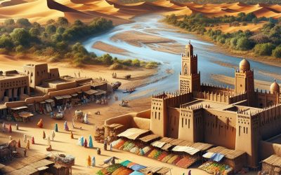
Mali Country Profile: The Mali Empire, Map, History, and Profile of the West Africa Empire
Mali (République du Mali (Republic of Mali)) Capital: Bamako Population (Estimated July 2012): 14,533,511 Area: 1,248,574 km2 or 482,077 mi2 Currency: CFA Franc (CFAF) Official Language: French Political Information: Semi-Presidential Republic Official Religion: No Official Religion (approximately 90% of the population are Muslim, 9% follow Indigenous beliefs and 1% are Christian) Highest Mountain: Hombori Tondo at 1,155m or 3789ft GDP Official Exchange Rate (OER is more precise at gauging a country’s economic power) (Estimated 2011): $11 billion (US$) or (GBP) GDP (OER) Per Capita (per member of the population estimated 2011): (US$) or (GBP) GDP Purchasing Power Parity (PPP is good for gauging living conditions and the use of resources but not as accurate as OER. This data has been calculated based on the sum value of all goods and services produced in the country valued at prices prevailing in the United States) (Estimated 2011): $18.26 billion (US$) or (GBP) GDP (PPP) Per Capita (per member of the population estimated 2011): $1,300 (US$) or (GBP) Time Zone (GMT/UTC): GMT Wildlife: Counties/Provinces/States: 8 regions (regions, singular – region), 1 district*; District de Bamako*, Gao, Kayes, Kidal, Koulikoro, Mopti, Segou, Sikasso, Tombouctou (Timbuktu) Leaders: President Amadou Toumani Touré with Prime Minister Cissé Mariam Kaïdama Sidibé Additional: Gained independence from France on the 22nd of September 1960. Sources: CIA World Fact Book, Encyclopaedia Britannica. Mali and the Mighty Empire of West Africa: A Deep Dive into the Mali Country Profile and History Mali — a land steeped in history, from the golden age of the Mali Empire to the modern-day Republic of Mali — stands as a fascinating study of resilience, culture, and geopolitics in West Africa. Once a mighty empire renowned for its wealth...

Political Boundaries of Maldives: Provinces, Districts, or Historical Boundaries.
The Maldives, an archipelago situated in the Indian Ocean, is a sovereign state with a distinctive political boundary structure. The country comprises 26 atolls, which are further subdivided into administrative divisions known as provinces and districts. The political boundaries of the Maldives play a crucial role in the governance and administration of the country, as they determine the allocation of resources, implementation of policies and provision of public services. Understanding the intricacies of these boundaries is essential for comprehending the political landscape of the Maldives and the challenges it faces in maintaining effective governance. The political boundaries of the Maldives have evolved over time, influenced by historical, geographical and administrative factors. The country’s unique geography, with its scattered islands and atolls, presents a complex challenge in terms of governance and administration. As such, the political boundaries have been designed to address these challenges and ensure effective governance across the archipelago. This article will explore the structure and function of provinces and districts in the Maldives, examine the historical boundaries and their significance, and discuss the potential changes and developments in the future of the country’s political boundaries. Summary The political boundaries of Maldives are defined by its 26 atolls, which are further divided into administrative divisions. Maldives is divided into 20 administrative provinces, each with its own council responsible for local governance and development. The districts in Maldives are organized under the provinces and are responsible for local administration and service delivery. The historical boundaries of Maldives have been influenced by colonial powers and have significant cultural and political significance. Comparing provinces, districts, and historical boundaries in Maldives provides...