World Geography
Geography is the study of the Earth’s landscapes, environments, and the relationships between people and their surroundings. It encompasses both the physical aspects of the Earth, such as its landforms, bodies of water, and climate, as well as the human aspects, including population distribution, cultures, and economies. World geography is a broad field that seeks to understand the complexities of our planet and how humans interact with it. By studying world geography, we can gain a deeper appreciation for the diversity of our planet and the interconnectedness of its various regions.
Geography is a multidisciplinary field that draws on elements of physical science, social science, and humanities. It involves the use of maps, spatial analysis, and geographic information systems (GIS) to understand the Earth’s surface and the processes that shape it. World geography also encompasses the study of human geography, which examines the ways in which people and their activities are distributed across the Earth. By understanding world geography, we can better appreciate the environmental, cultural, and economic challenges facing different regions of the world. This knowledge is crucial for addressing global issues such as climate change, resource management, and international development.
The Five Oceans and Seven Continents
The Earth’s surface is divided into five major oceans: the Pacific, Atlantic, Indian, Southern (or Antarctic), and Arctic Oceans. These vast bodies of water play a crucial role in regulating the Earth’s climate and supporting diverse marine ecosystems. The oceans also serve as important transportation routes and a source of food and other natural resources for human societies around the world.
In addition to the oceans, the Earth’s landmasses are divided into seven continents: Africa, Antarctica, Asia, Europe, North America, Australia (or Oceania), and South America. Each continent has its own unique physical and cultural characteristics, shaped by millions of years of geological processes and human history. From the deserts of Africa to the rainforests of South America, the continents offer a rich tapestry of landscapes and environments for exploration and study.
Major Mountain Ranges and Deserts
The Earth’s surface is also marked by major mountain ranges and deserts that have shaped the planet’s physical and cultural landscapes. The Himalayas, for example, are the highest mountain range in the world and are home to diverse ecosystems and cultures in countries such as India, Nepal, and Bhutan. The Andes in South America, the Rockies in North America, and the Alps in Europe are other prominent mountain ranges that have influenced human settlement patterns and economic activities.
Deserts cover about one-third of the Earth’s land surface and are characterized by low precipitation and extreme temperatures. The Sahara Desert in Africa is the largest hot desert in the world, while the Gobi Desert in Asia is one of the largest cold deserts. Deserts are not only home to unique flora and fauna but have also been important trade routes and cultural crossroads throughout history.
Climate Zones and Biomes
The Earth’s climate is influenced by a variety of factors, including latitude, altitude, ocean currents, and prevailing winds. As a result, the planet is divided into different climate zones, each with its own characteristic weather patterns and ecosystems. The equator, for example, experiences a tropical climate with high temperatures and heavy rainfall, while the polar regions have a cold and dry climate.
These climate zones give rise to different biomes, or large ecological areas characterized by distinct plant and animal communities. The tropical rainforest biome, found near the equator, is home to a diverse array of species and is vital for regulating the Earth’s climate. The grasslands biome, found in regions such as the African savannah and North American prairies, supports grazing animals and has been important for human agriculture throughout history.
Human Geography and Population Distribution
Human geography examines the ways in which people and their activities are distributed across the Earth’s surface. It encompasses topics such as population growth, migration patterns, urbanization, and cultural diversity. Understanding human geography is crucial for addressing global challenges such as poverty, inequality, and environmental degradation.
Population distribution is uneven across the world, with some regions experiencing rapid population growth while others are declining. The majority of the world’s population lives in Asia, particularly in countries such as China and India. Urban areas are also growing rapidly, with more than half of the world’s population now living in cities. This trend has significant implications for infrastructure development, resource management, and social inequality.
Historical and Cultural Geography
Historical geography examines how human activities have shaped the Earth’s landscapes over time. It explores topics such as colonialism, trade routes, and the rise and fall of empires. Cultural geography focuses on how human cultures have developed in different regions of the world and how they interact with their environments.
The Silk Road, for example, was an ancient trade route that connected China with Europe and facilitated the exchange of goods, ideas, and technologies across Eurasia. This historical trade route had a profound impact on the development of cultures and economies along its path. Similarly, cultural geographers study how different societies have adapted to their environments through practices such as agriculture, architecture, and religious beliefs.
The Importance of Geographic Knowledge
Geographic knowledge is crucial for addressing global challenges such as climate change, resource management, and international development. By understanding world geography, we can better appreciate the environmental, cultural, and economic challenges facing different regions of the world. This knowledge is crucial for addressing global issues such as climate change, resource management, and international development.
Geographic knowledge also helps us to understand our interconnectedness with other regions of the world. By studying world geography, we can gain a deeper appreciation for the diversity of our planet and the interconnectedness of its various regions. This understanding can foster a sense of global citizenship and empathy for people from different cultures and backgrounds.
In conclusion, world geography is a complex and multifaceted field that encompasses both physical and human aspects of the Earth’s landscapes. By studying world geography, we can gain a deeper appreciation for the diversity of our planet and the interconnectedness of its various regions. This knowledge is crucial for addressing global challenges such as climate change, resource management, and international development. It also helps us to understand our interconnectedness with other regions of the world and fosters a sense of global citizenship.
FAQs
What is world geography?
World geography is the study of the Earth’s landscapes, environments, and the relationships between people and their environments. It encompasses the physical features of the Earth, as well as the human activity that takes place on it.
Why is world geography important?
World geography is important because it helps us understand the world around us. It provides insights into the physical and human processes that shape our planet, and helps us make informed decisions about how to interact with our environment.
What are the main branches of world geography?
The main branches of world geography include physical geography, which focuses on the Earth’s natural features and processes, and human geography, which examines the relationships between people and their environments.
How does world geography impact our daily lives?
World geography impacts our daily lives in numerous ways, from influencing the weather and climate we experience, to shaping the availability of natural resources and influencing the distribution of populations and cultures around the world.
What are some key concepts in world geography?
Key concepts in world geography include location, place, human-environment interaction, movement, and region. These concepts help geographers understand and interpret the world around them.

History of Dominica
Dominica, also known as the “Nature Isle of the Caribbean,” is a small island nation located in the Eastern Caribbean Sea. It is known for its lush rainforests, pristine beaches, and vibrant culture. The history of Dominica is rich and diverse, shaped by the indigenous Kalinago people, European colonization, struggles for independence, and the island’s contributions to the abolition of slavery and fight against colonialism. Today, Dominica faces challenges such as climate change and economic growth, but remains resilient and hopeful for a bright future. Summary The Kalinago people are the indigenous population of Dominica, with a rich cultural heritage. European colonization brought the French and British to Dominica, leading to a complex history of power struggles and political change. The Windward Islands Federation played a key role in Dominica’s fight for independence. The Dominica Labour Party and the United Workers’ Party are the two major political parties in Dominica. Hurricane David had a devastating impact on Dominica’s development, highlighting the need for sustainable growth and climate resilience. Dominica’s Indigenous Peoples: The Kalinago The Kalinago people, also known as Caribs, are the indigenous inhabitants of Dominica. They have a long and storied history on the island, dating back thousands of years. The Kalinago were skilled seafarers and traders, known for their craftsmanship and knowledge of medicinal plants. They lived in harmony with nature and had a deep spiritual connection to the land. Today, the Kalinago people continue to preserve their culture and traditions. The Kalinago Territory, located on the eastern coast of Dominica, is home to the majority of the Kalinago population. Efforts have been made to promote sustainable...

Population Density of Dominica
Dominica, officially known as the Commonwealth of Dominica, is a small island nation located in the Caribbean Sea. It is part of the Lesser Antilles archipelago and is situated between the French overseas territories of Guadeloupe and Martinique. With a total land area of just 750 square kilometers, Dominica is one of the smallest countries in the world. Despite its small size, Dominica has a population of approximately 72,000 people. Population density is a measure of the number of people living in a given area, usually expressed as the number of individuals per square kilometer. It is an important demographic indicator that provides insights into how people are distributed across a country’s territory. Understanding population density can help policymakers and researchers analyze patterns of settlement, plan infrastructure development, and assess the availability of resources and services in different areas. Summary Dominica has a relatively low population density compared to other Caribbean countries. Historical trends show a gradual increase in population density, with a peak in the 1980s. Factors influencing population density include geography, climate, and economic opportunities. Regional variations in population density exist, with higher densities in urban areas and coastal regions. Urbanization has led to increased population density and pressure on natural resources in Dominica. Historical trends in Dominica’s population density Over the past century, Dominica has experienced fluctuations in its population density. In the early 1900s, the population density was relatively low, with only around 20 people per square kilometer. However, during the mid-20th century, there was a significant increase in population density due to factors such as improved healthcare and increased agricultural productivity. In recent decades,...

Population Density of Dominica
Population density refers to the number of people living in a specific area, usually measured per square kilometer or square mile. It is an important indicator of the level of development and resource distribution within a country. Understanding population density is crucial for policymakers and planners as it helps them make informed decisions regarding infrastructure development, resource allocation, and social services provision. In the case of Dominica, a small island nation in the Caribbean, understanding population density is particularly important due to its unique geographical and environmental characteristics. Dominica is known for its lush rainforests, volcanic peaks, and pristine rivers. The country’s population density plays a significant role in determining how these natural resources are managed and protected. Summary Dominica has a relatively low population density compared to other Caribbean countries. Dominica’s mountainous terrain and lack of flat land contribute to its low population density. Dominica’s population density has fluctuated over time due to factors such as natural disasters and economic opportunities. The majority of Dominica’s population is concentrated in urban areas, leading to higher population density in these regions. The environmental impact of population density in Dominica is a concern for sustainable development. Geographical Overview of Dominica Dominica is located in the Eastern Caribbean Sea, between the French overseas territories of Guadeloupe and Martinique. It covers an area of approximately 750 square kilometers (290 square miles), making it one of the smallest countries in the region. Despite its small size, Dominica boasts a diverse topography, with rugged mountains, deep valleys, and fertile coastal plains. The climate in Dominica is tropical, characterized by high humidity and rainfall throughout the...

Natural Resources of Dominica: Where Natural Resources are located In Dominica
Dominica, also known as the “Nature Isle of the Caribbean,” is a small island nation located in the Eastern Caribbean Sea. It is known for its lush rainforests, pristine rivers, and stunning natural beauty. Dominica is blessed with a wide range of natural resources, including forests, minerals, water, agriculture, marine resources, and energy sources. These resources play a crucial role in the country’s economy and provide livelihoods for its people. Summary Dominica is a small island nation in the Caribbean with abundant natural resources. Its location in the hurricane belt and volcanic terrain have shaped its natural resources. Dominica’s forests cover over 60% of the island and are home to a variety of tree species. Mineral resources in Dominica are limited, with only small-scale extraction of volcanic materials. Dominica’s water resources include numerous rivers, lakes, and waterfalls, which are important for tourism and agriculture. Dominica’s Geographical Location and its Impact on Natural Resources Dominica is situated between the French overseas territories of Guadeloupe to the north and Martinique to the south. Its location in the Caribbean makes it vulnerable to hurricanes and tropical storms, but it also provides a unique environment for diverse natural resources. The warm tropical climate and fertile soil contribute to the growth of lush forests and abundant agricultural crops. The island’s volcanic origin has also shaped its natural resources. Dominica is home to several active volcanoes, which have contributed to the formation of mineral deposits such as sulfur, clay, and pumice. The volcanic activity has also created hot springs and geothermal energy potential. Forest Resources in Dominica: Types and Distribution Dominica is renowned for its...

Cultural or Historical Sites of Dominica: Important Cultural Landmarks or Historical Sites in Dominica
Dominica, known as the “Nature Island of the Caribbean,” is not only blessed with stunning natural beauty but also a rich cultural heritage. This small island nation is home to a diverse population with a vibrant history that dates back centuries. Exploring Dominica’s historical sites is not only a way to learn about its past but also a means of preserving its cultural heritage for future generations. Summary Dominica is home to a rich cultural heritage, with numerous historical sites to explore. Visitors can trace the island’s history from pre-colonial times to the present day through its many sites. Indigenous sites offer a glimpse into the lives of Dominica’s ancestors and their way of life. Colonial legacy is also evident on the island, with must-visit sites from this period of history. Dominica’s religious heritage is also worth exploring, with churches, cathedrals, and temples to visit. Discovering Dominica’s Rich Cultural Heritage: A Guide to the Island’s Top Historical Sites Dominica is dotted with numerous historical sites that offer a glimpse into its fascinating past. From ancient indigenous settlements to colonial forts and churches, each site tells a unique story. These sites are not only important for understanding Dominica’s history but also for preserving its cultural heritage. One of the top historical sites on the island is Fort Shirley in Cabrits National Park. This 18th-century British fort played a significant role in the island’s colonial history and offers panoramic views of the surrounding area. Another must-visit site is the Kalinago Barana Autê, an indigenous village that showcases the traditional way of life of the Kalinago people, Dominica’s indigenous population. A Journey...

Climate Zones Of Djibouti: Different climate regions Of Djibouti
Djibouti, located in the Horn of Africa, is a small country with a diverse range of climate zones. Its geography is characterized by rugged mountains, arid deserts, and a coastline along the Red Sea. Understanding Djibouti’s climate zones is crucial for various reasons, including agriculture, tourism, and conservation efforts. Each climate zone has its own unique characteristics, which influence the vegetation, wildlife, and human settlements found in the region. Summary Djibouti has five main climate zones: equatorial, semi-arid, arid, coastal, and mountainous. The equatorial region experiences high temperatures and rainfall throughout the year. The semi-arid region has a dry season and a short rainy season, with temperatures ranging from hot to cool. The arid region is extremely dry and hot, with little to no rainfall. The coastal region has a hot and humid climate, with occasional rainfall and strong winds. The Equatorial Climate Region of Djibouti The equatorial climate region in Djibouti is characterized by high temperatures and heavy rainfall throughout the year. The average temperature in this region ranges from 25 to 35 degrees Celsius (77 to 95 degrees Fahrenheit). The rainfall is abundant, with an average of 500 to 1000 millimeters (20 to 40 inches) per year. The equatorial climate zone is home to lush vegetation, including tropical rainforests and savannahs. The forests are filled with a variety of trees such as acacia, baobab, and ebony. These forests provide habitat for a diverse range of wildlife, including elephants, giraffes, lions, and various species of birds. The Semi-Arid Climate Region of Djibouti The semi-arid climate region in Djibouti experiences hot temperatures and low rainfall. The average temperature in...

Political Boundaries of Djibouti: Provinces, Districts, or Historical Boundaries.
Political boundaries are defined as the lines that separate one political entity from another. These boundaries are crucial in governance as they determine the jurisdiction and authority of a particular government over a specific territory. In Djibouti, political boundaries play a significant role in the administration and management of the country. The importance of political boundaries in governance cannot be overstated. They provide a framework for the distribution of power, resources, and responsibilities among different regions or provinces within a country. Political boundaries also help in maintaining law and order, as they define the areas where a particular government has the authority to enforce its laws and regulations. Summary Djibouti is a small country located in the Horn of Africa with a complex political boundary system. The country is divided into six provinces, each with its own governor and administrative structure. Djibouti’s district boundaries have evolved over time, with some districts being merged or split to accommodate changing political and economic needs. The historical boundaries of Djibouti have played a significant role in shaping the country’s identity and political landscape. Political boundaries in Djibouti have a direct impact on the country’s governance, economy, and relationships with neighbouring countries. Overview of Djibouti’s Provinces Djibouti is divided into six provinces, each with its own distinct characteristics and demographics. These provinces are: 1. Djibouti City: This province is the capital and largest city of Djibouti. It is located on the Gulf of Tadjoura and serves as the economic, political, and cultural center of the country. Djibouti City is home to the majority of the population and is known for its bustling port...

History of Djibouti
Djibouti, located in the Horn of Africa, has a rich and diverse history that has shaped its significance in the region. The country has been inhabited for thousands of years, with early settlements dating back to ancient times. Over the centuries, Djibouti has been influenced by various cultures and civilizations, including the arrival of Islam in the 7th century and European colonial powers in the 19th century. Today, Djibouti plays a crucial role in regional security and stability, as well as being a key player in international trade and commerce. Summary Djibouti has a long history of early settlements and the arrival of Islam, which has shaped its culture and society. Colonialism and European influence played a significant role in Djibouti’s history, with the French establishing it as a colony. Djibouti played a crucial role in World War II and the Cold War, serving as a strategic location for military operations. Independence and the formation of the Republic of Djibouti marked a new era for the country, but it faced challenges such as the Ogaden War and political instability. Djibouti’s strategic importance in the Horn of Africa has made it a key player in regional politics and economic development, but it still faces contemporary challenges such as poverty and unemployment. Early Settlements and the Arrival of Islam in Djibouti The first inhabitants of Djibouti were likely nomadic tribes who settled in the region thousands of years ago. These early settlements were primarily focused on agriculture and animal husbandry, with communities living in small villages and practicing subsistence farming. The region’s strategic location along the Red Sea and the Gulf...
Djibouti
Djibouti (Jumhūrīyah Jībūtī (Arabic); République de Djibouti (French) (Republic of Djibouti)) Capital: Djibouti Population (Estimated July 2012): 774,389 Area: 23,200 km2 or 8,950 mi2 Currency: Djibouti Franc (FDJ) Official Language: Arabic and French Political Information: Semi-Presidential Republic Official Religion: Islam(approximately 94% of the population are Muslim and 6% are Christian) Highest Mountain: Moussa Ali at 2,028m or 6,654ft GDP Official Exchange Rate (OER is more precise at gauging a countries economic power) (Estimated 2011): $1.3 billion (US$) or (GBP) GDP (OER) Per Capita (per member of the population estimated 2011): (US$) or (GBP) GDP Purchasing Power Parity (PPP is good for gauging living conditions and use of resources but not as accurate as OER. This data has been calculated based on the sum value of all goods and services produced in the country valued at prices prevailing in the United States) (Estimated 2011): $2.244 billion (US$) or (GBP) GDP (PPP) Per Capita (per member of the population estimated 2011): $2,600 (US$) or (GBP) Time Zone (GMT/UTC): +3:00 Wildlife: Counties/Provinces/States: 6 districts (cercles, singular – cercle); Ali Sabieh, Arta, Dikhil, Djibouti, Obock, Tadjourah Leaders: President Ismail Omar Guelleh with Dileita Mohamed Dileita as Prime Minister. Additional: Gained Independence from France on the 27th of June 1977. Sources: CIA World Fact Book, Encyclopaedia Britannica. Djibouti Djibouti, officially known as the Republic of Djibouti, is a small country located in the Horn of Africa. It is bordered by Eritrea to the north, Ethiopia to the west and southwest, and Somalia to the southeast. With a land area of approximately 23,200 square kilometres and a population of around one million people, Djibouti is one of the smallest countries in Africa. Despite...

Population Density of Djibouti
Djibouti, located in the Horn of Africa, is a small country with a population density that is among the highest in the world. With an area of just 23,200 square kilometers (8,958 square miles), Djibouti is home to approximately 1 million people, resulting in a population density of over 43 people per square kilometer (112 people per square mile). Understanding the factors that contribute to this high population density is crucial for effective planning and development in Djibouti. Summary Djibouti is a small country with a high population density. Population density is the number of people per unit of land area and can be calculated by dividing the total population by the land area. Djibouti’s small land area is a key factor in its high population density. Djibouti’s population density has shifted from nomadic to urban over time. Population density in Djibouti presents both opportunities and challenges for economic development. Understanding Population Density: Definition and Calculation Population density refers to the number of people living in a specific area, usually measured in terms of persons per square kilometer or square mile. It is calculated by dividing the total population of an area by its land area. In the case of Djibouti, the population density is calculated by dividing the country’s population of 1 million by its land area of 23,200 square kilometers. When comparing Djibouti’s population density with other countries, it becomes evident that it is significantly higher than the global average. For example, the global average population density is around 57 people per square kilometer (148 people per square mile), while Djibouti’s population density is over 43 people...

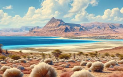
Terrain and Topography of Djibouti: mountains, valleys, and plains.
Djibouti, located in the Horn of Africa, is a small country with a diverse and unique terrain. Its geography is characterized by mountains, valleys, plains, plateaus, and coastal regions. Understanding Djibouti’s terrain and topography is crucial for various reasons, including environmental conservation, infrastructure development, and tourism. This article will provide an in-depth overview of Djibouti’s terrain and topography, highlighting the importance of preserving its unique landscape. Summary Djibouti’s terrain is diverse, with mountainous regions, valleys, plains, coastal areas, and plateaus. The mountainous regions of Djibouti are home to unique flora and fauna, including the endangered Djibouti francolin bird. The valleys of Djibouti are characterized by their steep walls and narrow floors, creating a striking landscape. The plains of Djibouti are vast and open, with sparse vegetation and a harsh climate. Volcanic activity has played a significant role in shaping Djibouti’s topography, with several active and dormant volcanoes in the region. Overview of Djibouti’s Terrain and Topography Djibouti’s landscape is a result of various geological processes that have shaped the region over millions of years. The country is located at the junction of three tectonic plates, which has contributed to its diverse topography. The terrain in Djibouti is characterized by mountains, valleys, plains, plateaus, and coastal regions. The Mountainous Regions of Djibouti Djibouti is home to several mountain ranges, including the Goda Mountains and the Mabla Mountains. These mountains are an important part of Djibouti’s ecosystem as they provide a habitat for a variety of plant and animal species. They also play a crucial role in regulating the climate by influencing wind patterns and rainfall distribution. The Valleys of Djibouti:...

Cultural or Historical Sites of Djibouti: Important Cultural Landmarks or Historical Sites in Djibouti
Djibouti, a small country located in the Horn of Africa, may not be on the top of everyone’s travel list, but it is a hidden gem waiting to be explored. With its rich cultural heritage and stunning natural wonders, Djibouti offers a unique and unforgettable experience for travelers. From ancient cities to salt lakes, from historical landmarks to ecological treasures, Djibouti has something for everyone. In this article, we will take a closer look at some of the must-visit cultural and natural wonders in Djibouti. Summary Tadjourah offers a glimpse into Djibouti’s ancient past Arta Plage combines history and natural beauty in one stunning location The Grand Mosque of Djibouti is a symbol of the country’s Islamic heritage Day Forest National Park is a must-visit for those seeking natural and cultural wonders The Afar Triangle is a geological and cultural marvel that should not be missed The ancient city of Tadjourah: A glimpse into Djibouti’s past Tadjourah, located on the Gulf of Tadjourah, is one of the oldest cities in Djibouti and offers a glimpse into the country’s past. With its narrow streets and traditional architecture, Tadjourah exudes an old-world charm that is hard to resist. The city has a rich history, having been an important trading port for centuries. It was once a major center for the slave trade and served as a hub for merchants from across the region. One of the must-see landmarks in Tadjourah is the Tadjourah Mosque, also known as the Sheikh Ahmed Dini Mosque. This beautiful mosque, built in the 19th century, is made entirely of coral stone and is a testament to...