World Geography
Geography is the study of the Earth’s landscapes, environments, and the relationships between people and their surroundings. It encompasses both the physical aspects of the Earth, such as its landforms, bodies of water, and climate, as well as the human aspects, including population distribution, cultures, and economies. World geography is a broad field that seeks to understand the complexities of our planet and how humans interact with it. By studying world geography, we can gain a deeper appreciation for the diversity of our planet and the interconnectedness of its various regions.
Geography is a multidisciplinary field that draws on elements of physical science, social science, and humanities. It involves the use of maps, spatial analysis, and geographic information systems (GIS) to understand the Earth’s surface and the processes that shape it. World geography also encompasses the study of human geography, which examines the ways in which people and their activities are distributed across the Earth. By understanding world geography, we can better appreciate the environmental, cultural, and economic challenges facing different regions of the world. This knowledge is crucial for addressing global issues such as climate change, resource management, and international development.
The Five Oceans and Seven Continents
The Earth’s surface is divided into five major oceans: the Pacific, Atlantic, Indian, Southern (or Antarctic), and Arctic Oceans. These vast bodies of water play a crucial role in regulating the Earth’s climate and supporting diverse marine ecosystems. The oceans also serve as important transportation routes and a source of food and other natural resources for human societies around the world.
In addition to the oceans, the Earth’s landmasses are divided into seven continents: Africa, Antarctica, Asia, Europe, North America, Australia (or Oceania), and South America. Each continent has its own unique physical and cultural characteristics, shaped by millions of years of geological processes and human history. From the deserts of Africa to the rainforests of South America, the continents offer a rich tapestry of landscapes and environments for exploration and study.
Major Mountain Ranges and Deserts
The Earth’s surface is also marked by major mountain ranges and deserts that have shaped the planet’s physical and cultural landscapes. The Himalayas, for example, are the highest mountain range in the world and are home to diverse ecosystems and cultures in countries such as India, Nepal, and Bhutan. The Andes in South America, the Rockies in North America, and the Alps in Europe are other prominent mountain ranges that have influenced human settlement patterns and economic activities.
Deserts cover about one-third of the Earth’s land surface and are characterized by low precipitation and extreme temperatures. The Sahara Desert in Africa is the largest hot desert in the world, while the Gobi Desert in Asia is one of the largest cold deserts. Deserts are not only home to unique flora and fauna but have also been important trade routes and cultural crossroads throughout history.
Climate Zones and Biomes
The Earth’s climate is influenced by a variety of factors, including latitude, altitude, ocean currents, and prevailing winds. As a result, the planet is divided into different climate zones, each with its own characteristic weather patterns and ecosystems. The equator, for example, experiences a tropical climate with high temperatures and heavy rainfall, while the polar regions have a cold and dry climate.
These climate zones give rise to different biomes, or large ecological areas characterized by distinct plant and animal communities. The tropical rainforest biome, found near the equator, is home to a diverse array of species and is vital for regulating the Earth’s climate. The grasslands biome, found in regions such as the African savannah and North American prairies, supports grazing animals and has been important for human agriculture throughout history.
Human Geography and Population Distribution
Human geography examines the ways in which people and their activities are distributed across the Earth’s surface. It encompasses topics such as population growth, migration patterns, urbanization, and cultural diversity. Understanding human geography is crucial for addressing global challenges such as poverty, inequality, and environmental degradation.
Population distribution is uneven across the world, with some regions experiencing rapid population growth while others are declining. The majority of the world’s population lives in Asia, particularly in countries such as China and India. Urban areas are also growing rapidly, with more than half of the world’s population now living in cities. This trend has significant implications for infrastructure development, resource management, and social inequality.
Historical and Cultural Geography
Historical geography examines how human activities have shaped the Earth’s landscapes over time. It explores topics such as colonialism, trade routes, and the rise and fall of empires. Cultural geography focuses on how human cultures have developed in different regions of the world and how they interact with their environments.
The Silk Road, for example, was an ancient trade route that connected China with Europe and facilitated the exchange of goods, ideas, and technologies across Eurasia. This historical trade route had a profound impact on the development of cultures and economies along its path. Similarly, cultural geographers study how different societies have adapted to their environments through practices such as agriculture, architecture, and religious beliefs.
The Importance of Geographic Knowledge
Geographic knowledge is crucial for addressing global challenges such as climate change, resource management, and international development. By understanding world geography, we can better appreciate the environmental, cultural, and economic challenges facing different regions of the world. This knowledge is crucial for addressing global issues such as climate change, resource management, and international development.
Geographic knowledge also helps us to understand our interconnectedness with other regions of the world. By studying world geography, we can gain a deeper appreciation for the diversity of our planet and the interconnectedness of its various regions. This understanding can foster a sense of global citizenship and empathy for people from different cultures and backgrounds.
In conclusion, world geography is a complex and multifaceted field that encompasses both physical and human aspects of the Earth’s landscapes. By studying world geography, we can gain a deeper appreciation for the diversity of our planet and the interconnectedness of its various regions. This knowledge is crucial for addressing global challenges such as climate change, resource management, and international development. It also helps us to understand our interconnectedness with other regions of the world and fosters a sense of global citizenship.
FAQs
What is world geography?
World geography is the study of the Earth’s landscapes, environments, and the relationships between people and their environments. It encompasses the physical features of the Earth, as well as the human activity that takes place on it.
Why is world geography important?
World geography is important because it helps us understand the world around us. It provides insights into the physical and human processes that shape our planet, and helps us make informed decisions about how to interact with our environment.
What are the main branches of world geography?
The main branches of world geography include physical geography, which focuses on the Earth’s natural features and processes, and human geography, which examines the relationships between people and their environments.
How does world geography impact our daily lives?
World geography impacts our daily lives in numerous ways, from influencing the weather and climate we experience, to shaping the availability of natural resources and influencing the distribution of populations and cultures around the world.
What are some key concepts in world geography?
Key concepts in world geography include location, place, human-environment interaction, movement, and region. These concepts help geographers understand and interpret the world around them.

Natural Resources of Egypt: Where Natural Resources are located In Egypt
Egypt, located in the northeastern corner of Africa, is a country rich in natural resources. From the fertile lands of the Nile Delta to the mineral wealth of the Eastern Desert, Egypt’s natural resources have played a crucial role in shaping the country’s economy and development. The Nile River, often referred to as the lifeblood of Egypt, has been a vital resource for thousands of years, providing water for irrigation, transportation, and sustenance for the population. In addition to its agricultural resources, Egypt also boasts significant mineral wealth, renewable energy potential, and natural gas reserves. However, the management and sustainable use of these resources present both challenges and opportunities for the country. Summary Egypt is rich in natural resources, including the Nile River, mineral wealth, agricultural resources, renewable energy potential, and natural gas reserves. The Nile River is a vital resource for Egypt, providing water for irrigation, transportation, and hydroelectric power generation. The Eastern Desert is home to mineral wealth, including gold, phosphate, and iron ore, which presents opportunities for economic development. The Nile Delta is a fertile agricultural region, producing a variety of crops such as rice, cotton, and vegetables, contributing to Egypt’s food security. The Red Sea has significant potential for renewable energy, including wind and solar power, which can help diversify Egypt’s energy sources and reduce reliance on fossil fuels. Egypt’s natural gas reserves in the Mediterranean Sea offer opportunities for economic growth, but also pose challenges for sustainable resource management and environmental protection. The Nile River: A Vital Resource The Nile River is undoubtedly one of Egypt’s most vital natural resources. It is the longest...

Cultural or Historical Sites of Egypt: Important Cultural Landmarks or Historical Sites in Egypt
The Great Pyramids of Giza are perhaps the most iconic and enduring symbol of ancient Egypt. These colossal structures, built over 4,500 years ago, stand as a testament to the incredible engineering prowess of the ancient Egyptians. The sheer size and precision of the pyramids are a marvel to behold, especially considering the limited technology and tools available at the time. The construction of these pyramids required meticulous planning, skilled labour, and an advanced understanding of mathematics and engineering. The Great Pyramid of Giza, also known as the Pyramid of Khufu, is the largest of the three pyramids and was built as a tomb for the Pharaoh Khufu. It is estimated that over 2 million limestone blocks, each weighing several tons, were used in its construction. The precision with which these blocks were cut and placed is truly remarkable, with the pyramid’s sides aligning almost perfectly with the cardinal points of the compass. The construction of the pyramids is a testament to the ingenuity and resourcefulness of the ancient Egyptians, who were able to harness the power of human labour and simple tools to create structures that have stood the test of time. The Great Pyramids of Giza continue to captivate and inspire people from all over the world, drawing millions of visitors each year. Their enduring presence serves as a reminder of the incredible achievements of ancient civilizations and the timeless allure of human ingenuity. The pyramids stand as a testament to the enduring legacy of ancient Egyptian engineering and continue to be a source of wonder and fascination for people of all ages. Summary The Great Pyramids...
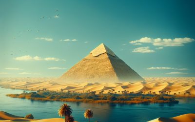
Egypt
Egypt (Jumhūriyyat Miṣr al-Arabiyyah (Arab Republic of Egypt)) Capital: Cairo Population (Estimated July 2012): 83,688,164 Area: 1,002,000 km2 or 386,874 mi2 Currency: Egyptian pound (LE) Official Language: Arabic Political Information: Military Junta (military Committee) Official Religion: Islam(approximately 90% of the population are Muslim, 9% are Coptic and 1% have other Christian Beliefs) Highest Mountain: Mount Catherine at 2,629m or 8,625ft GDP Official Exchange Rate (OER is more precise at gauging a countries economic power) (Estimated 2011): $231.9 billion (US$) or (GBP) GDP (OER) Per Capita (per member of the population estimated 2011): (US$) or (GBP) GDP Purchasing Power Parity (PPP is good for gauging living conditions and use of resources but not as accurate as OER. This data has been calculated based on the sum value of all goods and services produced in the country valued at prices prevailing in the United States) (Estimated 2011): $515.4 billion (US$) or (GBP) GDP (PPP) Per Capita (per member of the population estimated 2011): $6,500 (US$) or (GBP) Time Zone (GMT/UTC): +2:00 Wildlife: Counties/Provinces/States: 27 governorates (muhafazat, singular – muhafazat); Ad Daqahliyah, Al Bahr al Ahmar (Red Sea), Al Buhayrah, Al Fayyum, Al Gharbiyah, Al Iskandariyah (Alexandria), Al Isma’iliyah (Ismailia), Al Jizah (Giza), Al Minufiyah, Al Minya, Al Qahirah (Cairo), Al Qalyubiyah, Al Uqsur (Luxor), Al Wadi al Jadid (New Valley), As Suways (Suez), Ash Sharqiyah, Aswan, Asyut, Bani Suwayf, Bur Sa’id (Port Said), Dumyat (Damietta), Janub Sina’ (South Sinai), Kafr ash Shaykh, Matruh, Qina, Shamal Sina’ (North Sinai), Suhaj Leaders: Mohamed Hussein Tantawi is the Chairman of the ‘Supreme Council of the Armed Forces’ who has taken over since January 2012 due to the former President, Hosni Mubarak stepping...

Climate Zones Of Ecuador: Different climate regions Of Ecuador
Ecuador is a country known for its incredible biodiversity and stunning landscapes. One of the factors that contributes to this diversity is its range of climate zones. From the equatorial climate zone to the cloud forest and coastal zones, Ecuador offers a variety of climates for travelers to explore. Understanding these different climate zones is essential for planning a trip to Ecuador, as it will help you pack appropriately and make the most of your time in this beautiful country. Summary Ecuador’s climate is diverse and can be divided into several distinct zones. The equatorial climate zone is characterized by high temperatures and heavy rainfall throughout the year. The tropical climate zone experiences warm temperatures and distinct wet and dry seasons. The subtropical climate zone has mild temperatures and a mix of wet and dry seasons. The highland climate zone is marked by cooler temperatures and distinct wet and dry seasons. Equatorial Climate Zone The equatorial climate zone in Ecuador is characterized by warm temperatures and high humidity throughout the year. This zone is located near the equator, which means that it experiences relatively consistent weather patterns. Cities such as Quito and Guayaquil fall within this climate zone. In the equatorial climate zone, temperatures tend to range between 20°C (68°F) and 25°C (77°F) during the day, with cooler temperatures at night. Rainfall is common throughout the year, but there are two distinct seasons: the dry season from June to September and the wet season from October to May. It’s important to note that even during the dry season, you may still experience some rainfall, so it’s always a good...

History of Ecuador
Ecuador, located on the western coast of South America, has a rich and complex history that has shaped the country into what it is today. From its pre-colonial era to Spanish colonization, struggle for independence, and periods of political instability, Ecuador has faced numerous challenges throughout its history. These challenges have had a profound impact on the country’s economy, society, and political landscape. In this article, we will explore the key events and figures that have shaped Ecuador’s history and discuss the ongoing impact of these historical factors on the country today. Summary Pre-Colonial Era: Ecuador was home to various indigenous groups, including the Inca, who had a sophisticated society and advanced agricultural practices. Spanish Colonization: The arrival of the Spanish in the 16th century led to the conquest and colonization of Ecuador, resulting in the exploitation of indigenous people and resources. Struggle for Independence: Ecuador, along with other South American countries, fought for independence from Spanish rule in the early 19th century, eventually gaining freedom in 1822. The Republic of Ecuador: After gaining independence, Ecuador experienced political instability and frequent changes in government, leading to a struggle to establish a stable republic. Political Instability and Military Rule: Throughout the 20th century, Ecuador faced numerous coups and military dictatorships, contributing to a lack of political stability and economic development. Economic and Social Challenges: Ecuador has grappled with economic challenges, including dependence on oil exports and high levels of poverty, as well as social issues such as inequality and discrimination. Modern Ecuador: In recent years, Ecuador has made strides in addressing social and economic issues, with a focus on sustainable...

Terrain and Topography of Ecuador: mountains, valleys, and plains.
Ecuador is a country known for its diverse and stunning terrain. From the majestic Andes Mountains to the lush valleys and plateaus, and the coastal plains and lowlands, Ecuador offers a wide range of geographical features. Understanding the country’s geography is crucial for various reasons, including its impact on the climate, economy, biodiversity, and tourism. In this article, we will explore the different types of terrain found in Ecuador and discuss their significance. Summary Ecuador’s diverse terrain includes the Andes Mountains, lush valleys, coastal plains, and unique geographical features. The majestic Andes Mountains in Ecuador offer stunning landscapes and opportunities for adventure sports and eco-tourism. Lush valleys and plateaus in Ecuador are home to rich biodiversity and agricultural activities. The coastal plains and lowlands of Ecuador provide fertile land for agriculture and diverse ecosystems. Unique geographical features in Ecuador, such as the Galapagos Islands, contribute to the country’s exceptional biodiversity. Overview of Ecuador’s Diverse Terrain Ecuador’s diverse terrain can be categorized into three main types: mountains, valleys and plateaus, and coastal plains and lowlands. Each of these areas has its own unique characteristics and plays a vital role in the country’s geography. The mountains in Ecuador are dominated by the Andes, which run through the center of the country from north to south. The Andes Mountains are a majestic sight, with towering peaks reaching over 6,000 meters in height. These mountains not only provide breathtaking scenery but also have a significant impact on the country’s climate. They act as a barrier, causing variations in temperature and precipitation across different regions of Ecuador. Majestic Andes Mountains of Ecuador The Andes...

Political Boundaries of Ecuador: Provinces, Districts, or Historical Boundaries.
Ecuador, a country located in South America, is divided into various administrative divisions that play a crucial role in its governance. Understanding the political and administrative structure of Ecuador is essential for comprehending the country’s governance and decision-making processes. This article aims to provide a comprehensive overview of Ecuador’s administrative divisions, including provinces, districts, and historical boundaries. Summary Ecuador is divided into 24 provinces, each with its own administrative capital and local government. Districts in Ecuador are smaller administrative units within provinces, responsible for local governance and services. The historical boundaries of Ecuador have evolved over time, influenced by political, social, and geographical factors. Provinces play a crucial role in Ecuador’s political landscape, with each having its own governor and elected officials. Districts in Ecuador are essential for local government and administrative functions, providing services and representation to local communities. Provinces of Ecuador: A Breakdown of Administrative Divisions The provinces in Ecuador serve as the first-level administrative divisions. There are 24 provinces in total, each with its own unique characteristics and significance in the country’s governance. These provinces are further divided into cantons, which are the third-level administrative divisions. The provinces play a vital role in the political landscape of Ecuador. They have their own provincial governments, headed by a governor who is elected by the people. The provincial governments have powers and responsibilities that include managing public services, promoting economic development, and ensuring the well-being of their respective provinces. Understanding Ecuador’s Districts: Local Governance and Boundaries Districts are the second-level administrative divisions in Ecuador. They are smaller subdivisions within the provinces and are responsible for local governance and...

Population Density of Ecuador
Population density refers to the number of people living in a specific area, usually measured per square kilometer. It is an important indicator of how crowded or sparsely populated an area is. Understanding population density is crucial for policymakers and planners as it helps them make informed decisions about resource allocation, infrastructure development, and service provision. In the case of Ecuador, a country located in South America, population density plays a significant role in shaping its social, economic, and environmental landscape. Summary Ecuador has a diverse population density, with factors such as geography, climate, and economic opportunities influencing distribution. Urban areas in Ecuador have higher population density compared to rural areas, leading to challenges in infrastructure and service provision. There are regional variations in population density across Ecuador, with the Sierra region being the most densely populated. High population density in Ecuador presents challenges such as strain on infrastructure, but also opportunities for economic growth and development. Government policies and initiatives are being implemented to manage population density and promote sustainable development in Ecuador. Factors Influencing Population Distribution in Ecuador Several factors influence population distribution in Ecuador. One of the key factors is geographic features. The country’s diverse topography, which includes the Andes Mountains, the Amazon Rainforest, and the Pacific coastline, has a significant impact on where people choose to live. The coastal region, with its access to ports and fertile agricultural land, attracts a large number of people. The highlands, with their cooler climate and opportunities for agriculture and tourism, also have a relatively high population density. On the other hand, the Amazon Rainforest, with its dense vegetation...

Cultural or Historical Sites of Ecuador: Important Cultural Landmarks or Historical Sites in Ecuador
Ecuador is a country rich in cultural and natural heritage. From the stunning Galapagos Islands to the historic cities of Quito and Cuenca, Ecuador offers a diverse range of UNESCO World Heritage Sites that showcase its unique history and culture. These sites play a crucial role in preserving Ecuador’s heritage for future generations and attracting tourists from around the world. In this article, we will explore some of Ecuador’s most significant UNESCO World Heritage Sites and delve into the importance of preserving and appreciating their cultural and natural value. Summary The Galapagos Islands are a UNESCO World Heritage Site, known for their unique and diverse wildlife. Quito’s Historic Centre is dedicated to preserving colonial architecture, offering a glimpse into Ecuador’s rich history. Ingapirca is home to the largest Inca ruins in Ecuador, providing a fascinating insight into ancient Incan culture. Cuenca’s Historic District is a UNESCO World Heritage Site, showcasing the city’s well-preserved colonial architecture. The Temple of the Sun offers a chance to explore ancient Incan culture and history in Ecuador. The Galapagos Islands: A UNESCO World Heritage Site The Galapagos Islands are perhaps one of the most famous UNESCO World Heritage Sites in Ecuador. Known for their unique biodiversity and natural beauty, these islands have captivated the imaginations of scientists, explorers, and nature enthusiasts for centuries. The islands are home to a wide variety of species, many of which are found nowhere else on Earth. This makes the Galapagos Islands a living laboratory for the study of evolution and a testament to the power of nature. The significance of the Galapagos Islands is further enhanced by their...

Natural Resources of Ecuador: Where Natural Resources are located In Ecuador
Ecuador, a small country located in South America, is known for its rich and diverse natural resources. From the lush Amazon rainforest to the towering Andes mountains and the pristine Galapagos Islands, Ecuador is home to a wide range of natural wonders. These resources play a crucial role in the country’s economy and provide opportunities for sustainable development. In this article, we will explore the various natural resources found in Ecuador and discuss their significance. Summary Ecuador is rich in natural resources, including the Amazon Rainforest, Andes Mountains, Coastal Region, and Galapagos Islands. The Amazon Rainforest in Ecuador is home to a diverse range of flora and fauna, making it one of the most biodiverse regions in the world. The Andes Mountains in Ecuador are abundant in mineral resources such as gold, silver, and copper, contributing to the country’s economy. The Coastal Region of Ecuador boasts fertile agricultural land, making it a key area for agricultural production and export. The Galapagos Islands are known for their diverse marine resources, including unique wildlife and ecosystems that attract ecotourism. Overview of Natural Resources in Ecuador Ecuador is blessed with a diverse range of natural resources, thanks to its unique geographical location. The country can be divided into four distinct regions: the Amazon rainforest, the Andes mountains, the coastal region, and the Galapagos Islands. Each region has its own set of natural resources that contribute to Ecuador’s economy. Rich Biodiversity in the Amazon Rainforest The Amazon rainforest in Ecuador is one of the most biodiverse regions on Earth. It is home to thousands of plant and animal species, many of which are...
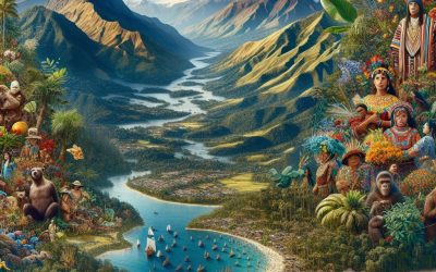
Ecuador
Ecuador (República del Ecuador (Republic of Ecuador)) Capital: Quito Population (Estimated July 2012): 15,223,680 Area: 256,370 km2 or 98,985 mi2 Currency: Dollar (U.S.$) Official Language: Spanish Political Information: Unitary Presidential Republic Official Religion: No Official Religion (approximately 95% of the population are Roman Catholic and 5% have other religious beliefs) Highest Mountain: Mount Chimborazo at 6,267m or 20,561ft (see Additional info). GDP Official Exchange Rate (OER is more precise at gauging a country’s economic power) (Estimated 2011): $65.9 billion (US$) or (GBP) GDP (OER) Per Capita (per member of the population estimated 2011): (US$) or (GBP) GDP Purchasing Power Parity (PPP is good for gauging living conditions and the use of resources but is not as accurate as OER. This data has been calculated based on the sum value of all goods and services produced in the country valued at prices prevailing in the United States) (Estimated 2011): $125.8 billion (US$) or (GBP) GDP (PPP) Per Capita (per member of the population estimated 2011): $8,300 (US$) or (GBP) Time Zone (GMT/UTC): -5:00 Wildlife: Counties/Provinces/States: 24 provinces (provincias, singular – provincia); Azuay, Bolivar, Canar, Carchi, Chimborazo, Cotopaxi, El Oro, Esmeraldas, Galapagos, Guayas, Imbabura, Loja, Los Rios, Manabi, Morona-Santiago, Napo, Orellana, Pastaza, Pichincha, Santa Elena, Santo Domingo de los Tsachilas, Sucumbios, Tungurahua, Zamora-Chinchipe Leaders: President is Rafael Correa with Lenin Moreno as Vice President. Additional: Independence from Spain was recognised on the 16th of February 1830. The peak of Ecuador’s highest mountain, Mount Chimborazo, is the furthest distance from the centre of the Earth. Mount Everest is the highest mountain above sea level but due to the Earth’s bulge at the Equator Mount Chimborazo is the closest point to space. The Galapagos...
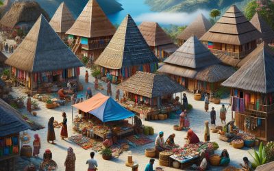
Timor-Leste ( East Timor )
Timor-Leste (East Timor) (Repúblika Demokrátika Timor Lorosa’e (Tetum); República Democrática de Timor-Leste (Portuguese) (Democratic Republic of Timor-Leste) Capital: Dili Population (Estimated July 2012): 1,201,255 Area: 14,919km2 or 5,760mi2 Currency: United States Dollar (U.S.$) Official Language: Tetum and Portuguese Political Information: Parliamentary Republic Official Religion: No Official Religion(approximately 98% of the population are Roman Catholic, 1% are Protestant and 1% are Muslim) Highest Mountain: Foho Tatamailau at 2,986m or 9,797ft GDP Official Exchange Rate (OER is more precise at gauging a countries economic power) (Estimated 2011): $700 million (US$) or (GBP) GDP (OER) Per Capita (per member of the population estimated 2011): (US$) or (GBP) GDP Purchasing Power Parity (PPP is good for gauging living conditions and use of resources but not as accurate as OER. This data has been calculated based on the sum value of all goods and services produced in the country valued at prices prevailing in the United States) (Estimated 2011): $3.366 billion (US$) or (GBP) GDP (PPP) Per Capita (per member of the population estimated 2011): $3,100 (US$) or (GBP) Time Zone (GMT/UTC): +9:00 Wildlife: Counties/Provinces/States: 13 administrative districts; Aileu, Ainaro, Baucau, Bobonaro (Maliana), Cova-Lima (Suai), Dili, Ermera (Gleno), Lautem (Los Palos), Liquica, Manatuto, Manufahi (Same), Oecussi (Ambeno), Viqueque Leaders: President José Ramos-Horta; Prime Minister Xanana Gusmäo Additional: On the 28th of November 1975 Timor-Leste proclaimed its independence from Portugal. Timor-Leste’s independence from Indonesia was recognised internationally on the 20th of May 2002. Sources: CIA World Fact Book, Encyclopaedia Britannica. Timor-Leste Timor-Leste, also known as East Timor, is a small island nation located in Southeast Asia. It is situated in the eastern part of the island of Timor,...