World Geography
Geography is the study of the Earth’s landscapes, environments, and the relationships between people and their surroundings. It encompasses both the physical aspects of the Earth, such as its landforms, bodies of water, and climate, as well as the human aspects, including population distribution, cultures, and economies. World geography is a broad field that seeks to understand the complexities of our planet and how humans interact with it. By studying world geography, we can gain a deeper appreciation for the diversity of our planet and the interconnectedness of its various regions.
Geography is a multidisciplinary field that draws on elements of physical science, social science, and humanities. It involves the use of maps, spatial analysis, and geographic information systems (GIS) to understand the Earth’s surface and the processes that shape it. World geography also encompasses the study of human geography, which examines the ways in which people and their activities are distributed across the Earth. By understanding world geography, we can better appreciate the environmental, cultural, and economic challenges facing different regions of the world. This knowledge is crucial for addressing global issues such as climate change, resource management, and international development.
The Five Oceans and Seven Continents
The Earth’s surface is divided into five major oceans: the Pacific, Atlantic, Indian, Southern (or Antarctic), and Arctic Oceans. These vast bodies of water play a crucial role in regulating the Earth’s climate and supporting diverse marine ecosystems. The oceans also serve as important transportation routes and a source of food and other natural resources for human societies around the world.
In addition to the oceans, the Earth’s landmasses are divided into seven continents: Africa, Antarctica, Asia, Europe, North America, Australia (or Oceania), and South America. Each continent has its own unique physical and cultural characteristics, shaped by millions of years of geological processes and human history. From the deserts of Africa to the rainforests of South America, the continents offer a rich tapestry of landscapes and environments for exploration and study.
Major Mountain Ranges and Deserts
The Earth’s surface is also marked by major mountain ranges and deserts that have shaped the planet’s physical and cultural landscapes. The Himalayas, for example, are the highest mountain range in the world and are home to diverse ecosystems and cultures in countries such as India, Nepal, and Bhutan. The Andes in South America, the Rockies in North America, and the Alps in Europe are other prominent mountain ranges that have influenced human settlement patterns and economic activities.
Deserts cover about one-third of the Earth’s land surface and are characterized by low precipitation and extreme temperatures. The Sahara Desert in Africa is the largest hot desert in the world, while the Gobi Desert in Asia is one of the largest cold deserts. Deserts are not only home to unique flora and fauna but have also been important trade routes and cultural crossroads throughout history.
Climate Zones and Biomes
The Earth’s climate is influenced by a variety of factors, including latitude, altitude, ocean currents, and prevailing winds. As a result, the planet is divided into different climate zones, each with its own characteristic weather patterns and ecosystems. The equator, for example, experiences a tropical climate with high temperatures and heavy rainfall, while the polar regions have a cold and dry climate.
These climate zones give rise to different biomes, or large ecological areas characterized by distinct plant and animal communities. The tropical rainforest biome, found near the equator, is home to a diverse array of species and is vital for regulating the Earth’s climate. The grasslands biome, found in regions such as the African savannah and North American prairies, supports grazing animals and has been important for human agriculture throughout history.
Human Geography and Population Distribution
Human geography examines the ways in which people and their activities are distributed across the Earth’s surface. It encompasses topics such as population growth, migration patterns, urbanization, and cultural diversity. Understanding human geography is crucial for addressing global challenges such as poverty, inequality, and environmental degradation.
Population distribution is uneven across the world, with some regions experiencing rapid population growth while others are declining. The majority of the world’s population lives in Asia, particularly in countries such as China and India. Urban areas are also growing rapidly, with more than half of the world’s population now living in cities. This trend has significant implications for infrastructure development, resource management, and social inequality.
Historical and Cultural Geography
Historical geography examines how human activities have shaped the Earth’s landscapes over time. It explores topics such as colonialism, trade routes, and the rise and fall of empires. Cultural geography focuses on how human cultures have developed in different regions of the world and how they interact with their environments.
The Silk Road, for example, was an ancient trade route that connected China with Europe and facilitated the exchange of goods, ideas, and technologies across Eurasia. This historical trade route had a profound impact on the development of cultures and economies along its path. Similarly, cultural geographers study how different societies have adapted to their environments through practices such as agriculture, architecture, and religious beliefs.
The Importance of Geographic Knowledge
Geographic knowledge is crucial for addressing global challenges such as climate change, resource management, and international development. By understanding world geography, we can better appreciate the environmental, cultural, and economic challenges facing different regions of the world. This knowledge is crucial for addressing global issues such as climate change, resource management, and international development.
Geographic knowledge also helps us to understand our interconnectedness with other regions of the world. By studying world geography, we can gain a deeper appreciation for the diversity of our planet and the interconnectedness of its various regions. This understanding can foster a sense of global citizenship and empathy for people from different cultures and backgrounds.
In conclusion, world geography is a complex and multifaceted field that encompasses both physical and human aspects of the Earth’s landscapes. By studying world geography, we can gain a deeper appreciation for the diversity of our planet and the interconnectedness of its various regions. This knowledge is crucial for addressing global challenges such as climate change, resource management, and international development. It also helps us to understand our interconnectedness with other regions of the world and fosters a sense of global citizenship.
FAQs
What is world geography?
World geography is the study of the Earth’s landscapes, environments, and the relationships between people and their environments. It encompasses the physical features of the Earth, as well as the human activity that takes place on it.
Why is world geography important?
World geography is important because it helps us understand the world around us. It provides insights into the physical and human processes that shape our planet, and helps us make informed decisions about how to interact with our environment.
What are the main branches of world geography?
The main branches of world geography include physical geography, which focuses on the Earth’s natural features and processes, and human geography, which examines the relationships between people and their environments.
How does world geography impact our daily lives?
World geography impacts our daily lives in numerous ways, from influencing the weather and climate we experience, to shaping the availability of natural resources and influencing the distribution of populations and cultures around the world.
What are some key concepts in world geography?
Key concepts in world geography include location, place, human-environment interaction, movement, and region. These concepts help geographers understand and interpret the world around them.
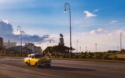
Cultural or Historical Sites of Cuba: Important Cultural Landmarks or Historical Sites in Cuba
Cuba is a country with a rich history and vibrant culture that has captivated the world for centuries. From its colonial past to its revolutionary present, Cuba offers a unique blend of influences that can be seen in its historic sites. Exploring these sites not only allows visitors to delve into the country’s fascinating past, but also provides a deeper understanding of its culture and identity. Summary Havana’s historic centre is a UNESCO World Heritage Site, showcasing the city’s rich history and architecture. The Monumental Cemetery of Havana reflects Cuban history and culture, with elaborate tombs and memorials. Trinidad is a colonial town preserved in time, with colourful buildings and cobblestone streets. The Mausoleum of Che Guevara pays tribute to the revolutionary hero and his legacy. The Museum of the Revolution takes visitors on a journey through Cuba’s revolutionary past, with exhibits and artefacts. The Historic Centre of Havana: A UNESCO World Heritage Site The historic center of Havana, also known as La Habana Vieja, is a UNESCO World Heritage Site that showcases the city’s colonial architecture and rich history. This area is home to numerous landmarks and buildings that date back to the 16th century, including the famous Plaza de la Catedral and Castillo de la Real Fuerza. The cobblestone streets and colorful buildings create a picturesque setting that transports visitors back in time. The UNESCO World Heritage Site designation of the historic center of Havana highlights its cultural and historical significance. It recognizes the importance of preserving and protecting this unique area for future generations to appreciate and enjoy. The designation also brings international attention to Havana’s...
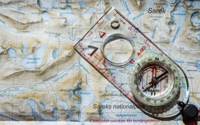
Population Density of Cuba
Cuba, a Caribbean island nation located just south of the United States, is known for its vibrant culture, beautiful beaches, and rich history. However, one aspect of Cuba that often goes unnoticed is its population density. Population density refers to the number of people living in a given area, usually measured in square kilometers or square miles. Understanding Cuba’s population density is important as it can provide insights into the country’s social, economic, and political dynamics. Summary Cuba has a population density of 106 people per square kilometer. Cuba’s population density has been steadily increasing since the 1950s. Havana has the highest population density in Cuba, while the eastern provinces have the lowest. Factors affecting Cuba’s population density include government policies, economic opportunities, and natural disasters. Urbanization has led to higher population density in Cuba, while rural areas have experienced a decline in population. Overview of Cuba’s Population Density Cuba has a population density of approximately 106 people per square kilometer (275 people per square mile). This means that on average, there are 106 individuals living in every square kilometer of land in Cuba. Compared to other countries in the region, Cuba has a relatively high population density. For example, neighboring countries like the Dominican Republic and Haiti have population densities of 222 and 402 people per square kilometer respectively. Historical Trends in Cuba’s Population Density Cuba’s population density has fluctuated over time due to various factors. In the early 20th century, Cuba experienced a period of rapid population growth, fueled by immigration from Spain and other European countries. This led to an increase in population density as more...
Cuba
Cuba (República de Cuba (Republic of Cuba)) Capital: Havana Population (Estimated July 2012): 11,075,244 Area: 109,886 km2 or 42,427 mi2 Currency: Cuban peso (CUP) Official Language: Spanish Political Information: Unitary Republic, Communist State Official Religion: No Official Religion (approximately 85% of the population are Roman Catholic and 15% have other religious beliefs) Highest Mountain: Pico Turquino at 2,005m or 6,578ft GDP Official Exchange Rate (OER is more precise at gauging a countries economic power) (Estimated 2010): $57.49 billion (US$) or (GBP) GDP (OER) Per Capita (per member of the population estimated 2011): (US$) or (GBP) GDP Purchasing Power Parity (PPP is good for gauging living conditions and use of resources but not as accurate as OER. This data has been calculated based on the sum value of all goods and services produced in the country valued at prices prevailing in the United States) (Estimated 2010): $114.1 billion (US$) or (GBP) GDP (PPP) Per Capita (per member of the population estimated 2010): $9,900 (US$) or (GBP) Time Zone (GMT/UTC): -5:00 Wildlife: Counties/Provinces/States: 15 provinces (provincias, singular – provincia) and 1 special municipality* (municipio especial); Artemisa, Camaguey, Ciego de Avila, Cienfuegos, Granma, Guantanamo, Holguin, Isla de la Juventud*, La Habana, Las Tunas, Matanzas, Mayabeque, Pinar del Rio, Sancti Spiritus, Santiago de Cuba, Villa Clara Leaders: Raúl Castro is both the president and Premier with J.R.M. Ventura as 1st Vice President. Additional: Has the highest population and has the largest area of any Island nation in the Caribbean. Sources: CIA World Fact Book, Encyclopaedia Britannica. Cuba Cuba, located in the Caribbean Sea, is the largest island in the Caribbean and is known for its vibrant culture, stunning beaches, and rich...

Climate Zones Of Croatia: Different Climate Regions Of Croatia
Croatia, located in Southeast Europe, is known for its stunning landscapes, diverse ecosystems, and rich cultural heritage. The country’s geography is characterized by a mix of coastal areas, mountains, and plains, which contribute to its varied climate zones. Understanding Croatia’s climate zones is crucial for various reasons, including agriculture, tourism, and overall sustainability. Summary Croatia has a diverse range of climate zones, including Mediterranean, Continental, Mountainous, Coastal, Sub-Mediterranean, and Transitional. The Mediterranean climate region is characterized by hot, dry summers and mild, wet winters. The Continental climate region experiences cold winters and hot summers, with significant temperature variations throughout the year. The Mountainous climate region has cooler temperatures and higher precipitation levels, with snowfall in the winter months. The Coastal climate region has mild winters and hot summers, with high humidity levels and occasional thunderstorms. The Sub-Mediterranean climate region has a mix of Mediterranean and Continental climates, with mild winters and hot summers. The Transitional climate region experiences a mix of Mediterranean and Continental climates, with significant temperature variations throughout the year. Climate variations within Croatia’s regions can impact agriculture and tourism, with some areas more suitable for certain crops or activities. Climate change may lead to changes in Croatia’s climate zones, with potential impacts on agriculture, tourism, and the environment. The Mediterranean Climate Region of Croatia The Mediterranean climate region in Croatia is characterized by hot, dry summers and mild, wet winters. This climate is influenced by the Adriatic Sea, which helps moderate temperatures and provides moisture. Regions such as Dalmatia and parts of Istria fall under this climate zone. In the Mediterranean climate region, you can find...

Terrain and Topography of Croatia: mountains, valleys, and plains.
Croatia is a country known for its stunning natural beauty, and much of this can be attributed to its diverse topography. From towering mountain ranges to picturesque coastal mountains, Croatia offers a wide range of landscapes for visitors to explore. Understanding the geography of a destination is crucial before visiting, as it allows travellers to plan their activities and make the most of their time in the country. In this article, we will delve into the various regions and topography of Croatia, highlighting the unique features and activities that each area has to offer. Summary Croatia’s terrain and topography is diverse and varied, offering a range of landscapes to explore. From the mountain ranges of Velebit and Medvednica to the coastal mountains of Biokovo and Učka, Croatia has plenty of peaks to climb. The Cetina and Sava River Valleys offer a chance to explore Croatia’s lush greenery and natural beauty. The Karst landscape of Croatia is home to fascinating caves, sinkholes, and underground rivers waiting to be explored. The Dinaric Alps are Croatia’s most iconic mountain range, while the Pannonian Plain offers a unique flatland region to explore. Mountain Ranges in Croatia: From Velebit to Medvednica Croatia is home to several mountain ranges, each with its own distinct characteristics. One of the most notable mountain ranges is Velebit, which stretches along the Adriatic coast. Velebit is known for its rugged terrain and diverse flora and fauna. It is a popular destination for hikers and nature enthusiasts, with numerous trails that offer breathtaking views of the surrounding landscape. Another prominent mountain range in Croatia is Medvednica, located near the capital...

Political Boundaries of Croatia: Provinces, Districts, or Historical Boundaries.
Political boundaries are defined as the lines that separate one political entity from another. These boundaries are crucial in defining a country’s identity as they determine the extent of its territory and sovereignty. In the case of Croatia, political boundaries play a significant role in shaping its identity as a nation. Summary Croatia is divided into provinces and regions with distinct cultural and historical backgrounds. The country’s political boundaries have evolved over time, with influences from neighboring countries and empires. Political boundaries have played a significant role in shaping Croatia’s culture, society, and economic development. Croatia’s administrative divisions are organized into districts, which have varying levels of autonomy and decision-making power. Border disputes remain a challenge for Croatia, but the country’s political boundaries continue to shape its identity and future. Overview of Croatia’s Provinces and Regions Croatia is divided into 20 counties, which are further divided into municipalities and cities. Each county has its own unique characteristics and cultural heritage. The provinces and regions of Croatia have a rich history that dates back centuries. One of the most well-known provinces in Croatia is Istria, located in the northwest part of the country. Istria is known for its beautiful coastline, picturesque towns, and rich cultural heritage. It has a diverse population with influences from Italian, Slovenian, and Croatian cultures. Another important province is Dalmatia, which stretches along the Adriatic Sea. Dalmatia is famous for its stunning coastline, historic cities such as Split and Dubrovnik, and delicious seafood cuisine. It has a strong maritime tradition and is a popular tourist destination. Historical Boundaries of Croatia: A Brief Overview The historical boundaries...

History of Croatia
Croatia, located in Southeast Europe, has a rich and diverse cultural heritage that has been shaped by its unique geographical location and historical events. Situated at the crossroads of Central Europe, the Mediterranean, and the Balkans, Croatia has been influenced by various civilizations throughout its history. This has resulted in a vibrant and diverse cultural landscape that is celebrated and cherished by its people. Croatia’s cultural heritage is a reflection of its complex history, which includes influences from the Illyrians, Greeks, Romans, Slavs, Ottomans, Habsburgs, and more. Each of these civilizations has left its mark on the country, contributing to its unique identity. From ancient ruins and medieval castles to traditional folk dances and music, Croatia’s cultural heritage is a testament to its rich history and the resilience of its people. Summary Croatia has a rich cultural heritage that spans thousands of years. Prehistoric settlements in Croatia date back to the Stone Age. Roman rule brought Christianity to Croatia, which became the dominant religion. The arrival of the Slavs led to the formation of the Croatian state. Croatia has a long history of struggle for independence, including during World War II and the breakup of Yugoslavia. Early settlements and prehistoric times in Croatia The history of Croatia dates back to prehistoric times when the region was inhabited by the Illyrians. The Illyrians were an ancient Indo-European people who settled in the Balkans around 2000 BC. They had a significant impact on Croatia’s culture, introducing elements such as pottery making, metalworking, and agriculture. During the Bronze and Iron Ages, Croatia saw the rise of fortified settlements and hillforts. These settlements...

Natural Resources of Croatia: Where Natural Resources are Located in Croatia
Croatia, located in Southeast Europe, is a country known for its stunning natural beauty. From its crystal-clear waters along the Adriatic coast to its lush forests and diverse wildlife, Croatia is blessed with a wide range of natural resources. These resources play a crucial role in the country’s economy, providing opportunities for tourism, agriculture, and energy production. However, they also face threats from human activities and climate change. In this article, we will explore Croatia’s natural resources in detail, their importance to the country, and the efforts being made to protect and conserve them. Summary Croatia has a diverse range of natural resources, including minerals, forests, water, agriculture, and renewable energy potential. The country is rich in mineral resources, including bauxite, coal, and oil, but these industries have declined in recent years. Croatia’s forests cover over 2 million hectares and are an important source of timber and biodiversity. The country has abundant water resources, including rivers, lakes, and groundwater, which are used for drinking, irrigation, and hydropower. Agriculture is a significant sector in Croatia, with fertile land and a variety of crops, including grapes, olives, and lavender. Croatia has potential for renewable energy, particularly in wind and solar power, but development has been slow due to regulatory and financial barriers. Natural resources play an important role in Croatia’s economy, contributing to industries such as tourism, manufacturing, and energy. Threats to Croatia’s natural resources include pollution, climate change, and unsustainable practices such as overfishing and deforestation. Conservation efforts are underway to protect Croatia’s natural resources, including national parks, protected areas, and sustainable management practices. The future prospects for Croatia’s natural...

History of Croatia
Croatia, located in Southeast Europe, has a rich and complex history that spans thousands of years. From its early settlements to its modern-day status as a member of the European Union, understanding Croatia’s past is crucial in comprehending its present. This article will provide a comprehensive overview of Croatia’s history, highlighting key events and periods that have shaped the country. Summary Croatia’s early settlements date back to the Neolithic period, with evidence of human presence found in the Danube basin and on the Adriatic coast. The arrival of the Croats in the 7th century marked the beginning of the Croatian state, with the establishment of the Duchy of Croatia under Tomislav in the 10th century. The Kingdom of Croatia in the Middle Ages saw the country’s expansion and cultural development, with the introduction of Christianity and the Glagolitic script. The Ottoman Empire and the Habsburg Monarchy had a significant impact on Croatia’s history, with the country being divided and ruled by different powers for centuries. The rise of nationalism in the 19th century led to the formation of the Illyrian Movement and the Croatian National Revival, which aimed to promote Croatian language and culture. World War I and the formation of Yugoslavia brought Croatia under a new state, which was initially seen as a positive development but later led to tensions and conflicts. World War II and the Independent State of Croatia were marked by atrocities committed against minorities, including Jews, Serbs, and Roma. Tito’s Yugoslavia and the Croatian Spring saw some liberalization and decentralization, but also repression of dissent and nationalism. The Croatian War of Independence in the...

Population Density of Croatia
Croatia, located in Southeast Europe, has a population density of approximately 73 people per square kilometer. While this may seem relatively low compared to other European countries, it is important to understand the factors influencing population density in order to make informed policy decisions. Population density refers to the number of people living in a specific area, and it is influenced by a variety of social, economic, and environmental factors. By understanding these factors, policymakers can better plan for the needs of the population and allocate resources accordingly. Summary Croatia has a population density of 73 people per square kilometer. Factors influencing population density in Croatia include historical events, economic development, and environmental factors. Population density varies greatly across Croatia, with coastal regions being more densely populated than inland areas. Urbanization has led to an increase in population density in Croatia, particularly in major cities like Zagreb and Split. Demographic changes, such as an aging population and declining birth rates, will have significant implications for Croatia’s population density and infrastructure in the future. Understanding the Factors Influencing Population Density in Croatia Population density is determined by a combination of factors, including birth rates, death rates, migration patterns, and urbanization. In the case of Croatia, these factors have contributed to its current population density. Birth rates have been declining in recent years, leading to a slower population growth rate. Additionally, death rates have been increasing due to an aging population. Migration patterns also play a role in population density, as people move from rural areas to urban centers in search of better job opportunities and amenities. Historical Overview of Croatia’s...

Cultural or Historical Sites of Croatia: Important Cultural Landmarks or Historical Sites in Croatia
Introduction Croatia is a country with a rich history and cultural heritage that spans centuries. From its ancient Roman ruins to its medieval walled cities, Croatia is home to numerous landmarks and attractions that showcase its unique heritage. It is important to preserve and promote these sites, as they not only serve as reminders of Croatia’s past, but also contribute to its tourism industry and economy. By protecting and showcasing these treasures, Croatia can continue to attract visitors from around the world and ensure that future generations can appreciate its rich history. The Walled City of Dubrovnik: A UNESCO World Heritage Site One of Croatia’s most famous landmarks is the Walled City of Dubrovnik, which is a UNESCO World Heritage Site. The walls of Dubrovnik have a long and storied history, dating back to the 13th century. They were built to protect the city from invasions and have since become an iconic symbol of Dubrovnik. Today, visitors can explore the city’s narrow streets and stunning architecture within the walls. Within the walls of Dubrovnik, there are several must-see attractions. One of these is the Rector’s Palace, which was the seat of power for the Republic of Ragusa. The palace features beautiful Gothic and Renaissance architecture, as well as a museum that showcases the history of Dubrovnik. Another notable attraction is the Cathedral of the Assumption, which dates back to the 7th century. The cathedral is known for its stunning Baroque interior and houses relics of Saint Blaise, the patron saint of Dubrovnik. Diocletian’s Palace: A Roman Emperor’s Legacy in Split Located in the city of Split, Diocletian’s Palace is...

Political Boundaries of Côte d’lvoire: Provinces, Districts, or Historical Boundaries.
Political boundaries refer to the lines that separate one political entity from another. These boundaries are crucial in defining the territorial limits of a country and determining its governance structure. In the case of Côte d’Ivoire, understanding its political boundaries is of utmost importance due to the country’s complex history and diverse population. Côte d’Ivoire, also known as Ivory Coast, is a West African country that shares borders with Liberia, Guinea, Mali, Burkina Faso, and Ghana. It has a coastline along the Gulf of Guinea. The country’s political boundaries have evolved over time, influenced by both pre-colonial and colonial factors. Understanding these boundaries is essential for comprehending the country’s governance structure and its impact on society. Summary Côte d’Ivoire has political boundaries that have evolved over time, with historical and administrative significance. The provinces of Côte d’Ivoire are important administrative divisions that help to govern the country. The local government system in Côte d’Ivoire is organized into districts, which play a key role in governance. Political boundaries have a significant impact on Côte d’Ivoire’s economy and society, and their maintenance is a challenge. Understanding the historical and current political boundaries of Côte d’Ivoire is important for effective governance and development. Historical Boundaries of Côte d’Ivoire: A Brief Overview Before the arrival of European colonial powers, Côte d’Ivoire was home to various ethnic groups with their own territories and boundaries. These pre-colonial boundaries were often fluid and subject to change as different groups migrated or expanded their territories. However, they played a significant role in defining the cultural and linguistic diversity of the region. During the colonial era, Côte d’Ivoire...