World Geography
Geography is the study of the Earth’s landscapes, environments, and the relationships between people and their surroundings. It encompasses both the physical aspects of the Earth, such as its landforms, bodies of water, and climate, as well as the human aspects, including population distribution, cultures, and economies. World geography is a broad field that seeks to understand the complexities of our planet and how humans interact with it. By studying world geography, we can gain a deeper appreciation for the diversity of our planet and the interconnectedness of its various regions.
Geography is a multidisciplinary field that draws on elements of physical science, social science, and humanities. It involves the use of maps, spatial analysis, and geographic information systems (GIS) to understand the Earth’s surface and the processes that shape it. World geography also encompasses the study of human geography, which examines the ways in which people and their activities are distributed across the Earth. By understanding world geography, we can better appreciate the environmental, cultural, and economic challenges facing different regions of the world. This knowledge is crucial for addressing global issues such as climate change, resource management, and international development.
The Five Oceans and Seven Continents
The Earth’s surface is divided into five major oceans: the Pacific, Atlantic, Indian, Southern (or Antarctic), and Arctic Oceans. These vast bodies of water play a crucial role in regulating the Earth’s climate and supporting diverse marine ecosystems. The oceans also serve as important transportation routes and a source of food and other natural resources for human societies around the world.
In addition to the oceans, the Earth’s landmasses are divided into seven continents: Africa, Antarctica, Asia, Europe, North America, Australia (or Oceania), and South America. Each continent has its own unique physical and cultural characteristics, shaped by millions of years of geological processes and human history. From the deserts of Africa to the rainforests of South America, the continents offer a rich tapestry of landscapes and environments for exploration and study.
Major Mountain Ranges and Deserts
The Earth’s surface is also marked by major mountain ranges and deserts that have shaped the planet’s physical and cultural landscapes. The Himalayas, for example, are the highest mountain range in the world and are home to diverse ecosystems and cultures in countries such as India, Nepal, and Bhutan. The Andes in South America, the Rockies in North America, and the Alps in Europe are other prominent mountain ranges that have influenced human settlement patterns and economic activities.
Deserts cover about one-third of the Earth’s land surface and are characterized by low precipitation and extreme temperatures. The Sahara Desert in Africa is the largest hot desert in the world, while the Gobi Desert in Asia is one of the largest cold deserts. Deserts are not only home to unique flora and fauna but have also been important trade routes and cultural crossroads throughout history.
Climate Zones and Biomes
The Earth’s climate is influenced by a variety of factors, including latitude, altitude, ocean currents, and prevailing winds. As a result, the planet is divided into different climate zones, each with its own characteristic weather patterns and ecosystems. The equator, for example, experiences a tropical climate with high temperatures and heavy rainfall, while the polar regions have a cold and dry climate.
These climate zones give rise to different biomes, or large ecological areas characterized by distinct plant and animal communities. The tropical rainforest biome, found near the equator, is home to a diverse array of species and is vital for regulating the Earth’s climate. The grasslands biome, found in regions such as the African savannah and North American prairies, supports grazing animals and has been important for human agriculture throughout history.
Human Geography and Population Distribution
Human geography examines the ways in which people and their activities are distributed across the Earth’s surface. It encompasses topics such as population growth, migration patterns, urbanization, and cultural diversity. Understanding human geography is crucial for addressing global challenges such as poverty, inequality, and environmental degradation.
Population distribution is uneven across the world, with some regions experiencing rapid population growth while others are declining. The majority of the world’s population lives in Asia, particularly in countries such as China and India. Urban areas are also growing rapidly, with more than half of the world’s population now living in cities. This trend has significant implications for infrastructure development, resource management, and social inequality.
Historical and Cultural Geography
Historical geography examines how human activities have shaped the Earth’s landscapes over time. It explores topics such as colonialism, trade routes, and the rise and fall of empires. Cultural geography focuses on how human cultures have developed in different regions of the world and how they interact with their environments.
The Silk Road, for example, was an ancient trade route that connected China with Europe and facilitated the exchange of goods, ideas, and technologies across Eurasia. This historical trade route had a profound impact on the development of cultures and economies along its path. Similarly, cultural geographers study how different societies have adapted to their environments through practices such as agriculture, architecture, and religious beliefs.
The Importance of Geographic Knowledge
Geographic knowledge is crucial for addressing global challenges such as climate change, resource management, and international development. By understanding world geography, we can better appreciate the environmental, cultural, and economic challenges facing different regions of the world. This knowledge is crucial for addressing global issues such as climate change, resource management, and international development.
Geographic knowledge also helps us to understand our interconnectedness with other regions of the world. By studying world geography, we can gain a deeper appreciation for the diversity of our planet and the interconnectedness of its various regions. This understanding can foster a sense of global citizenship and empathy for people from different cultures and backgrounds.
In conclusion, world geography is a complex and multifaceted field that encompasses both physical and human aspects of the Earth’s landscapes. By studying world geography, we can gain a deeper appreciation for the diversity of our planet and the interconnectedness of its various regions. This knowledge is crucial for addressing global challenges such as climate change, resource management, and international development. It also helps us to understand our interconnectedness with other regions of the world and fosters a sense of global citizenship.
FAQs
What is world geography?
World geography is the study of the Earth’s landscapes, environments, and the relationships between people and their environments. It encompasses the physical features of the Earth, as well as the human activity that takes place on it.
Why is world geography important?
World geography is important because it helps us understand the world around us. It provides insights into the physical and human processes that shape our planet, and helps us make informed decisions about how to interact with our environment.
What are the main branches of world geography?
The main branches of world geography include physical geography, which focuses on the Earth’s natural features and processes, and human geography, which examines the relationships between people and their environments.
How does world geography impact our daily lives?
World geography impacts our daily lives in numerous ways, from influencing the weather and climate we experience, to shaping the availability of natural resources and influencing the distribution of populations and cultures around the world.
What are some key concepts in world geography?
Key concepts in world geography include location, place, human-environment interaction, movement, and region. These concepts help geographers understand and interpret the world around them.

Climate Zones of Cambodia: Different climate regions Of Cambodia
Cambodia is a country located in Southeast Asia, bordered by Thailand, Laos, and Vietnam. It has a diverse geography, with mountains, plateaus, and coastal areas. The climate in Cambodia is influenced by the monsoon season, which brings heavy rainfall and distinct wet and dry seasons. Understanding Cambodia’s climate zones is important for various reasons, including agriculture, tourism, and conservation efforts. Summary Cambodia has a diverse range of climate zones due to its location in Southeast Asia. The Tropical Wet and Dry Climate Zone is characterized by distinct wet and dry seasons. The Tropical Monsoon Climate Zone experiences heavy rainfall during the monsoon season. The Temperate Highland Climate Zone has cooler temperatures due to its higher elevation. Climate change is impacting Cambodia’s climate zones, leading to more extreme weather events. Tropical Wet and Dry Climate Zone The tropical wet and dry climate zone is characterized by distinct wet and dry seasons. The wet season typically lasts from May to October, with heavy rainfall and high humidity. The dry season, on the other hand, occurs from November to April and is characterized by lower rainfall and cooler temperatures. Regions in Cambodia that fall under this climate zone include the central lowlands and the Mekong River Basin. These areas are known for their fertile soil and are important for agriculture, particularly rice cultivation. The wet season provides ample water for irrigation, while the dry season allows for harvesting. Vegetation found in this climate zone includes deciduous forests, grasslands, and shrubs. Wildlife commonly found in this region includes elephants, tigers, deer, and various bird species. Tropical Monsoon Climate Zone The tropical monsoon climate...

Terrain and Topography of Cambodia: mountains, valleys, and plains.
Cambodia, located in Southeast Asia, is a country known for its rich history, vibrant culture, and stunning landscapes. Understanding the terrain and topography of Cambodia is crucial for various reasons. It helps in understanding the country’s biodiversity, planning for agriculture and infrastructure development, and preparing for natural disasters. Cambodia’s terrain consists of mountainous regions, central plains, coastal lowlands, and river basins. Each of these regions plays a significant role in the country’s development and should be studied in detail. Summary Cambodia’s terrain is diverse, ranging from mountainous regions to coastal lowlands. The Cardamom Mountains and Dangrek Mountains are two prominent mountain ranges in Cambodia. The Tonle Sap Basin and Mekong River and Delta are important water systems in Cambodia. Topography plays a significant role in Cambodia’s climate, with the country experiencing both wet and dry seasons. Cambodia’s terrain has a significant impact on agriculture and infrastructure development. The Mountainous Regions of Cambodia Cambodia is home to several mountain ranges that run across the country. The most prominent ones include the Cardamom Mountains in the southwest and the Dangrek Mountains in the north. These mountainous regions are not only visually stunning but also serve as important habitats for a diverse range of flora and fauna. They are home to many endangered species, making them crucial for biodiversity conservation efforts. Moreover, these mountain ranges also attract tourists from around the world. The lush green forests, cascading waterfalls, and breathtaking views make them popular destinations for hiking, trekking, and wildlife spotting. The tourism industry plays a significant role in Cambodia’s economy, and these mountainous regions contribute to its growth. The Central Plains...

History of Cambodia
Introduction Cambodia is a country with a rich and vibrant history that dates back thousands of years. From the early civilizations of Funan and Chenla to the rise and fall of the Angkor Empire, Cambodia has played a significant role in shaping Southeast Asian culture and history. Understanding Cambodia’s history is crucial in order to appreciate the country’s cultural heritage and to learn from its past experiences. In this article, we will explore the different eras of Cambodia’s history, from the pre-Angkor era to modern times, and discuss the importance of preserving Cambodia’s cultural heritage. Pre-Angkor Era: The Early Civilizations of Cambodia The pre-Angkor era in Cambodia saw the rise of two powerful kingdoms: Funan and Chenla. Funan, which existed from the 1st to the 6th century AD, was one of the earliest Indianized states in Southeast Asia. It was a major center for trade and played a crucial role in spreading Indian culture and religion throughout the region. Funan’s influence can be seen in the art, architecture, and language of later Khmer civilizations. After the decline of Funan, the Chenla kingdom emerged as a dominant power in Cambodia. Chenla was divided into two periods: Chenla Proper and Water Chenla. During this time, Buddhism became the dominant religion in Cambodia, and many temples and religious structures were built. The Chenla period also saw advancements in agriculture, trade, and irrigation systems. The Rise of Angkor: The Golden Age of Cambodia The Angkor Empire, which existed from the 9th to the 15th century AD, is considered the golden age of Cambodia. The empire was known for its impressive architecture, including the...

Population Density of Cambodia
Cambodia, located in Southeast Asia, is a country with a population density that has been steadily increasing over the years. With an estimated population of over 16 million people, Cambodia has a population density of approximately 92 people per square kilometer. This makes it one of the most densely populated countries in the region. Understanding population density is crucial for policymakers and planners as it helps in making informed decisions regarding resource allocation, infrastructure development, and social services. Summary Cambodia has a population density of 92 people per square kilometer. Cambodia’s population growth has fluctuated throughout history due to various factors such as war and disease. There are significant regional differences in population density, with the highest densities found in the central lowlands and the lowest in the mountainous regions. Urbanisation has contributed to the increase in population density, with Phnom Penh being the most densely populated city in Cambodia. Factors such as high fertility rates, rural-urban migration, and lack of family planning contribute to Cambodia’s high population density. Historical Overview of Cambodia’s Population Growth Cambodia’s population growth has seen significant fluctuations over the years. In the 1960s, the population growth rate was relatively low due to political instability and conflicts. However, after the Khmer Rouge regime ended in 1979, the population began to recover and grow rapidly. The population growth rate peaked in the 1990s and has since slowed down but remains steady. Several factors have contributed to Cambodia’s population growth. Improved healthcare and access to medical facilities have led to a decline in infant mortality rates and an increase in life expectancy. Additionally, high fertility rates have...

Natural Resources of Cambodia: Where Natural Resources are located In Cambodia
Natural Resources of Cambodia: Where Natural Resources are located in Cambodia Cambodia is a nation endowed with abundant natural resources, yet its true economic potential remains partially untapped due to challenges in natural resource governance. From the fertile banks of the Mekong River to rich forestry zones and promising offshore oil reserves, Cambodia has much to offer. This article will explore the natural resources of Cambodia, their importance to the Cambodian economy, and the policies guiding their sustainable use. Whether you’re a researcher, investor, or geography enthusiast, this deep dive offers essential insights into Cambodia’s strategic natural wealth. Article Outline What Are the Most Valuable Natural Resources in Cambodia Today? How Do Cambodia’s Mineral Resources Contribute to Its Economy? What Role Does the Mekong River Play in Cambodia’s Natural Resource Landscape? Is Cambodia Rich in Oil and Natural Gas? How Important Is Forestry and Timber to Cambodia? Why Is Tonle Sap Lake Crucial to Cambodian Livelihoods and Water Resources? How Does Biodiversity Fit Into Cambodia’s Ecosystem and Natural Resource Strategy? What Are the Key Challenges in Cambodia’s Natural Resource Governance? How Are Cambodia’s Natural Resources Tied to the Agricultural and Fishery Sectors? What Is the Future of Energy in Rural Areas and Sustainable Development in Cambodia? What Are the Most Valuable Natural Resources in Cambodia Today? Cambodia’s landscape is rich with natural resources that span a wide spectrum—from forestry and water to mineral resources and natural gas. The country’s abundant natural resources are mainly hosted in provinces like Kampot, and areas around the Mekong basin, making them crucial for both domestic use and export potential. Key natural resources of...

Cultural or Historical Sites of Cambodia: Important Cultural Landmarks or Historical Sites In Cambodia
Cambodia is a country with a rich cultural and historical heritage that dates back thousands of years. From the magnificent temples of Angkor Wat to the tragic history of the Khmer Rouge regime, Cambodia’s past is both fascinating and heartbreaking. It is important to preserve and promote Cambodia’s cultural heritage in order to educate future generations and ensure that these important sites are protected for years to come. Summary Cambodia has a rich cultural and historical heritage worth exploring. Angkor Wat is a magnificent symbol of Cambodia’s glory and a must-visit site. The Royal Palace of Phnom Penh is a testament to Cambodia’s monarchy and its history. The Killing Fields of Choeung Ek serve as a reminder of Cambodia’s tragic past and the atrocities committed during the Khmer Rouge regime. The Bayon Temple is a breathtaking masterpiece of Khmer architecture and a must-see attraction. The Magnificent Angkor Wat Angkor Wat is perhaps the most famous and iconic temple in Cambodia. Built in the 12th century, it was originally a Hindu temple dedicated to the god Vishnu, but later became a Buddhist temple. The temple complex covers an area of over 400 acres and is surrounded by a moat. The main temple is made up of five towers, each representing a mountain in Hindu mythology. Visiting Angkor Wat is a truly awe-inspiring experience. The intricate carvings and stunning architecture are a testament to the skill and craftsmanship of the Khmer people. It is recommended to visit Angkor Wat early in the morning or late in the afternoon to avoid the crowds and witness the temple at its most beautiful. The...
Cape Verde’s Population Density: A Closer Look
Cape Verde is an archipelago located off the northwest coast of Africa in the Atlantic Ocean. It consists of ten islands and several islets, with a total land area of approximately 4,033 square kilometers. The country is known for its beautiful beaches, vibrant culture, and diverse landscapes. Population density refers to the number of people living in a given area, usually measured in terms of persons per square kilometer. It is an important indicator of the level of development and resource distribution within a country. Understanding population density can help policymakers and planners make informed decisions regarding infrastructure development, resource allocation, and social services provision. Summary Cape Verde has a relatively small population density compared to other African countries. The population of Cape Verde has grown steadily over the past century, with a significant increase in the last few decades. The majority of Cape Verde’s population is concentrated on a few of its islands, with significant differences in population density between them. Urbanization is a growing trend in Cape Verde, with more people moving to cities and towns. Cape Verde’s population is relatively young, with a high proportion of people under the age of 30. Historical Overview of Cape Verde’s Population Cape Verde has a complex colonial history that has had a significant impact on its population. The islands were uninhabited until the 15th century when Portuguese explorers arrived and established settlements. The Portuguese brought African slaves to work on plantations, leading to a mixed-race population that is still prevalent today. During the 20th century, Cape Verde experienced significant population growth due to high birth rates and limited emigration...
Exploring the Fascinating History of Cape Verde
Cape Verde, officially known as the Republic of Cabo Verde, is an archipelago located off the coast of West Africa in the Atlantic Ocean. It consists of ten islands and five islets, with a total population of approximately 550,000 people. The islands are known for their stunning landscapes, ranging from volcanic peaks to sandy beaches, and are a popular tourist destination. The history and culture of Cape Verde have played a significant role in shaping its identity as a nation. The islands were uninhabited until the arrival of the Portuguese in the 15th century, who established a colony and brought African slaves to work on plantations. This mix of Portuguese and African influences has created a unique cultural blend that is evident in the music, dance, cuisine, and language of Cape Verde. Summary Cape Verde is an archipelago with a rich history and culture. The Portuguese colonization had a significant impact on Cape Verdean society and economy. Cape Verde played a role in the transatlantic slave trade as a global trade route. The Cape Verdean War of Independence was a struggle for independence. Cape Verde faces challenges of globalization and climate change in the future. The Pre-Colonial Era: Discovering the Indigenous People of Cape Verde Before the arrival of the Portuguese, Cape Verde was inhabited by various indigenous groups. These groups included the Bantu-speaking people, who were skilled farmers and fishermen, as well as the nomadic Fulani people, who raised livestock. The indigenous people had their own distinct cultures and traditions, which were passed down through generations. The way of life for these indigenous groups revolved around agriculture and...
Exploring Cape Verde’s Varied Terrain: Mountains, Valleys, and Plains
Cape Verde, an archipelago located off the coast of West Africa, is known for its diverse and stunning terrain. The country is made up of ten islands and several islets, each with its own unique geography and topography. From majestic mountains to lush valleys, vast plains to picturesque coastlines, Cape Verde offers a wide range of landscapes that attract tourists from around the world. The varied terrain of Cape Verde not only provides breathtaking views and outdoor recreational opportunities but also plays a crucial role in the livelihoods of the local population. The diverse geography of Cape Verde is a major draw for tourists. The islands are known for their stunning natural beauty, with landscapes that range from rugged mountains to fertile valleys and pristine beaches. Visitors can explore the volcanic peaks, hike through lush forests, or relax on the sandy shores. The varied terrain also offers a wide range of activities such as hiking, birdwatching, snorkeling, and surfing. Additionally, the unique flora and fauna found in Cape Verde’s different ecosystems make it a haven for nature lovers and wildlife enthusiasts. Summary Cape Verde’s terrain is diverse and varied, offering a range of landscapes to explore. The mountains of Cape Verde are majestic and offer great hiking opportunities. The valleys of Cape Verde are also worth exploring, with unique flora and fauna. The plains of Cape Verde are vast and beautiful, with a unique geology. Cape Verde’s varied terrain is important for agriculture and livelihoods, as well as for sustainable tourism. The Majestic Mountains of Cape Verde Cape Verde is home to several mountain ranges that offer breathtaking views...
Cape Verde’s Climate Zones: Diverse Regions to Explore
Cape Verde, an archipelago located off the coast of West Africa, is known for its diverse climate zones. The country consists of ten islands, each with its own unique geography and climate. Understanding the different climate zones is essential for travelers who want to make the most of their visit to Cape Verde. The climate in Cape Verde is influenced by its location in the Atlantic Ocean and the trade winds that blow from the northeast. The islands are divided into several climate zones, including arid, semi-arid, subtropical, temperate, tropical, coastal, continental, and mountain. Each zone has its own distinct characteristics and offers a variety of activities and attractions for visitors. Summary Cape Verde has diverse climate zones that offer unique experiences for adventure seekers. The arid climate zone features a desert landscape with stunning rock formations. The semi-arid climate zone has savanna grasslands and is home to many bird species. The subtropical climate zone has mild temperatures and is perfect for beach activities. The temperate climate zone has green mountains and is ideal for hiking and nature walks. The Arid Climate Zone: Discovering the Desert Landscape The arid climate zone in Cape Verde is characterized by hot and dry weather throughout the year. This zone is found on the islands of Boa Vista and Sal, which are known for their stunning desert landscapes. The lack of rainfall in this region has resulted in a barren and rocky terrain. Popular destinations in the arid climate zone include the Viana Desert on Boa Vista and the Pedra de Lume Salt Crater on Sal. Travelers can explore the vast sand dunes...
Cape Verde’s Political Boundaries: Provinces, Districts, or Historical Limits?
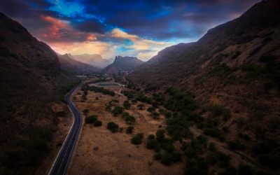
Cape Verde, officially known as the Republic of Cabo Verde, is an archipelago located off the coast of West Africa. It consists of ten main islands and several smaller ones, with a total land area of approximately 4,033 square kilometers. Understanding Cape Verde’s political boundaries is crucial for effective governance and decision-making within the country. Political boundaries define the territorial limits of a nation and determine its administrative divisions. They play a vital role in establishing the jurisdiction and authority of governments at various levels, from local municipalities to national governance. By understanding these boundaries, policymakers can better allocate resources, plan infrastructure development, and address the needs of different regions within the country. Summary Cape Verde is an archipelago nation located off the coast of West Africa. The country’s political boundaries have evolved over time, with changes to provinces, districts, and municipalities. Regional and national governance are closely intertwined in Cape Verde. Colonialism has had a significant impact on the country’s political boundaries. Understanding Cape Verde’s political boundaries is crucial for effective administration and future development. Historical Background of Cape Verde’s Political Boundaries Cape Verde has a complex colonial history that has greatly influenced its political boundaries. The islands were uninhabited until the 15th century when Portuguese explorers arrived and established settlements. The archipelago became an important stopover point for ships traveling between Europe, Africa, and the Americas, leading to its colonization by the Portuguese. During the colonial period, Cape Verde was administered as a single territory under Portuguese rule. The islands served as a strategic base for trade and as a center for the transatlantic slave trade. However,...
Natural Resources of Cape Verde: Where Natural Resources Are in Cabo Verde
Natural Resources of Cape Verde: Where Natural Resources Are in Cabo Verde Cape Verde, also known as Cabo Verde, is a stunning island nation in the Atlantic Ocean off the west coast of Africa. Although it’s famous for its beautiful beaches and thriving tourism sector, there’s more to explore beneath the surface. This article dives deep into Cape Verde’s natural resources, examining how this archipelago manages to thrive with limited natural wealth. From renewable energy efforts to unique geological formations, this post is a must-read for anyone interested in sustainable development, energy resources, and economic resilience in small island nations. Article Outline Where is Cape Verde and What Makes It Unique? Does Cape Verde Have Abundant Natural Resources? What Are the Mineral Resources in Cape Verde? How Important Is Agriculture in Cabo Verde? What Role Does Renewable Energy Play in Cape Verde’s Economy? How Are Water Resources Managed in Cape Verde? Why Is Tourism So Important for the Cape Verde Islands? What Is the Government of Cape Verde Doing to Boost Resource Efficiency? How Did Cape Verde’s Strategic Location Shape Its Resource Use? What Can Other Nations Learn from Cabo Verde’s Development Model? 1. Where is Cape Verde and What Makes It Unique? Cape Verde is an island nation located in the Atlantic Ocean, around 570 kilometers off the west coast of Africa. It comprises ten main islands and several smaller islets, forming the Cape Verde archipelago. The islands are split into two groups: Barlavento (windward) and Sotavento (leeward). The cape verde islands are volcanic islands, which contributes to their rugged terrain and limited arable land. The island...