World Geography
Geography is the study of the Earth’s landscapes, environments, and the relationships between people and their surroundings. It encompasses both the physical aspects of the Earth, such as its landforms, bodies of water, and climate, as well as the human aspects, including population distribution, cultures, and economies. World geography is a broad field that seeks to understand the complexities of our planet and how humans interact with it. By studying world geography, we can gain a deeper appreciation for the diversity of our planet and the interconnectedness of its various regions.
Geography is a multidisciplinary field that draws on elements of physical science, social science, and humanities. It involves the use of maps, spatial analysis, and geographic information systems (GIS) to understand the Earth’s surface and the processes that shape it. World geography also encompasses the study of human geography, which examines the ways in which people and their activities are distributed across the Earth. By understanding world geography, we can better appreciate the environmental, cultural, and economic challenges facing different regions of the world. This knowledge is crucial for addressing global issues such as climate change, resource management, and international development.
The Five Oceans and Seven Continents
The Earth’s surface is divided into five major oceans: the Pacific, Atlantic, Indian, Southern (or Antarctic), and Arctic Oceans. These vast bodies of water play a crucial role in regulating the Earth’s climate and supporting diverse marine ecosystems. The oceans also serve as important transportation routes and a source of food and other natural resources for human societies around the world.
In addition to the oceans, the Earth’s landmasses are divided into seven continents: Africa, Antarctica, Asia, Europe, North America, Australia (or Oceania), and South America. Each continent has its own unique physical and cultural characteristics, shaped by millions of years of geological processes and human history. From the deserts of Africa to the rainforests of South America, the continents offer a rich tapestry of landscapes and environments for exploration and study.
Major Mountain Ranges and Deserts
The Earth’s surface is also marked by major mountain ranges and deserts that have shaped the planet’s physical and cultural landscapes. The Himalayas, for example, are the highest mountain range in the world and are home to diverse ecosystems and cultures in countries such as India, Nepal, and Bhutan. The Andes in South America, the Rockies in North America, and the Alps in Europe are other prominent mountain ranges that have influenced human settlement patterns and economic activities.
Deserts cover about one-third of the Earth’s land surface and are characterized by low precipitation and extreme temperatures. The Sahara Desert in Africa is the largest hot desert in the world, while the Gobi Desert in Asia is one of the largest cold deserts. Deserts are not only home to unique flora and fauna but have also been important trade routes and cultural crossroads throughout history.
Climate Zones and Biomes
The Earth’s climate is influenced by a variety of factors, including latitude, altitude, ocean currents, and prevailing winds. As a result, the planet is divided into different climate zones, each with its own characteristic weather patterns and ecosystems. The equator, for example, experiences a tropical climate with high temperatures and heavy rainfall, while the polar regions have a cold and dry climate.
These climate zones give rise to different biomes, or large ecological areas characterized by distinct plant and animal communities. The tropical rainforest biome, found near the equator, is home to a diverse array of species and is vital for regulating the Earth’s climate. The grasslands biome, found in regions such as the African savannah and North American prairies, supports grazing animals and has been important for human agriculture throughout history.
Human Geography and Population Distribution
Human geography examines the ways in which people and their activities are distributed across the Earth’s surface. It encompasses topics such as population growth, migration patterns, urbanization, and cultural diversity. Understanding human geography is crucial for addressing global challenges such as poverty, inequality, and environmental degradation.
Population distribution is uneven across the world, with some regions experiencing rapid population growth while others are declining. The majority of the world’s population lives in Asia, particularly in countries such as China and India. Urban areas are also growing rapidly, with more than half of the world’s population now living in cities. This trend has significant implications for infrastructure development, resource management, and social inequality.
Historical and Cultural Geography
Historical geography examines how human activities have shaped the Earth’s landscapes over time. It explores topics such as colonialism, trade routes, and the rise and fall of empires. Cultural geography focuses on how human cultures have developed in different regions of the world and how they interact with their environments.
The Silk Road, for example, was an ancient trade route that connected China with Europe and facilitated the exchange of goods, ideas, and technologies across Eurasia. This historical trade route had a profound impact on the development of cultures and economies along its path. Similarly, cultural geographers study how different societies have adapted to their environments through practices such as agriculture, architecture, and religious beliefs.
The Importance of Geographic Knowledge
Geographic knowledge is crucial for addressing global challenges such as climate change, resource management, and international development. By understanding world geography, we can better appreciate the environmental, cultural, and economic challenges facing different regions of the world. This knowledge is crucial for addressing global issues such as climate change, resource management, and international development.
Geographic knowledge also helps us to understand our interconnectedness with other regions of the world. By studying world geography, we can gain a deeper appreciation for the diversity of our planet and the interconnectedness of its various regions. This understanding can foster a sense of global citizenship and empathy for people from different cultures and backgrounds.
In conclusion, world geography is a complex and multifaceted field that encompasses both physical and human aspects of the Earth’s landscapes. By studying world geography, we can gain a deeper appreciation for the diversity of our planet and the interconnectedness of its various regions. This knowledge is crucial for addressing global challenges such as climate change, resource management, and international development. It also helps us to understand our interconnectedness with other regions of the world and fosters a sense of global citizenship.
FAQs
What is world geography?
World geography is the study of the Earth’s landscapes, environments, and the relationships between people and their environments. It encompasses the physical features of the Earth, as well as the human activity that takes place on it.
Why is world geography important?
World geography is important because it helps us understand the world around us. It provides insights into the physical and human processes that shape our planet, and helps us make informed decisions about how to interact with our environment.
What are the main branches of world geography?
The main branches of world geography include physical geography, which focuses on the Earth’s natural features and processes, and human geography, which examines the relationships between people and their environments.
How does world geography impact our daily lives?
World geography impacts our daily lives in numerous ways, from influencing the weather and climate we experience, to shaping the availability of natural resources and influencing the distribution of populations and cultures around the world.
What are some key concepts in world geography?
Key concepts in world geography include location, place, human-environment interaction, movement, and region. These concepts help geographers understand and interpret the world around them.
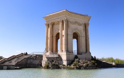
Cape Verde’s Cultural and Historical Landmarks: Must-Visit Sites
Cape Verde, an archipelago located off the coast of West Africa, is a country rich in cultural heritage. Its unique history and geographical location have resulted in a diverse and vibrant culture that is influenced by various African, European, and Caribbean traditions. From its UNESCO World Heritage Sites to its colonial architecture, music and dance, and traditional art and craft, Cape Verde offers a wealth of cultural experiences for visitors to explore. In this article, we will delve into the different aspects of Cape Verde’s cultural heritage and highlight the significance of preserving and celebrating it. Summary Cape Verde has a rich cultural heritage that is worth exploring. There are several UNESCO World Heritage Sites in Cape Verde that are worth visiting. The colonial architecture of Cape Verde is fascinating and worth exploring. Music and dance play a significant role in Cape Verdean culture. Cape Verde played a significant role in the transatlantic slave trade. Discovering Cape Verde’s rich cultural heritage Cape Verde’s cultural heritage is a melting pot of influences from different parts of the world. The islands were uninhabited until the 15th century when Portuguese explorers arrived and established settlements. Over the centuries, Cape Verde became a hub for trade between Europe, Africa, and the Americas, resulting in a fusion of cultures. African traditions, European colonial influences, and elements of Caribbean culture all contribute to the unique identity of Cape Verdean culture. Preserving cultural heritage is crucial for maintaining a sense of identity and connection to the past. It allows future generations to understand their roots and appreciate the diversity that exists within their society. Cultural heritage...
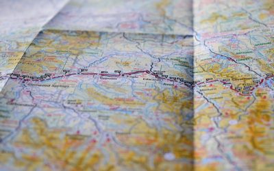
Population Density of Burundi
Burundi, a small landlocked country in East Africa, is known for its high population density. With a population of over 11 million people, Burundi has one of the highest population densities in Africa, with an average of 463 people per square kilometer. Understanding population density is crucial for policymakers and researchers as it provides insights into the social, economic, and environmental challenges faced by the country. Population density refers to the number of individuals living in a specific area, usually measured in terms of people per square kilometer. It is an important indicator of how crowded an area is and can provide valuable information about resource allocation, infrastructure development, and social services provision. In the case of Burundi, its high population density poses unique challenges in terms of land scarcity, access to basic services, and environmental sustainability. Summary Burundi has a high population density, with over 11 million people living in an area roughly the size of Maryland. The country’s geography and demographics play a significant role in its population density, with most people living in rural areas. Population growth in Burundi has been influenced by historical events such as colonization and conflict, as well as cultural and religious factors. Factors such as access to healthcare, education, and economic opportunities can impact population density in Burundi. The government’s policies on urbanization, land use, and family planning will play a crucial role in shaping future population density in Burundi. Understanding the Geography and Demographics of Burundi Burundi is located in the Great Lakes region of East Africa and is bordered by Rwanda to the north, Tanzania to the east and...
History of Burundi
Burundi, a small landlocked country in East Africa, has a rich and complex history that spans thousands of years. From its early inhabitants to the arrival of the Tutsi and Hutu peoples, the rise of the Burundian monarchy, and the impact of European colonization, Burundi’s past has shaped its present. Understanding this history is crucial for comprehending the challenges and opportunities that Burundi faces today. By delving into the country’s past, we can gain insights into its cultural heritage, political landscape, and social dynamics. Summary Burundi was inhabited by hunter-gatherer communities for thousands of years before the arrival of the Tutsi and Hutu peoples. The Tutsi and Hutu peoples arrived in Burundi in the 15th century and established a complex social hierarchy based on cattle ownership and agriculture. The Kingdom of Burundi emerged in the 17th century and was ruled by a monarchy until the arrival of European explorers and traders in the late 19th century. Burundi was colonized by Germany in 1899 and later by Belgium, which imposed a system of forced labor and racial segregation that had a lasting impact on the country’s society and economy. Burundi gained independence in 1962, but political instability and ethnic tensions led to a series of coups and a genocide in 1972 under the rule of President Micombero. Burundi has since transitioned to a democratic system of government, but faces ongoing challenges related to poverty, corruption, and human rights abuses. Burundi has a rich cultural heritage that includes traditional music, dance, and storytelling, as well as unique customs related to marriage, birth, and death. The Early Inhabitants of Burundi Before the...
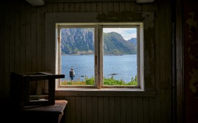
Terrain and Topography of Burundi: mountains, valleys, and plains.
Burundi, a small landlocked country in East Africa, is known for its diverse and stunning terrain. Nestled between Rwanda, Tanzania, and the Democratic Republic of Congo, Burundi is home to majestic mountains, lush valleys, fertile plains, the Great Rift Valley, scenic hills, unique plateaus, mesmerizing waterfalls, abundant lakes, and mysterious volcanoes. Understanding the geography of Burundi is crucial in appreciating the country’s natural beauty and the importance of preserving its resources. Summary Burundi’s terrain and topography is diverse and varied, with mountains, valleys, plains, plateaus, and more. The majestic mountains of Burundi are awe-inspiring landmarks that offer stunning views and challenging hikes. The valleys of Burundi are a natural haven for wildlife, with lush vegetation and abundant water sources. The plains of Burundi are fertile grounds for agriculture, providing a vital source of food and income for the country. The Great Rift Valley is a geological marvel of Burundi, offering a glimpse into the earth’s history and natural wonders. The Majestic Mountains of Burundi: Awe-Inspiring Landmarks Burundi is blessed with several mountain ranges that add to its picturesque landscape. The most prominent mountain range is the Mitumba Mountains, which stretch across the western part of the country. These mountains are part of the Albertine Rift, a branch of the East African Rift System. The Mitumba Mountains are characterized by their steep slopes and dense vegetation, making them a haven for hikers and nature enthusiasts. Notable peaks in Burundi include Mount Heha, the highest peak in the country at 2,670 meters (8,760 feet) above sea level. Mount Heha offers breathtaking views of the surrounding landscape and is a popular destination...
Political Boundaries of Burundi: Provinces, Districts, or Historical Boundaries.
Burundi, a landlocked country located in East Africa, is known for its rich history and diverse culture. It shares borders with Rwanda to the north, Tanzania to the east and south, and the Democratic Republic of the Congo to the west. Understanding the political boundaries of Burundi is crucial for comprehending its history, culture, and political system. This article aims to provide a comprehensive overview of Burundi’s political boundaries, including its provinces, districts, historical boundaries, and the challenges it faces in maintaining these boundaries. Summary Burundi is divided into 18 provinces and 129 districts. The historical boundaries of Burundi have been shaped by various factors, including colonialism and ethnic tensions. Ethnicity plays a significant role in Burundi’s political boundaries, with the Hutu and Tutsi groups being the most prominent. Maintaining political boundaries in Burundi is challenging due to ongoing conflicts and political instability. Burundi’s political boundaries have implications for regional and international relations, and their future prospects and challenges remain uncertain. Burundi’s Provinces: Names and Characteristics Burundi is divided into 18 provinces, each with its own unique characteristics. These provinces are Bubanza, Bujumbura Mairie, Bujumbura Rural, Bururi, Cankuzo, Cibitoke, Gitega, Karuzi, Kayanza, Kirundo, Makamba, Muramvya, Muyinga, Mwaro, Ngozi, Rumonge, Rutana, and Ruyigi. Bubanza is located in the northwest region of Burundi and is known for its agricultural production. Bujumbura Mairie is the capital city of Burundi and is an important economic and political center. Bujumbura Rural surrounds the capital city and is known for its scenic landscapes. Bururi is located in the southwest region and is known for its coffee production. Cankuzo is situated in the eastern part of...
Climate Zones of Burundi: Different climate regions Of Burundi
Burundi, a landlocked country located in East Africa, is known for its diverse geography and climate. The country is situated on the eastern edge of the Albertine Rift, which is part of the Great Rift Valley. This geographical location gives rise to a variety of climate zones within Burundi. Understanding these climate zones is crucial for the country’s agriculture sector, as it helps farmers determine the most suitable crops to grow and the best farming practices to adopt. Summary Burundi has a diverse range of climate zones, each with unique characteristics and impacts on agriculture and the economy. The Equatorial Climate Zone is characterized by high temperatures and rainfall, making it ideal for growing crops such as coffee and bananas. The Highland Climate Zone has cooler temperatures and is suitable for growing crops such as maize and beans. The Semi-Arid Climate Zone experiences low rainfall and is prone to drought, making it difficult for farmers to grow crops and sustain their livelihoods. The Tropical Savanna Climate Zone has a distinct wet and dry season, making it suitable for growing crops such as sorghum and millet. The Equatorial Climate Zone of Burundi The equatorial climate zone in Burundi is characterized by high temperatures and heavy rainfall throughout the year. This climate zone is found in the low-lying areas of the country, particularly in the western and central regions. The equatorial climate zone is ideal for growing crops such as bananas, coffee, tea, and maize. In the equatorial climate zone, farmers rely heavily on rainwater for irrigation, as there are no distinct dry seasons. The abundant rainfall supports the growth of...

Natural Resources of Burundi: Where Are The Natural Resources In Burundi and Its Emerging Mining Industry
Natural Resources of Burundi: Where Are The Natural Resources In Burundi and Its Emerging Mining Industry Burundi, a landlocked country nestled in Africa’s Great Lakes region, is often overlooked when discussing natural wealth. However, the natural resources of Burundi hold untapped potential that could transform its economic landscape. From valuable mineral deposits like nickel, tantalum, and tungsten, to promising peat reserves, Burundi is quietly rich in natural assets. This article explores natural resources in Burundi in detail, addressing what makes the mining industry significant, how these resources are currently used, and what challenges and opportunities lie ahead. For policymakers, investors, environmentalists, and anyone interested in Africa’s future, this article offers deep insights into the reserves in Burundi and the steps needed for sustainable development. Outline: A Deep Dive into Burundi’s Natural Resources Where Is Burundi and Why Are Its Natural Resources Important? What Are the Main Natural Resources in Burundi? How Significant Are Nickel Deposits in Burundi? What Role Does Tantalum Play in Burundi’s Resource Sector? Tungsten in Burundi: A Hidden Asset? Understanding Burundi’s Peat Reserves and Energy Potential How Is Artisanal Mining Shaping Burundi’s Mining Industry? Is There a Strategy for the Sustainable Use of Natural Resources? What Are the Environmental Impacts of Resource Extraction in Burundi? What Does the Future Hold for Burundi’s Mining Sector and Economic Growth? 1. Where Is Burundi and Why Are Its Natural Resources Important? Burundi is a landlocked country in East Africa, bordered by Rwanda to the north, Tanzania to the east and south, and the Democratic Republic of Congo to the west. It lies within Africa’s Great Lakes region, near...

Cultural or Historical Sites of Burundi: Important Cultural Landmarks or Historical Sites In Burundi
Burundi, a small landlocked country in East Africa, may not be on the top of everyone’s travel list, but it is a destination rich in cultural and historical significance. From its traditional drummers to its sacred forests and national parks, Burundi offers a unique blend of natural beauty and cultural heritage. Preserving these cultural sites is crucial not only for the people of Burundi but also for future generations to appreciate and learn from. Summary Burundi has a rich cultural and historical heritage worth exploring. The Royal Drummers of Burundi are a cultural icon and a must-see attraction. The National Museum of Gitega is a treasure trove of Burundian history and culture. The Sacred Forests of Burundi are a testament to traditional beliefs and practices. The Karera Waterfalls are a natural wonder with a rich cultural history. The Royal Drummers of Burundi: A Cultural Icon The Royal Drummers of Burundi are renowned worldwide for their mesmerizing performances and rhythmic beats. This group of drummers has a long history dating back centuries and holds a significant role in Burundian culture. The drums are not just instruments; they are considered sacred objects that connect the living with the spirits of their ancestors. The drummers can be seen performing at various events and festivals throughout the country, but one of the best places to witness their captivating performances is at the Gishora Drum Sanctuary. Located near the capital city of Bujumbura, this sanctuary is a place of worship and cultural preservation. Visitors can experience the power and energy of the drummers as they perform traditional rhythms passed down through generations. The National...

Population Density of Burkina Faso
Burkina Faso, located in West Africa, is a landlocked country with a diverse geography that includes savannahs, mountains, and desert regions. It is bordered by six countries and has a population of approximately 20 million people. Population density refers to the number of people living in a specific area, usually measured in terms of persons per square kilometer. Understanding population density is crucial for policymakers and stakeholders as it helps in planning and resource allocation. Summary Burkina Faso has a population density of 76 people per square kilometer. Population growth in Burkina Faso has been steadily increasing since the 1950s. The Sahel region has the lowest population density in Burkina Faso, while the Centre-Est region has the highest. Urbanization has led to a significant increase in population density in Burkina Faso’s cities. High fertility rates and low levels of education are key demographic factors contributing to population density in Burkina Faso. Historical trends in population growth and migration Over the years, Burkina Faso has experienced significant population growth and migration patterns. In the 1960s, the population was around 4 million, and by 2020, it had quadrupled to approximately 20 million. This rapid growth can be attributed to several factors, including high fertility rates, improved healthcare leading to lower mortality rates, and increased life expectancy. Migration has also played a significant role in shaping Burkina Faso’s population density. Many people from rural areas have migrated to urban centers in search of better economic opportunities. This internal migration has led to increased population density in cities such as Ouagadougou and Bobo-Dioulasso. Regional variations in population density across Burkina Faso Burkina Faso...

History of Burkina Faso
Burkina Faso, a landlocked country in West Africa, has a rich and complex history that has shaped its present and will continue to shape its future. Understanding the country’s past is crucial in order to comprehend its current political and economic challenges, as well as its potential for growth and development. From the pre-colonial era of the Mossi Kingdoms to French colonial rule, the struggle for independence, and the subsequent political turmoil, Burkina Faso has experienced a series of significant events that have shaped its identity and trajectory. Summary The Mossi Kingdoms were powerful pre-colonial states in Burkina Faso French colonial rule led to the establishment of Upper Volta Burkina Faso gained independence after a struggle for freedom Thomas Sankara’s presidency brought about a revolution in Burkina Faso Sankara’s assassination led to political turmoil and controversial rule under Blaise Compaoré Compaoré was overthrown in a popular uprising in 2014 Burkina Faso transitioned to democracy and elected President Roch Marc Christian Kaboré Burkina Faso faces challenges such as terrorism and economic instability Burkina Faso plays a role in regional and international affairs. Pre-colonial era: the Mossi Kingdoms Before European contact, Burkina Faso was home to several powerful kingdoms, most notably the Mossi Kingdoms. The Mossi people established a series of kingdoms in the region, with Ouagadougou as their capital. These kingdoms were known for their political organization and military strength, as well as their cultural achievements. The Mossi Kingdoms had a hierarchical social structure, with a king at the top and various chiefs and nobles below him. They also had a complex system of governance and justice. European contact with...

Terrain and Topography of Burkina Faso: mountains, valleys, and plains.
Burkina Faso, located in West Africa, is a landlocked country known for its rich cultural heritage and diverse landscapes. Understanding the country’s terrain and topography is crucial for various reasons, including tourism, agriculture, and infrastructure development. With its unique geographical features, Burkina Faso offers a range of opportunities and challenges that shape the lives of its people. Summary Burkina Faso’s terrain is diverse, with regions of rolling hills, plains, rocky outcrops, and gorges. The Sahel region has a significant impact on Burkina Faso’s landscape, with desertification and droughts affecting the country. The Volta River Basin influences the topography of Burkina Faso, with the Black Volta River Valley being a major agricultural hub. The Atakora Mountains are the highest peaks in Burkina Faso, while the Gambaga Escarpment acts as a natural barrier in the north. The Comoé River Basin is a vital ecosystem for wildlife, while the Plateau Central is a region of rolling hills and plains. Overview of Burkina Faso’s Terrain and Topography Burkina Faso is situated in the heart of West Africa and covers an area of approximately 274,200 square kilometers. It is bordered by six countries: Mali to the north, Niger to the east, Benin to the southeast, Togo and Ghana to the south, and Côte d’Ivoire to the southwest. The country’s diverse landscapes include savannahs, grasslands, mountains, plateaus, and river valleys. The Sahel Region and its Impact on Burkina Faso’s Landscape The Sahel region is a transitional zone between the Sahara Desert to the north and the Sudanian Savanna to the south. It stretches across several countries in West Africa, including Burkina Faso. The Sahel is...

Climate Zones of Burkina Faso: Different climate regions Of Burkina Faso
Introduction to Burkina Faso’s Climate Zones Burkina Faso, located in West Africa, is a landlocked country known for its diverse geography and climate. Understanding the different climate zones in Burkina Faso is crucial for various reasons, including agriculture, human settlements, and wildlife conservation. The country experiences a range of climates, from the arid Sahel region in the north to the humid South Sudanian region in the south. Each climate zone presents unique challenges and opportunities for the communities living there. The Sahel Region: Burkina Faso’s Hottest Climate Zone The Sahel region is located in the northern part of Burkina Faso and is characterized by its hot and dry climate. This region experiences high temperatures throughout the year, with average temperatures often exceeding 40 degrees Celsius (104 degrees Fahrenheit) during the hottest months. Rainfall is scarce and irregular, making it difficult for communities to rely on agriculture as a source of livelihood. Communities in the Sahel region face numerous challenges due to the harsh climate. Water scarcity is a major issue, as there are limited water sources available for both human consumption and agricultural activities. The lack of rainfall also leads to desertification and soil degradation, making it even more challenging for farmers to cultivate crops. Additionally, the extreme heat poses health risks for residents, especially vulnerable populations such as children and the elderly. The Sudan Savanna Region: A Transitional Climate Zone The Sudan Savanna region lies between the Sahel and Guinea Savanna regions and experiences a transitional climate. This region has a longer rainy season compared to the Sahel, with more reliable rainfall patterns. The temperature is generally lower...