World Geography
Geography is the study of the Earth’s landscapes, environments, and the relationships between people and their surroundings. It encompasses both the physical aspects of the Earth, such as its landforms, bodies of water, and climate, as well as the human aspects, including population distribution, cultures, and economies. World geography is a broad field that seeks to understand the complexities of our planet and how humans interact with it. By studying world geography, we can gain a deeper appreciation for the diversity of our planet and the interconnectedness of its various regions.
Geography is a multidisciplinary field that draws on elements of physical science, social science, and humanities. It involves the use of maps, spatial analysis, and geographic information systems (GIS) to understand the Earth’s surface and the processes that shape it. World geography also encompasses the study of human geography, which examines the ways in which people and their activities are distributed across the Earth. By understanding world geography, we can better appreciate the environmental, cultural, and economic challenges facing different regions of the world. This knowledge is crucial for addressing global issues such as climate change, resource management, and international development.
The Five Oceans and Seven Continents
The Earth’s surface is divided into five major oceans: the Pacific, Atlantic, Indian, Southern (or Antarctic), and Arctic Oceans. These vast bodies of water play a crucial role in regulating the Earth’s climate and supporting diverse marine ecosystems. The oceans also serve as important transportation routes and a source of food and other natural resources for human societies around the world.
In addition to the oceans, the Earth’s landmasses are divided into seven continents: Africa, Antarctica, Asia, Europe, North America, Australia (or Oceania), and South America. Each continent has its own unique physical and cultural characteristics, shaped by millions of years of geological processes and human history. From the deserts of Africa to the rainforests of South America, the continents offer a rich tapestry of landscapes and environments for exploration and study.
Major Mountain Ranges and Deserts
The Earth’s surface is also marked by major mountain ranges and deserts that have shaped the planet’s physical and cultural landscapes. The Himalayas, for example, are the highest mountain range in the world and are home to diverse ecosystems and cultures in countries such as India, Nepal, and Bhutan. The Andes in South America, the Rockies in North America, and the Alps in Europe are other prominent mountain ranges that have influenced human settlement patterns and economic activities.
Deserts cover about one-third of the Earth’s land surface and are characterized by low precipitation and extreme temperatures. The Sahara Desert in Africa is the largest hot desert in the world, while the Gobi Desert in Asia is one of the largest cold deserts. Deserts are not only home to unique flora and fauna but have also been important trade routes and cultural crossroads throughout history.
Climate Zones and Biomes
The Earth’s climate is influenced by a variety of factors, including latitude, altitude, ocean currents, and prevailing winds. As a result, the planet is divided into different climate zones, each with its own characteristic weather patterns and ecosystems. The equator, for example, experiences a tropical climate with high temperatures and heavy rainfall, while the polar regions have a cold and dry climate.
These climate zones give rise to different biomes, or large ecological areas characterized by distinct plant and animal communities. The tropical rainforest biome, found near the equator, is home to a diverse array of species and is vital for regulating the Earth’s climate. The grasslands biome, found in regions such as the African savannah and North American prairies, supports grazing animals and has been important for human agriculture throughout history.
Human Geography and Population Distribution
Human geography examines the ways in which people and their activities are distributed across the Earth’s surface. It encompasses topics such as population growth, migration patterns, urbanization, and cultural diversity. Understanding human geography is crucial for addressing global challenges such as poverty, inequality, and environmental degradation.
Population distribution is uneven across the world, with some regions experiencing rapid population growth while others are declining. The majority of the world’s population lives in Asia, particularly in countries such as China and India. Urban areas are also growing rapidly, with more than half of the world’s population now living in cities. This trend has significant implications for infrastructure development, resource management, and social inequality.
Historical and Cultural Geography
Historical geography examines how human activities have shaped the Earth’s landscapes over time. It explores topics such as colonialism, trade routes, and the rise and fall of empires. Cultural geography focuses on how human cultures have developed in different regions of the world and how they interact with their environments.
The Silk Road, for example, was an ancient trade route that connected China with Europe and facilitated the exchange of goods, ideas, and technologies across Eurasia. This historical trade route had a profound impact on the development of cultures and economies along its path. Similarly, cultural geographers study how different societies have adapted to their environments through practices such as agriculture, architecture, and religious beliefs.
The Importance of Geographic Knowledge
Geographic knowledge is crucial for addressing global challenges such as climate change, resource management, and international development. By understanding world geography, we can better appreciate the environmental, cultural, and economic challenges facing different regions of the world. This knowledge is crucial for addressing global issues such as climate change, resource management, and international development.
Geographic knowledge also helps us to understand our interconnectedness with other regions of the world. By studying world geography, we can gain a deeper appreciation for the diversity of our planet and the interconnectedness of its various regions. This understanding can foster a sense of global citizenship and empathy for people from different cultures and backgrounds.
In conclusion, world geography is a complex and multifaceted field that encompasses both physical and human aspects of the Earth’s landscapes. By studying world geography, we can gain a deeper appreciation for the diversity of our planet and the interconnectedness of its various regions. This knowledge is crucial for addressing global challenges such as climate change, resource management, and international development. It also helps us to understand our interconnectedness with other regions of the world and fosters a sense of global citizenship.
FAQs
What is world geography?
World geography is the study of the Earth’s landscapes, environments, and the relationships between people and their environments. It encompasses the physical features of the Earth, as well as the human activity that takes place on it.
Why is world geography important?
World geography is important because it helps us understand the world around us. It provides insights into the physical and human processes that shape our planet, and helps us make informed decisions about how to interact with our environment.
What are the main branches of world geography?
The main branches of world geography include physical geography, which focuses on the Earth’s natural features and processes, and human geography, which examines the relationships between people and their environments.
How does world geography impact our daily lives?
World geography impacts our daily lives in numerous ways, from influencing the weather and climate we experience, to shaping the availability of natural resources and influencing the distribution of populations and cultures around the world.
What are some key concepts in world geography?
Key concepts in world geography include location, place, human-environment interaction, movement, and region. These concepts help geographers understand and interpret the world around them.

Political Boundaries of Bosnia and Herzegovina: Provinces, Districts, or Historical Boundaries.
Bosnia and Herzegovina is a country located in the Balkan Peninsula of Southeast Europe. It is bordered by Croatia to the north, west, and south, Serbia to the east, and Montenegro to the southeast. The country’s political boundaries are of great importance for its future stability and development. Understanding these boundaries is crucial for maintaining peace and ensuring the rights of all ethnic groups within the country. Summary Bosnia and Herzegovina has a complex political structure with multiple boundaries and entities. The country’s historical boundaries have been shaped by Ottoman rule and Yugoslavia. The Federation of Bosnia and Herzegovina plays a significant role in the country’s political boundaries. The Republika Srpska has a unique history and place within Bosnia and Herzegovina’s political boundaries. The Brcko District is a distinct entity within the country’s political boundaries. Historical Boundaries of Bosnia and Herzegovina: From Ottoman Rule to Yugoslavia The historical boundaries of Bosnia and Herzegovina have been shaped by various empires and political entities throughout history. The region was under Ottoman rule from the 15th century until the late 19th century when it became part of the Austro-Hungarian Empire. After World War I, Bosnia and Herzegovina became part of the Kingdom of Serbs, Croats, and Slovenes, which later became Yugoslavia. The breakup of Yugoslavia in the 1990s had a significant impact on the political boundaries of Bosnia and Herzegovina. The country declared independence in 1992, leading to a brutal war between Bosnian Serbs, Croats, and Bosniaks (Bosnian Muslims). The Dayton Agreement, signed in 1995, ended the war and established the current political boundaries of the country. The Provinces of Bosnia and...

Natural Resources of Bosnia and Herzegovina: Where Natural Resources are located In Bosnia and Herzegovina
Discover the Rich Natural Resources of Bosnia and Herzegovina Explore the geography, minerals, forests, and waters that power Bosnia and Herzegovina’s economy Bosnia and Herzegovina, located in Southeastern Europe, is a country blessed with a wealth of natural resources. From its expansive forests and fertile lands to valuable minerals and water systems, Bosnia and Herzegovina’s geography has shaped its economic development, cultural legacy, and geopolitical importance. This article explores the natural resources of Bosnia, examines their role in the economy of Bosnia and Herzegovina, and highlights how resource management continues to influence both environmental sustainability and regional cooperation. Whether you’re a student, researcher, or just curious about this fascinating country, this detailed overview will give you a strong understanding of the resources of Bosnia and Herzegovina, and why they matter in today’s global economy. 🧭 Article Outline 1. Where is Bosnia and Herzegovina Located and Why Is It Geographically Important? 2. What Are the Main Forest Resources in Bosnia and Herzegovina? 3. How Do Bosnia and Herzegovina’s Water Resources Fuel the Country? 4. Which Mineral Resources Drive Industrial Production in Bosnia and Herzegovina? 5. How Significant Are Bosnia’s Energy Resources for Its Economic Development? 6. What Role Does Coal Play in Energy in Bosnia and Herzegovina? 7. Are There Natural Gas Resources or Oil in Bosnia? 8. How Does Arable Land Contribute to the Agriculture Sector? 9. How Are the Natural Resources Distributed Between the Federation of Bosnia and Herzegovina and Republika Srpska? 10. What Challenges and Opportunities Lie Ahead for Bosnia and Herzegovina’s Resource Sector? 1. Where is Bosnia and Herzegovina Located and Why Is It Geographically Important?...

Cultural or Historical Sites of Bosnia and Herzegovina: Important Cultural Landmarks or Historical Sites In Bosnia and Herzegovina
Bosnia and Herzegovina is a country rich in cultural and historical significance. Located in the heart of the Balkans, it has been influenced by various civilizations throughout history, resulting in a diverse and unique cultural heritage. From ancient fortresses to stunning natural wonders, Bosnia and Herzegovina is home to numerous landmarks that showcase its rich history and beauty. It is important to preserve and promote these cultural treasures, as they not only serve as a reminder of the past but also contribute to the country’s identity and tourism industry. Preserving and promoting cultural heritage is crucial for several reasons. Firstly, it allows us to connect with our roots and understand our history. Cultural landmarks serve as tangible reminders of the past, allowing us to learn from our ancestors and appreciate their achievements. Secondly, cultural heritage plays a significant role in tourism. Many tourists are drawn to destinations that offer unique cultural experiences, such as visiting historical sites or participating in traditional festivals. By preserving and promoting cultural heritage, countries can attract more tourists and boost their economy. Lastly, cultural heritage contributes to a sense of national identity. Landmarks and traditions are often deeply rooted in a country’s history and are an integral part of its identity. By preserving these cultural treasures, we can ensure that future generations have a strong sense of their heritage. Summary Bosnia and Herzegovina is a culturally and historically significant country. The Old Bridge of Mostar represents unity and resilience. The Sebilj Fountain is a cultural icon of Sarajevo. The Stari Grad of Jajce is a medieval fortress town. The Blagaj Tekke is a mystical...

History of Bolivia
Bolivia, a landlocked country in South America, has a rich and complex history that has shaped its present-day society and culture. From its pre-Columbian origins to the Spanish conquest and colonization, the struggle for independence, and the modern political landscape, understanding Bolivia’s past is crucial for understanding its present. This article will provide a comprehensive overview of Bolivia’s history, highlighting key events and their significance in shaping the nation. Summary Bolivia’s indigenous people have a rich history that dates back to the Pre-Columbian era. Spanish conquest and colonial rule had a significant impact on Bolivia’s culture and society. Bolivia’s struggle for independence was marked by political and social upheaval. The Chaco War was a costly conflict that had lasting effects on Bolivia’s economy and politics. The National Revolution of 1952 brought about significant social and political change in Bolivia. Pre-Columbian Era: The Origins of Bolivia’s Indigenous People Before the arrival of the Spanish, Bolivia was home to a diverse range of indigenous groups, each with their own unique cultures, traditions, and ways of life. The most prominent indigenous groups in Bolivia include the Aymara, Quechua, Guarani, and many others. These groups had developed sophisticated agricultural systems and had a deep connection to the land and natural resources. The Aymara people, for example, were known for their advanced knowledge of agriculture and their ability to cultivate crops at high altitudes. They built terraced fields and irrigation systems to maximize their agricultural output. The Quechua people, on the other hand, were skilled weavers and traders who established vast networks of trade routes throughout the Andean region. The land and natural resources...

Climate Zones of Bolivia: Different climate regions Of Bolivia
Bolivia, located in the heart of South America, is a country known for its diverse geography and climate. From the towering peaks of the Andes Mountains to the vast expanse of the Amazon rainforest, Bolivia is home to a wide range of climate zones. Understanding these climate zones is crucial for both residents and visitors alike, as it allows for better preparation and planning when it comes to activities, agriculture, and conservation efforts. Summary Bolivia has a diverse range of climate zones, including tropical lowlands, temperate highlands, high-altitude zones, cold puna regions, subtropical Yungas, semi-arid Chaco, and humid Amazon Basin. The tropical lowlands are hot and humid, with temperatures averaging around 30°C and high levels of rainfall. The Andean highlands have a temperate climate, with cooler temperatures and lower humidity levels. The high-altitude Altiplano region experiences cold temperatures and strong winds, with temperatures dropping below freezing at night. The Puna region is the coldest climate zone in Bolivia, with temperatures often below freezing and little rainfall. Tropical Lowlands: The Hot and Humid Climate The tropical lowlands of Bolivia, also known as the Oriente, are characterized by a hot and humid climate. This region encompasses the Amazon Basin and stretches across the northern and eastern parts of the country. The average temperature in this climate zone ranges from 25 to 30 degrees Celsius (77 to 86 degrees Fahrenheit), with high levels of humidity throughout the year. Rainfall in the tropical lowlands is abundant, with an average annual precipitation ranging from 1,500 to 3,000 millimeters (59 to 118 inches). This makes it one of the wettest regions in Bolivia. The combination...

Terrain and Topography of Bolivia: mountains, valleys, and plains.
Bolivia, located in the heart of South America, is a country known for its diverse and stunning landscapes. From the towering peaks of the Andes Mountains to the lush valleys of the Yungas and the vast plains of the Chaco, Bolivia’s terrain and topography are as varied as they are breathtaking. Understanding Bolivia’s geography is crucial for a variety of reasons, including agriculture, transportation, and conservation efforts. Summary Bolivia’s terrain and topography is diverse and varied, ranging from high mountains to lowland plains. The Andes Mountains are the backbone of Bolivia, running through the country from north to south. The high plateau is a landscape of extremes, with harsh weather conditions and unique flora and fauna. The Yungas region is known for its lush valleys and cloud forests, while the Chaco is a vast lowland plain. Bolivia’s river systems are the lifeblood of the country, providing water for agriculture and hydroelectric power. The Andes Mountains: Bolivia’s Backbone The Andes Mountains, which run through several South American countries including Bolivia, are a defining feature of the country’s landscape. These majestic peaks not only provide a stunning backdrop but also play a vital role in Bolivia’s economy and culture. The Andes Mountains are home to some of Bolivia’s highest peaks, including Mount Illimani, Mount Sajama, and Mount Huayna Potosi. The High Plateau: A Landscape of Extremes The high plateau, also known as the Altiplano, is a unique landscape that stretches across much of western Bolivia. This vast expanse of high-altitude plains is characterized by its extreme conditions, including low oxygen levels and harsh weather. Despite these challenges, the high plateau is...

Political Boundaries of Bolivia: Provinces, Districts, or Historical Boundaries.
Bolivia, located in the heart of South America, is a landlocked country with a rich and diverse cultural heritage. Understanding Bolivia’s political boundaries is crucial for comprehending the country’s governance, society, and international relations. This article aims to provide a comprehensive overview of Bolivia’s political boundaries, including its provinces, districts, municipalities, and indigenous territories. By delving into the history, significance, challenges, and future prospects of these boundaries, we can gain a deeper understanding of Bolivia’s political landscape. Summary Bolivia is divided into 9 departments, which are further divided into 112 provinces and 339 municipalities. Each department has its own capital city and is governed by a departmental governor and departmental assembly. Bolivia’s districts are administrative subdivisions within provinces, responsible for local governance and public services. Bolivia’s political boundaries have been shaped by colonialism, wars, and territorial disputes with neighboring countries. Political boundaries in Bolivia are crucial for the distribution of resources, representation, and recognition of indigenous communities. Bolivia’s Provinces: A Breakdown Provinces are administrative divisions within a country that are typically larger than districts or municipalities. In Bolivia, there are nine provinces, each with its own unique characteristics. For example, La Paz is the largest province in terms of population and is home to the country’s administrative capital. It is known for its stunning landscapes, including the famous Lake Titicaca and the Andes Mountains. On the other hand, Pando is the smallest province in terms of both population and area. It is located in the northern part of the country and is known for its rich biodiversity and natural resources. Understanding Bolivia’s Districts Districts are smaller administrative divisions within...

Bolivia: Natural Resources, Mines, and Mining
Natural Resources of Bolivia: How Mines, Fuel, and Lithium Drive the Economy of Bolivia Bolivia is rich in natural resources, and its mines play a pivotal role in the economy of Bolivia. From vast lithium reserves in the Salar de Uyuni to historic tin mines and growing natural gas production, the country’s mineral wealth is both a national asset and a global point of interest. This article is worth reading because it explores how Bolivia’s natural resource base shapes its economic growth, geopolitical stance, and future development. You’ll discover how Bolivia’s government manages its mining sector, the challenges it faces, and what lies ahead for one of Latin America’s most resource-rich yet poorest countries. Article Outline What Makes Bolivia Rich in Natural Resources? How Does the Mining Industry Shape the Bolivian Economy? What Role Does Natural Gas Play in Bolivia’s Energy and Export Strategy? Why Is Lithium So Important to Bolivia’s Future? What Is the Salar de Uyuni and Why Does It Matter Globally? How Did Tin Transform Bolivia’s Industrial History? How Does Government Control Affect the Mining Sector? What Are the Environmental and Social Impacts of Mining in Bolivia? How Do Bolivia’s Resources Influence Its Foreign Relations? What’s the Future of Bolivia’s Natural Resource Sector? 1. What Makes Bolivia Rich in Natural Resources? Bolivia is rich in natural resources, ranging from minerals to hydrocarbons. Its unique natural landscape includes mountainous regions packed with metallic mineral deposits and salt flats abundant in lithium resources. Key minerals include tin, silver, zinc, and increasingly, lithium—all vital for global industries. Among Bolivia’s most important natural resources are its vast natural...

Cultural or Historical Sites of Bolivia: Important Cultural Landmarks or Historical Sites In Bolivia
Bolivia is a country rich in cultural heritage and diverse attractions. Located in the heart of South America, it is known for its stunning landscapes, ancient ruins, and vibrant traditions. From the magnificent ruins of Tiwanaku to the mystical charm of Lake Titicaca, Bolivia offers a unique and unforgettable experience for travellers. Summary Tiwanaku ruins offer a glimpse into Bolivia’s pre-Columbian past La Paz’s historic centre showcases Bolivia’s colonial legacy Lake Titicaca is a sacred site for Aymara and Quechua people Oruro’s Carnival is Bolivia’s most spectacular festivity Sucre’s historic buildings are a majestic beauty and Bolivia’s first capital city The Magnificent Ruins of Tiwanaku: A Glimpse into Bolivia’s Pre-Columbian Past Tiwanaku is an archaeological site located near Lake Titicaca in western Bolivia. It was once the capital of a powerful pre-Columbian civilization that thrived from around 300 to 1000 AD. The ruins of Tiwanaku are considered one of the most important archaeological sites in South America and offer a glimpse into Bolivia’s pre-Columbian past. The highlights of the Tiwanaku site include the Akapana Pyramid, which was once a massive stepped pyramid that served as a ceremonial center. The Gate of the Sun is another iconic feature, with intricate carvings depicting various deities and symbols. The site also includes several temples, residential areas, and a museum that houses artifacts found during excavations. The Wonders of La Paz’s Historic Centre: Exploring Bolivia’s Colonial Legacy La Paz, Bolivia’s administrative capital, is home to a historic center that showcases the country’s colonial legacy. The city’s architecture reflects a blend of Spanish colonial and indigenous influences, creating a unique and vibrant atmosphere. Must-see...
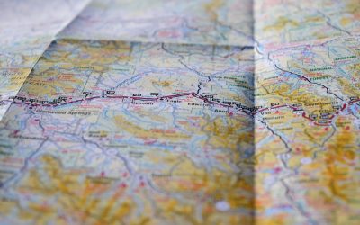
Political Boundaries of Bhutan: Provinces, Districts, or Historical Boundaries.
Bhutan, also known as the Kingdom of Bhutan, is a landlocked country located in the Eastern Himalayas. It is bordered by China to the north and India to the south, east, and west. With an area of approximately 38,394 square kilometers, Bhutan is a relatively small country. However, its unique geography and location make it an important player in regional politics. Understanding Bhutan’s political boundaries is crucial for several reasons. Firstly, it helps in understanding the country’s historical and cultural context. Bhutan has a rich history that has shaped its political boundaries over time. Secondly, knowing the administrative divisions within Bhutan helps in understanding how the country is governed and administered. Finally, Bhutan’s international borders play a significant role in trade and diplomacy, making it important to understand their significance. Summary Bhutan’s political boundaries have evolved over time and play a significant role in its political system, culture, and people. The administrative divisions of Bhutan include provinces and districts, with dzongkhags playing a crucial role in the political system. Bhutan’s international borders are significant and present both challenges and opportunities in managing its political boundaries. The impact of Bhutan’s political boundaries on its people and culture is significant and should be considered in any management decisions. Bhutan’s political boundaries are important in a global context and should be managed carefully to ensure the country’s continued success. Historical Boundaries of Bhutan: A Brief Overview Bhutan’s historical boundaries have evolved over time due to various factors such as wars, treaties, and geopolitical changes. The earliest recorded boundaries of Bhutan date back to the 17th century when it was ruled by the...
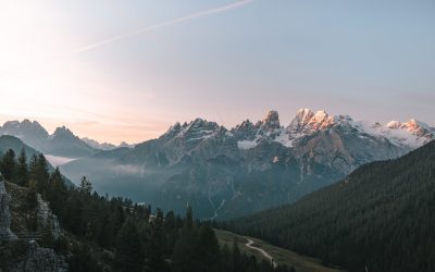
Terrain and Topography of Bhutan: mountains, valleys, and plains.
Bhutan, a small landlocked country nestled in the eastern Himalayas, is known for its stunning and diverse terrain. From towering mountains to deep valleys and lush plains, Bhutan’s landscape is a testament to the country’s natural beauty. Understanding Bhutan’s terrain and topography is crucial for appreciating the country’s unique culture, climate, and biodiversity. Summary Bhutan’s terrain is diverse and ranges from high altitude plateaus to lush subtropical valleys and plains. The majestic Himalayan mountains dominate Bhutan’s landscape and offer breathtaking views. Bhutan’s terrain plays a significant role in its cultural and religious traditions. The country’s terrain presents both challenges and opportunities for agriculture and development. Bhutan’s terrain is crucial for its biodiversity and conservation efforts. The Majestic Himalayan Mountains of Bhutan The Himalayan mountain range dominates Bhutan’s landscape, with peaks reaching heights of over 7,000 meters. These majestic mountains not only provide a breathtaking backdrop but also hold immense cultural and religious significance for the Bhutanese people. The mountains are believed to be the abode of deities and are revered as sacred sites. Many monasteries and temples are perched on the slopes of these mountains, attracting pilgrims and tourists alike. The Himalayas also play a crucial role in shaping Bhutan’s climate. They act as a barrier, preventing the cold winds from the north from reaching the southern parts of the country. As a result, the northern regions experience colder temperatures and heavier snowfall, while the southern regions enjoy a more temperate climate. The mountains also contribute to Bhutan’s water resources, as they capture moisture from the monsoon winds, resulting in abundant rainfall. The High Altitude Plateaus and Valleys of...

History of Bhutan
Introduction to Bhutan’s Rich Cultural Heritage Bhutan, a small landlocked country nestled in the eastern Himalayas, is known for its rich cultural heritage. The country’s unique culture and traditions have been preserved for centuries, making it a fascinating destination for travellers from around the world. Bhutan’s cultural heritage is deeply rooted in its history, religion, and way of life. It is a source of pride for the Bhutanese people and plays a significant role in shaping their identity. Preserving Bhutan’s cultural heritage is of utmost importance to the Bhutanese government and its people. The country has taken great strides to protect and promote its cultural traditions, recognizing that they are an integral part of its national identity. Bhutan’s cultural heritage not only attracts tourists but also contributes to the overall well-being and happiness of its citizens. By preserving their traditions, the Bhutanese people are able to maintain a sense of belonging and pride in their unique cultural heritage. Early History: The Formation of Bhutan The early history of Bhutan is shrouded in mystery, with little known about its early inhabitants. However, archaeological evidence suggests that humans have lived in the region for thousands of years. The earliest recorded history of Bhutan dates back to the 7th century when it was ruled by various local chieftains. Bhutan emerged as a distinct entity in the 17th century under the leadership of Zhabdrung Ngawang Namgyal, a revered religious figure who unified the country. Zhabdrung Ngawang Namgyal played a crucial role in shaping Bhutan’s early history by establishing a system of governance and promoting Buddhism as the state religion. The Rise of Buddhism...