World Geography
Geography is the study of the Earth’s landscapes, environments, and the relationships between people and their surroundings. It encompasses both the physical aspects of the Earth, such as its landforms, bodies of water, and climate, as well as the human aspects, including population distribution, cultures, and economies. World geography is a broad field that seeks to understand the complexities of our planet and how humans interact with it. By studying world geography, we can gain a deeper appreciation for the diversity of our planet and the interconnectedness of its various regions.
Geography is a multidisciplinary field that draws on elements of physical science, social science, and humanities. It involves the use of maps, spatial analysis, and geographic information systems (GIS) to understand the Earth’s surface and the processes that shape it. World geography also encompasses the study of human geography, which examines the ways in which people and their activities are distributed across the Earth. By understanding world geography, we can better appreciate the environmental, cultural, and economic challenges facing different regions of the world. This knowledge is crucial for addressing global issues such as climate change, resource management, and international development.
The Five Oceans and Seven Continents
The Earth’s surface is divided into five major oceans: the Pacific, Atlantic, Indian, Southern (or Antarctic), and Arctic Oceans. These vast bodies of water play a crucial role in regulating the Earth’s climate and supporting diverse marine ecosystems. The oceans also serve as important transportation routes and a source of food and other natural resources for human societies around the world.
In addition to the oceans, the Earth’s landmasses are divided into seven continents: Africa, Antarctica, Asia, Europe, North America, Australia (or Oceania), and South America. Each continent has its own unique physical and cultural characteristics, shaped by millions of years of geological processes and human history. From the deserts of Africa to the rainforests of South America, the continents offer a rich tapestry of landscapes and environments for exploration and study.
Major Mountain Ranges and Deserts
The Earth’s surface is also marked by major mountain ranges and deserts that have shaped the planet’s physical and cultural landscapes. The Himalayas, for example, are the highest mountain range in the world and are home to diverse ecosystems and cultures in countries such as India, Nepal, and Bhutan. The Andes in South America, the Rockies in North America, and the Alps in Europe are other prominent mountain ranges that have influenced human settlement patterns and economic activities.
Deserts cover about one-third of the Earth’s land surface and are characterized by low precipitation and extreme temperatures. The Sahara Desert in Africa is the largest hot desert in the world, while the Gobi Desert in Asia is one of the largest cold deserts. Deserts are not only home to unique flora and fauna but have also been important trade routes and cultural crossroads throughout history.
Climate Zones and Biomes
The Earth’s climate is influenced by a variety of factors, including latitude, altitude, ocean currents, and prevailing winds. As a result, the planet is divided into different climate zones, each with its own characteristic weather patterns and ecosystems. The equator, for example, experiences a tropical climate with high temperatures and heavy rainfall, while the polar regions have a cold and dry climate.
These climate zones give rise to different biomes, or large ecological areas characterized by distinct plant and animal communities. The tropical rainforest biome, found near the equator, is home to a diverse array of species and is vital for regulating the Earth’s climate. The grasslands biome, found in regions such as the African savannah and North American prairies, supports grazing animals and has been important for human agriculture throughout history.
Human Geography and Population Distribution
Human geography examines the ways in which people and their activities are distributed across the Earth’s surface. It encompasses topics such as population growth, migration patterns, urbanization, and cultural diversity. Understanding human geography is crucial for addressing global challenges such as poverty, inequality, and environmental degradation.
Population distribution is uneven across the world, with some regions experiencing rapid population growth while others are declining. The majority of the world’s population lives in Asia, particularly in countries such as China and India. Urban areas are also growing rapidly, with more than half of the world’s population now living in cities. This trend has significant implications for infrastructure development, resource management, and social inequality.
Historical and Cultural Geography
Historical geography examines how human activities have shaped the Earth’s landscapes over time. It explores topics such as colonialism, trade routes, and the rise and fall of empires. Cultural geography focuses on how human cultures have developed in different regions of the world and how they interact with their environments.
The Silk Road, for example, was an ancient trade route that connected China with Europe and facilitated the exchange of goods, ideas, and technologies across Eurasia. This historical trade route had a profound impact on the development of cultures and economies along its path. Similarly, cultural geographers study how different societies have adapted to their environments through practices such as agriculture, architecture, and religious beliefs.
The Importance of Geographic Knowledge
Geographic knowledge is crucial for addressing global challenges such as climate change, resource management, and international development. By understanding world geography, we can better appreciate the environmental, cultural, and economic challenges facing different regions of the world. This knowledge is crucial for addressing global issues such as climate change, resource management, and international development.
Geographic knowledge also helps us to understand our interconnectedness with other regions of the world. By studying world geography, we can gain a deeper appreciation for the diversity of our planet and the interconnectedness of its various regions. This understanding can foster a sense of global citizenship and empathy for people from different cultures and backgrounds.
In conclusion, world geography is a complex and multifaceted field that encompasses both physical and human aspects of the Earth’s landscapes. By studying world geography, we can gain a deeper appreciation for the diversity of our planet and the interconnectedness of its various regions. This knowledge is crucial for addressing global challenges such as climate change, resource management, and international development. It also helps us to understand our interconnectedness with other regions of the world and fosters a sense of global citizenship.
FAQs
What is world geography?
World geography is the study of the Earth’s landscapes, environments, and the relationships between people and their environments. It encompasses the physical features of the Earth, as well as the human activity that takes place on it.
Why is world geography important?
World geography is important because it helps us understand the world around us. It provides insights into the physical and human processes that shape our planet, and helps us make informed decisions about how to interact with our environment.
What are the main branches of world geography?
The main branches of world geography include physical geography, which focuses on the Earth’s natural features and processes, and human geography, which examines the relationships between people and their environments.
How does world geography impact our daily lives?
World geography impacts our daily lives in numerous ways, from influencing the weather and climate we experience, to shaping the availability of natural resources and influencing the distribution of populations and cultures around the world.
What are some key concepts in world geography?
Key concepts in world geography include location, place, human-environment interaction, movement, and region. These concepts help geographers understand and interpret the world around them.
Population Density of Austria
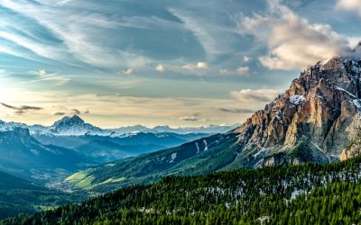
Population density refers to the number of individuals living in a specific area, usually measured per square kilometer. It is an important indicator of how crowded or sparse a region is and provides insights into the distribution of people within a country. Studying population density in Austria is crucial for understanding the social, economic, and environmental dynamics of the country. Austria, a landlocked country in Central Europe, has a rich history and diverse geography. It is known for its stunning landscapes, vibrant cities, and high standard of living. Understanding the population density in Austria helps policymakers, urban planners, and researchers make informed decisions about resource allocation, infrastructure development, and environmental conservation. Summary Austria has a population density of 106 people per square kilometer. The population density of Austria has been steadily increasing since the 19th century. Vienna has the highest population density in Austria, while the western regions have the lowest. Factors affecting Austria’s population density include urbanization, migration, and economic opportunities. Future projections suggest that Austria’s population density will continue to increase, particularly in urban areas. Historical Overview of Austria’s Population Density Over the years, Austria’s population density has undergone significant changes. In the early 19th century, the country experienced a period of rapid population growth due to improvements in healthcare and living conditions. This led to an increase in population density, particularly in urban areas. However, during the 20th century, Austria faced several challenges that influenced its population density. The two World Wars and subsequent political changes resulted in large-scale migration and displacement. Many people fled the country or were forced to leave their homes, leading to...
Cultural or Historical Sites of Austria: Important Cultural Landmarks or Historical Sites In Austria
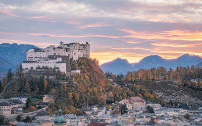
Austria is a country with a rich history and cultural heritage that spans centuries. From its imperial past to its contributions to the world of music and art, Austria has left an indelible mark on the world. One of the best ways to understand Austria’s past is by visiting its historical landmarks. These landmarks not only showcase the country’s architectural beauty but also provide a glimpse into its fascinating history. Whether it’s exploring the grandeur of the Imperial Palace or marveling at the Gothic masterpiece of St. Stephen’s Cathedral, each landmark tells a unique story that is worth discovering. Summary The Imperial Palace offers a glimpse into Austria’s royal past with its opulent interiors and extensive art collections. History buffs must visit the Hofburg Complex, which served as the seat of power for the Habsburg dynasty for centuries. The Salzburg Cathedral is a stunning example of Austria’s rich religious heritage, with its ornate Baroque architecture and impressive artwork. The Schönbrunn Palace is a must-see for lovers of Baroque architecture, with its grand gardens and lavish interiors. The Melk Abbey is a majestic Benedictine monastery that showcases Austria’s rich cultural and religious history. The Imperial Palace: A Window into Austria’s Royal Past The Imperial Palace, also known as the Hofburg Palace, is one of Vienna’s most iconic landmarks. It served as the residence of the Habsburg dynasty, one of Europe’s most powerful royal families, for over six centuries. The palace complex is vast and offers visitors a chance to explore various museums and attractions that provide insights into Austria’s royal past. One of the highlights of a visit to the...
Natural Resources of Austria: Where Natural Resources are Located in Austria
Natural Resources of Austria: Where Natural Resources are Located in Austria Austria is more than just a scenic alpine wonder—it’s a nation with a wealth of natural resources and a deeply rooted tradition of environmental protection and sustainable development. From its mineral-rich mountains to its fertile farmland and dense forests, the natural resources of Austria play a key role in shaping the country’s economy, identity, and international standing. This article explores how Austria’s unique geography, diverse raw materials, and careful environmental policies work together to power its GDP, support its people, and safeguard future generations. Austria, located in Central Europe, is known for its stunning landscapes and rich natural resources. The country is bordered by Germany, Czech Republic, Slovakia, Hungary, Slovenia, Italy, Switzerland, and Liechtenstein. Its diverse geography includes the Alps in the west, the Danube River in the north, and the Pannonian Plain in the east. These geographical features contribute to Austria’s abundance of natural resources, including forests, minerals, water, agricultural land, geothermal energy, wildlife, and oil and gas reserves. Article Outline 1. What Makes Austria’s Geography Unique for Natural Resource Utilisation? 2. Which Mineral Resources Are Found in Austria? 3. How Important Is the Mining Industry to the Austrian Economy? 4. What Role Does Agriculture and Forestry Play in Austria’s Resource Sector? 5. How Does Austria Use Its Arable Land Effectively? 6. What Are the Major Agricultural Products of Austria? 7. How Do Forestry and Timber Contribute to Austria’s GDP? 8. How Has Austria Adapted to Structural Changes in the Global Economy? 9. What Is the Role of Environmental Protection in Resource Management? 10. How Do...

Political Boundaries of Armenia: Provinces, Districts, or Historical Boundaries.
Armenia, a landlocked country located in the South Caucasus region of Eurasia, is known for its rich history and cultural heritage. Understanding the political boundaries of Armenia is crucial for effective governance and administration. Political boundaries define the territorial limits of a country and play a significant role in shaping its governance structure, policies, and relationships with other nations. Summary Armenia is a landlocked country in the South Caucasus region, bordered by Georgia, Azerbaijan, Iran, and Turkey. Armenia is divided into 11 provinces, each with its own governor and administrative center. Districts are the smallest administrative units in Armenia, responsible for local governance and public services. Armenia’s historical boundaries have fluctuated over time due to wars, treaties, and political changes. Soviet rule had a significant impact on Armenia’s political boundaries, including the creation of new administrative divisions and the incorporation of Nagorno-Karabakh. Understanding Armenia’s Administrative Divisions: Provinces Armenia is divided into provinces, also known as marzes, which serve as administrative divisions within the country. There are a total of 11 provinces in Armenia, each with its own unique characteristics and significance. These provinces play a crucial role in governance by decentralizing power and allowing for local administration and decision-making. For example, the province of Shirak is located in the northwestern part of Armenia and is known for its agricultural production. It is home to several important cities, including Gyumri, the second-largest city in Armenia. The province of Syunik, on the other hand, is located in the southern part of the country and is known for its natural beauty and historical sites. It is also strategically important due to its...

Climate Zones of Armenia: Different climate regions Of Armenia
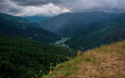
Armenia, a landlocked country in the South Caucasus region of Eurasia, is known for its diverse geography and climate. Situated between Europe and Asia, Armenia is surrounded by mountains and has a varied topography, ranging from highlands to lowlands. This geographical diversity contributes to the presence of multiple climate zones in the country. Understanding these climate zones is crucial for various industries, including agriculture, as it helps determine the suitability of different crops and farming practices in different regions. Summary Armenia has a diverse range of climate zones, including continental, highland, Mediterranean, subtropical, humid continental, semi-arid, and desert. The continental climate of Armenia is characterized by hot summers and cold winters, with significant temperature fluctuations throughout the year. The highland climate of Armenia is characterized by cool summers and cold winters, with high levels of precipitation. The Mediterranean climate of Armenia is characterized by mild, wet winters and hot, dry summers. The subtropical climate of Armenia is characterized by hot, humid summers and mild winters with high levels of precipitation. The impact of these climate zones on agriculture in Armenia is significant, with certain crops thriving in specific regions and others struggling to grow. Microclimates also play a role in agriculture, with variations in temperature, precipitation, and soil affecting crop growth. Continental Climate of Armenia The continental climate is the most dominant climate zone in Armenia. It is characterized by hot summers and cold winters, with significant temperature variations throughout the year. The average temperature in summer ranges from 25°C to 35°C (77°F to 95°F), while in winter, it can drop as low as -15°C to -20°C (5°F to...

Terrain and Topography of Armenia: mountains, valleys, and plains.
Armenia, a landlocked country in the South Caucasus region of Eurasia, is known for its diverse and stunning terrain. Nestled between the Black Sea to the north and the Caspian Sea to the east, Armenia is characterized by its mountainous landscape, deep valleys, and vast plains. The country’s topography has played a significant role in shaping its history, culture, and economy. The terrain of Armenia is dominated by the Armenian Highlands, a vast plateau that stretches across the country. The highlands are surrounded by several mountain ranges, including the Lesser Caucasus to the south and the Geghama Mountains to the east. These mountains not only provide breathtaking scenery but also serve as important cultural and religious symbols for the Armenian people. Summary Armenia’s terrain is diverse and includes mountains, valleys, and plains. The mountains of Armenia are mighty and offer opportunities for hiking and skiing. The valleys of Armenia are lush and fertile, making them ideal for agriculture. The vast plains of Armenia are home to many important cities and towns. The terrain of Armenia has a significant impact on its climate, agriculture, and history. The Mighty Mountains of Armenia Armenia is often referred to as the “Land of Mountains,” and for good reason. The country is home to several majestic mountain ranges that offer a wide range of outdoor activities and breathtaking views. The highest peak in Armenia is Mount Aragats, standing at an impressive 4,090 meters (13,419 feet) above sea level. Mountains hold great significance in Armenian culture and religion. They are often associated with strength, endurance, and spirituality. Many ancient Armenian monasteries and churches are perched...

Cultural or Historical Sites of Armenia: Important Cultural Landmarks or Historical Sites In Armenia
Armenia, a small country located in the South Caucasus region of Eurasia, is known for its rich history and cultural heritage. With a history dating back thousands of years, Armenia has been home to various civilizations and empires, each leaving their mark on the land. From ancient cities to medieval monasteries, Armenia is a treasure trove of archaeological sites and monuments that offer a glimpse into its fascinating past. Exploring these ancient sites is not only a way to learn about Armenia’s history but also to appreciate its cultural heritage and the resilience of its people. Summary Ani offers a glimpse into Armenia’s medieval past with its well-preserved ruins. Geghard Monastery showcases the country’s unique blend of spirituality and architecture. The Temple of Garni is a must-visit for those interested in Armenia’s pagan history. The Armenian Genocide Memorial is a somber reminder of the country’s tragic past. The Matenadaran is a treasure trove of Armenian literature and intellectual heritage. The Ancient City of Ani: A Window into Armenia’s Medieval Past One of the most significant ancient sites in Armenia is the city of Ani. Located on the border with Turkey, Ani was once the capital of the Bagratid Kingdom of Armenia in the 10th and 11th centuries. Known as the “City of 1001 Churches,” Ani was a thriving center of trade and culture during its heyday. Today, it stands as a testament to Armenia’s medieval past. The architecture of Ani is a blend of Armenian, Byzantine, and Islamic influences. The city is home to numerous churches, palaces, and fortifications, each showcasing intricate stone carvings and architectural details. Some of...

Armenia’s Mining and Mineral Riches: A Deep Dive into Natural Resources of Armenia
Armenia’s Mining and Mineral Riches: A Deep Dive into Natural Resources of Armenia Armenia is rich in mineral wealth, boasting significant deposits of copper, molybdenum, gold, and other metals. As a landlocked nation with a mountainous terrain, Armenia has long relied on its underground assets to power its economy. This article explores the natural resources of Armenia, delves into the country’s mining and mineral sector, and examines how responsible mining can shape the nation’s future. If you’re interested in Armenia’s economic prospects, its mineral-rich soil, and how it navigates environmental concerns while boosting exports, this is a must-read. Outline What Are the Major Mineral Resources in Armenia? How Does the Mining Industry Impact Armenia’s Economy? Where Are the Largest Mines Located in Armenia? What Role Do Copper and Molybdenum Play in the Armenian Mining Sector? How Does Armenia Promote Responsible Mining? What Are the Leading Mining Companies in Armenia? What Minerals Are Exported from Armenia? How Does the Armenian Government Regulate Mining? What Are the Environmental Effects of Mining in Armenia? What Is the Future of Armenia’s Mining Industry by 2035? What Are the Major Mineral Resources in Armenia? Armenia is rich in natural resources, especially mineral resources such as copper, molybdenum, gold, and other metals. These resources are registered in the state inventory of mineral resources and play a vital role in the economic framework of the republic of Armenia. The country has a diverse array of mines including base metal mines, gold and gold-polymetallic mines, and 2 iron ore mines. The abundance of copper and molybdenum concentrates in Armenia is a testament to its...

Population Density of Armenia
Population density refers to the number of people living in a specific area, usually measured per square kilometer. It is an important indicator that helps us understand how people are distributed across a country or region. Studying population density is crucial for policymakers and researchers as it provides insights into various social, economic, and environmental factors. In the case of Armenia, understanding population density is particularly significant due to the country’s unique geographical and historical context. Armenia is a landlocked country located in the South Caucasus region of Eurasia. It has a rich history and a diverse population, making it an interesting case study for examining population density trends and their implications. Summary Armenia has a population density of 104 people per square kilometer. The population density of Armenia has fluctuated throughout history due to various factors such as wars and migration. Factors affecting population density in Armenia include economic opportunities, natural resources, and political stability. The majority of Armenia’s population is concentrated in the central and northern regions of the country. Urbanization has led to higher population density in cities, while rural areas have experienced a decline in population. Historical Overview of Armenia’s Population Density Armenia has experienced significant changes in its population density over time. In ancient times, the region was densely populated, with numerous settlements and cities. However, due to various historical events such as invasions, wars, and forced migrations, the population of Armenia declined significantly. During the Soviet era, Armenia experienced a period of rapid population growth. The government implemented policies to encourage population growth, resulting in increased birth rates and decreased mortality rates. This...

Political Boundaries of Argentina: Provinces, Districts, or Historical Boundaries.
Political boundaries are the lines that separate different political entities, such as countries, states, or provinces. They define the jurisdictional authority of a particular government and determine the rights and responsibilities of its citizens. Understanding political boundaries is crucial for effective governance and administration, as well as for maintaining peace and order within a country. In Argentina, a vast and diverse country located in South America, political boundaries play a significant role in shaping its political, economic, and social landscape. With 23 provinces and one autonomous city, Argentina’s political boundaries define the distribution of power and resources across the country. It is essential to have a comprehensive understanding of these boundaries to grasp the complexities of Argentine politics and society. Summary Argentina is divided into 23 provinces and one autonomous city, Buenos Aires. Buenos Aires is the capital district and holds significant political power in the country. Argentina’s historical boundaries have evolved from the Viceroyalty to the Republic. The federal system of government in Argentina has its own powers and limitations. Municipalities play a crucial role in local governance and autonomy in Argentine politics. The 23 Provinces of Argentina: A Brief Overview Argentina is divided into 23 provinces, each with its own distinct characteristics and contributions to the country’s overall development. These provinces are: 1. Buenos Aires2. Catamarca3. Chaco4. Chubut5. Córdoba6. Corrientes7. Entre Ríos8. Formosa9. Jujuy10. La Pampa11. La Rioja12. Mendoza13. Misiones14. Neuquén15. Río Negro16. Salta17. San Juan18. San Luis19. Santa Cruz20. Santa Fe21. Santiago del Estero22. Tierra del Fuego, Antártida e Islas del Atlántico Sur23. Tucumán Each province has its own unique geography, culture, and economic activities that...
Climate Zones of Argentina: Different climate regions Of Argentina
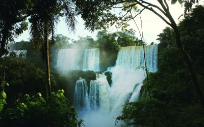
Argentina is a country known for its vast and diverse landscapes, ranging from the towering Andes mountains to the expansive Pampas plains. This diversity is reflected in the country’s climate zones, which vary greatly from region to region. Argentina is located in the southern hemisphere, which means that its seasons are opposite to those in the northern hemisphere. The country’s geography and size contribute to its climate diversity, with influences from the Atlantic Ocean, the Andes mountains, and the surrounding landmasses. Summary Argentina has a diverse range of climate zones, each with unique characteristics and weather patterns. The Humid Pampas Region is known for its fertile soil and agricultural production, but also experiences frequent flooding. The Dry Andes Region is a high-altitude desert with extreme temperature fluctuations and limited vegetation. The Subtropical Region is hot and humid, with a rainy season and a dry season. The Temperate Forest Region has a mild climate and is home to diverse flora and fauna, including the iconic Argentinean national tree, the ombú. The Patagonian Desert Region is a cold and windy desert with sparse vegetation and unique geological formations. The Mediterranean Region has a mild, rainy winter and a hot, dry summer, making it ideal for wine production. Climate change is affecting Argentina’s climate zones, with increased temperatures and changes in precipitation patterns. Argentina’s climate zones offer a range of tourism opportunities, from skiing in the Andes to exploring the wildlife in the subtropical rainforest. Appreciating the diversity of Argentina’s climate zones is key to understanding the country’s natural beauty and cultural heritage. The Humid Pampas Region The Humid Pampas region is...
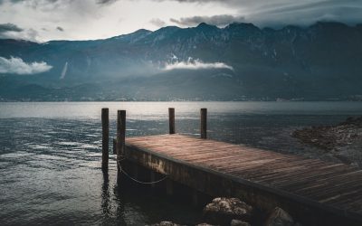
Terrain and Topography of Argentina: mountains, valleys, and plains.
Introduction Argentina is a country known for its diverse and stunning landscapes. From the majestic Andes Mountains to the vast plains of the Pampas, Argentina’s terrain offers a wide range of geographical features that contribute to its unique beauty and cultural heritage. Understanding the country’s geography is essential for appreciating its natural wonders and the importance they hold for Argentina’s economy, culture, and history. The Andes Mountains: A Majestic Range The Andes Mountains are a prominent feature of Argentina’s geography. Stretching along the western border of the country, this majestic range is one of the longest mountain ranges in the world. The highest peaks in Argentina, such as Aconcagua, reach heights of over 6,000 meters, making them some of the tallest mountains in the Americas. The Andes Mountains hold great significance for Argentina’s economy and culture. The region is rich in mineral resources, including copper, gold, and silver, which have played a crucial role in the country’s economic development. Additionally, the Andes are home to several indigenous communities that have preserved their traditional way of life and cultural practices for centuries. The Pampas: Vast Plains of Argentina The Pampas is a vast region of flat plains that covers a significant portion of central Argentina. This fertile land is known for its agricultural importance, as it provides ideal conditions for growing crops such as wheat, corn, and soybeans. The Pampas is often referred to as the “breadbasket” of Argentina due to its role in supplying food for the country and exporting agricultural products worldwide. Aside from its agricultural significance, the Pampas also boasts stunning natural beauty and diverse wildlife. The...