World Geography
Geography is the study of the Earth’s landscapes, environments, and the relationships between people and their surroundings. It encompasses both the physical aspects of the Earth, such as its landforms, bodies of water, and climate, as well as the human aspects, including population distribution, cultures, and economies. World geography is a broad field that seeks to understand the complexities of our planet and how humans interact with it. By studying world geography, we can gain a deeper appreciation for the diversity of our planet and the interconnectedness of its various regions.
Geography is a multidisciplinary field that draws on elements of physical science, social science, and humanities. It involves the use of maps, spatial analysis, and geographic information systems (GIS) to understand the Earth’s surface and the processes that shape it. World geography also encompasses the study of human geography, which examines the ways in which people and their activities are distributed across the Earth. By understanding world geography, we can better appreciate the environmental, cultural, and economic challenges facing different regions of the world. This knowledge is crucial for addressing global issues such as climate change, resource management, and international development.
The Five Oceans and Seven Continents
The Earth’s surface is divided into five major oceans: the Pacific, Atlantic, Indian, Southern (or Antarctic), and Arctic Oceans. These vast bodies of water play a crucial role in regulating the Earth’s climate and supporting diverse marine ecosystems. The oceans also serve as important transportation routes and a source of food and other natural resources for human societies around the world.
In addition to the oceans, the Earth’s landmasses are divided into seven continents: Africa, Antarctica, Asia, Europe, North America, Australia (or Oceania), and South America. Each continent has its own unique physical and cultural characteristics, shaped by millions of years of geological processes and human history. From the deserts of Africa to the rainforests of South America, the continents offer a rich tapestry of landscapes and environments for exploration and study.
Major Mountain Ranges and Deserts
The Earth’s surface is also marked by major mountain ranges and deserts that have shaped the planet’s physical and cultural landscapes. The Himalayas, for example, are the highest mountain range in the world and are home to diverse ecosystems and cultures in countries such as India, Nepal, and Bhutan. The Andes in South America, the Rockies in North America, and the Alps in Europe are other prominent mountain ranges that have influenced human settlement patterns and economic activities.
Deserts cover about one-third of the Earth’s land surface and are characterized by low precipitation and extreme temperatures. The Sahara Desert in Africa is the largest hot desert in the world, while the Gobi Desert in Asia is one of the largest cold deserts. Deserts are not only home to unique flora and fauna but have also been important trade routes and cultural crossroads throughout history.
Climate Zones and Biomes
The Earth’s climate is influenced by a variety of factors, including latitude, altitude, ocean currents, and prevailing winds. As a result, the planet is divided into different climate zones, each with its own characteristic weather patterns and ecosystems. The equator, for example, experiences a tropical climate with high temperatures and heavy rainfall, while the polar regions have a cold and dry climate.
These climate zones give rise to different biomes, or large ecological areas characterized by distinct plant and animal communities. The tropical rainforest biome, found near the equator, is home to a diverse array of species and is vital for regulating the Earth’s climate. The grasslands biome, found in regions such as the African savannah and North American prairies, supports grazing animals and has been important for human agriculture throughout history.
Human Geography and Population Distribution
Human geography examines the ways in which people and their activities are distributed across the Earth’s surface. It encompasses topics such as population growth, migration patterns, urbanization, and cultural diversity. Understanding human geography is crucial for addressing global challenges such as poverty, inequality, and environmental degradation.
Population distribution is uneven across the world, with some regions experiencing rapid population growth while others are declining. The majority of the world’s population lives in Asia, particularly in countries such as China and India. Urban areas are also growing rapidly, with more than half of the world’s population now living in cities. This trend has significant implications for infrastructure development, resource management, and social inequality.
Historical and Cultural Geography
Historical geography examines how human activities have shaped the Earth’s landscapes over time. It explores topics such as colonialism, trade routes, and the rise and fall of empires. Cultural geography focuses on how human cultures have developed in different regions of the world and how they interact with their environments.
The Silk Road, for example, was an ancient trade route that connected China with Europe and facilitated the exchange of goods, ideas, and technologies across Eurasia. This historical trade route had a profound impact on the development of cultures and economies along its path. Similarly, cultural geographers study how different societies have adapted to their environments through practices such as agriculture, architecture, and religious beliefs.
The Importance of Geographic Knowledge
Geographic knowledge is crucial for addressing global challenges such as climate change, resource management, and international development. By understanding world geography, we can better appreciate the environmental, cultural, and economic challenges facing different regions of the world. This knowledge is crucial for addressing global issues such as climate change, resource management, and international development.
Geographic knowledge also helps us to understand our interconnectedness with other regions of the world. By studying world geography, we can gain a deeper appreciation for the diversity of our planet and the interconnectedness of its various regions. This understanding can foster a sense of global citizenship and empathy for people from different cultures and backgrounds.
In conclusion, world geography is a complex and multifaceted field that encompasses both physical and human aspects of the Earth’s landscapes. By studying world geography, we can gain a deeper appreciation for the diversity of our planet and the interconnectedness of its various regions. This knowledge is crucial for addressing global challenges such as climate change, resource management, and international development. It also helps us to understand our interconnectedness with other regions of the world and fosters a sense of global citizenship.
FAQs
What is world geography?
World geography is the study of the Earth’s landscapes, environments, and the relationships between people and their environments. It encompasses the physical features of the Earth, as well as the human activity that takes place on it.
Why is world geography important?
World geography is important because it helps us understand the world around us. It provides insights into the physical and human processes that shape our planet, and helps us make informed decisions about how to interact with our environment.
What are the main branches of world geography?
The main branches of world geography include physical geography, which focuses on the Earth’s natural features and processes, and human geography, which examines the relationships between people and their environments.
How does world geography impact our daily lives?
World geography impacts our daily lives in numerous ways, from influencing the weather and climate we experience, to shaping the availability of natural resources and influencing the distribution of populations and cultures around the world.
What are some key concepts in world geography?
Key concepts in world geography include location, place, human-environment interaction, movement, and region. These concepts help geographers understand and interpret the world around them.

Population Density of Russia
Russia, the largest country in the world, spans over 17 million square kilometres, yet it is home to a population of approximately 146 million people. This vast expanse of land presents a unique demographic landscape characterised by significant variations in population density. Whilst some regions are densely populated, particularly in the west, others are sparsely inhabited, especially in the expansive Siberian territories. The average population density in Russia is around 8.4 people per square kilometre, a figure that starkly contrasts with global averages. This disparity raises intriguing questions about the factors that contribute to such uneven distribution and the implications it has for the country’s socio-economic fabric. Understanding Russia’s population density is crucial for grasping the complexities of its demographic dynamics. The interplay between geography, climate, and historical development has shaped where people choose to live and work. Urban centres like Moscow and St Petersburg are bustling metropolises that attract millions due to their economic opportunities and cultural offerings. In contrast, the vast stretches of Siberia, with its harsh climate and limited infrastructure, remain largely uninhabited. This article delves into the factors influencing population distribution, the contrast between urban and rural densities, regional variations, and the broader implications of these patterns on infrastructure and services. Summary Russia is the largest country in the world by land area, but it has a relatively low population density. Factors affecting population distribution in Russia include climate, natural resources, and historical settlement patterns. Urban population density in Russia is much higher than rural population density, with Moscow and St. Petersburg being the most densely populated cities. Regional variations in population density are significant,...

Political Boundaries of Romania: Provinces, Districts, or Historical Boundaries.
Romania, a nation steeped in history and cultural diversity, is situated in Southeast Europe, bordered by the Black Sea to the east and sharing land borders with Ukraine to the north, Moldova to the east, Hungary to the west, and Serbia to the southwest. The political boundaries of Romania have been shaped by a multitude of historical events, territorial disputes, and socio-political changes over the centuries. These boundaries not only delineate the geographical extent of the country but also reflect the complex interplay of ethnicities, languages, and cultures that characterise this vibrant nation. Understanding Romania’s political boundaries is essential for grasping the broader context of its governance, regional relationships, and national identity. The delineation of Romania’s political boundaries has evolved significantly since its formation as a modern state in the 19th century. The unification of the principalities of Wallachia and Moldavia in 1859 marked a pivotal moment in Romanian history, laying the groundwork for the establishment of a cohesive national identity. Subsequent territorial adjustments, particularly following the World Wars and the shifting political landscape of Eastern Europe during the Cold War, have further influenced Romania’s borders. Today, Romania is divided into several administrative units that reflect both historical legacies and contemporary governance structures, making it a fascinating case study in the dynamics of political geography. Summary Romania’s political boundaries have evolved over time, influenced by historical, geographical, and cultural factors. The country is divided into 41 provinces, each with its own unique characteristics and significance. Romania is further divided into 320 districts, each playing a crucial role in the governance and administration of the country. The historical boundaries of...

History of Romania
The history of Romania is inextricably linked with the ancient Dacians, a group of Thracian tribes that inhabited the region now known as Romania. The Dacians were renowned for their formidable warrior culture and rich traditions, which encompassed advanced agricultural practices and a complex social structure. They established numerous fortified settlements, with Sarmizegetusa Regia being the most notable, serving as their capital and religious centre. The Dacians exhibited exceptional skill in metalwork, particularly with gold and silver, and their craftsmanship was highly esteemed throughout the ancient world. Their society was characterised by a strong sense of identity and resistance to external influences, especially from the expanding Roman Empire. The Roman conquest of Dacia, which reached its culmination in 106 AD under Emperor Trajan, marked a significant turning point in the region’s history. The Romans sought to exploit Dacia’s abundant mineral resources, particularly gold, and to expand their empire’s borders. The conquest presented considerable challenges; the Dacians, led by their king Decebalus, mounted fierce resistance against the Roman legions. However, after a series of intense battles, the Romans emerged victorious, leading to the establishment of Dacia as a Roman province. This conquest facilitated a profound transformation of the region, as Roman culture, language, and governance began to permeate Dacian society. The integration of Dacia into the Roman Empire laid the foundation for the development of Romanian identity, as the Latin language and Roman customs merged with local traditions. Summary The Dacians were an ancient people who inhabited the territory of modern-day Romania and were conquered by the Romans in 106 AD. Wallachia and Moldavia emerged as powerful medieval Romanian principalities...

Climate Zones of Romania: Different Climate Regions Of Romania
Romania, a country steeped in history and natural beauty, boasts a remarkable diversity of climate zones that reflect its varied topography and geographical position in southeastern Europe. This rich tapestry of climates is shaped by the interplay of the Carpathian Mountains, the Danube River, and the Black Sea, each contributing to the unique weather patterns experienced across the nation. From the temperate continental climate that dominates much of the country to the subtropical influences found in certain regions, Romania‘s climate is as multifaceted as its cultural heritage. Understanding these climate zones is essential not only for appreciating the natural environment but also for grasping how they influence agriculture, tourism, and daily life in Romania. The climate of Romania is characterised by significant regional variations, which can be attributed to its geographical features and location. The country is bordered by Ukraine to the north, Moldova to the east, and Bulgaria to the south, whilst the west is flanked by Hungary. This positioning creates a complex climatic landscape that ranges from cold winters to hot summers, with distinct seasonal changes. The interplay between continental and maritime influences results in a variety of microclimates, each with its own unique characteristics. As we delve deeper into the specific climate zones of Romania, we will uncover how these diverse environments shape not only the physical landscape but also the cultural and economic activities of its inhabitants. Summary Romania has a diverse range of climate zones, from continental to subtropical, due to its varied topography and geographical location. The continental climate in Romania is characterized by hot summers and cold winters, with significant temperature variations...

Natural Resources of Romania: Where Natural Resources are Located in Romania
Romania, a nation rich in history and natural splendour, possesses a diverse array of natural resources that are crucial to its economy and cultural identity. Situated in Eastern Europe, Romania‘s geographical location has bestowed upon it a varied landscape, ranging from the Carpathian Mountains to the fertile Danube River plains. This topographical diversity not only contributes to the country’s picturesque scenery but also supports a wealth of natural resources essential for its development. The country is endowed with abundant minerals, forests, agricultural land, and water bodies, all of which are vital for sustaining its population and promoting economic growth. The importance of these resources extends beyond their economic value; they are deeply interwoven with Romania’s cultural heritage and environmental sustainability. The forests, for example, serve not only as a source of timber and biodiversity but also hold cultural significance for many communities. Similarly, the agricultural lands are not merely crop fields but are imbued with traditions and practices that have been handed down through generations. As Romania grapples with the complexities of modernisation and globalisation, the challenge lies in striking a balance between resource exploitation and the imperative of conservation and sustainable management. This delicate equilibrium is crucial to ensure that future generations can continue to benefit from Romania’s natural wealth. Summary Romania is rich in natural resources, including minerals, forests, agriculture, water, and energy sources. The country has significant mineral resources, including coal, oil, natural gas, and various metals. Romania’s forest resources are extensive, covering over a quarter of the country’s land area and providing valuable timber and biodiversity. The agricultural sector in Romania is diverse, with fertile...

Terrain and Topography of Romania: mountains, valleys, and plains.
Romania, a country rich in history and culture, boasts a remarkably diverse terrain that captivates both locals and visitors alike. Situated in Eastern Europe, it is bordered by the Carpathian Mountains to the west and the Black Sea to the east, creating a striking contrast between rugged highlands and serene coastal landscapes. The country’s topography comprises various geographical features, including mountains, plateaus, rivers and plains, each contributing to Romania‘s unique ecological and cultural identity. This rich variety not only shapes the natural environment but also influences the lifestyle, traditions and economic activities of its inhabitants. The interplay of these geographical elements has resulted in a landscape that is both varied and beautiful. From the snow-capped peaks of the Carpathians to the verdant valleys of Transylvania, Romania’s terrain offers numerous opportunities for exploration and adventure. The Danube River, one of Europe’s most significant waterways, meanders through the country, providing vital resources and serving as a natural boundary with neighbouring nations. As one delves deeper into the distinct regions of Romania, one uncovers the intricate relationship between its topography and the cultural heritage that has flourished in this captivating land. Summary Romania’s terrain and topography are diverse, ranging from mountains to plains and plateaus. The Carpathian Mountains are the backbone of Romania, running from the north to the southwest. The Transylvanian Plateau is characterized by rolling hills and valleys, making it a picturesque region. The Danube River Basin is known for its fertile plains and wetlands, making it an important agricultural area. The Moldavian and Wallachian Plains are the agricultural heartlands of Romania, known for their rich soil and productive farms....

Cultural or Historical Sites of Romania: Important Cultural Landmarks or Historical Sites In Romania
Romania, a country steeped in rich history and vibrant culture, offers numerous cultural and historical sites that reflect its diverse heritage. Situated in Eastern Europe, Romania is a land where ancient traditions intertwine with modern influences, creating a unique tapestry that attracts visitors from around the world. From the Carpathian Mountains to the Danube Delta, the landscape is dotted with architectural marvels, ancient ruins and picturesque villages that illustrate the story of a nation shaped by centuries of tumultuous events and cultural exchanges. The country’s historical sites are not merely relics of the past; they are living testaments to the resilience and creativity of the Romanian people. As one traverses this captivating land, one cannot help but be drawn to its myriad cultural treasures. Each site offers insight into Romania’s complex history, showcasing influences from the Roman Empire, the Ottoman Empire and various European powers that have left their mark on the nation. The rich folklore and traditions that permeate Romanian culture further enhance the appeal of its historical sites, inviting exploration and discovery. Whether one is wandering through medieval towns, admiring intricate frescoes in monasteries or observing grand palaces, Romania’s cultural and historical sites provide a remarkable journey through time, revealing the essence of a nation that has endured and thrived through adversity. Summary Romania is home to a wealth of cultural and historical sites, each with its own unique story and significance. Bran Castle, often associated with the legend of Dracula, is a must-visit for those interested in the mysterious and mythical side of Romania’s history. The Painted Monasteries of Bucovina showcase stunning frescoes that depict religious...

Population Density of Romania
Romania, a country steeped in history and cultural diversity, presents a fascinating case study when it comes to population density. As of the latest estimates, Romania‘s population stands at approximately 19 million, spread across a land area of about 238,397 square kilometres. This results in a population density of around 80 people per square kilometre, which is relatively moderate compared to other European nations. However, this figure belies the complexities of demographic distribution within the country. The population density is not uniform; it varies significantly from one region to another, influenced by a myriad of factors including geography, economic opportunities, and historical migration patterns. Understanding these nuances is essential for grasping the broader socio-economic landscape of Romania. The implications of population density extend beyond mere numbers; they shape the very fabric of Romanian society. High-density areas often experience a concentration of resources, services, and infrastructure, whilst sparsely populated regions may struggle with access to basic amenities. This uneven distribution can lead to significant disparities in quality of life, economic development, and social cohesion. As Romania continues to evolve in the wake of globalisation and European integration, examining its population density becomes crucial for policymakers and citizens alike. It serves as a lens through which one can assess the challenges and opportunities that lie ahead for this vibrant nation. Summary Romania has a population density of 84 people per square kilometre, making it one of the least densely populated countries in Europe. Factors affecting population density in Romania include historical migration patterns, economic opportunities, and natural geographical barriers. The urban population in Romania is increasing, leading to a higher population...
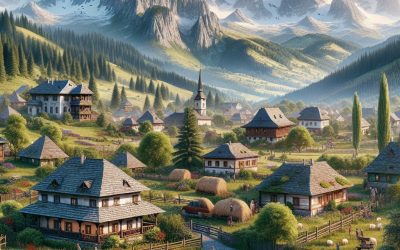
Romania
Romania (România) Capital: Bucharest Population (Estimated July 2012): 21,848,504 Area: 238,391km2 or 92,043mi2 Currency: Leu (Plural Lei) Official Language: Romanian Political Information: Presidential Republic Official Religion: No Official Religion(approximately 86.8% of the population are Eastern Orthodox, 7.5% are Protestant, 4.7% are Roman Catholic, 0.9% have other or unspecified beliefs and 0.1% have no religious beliefs). Highest Mountain: Moldoveanu at 2,544 m or 8,346ft GDP Official Exchange Rate (OER is more precise at gauging a country’s economic power) (Estimated 2011): $185.3 billion (US$) or (GBP) GDP (OER) Per Capita (per member of the population estimated 2011): (US$) or (GBP) GDP Purchasing Power Parity (PPP is good for gauging living conditions and the use of resources but is not as accurate as OER. This data has been calculated based on the sum value of all goods and services produced in the country valued at prices prevailing in the United States) (Estimated 2011): $263.9 billion (US$) or (GBP) GDP (PPP) Per Capita (per member of the population estimated 2011): $12,300 (US$) or (GBP) Time Zone (GMT/UTC): +2:00 Wildlife: Counties/Provinces/States: 41 counties (judete, singular – judet) and 1 municipality* (municipiu); Alba, Arad, Arges, Bacau, Bihor, Bistrita-Nasaud, Botosani, Braila, Brasov, Bucuresti (Bucharest)*, Buzau, Calarasi, Caras-Severin, Cluj, Constanta, Covasna, Dimbovita, Dolj, Galati, Gorj, Giurgiu, Harghita, Hunedoara, Ialomita, Iasi, Ilfov, Maramures, Mehedinti, Mures, Neamt, Olt, Prahova, Salaj, Satu Mare, Sibiu, Suceava, Teleorman, Timis, Tulcea, Vaslui, Vilcea, Vrancea Leaders: President Traian Băsescu with Prime Minister: Mihai Răzvan Ungureanu. Additional: Proclaimed independence from the Ottoman Empire on the 9th of May 1877 which was recognised by the Treaty of Berlin on the 13th of July 1878. Sources: CIA World Fact Book, Encyclopaedia Britannica. Romania...
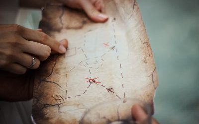
Political Boundaries of Qatar: Provinces, Districts, or Historical Boundaries.
Qatar, a small peninsula in the Arabian Gulf, is a sovereign state situated in the Middle East. The political boundaries of Qatar delineate its territorial limits and jurisdiction, both domestically and internationally. The nation shares a land border with Saudi Arabia to the south, whilst the remainder of its territory is encompassed by the Gulf waters. Qatar’s political boundaries are crucial for the governance and administration of the country, as they determine the extent of its sovereignty and influence. Understanding these boundaries is essential for comprehending Qatar’s geopolitical position and the dynamics of its relationships with neighbouring states and the international community. The political boundaries of Qatar are defined not only by its physical geography but also by its legal and administrative divisions. These boundaries are delineated by laws, treaties and agreements that Qatar has entered into with other states and international organisations. Qatar’s political boundaries play a significant role in shaping its domestic policies, economic activities and foreign relations. As such, they are a fundamental aspect of Qatar’s identity and influence in the region and beyond. Summary Qatar’s political boundaries have evolved over time, shaping the country’s governance and administration. The provinces and districts of Qatar play a significant role in the country’s political structure and local governance. Historical boundaries of Qatar have been influenced by various factors, including colonialism and regional geopolitics. Changes in Qatar’s political boundaries over time have been driven by internal and external factors, such as territorial disputes and diplomatic negotiations. The impact of political boundaries on Qatar’s governance is evident in the distribution of resources, representation, and decision-making processes. Provinces and Districts of...
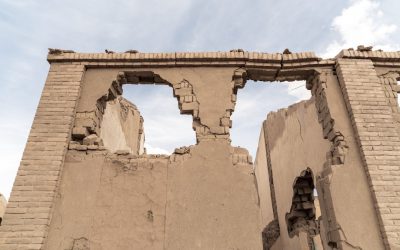
Natural Resources of Qatar: Where Natural Resources are Located in Qatar
Qatar, a small nation situated on the north-eastern coast of the Arabian Peninsula, possesses substantial natural resources that have significantly contributed to its economic development. Despite its diminutive size, Qatar boasts considerable oil and gas reserves, water resources, mining and quarrying materials, agricultural resources, and renewable energy sources. These assets have been instrumental in driving the country’s rapid economic growth over recent decades. However, the sustainable utilisation and conservation of these natural resources are crucial for Qatar’s future economic and environmental well-being. The exploitation of Qatar’s natural resources has generated substantial revenue, which has been invested in infrastructure development, education, healthcare and other sectors. Nonetheless, the country’s heavy reliance on finite resources presents a challenge for long-term sustainability. Consequently, it is imperative for Qatar to prioritise conservation and sustainable use of its natural resources to ensure balanced and sustainable development for future generations. Summary Qatar is rich in natural resources, including oil, gas, water, minerals, and renewable energy sources. The country’s oil and gas reserves are among the largest in the world, making it a major player in the global energy market. Despite its arid climate, Qatar has invested in desalination technology to meet its water needs, making it a leader in water resource management. Qatar’s mining and quarrying industry focuses on the extraction of limestone, silica sand, and gypsum for construction and industrial purposes. The agricultural sector in Qatar is supported by advanced irrigation techniques and technology to overcome the challenges of limited arable land and water scarcity. Qatar is investing in renewable energy sources such as solar and wind power to diversify its energy mix and reduce...
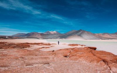
Climate Zones of Qatar: Different Climate Regions Of Qatar
Qatar, a small peninsula in the Arabian Gulf, is renowned for its extreme climatic conditions. The country is divided into several distinct climate zones, each with its own unique characteristics and challenges. These climate zones include the coastal region, desert region, semi-arid region and mountain region. Each of these zones experiences different levels of temperature, humidity and precipitation, making Qatar a diverse and dynamic environment. Understanding the intricacies of these climate zones is crucial for both residents and policymakers to effectively manage and adapt to the changing climate conditions in the region. Qatar’s climate is largely influenced by its geographical location, with the Arabian Gulf to the west and the vast Arabian Desert to the south. The country experiences long, hot summers and short, mild winters, with temperatures often exceeding 40°C during the summer months. The coastal region benefits from the moderating effects of the sea, whilst the desert region is characterised by extreme heat and aridity. The semi-arid region experiences slightly more moderate temperatures and lower levels of precipitation, whilst the mountain region offers cooler temperatures and higher levels of rainfall. Understanding the unique characteristics of each climate zone is essential for developing effective strategies to mitigate the impact of climate change and ensure the sustainability of Qatar’s natural resources. Summary Qatar has four main climate zones: coastal, desert, semi-arid, and mountain. The coastal climate region experiences hot and humid weather with mild winters and high precipitation. The desert climate region is characterized by extremely hot and dry weather with minimal rainfall. The semi-arid climate region has hot summers and mild winters with low precipitation. The mountain climate...