World Geography
Geography is the study of the Earth’s landscapes, environments, and the relationships between people and their surroundings. It encompasses both the physical aspects of the Earth, such as its landforms, bodies of water, and climate, as well as the human aspects, including population distribution, cultures, and economies. World geography is a broad field that seeks to understand the complexities of our planet and how humans interact with it. By studying world geography, we can gain a deeper appreciation for the diversity of our planet and the interconnectedness of its various regions.
Geography is a multidisciplinary field that draws on elements of physical science, social science, and humanities. It involves the use of maps, spatial analysis, and geographic information systems (GIS) to understand the Earth’s surface and the processes that shape it. World geography also encompasses the study of human geography, which examines the ways in which people and their activities are distributed across the Earth. By understanding world geography, we can better appreciate the environmental, cultural, and economic challenges facing different regions of the world. This knowledge is crucial for addressing global issues such as climate change, resource management, and international development.
The Five Oceans and Seven Continents
The Earth’s surface is divided into five major oceans: the Pacific, Atlantic, Indian, Southern (or Antarctic), and Arctic Oceans. These vast bodies of water play a crucial role in regulating the Earth’s climate and supporting diverse marine ecosystems. The oceans also serve as important transportation routes and a source of food and other natural resources for human societies around the world.
In addition to the oceans, the Earth’s landmasses are divided into seven continents: Africa, Antarctica, Asia, Europe, North America, Australia (or Oceania), and South America. Each continent has its own unique physical and cultural characteristics, shaped by millions of years of geological processes and human history. From the deserts of Africa to the rainforests of South America, the continents offer a rich tapestry of landscapes and environments for exploration and study.
Major Mountain Ranges and Deserts
The Earth’s surface is also marked by major mountain ranges and deserts that have shaped the planet’s physical and cultural landscapes. The Himalayas, for example, are the highest mountain range in the world and are home to diverse ecosystems and cultures in countries such as India, Nepal, and Bhutan. The Andes in South America, the Rockies in North America, and the Alps in Europe are other prominent mountain ranges that have influenced human settlement patterns and economic activities.
Deserts cover about one-third of the Earth’s land surface and are characterized by low precipitation and extreme temperatures. The Sahara Desert in Africa is the largest hot desert in the world, while the Gobi Desert in Asia is one of the largest cold deserts. Deserts are not only home to unique flora and fauna but have also been important trade routes and cultural crossroads throughout history.
Climate Zones and Biomes
The Earth’s climate is influenced by a variety of factors, including latitude, altitude, ocean currents, and prevailing winds. As a result, the planet is divided into different climate zones, each with its own characteristic weather patterns and ecosystems. The equator, for example, experiences a tropical climate with high temperatures and heavy rainfall, while the polar regions have a cold and dry climate.
These climate zones give rise to different biomes, or large ecological areas characterized by distinct plant and animal communities. The tropical rainforest biome, found near the equator, is home to a diverse array of species and is vital for regulating the Earth’s climate. The grasslands biome, found in regions such as the African savannah and North American prairies, supports grazing animals and has been important for human agriculture throughout history.
Human Geography and Population Distribution
Human geography examines the ways in which people and their activities are distributed across the Earth’s surface. It encompasses topics such as population growth, migration patterns, urbanization, and cultural diversity. Understanding human geography is crucial for addressing global challenges such as poverty, inequality, and environmental degradation.
Population distribution is uneven across the world, with some regions experiencing rapid population growth while others are declining. The majority of the world’s population lives in Asia, particularly in countries such as China and India. Urban areas are also growing rapidly, with more than half of the world’s population now living in cities. This trend has significant implications for infrastructure development, resource management, and social inequality.
Historical and Cultural Geography
Historical geography examines how human activities have shaped the Earth’s landscapes over time. It explores topics such as colonialism, trade routes, and the rise and fall of empires. Cultural geography focuses on how human cultures have developed in different regions of the world and how they interact with their environments.
The Silk Road, for example, was an ancient trade route that connected China with Europe and facilitated the exchange of goods, ideas, and technologies across Eurasia. This historical trade route had a profound impact on the development of cultures and economies along its path. Similarly, cultural geographers study how different societies have adapted to their environments through practices such as agriculture, architecture, and religious beliefs.
The Importance of Geographic Knowledge
Geographic knowledge is crucial for addressing global challenges such as climate change, resource management, and international development. By understanding world geography, we can better appreciate the environmental, cultural, and economic challenges facing different regions of the world. This knowledge is crucial for addressing global issues such as climate change, resource management, and international development.
Geographic knowledge also helps us to understand our interconnectedness with other regions of the world. By studying world geography, we can gain a deeper appreciation for the diversity of our planet and the interconnectedness of its various regions. This understanding can foster a sense of global citizenship and empathy for people from different cultures and backgrounds.
In conclusion, world geography is a complex and multifaceted field that encompasses both physical and human aspects of the Earth’s landscapes. By studying world geography, we can gain a deeper appreciation for the diversity of our planet and the interconnectedness of its various regions. This knowledge is crucial for addressing global challenges such as climate change, resource management, and international development. It also helps us to understand our interconnectedness with other regions of the world and fosters a sense of global citizenship.
FAQs
What is world geography?
World geography is the study of the Earth’s landscapes, environments, and the relationships between people and their environments. It encompasses the physical features of the Earth, as well as the human activity that takes place on it.
Why is world geography important?
World geography is important because it helps us understand the world around us. It provides insights into the physical and human processes that shape our planet, and helps us make informed decisions about how to interact with our environment.
What are the main branches of world geography?
The main branches of world geography include physical geography, which focuses on the Earth’s natural features and processes, and human geography, which examines the relationships between people and their environments.
How does world geography impact our daily lives?
World geography impacts our daily lives in numerous ways, from influencing the weather and climate we experience, to shaping the availability of natural resources and influencing the distribution of populations and cultures around the world.
What are some key concepts in world geography?
Key concepts in world geography include location, place, human-environment interaction, movement, and region. These concepts help geographers understand and interpret the world around them.
Terrain and Topography of Qatar: mountains, valleys, and plains.
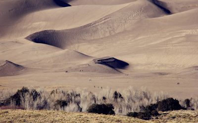
Qatar, a small peninsula in the Persian Gulf, is characterised by its distinctive and varied terrain and topography. The nation is predominantly flat and arid, with extensive expanses of desert and sand dunes. However, it also features coastal valleys and wadis, as well as the Jebel Dukhan mountain range in the west. The terrain and topography of Qatar exert a significant influence on the country’s climate, environment and overall development. This article shall examine the various aspects of Qatar’s terrain and topography, from its flat plains to its mountainous regions, and analyse the challenges and opportunities they present for the future. Summary Qatar’s terrain is characterized by flat and arid plains, coastal valleys and wadis, sand dunes and desert terrain, and the Jebel Dukhan mountain range. The flat and arid plains of Qatar dominate much of the country’s landscape, making it ideal for oil and gas exploration and extraction. Coastal valleys and wadis in Qatar provide important habitats for wildlife and serve as important water sources for the country. The sand dunes and desert terrain of Qatar are popular tourist attractions and offer unique opportunities for desert adventures. The Jebel Dukhan mountain range is the highest point in Qatar and plays a significant role in influencing the country’s climate and environment. The Flat and Arid Plains of Qatar The majority of Qatar’s terrain is characterized by flat and arid plains, with little to no natural vegetation. The landscape is dominated by vast expanses of sand and gravel, with occasional patches of salt flats and sabkhas. The flat plains of Qatar are a result of the country’s geological history, which...
Population Density of Qatar
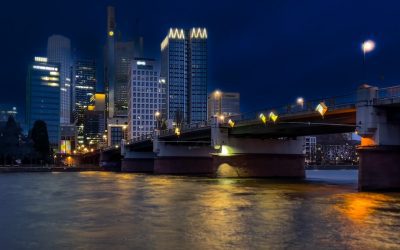
Qatar, a small peninsula in the Arabian Gulf, is renowned for its high population density. With a land area of merely 11,586 square kilometres, Qatar ranks among the most densely populated countries globally. The population density of Qatar is estimated at approximately 244 people per square kilometre, placing it amongst the highest worldwide. The rapid population growth in recent years has resulted in an increased population density, presenting various challenges for the nation. It is crucial to comprehend the factors contributing to this high population density and its impact on the country’s infrastructure to address these challenges and plan for sustainable development. Qatar’s population density is primarily concentrated in urban areas such as Doha, the capital city, and its surrounding metropolitan regions. The influx of expatriate workers, drawn by the country’s thriving economy and employment prospects, has significantly contributed to the high population density. Moreover, the natural growth of the Qatari population has also played a role in increasing the population density. Consequently, Qatar faces unique challenges in managing its limited land resources and providing adequate infrastructure and services to support its growing population. Understanding the factors contributing to Qatar’s high population density is essential for developing effective strategies to manage and sustainably accommodate the expanding population. Summary Qatar has one of the highest population densities in the world, with a rapidly growing population and limited land area. Factors contributing to Qatar’s high population density include rapid urbanization, influx of expatriate workers, and high birth rates. High population density in Qatar has put a strain on infrastructure, leading to challenges in providing adequate housing, healthcare, and transportation. Challenges faced...
History of Qatar
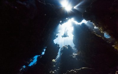
Qatar boasts a rich and diverse history dating back to antiquity. The earliest known inhabitants of the region were Bedouin tribes who led a nomadic lifestyle, herding camels and engaging in trade across the Arabian Peninsula. The area now known as Qatar was also part of the ancient civilisations of Mesopotamia and the Indus Valley, serving as an important trading hub for the ancient Sumerians, Babylonians, and Assyrians. In the 7th century, Qatar came under the influence of Islam and became part of the Islamic Caliphate. The region was subsequently ruled by various Islamic dynasties, including the Umayyads, Abbasids, and Ottomans. Qatar’s strategic location along the Arabian Gulf rendered it an important trading post, renowned for its pearl diving and fishing industries. The Al Thani family, who continue to rule Qatar to this day, emerged as a prominent political force in the 18th century, eventually establishing Qatar as a unified and independent state. Summary Qatar’s early history dates back to the 4th century, with evidence of human habitation and trade activities. Ottoman and British influence in Qatar led to the signing of several treaties, ultimately resulting in Qatar becoming a British protectorate in the early 20th century. The discovery of oil in the 1940s transformed Qatar’s economy and paved the way for its independence from British rule in 1971. Modernization and development efforts have propelled Qatar into a global player, with significant investments in infrastructure, education, and healthcare. Qatar plays a key role in the Gulf Cooperation Council, working with neighbouring countries on issues such as security, trade, and economic cooperation. Ottoman and British Influence The Discovery of Oil...
Cultural or Historical Sites of Qatar: Important Cultural Landmarks or Historical Sites In Qatar
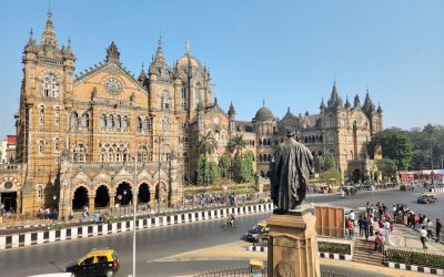
The Pearl-Qatar is an artificial island situated in Doha, Qatar‘s capital city. It stands as a representation of Qatar’s rich history and culture, having been constructed on the site of a former pearl diving and trading centre. The island serves as a testament to Qatar’s profound connection to the sea and its historical dependence on pearl diving as a significant source of income. The Pearl-Qatar is a modern architectural achievement that pays tribute to the country’s past, featuring opulent residential and commercial developments, along with impressive marinas and promenades. The island’s architecture and design draw inspiration from traditional Qatari and Arabian influences, seamlessly blending historical elements with contemporary aesthetics to create a distinctive and lively community. The Pearl-Qatar not only symbolises Qatar’s rich history and culture but also demonstrates the country’s vision for the future. It exemplifies Qatar’s dedication to sustainable development and urban planning, with its emphasis on establishing a vibrant and inclusive community that honours the country’s heritage whilst embracing modernity. The island is home to a diverse population, with residents from various parts of the world coming together to form a dynamic and cosmopolitan society. The Pearl-Qatar embodies Qatar’s past, present, and future, standing as a prime example of the country’s ability to preserve its heritage whilst embracing progress and innovation. Summary The Pearl-Qatar is a symbol of Qatar’s rich history and culture, showcasing the country’s modern development while preserving its heritage. Al Zubarah Fort plays a crucial role in preserving Qatar’s heritage and history, offering visitors a glimpse into the country’s past. The Museum of Islamic Art is a testament to Qatar’s artistic and cultural...
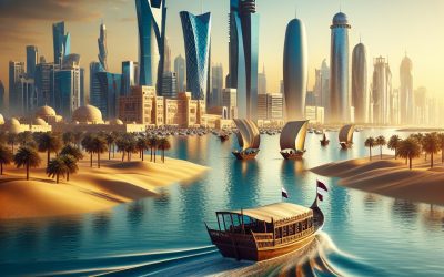
Qatar
Qatar (Dawlat Qaṭar (State of Qatar)) Capital: Doha Population (Estimated July 2012): 1,951,591 Area: 11,571km2 or 4,468mi2 Currency: Qatari Riyal (QR) Official Language: Arabic Political Information: Constitutional Emirate Official Religion: Islam(approximately 77.5% of the population are Muslim, 8.5% are Christian and 14% have other religious beliefs) Highest Point: Qurayn Abu al Bawl (Tuwayyir Al Hamir) at 103m or 338ft GDP Official Exchange Rate (OER is more precise at gauging a country’s economic power) (Estimated 2011): $173.2 billion (US$) or (GBP) GDP (OER) Per Capita (per member of the population estimated 2011): (US$) or (GBP) GDP Purchasing Power Parity (PPP is good for gauging living conditions and the use of resources but is not as accurate as OER. This data has been calculated based on the sum value of all goods and services produced in the country valued at prices prevailing in the United States) (Estimated 2011): $181.7 billion (US$) or (GBP) GDP (PPP) Per Capita (per member of the population estimated 2011): $102,700 (US$) or (GBP) Time Zone (GMT/UTC): +3:00 Wildlife: Counties/Provinces/States: 7 municipalities (Baladiyat, singular – baladiyah); Ad Dawhah, Al Khawr wa adh Dhakhirah, Al Wakrah, Ar Rayyan, Ash Shamal, Az Za’ayin, Umm Salal Leaders: Emir Sheikh Hamad ibn Khalifah Al Thani assisted by Prime Minister Sheikh Hamad ibn Jasim ibn Jabr Al Thani. Additional: Gained independence from the U.K. on the 3rd of September 1971. Sources: CIA World Fact Book, Encyclopaedia Britannica. Qatar Qatar, officially known as the State of Qatar, is a sovereign country situated in Western Asia. It is located on the north-eastern coast of the Arabian Peninsula and shares its sole land border with Saudi Arabia to the south....

Fun and Unique Geography Topics
The Earth harbours numerous extraordinary and captivating landforms that have been sculpted by natural forces over millions of years. One of the most remarkable is the Salar de Uyuni in Bolivia, the world’s largest salt flat. This otherworldly landscape spans over 10,000 square kilometres and comprises a thick salt crust covering a pool of brine. During the rainy season, the flat transforms into an enormous mirror, reflecting the sky and producing a striking visual effect. Another peculiar landform is the Giant’s Causeway in Northern Ireland, consisting of thousands of interlocking basalt columns formed by volcanic activity more than 50 million years ago. The columns are predominantly hexagonal in shape and create a surreal and unearthly landscape that has enthralled visitors for centuries. The Wave in Arizona is yet another extraordinary landform, featuring undulating, swirling rock formations that appear alien in nature. This sandstone rock formation has been eroded by wind and water over millions of years, resulting in a unique and mesmerising landscape. Summary The World’s Strangest Landforms: Landforms such as the Giant’s Causeway and the Salar de Uyuni showcase the incredible diversity of the Earth’s natural formations. Unusual Geographic Phenomena: From the mysterious moving rocks of Death Valley to the stunning light pillars in cold climates, the world is full of fascinating and unusual geographic phenomena. Quirky Geographic Facts: Did you know that the world’s largest desert is actually Antarctica? Or that the Great Blue Hole in Belize is a giant underwater sinkhole? Weird and Wonderful Natural Wonders: The unique landscapes of places like the Chocolate Hills in the Philippines and the Stone Forest in China are truly...

Environmental Geography
Environmental geography is a branch of geography that examines the interaction between humans and the environment. It investigates the impact of human activities on the natural world and seeks to comprehend the intricate relationships between physical and human systems. Environmental geography also analyses the spatial patterns of environmental phenomena and how they are influenced by factors such as climate, topography, and land use. This field of study is vital for understanding the challenges facing our planet and for developing sustainable solutions to environmental issues. Environmental geography encompasses a wide range of topics, including climate change, natural resource management, conservation, and environmental policy. It draws upon principles from physical geography, ecology, and social science to provide a comprehensive understanding of the Earth’s systems and the ways in which they are affected by human activities. By studying environmental geography, researchers and policy-makers can gain valuable insights into the complex dynamics of the natural world and work towards creating a more sustainable future for all. Summary Environmental geography is the study of the relationship between humans and the environment, focusing on the impact of human activities on the natural world. Understanding environmental geography is crucial for addressing environmental issues such as climate change, deforestation, and pollution. Key concepts in environmental geography include ecosystems, biodiversity, natural resources, and environmental sustainability. Case studies in environmental geography provide real-world examples of how human activities have affected the environment, such as the impact of urbanization on local ecosystems. Human impact on the environment includes factors such as population growth, industrialization, and consumption patterns, all of which contribute to environmental degradation. The Importance of Environmental Geography Understanding...
Ethnic Geography: How Ethnic Groups Are Distributed Globally
Ethnic geography is the study of the spatial distribution of ethnic groups and the factors influencing their distribution. It examines how different ethnic groups are distributed across the world and within specific regions, as well as the impact of this distribution on cultural landscapes, political boundaries and social dynamics. Ethnic geography also explores the relationships between ethnic groups and their environments, including how they interact with natural resources and how their cultural practices shape the physical landscape. This field of study is important for understanding the complexities of human diversity and the ways in which it shapes our world. Ethnic geography is a multidisciplinary field that draws on concepts and methods from geography, anthropology, sociology and political science. It seeks to understand the spatial patterns of ethnic diversity and the processes that drive these patterns, such as migration, colonialism and globalisation. By examining the distribution of ethnic groups, ethnic geography can provide insights into the social, economic and political dynamics of different regions, as well as the ways in which ethnic diversity contributes to cultural richness and social cohesion. Overall, ethnic geography is a crucial area of study for understanding the complexities of human societies and the ways in which they are shaped by their cultural diversity. Summary Ethnic geography is the study of the spatial distribution of ethnic groups and their interactions with the environment. Factors such as migration, historical events, and government policies influence the distribution of ethnic groups within a region. Major ethnic groups are distributed unevenly across the globe, with some regions being more ethnically diverse than others. Political boundaries often reflect and influence the...

World Religions: How Geography Influences Belief Systems
Religion has been a fundamental aspect of human society for thousands of years, shaping cultures, influencing politics and guiding individual beliefs and practices. The world is home to a diverse array of religious traditions, each with its own unique set of beliefs, rituals and values. From the ancient polytheistic traditions of the Greeks and Romans to the monotheistic faiths of Christianity, Islam and Judaism, to the Eastern philosophies of Hinduism and Buddhism, the world’s religions offer a rich tapestry of spiritual expression. Each religion provides a framework for understanding the nature of existence, the purpose of life and the relationship between humanity and the divine. As such, religion has played a central role in shaping human history and continues to be a powerful force in the modern world. Religious beliefs and practices are deeply ingrained in the fabric of human society, influencing everything from art and architecture to social customs and moral codes. The study of world religions offers valuable insights into the diversity of human experience and the ways in which different cultures have sought to make sense of the world around them. By examining the beliefs, rituals and ethical teachings of various religious traditions, we can gain a deeper understanding of the human experience and the complex interplay between faith, culture and society. In an increasingly globalised world, where different religious traditions come into contact with one another more frequently than ever before, it is essential to have a nuanced understanding of the world’s religions in order to foster mutual respect and understanding among diverse communities. Summary World religions encompass a wide range of belief systems and...

Indigenous Peoples and Their Connection to Geography
Indigenous peoples possess a profound and historical connection to their land, spanning numerous generations. For these communities, the land is not merely a physical space but is intricately linked to their cultural, spiritual and economic well-being. Many indigenous groups regard the land as sacred, viewing it as a source of life and sustenance. This relationship is often reflected in traditional narratives, ceremonies and practices, which are transmitted orally from one generation to the next. Moreover, the land plays a crucial role in shaping the identity and social structure of indigenous peoples. Many indigenous communities have specific territories they have inhabited for centuries, which are central to their sense of belonging and cultural heritage. The land also provides the foundation for indigenous economies, as numerous communities rely on traditional practices such as hunting, fishing and agriculture for their livelihoods. In essence, the land is not simply a physical space for indigenous peoples but a fundamental aspect of their cultural, social and economic existence. Furthermore, the land holds significant spiritual and religious importance for many indigenous groups. It is often perceived as a living entity to be respected and cared for, rather than exploited for material gain. This spiritual connection to the land is reflected in the traditional knowledge and practices of indigenous communities, which often centre around sustainable and harmonious interactions with the natural environment. Overall, the historical relationship between indigenous peoples and their land is deeply rooted in cultural, spiritual and economic significance. Summary Indigenous peoples have a deep historical relationship with their land, often viewing it as sacred and essential to their cultural identity. Traditional indigenous knowledge of...

The Role of Geography in Sustainable Tourism
Sustainable tourism is a concept that aims to minimise the negative impact of tourism on the environment whilst also benefiting local communities and economies. It involves responsible travel to natural areas that conserves the environment, sustains the well-being of the local people, and incorporates interpretation and education. Geography plays a crucial role in sustainable tourism, as it encompasses the physical and human aspects of the Earth’s surface. The geographical features of a destination, such as its climate, topography and natural resources, can significantly influence the type of tourism activities that can be developed in the area. Furthermore, the cultural and historical aspects of a place, which are also part of its geography, can shape the way tourism is managed and experienced. Geography also influences the accessibility and infrastructure of a destination, which in turn affects the level of tourism development and its impact on the environment. Sustainable tourism seeks to strike a balance between promoting economic growth through tourism and preserving the natural and cultural heritage of a place. This requires an understanding of the geographical context in which tourism takes place, as well as the implementation of strategies that take into account the unique characteristics of each destination. In this article, we will explore the impact of geography on tourism, the challenges and opportunities for sustainable tourism in different geographical contexts, and successful sustainable tourism practices in various geographical locations. Summary Sustainable tourism aims to minimise the negative impact on the environment and local cultures, while promoting economic benefits and community involvement. Geography plays a crucial role in shaping tourism, influencing factors such as climate, landscape, and accessibility....

Borders and Boundaries: How Countries Are Divided
Borders and boundaries have played a significant role in shaping the world as we know it today. They are the lines that separate one country from another, defining the territorial limits of a nation. Borders can be physical, such as rivers, mountains, or man-made structures, or they can be imaginary lines agreed upon by neighbouring countries. Boundaries, on the other hand, refer to the legal and political aspects of border demarcation. They determine the rights and responsibilities of each country in relation to their shared border. The concept of borders and boundaries has been a fundamental aspect of human civilisation, dating back to ancient times. They have been used to establish sovereignty, regulate trade and migration, and maintain security. The establishment of borders and boundaries has been a complex and often contentious process throughout history. It has involved wars, treaties, and diplomatic negotiations. The impact of borders on culture, society, and politics cannot be overstated. In this article, we will explore the historical origins of country divisions, the modern methods of border establishment, border disputes and resolutions, the impact of borders on culture and society, as well as the economic and political implications of borders. We will also discuss future trends in border management and security, as the world continues to grapple with issues of migration, security, and globalisation. Summary Borders and boundaries have been used throughout history to define and separate territories, often leading to conflicts and disputes. The historical origins of country divisions can be traced back to ancient empires and colonial powers, shaping the modern map of the world. Modern methods of border establishment include treaties,...