World Geography
Geography is the study of the Earth’s landscapes, environments, and the relationships between people and their surroundings. It encompasses both the physical aspects of the Earth, such as its landforms, bodies of water, and climate, as well as the human aspects, including population distribution, cultures, and economies. World geography is a broad field that seeks to understand the complexities of our planet and how humans interact with it. By studying world geography, we can gain a deeper appreciation for the diversity of our planet and the interconnectedness of its various regions.
Geography is a multidisciplinary field that draws on elements of physical science, social science, and humanities. It involves the use of maps, spatial analysis, and geographic information systems (GIS) to understand the Earth’s surface and the processes that shape it. World geography also encompasses the study of human geography, which examines the ways in which people and their activities are distributed across the Earth. By understanding world geography, we can better appreciate the environmental, cultural, and economic challenges facing different regions of the world. This knowledge is crucial for addressing global issues such as climate change, resource management, and international development.
The Five Oceans and Seven Continents
The Earth’s surface is divided into five major oceans: the Pacific, Atlantic, Indian, Southern (or Antarctic), and Arctic Oceans. These vast bodies of water play a crucial role in regulating the Earth’s climate and supporting diverse marine ecosystems. The oceans also serve as important transportation routes and a source of food and other natural resources for human societies around the world.
In addition to the oceans, the Earth’s landmasses are divided into seven continents: Africa, Antarctica, Asia, Europe, North America, Australia (or Oceania), and South America. Each continent has its own unique physical and cultural characteristics, shaped by millions of years of geological processes and human history. From the deserts of Africa to the rainforests of South America, the continents offer a rich tapestry of landscapes and environments for exploration and study.
Major Mountain Ranges and Deserts
The Earth’s surface is also marked by major mountain ranges and deserts that have shaped the planet’s physical and cultural landscapes. The Himalayas, for example, are the highest mountain range in the world and are home to diverse ecosystems and cultures in countries such as India, Nepal, and Bhutan. The Andes in South America, the Rockies in North America, and the Alps in Europe are other prominent mountain ranges that have influenced human settlement patterns and economic activities.
Deserts cover about one-third of the Earth’s land surface and are characterized by low precipitation and extreme temperatures. The Sahara Desert in Africa is the largest hot desert in the world, while the Gobi Desert in Asia is one of the largest cold deserts. Deserts are not only home to unique flora and fauna but have also been important trade routes and cultural crossroads throughout history.
Climate Zones and Biomes
The Earth’s climate is influenced by a variety of factors, including latitude, altitude, ocean currents, and prevailing winds. As a result, the planet is divided into different climate zones, each with its own characteristic weather patterns and ecosystems. The equator, for example, experiences a tropical climate with high temperatures and heavy rainfall, while the polar regions have a cold and dry climate.
These climate zones give rise to different biomes, or large ecological areas characterized by distinct plant and animal communities. The tropical rainforest biome, found near the equator, is home to a diverse array of species and is vital for regulating the Earth’s climate. The grasslands biome, found in regions such as the African savannah and North American prairies, supports grazing animals and has been important for human agriculture throughout history.
Human Geography and Population Distribution
Human geography examines the ways in which people and their activities are distributed across the Earth’s surface. It encompasses topics such as population growth, migration patterns, urbanization, and cultural diversity. Understanding human geography is crucial for addressing global challenges such as poverty, inequality, and environmental degradation.
Population distribution is uneven across the world, with some regions experiencing rapid population growth while others are declining. The majority of the world’s population lives in Asia, particularly in countries such as China and India. Urban areas are also growing rapidly, with more than half of the world’s population now living in cities. This trend has significant implications for infrastructure development, resource management, and social inequality.
Historical and Cultural Geography
Historical geography examines how human activities have shaped the Earth’s landscapes over time. It explores topics such as colonialism, trade routes, and the rise and fall of empires. Cultural geography focuses on how human cultures have developed in different regions of the world and how they interact with their environments.
The Silk Road, for example, was an ancient trade route that connected China with Europe and facilitated the exchange of goods, ideas, and technologies across Eurasia. This historical trade route had a profound impact on the development of cultures and economies along its path. Similarly, cultural geographers study how different societies have adapted to their environments through practices such as agriculture, architecture, and religious beliefs.
The Importance of Geographic Knowledge
Geographic knowledge is crucial for addressing global challenges such as climate change, resource management, and international development. By understanding world geography, we can better appreciate the environmental, cultural, and economic challenges facing different regions of the world. This knowledge is crucial for addressing global issues such as climate change, resource management, and international development.
Geographic knowledge also helps us to understand our interconnectedness with other regions of the world. By studying world geography, we can gain a deeper appreciation for the diversity of our planet and the interconnectedness of its various regions. This understanding can foster a sense of global citizenship and empathy for people from different cultures and backgrounds.
In conclusion, world geography is a complex and multifaceted field that encompasses both physical and human aspects of the Earth’s landscapes. By studying world geography, we can gain a deeper appreciation for the diversity of our planet and the interconnectedness of its various regions. This knowledge is crucial for addressing global challenges such as climate change, resource management, and international development. It also helps us to understand our interconnectedness with other regions of the world and fosters a sense of global citizenship.
FAQs
What is world geography?
World geography is the study of the Earth’s landscapes, environments, and the relationships between people and their environments. It encompasses the physical features of the Earth, as well as the human activity that takes place on it.
Why is world geography important?
World geography is important because it helps us understand the world around us. It provides insights into the physical and human processes that shape our planet, and helps us make informed decisions about how to interact with our environment.
What are the main branches of world geography?
The main branches of world geography include physical geography, which focuses on the Earth’s natural features and processes, and human geography, which examines the relationships between people and their environments.
How does world geography impact our daily lives?
World geography impacts our daily lives in numerous ways, from influencing the weather and climate we experience, to shaping the availability of natural resources and influencing the distribution of populations and cultures around the world.
What are some key concepts in world geography?
Key concepts in world geography include location, place, human-environment interaction, movement, and region. These concepts help geographers understand and interpret the world around them.

Terrain and Topography of The Philippines: mountains, valleys, and plains.
The Philippines is an archipelago situated in Southeast Asia, comprising more than 7,000 islands. The nation is renowned for its diverse and striking terrain and topography, which encompasses majestic mountains, picturesque valleys and expansive plains. the Philippines also boasts active volcanoes, verdant rainforests and splendid beaches. The varied landscape of the Philippines renders it a popular destination for nature enthusiasts and adventure seekers alike. The terrain of the Philippines is characterised by its rugged and mountainous landscape, featuring over 20 active volcanoes and numerous mountain ranges. The topography of the country is also influenced by its position along the Pacific Ring of Fire, which makes it susceptible to earthquakes and volcanic eruptions. The Philippines is also endowed with fertile valleys and plains, which are ideal for agriculture and farming. The diverse terrain and topography of the Philippines have a considerable impact on the country’s climate, biodiversity and natural resources. Summary The Philippines is an archipelago consisting of over 7,000 islands, with a diverse terrain and topography that includes mountains, valleys, and plains. The majestic mountains of the Philippines, such as Mount Apo and Mount Pulag, offer breathtaking views and challenging hiking opportunities for outdoor enthusiasts. The scenic valleys of the Philippines, like the Banaue Rice Terraces and Sagada Valley, showcase the country’s natural beauty and rich cultural heritage. The vast plains of the Philippines, particularly in Luzon and Mindanao, are important agricultural areas that contribute to the country’s economy. The varied terrain and topography of the Philippines have a significant impact on the country’s climate, biodiversity, and natural resources. The Majestic Mountains of The Philippines The Philippines is home...

History of the Philippines
The pre-colonial era of the Philippines was characterised by a diverse range of cultures and societies that thrived across the archipelago. The early Filipinos were adept at utilising their natural resources for sustenance and trade, and they had developed sophisticated social structures and belief systems. The barangay system, led by datus, was the cornerstone of their society, providing a framework for governance and community living. The early Filipinos also had a deep spiritual connection to nature, believing in animism and conducting rituals to honour the spirits that inhabited their surroundings. Their advanced knowledge of agriculture, fishing, and trade allowed them to establish thriving communities that engaged in commerce with neighbouring societies in Southeast Asia. The pre-colonial Filipinos also had a rich cultural heritage, with a system of writing known as baybayin, an oral tradition of epic poems and folk tales, and a tradition of skilled craftsmanship in jewellery, pottery, and textiles. These cultural and societal foundations laid the groundwork for the development of Filipino culture and society in the centuries to come. Summary Pre-colonial era: Filipino culture and society were diverse and rich, with influences from Malay, Chinese, and Islamic cultures. Spanish colonial period: Spanish rule brought about significant changes in Filipino society, including the introduction of Christianity, the encomienda system, and the galleon trade. American occupation: American governance and culture left a lasting impact on the Philippines, including the introduction of public education, the English language, and democratic ideals. Japanese occupation: The Japanese occupation during World War II brought about widespread devastation and suffering in the Philippines, but also sparked the Filipino resistance movement. Independence: The struggle for...

Natural Resources of The Philippines: Where Natural Resources are located In the Philippines
The Philippines, a nation situated in Southeast Asia, is renowned for its abundant and varied natural resources. Comprising more than 7,000 islands, the Philippines boasts a diverse array of natural assets, including rich biodiversity, substantial mineral deposits, productive agricultural lands, extensive forest resources, and plentiful marine and aquatic reserves. These natural resources are integral to the country’s economy, providing employment for millions of citizens and contributing significantly to its overall development. Moreover, the Philippines possesses considerable renewable energy potential, positioning it as a promising centre for sustainable energy production. This article shall examine the various natural resources of the Philippines and their importance to the nation’s economy and environment. Summary The Philippines is rich in natural resources, making it a valuable asset in the global market. The country boasts a diverse range of flora and fauna, making it a hotspot for biodiversity. The Philippines is abundant in mineral resources such as gold, copper, and nickel, contributing to its economic growth. The fertile agricultural lands of the Philippines make it a key player in the production of rice, coconut, and other crops. The vast forest resources of the Philippines are crucial for biodiversity conservation and sustainable development. The marine and aquatic resources of the Philippines are abundant, providing livelihood and sustenance to millions of people. The Philippines has great potential for renewable energy sources such as solar, wind, and geothermal power. The Rich Biodiversity of The Philippines The Philippines is renowned for its rich biodiversity, being one of the world’s 17 mega-diverse countries. It is home to a vast array of flora and fauna, many of which are endemic to...

Cultural or Historical Sites of the Philippines: Important Cultural Landmarks or Historical Sites In The Philippines
The Philippines boasts a wealth of cultural and historical heritage, featuring a diverse array of sites that exemplify its distinctive history and traditions. From ancient rice terraces to colonial-era churches, the nation’s cultural and historical landmarks provide insight into its rich and complex past. These sites serve as both important historical monuments and popular tourist attractions, drawing visitors from across the globe. This article shall examine some of the most significant cultural and historical sites in the Philippines, ranging from the ancient Banaue Rice Terraces to the colonial-era San Agustin Church in Manila. Summary The Philippines is home to a rich tapestry of cultural and historical sites that showcase the country’s diverse heritage. The Intramuros in Manila is a well-preserved historical walled city that offers a glimpse into the country’s colonial past. The Banaue Rice Terraces, a UNESCO World Heritage Site, are a testament to the ingenuity of the Ifugao people and their sustainable agricultural practices. The Chocolate Hills of Bohol are not only a natural wonder but also hold historical significance as they are believed to be the result of ancient coral deposits. The Tubbataha Reefs Natural Park is a marine biodiversity hotspot, offering a stunning array of marine life and coral formations. The Intramuros in Manila: A Historical Walled City One of the most iconic historical sites in the Philippines is the Intramuros, a historical walled city located in the heart of Manila. Built during the Spanish colonial period, the Intramuros served as the seat of government and military power for over 300 years. Today, it stands as a living testament to the country’s colonial past, with...

Population Density of the Philippines
Population density refers to the number of people living per unit of area, typically measured per square kilometre or square mile. It is a crucial demographic indicator that offers insights into the distribution of individuals within a specific geographical region. In the context of the Philippines, population density plays a vital role in comprehending the spatial distribution of its populace and the associated social, economic and environmental ramifications. the Philippines is an archipelagic nation in Southeast Asia with a population exceeding 100 million inhabitants, rendering it one of the most densely populated countries globally. Comprehending the factors influencing population density, the consequences of high population density, and the governmental policies and initiatives to address this matter is essential for sustainable development and efficacious urban planning in the Philippines. Summary Population density refers to the number of people living in a specific area, usually measured in square kilometres or square miles. Factors influencing population density in the Philippines include geographical features, economic opportunities, and government policies. Urban areas in the Philippines have higher population density compared to rural areas due to better job opportunities and access to amenities. High population density in the Philippines leads to increased pressure on resources, infrastructure, and the environment. The government of the Philippines has implemented policies and initiatives to address population density, including family planning programs and urban development projects. Factors Influencing Population Density in the Philippines Several factors influence population density in the Philippines, including geographical features, economic opportunities, infrastructure development, and historical and cultural factors. The country’s geographical features, such as its mountainous terrain and scattered islands, have led to variations in...

How Different Cultures Adapt to Their Geographic Environment
Geographic adaptation refers to the manner in which human cultures have evolved and adapted to their natural surroundings. This encompasses the influence of climate, terrain, natural resources, water sources and geographic isolation on cultural practices and traditions. Throughout history, different cultures have developed unique ways of living and surviving in their specific environments, leading to a rich tapestry of diverse traditions and customs around the world. Understanding the impact of geography on cultural adaptation is crucial for appreciating the complexity and diversity of human societies. Geographic adaptation has played a significant role in shaping human history and culture. From the nomadic tribes of the Sahara Desert to the indigenous peoples of the Amazon rainforest, the environment has profoundly influenced the way people live, work and interact with their surroundings. By examining the ways in which different cultures have adapted to their geographic environments, one can gain a deeper understanding of the complexities of human society and the remarkable ingenuity of people in adapting to diverse and challenging landscapes. Summary Geographic adaptation refers to how cultures have evolved to suit their natural environment Climate greatly influences cultural practices, from clothing to food choices Terrain can impact cultural traditions, such as nomadic lifestyles in mountainous regions Cultural adaptations to natural resources can include hunting, farming, and fishing techniques Different cultures utilise water sources for drinking, agriculture, and religious rituals Geographic isolation has played a significant role in shaping unique cultural developments The future of cultural adaptation will be influenced by environmental changes and technological advancements The Influence of Climate on Cultural Practices The climate of a region has a profound impact...

Exploring the World’s Largest Rivers
Rivers are a vital component of the Earth’s ecosystem, providing essential resources for both the environment and human societies. They play a crucial role in shaping the landscape, supporting diverse wildlife, and sustaining human life through agriculture, transport, and commerce. The world’s largest rivers are awe-inspiring natural wonders that have captured the imagination of people for centuries. These mighty waterways have shaped the course of history, influenced cultures, and continue to play a significant role in the global economy. The Amazon, Nile, Yangtze, Mississippi, and Congo rivers are among the largest and most iconic rivers on the planet. Each of these waterways has its own unique characteristics, biodiversity, and cultural significance. From the dense rainforests of the Amazon to the ancient civilisations along the Nile, these rivers have a rich and diverse history that continues to fascinate and inspire people around the world. In this article, we shall explore the importance of rivers for the environment and communities, as well as delve into the unique features and cultural significance of each of these remarkable waterways. Summary The world’s largest rivers play a crucial role in shaping the environment and supporting communities around the globe. Rivers are vital for the environment, providing habitats for diverse species and regulating the water cycle, as well as for communities, offering resources for agriculture, transportation, and recreation. The Amazon River is home to an unparalleled biodiversity and indigenous cultures, making it a crucial area for conservation and cultural preservation. The Nile River has been the cradle of ancient civilizations and continues to present modern challenges such as water scarcity and pollution. The Yangtze River...

Philippines
Philippines (Republika ng Pilipinas (Filipino); Republic of the Philippines (English)) Capital: Manila Population (Estimated July 2012): 103,775,002 Area: 300,000km2 or 115,831mi2 Currency: Piso (₱) Official Language: Filipino and English Political Information: Presidential Republic Official Religion: No Official Religion (but approximately 82.9% of the population Roman Catholic, 9.6% are other Christian, 5% are Muslim, 2.4% have other or unspecified beliefs and 0.1% have no religious beliefs). Highest Mountain: Mount Apo at 2,954m or 9692ft GDP Official Exchange Rate (OER is more precise at gauging a countries economic power) (Estimated 2011): $216.1 billion (US$) or (GBP) GDP (OER) Per Capita (per member of the population estimated 2011): (US$) or (GBP) GDP Purchasing Power Parity (PPP is good for gauging living conditions and use of resources but not as accurate as OER. This data has been calculated based on the sum value of all goods and services produced in the country valued at prices prevailing in the United States) (Estimated 2011): $389.8 billion (US$) or (GBP) GDP (PPP) Per Capita (per member of the population estimated 2011): $4,100 (US$) or (GBP) Time Zone (GMT/UTC): +8:00 Wildlife: Counties/Provinces/States: 80 provinces and 39 chartered citiesprovinces: Abra, Agusan del Norte, Agusan del Sur, Aklan, Albay, Antique, Apayao, Aurora, Basilan, Bataan, Batanes, Batangas, Biliran, Benguet, Bohol, Bukidnon, Bulacan, Cagayan, Camarines Norte, Camarines Sur, Camiguin, Capiz, Catanduanes, Cavite, Cebu, Compostela, Davao del Norte, Davao del Sur, Davao Oriental, Dinagat Islands, Eastern Samar, Guimaras, Ifugao, Ilocos Norte, Ilocos Sur, Iloilo, Isabela, Kalinga, Laguna, Lanao del Norte, Lanao del Sur, La Union, Leyte, Maguindanao, Marinduque, Masbate, Mindoro Occidental, Mindoro Oriental, Misamis Occidental, Misamis Oriental, Mountain Province, Negros Occidental, Negros Oriental, North Cotabato, Northern Samar, Nueva Ecija,...

Tundra Biome: The Cold Desert
The tundra biome is a distinctive and intriguing ecosystem characterised by its exceptionally cold temperatures, low precipitation and permafrost. It is found in the northern regions of the world, including parts of Canada, Alaska, Russia and Scandinavia. The word ‘tundra’ originates from the Finnish word ‘tunturi’, which translates to treeless plain. This aptly describes the tundra, as it is largely devoid of trees and is dominated by grasses, mosses, lichens and low-growing shrubs. The tundra is also known for its long, harsh winters and short, cool summers, making it a challenging environment for both flora and fauna to survive in. The tundra biome can be further divided into two types: the Arctic tundra and the alpine tundra. The Arctic tundra is found in the northernmost regions of the world, within the Arctic Circle, whilst the alpine tundra is found at high elevations in mountainous regions. Despite their differences in location, both types of tundra share similar characteristics, such as low temperatures, short growing seasons and a fragile ecosystem that is easily disrupted by human activity. The tundra biome is an important part of the global ecosystem and plays a crucial role in regulating the Earth’s climate. Understanding and preserving this unique biome is essential for the health of our planet. Summary The tundra biome is a cold, treeless ecosystem found in the Arctic and high mountain regions. Tundra biomes are characterized by low temperatures, short growing seasons, and permafrost. Flora in the tundra biome includes mosses, lichens, and small shrubs, while fauna includes caribou, musk oxen, and Arctic foxes. Plants and animals in the tundra biome have adapted to...
Deserts: How Life Survives in Extreme Conditions
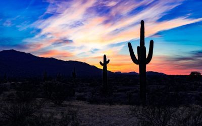
Deserts are amongst the most inhospitable environments on Earth, characterised by extreme temperatures, minimal rainfall, and sparse vegetation. These arid landscapes cover approximately one-fifth of the planet’s land surface, with notable examples including the Sahara in Africa, the Arabian Desert in the Middle East, and the Mojave Desert in North America. The lack of precipitation in deserts results in dry, sandy terrain, rocky plateaux, and occasional sand dunes. The climate in deserts is known for its extreme temperature fluctuations, with scorching hot days and freezing cold nights. Despite these harsh conditions, deserts are home to a surprising variety of plant and animal life that have evolved unique adaptations to survive in this challenging environment. Deserts are often divided into four main types: hot, semi-arid, coastal, and cold. Hot deserts, such as the Sahara, experience high temperatures and very low humidity, whilst semi-arid deserts, like the Great Basin in the United States, have slightly more rainfall but are still very dry. Coastal deserts, such as the Atacama Desert in South America, are influenced by cold ocean currents and experience fog and low cloud cover. Cold deserts, like the Gobi Desert in Asia, have harsh winters with snow and freezing temperatures. Despite their differences, all deserts share the common characteristics of aridity and limited vegetation, making them some of the most challenging environments for life on Earth. Summary Deserts are characterized by extreme conditions such as high temperatures, low precipitation, and limited vegetation. Plant life in deserts has adapted to thrive in arid environments through mechanisms such as water storage, reduced leaf surface area, and deep root systems. Desert animals have...

Exploring Peru’s Diverse Terrain: Mountains, Valleys, and Plains
Peru’s Andes mountain range is a remarkable natural feature that extends the length of the country, running from north to south. The Andes are the world’s longest mountain range and contain some of the highest peaks in the Americas, including the notable Mount Huascarán, which reaches an altitude of 6,768 metres above sea level. The Andes’ rugged terrain is characterised by steep slopes, deep valleys, and snow-capped peaks, making it an ideal destination for adventure enthusiasts and nature lovers. The Andes play a vital role in shaping Peru‘s climate and geography. The mountains serve as a natural barrier, influencing weather patterns and creating distinct microclimates throughout the region. This diverse range of climates has facilitated the development of unique ecosystems and contributed to Peru’s rich biodiversity. The Andes are also home to numerous indigenous communities who have adapted to the challenging conditions of high-altitude living, preserving their traditional way of life and cultural heritage for generations. Summary The Andes in Peru offer a majestic and rugged terrain, perfect for adventurous travellers and hikers. The Sacred Valley in Peru is a picturesque and historically rich area that is worth exploring for its natural beauty and cultural significance. Peru’s coastal plains are home to a rich and diverse range of wildlife, making it a must-visit destination for nature enthusiasts. Trekking through the Amazon rainforest in Peru offers a lush and vibrant jungle terrain, perfect for those seeking an immersive and unique experience. The Nazca Plains in Peru are home to mysterious geoglyphs that continue to intrigue and fascinate visitors, offering a glimpse into the country’s enigmatic desert landscape. Navigating the Sacred...

Political Boundaries of Peru: Provinces, Districts, and Historical Boundaries
Peru, a South American nation, is renowned for its historical significance, cultural diversity and striking natural scenery. The political boundaries of Peru are integral to the country’s governance and administration. These boundaries are delineated by its borders with neighbouring countries and its internal administrative divisions, including provinces and districts. Over time, these boundaries have evolved, moulding the nation’s political landscape and influencing its governance and administration. A thorough understanding of Peru’s political boundaries is crucial for comprehending the country’s political structure and the challenges it faces in managing its varied territories. The political boundaries of Peru are not solely defined by its borders with neighbouring countries, such as Ecuador, Colombia, Brazil, Bolivia and Chile, but also by its internal administrative divisions. The country is divided into 25 regions, which are further subdivided into provinces, and then into districts. These administrative divisions are pivotal in the country’s governance and administration, as they determine resource allocation, public service delivery and policy implementation at the local level. A comprehensive understanding of Peru’s administrative divisions is essential for grasping the country’s political structure and the challenges it faces in managing its diverse territories. The political boundaries of Peru have evolved over time, reflecting the country’s historical development and the influence of external forces. By examining the historical evolution of Peru’s territorial borders, one can gain insight into the country’s past and understand how its political boundaries have shaped its present-day governance and administration. Summary Peru is divided into administrative regions known as provinces, which are further subdivided into districts. The historical evolution of Peru’s territorial borders has been influenced by various factors, including...