Explore the World Through Geography, Natural Resources & Daily History
Clear, reliable and engaging guides that help you understand our planet — from UK geography education to global natural resources and On This Day history events.
Explore, discover, and learn about the wonders of our world! At Earth Site, we’re passionate about bringing geography, history, and science to life for curious minds of all ages. Whether you’re delving into historical events, uncovering the mysteries of the natural world, or seeking interactive resources, you’re in the right place.
Here, you can uncover the stories behind historical events, explore the natural wonders of our planet, and gain valuable insights into how the Earth’s systems shape our daily lives. From the towering peaks of mountain ranges to the far-reaching impacts of human innovation, we aim to make every topic both engaging and informative.
Start your journey of discovery with us today, and let’s make learning an adventure!
What We Cover
Earth Site brings together engaging and accessible educational content designed to help you understand the world, its history, and its natural systems.
🌍 Geography Education (UK & Worldwide)
We publish clear, easy-to-understand geography resources for students, teachers and curious learners. Our guides support geography education in the UK and cover physical geography, climate, ecosystems, population, and global development.
⛏️ Natural Resources & Environmental Geography
Explore detailed country profiles covering natural resources, mining, energy, geology and global environmental challenges. We show how nations manage minerals, water, land and ecosystems, and why these resources matter.
📅 On This Day in History
Every day has a story. Our On This Day history series features major events, anniversaries, traditions, and cultural milestones from around the world — with timelines, context, and fun facts.
TIMELINE
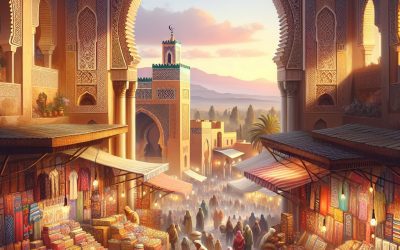
Morocco
Morocco (Al-Mamlakah al-Maghribiyyah (Kingdom of Morocco)) Capital: Rabat Population (Estimated July 2012): 32,309,239 Area: 442,300km2 or 170,773mi2 Currency: Moroccan Dirham (DH) Official Language: Arabic and Tamazight Political Information: Constitutional Monarchy and Parliamentary Democracy Official Religion: Muslim(with approximately 99% of the population Muslim and 1% Christian) Highest Mountain: Jebel Toubkal at 4,167m or 13 671ft GDP Official Exchange Rate (OER is more precise at gauging a country’s economic power) (Estimated 2011): $101.8 billion (US$) or (GBP) GDP (OER) Per Capita (per member of the population estimated 2011): (US$) or (GBP) GDP Purchasing Power Parity (PPP is good for gauging living conditions and the use of resources but is not as accurate as OER. This data has been calculated based on the sum value of all goods and services produced in the country valued at prices prevailing in the United States) (Estimated 2011): $163 billion (US$) or (GBP) GDP (PPP) Per Capita (per member of the population estimated 2011): $5,100 (US$) or (GBP) Time Zone (GMT/UTC): GMT Wildlife: Counties/Provinces/States: 15 regions; Grand Casablanca, Chaouia-Ouardigha, Doukkala-Abda, Fes-Boulemane, Gharb-Chrarda-Beni Hssen, Guelmim-Es Smara, Laayoune-Boujdour-Sakia El Hamra, Marrakech-Tensift-Al Haouz, Meknes-Tafilalet, Oriental, Rabat-Sale-Zemmour-Zaer, Souss-Massa-Draa, Tadla-Azilal, Tanger-Tetouan, Taza-Al Hoceima-Taounate Leaders: King Muhammad VI with Prime Minister Abdelilah Benkirane. Additional: Gained Independence from France on the 2nd of March 1956. Sources: CIA World Fact Book, Encyclopaedia Britannica. Morocco Morocco, situated in North Africa, is a nation renowned for its rich history, diverse culture and striking landscapes. It is a land of contrasts, where ancient traditions meld seamlessly with modern influences. The country is a fusion of different cultures, with influences from Arab, Berber and European civilisations. From the bustling souks of Marrakech to the tranquil beaches of Essaouira, Morocco offers a unique and...

Natural Resources of Montenegro: Where Natural Resources are located In Montenegro
Montenegro, a small country situated in the Balkans, possesses a diverse array of natural resources. Its landscape encompasses verdant forests and woodlands, as well as mineral-rich mountains, which play a crucial role in the nation’s economy and environment. The country’s abundant water resources, including rivers, lakes and coastal areas, provide essential support for agriculture, tourism and energy production. Moreover, Montenegro boasts various renewable energy sources, such as wind and solar power, which contribute to the country’s sustainable development. With its rich biodiversity and protected areas, Montenegro’s natural resources hold significant value for both its economy and ecological importance. Montenegro’s natural resources are an integral part of the country’s landscape and make a substantial contribution to its economy. The forests and woodlands supply timber for construction and furniture, whilst also providing habitats for diverse wildlife. The mineral resources, including coal, bauxite and lead, are vital for the country’s industrial development and export sector. Water resources, such as the Tara River and Skadar Lake, support agriculture, fishing and tourism, whilst also providing hydropower for energy production. The agricultural resources, comprising fertile soil and a favourable climate, enable the cultivation of various crops and livestock. Furthermore, Montenegro’s renewable energy sources, including wind and solar power, contribute to the nation’s efforts towards sustainable energy production. With its protected areas and rich biodiversity, Montenegro’s natural resources hold significant value for both its economy and ecological importance. Summary Montenegro is rich in natural resources, including forests, minerals, water, agriculture, renewable energy sources, and protected areas. The country’s forests and woodlands cover a significant portion of its land, providing valuable resources for timber, wildlife, and biodiversity....

Political Boundaries of Montenegro: Provinces, Districts, or Historical Boundaries.
Montenegro, a small nation situated in the Balkans, is renowned for its rich history and diverse culture. The political boundaries of Montenegro play a crucial role in shaping the administrative and governance structure of the country. These boundaries are essential for defining the territorial jurisdiction of the government and ensuring effective management of resources and services for the citizens. Montenegro’s political boundaries consist of municipalities and regions, each with its own unique functions and responsibilities. Furthermore, the historical boundaries of Montenegro hold significant cultural and historical importance, shaping the identity and heritage of the country. Understanding the political boundaries of Montenegro is essential for comprehending the country’s administrative framework and its historical evolution. Summary Montenegro’s political boundaries have evolved over time, influenced by historical, cultural, and geopolitical factors. The provinces of Montenegro play a key role in the country’s administrative and governance structure, with each province having its own distinct functions and responsibilities. The districts of Montenegro are important administrative units that oversee local governance and public services within the country. The historical boundaries of Montenegro hold significant cultural and historical importance, reflecting the country’s rich heritage and evolution over time. A comparison of provinces, districts, and historical boundaries provides insight into the complex and interconnected nature of Montenegro’s political landscape. Provinces of Montenegro: Structure and Function Administrative Roles and Responsibilities The provinces serve as regional administrative units responsible for coordinating and implementing government policies and programmes at the local level. They play a crucial role in ensuring the delivery of public services, infrastructure development, and economic growth within their respective regions. Additionally, the provinces have their own legislative...

Climate Zones of Montenegro: Different climate regions Of Montenegro
Montenegro, a small nation situated in the Balkans, is characterised by diverse climate zones. The country’s distinctive geographical position, featuring an Adriatic Sea coastline and mountainous interior, contributes to the formation of several distinct climate regions. These climate zones significantly influence the country’s natural landscapes, flora and fauna, whilst also shaping the lifestyle and activities of its inhabitants. A comprehensive understanding of Montenegro‘s varied climate zones is crucial for those wishing to explore the country’s natural beauty and partake in outdoor pursuits. Each climate zone, from the coastal region to the mountainous areas, presents its own unique characteristics and experiences. Summary Montenegro has diverse climate zones, including coastal, mountain, subtropical, continental, and Mediterranean regions. The coastal climate region experiences hot, dry summers and mild, rainy winters, making it a popular tourist destination. The mountain climate region is characterized by cold winters, heavy snowfall, and mild summers, attracting outdoor enthusiasts for skiing and hiking. The subtropical climate region features warm temperatures, high humidity, and lush vegetation, creating a unique microclimate for exotic plants and fruits. The continental climate region has hot summers and cold winters with significant temperature variations, influencing agriculture and outdoor activities. Coastal Climate Region Flora and Fauna The coastal region is home to a diverse range of flora and fauna, including olive trees, citrus fruits, and various species of fish and marine life. The mild winters in this region make it an ideal destination for winter sun seekers, as well as for exploring historic towns and cultural sites without the crowds of the summer months. Overall, the coastal climate region of Montenegro offers a perfect blend of...

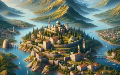
Terrain and Topography of Montenegro: mountains, valleys, and plains.
Montenegro, a small country in South-eastern Europe, is renowned for its diverse and striking terrain and topography. The nation shares borders with Croatia, Bosnia and Herzegovina, Serbia, Kosovo, and Albania, and boasts a varied landscape encompassing rugged mountains, deep valleys, and scenic plains. The terrain and topography of Montenegro have significantly influenced the country’s culture, history, and natural splendour. From the lofty peaks of the Dinaric Alps to the serene waters of the Adriatic Sea, Montenegro’s terrain and topography offer a wealth of natural wonders to explore and appreciate. The diverse terrain and topography of Montenegro present a rich tapestry of natural beauty that attracts visitors from across the globe. The country’s landscape is characterised by its dramatic contrasts, with steep mountains giving way to lush valleys and fertile plains. Montenegro’s terrain is also shaped by its proximity to the Adriatic Sea, which has carved out a stunning coastline adorned with picturesque bays and sandy beaches. The country’s topography is a testament to the forces of nature, with rugged cliffs, deep gorges, and crystal-clear rivers contributing to its allure. Montenegro’s terrain and topography are not only a source of natural beauty but also a reflection of the country’s rich history and cultural heritage. Summary Montenegro’s terrain and topography are diverse and varied, with mountains, valleys, and plains. The majestic mountains of Montenegro offer stunning views and opportunities for outdoor activities such as hiking and mountaineering. Exploring the valleys of Montenegro provides a chance to discover hidden villages and lush, fertile landscapes. The scenic plains of Montenegro are home to agricultural activities and offer a different perspective of the country’s...

History of Montenegro
Montenegro’s history extends to ancient times, with archaeological evidence indicating human settlements dating to the Palaeolithic period. The region was inhabited by Illyrian tribes, renowned for their fierce resistance to Roman conquest. The Illyrians established a significant presence in the area, with their influence reaching the Adriatic coast and the hinterland. The Illyrian Kingdom was a formidable force in the region, with its capital at Rhizon (present-day Risan). The Illyrians were known for their skilled craftsmanship, particularly in pottery and metalwork production. During the Roman era, Montenegro formed part of the province of Dalmatia, experiencing significant Romanisation. The Romans constructed roads, bridges and fortifications, leaving a lasting impact on Montenegro’s landscape. The town of Doclea (present-day Podgorica) became an important Roman settlement, with evidence of Roman baths, temples and villas. Christianity also spread to the region during the Roman period, with the establishment of early Christian communities and churches. The fall of the Western Roman Empire saw Montenegro come under the control of various barbarian tribes, including the Goths and the Huns. This period of instability led to the emergence of Slavic tribes in the region, who would go on to shape Montenegro’s future. The early history of Montenegro demonstrates the resilience and adaptability of its people, who navigated through various periods of conquest and cultural exchange. The legacy of the Illyrians and Romans remains visible in the archaeological sites and cultural traditions of modern-day Montenegro. This rich tapestry of ancient history has laid the foundation for the diverse and vibrant culture of Montenegro today. Summary Early settlements in Montenegro date back to ancient times, with evidence of human...

Population Density of Montenegro
Montenegro, a small Balkan nation, has a population density of approximately 46 people per square kilometre. With a total population of around 620,000, Montenegro is one of the least densely populated countries in Europe. The population density varies significantly across the country, with the coastal areas being more densely populated than the mountainous regions. The capital city, Podgorica, has the highest population density in the country, whilst the northern and eastern regions have the lowest. Understanding the factors that influence population density in Montenegro is crucial for policymakers and urban planners to ensure sustainable development and efficient allocation of resources. Montenegro’s population density has been influenced by a variety of factors, including historical, geographical, and economic aspects. The country’s turbulent history, including periods of conflict and migration, has had a significant impact on its population distribution. Geographically, Montenegro’s diverse landscape, which includes coastal areas, mountains, and valleys, has also played a role in shaping population density. Additionally, economic opportunities and infrastructure development have attracted people to certain areas, leading to disparities in population density across the country. As Montenegro continues to develop and modernise, understanding these factors becomes increasingly important for managing population density and ensuring balanced regional development. Summary Montenegro has a relatively low population density compared to other European countries, with an average of 46 people per square kilometre. Factors influencing population density in Montenegro include topography, economic opportunities, and historical settlement patterns. Urban population density in Montenegro is higher than rural population density, with the capital city of Podgorica being the most densely populated area. The impact of population density on infrastructure and services in Montenegro...

Cultural or Historical Sites of Montenegro: Important Cultural Landmarks or Historical Sites In Montenegro
Montenegro, a diminutive nation in the Balkans, boasts a wealth of cultural and historical sites that have endured through the ages. The country’s heritage encompasses ancient settlements, hallowed monasteries, awe-inspiring natural phenomena and emblematic national parks. Montenegro presents a diverse array of experiences for visitors keen to explore its rich cultural tapestry. The myriad cultural influences that have moulded Montenegro over the centuries are manifest in its architectural wonders, religious edifices and natural landscapes. This text shall examine several of the most notable cultural and historical sites in Montenegro, elucidating their significance and the narratives they embody. Summary Montenegro is home to a rich tapestry of cultural and historical sites, each with its own unique significance. The Old Town of Kotor is a UNESCO World Heritage Site, renowned for its well-preserved medieval architecture and stunning natural surroundings. The Ostrog Monastery is a sacred pilgrimage site, attracting visitors from all over the world for its spiritual and religious importance. The Bay of Kotor is a hub of historical and cultural significance, with a wealth of ancient monuments and a vibrant cultural scene. The Lovćen National Park stands as a symbol of Montenegrin identity, offering breathtaking natural beauty and a glimpse into the country’s heritage. The Old Town of Kotor: A UNESCO World Heritage Site A Blend of Architectural Styles The architecture of the Old Town reflects the various influences that have shaped Montenegro over the centuries, including Venetian, Byzantine, and Slavic elements. A Symbol of Cultural Heritage The town’s most iconic feature is the Cathedral of Saint Tryphon, a Romanesque church that dates back to the 12th century and stands...
Montenegro
Montenegro (Crna Gora (Montenegro)) Capital: Podgorica Population (Estimated July 2011): 657,394 Area: 13,812km2 or 5,333mi2 Currency: euro (€) Official Language: Montenegrin Political Information: Multiparty Republic Official Religion: No Official Religion (approximately 74.2% of the population are Orthodox, 17.7% are Muslim, 3.5% are Catholic, 1% have no religious beliefs and 3.6% have other religious beliefs) Highest Mountain: Bobotov Kuk at 2,522m or 8,274ft GDP Official Exchange Rate (OER is more precise at gauging a country’s economic power) (Estimated 2011): $4.2 billion (US$) or (GBP) GDP (OER) Per Capita (per member of the population estimated 2011): (US$) or (GBP) GDP Purchasing Power Parity (PPP is good for gauging living conditions and the use of resources but is not as accurate as OER. This data has been calculated based on the sum value of all goods and services produced in the country valued at prices prevailing in the United States) (Estimated 2011): $6.957 billion (US$) or (GBP) GDP (PPP) Per Capita (per member of the population estimated 2011): $11,200 (US$) or (GBP) Time Zone (GMT/UTC): +1:00 Wildlife: Counties/Provinces/States: 21 municipalities (opstine, singular – opstina); Andrijevica, Bar, Berane, Bijelo Polje, Budva, Cetinje, Danilovgrad, Herceg Novi, Kolasin, Kotor, Mojkovac, Niksic, Plav, Pljevlja, Pluzine, Podgorica, Rozaje, Savnik, Tivat, Ulcinj, Zabljak Leaders: President Filip Vujanovic with Prime Minister Igor Luksic. Additional: Originally part of the Socialist Federal Republic of Yugoslavia (SFRY) until its dissolution in 1992 when Serbia and Montenegro united as the Federal Republic of Yugoslavia (FRY). In 2003 they became officially known as the State Union of Serbia and Montenegro until the 5th of June 2006 when they split to become two separate republics as they are...

Political Boundaries of Monaco: Provinces, Districts, or Historical Boundaries.
Monaco, a sovereign city-state situated on the French Riviera in Western Europe, is renowned for its opulent casinos, luxurious yachts and esteemed Grand Prix motor race. Despite its diminutive size, Monaco boasts a rich political history and a distinctive set of political boundaries. The city-state is bordered by France on three sides, with the Mediterranean Sea to the south. Monaco’s political boundaries are delineated by its territorial limits, which encompass an area of just 2.02 square kilometres. The principality is divided into several administrative wards, including quartiers and districts, each with its own distinct political boundaries. Monaco’s political boundaries play a crucial role in shaping the governance and administration of the city-state, as well as its relationship with neighbouring countries. Summary Monaco is a sovereign city-state located on the French Riviera, with a unique political boundary as a microstate. The country is divided into four traditional quarters, which are further divided into ten wards, each with its own administrative council. Monaco’s historical boundaries have evolved over time, with significant changes in the 19th and 20th centuries. The political boundaries of Monaco have been influenced by treaties and agreements with neighbouring countries, particularly France. The impact of political boundaries on Monaco’s governance is significant, as it affects the country’s autonomy and relationship with neighbouring nations. Monaco has a close relationship with France, with which it shares an open border and customs union, and the country’s future developments in political boundaries will likely continue to be influenced by this relationship. Provinces and Districts of Monaco The Quarters of Monaco Monaco-Ville, also known as “The Rock,” is the oldest part of the...

Climate Zones Of Monaco: Different Climate Regions Of Monaco
Monaco, a diminutive sovereign city-state situated on the French Riviera in Western Europe, is renowned for its opulent lifestyle, picturesque coastline and temperate climate. The weather patterns in Monaco are influenced by its geographical position, which encompasses a combination of coastal, Mediterranean and alpine climates. These varied climate zones contribute to the distinctive meteorological conditions experienced in Monaco, rendering it a compelling area for climate and weather studies. Comprehending the diverse climate zones in Monaco is crucial for residents, visitors and researchers alike, as it offers valuable insights into the myriad environmental factors that shape the region’s weather and overall climate. Summary Monaco has a diverse range of climate zones, influenced by its unique geography and location on the Mediterranean coast. The Mediterranean climate of Monaco is characterized by hot, dry summers and mild, wet winters, making it a popular tourist destination. The Alpine climate in the higher elevations of Monaco brings cooler temperatures and more precipitation, creating a contrast to the coastal areas. The coastal climate of Monaco experiences milder temperatures and less extreme weather due to its proximity to the Mediterranean Sea. The urban heat island effect in Monaco is a result of the city’s dense urban development, leading to higher temperatures compared to surrounding rural areas. The Influence of Geography on Monaco’s Climate Climate Zones in Monaco The combination of these geographical factors results in a diverse range of climate zones within Monaco, each with its own unique characteristics and weather patterns. The influence of geography on Monaco’s climate is evident in the variation of temperatures, precipitation levels, and wind patterns across different parts of the...

Terrain and Topography of Monaco: mountains, valleys, and plains.
Monaco, a diminutive sovereign city-state situated on the French Riviera in Western Europe, is renowned for its striking natural beauty and varied terrain. The topography of Monaco is characterised by its mountainous landscape, profound valleys and gorges, as well as its coastal plains. The terrain of Monaco has played a crucial role in shaping the development and infrastructure of the city-state, whilst also providing a unique environment for outdoor pursuits and conservation endeavours. This article shall examine the various aspects of Monaco’s terrain and topography, and the influence it has exerted on the region’s development and natural landscape. Summary Monaco’s terrain is characterized by a diverse landscape of mountains, valleys, gorges, plains, and coastal areas. The mountainous landscape of Monaco offers stunning panoramic views and is home to unique flora and fauna. The valleys and gorges of Monaco provide opportunities for exploration and are important for the natural water flow of the region. The plains and coastal areas of Monaco are vital for agriculture, urban development, and tourism. The terrain of Monaco has influenced the development of infrastructure and the conservation efforts to preserve its natural landscape. The Mountainous Landscape of Monaco The Natural Setting The mountainous landscape of Monaco not only provides a stunning natural setting, but also offers opportunities for outdoor activities such as hiking, rock climbing, and mountain biking. The rugged terrain has also presented challenges for urban development, as the city-state has had to carefully plan and construct its infrastructure to accommodate the steep slopes and rocky terrain. A Shaping Force in History and Culture The mountainous landscape of Monaco has also played a significant...